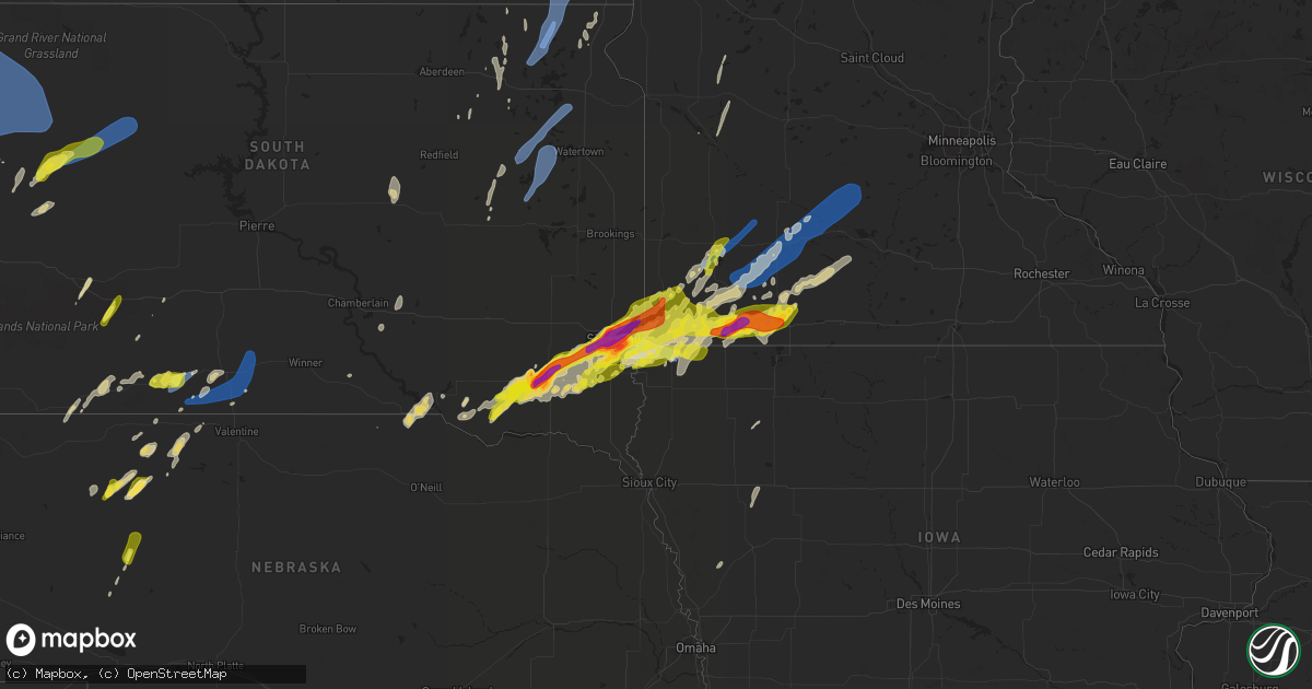
Hail Map on May 28, 2022
Get this storm
May 28 map
$229
one time, instant access
Download today. No call, no setup
Keep the $229
Bought the map and want the full workflow? Apply the entire $229 to a subscription within 7 days. None of it is wasted.
Every map, not just this one
This buys you this map. Subscription and you get every map we run, in the markets you choose from a few cities to whole states to nationwide. Plus real-time alerts the moment a storm fires.
Contact data
Name, contact info, occupancy, even credit band for addresses in the footprint. You go from where it hit to who to call.
Become the source they trust
Unlimited branding weather history reports on demand. You already have the documented answer ready for the property owner, and you are the one who showed up with it.
Property data and RoofTrace estimates
Pull up any address you have got, its value and the exact code rules for that jurisdiction, straight from One Click Code. Then RoofTrace estimates the squares, pitch, and roof value, priced the way you price.
States Impacted by Hail Map on May 28, 2022
Storm reports
Rhode Island
| Date | Description |
|---|---|
| 05/27/20229:34 PM CDT | At 234 PM EDT, a severe thunderstorm was located over Stafford, or 12 miles east of Enfield, moving northeast at 35 mph. HAZARD...60 mph wind gusts and nickel size hail. SOURCE...Radar indicated. IMPACT...Expect damage to trees and power lines. Locations impacted include... Worcester, Springfield, Enfield, Vernon, South Windsor, Ludlow, Holden, Webster, Southbridge, Auburn, Longmeadow, East Longmeadow, Ellington, Tolland, Belchertown, Wilbraham, Oxford, Millbury, Charlton and Palmer. |
Connecticut
| Date | Description |
|---|---|
| 05/28/202212:58 PM CDT | Numerous reports of trees and wires down around town. |
New York
| Date | Description |
|---|---|
| 05/28/202211:30 AM CDT | 52 kt wind gust. Mesonet station mhrn6 2 se elizabeth. |
New Jersey
| Date | Description |
|---|---|
| 05/28/202211:26 AM CDT | Large tree and poles/wires down on oakridge st. Time estimated from radar. |
| 05/28/20227:23 AM CDT | At 1223 PM EDT, a severe thunderstorm was located over Hawthorne, or over Wayne, moving northeast at 20 mph. HAZARD...60 mph wind gusts and quarter size hail. SOURCE...Radar indicated. IMPACT...Minor hail damage to vehicles is possible. Expect wind damage to trees and power lines. This severe thunderstorm will be near... Hackensack and Paramus around 1240 PM EDT. Bergenfield and Oradell around 1250 PM EDT. Monsey around 100 PM EDT. Nanuet and Pearl River around 105 PM EDT. Tappan and Orangeburg around 110 PM EDT. Yonkers and New City around 115 PM EDT. |
Nevada
| Date | Description |
|---|---|
| 05/28/20223:36 AM CDT | Nv dot warm springs rwis |
| 05/28/20221:37 AM CDT | Morey creek raws |
Oklahoma
| Date | Description |
|---|---|
| 05/28/20222:23 AM CDT | At 723 PM CDT, a severe thunderstorm was located near Martha, moving northeast at 40 mph. HAZARD...60 mph wind gusts and quarter size hail. SOURCE...Radar indicated. IMPACT...Hail damage to vehicles is expected. Expect wind damage to roofs, siding, and trees. Locations impacted include... Altus, Blair, Roosevelt, Martha, Friendship, Cooperton, Altus Air Force Base, Warren and Tom Steed Reservoir. |
| 05/28/20221:12 AM CDT | At 611 PM CDT, a severe thunderstorm was located 4 miles southeast of Quanah, moving northeast at 35 mph. HAZARD...60 mph wind gusts and nickel size hail. SOURCE...Radar indicated. IMPACT...Expect damage to roofs, siding, and trees. Locations impacted include... Quanah, Chillicothe, Odell and Fargo. |
| 05/27/20227:20 PM CDT | Relay from kwtv. |
Montana
| Date | Description |
|---|---|
| 05/28/202212:13 AM CDT | At 512 PM MDT, severe thunderstorms were located along a line extending from 17 miles northwest of Alzada to 14 miles west of Gustave to Antelope Butte, moving northeast at 80 mph. HAZARD...60 mph wind gusts. A gust to 70 mph was reported just south of Alzada in Wyoming with this line of storms. SOURCE...Radar indicated. IMPACT...Expect damage to roofs, siding, and trees. Locations impacted include... Alzada, Ridgeway, Belltower, Capitol, Albion and Mill Iron. |
| 05/28/202212:09 AM CDT | At 509 PM MDT, severe thunderstorms were located along a line extending from 9 miles south of Gustave to 3 miles northwest of Newell, moving north northeast at 45 mph. HAZARD...70 mph wind gusts and quarter size hail. SOURCE...Radar indicated. IMPACT...Hail damage to vehicles is expected. Expect considerable tree damage. Wind damage is also likely to mobile homes, roofs, and outbuildings. Severe thunderstorms will be near... Gustave around 520 PM MDT. Castle Rock around 525 PM MDT.Other locations in the path of these severe thunderstorms includeHarding, West Short Pines, Haystack Buttes, Camp Crook, Hoover, Revaand Slim Buttes. |
South Dakota
| Date | Description |
|---|---|
| 05/28/20226:56 PM CDT | A local report indicates 64 MPH wind near 27 WNW CASTLE ROCK |
| 05/28/20226:46 PM CDT | A local report indicates 63 MPH wind near 8 N REDIG |
| 05/28/20226:42 PM CDT | A local report indicates 65 MPH wind near 7 WSW HOOVER |
| 05/28/20225:51 PM CDT | A local report indicates 64 MPH wind near 13 NW BELLE FOURCHE |
| 05/28/20224:17 AM CDT | Report via social media. |
| 05/28/20224:15 AM CDT | Corrects previous non-tstm wnd gst report from 1 nne harrisburg. Winds estimated 60 - 70 mph. Some vegetation damage noted due to wind driven pea sized hail. |
| 05/28/20224:12 AM CDT | Report from mping: golf ball |
| 05/28/20224:05 AM CDT | At 905 PM CDT, a severe thunderstorm was located 3 miles south of Antelope, or 4 miles southeast of Mission, moving northeast at 35 mph. HAZARD...70 mph wind gusts and nickel size hail. SOURCE...Radar indicated. IMPACT...Expect considerable tree damage. Damage is likely to mobile homes, roofs, and outbuildings. This severe thunderstorm will be near... Haystack Butte around 915 PM CDT. Hidden Timber around 920 PM CDT.Other locations in the path of this severe thunderstorm includeOkreek, Carter, Mosher and Witten. |
| 05/28/20224:04 AM CDT | Report from mping: hen egg+ |
| 05/28/20224:00 AM CDT | A local report indicates 2.00 inch wind near 2 W SIOUX FALLS |
| 05/28/20223:56 AM CDT | Report from mping: hen egg |
| 05/28/20223:55 AM CDT | A local report indicates 2.00 inch wind near 4 WSW SIOUX FALLS |
| 05/28/20223:30 AM CDT | Mesonet station 310 sd rwis parker. |
| 05/28/20223:29 AM CDT | At 828 PM CDT, severe thunderstorms were located along a line extending from 3 miles north of Parmelee to 3 miles north of Grass Mountain to 5 miles northwest of Kilgore, moving east at 20 mph. HAZARD...60 mph wind gusts and quarter size hail. SOURCE...Radar indicated. IMPACT...Hail damage to vehicles is expected. Expect wind damage to roofs, siding, and trees. Severe thunderstorms will be near... Two Strike around 835 PM CDT. Soldier Creek around 840 PM CDT. Rosebud and Fairgrounds Housing around 845 PM CDT.Other locations in the path of these severe thunderstorms includeRing Thunder, Lakeview, Mission and Antelope. |
| 05/28/20223:05 AM CDT | Mostly nickel sized but a few ping pong sized. |
| 05/28/20222:53 AM CDT | At 752 PM CDT/652 PM MDT/, a severe thunderstorm was located over Medicine Lake, or 32 miles southeast of Martin, moving northeast at 25 mph. HAZARD...Ping pong ball size hail and 60 mph wind gusts. SOURCE...Radar indicated. IMPACT...People and animals outdoors will be injured. Expect hail damage to roofs, siding, windows, and vehicles. Expect wind damage to roofs, siding, and trees. Locations impacted include... Cody, Kilgore, Nenzel, Medicine Lake, Cody Lake, Eli, Steer Creek Campground and Schoolhouse Lake.This includes Highway 20 between mile markers 146 and 178. |
| 05/28/20222:51 AM CDT | At 751 PM MDT, severe thunderstorms were located along a line extending from 7 miles east of Meadow to 2 miles east of Arrow Head Buttes to 6 miles west of Red Scaffold, moving east at 35 mph. HAZARD...60 mph wind gusts and quarter size hail. SOURCE...Radar indicated. IMPACT...Hail damage to vehicles is expected. Expect wind damage to roofs, siding, and trees. Severe thunderstorms will be near... Red Scaffold around 800 PM MDT. Iron Lightning around 805 PM MDT.Other locations in the path of these severe thunderstorms includeThunder Butte, Intersection of Cherry Creek and Sunnybrook Roads,Intersection of Highway 63 and BIA Road 8 and South Eagle Butte. |
| 05/28/20222:40 AM CDT | Report via social media. |
| 05/28/20222:32 AM CDT | Mesonet station 2 lake city |
| 05/28/20222:25 AM CDT | At 721 PM MDT, a severe thunderstorm was located 6 miles southeast of Opal, or 22 miles southwest of Faith, moving northeast at 35 mph. HAZARD...60 mph wind gusts and quarter size hail. SOURCE...Radar indicated. IMPACT...Hail damage to vehicles is expected. Expect wind damage to roofs, siding, and trees. Locations impacted include... Durkee Lake. |
| 05/28/20221:34 AM CDT | 1-inch tree limbs broken; shingles blown off. |
| 05/28/20221:34 AM CDT | Storage building damaged... Hail bailers tipped over... Small branch damage. |
| 05/28/20221:34 AM CDT | Mesonet station 174 clark |
| 05/28/20221:29 AM CDT | At 629 PM MDT/729 PM CDT/, a severe thunderstorm was located 3 miles northeast of Vetal, or 21 miles east of Martin, moving northeast at 25 mph. HAZARD...60 mph wind gusts and quarter size hail. SOURCE...Radar indicated. IMPACT...Hail damage to vehicles is expected. Expect wind damage to roofs, siding, and trees. Locations impacted include... Upper Cut Meat, He Dog, Parmelee and Soldier Creek. |
| 05/28/20221:27 AM CDT | Mesonet station 262 sd rwis bryant se corner sd25/sd28. |
| 05/28/20221:26 AM CDT | At 625 PM MDT, severe thunderstorms were located along a line extending from 6 miles southwest of Ladner to 8 miles southwest of Ralph, moving northeast at 45 mph. HAZARD...60 mph wind gusts and penny size hail. SOURCE...Radar indicated. IMPACT...Expect damage to roofs, siding, and trees. Locations impacted include... Bowman, Hettinger and Scranton. |
| 05/28/20221:20 AM CDT | Storage garage/shed destroyed. Time estimated. Relayed via social media. |
| 05/28/20221:16 AM CDT | At 616 PM MDT, severe thunderstorms were located along a line extending from 4 miles southwest of Ladner to 4 miles southwest of Ralph, moving northeast at 45 mph. HAZARD...70 mph wind gusts and quarter size hail. SOURCE...Radar indicated. IMPACT...Hail damage to vehicles is expected. Expect considerable tree damage. Wind damage is also likely to mobile homes, roofs, and outbuildings. Severe thunderstorms will be near... Ralph around 620 PM MDT. Table Mountain around 630 PM MDT. |
| 05/28/20221:13 AM CDT | At 613 PM MDT, severe thunderstorms were located along a line extending from 3 miles southeast of Slim Buttes to Zeona to 7 miles south of Mud Butte, moving northeast at 40 mph. HAZARD...70 mph wind gusts and quarter size hail. SOURCE...Radar indicated. IMPACT...Hail damage to vehicles is expected. Expect considerable tree damage. Wind damage is also likely to mobile homes, roofs, and outbuildings. Severe thunderstorms will be near... Reva and Sorum around 625 PM MDT.Other locations in the path of these severe thunderstorms includeMaurine, Date, Prairie City, Owen Lake and Bison. |
| 05/28/20221:08 AM CDT | A metal outbuilding was badly damaging from a strong wind gust causing it to collapse. |
| 05/28/202212:57 AM CDT | At 557 PM MDT, a severe thunderstorm was located 7 miles southeast of Cactus Flat, or 13 miles west of Kadoka, moving northeast at 30 mph. HAZARD...60 mph wind gusts and quarter size hail. SOURCE...Radar indicated. IMPACT...Hail damage to vehicles is expected. Expect wind damage to roofs, siding, and trees. Locations impacted include... Kadoka and Nowlin.This includes Interstate 90 in South Dakota between Mile Markers 134and 154. |
| 05/28/202212:45 AM CDT | Mesonet station 6 sd rwis forestburg. |
| 05/28/202212:28 AM CDT | At 528 PM MDT, a severe thunderstorm was located 5 miles west of LaCreek North Housing, or 5 miles northwest of Martin, moving northeast at 35 mph. HAZARD...60 mph wind gusts and quarter size hail. SOURCE...Radar indicated. IMPACT...Hail damage to vehicles is expected. Expect wind damage to roofs, siding, and trees. Locations impacted include... Hisle, Eagle Nest Butte and Long Valley. |
| 05/28/202212:12 AM CDT | Mesonet station 214 sd rwis plankinton. |
| 05/28/202212:08 AM CDT | Corrects previous tstm wnd gst report from 5 w plankinton. Mesonet station 214 sd rwis plankinton. |
| 05/27/202211:04 PM CDT | At 404 PM MDT, severe thunderstorms were located along a line extending from 6 miles southwest of Rockypoint to 4 miles southwest of New Haven to 7 miles southwest of Sundance, moving northeast at 45 mph. HAZARD...60 mph wind gusts and half dollar size hail. SOURCE...Radar indicated. IMPACT...Hail damage to vehicles is expected. Expect wind damage to roofs, siding, and trees. Severe thunderstorms will be near... New Haven around 410 PM MDT. Rockypoint around 415 PM MDT. Lightning Flat and Warren Peak around 420 PM MDT.Other locations in the path of these severe thunderstorms includeCook Lake, Aladdin, Bear Lodge Campground and Colony.This includes Interstate 90 in Wyoming between Mile Markers 170 and201. |
| 05/27/20228:55 PM CDT | A local report indicates 68 MPH wind near 7 ESE ROSEBUD |
| 05/27/20228:35 PM CDT | A local report indicates 59 MPH wind near 7 SSE MEADOW |
| 05/27/20228:32 PM CDT | 50 to 60 mph winds... Pea sized hail |
| 05/27/20228:15 PM CDT | A local report indicates 72 MPH wind near 6 W PARMELEE |
| 05/27/20227:35 PM CDT | A local report indicates 1.00 inch wind near 1 W VETAL |
| 05/27/20227:03 PM CDT | A local report indicates 75 MPH wind near 1 N BUFFALO |
Wyoming
| Date | Description |
|---|---|
| 05/28/20225:25 PM CDT | Also small marble sized hail |
| 05/28/20225:20 PM CDT | A local report indicates 60 MPH wind near 1 NNE HULETT |
| 05/28/20224:52 PM CDT | A local report indicates 59 MPH wind near 10 ESE PINE HAVEN |
| 05/28/20224:30 PM CDT | A local report indicates 58 MPH wind near 10 SW DWTN GILLETTE |
| 05/28/20224:15 PM CDT | Pea size hail |
| 05/28/20224:15 PM CDT | A local report indicates 62 MPH wind near 10 SW DWTN GILLETTE |
| 05/28/20224:10 PM CDT | Part of neighbor's tin roof blew into yard |
| 05/27/202211:38 PM CDT | At 438 PM MDT, a severe thunderstorm was located 7 miles northeast of Beulah, or 8 miles west of Belle Fourche, moving northeast at 40 mph. HAZARD...60 mph wind gusts and quarter size hail. SOURCE...Radar indicated. IMPACT...Hail damage to vehicles is expected. Expect wind damage to roofs, siding, and trees. This severe thunderstorm will be near... Belle Fourche around 450 PM MDT.Other locations in the path of this severe thunderstorm includenorthwestern Belle Fourche Reservoir.This includes... Interstate 90 in South Dakota between Mile Markers 1 and 29. Interstate 90 in Wyoming between Mile Markers 206 and 207. |
| 05/27/202211:28 PM CDT | At 426 PM MDT, severe thunderstorms were located along a line extending from 7 miles east of Rockypoint to 10 miles north of Hulett to near Aladdin, moving northeast at 65 mph. HAZARD...60 mph wind gusts and quarter size hail. SOURCE...Radar indicated. Storms have a history of producing strong winds over northeast Wyoming over the past hour. IMPACT...Hail damage to vehicles is expected. Expect wind damage to roofs, siding, and trees. Locations impacted include... Alzada, Ridgeway, Hammond, Capitol, Albion, Boyes and Ridge. |
| 05/27/202210:08 PM CDT | At 308 PM MDT, severe thunderstorms were located along a line extending from 3 miles southwest of Gillette Airport to 18 miles south of Rozet to 15 miles northwest of Clareton, moving northeast at 45 mph. HAZARD...60 mph wind gusts and quarter size hail. SOURCE...Radar indicated. IMPACT...Hail damage to vehicles is expected. Expect wind damage to roofs, siding, and trees. Severe thunderstorms will be near... Gillette Airport and Camplex Event Facility around 315 PM MDT.Other locations in the path of these severe thunderstorms includeMoorcroft, Upton, Pine Haven, Weston, Keyhole Reservoir, Carlile,Devils Tower Junction, Oshoto and Devils Tower National Monument.This includes Interstate 90 in Wyoming between Mile Markers 113 and186. |
Virginia
| Date | Description |
|---|---|
| 05/28/20228:23 AM CDT | One tree down due to thunderstorm winds at the intersection of river ridge road and morning star road. |
| 05/28/20228:03 AM CDT | One tree down due to thunderstorm winds along reedy spring road. |
| 05/28/20228:03 AM CDT | One tree down due to thunderstorm winds along lewis ford road. |
Minnesota
| Date | Description |
|---|---|
| 05/28/20226:25 AM CDT | A local report indicates 1.50 inch wind near 6 SSW BERGEN |
| 05/28/20225:50 AM CDT | A local report indicates 1.25 inch wind near 2 S OKABENA |
| 05/28/20225:35 AM CDT | A local report indicates 1.00 inch wind near TRACY |
| 05/28/20225:30 AM CDT | Quarter to golf ball sized hail. |
| 05/28/20225:23 AM CDT | Mostly pea sized... A few quarter sized. |
| 05/28/20224:35 AM CDT | A local report indicates 1.00 inch wind near 5 W HARDWICK |
Texas
| Date | Description |
|---|---|
| 05/28/20225:50 PM CDT | West texas mesonet reported gusts from 59 to 68 mph between 5:45 and 5:50 pm. The peak gust of 68 mph occurred at both 5:48 and 5:49 pm. Little to no lightning occurred |
| 05/28/20225:45 PM CDT | Measured by the west texas mesonet with a weak high-based shower that occasionally had a little lightning |
| 05/28/20224:40 AM CDT | At 940 PM CDT, a severe thunderstorm was located near Vera, moving east at 30 mph. HAZARD...60 mph wind gusts. SOURCE...Radar indicated. IMPACT...Expect damage to roofs, siding, and trees. Locations impacted include... Red Springs, Vera and Lake Kemp. |
| 05/28/20224:32 AM CDT | At 932 PM CDT, severe thunderstorms were located along a line extending from 11 miles west of Benjamin to 10 miles west of O'brien to 12 miles north of Old Glory, moving east at 25 mph. HAZARD...60 mph wind gusts and quarter size hail. SOURCE...Radar indicated. IMPACT...Hail damage to vehicles is expected. Expect wind damage to roofs, siding, and trees. Locations impacted include... Knox City and Benjamin. |
| 05/28/20223:59 AM CDT | At 858 PM CDT, a severe thunderstorm was located 5 miles north of Swenson, or 10 miles northwest of Aspermont, moving east at 30 mph. THIS IS A DESTRUCTIVE STORM FOR LOCATIONS BETWEEN GUTHRIE AND ASPERMONT. HAZARD...80 mph wind gusts and ping pong ball size hail. SOURCE...Radar indicated. IMPACT...Flying debris will be dangerous to those caught without shelter. Mobile homes will be heavily damaged. Expect considerable damage to roofs, windows, and vehicles. Extensive tree damage and power outages are likely. Locations impacted include... Us-380 Near The Haskell-Stonewall County Line. |
| 05/28/20223:14 AM CDT | At 814 PM CDT, a severe thunderstorm was located 6 miles southwest of Girard, or 11 miles west of Jayton, moving east at 15 mph. HAZARD...70 mph wind gusts and quarter size hail. SOURCE...Radar indicated. IMPACT...Hail damage to vehicles is expected. Expect considerable tree damage. Wind damage is also likely to mobile homes, roofs, and outbuildings. Locations impacted include... Spur, Jayton, Girard and Swenson. |
| 05/28/20222:56 AM CDT | At 756 PM CDT, a severe thunderstorm was located 6 miles north of Red Springs, moving east at 30 mph. HAZARD...60 mph wind gusts and quarter size hail. SOURCE...Radar indicated. IMPACT...Hail damage to vehicles is expected. Expect wind damage to roofs, siding, and trees. Locations impacted include... Dundee, Lake Kemp, Mabelle, Lake Diversion and Lake Kickapoo. |
| 05/28/20222:08 AM CDT | At 708 PM CDT, a severe thunderstorm was located 4 miles southeast of Truscott, moving northeast at 25 mph. HAZARD...60 mph wind gusts and quarter size hail. SOURCE...Radar indicated. IMPACT...Hail damage to vehicles is expected. Expect wind damage to roofs, siding, and trees. Locations impacted include... Thalia, Gilliland and Truscott. |
| 05/28/20221:30 AM CDT | At 630 PM CDT, a severe thunderstorm was located 10 miles west of Benjamin, moving east at 25 mph. HAZARD...60 mph wind gusts and nickel size hail. SOURCE...Radar indicated. IMPACT...Expect damage to roofs, siding, and trees. Locations impacted include... Benjamin. |
| 05/28/20221:28 AM CDT | At 628 PM CDT, a severe thunderstorm was located near Thalia, moving east at 25 mph. HAZARD...60 mph wind gusts and nickel size hail. SOURCE...Radar indicated. IMPACT...Expect damage to roofs, siding, and trees. Locations impacted include... Vernon, Thalia, Lockett and Rayland. |
| 05/28/20221:27 AM CDT | At 627 PM CDT, a severe thunderstorm was located near Truscott, moving east at 30 mph. HAZARD...60 mph wind gusts and quarter size hail. SOURCE...Radar indicated. IMPACT...Hail damage to vehicles is expected. Expect wind damage to roofs, siding, and trees. Locations impacted include... Gilliland and Truscott. |
| 05/28/20221:06 AM CDT | At 606 PM CDT, a severe thunderstorm was located 4 miles south of Margaret, moving northeast at 35 mph. HAZARD...60 mph wind gusts and nickel size hail. SOURCE...Radar indicated. IMPACT...Expect damage to roofs, siding, and trees. Locations impacted include... Vernon, Crowell, Margaret, Thalia, Lockett and Rayland. |
| 05/28/20221:00 AM CDT | At 600 PM CDT, a severe thunderstorm was located 7 miles west of Truscott, moving northeast at 35 mph. HAZARD...60 mph wind gusts and nickel size hail. SOURCE...Radar indicated. IMPACT...Expect damage to roofs, siding, and trees. Locations impacted include... Gilliland and Truscott. |
| 05/28/202212:54 AM CDT | At 554 PM CDT, a severe thunderstorm was located 8 miles west of Guthrie, moving east-northeast at 20 mph. HAZARD...70 mph wind gusts and quarter size hail. SOURCE...Radar indicated. IMPACT...Hail damage to vehicles is expected. Expect considerable tree damage. Wind damage is also likely to mobile homes, roofs, and outbuildings. Locations impacted include... Guthrie and Finney. |
| 05/28/202212:11 AM CDT | At 511 PM CDT, a severe thunderstorm was located over Finney, or 13 miles northwest of Guthrie, moving northeast at 20 mph. HAZARD...70 mph wind gusts and quarter size hail. SOURCE...Radar indicated. IMPACT...Hail damage to vehicles is expected. Expect considerable tree damage. Wind damage is also likely to mobile homes, roofs, and outbuildings. Locations impacted include... Grow, Finney, Delwin, Chalk and Hackberry. |
New Hampshire
| Date | Description |
|---|---|
| 05/28/20224:00 PM CDT | Delayed report...measured 1 inch hail began at approximately 5pm and fell for 4-5 minutes. |
Nebraska
| Date | Description |
|---|---|
| 05/28/20226:09 PM CDT | 62 mph wind gust measured on a home weather station |
| 05/28/20221:56 AM CDT | At 655 PM MDT, a severe thunderstorm was located 22 miles south of Medicine Lake, or 38 miles northwest of Mullen, moving northeast at 20 mph. HAZARD...Ping pong ball size hail and 60 mph wind gusts. SOURCE...Radar indicated. IMPACT...People and animals outdoors will be injured. Expect hail damage to roofs, siding, windows, and vehicles. Expect wind damage to roofs, siding, and trees. Locations impacted include... Indian Hill, Speckel Meir Lake, Round Lake and Intersection of Highway 61 and Survey Valley Road.This includes Highway 61 between mile markers 180 and 196. |
| 05/28/20221:12 AM CDT | At 612 PM MDT, a severe thunderstorm was located 27 miles southwest of Medicine Lake, or 32 miles southeast of Gordon, moving northeast at 30 mph. HAZARD...Two inch hail and 60 mph wind gusts. SOURCE...Radar indicated. IMPACT...People and animals outdoors will be injured. Expect hail damage to roofs, siding, windows, and vehicles. Expect wind damage to roofs, siding, and trees. Locations impacted include... Indian Hill, Highway 61 crossing the Snake River, Round Lake and Intersection of Highway 61 and Survey Valley Road.This includes Highway 61 between mile markers 179 and 208. |
| 05/28/20221:10 AM CDT | At 609 PM MDT, a severe thunderstorm was located near Whitman, or 28 miles north of Arthur, moving northeast at 40 mph. HAZARD...60 mph wind gusts and half dollar size hail. SOURCE...Radar indicated. IMPACT...Hail damage to vehicles is expected. Expect wind damage to roofs, siding, and trees. Locations impacted include... Whitman, Speckel Meir Lake, Duluth, Hire, Whitman Road crossing the North Branch of the Middle Loup River, Pratt Lake, Sevenmile Hill and Weir.This includes the following highways... Highway 2 between mile markers 148 and 168. Highway 61 between mile markers 153 and 156. |
| 05/28/202212:33 AM CDT | At 533 PM MDT, a severe thunderstorm was located 9 miles northwest of Arthur, moving north at 35 mph. HAZARD...70 mph wind gusts and quarter size hail. SOURCE...Radar indicated. IMPACT...Hail damage to vehicles is expected. Expect considerable tree damage. Wind damage is also likely to mobile homes, roofs, and outbuildings. Locations impacted include... Hyannis, Whitman, Carr Lake, Duluth, Sand Puddin Lake, Cogill Lake, Mother Lake, Jensen Lake, Green Lake, Hire, Whitman Road crossing the North Branch of the Middle Loup River, Velma, Pratt Lake, Spring Valley Lake and Weir.This includes the following highways... Highway 2 between mile markers 140 and 173. Highway 61 between mile markers 126 and 178. |
| 05/27/202211:42 PM CDT | At 442 PM MDT, a severe thunderstorm was located over Wakpamni, or 16 miles north of Gordon, moving northeast at 35 mph. HAZARD...60 mph wind gusts and quarter size hail. SOURCE...Radar indicated. IMPACT...Hail damage to vehicles is expected. Expect wind damage to roofs, siding, and trees. This severe thunderstorm will be near... Batesland around 455 PM MDT.Other locations in the path of this severe thunderstorm includeSwett, Allen and Yellow Bear Canyon. |
Iowa
| Date | Description |
|---|---|
| 05/28/20224:28 AM CDT | A local report indicates 1.50 inch wind near 5 SSW LARCHWOOD |
Cities Impacted by Hail Map on May 28, 2022
- Forman, ND
- Hawley, MN
- Mission, SD
- Sisseton, SD
- Saint Francis, SD
- Hulett, WY
- Devils Tower, WY
- Sleepy Eye, MN
- Morgan, MN
- Springfield, MN
- Clements, MN
- Erskine, MN
- Winger, MN
- Gary, MN
- Twin Valley, MN
- Mahnomen, MN
- Ulen, MN
- Fertile, MN
- Mcintosh, MN
- Fosston, MN
- Bejou, MN
- Mentor, MN
- Cody, NE
- Beulah, WY
- Aspermont, TX
- Girard, TX
- Old Glory, TX
- Jayton, TX
- Bingham Lake, MN
- Windom, MN
- Wagner, SD
- Adrian, MN
- Rushmore, MN
- Jackson, MN
- Mountain Lake, MN
- Okeechobee, FL
- Fairfax, SD
- Newell, SD
- Viborg, SD
- Hurley, SD
- Sioux Falls, SD
- Tea, SD
- Harrisburg, SD
- Canton, SD
- Thornwood, NY
- Pleasantville, NY
- Miller, SD
- Ellsworth, MN
- Martin, SD
- Lamberton, MN
- Sanborn, MN
- Parmelee, SD
- Tuthill, SD
- Raymond, SD
- Carpenter, SD
- Andover, SD
- Britton, SD
- Whitman, NE
- Chancellor, SD
- Hialeah, FL
- Miami, FL
- Batesland, SD
- George, IA
- Rock Rapids, IA
- Edgerton, MN
- Hardwick, MN
- Menno, SD
- Irene, SD
- Freeman, SD
- Yale, SD
- Mellette, SD
- Union Center, SD
- Rothsay, MN
- Wanblee, SD
- Milnor, ND
- Belvidere, SD
- New Effington, SD
- Quinn, SD
- Bristol, SD
- Kilgore, NE
- Larchwood, IA
- Platte, SD
- Altus, OK
- Worthing, SD
- Lennox, SD
- Valley Springs, SD
- Renner, SD
- Garretson, SD
- Hartford, SD
- Brandon, SD
- Marion, SD
- Nenzel, NE
- Kenneth, MN
- Wilmont, MN
- Lismore, MN
- Brewster, MN
- Worthington, MN
- Moorcroft, WY
- Gordon, NE
- Gwinner, ND
- Saint Lawrence, SD
- Sundance, WY
- Kadoka, SD
- Weston, WY
- Rozet, WY
- Duke, OK
- Hills, MN
- Butterfield, MN
- Saint James, MN
- Cogswell, ND
- Lake Park, MN
- Waubun, MN
- Slayton, MN
- Woodstock, MN
- Tracy, MN
- Balaton, MN
- Lake Wilson, MN
- Garvin, MN
- Chandler, MN
- Howes, SD
- Wasta, SD
- Enning, SD
- White Owl, SD
- Gregory, SD
- Butte, NE
- Lake Andes, SD
- Spencer, NE
- Huron, SD
- Sebring, FL
- Corinne, UT
- Parker, SD
- Okabena, MN
- Lakefield, MN
- Reading, MN
- Conde, SD
- Merriman, NE
- Allen, SD
- Haledon, NJ
- Paterson, NJ
- Wayne, NJ
- Tyndall, SD
- Avon, SD
- Scotland, SD
- Seymour, TX
- Paducah, TX
- Crowell, TX
- Inwood, IA
- Robinson, KS
- Highland, KS
- Kanaranzi, MN
- Luverne, MN
- Magnolia, MN
- Labelle, FL
- Langford, SD
- Hitterdal, MN
- Centerville, SD
- Heron Lake, MN
- Bigelow, MN
- Little Rock, IA
- Leota, MN
- Humboldt, SD
- Fulda, MN
- Sibley, IA
- Utica, SD
- Jeffers, MN
- Lesterville, SD
- Beaver Creek, MN
- Kaylor, SD
- Lester, IA
- Hanska, MN
- Pipestone, MN
- Iona, MN
- Jasper, MN
- Westbrook, MN
- Olivet, SD
- Davis, SD
- Springfield, SD
- Avoca, MN
- Madelia, MN
- Ocheyedan, IA
- Storden, MN
- Steen, MN
- Round Lake, MN
- Alvord, IA
- Tripp, SD
- Doon, IA
- Ashby, NE
- Mud Butte, SD
- Faith, SD
- Rotan, TX
- Interior, SD
- South Bay, FL
- Montevideo, MN
- Benson, MN
- Schaller, IA
- Arthur, IA
- Galva, IA
- Odebolt, IA
- Starbuck, MN
- Peterson, IA
- Kimball, SD
- Hancock, MN
- Clontarf, MN
- Dante, SD
- Norwalk, CT
- Westport, CT
- Clewiston, FL
- Valentine, NE
- Lake Wales, FL
- Frostproof, FL
- Sturgis, SD
- Belle Fourche, SD
- Quanah, TX
- Dunlap, IA
- Gillette, WY
- Upton, WY
- Ludlow, SD
- Prairie City, SD
- Meadow, SD
- Buffalo, SD
- Bison, SD
- Aladdin, WY
- Reva, SD
- Alzada, MT
- Dupree, SD
- Okreek, SD
- Wood, SD
- Vienna, SD
- Garden City, SD
- Clark, SD
- Henry, SD
- Willow Lake, SD
- Bryant, SD
- Hazel, SD
- Ortley, SD
- Waubay, SD
- Wallace, SD
- Florence, SD
- Webster, SD
- Eden, SD
- Pierpont, SD
- Lake City, SD
- Roslyn, SD
- Wyndmere, ND
- Veblen, SD
- Cayuga, ND
- Lidgerwood, ND
- Dell Rapids, SD
- Crooks, SD
- Baltic, SD
- Beresford, SD
- Hyannis, NE
- Stewart, MN
- Comfrey, MN
- Brownton, MN
- Winthrop, MN
- Fairfax, MN
- Gibbon, MN
- Lafayette, MN
- New Ulm, MN
- Walnut Grove, MN
- Wabasso, MN
- Lucan, MN
- Electra, TX
- Altus Afb, OK