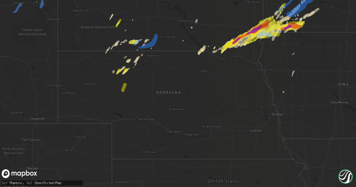
Hail Map in Nebraska on May 28, 2022
Get this storm
May 28 map
$229
one time, instant access
Download today. No call, no setup
Keep the $229
Bought the map and want the full workflow? Apply the entire $229 to a subscription within 7 days. None of it is wasted.
Every map, not just this one
This buys you this map. Subscription and you get every map we run, in the markets you choose from a few cities to whole states to nationwide. Plus real-time alerts the moment a storm fires.
Contact data
Name, contact info, occupancy, even credit band for addresses in the footprint. You go from where it hit to who to call.
Become the source they trust
Unlimited branding weather history reports on demand. You already have the documented answer ready for the property owner, and you are the one who showed up with it.
Property data and RoofTrace estimates
Pull up any address you have got, its value and the exact code rules for that jurisdiction, straight from One Click Code. Then RoofTrace estimates the squares, pitch, and roof value, priced the way you price.
Storm reports in Nebraska
Nebraska
| Date | Description |
|---|---|
| 05/28/20226:09 PM CDT | 62 mph wind gust measured on a home weather station |
| 05/28/20221:56 AM CDT | At 655 PM MDT, a severe thunderstorm was located 22 miles south of Medicine Lake, or 38 miles northwest of Mullen, moving northeast at 20 mph. HAZARD...Ping pong ball size hail and 60 mph wind gusts. SOURCE...Radar indicated. IMPACT...People and animals outdoors will be injured. Expect hail damage to roofs, siding, windows, and vehicles. Expect wind damage to roofs, siding, and trees. Locations impacted include... Indian Hill, Speckel Meir Lake, Round Lake and Intersection of Highway 61 and Survey Valley Road.This includes Highway 61 between mile markers 180 and 196. |
| 05/28/20221:12 AM CDT | At 612 PM MDT, a severe thunderstorm was located 27 miles southwest of Medicine Lake, or 32 miles southeast of Gordon, moving northeast at 30 mph. HAZARD...Two inch hail and 60 mph wind gusts. SOURCE...Radar indicated. IMPACT...People and animals outdoors will be injured. Expect hail damage to roofs, siding, windows, and vehicles. Expect wind damage to roofs, siding, and trees. Locations impacted include... Indian Hill, Highway 61 crossing the Snake River, Round Lake and Intersection of Highway 61 and Survey Valley Road.This includes Highway 61 between mile markers 179 and 208. |
| 05/28/20221:10 AM CDT | At 609 PM MDT, a severe thunderstorm was located near Whitman, or 28 miles north of Arthur, moving northeast at 40 mph. HAZARD...60 mph wind gusts and half dollar size hail. SOURCE...Radar indicated. IMPACT...Hail damage to vehicles is expected. Expect wind damage to roofs, siding, and trees. Locations impacted include... Whitman, Speckel Meir Lake, Duluth, Hire, Whitman Road crossing the North Branch of the Middle Loup River, Pratt Lake, Sevenmile Hill and Weir.This includes the following highways... Highway 2 between mile markers 148 and 168. Highway 61 between mile markers 153 and 156. |
| 05/28/202212:33 AM CDT | At 533 PM MDT, a severe thunderstorm was located 9 miles northwest of Arthur, moving north at 35 mph. HAZARD...70 mph wind gusts and quarter size hail. SOURCE...Radar indicated. IMPACT...Hail damage to vehicles is expected. Expect considerable tree damage. Wind damage is also likely to mobile homes, roofs, and outbuildings. Locations impacted include... Hyannis, Whitman, Carr Lake, Duluth, Sand Puddin Lake, Cogill Lake, Mother Lake, Jensen Lake, Green Lake, Hire, Whitman Road crossing the North Branch of the Middle Loup River, Velma, Pratt Lake, Spring Valley Lake and Weir.This includes the following highways... Highway 2 between mile markers 140 and 173. Highway 61 between mile markers 126 and 178. |
| 05/27/202211:42 PM CDT | At 442 PM MDT, a severe thunderstorm was located over Wakpamni, or 16 miles north of Gordon, moving northeast at 35 mph. HAZARD...60 mph wind gusts and quarter size hail. SOURCE...Radar indicated. IMPACT...Hail damage to vehicles is expected. Expect wind damage to roofs, siding, and trees. This severe thunderstorm will be near... Batesland around 455 PM MDT.Other locations in the path of this severe thunderstorm includeSwett, Allen and Yellow Bear Canyon. |
All States Impacted by Hail Map on May 28, 2022
Cities Impacted by Hail Map on May 28, 2022
- Forman, ND
- Hawley, MN
- Mission, SD
- Sisseton, SD
- Saint Francis, SD
- Hulett, WY
- Devils Tower, WY
- Sleepy Eye, MN
- Morgan, MN
- Springfield, MN
- Clements, MN
- Erskine, MN
- Winger, MN
- Gary, MN
- Twin Valley, MN
- Mahnomen, MN
- Ulen, MN
- Fertile, MN
- Mcintosh, MN
- Fosston, MN
- Bejou, MN
- Mentor, MN
- Cody, NE
- Beulah, WY
- Aspermont, TX
- Girard, TX
- Old Glory, TX
- Jayton, TX
- Bingham Lake, MN
- Windom, MN
- Wagner, SD
- Adrian, MN
- Rushmore, MN
- Jackson, MN
- Mountain Lake, MN
- Okeechobee, FL
- Fairfax, SD
- Newell, SD
- Viborg, SD
- Hurley, SD
- Sioux Falls, SD
- Tea, SD
- Harrisburg, SD
- Canton, SD
- Thornwood, NY
- Pleasantville, NY
- Miller, SD
- Ellsworth, MN
- Martin, SD
- Lamberton, MN
- Sanborn, MN
- Parmelee, SD
- Tuthill, SD
- Raymond, SD
- Carpenter, SD
- Andover, SD
- Britton, SD
- Whitman, NE
- Chancellor, SD
- Hialeah, FL
- Miami, FL
- Batesland, SD
- George, IA
- Rock Rapids, IA
- Edgerton, MN
- Hardwick, MN
- Menno, SD
- Irene, SD
- Freeman, SD
- Yale, SD
- Mellette, SD
- Union Center, SD
- Rothsay, MN
- Wanblee, SD
- Milnor, ND
- Belvidere, SD
- New Effington, SD
- Quinn, SD
- Bristol, SD
- Kilgore, NE
- Larchwood, IA
- Platte, SD
- Altus, OK
- Worthing, SD
- Lennox, SD
- Valley Springs, SD
- Renner, SD
- Garretson, SD
- Hartford, SD
- Brandon, SD
- Marion, SD
- Nenzel, NE
- Kenneth, MN
- Wilmont, MN
- Lismore, MN
- Brewster, MN
- Worthington, MN
- Moorcroft, WY
- Gordon, NE
- Gwinner, ND
- Saint Lawrence, SD
- Sundance, WY
- Kadoka, SD
- Weston, WY
- Rozet, WY
- Duke, OK
- Hills, MN
- Butterfield, MN
- Saint James, MN
- Cogswell, ND
- Lake Park, MN
- Waubun, MN
- Slayton, MN
- Woodstock, MN
- Tracy, MN
- Balaton, MN
- Lake Wilson, MN
- Garvin, MN
- Chandler, MN
- Howes, SD
- Wasta, SD
- Enning, SD
- White Owl, SD
- Gregory, SD
- Butte, NE
- Lake Andes, SD
- Spencer, NE
- Huron, SD
- Sebring, FL
- Corinne, UT
- Parker, SD
- Okabena, MN
- Lakefield, MN
- Reading, MN
- Conde, SD
- Merriman, NE
- Allen, SD
- Haledon, NJ
- Paterson, NJ
- Wayne, NJ
- Tyndall, SD
- Avon, SD
- Scotland, SD
- Seymour, TX
- Paducah, TX
- Crowell, TX
- Inwood, IA
- Robinson, KS
- Highland, KS
- Kanaranzi, MN
- Luverne, MN
- Magnolia, MN
- Labelle, FL
- Langford, SD
- Hitterdal, MN
- Centerville, SD
- Heron Lake, MN
- Bigelow, MN
- Little Rock, IA
- Leota, MN
- Humboldt, SD
- Fulda, MN
- Sibley, IA
- Utica, SD
- Jeffers, MN
- Lesterville, SD
- Beaver Creek, MN
- Kaylor, SD
- Lester, IA
- Hanska, MN
- Pipestone, MN
- Iona, MN
- Jasper, MN
- Westbrook, MN
- Olivet, SD
- Davis, SD
- Springfield, SD
- Avoca, MN
- Madelia, MN
- Ocheyedan, IA
- Storden, MN
- Steen, MN
- Round Lake, MN
- Alvord, IA
- Tripp, SD
- Doon, IA
- Ashby, NE
- Mud Butte, SD
- Faith, SD
- Rotan, TX
- Interior, SD
- South Bay, FL
- Montevideo, MN
- Benson, MN
- Schaller, IA
- Arthur, IA
- Galva, IA
- Odebolt, IA
- Starbuck, MN
- Peterson, IA
- Kimball, SD
- Hancock, MN
- Clontarf, MN
- Dante, SD
- Norwalk, CT
- Westport, CT
- Clewiston, FL
- Valentine, NE
- Lake Wales, FL
- Frostproof, FL
- Sturgis, SD
- Belle Fourche, SD
- Quanah, TX
- Dunlap, IA
- Gillette, WY
- Upton, WY
- Ludlow, SD
- Prairie City, SD
- Meadow, SD
- Buffalo, SD
- Bison, SD
- Aladdin, WY
- Reva, SD
- Alzada, MT
- Dupree, SD
- Okreek, SD
- Wood, SD
- Vienna, SD
- Garden City, SD
- Clark, SD
- Henry, SD
- Willow Lake, SD
- Bryant, SD
- Hazel, SD
- Ortley, SD
- Waubay, SD
- Wallace, SD
- Florence, SD
- Webster, SD
- Eden, SD
- Pierpont, SD
- Lake City, SD
- Roslyn, SD
- Wyndmere, ND
- Veblen, SD
- Cayuga, ND
- Lidgerwood, ND
- Dell Rapids, SD
- Crooks, SD
- Baltic, SD
- Beresford, SD
- Hyannis, NE
- Stewart, MN
- Comfrey, MN
- Brownton, MN
- Winthrop, MN
- Fairfax, MN
- Gibbon, MN
- Lafayette, MN
- New Ulm, MN
- Walnut Grove, MN
- Wabasso, MN
- Lucan, MN
- Electra, TX
- Altus Afb, OK


