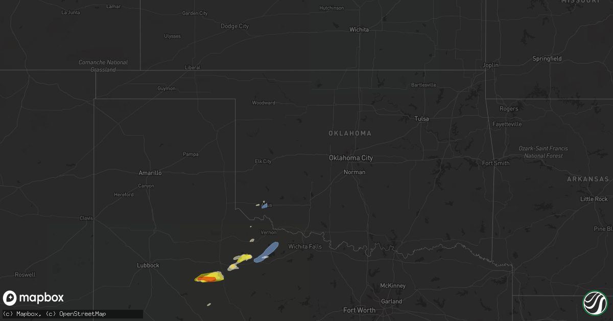
Hail Map in Oklahoma on May 28, 2022
Get this storm
May 28 map
$229
one time, instant access
Download today. No call, no setup
Keep the $229
Bought the map and want the full workflow? Apply the entire $229 to a subscription within 7 days. None of it is wasted.
Every map, not just this one
This buys you this map. Subscription and you get every map we run, in the markets you choose from a few cities to whole states to nationwide. Plus real-time alerts the moment a storm fires.
Contact data
Name, contact info, occupancy, even credit band for addresses in the footprint. You go from where it hit to who to call.
Become the source they trust
Unlimited branding weather history reports on demand. You already have the documented answer ready for the property owner, and you are the one who showed up with it.
Property data and RoofTrace estimates
Pull up any address you have got, its value and the exact code rules for that jurisdiction, straight from One Click Code. Then RoofTrace estimates the squares, pitch, and roof value, priced the way you price.
Storm reports in Oklahoma
Oklahoma
| Date | Description |
|---|---|
| 05/28/20222:23 AM CDT | At 723 PM CDT, a severe thunderstorm was located near Martha, moving northeast at 40 mph. HAZARD...60 mph wind gusts and quarter size hail. SOURCE...Radar indicated. IMPACT...Hail damage to vehicles is expected. Expect wind damage to roofs, siding, and trees. Locations impacted include... Altus, Blair, Roosevelt, Martha, Friendship, Cooperton, Altus Air Force Base, Warren and Tom Steed Reservoir. |
| 05/28/20221:12 AM CDT | At 611 PM CDT, a severe thunderstorm was located 4 miles southeast of Quanah, moving northeast at 35 mph. HAZARD...60 mph wind gusts and nickel size hail. SOURCE...Radar indicated. IMPACT...Expect damage to roofs, siding, and trees. Locations impacted include... Quanah, Chillicothe, Odell and Fargo. |
| 05/27/20227:20 PM CDT | Relay from kwtv. |
All States Impacted by Hail Map on May 28, 2022
Cities Impacted by Hail Map on May 28, 2022
- Forman, ND
- Hawley, MN
- Mission, SD
- Sisseton, SD
- Saint Francis, SD
- Hulett, WY
- Devils Tower, WY
- Sleepy Eye, MN
- Morgan, MN
- Springfield, MN
- Clements, MN
- Erskine, MN
- Winger, MN
- Gary, MN
- Twin Valley, MN
- Mahnomen, MN
- Ulen, MN
- Fertile, MN
- Mcintosh, MN
- Fosston, MN
- Bejou, MN
- Mentor, MN
- Cody, NE
- Beulah, WY
- Aspermont, TX
- Girard, TX
- Old Glory, TX
- Jayton, TX
- Bingham Lake, MN
- Windom, MN
- Wagner, SD
- Adrian, MN
- Rushmore, MN
- Jackson, MN
- Mountain Lake, MN
- Okeechobee, FL
- Fairfax, SD
- Newell, SD
- Viborg, SD
- Hurley, SD
- Sioux Falls, SD
- Tea, SD
- Harrisburg, SD
- Canton, SD
- Thornwood, NY
- Pleasantville, NY
- Miller, SD
- Ellsworth, MN
- Martin, SD
- Lamberton, MN
- Sanborn, MN
- Parmelee, SD
- Tuthill, SD
- Raymond, SD
- Carpenter, SD
- Andover, SD
- Britton, SD
- Whitman, NE
- Chancellor, SD
- Hialeah, FL
- Miami, FL
- Batesland, SD
- George, IA
- Rock Rapids, IA
- Edgerton, MN
- Hardwick, MN
- Menno, SD
- Irene, SD
- Freeman, SD
- Yale, SD
- Mellette, SD
- Union Center, SD
- Rothsay, MN
- Wanblee, SD
- Milnor, ND
- Belvidere, SD
- New Effington, SD
- Quinn, SD
- Bristol, SD
- Kilgore, NE
- Larchwood, IA
- Platte, SD
- Altus, OK
- Worthing, SD
- Lennox, SD
- Valley Springs, SD
- Renner, SD
- Garretson, SD
- Hartford, SD
- Brandon, SD
- Marion, SD
- Nenzel, NE
- Kenneth, MN
- Wilmont, MN
- Lismore, MN
- Brewster, MN
- Worthington, MN
- Moorcroft, WY
- Gordon, NE
- Gwinner, ND
- Saint Lawrence, SD
- Sundance, WY
- Kadoka, SD
- Weston, WY
- Rozet, WY
- Duke, OK
- Hills, MN
- Butterfield, MN
- Saint James, MN
- Cogswell, ND
- Lake Park, MN
- Waubun, MN
- Slayton, MN
- Woodstock, MN
- Tracy, MN
- Balaton, MN
- Lake Wilson, MN
- Garvin, MN
- Chandler, MN
- Howes, SD
- Wasta, SD
- Enning, SD
- White Owl, SD
- Gregory, SD
- Butte, NE
- Lake Andes, SD
- Spencer, NE
- Huron, SD
- Sebring, FL
- Corinne, UT
- Parker, SD
- Okabena, MN
- Lakefield, MN
- Reading, MN
- Conde, SD
- Merriman, NE
- Allen, SD
- Haledon, NJ
- Paterson, NJ
- Wayne, NJ
- Tyndall, SD
- Avon, SD
- Scotland, SD
- Seymour, TX
- Paducah, TX
- Crowell, TX
- Inwood, IA
- Robinson, KS
- Highland, KS
- Kanaranzi, MN
- Luverne, MN
- Magnolia, MN
- Labelle, FL
- Langford, SD
- Hitterdal, MN
- Centerville, SD
- Heron Lake, MN
- Bigelow, MN
- Little Rock, IA
- Leota, MN
- Humboldt, SD
- Fulda, MN
- Sibley, IA
- Utica, SD
- Jeffers, MN
- Lesterville, SD
- Beaver Creek, MN
- Kaylor, SD
- Lester, IA
- Hanska, MN
- Pipestone, MN
- Iona, MN
- Jasper, MN
- Westbrook, MN
- Olivet, SD
- Davis, SD
- Springfield, SD
- Avoca, MN
- Madelia, MN
- Ocheyedan, IA
- Storden, MN
- Steen, MN
- Round Lake, MN
- Alvord, IA
- Tripp, SD
- Doon, IA
- Ashby, NE
- Mud Butte, SD
- Faith, SD
- Rotan, TX
- Interior, SD
- South Bay, FL
- Montevideo, MN
- Benson, MN
- Schaller, IA
- Arthur, IA
- Galva, IA
- Odebolt, IA
- Starbuck, MN
- Peterson, IA
- Kimball, SD
- Hancock, MN
- Clontarf, MN
- Dante, SD
- Norwalk, CT
- Westport, CT
- Clewiston, FL
- Valentine, NE
- Lake Wales, FL
- Frostproof, FL
- Sturgis, SD
- Belle Fourche, SD
- Quanah, TX
- Dunlap, IA
- Gillette, WY
- Upton, WY
- Ludlow, SD
- Prairie City, SD
- Meadow, SD
- Buffalo, SD
- Bison, SD
- Aladdin, WY
- Reva, SD
- Alzada, MT
- Dupree, SD
- Okreek, SD
- Wood, SD
- Vienna, SD
- Garden City, SD
- Clark, SD
- Henry, SD
- Willow Lake, SD
- Bryant, SD
- Hazel, SD
- Ortley, SD
- Waubay, SD
- Wallace, SD
- Florence, SD
- Webster, SD
- Eden, SD
- Pierpont, SD
- Lake City, SD
- Roslyn, SD
- Wyndmere, ND
- Veblen, SD
- Cayuga, ND
- Lidgerwood, ND
- Dell Rapids, SD
- Crooks, SD
- Baltic, SD
- Beresford, SD
- Hyannis, NE
- Stewart, MN
- Comfrey, MN
- Brownton, MN
- Winthrop, MN
- Fairfax, MN
- Gibbon, MN
- Lafayette, MN
- New Ulm, MN
- Walnut Grove, MN
- Wabasso, MN
- Lucan, MN
- Electra, TX
- Altus Afb, OK


