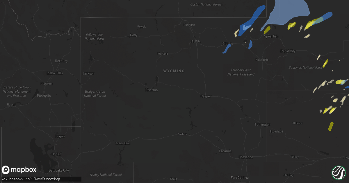
Hail Map in Wyoming on May 28, 2022
Get this storm
May 28 map
$229
one time, instant access
Download today. No call, no setup
Keep the $229
Bought the map and want the full workflow? Apply the entire $229 to a subscription within 7 days. None of it is wasted.
Every map, not just this one
This buys you this map. Subscription and you get every map we run, in the markets you choose from a few cities to whole states to nationwide. Plus real-time alerts the moment a storm fires.
Contact data
Name, contact info, occupancy, even credit band for addresses in the footprint. You go from where it hit to who to call.
Become the source they trust
Unlimited branding weather history reports on demand. You already have the documented answer ready for the property owner, and you are the one who showed up with it.
Property data and RoofTrace estimates
Pull up any address you have got, its value and the exact code rules for that jurisdiction, straight from One Click Code. Then RoofTrace estimates the squares, pitch, and roof value, priced the way you price.
Storm reports in Wyoming
Wyoming
| Date | Description |
|---|---|
| 05/28/20225:25 PM CDT | Also small marble sized hail |
| 05/28/20225:20 PM CDT | A local report indicates 60 MPH wind near 1 NNE HULETT |
| 05/28/20224:52 PM CDT | A local report indicates 59 MPH wind near 10 ESE PINE HAVEN |
| 05/28/20224:30 PM CDT | A local report indicates 58 MPH wind near 10 SW DWTN GILLETTE |
| 05/28/20224:15 PM CDT | A local report indicates 62 MPH wind near 10 SW DWTN GILLETTE |
| 05/28/20224:15 PM CDT | Pea size hail |
| 05/28/20224:10 PM CDT | Part of neighbor's tin roof blew into yard |
| 05/27/202211:38 PM CDT | At 438 PM MDT, a severe thunderstorm was located 7 miles northeast of Beulah, or 8 miles west of Belle Fourche, moving northeast at 40 mph. HAZARD...60 mph wind gusts and quarter size hail. SOURCE...Radar indicated. IMPACT...Hail damage to vehicles is expected. Expect wind damage to roofs, siding, and trees. This severe thunderstorm will be near... Belle Fourche around 450 PM MDT.Other locations in the path of this severe thunderstorm includenorthwestern Belle Fourche Reservoir.This includes... Interstate 90 in South Dakota between Mile Markers 1 and 29. Interstate 90 in Wyoming between Mile Markers 206 and 207. |
| 05/27/202211:28 PM CDT | At 426 PM MDT, severe thunderstorms were located along a line extending from 7 miles east of Rockypoint to 10 miles north of Hulett to near Aladdin, moving northeast at 65 mph. HAZARD...60 mph wind gusts and quarter size hail. SOURCE...Radar indicated. Storms have a history of producing strong winds over northeast Wyoming over the past hour. IMPACT...Hail damage to vehicles is expected. Expect wind damage to roofs, siding, and trees. Locations impacted include... Alzada, Ridgeway, Hammond, Capitol, Albion, Boyes and Ridge. |
| 05/27/202210:08 PM CDT | At 308 PM MDT, severe thunderstorms were located along a line extending from 3 miles southwest of Gillette Airport to 18 miles south of Rozet to 15 miles northwest of Clareton, moving northeast at 45 mph. HAZARD...60 mph wind gusts and quarter size hail. SOURCE...Radar indicated. IMPACT...Hail damage to vehicles is expected. Expect wind damage to roofs, siding, and trees. Severe thunderstorms will be near... Gillette Airport and Camplex Event Facility around 315 PM MDT.Other locations in the path of these severe thunderstorms includeMoorcroft, Upton, Pine Haven, Weston, Keyhole Reservoir, Carlile,Devils Tower Junction, Oshoto and Devils Tower National Monument.This includes Interstate 90 in Wyoming between Mile Markers 113 and186. |
All States Impacted by Hail Map on May 28, 2022
Cities Impacted by Hail Map on May 28, 2022
- Forman, ND
- Hawley, MN
- Mission, SD
- Sisseton, SD
- Saint Francis, SD
- Hulett, WY
- Devils Tower, WY
- Sleepy Eye, MN
- Morgan, MN
- Springfield, MN
- Clements, MN
- Erskine, MN
- Winger, MN
- Gary, MN
- Twin Valley, MN
- Mahnomen, MN
- Ulen, MN
- Fertile, MN
- Mcintosh, MN
- Fosston, MN
- Bejou, MN
- Mentor, MN
- Cody, NE
- Beulah, WY
- Aspermont, TX
- Girard, TX
- Old Glory, TX
- Jayton, TX
- Bingham Lake, MN
- Windom, MN
- Wagner, SD
- Adrian, MN
- Rushmore, MN
- Jackson, MN
- Mountain Lake, MN
- Okeechobee, FL
- Fairfax, SD
- Newell, SD
- Viborg, SD
- Hurley, SD
- Sioux Falls, SD
- Tea, SD
- Harrisburg, SD
- Canton, SD
- Thornwood, NY
- Pleasantville, NY
- Miller, SD
- Ellsworth, MN
- Martin, SD
- Lamberton, MN
- Sanborn, MN
- Parmelee, SD
- Tuthill, SD
- Raymond, SD
- Carpenter, SD
- Andover, SD
- Britton, SD
- Whitman, NE
- Chancellor, SD
- Hialeah, FL
- Miami, FL
- Batesland, SD
- George, IA
- Rock Rapids, IA
- Edgerton, MN
- Hardwick, MN
- Menno, SD
- Irene, SD
- Freeman, SD
- Yale, SD
- Mellette, SD
- Union Center, SD
- Rothsay, MN
- Wanblee, SD
- Milnor, ND
- Belvidere, SD
- New Effington, SD
- Quinn, SD
- Bristol, SD
- Kilgore, NE
- Larchwood, IA
- Platte, SD
- Altus, OK
- Worthing, SD
- Lennox, SD
- Valley Springs, SD
- Renner, SD
- Garretson, SD
- Hartford, SD
- Brandon, SD
- Marion, SD
- Nenzel, NE
- Kenneth, MN
- Wilmont, MN
- Lismore, MN
- Brewster, MN
- Worthington, MN
- Moorcroft, WY
- Gordon, NE
- Gwinner, ND
- Saint Lawrence, SD
- Sundance, WY
- Kadoka, SD
- Weston, WY
- Rozet, WY
- Duke, OK
- Hills, MN
- Butterfield, MN
- Saint James, MN
- Cogswell, ND
- Lake Park, MN
- Waubun, MN
- Slayton, MN
- Woodstock, MN
- Tracy, MN
- Balaton, MN
- Lake Wilson, MN
- Garvin, MN
- Chandler, MN
- Howes, SD
- Wasta, SD
- Enning, SD
- White Owl, SD
- Gregory, SD
- Butte, NE
- Lake Andes, SD
- Spencer, NE
- Huron, SD
- Sebring, FL
- Corinne, UT
- Parker, SD
- Okabena, MN
- Lakefield, MN
- Reading, MN
- Conde, SD
- Merriman, NE
- Allen, SD
- Haledon, NJ
- Paterson, NJ
- Wayne, NJ
- Tyndall, SD
- Avon, SD
- Scotland, SD
- Seymour, TX
- Paducah, TX
- Crowell, TX
- Inwood, IA
- Robinson, KS
- Highland, KS
- Kanaranzi, MN
- Luverne, MN
- Magnolia, MN
- Labelle, FL
- Langford, SD
- Hitterdal, MN
- Centerville, SD
- Heron Lake, MN
- Bigelow, MN
- Little Rock, IA
- Leota, MN
- Humboldt, SD
- Fulda, MN
- Sibley, IA
- Utica, SD
- Jeffers, MN
- Lesterville, SD
- Beaver Creek, MN
- Kaylor, SD
- Lester, IA
- Hanska, MN
- Pipestone, MN
- Iona, MN
- Jasper, MN
- Westbrook, MN
- Olivet, SD
- Davis, SD
- Springfield, SD
- Avoca, MN
- Madelia, MN
- Ocheyedan, IA
- Storden, MN
- Steen, MN
- Round Lake, MN
- Alvord, IA
- Tripp, SD
- Doon, IA
- Ashby, NE
- Mud Butte, SD
- Faith, SD
- Rotan, TX
- Interior, SD
- South Bay, FL
- Montevideo, MN
- Benson, MN
- Schaller, IA
- Arthur, IA
- Galva, IA
- Odebolt, IA
- Starbuck, MN
- Peterson, IA
- Kimball, SD
- Hancock, MN
- Clontarf, MN
- Dante, SD
- Norwalk, CT
- Westport, CT
- Clewiston, FL
- Valentine, NE
- Lake Wales, FL
- Frostproof, FL
- Sturgis, SD
- Belle Fourche, SD
- Quanah, TX
- Dunlap, IA
- Gillette, WY
- Upton, WY
- Ludlow, SD
- Prairie City, SD
- Meadow, SD
- Buffalo, SD
- Bison, SD
- Aladdin, WY
- Reva, SD
- Alzada, MT
- Dupree, SD
- Okreek, SD
- Wood, SD
- Vienna, SD
- Garden City, SD
- Clark, SD
- Henry, SD
- Willow Lake, SD
- Bryant, SD
- Hazel, SD
- Ortley, SD
- Waubay, SD
- Wallace, SD
- Florence, SD
- Webster, SD
- Eden, SD
- Pierpont, SD
- Lake City, SD
- Roslyn, SD
- Wyndmere, ND
- Veblen, SD
- Cayuga, ND
- Lidgerwood, ND
- Dell Rapids, SD
- Crooks, SD
- Baltic, SD
- Beresford, SD
- Hyannis, NE
- Stewart, MN
- Comfrey, MN
- Brownton, MN
- Winthrop, MN
- Fairfax, MN
- Gibbon, MN
- Lafayette, MN
- New Ulm, MN
- Walnut Grove, MN
- Wabasso, MN
- Lucan, MN
- Electra, TX
- Altus Afb, OK


