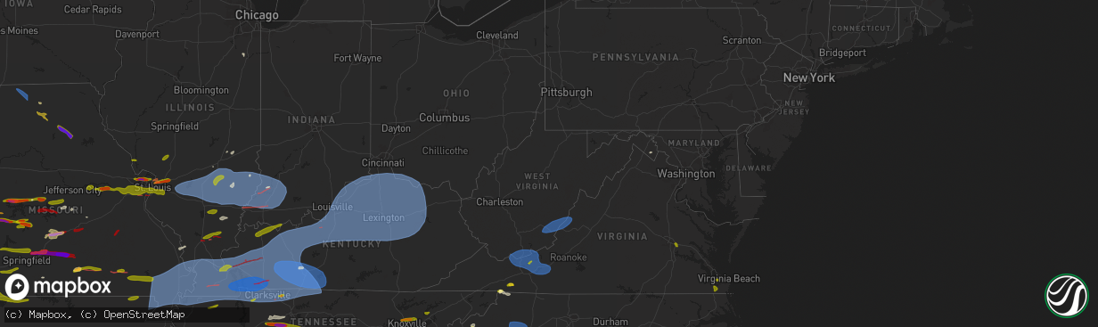
Hail Map in West Virginia on May 26, 2024
The weather event in West Virginia on May 26, 2024 includes Hail, Wind, and Tornado maps. 24 states and 2,056 cities were impacted and suffered possible damage. The total estimated number of properties impacted is 0.
Want more than just the map?
Turn this storm into a full workflow.
- Owner + property data so you know who to knock
- OnDemand branded weather history reports to win the "did we even have hail?" argument
- RoofTrace estimate so reps stop guessing numbers at the door
Bought this map? Upgrade within 7 days and we'll credit the $230. (10-15 min setup call)
Hail
Wind
Tornado
0
Estimated number of impacted properties by a 1.00" hail or larger0
Estimated number of impacted properties by a 1.75" hail or larger0
Estimated number of impacted properties by a 2.50" hail or largerStorm reports in West Virginia
West Virginia
| Date | Description |
|---|---|
| 05/26/20246:57 PM CDT | Tree down in seneca rocks. |
| 05/26/20246:57 PM CDT | Tree down across the road. |
| 05/26/20246:55 PM CDT | Numerous trees down. |
| 05/26/20246:55 PM CDT | Tree down on fishers mill with lines down. |
| 05/26/20246:52 PM CDT | Tree down... Power out... Lines down. |
| 05/26/20246:52 PM CDT | Numerous trees down. |
| 05/26/20246:50 PM CDT | Tree down. |
| 05/26/20246:48 PM CDT | Numerous trees down. |
| 05/26/20246:47 PM CDT | Numerous trees down. |
| 05/26/20246:40 PM CDT | Numerous trees down. |
| 05/26/20246:40 PM CDT | Trees down |
| 05/26/20246:39 PM CDT | Numerous trees down. |
| 05/26/20246:39 PM CDT | Numerous trees down. |
| 05/26/20246:39 PM CDT | Tree fell on camper at horseshoe recreation area... No injuries. |
| 05/26/20246:36 PM CDT | Tree down with lines involved. |
| 05/26/20246:36 PM CDT | Tree down blocking one lane on roadway. |
| 05/26/20246:34 PM CDT | Numerous trees down. |
| 05/26/20246:28 PM CDT | Tree down. |
| 05/26/20246:26 PM CDT | Tree down on road in the city of parsons... Wv. |
| 05/26/20246:22 PM CDT | Tree down. |
| 05/26/20246:19 PM CDT | Numerous trees down. |
| 05/26/20246:15 PM CDT | Tree down across roadway. Time estimated by radar. |
| 05/26/20246:12 PM CDT | Numerous trees down. |
| 05/26/20246:05 PM CDT | Numerous trees down. |
| 05/26/20246:01 PM CDT | Trees down blocking both lanes. |
| 05/26/20246:00 PM CDT | Reports of a tree down on mt union rd and sand run rd near buckhannon. Reported via upshur 911 center. Time estimated via radar. |
| 05/26/20245:57 PM CDT | Numerous trees down. |
| 05/26/20245:56 PM CDT | Numerous trees down. |
| 05/26/20245:55 PM CDT | Tree blocking entire road. |
| 05/26/20245:55 PM CDT | Trees down blocking both lanes approx 1 mile south of the 92 39 intersection. |
| 05/26/20245:50 PM CDT | Trees down on the campground rd - tree fell onto a camping trailer but occupants are out and safe. |
| 05/26/20245:50 PM CDT | Tree down blocking road in a curve. Time estimated from radar. |
| 05/26/20245:49 PM CDT | Upshur county 911 passed along a tree down completely blocking the road in the vicinity of 6000 alexander rd in french creek. Time estimated by radar. |
| 05/26/20245:46 PM CDT | Tree and lines blocking the road. Time estimated from radar. |
| 05/26/20245:45 PM CDT | Upshur county 911 center reports several trees and lines down along the 180 block of randolph street in buckhannon. |
| 05/26/20245:45 PM CDT | Tree down blocking road. Time estimated from radar. |
| 05/26/20245:44 PM CDT | 911 cente |
| 05/26/20245:44 PM CDT | Lewis county 911 center reported tree down 1000 block of hackers creek rd in jane lew. |
| 05/26/20245:44 PM CDT | 911 center reported power pole broken and lines down 200 block of n tenney dr in buckhannon. Time estimated via radar. |
| 05/26/20245:44 PM CDT | Upshur county 911 center reports a tree down on a line causing a fire at the 100 block of nora reid rd in tallmansville. Time estimated from radar. |
| 05/26/20245:44 PM CDT | Gilmer county 911 center reports trees and lines down in the roadway of lynncamp run rd and peach tree fork rd near normantown. Time estimated by radar. |
| 05/26/20245:44 PM CDT | Upshur county 911 reports a tree down completely blocking the slab camp rd at beaver camp rd in french creek. Time estimated from radar. |
| 05/26/20245:44 PM CDT | Upshur county 911 reports a tree down completely blocking hawkins rd at the intersection of heavner grove rd. Time estimated by radar. |
| 05/26/20245:44 PM CDT | Lewis county 911 center reports large tree down blocking a lane of us hwy 19 s and resort dr near walkersville. Time estimated from radar. |
| 05/26/20245:44 PM CDT | Upshur county 911 center reports lines and trees down along chestnut st and park st in buckhannon. Time estimated via radar. |
| 05/26/20245:44 PM CDT | Lewis county 911 center reports tree down at the intersection of abrams run and sapp run rd in walkersville. Tree is blocking entire roadway. Time estimated from radar. |
| 05/26/20245:44 PM CDT | Gilmer county 911 center reports tree down blocking a lane on us hwy 5 in the 4800 block. Time estimated via radar. |
| 05/26/20245:44 PM CDT | Upshur county 911 center reported a tree and lines down 3300 block of brushy fork rd in buckhannon. Time estimated from radar. |
| 05/26/20245:44 PM CDT | Tree down. Time estimated from radar. |
| 05/26/20245:42 PM CDT | Tree down blocking king schoolhouse road. Time estimated from radar. |
| 05/26/20245:40 PM CDT | Trees down |
| 05/26/20245:40 PM CDT | Upshur county 911 center has reports of a tree down blocking a portion of stony run rd. Time estimated via radar. |
| 05/26/20245:40 PM CDT | Upshur county 911 center has reports of a tree down on a power line in the 400 block of spruce run rd in buckhannon. Time estimated via radar. |
| 05/26/20245:37 PM CDT | Lewis county 911 center reports multiple trees down blocking the road along grass run rd and old route 33 in weston. Time estimated by radar. |
| 05/26/20245:37 PM CDT | Lewis county 911 center reports trees and lines down on sauls run rd in horner. Time estimated by radar. |
| 05/26/20245:37 PM CDT | Received a call about wind damage along the 2500 block of glady fork rd. A swath of trees are down on some property as well as sections of a wooden roof are missing. Ti |
| 05/26/20245:35 PM CDT | Tree down blocking bridge run road. Time estimated from radar. |
| 05/26/20245:34 PM CDT | Lewis county 911 center reported a tree down 600 block of bear run rd near oil creek rd in walkersville. Time estimated via radar. |
| 05/26/20245:34 PM CDT | Lewis county 911 center reported tree down blocking the road 3500 block of oil creek rd near two lick rd in walkersville. Time estimated from radar. |
| 05/26/20245:31 PM CDT | Multiple trees down along the stonewall resort marina. |
| 05/26/20245:30 PM CDT | Trees down. |
| 05/26/20245:29 PM CDT | Tree down blocking road. |
| 05/26/20245:20 PM CDT | Power lines down due to high wind. |
| 05/26/20245:20 PM CDT | Tree and power line damage widespread in the county. Time estimated from radar. |
| 05/26/20245:20 PM CDT | Tree down. |
| 05/26/20245:19 PM CDT | Roof damage at riverside shopping center. Power poles snapped. |
| 05/26/20245:17 PM CDT | Tree down near the lewis county line. Time estimated from radar. |
| 05/26/20245:16 PM CDT | Down tree road blocked. |
| 05/26/20245:10 PM CDT | Tree down. Time estimated from radar. |
| 05/26/20245:10 PM CDT | Tree down. Time estimated from radar. |
| 05/26/20245:10 PM CDT | Tree down. Time estimated from radar. |
| 05/26/20245:05 PM CDT | A 53 knot wind gust was recorded by the awos at the greenbrier valley airport |
| 05/26/20245:05 PM CDT | Thunderstorm winds blew down several trees in lewisburg with one on to a house and another on top of a car. |
| 05/26/20245:00 PM CDT | Tree down. Time estimated from radar. |
| 05/26/20244:50 PM CDT | Tree and lines blocking u.s. Highway 33 between apple drive and middle run. Time estimated from radar. |
| 05/26/20244:45 PM CDT | The quinwood coop observer reported that a few trees were blown down in the quinwood area. A couple of power lines were also downed by the fallen trees. |
| 05/26/20244:45 PM CDT | Tree reported down east of clay... Wv. Time is estimated by radar. |
| 05/26/20244:43 PM CDT | The quinwood coop observer reported that numerous trees and power lines were down in the alderson area. |
| 05/26/20244:38 PM CDT | Tree reported down on salisbury road. Time is estimated by radar. |
| 05/26/20244:32 PM CDT | Tree down blocking both lanes. |
| 05/26/20244:30 PM CDT | 4 inch limbs broken off tree confirmed by photo from a concerned citizen. |
| 05/26/20244:29 PM CDT | Tree reported down blocking both lanes of guy mullins road. Time is estimated by radar. |
| 05/26/20244:23 PM CDT | Extensive tree damage occurred along a quarter mile stretch of rich creek road. Peak wind speeds in the core of the microburst likely reached up to 110 mph. |
| 05/26/20244:15 PM CDT | A large tree was blown down along falling timber road near palestine. Time estimated from radar. |
| 05/26/20244:15 PM CDT | Multiple areas of downed trees observed in the parkersburg area... Including 19th avenue... Morningside avenue... And 26th street. Time estimated from radar. |
| 05/26/20244:13 PM CDT | *** 1 inj *** trees down along grandview road... Including at the grandview state park amphitheater. One person was injured after falling. |
| 05/26/20244:10 PM CDT | Numerous trees and power lines were blown down by thunderstorm winds across summers county. Several areas are without power this evening. |
| 05/26/20244:09 PM CDT | Thunderstorm winds blew down a large tree that fell on to a house along glenwood park road. |
| 05/26/20244:07 PM CDT | The mercer county 911 center reported that a large tree was down on camp creek road just before its intersection with u.s. 19 and was blocking the entire road. Time of |
| 05/26/20244:07 PM CDT | Small area of snapped and uprooted trees along elkridge road. |
| 05/26/20244:05 PM CDT | A 53 knot wind gust was recorded by the awos at the greenbrier valley airport |
| 05/26/20244:04 PM CDT | Mesonet station ccrw2 cross creek ridge. |
| 05/26/20244:04 PM CDT | A large tree was blown down by thunderstorm winds onto a home. |
| 05/26/20244:03 PM CDT | Trees snapped/uprooted near appalachian bible college. |
| 05/26/20244:03 PM CDT | The mercer county 911 center reported that a large tree was down on bull tail hollow road just before the horseshoe curve blocking the entire road at this location. Tim |
| 05/26/20244:02 PM CDT | A tree fell onto a van and through its windshield near a home along wadesville road. Time estimated from radar. |
| 05/26/20244:02 PM CDT | Numerous trees and power lines blown down in and around beckley. Some of these roads include reservoir road... Hillpark drive... And mercer street... Where a tree fell |
| 05/26/20244:02 PM CDT | A tree was blown down by thunderstorm winds onto a home along glenwood park road. |
| 05/26/20244:00 PM CDT | A tree and a power line were blown down by thunderstorm winds along kirk street. |
| 05/26/20244:00 PM CDT | A 52 knot gust was recorded by the asos at the mercer county airport |
| 05/26/20244:00 PM CDT | Tree down with damage on cunningham ave. Time estimated from radar. |
| 05/26/20243:58 PM CDT | *** 1 inj *** sparks from live power lines blown down by thunderstorm winds caused a structural fire. A person was reported injured. |
| 05/26/20243:58 PM CDT | A power line was blown down by thunderstorm winds along union street. |
| 05/26/20243:57 PM CDT | Tree and lines down. |
| 05/26/20243:57 PM CDT | Multiple local roads in crab orchard has observed downed trees and power lines... Including glenview road... Brethren road... And midway road. Time estimated from radar |
| 05/26/20243:56 PM CDT | Dozens of trees were blown down across the city of bluefield... Wv by thunderstorm winds. Some of the trees took down nearby power lines as they fell. |
| 05/26/20243:56 PM CDT | A tree and a power line were blown down by thunderstorm winds. |
| 05/26/20243:55 PM CDT | Tree down due to high wind. |
| 05/26/20243:55 PM CDT | Tree down over roadway. |
| 05/26/20243:54 PM CDT | A tree was blown down by thunderstorm winds along littlesburg road. |
| 05/26/20243:53 PM CDT | One tree down along harper road in surveyor. Time estimated from radar. |
| 05/26/20243:52 PM CDT | Multiple areas of downed trees and power lines between bolt and fairdale... Including ash lane and saxon road. Time estimated from radar. |
| 05/26/20243:50 PM CDT | Tree down across roadway. |
| 05/26/20243:45 PM CDT | Tree and power lines down on steps in front of house in north fork... Blocking entry and exit. Wife trapped inside... Husband trapped outside. |
| 05/26/20243:45 PM CDT | Tree down near bloomingrose. Time estimated by radar. |
| 05/26/20243:45 PM CDT | Corrects previous tstm wnd dmg report from 3 nne cross lanes. Tree down. |
| 05/26/20243:44 PM CDT | Two trees down in the poca area... Including along oakmont drive and dairy road. Time estimated by radar. |
| 05/26/20243:44 PM CDT | Trees fell on two house but no damage to either structure. One lane of state street... Rt 85... Blocked by a tree. Entrance to holly hills was blocked by a large limb o |
| 05/26/20243:40 PM CDT | Corrects previous tstm wnd dmg report from 2 wsw winfield. Tree down blocking both lanes. |
| 05/26/20243:36 PM CDT | Tree down over roadway. |
| 05/26/20243:34 PM CDT | Multiple trees down in the welch area. Time estimated from radar. |
| 05/26/20243:31 PM CDT | Several trees and power lines blown down in the winfield area... Including bills creek road and state route 34. Time estimated by radar. |
| 05/26/20243:29 PM CDT | Big pine tree down on main caretta road in war. Time estimated from radar. |
| 05/26/20243:28 PM CDT | Tree down. |
| 05/26/20243:25 PM CDT | Corrects previous tstm wnd dmg report from 1 se poca. Tree down over roadway. |
| 05/26/20243:25 PM CDT | Corrects previous tstm wnd dmg report from 1 nnw winfield. Tree down due to high wind. |
| 05/26/20243:23 PM CDT | A brief ef0 tornado occurred behind winfield elementary school causing mostly tree damage but also damaging one home. |
| 05/26/20243:20 PM CDT | Tree down with power lines. |
| 05/26/20243:18 PM CDT | Tree down on power lines. |
| 05/26/20243:18 PM CDT | Tree reported down blocking millstone road. |
| 05/26/20243:15 PM CDT | Tree down on power lines. Time is estimated by radar. |
| 05/26/20243:03 PM CDT | Several reports of trees down on power lines. Time is estimated by radar. |
| 05/26/20242:56 PM CDT | Tree down at buffalo creek rd. At the chattaroy church of god. Time estimated from radar. Also trees down throughout the county. |
| 05/26/20242:56 PM CDT | Tree down on maple walk. |
| 05/25/20249:30 PM CDT | Tree down in 10400 block of williamsport pike. |
| 05/25/20249:26 PM CDT | Multiple reports of trees down throughout jefferson county. |
| 05/25/20249:17 PM CDT | Tree down in the 400 block of weaver lane. |
| 05/25/20249:05 PM CDT | Tree down in 700 block of giles mill road. |
| 05/25/20248:21 PM CDT | A third tree was down on duncan road. |
| 05/25/20248:01 PM CDT | Trees and power lines down on vanderlip drive |
| 05/25/20248:01 PM CDT | Lightning struck at a tree which split it in half...part of the tree fell onto power lines. |
| 05/25/20247:58 PM CDT | Tree down. |
| 05/25/20247:57 PM CDT | Tree down across both lanes. |
| 05/25/20247:49 PM CDT | Tree down on upper patterson creek road in burlington. |
| 05/25/20247:43 PM CDT | Large tree down blocking the entire road. |
| 05/25/20247:34 PM CDT | Multiple reports of trees down in the western half of hardy county. |
| 05/25/20247:32 PM CDT | Tree down and blocking one lane. |
| 05/25/20247:24 PM CDT | Tree down on morgantown road near intersection with patterson creek road. |
| 05/25/20247:15 PM CDT | Tree down blocking whole road. |
| 05/25/20247:12 PM CDT | Tree down. |
| 05/25/20247:05 PM CDT | Tree down across entire roadway. |
All States Impacted by Hail Map on May 26, 2024
Cities Impacted by Hail Map on May 26, 2024
- Pawnee City, NE
- Omaha, NE
- Crescent, IA
- Council Bluffs, IA
- Carter Lake, IA
- McClelland, IA
- Honey Creek, IA
- Underwood, IA
- Holcomb, MO
- Qulin, MO
- Knobel, AR
- Gideon, MO
- Corning, AR
- Pollard, AR
- Lafe, AR
- Delaplaine, AR
- Lilbourn, MO
- Rector, AR
- Malden, MO
- Gibson, MO
- Greenway, AR
- Paragould, AR
- Saint Francis, AR
- Parma, MO
- Bernie, MO
- Dexter, MO
- Campbell, MO
- Portageville, MO
- Catron, MO
- Piggott, AR
- Clarkton, MO
- Neelyville, MO
- Dudley, MO
- Poplar Bluff, MO
- Broseley, MO
- Fisk, MO
- Puxico, MO
- Bloomfield, MO
- San Saba, TX
- Richland Springs, TX
- Purmela, TX
- Evant, TX
- Gatesville, TX
- Thebes, IL
- Wardell, MO
- Essex, MO
- Kennett, MO
- Benton, MO
- Vanduser, MO
- Oran, MO
- Sikeston, MO
- New Madrid, MO
- Marston, MO
- Bell City, MO
- Canalou, MO
- Matthews, MO
- Goldthwaite, TX
- East Prairie, MO
- Charleston, MO
- Bragg City, MO
- Lometa, TX
- Crawford, TX
- Valley Mills, TX
- Woodway, TX
- China Spring, TX
- Hayti, MO
- Tiptonville, TN
- Jonesboro, TX
- Scott City, MO
- Olive Branch, IL
- Tamms, IL
- Miller City, IL
- Bertrand, MO
- Cairo, IL
- Union City, TN
- Hickman, KY
- Anniston, MO
- Ridgely, TN
- Hornbeak, TN
- Mounds, IL
- Troy, TN
- Pulaski, IL
- Mound City, IL
- La Center, KY
- Villa Ridge, IL
- Olmsted, IL
- Arlington, KY
- Clinton, KY
- Kevil, KY
- Grand Chain, IL
- Wickliffe, KY
- Barlow, KY
- Columbus, KY
- Bardwell, KY
- McGregor, TX
- Waco, TX
- Fulton, KY
- South Fulton, TN
- Rives, TN
- Fancy Farm, KY
- Wingo, KY
- Metropolis, IL
- Paducah, KY
- West Paducah, KY
- Cunningham, KY
- Melber, KY
- Hickory, KY
- Water Valley, KY
- Mayfield, KY
- Lampasas, TX
- Obion, TN
- Rantoul, IL
- Boaz, KY
- Brookport, IL
- Martin, TN
- Dukedom, TN
- Sedalia, KY
- Calvert City, KY
- Benton, KY
- Tiline, KY
- Palmersville, TN
- Smithland, KY
- Ledbetter, KY
- Burna, KY
- Golconda, IL
- Symsonia, KY
- Kenton, TN
- Sharon, TN
- Fort Hood, TX
- Summersville, MO
- Salem, KY
- Farmington, KY
- Grand Rivers, KY
- Marion, KY
- Kirksey, KY
- Gilbertsville, KY
- Fredonia, KY
- Kuttawa, KY
- Dexter, KY
- Eddyville, KY
- Hardin, KY
- Almo, KY
- Murray, KY
- Hazel, KY
- Puryear, TN
- Cottage Grove, TN
- Dresden, TN
- Princeton, KY
- New Concord, KY
- Buchanan, TN
- Cadiz, KY
- Olney, IL
- Noble, IL
- Moody, TX
- Greenfield, TN
- Providence, KY
- Big Rock, TN
- Dawson Springs, KY
- Dover, TN
- Bumpus Mills, TN
- Stewart, TN
- Gracey, KY
- Fort Campbell, KY
- La Fayette, KY
- Hopkinsville, KY
- Herndon, KY
- Cerulean, KY
- Nebo, KY
- Indian Mound, TN
- Paris, TN
- Temple, TX
- Killeen, TX
- Fremont, MO
- Gleason, TN
- Ellsinore, MO
- Oglesby, TX
- McKenzie, TN
- Henry, TN
- Saint Charles, KY
- Manitou, KY
- Hanson, KY
- Earlington, KY
- Madisonville, KY
- Nortonville, KY
- Crofton, KY
- Cumberland City, TN
- Woodlawn, TN
- Tennessee Ridge, TN
- Mortons Gap, KY
- Pembroke, KY
- Trenton, KY
- Elkton, KY
- Oak Grove, KY
- Clarksville, TN
- Palmyra, TN
- White Plains, KY
- Greenville, MO
- Copperas Cove, TX
- Mill Spring, MO
- Van Buren, MO
- Williamsville, MO
- Troy, TX
- Eddy, TX
- Bruceville, TX
- Lorena, TX
- Piedmont, MO
- Flat Rock, IL
- Kempner, TX
- Springville, TN
- Wappapello, MO
- Kankakee, IL
- Bonfield, IL
- Chilton, TX
- Grandin, MO
- Big Sandy, TN
- Adams, TN
- Cedar Hill, TN
- Cunningham, TN
- Southside, TN
- Ashland City, TN
- Chapmansboro, TN
- Springfield, TN
- Cumberland Furnace, TN
- Pleasant View, TN
- Guthrie, KY
- Olmstead, KY
- Powderly, KY
- Sharon Grove, KY
- Rumsey, KY
- Dunmor, KY
- Browder, KY
- Belton, KY
- Beechmont, KY
- Adairville, KY
- Russellville, KY
- Drakesboro, KY
- Graham, KY
- Centertown, KY
- Island, KY
- Greenville, KY
- Central City, KY
- Sacramento, KY
- Beech Creek, KY
- Allensville, KY
- Lewisburg, KY
- Bremen, KY
- Calhoun, KY
- Owensboro, KY
- Utica, KY
- Livermore, KY
- Philpot, KY
- Slaughters, KY
- Zalma, MO
- Marlin, TX
- Yorktown, AR
- Bourbonnais, IL
- McGee, MO
- Manteno, IL
- Cross Plains, TN
- Orlinda, TN
- Greenbrier, TN
- Morgantown, KY
- Franklin, KY
- Rochester, KY
- Woodburn, KY
- Beaver Dam, KY
- Cottontown, TN
- McHenry, KY
- Hartford, KY
- Rockport, KY
- Portland, TN
- Rockfield, KY
- White House, TN
- Auburn, KY
- Fordsville, KY
- Cromwell, KY
- Whitesville, KY
- Bowling Green, KY
- Olaton, KY
- Dundee, KY
- Rosine, KY
- Hawesville, KY
- Horse Branch, KY
- Reynolds Station, KY
- Caneyville, KY
- Falls Of Rough, KY
- Cloverport, KY
- Marble Hill, MO
- Advance, MO
- Grady, AR
- Milford, IL
- Thornton, TX
- Hardinsburg, KY
- Scottsville, KY
- Alvaton, KY
- Adolphus, KY
- Westmoreland, TN
- Bethpage, TN
- Watseka, IL
- Lott, TX
- Holland, KY
- Lafayette, TN
- De Witt, AR
- Rosebud, TX
- Gallatin, TN
- Reagan, TX
- Saint Charles, AR
- Ethel, AR
- Elaine, AR
- Holly Grove, AR
- Red Boiling Springs, TN
- Moss, TN
- Hartsville, TN
- Lake City, AR
- Harned, KY
- Guston, KY
- Webster, KY
- Irvington, KY
- McDaniels, KY
- Hudson, KY
- Garfield, KY
- Custer, KY
- Westview, KY
- Big Clifty, KY
- Rineyville, KY
- Cecilia, KY
- Clarkson, KY
- Vine Grove, KY
- Millwood, KY
- Eastview, KY
- Leitchfield, KY
- Elizabeth, IN
- Fort Knox, KY
- West Point, KY
- Charlestown, IN
- Ekron, KY
- Jeffersonville, IN
- Clarksville, IN
- New Albany, IN
- Muldraugh, KY
- Laconia, IN
- Shepherdsville, KY
- Sellersburg, IN
- Radcliff, KY
- Brandenburg, KY
- Louisville, KY
- Elizabethtown, KY
- Fisherville, KY
- Fairdale, KY
- Finchville, KY
- Glenview, KY
- Lebanon Junction, KY
- Taylorsville, KY
- Simpsonville, KY
- Coxs Creek, KY
- Prospect, KY
- Boston, KY
- Mount Washington, KY
- Masonic Home, KY
- Clermont, KY
- Brooks, KY
- Springfield, KY
- Bloomfield, KY
- Fairfield, KY
- Willisburg, KY
- Bardstown, KY
- Tompkinsville, KY
- Hestand, KY
- New Washington, IN
- Buckner, KY
- Goshen, KY
- Crestwood, KY
- Nabb, IN
- La Grange, KY
- Pewee Valley, KY
- Marysville, IN
- White Mills, KY
- Loretto, KY
- New Haven, KY
- Hodgenville, KY
- Sonora, KY
- Glendale, KY
- Westport, KY
- Shelbyville, KY
- Harrodsburg, KY
- Chaplin, KY
- Lawrenceburg, KY
- Smithfield, KY
- Mount Eden, KY
- Salvisa, KY
- Waddy, KY
- Sulphur, KY
- Bagdad, KY
- Bedford, KY
- Bethlehem, IN
- Pendleton, KY
- New Castle, KY
- Eminence, KY
- Milton, KY
- Hanover, IN
- Campbellsburg, KY
- Pleasureville, KY
- Frankfort, KY
- Byrdstown, TN
- Pall Mall, TN
- Livingston, TN
- Monroe, TN
- Lancaster, KY
- Wilmore, KY
- Burgin, KY
- Versailles, KY
- Mackville, KY
- Perryville, KY
- Danville, KY
- Stanford, KY
- Saint Catharine, KY
- Lebanon, KY
- Lockport, KY
- Vevay, IN
- Bethlehem, KY
- Sanders, KY
- Worthville, KY
- Madison, IN
- Owenton, KY
- Ghent, KY
- Carrollton, KY
- Perry Park, KY
- Turners Station, KY
- New Liberty, KY
- Midway, KY
- Nicholasville, KY
- Jamestown, TN
- Calvert, TX
- Bremond, TX
- Trimble, TN
- Paint Lick, KY
- Georgetown, KY
- Lexington, KY
- Stamping Ground, KY
- Richmond, KY
- Bennington, IN
- Warsaw, KY
- Franklin, TX
- Crab Orchard, KY
- Patriot, IN
- Union, KY
- Florence, IN
- Glencoe, KY
- Rising Sun, IN
- Verona, KY
- Corinth, KY
- Williamstown, KY
- Jonesville, KY
- Dry Ridge, KY
- Sadieville, KY
- Sparta, KY
- Waco, KY
- Berea, KY
- Cynthiana, KY
- Winchester, KY
- Paris, KY
- Keystone, SD
- Hermosa, SD
- Brodhead, KY
- Crittenden, KY
- Irvine, KY
- Falmouth, KY
- De Mossville, KY
- Berry, KY
- Walton, KY
- Morning View, KY
- Independence, KY
- Carlisle, KY
- Norfolk, VA
- Mount Vernon, KY
- Normangee, TX
- Millersburg, KY
- Mount Sterling, KY
- Alexandria, KY
- Clay City, KY
- North Middletown, KY
- Foster, KY
- Butler, KY
- Latonia, KY
- Brooksville, KY
- Mount Olivet, KY
- Melbourne, KY
- California, KY
- Owingsville, KY
- Jeffersonville, KY
- Ravenna, KY
- Slade, KY
- Stanton, KY
- Sharpsburg, KY
- New Richmond, OH
- Georgetown, OH
- Germantown, KY
- Tollesboro, KY
- Moscow, OH
- Olympia, KY
- Bethel, OH
- Manchester, OH
- Flemingsburg, KY
- Dover, KY
- Maysville, KY
- Salt Lick, KY
- Neville, OH
- Aberdeen, OH
- Hillsboro, KY
- Moorefield, KY
- Mayslick, KY
- Hope, KY
- Vanceburg, KY
- Frenchburg, KY
- Ewing, KY
- Means, KY
- Ripley, OH
- Felicity, OH
- Wallingford, KY
- Hamersville, OH
- Augusta, KY
- Morehead, KY
- West Union, OH
- Russellville, OH
- Amelia, OH
- Parksville, KY
- Wellington, KY
- Junction City, KY
- Saint Francis, KY
- Raywick, KY
- Pine Ridge, KY
- New Hope, KY
- Gravel Switch, KY
- Denniston, KY
- Madisonville, TX
- Erin, TN
- Camden, TN
- Eva, TN
- Waverly, TN
- Kosse, TX
- Clearfield, KY
- Chesapeake, VA
- Portsmouth, VA
- McEwen, TN
- Vanleer, TN
- Midway, TX
- Manchester, KY
- Fairburn, SD
- Goodlettsville, TN
- Joelton, TN
- Hendersonville, TN
- New Johnsonville, TN
- Nashville, TN
- Allen, SD
- Dickson, TN
- Rapid City, SD
- Charlotte, TN
- West Liberty, KY
- Whites Creek, TN
- White Bluff, TN
- Black Hawk, SD
- Cannel City, KY
- Olive Hill, KY
- Sandy Hook, KY
- Warsaw, VA
- Madison, TN
- Old Hickory, TN
- Mize, KY
- Farnham, VA
- Nunnelly, TN
- Pine Ridge, SD
- Grayson, KY
- Flatgap, KY
- Keaton, KY
- Bon Aqua, TN
- Castalian Springs, TN
- Burns, TN
- Scenic, SD
- Nemo, SD
- Lyles, TN
- Albany, KY
- Mount Juliet, TN
- Lebanon, TN
- Interior, SD
- Wanblee, SD
- Philip, SD
- Fairview, TN
- Franklin, TN
- Paintsville, KY
- Sitka, KY
- Stambaugh, KY
- Canton, NC
- Monticello, KY
- Pegram, TN
- Kingston Springs, TN
- Pleasant Shade, TN
- Carthage, TN
- Martin, SD
- Hill City, SD
- Dixon Springs, TN
- Primm Springs, TN
- Kincaid, KS
- Blue Mound, KS
- Mound City, KS
- Whitleyville, TN
- Gainesboro, TN
- Leicester, NC
- Candler, NC
- South Mills, NC
- Fort Yates, ND
- Montrose, MO
- Delaware, OK
- Pleasanton, KS
- Nolensville, TN
- Quinn, SD
- Clinton, MO
- Wall, SD
- Tipton, MO
- Knoxville, TN
- Brush Creek, TN
- Gordonsville, TN
- California, MO
- Clarksburg, MO
- Antioch, TN
- Tuthill, SD
- Hermitage, TN
- La Vergne, TN
- Quincy, MO
- Vinita, OK
- Warsaw, MO
- Centertown, MO
- Foster, MO
- Kyle, SD
- Mapleton, KS
- Prescott, KS
- Fulton, KS
- Weaverville, NC
- Barnardsville, NC
- Lansing, NC
- Whitetop, VA
- Bonnots Mill, MO
- Linn, MO
- Loose Creek, MO
- Arrington, TN
- Troutdale, VA
- Corryton, TN
- Powell, TN
- College Grove, TN
- Buffalo Valley, TN
- Granville, TN
- Chestnut Mound, TN
- Elmwood, TN
- Baxter, TN
- Damascus, VA
- Dunlap, IA
- Asheville, NC
- Alexander, NC
- Lockwood, MO
- Golden City, MO
- Heiskell, TN
- Clinton, TN
- Calhoun, MO
- Laurel Bloomery, TN
- Sugar Grove, VA
- Elk Creek, VA
- Lincoln, MO
- Burnsville, NC
- La Cygne, KS
- Windsor, MO
- Edwards, MO
- Porcupine, SD
- Jefferson City, MO
- Holts Summit, MO
- Hartsburg, MO
- Chamois, MO
- Butler, MO
- Rich Hill, MO
- Hume, MO
- Strafford, MO
- Fair Grove, MO
- Benton, TN
- Reliance, TN
- Smyrna, TN
- Murfreesboro, TN
- Fort Scott, KS
- Rockvale, TN
- Nowata, OK
- Virginia Beach, VA
- Luttrell, TN
- Blaine, TN
- Ocoee, TN
- Gravois Mills, MO
- Delano, TN
- Greenfield, MO
- Earling, IA
- Bloomington Springs, TN
- Pleasant Hope, MO
- Springfield, MO
- Morrison, MO
- Stover, MO
- Climax Springs, MO
- Zuni, VA
- Schell City, MO
- Walker, MO
- Harwood, MO
- New Bloomfield, MO
- Tebbetts, MO
- Rocky Mount, MO
- Eldon, MO
- Barnett, MO
- Hermann, MO
- Everton, MO
- Bridgeville, DE
- Rhineland, MO
- Afton, OK
- Marshall, NC
- Sandston, VA
- Walnut Grove, MO
- Rockville, MO
- Mouth Of Wilson, VA
- Collins, MO
- Weaubleau, MO
- Osceola, MO
- Readyville, TN
- Warrenton, MO
- Wright City, MO
- Marthasville, MO
- Atkins, VA
- Marion, VA
- Portland, MO
- Mokane, MO
- Steedman, MO
- Versailles, MO
- Wheatland, MO
- Appleton City, MO
- Marshfield, MO
- Elkland, MO
- Buffalo, MO
- Ash Grove, MO
- Fairland, OK
- Wyandotte, OK
- Grove, OK
- Berger, MO
- New Haven, MO
- Lake Ozark, MO
- Roach, MO
- Sunrise Beach, MO
- Camdenton, MO
- Osage Beach, MO
- Richards, MO
- Eugene, MO
- Henley, MO
- Lebanon, MO
- Long Lane, MO
- Farner, TN
- Turtletown, TN
- Foristell, MO
- Grassy Creek, NC
- Bland, VA
- El Dorado Springs, MO
- Strawberry Plains, TN
- Oak Ridge, TN
- Cole Camp, MO
- Crockett, VA
- Wytheville, VA
- Woodbury, TN
- Rutledge, TN
- Phillipsburg, MO
- Windyville, MO
- Bakersville, NC
- Green Mountain, NC
- Saint Thomas, MO
- Hermitage, MO
- Bradyville, TN
- Murphy, NC
- Mascot, TN
- Niangua, MO
- Flemington, MO
- Talbott, TN
- Jefferson City, TN
- Morristown, TN
- Washington, MO
- Dow, IL
- Lowry City, MO
- Crumpler, NC
- Florence, MO
- Tuscumbia, MO
- Anderson, MO
- South West City, MO
- Preston, MO
- Linn Creek, MO
- Pearisburg, VA
- Grovespring, MO
- Hartville, MO
- Brighton, MO
- Willard, MO
- Conway, MO
- Kaiser, MO
- Brumley, MO
- Oliver Springs, TN
- Narrows, VA
- Rogersville, MO
- New Market, TN
- Mansfield, MO
- Seymour, MO
- Maynardville, TN
- Cosby, TN
- Fortuna, MO
- Syracuse, MO
- Bluefield, VA
- Falls Mills, VA
- Pocahontas, VA
- Bramwell, WV
- Bluefield, WV
- Montcalm, WV
- Rock, WV
- Princeton, WV
- Kegley, WV
- Freeman, WV
- Bastian, VA
- Rocky Gap, VA
- Staffordsville, VA
- Ripplemead, VA
- Athens, WV
- Glen Lyn, VA
- Peterstown, WV
- Rich Creek, VA
- Pembroke, VA
- Eggleston, VA
- Radford, VA
- Pulaski, VA
- Belspring, VA
- Dublin, VA
- Parrott, VA
- Draper, VA
- Max Meadows, VA
- Morrisville, MO
- Pittsburg, MO
- Tallassee, TN
- Maryville, TN
- Freeburg, MO
- Richland, MO
- Batchtown, IL
- Hardin, IL
- Hartford, TN
- Montreal, MO
- O'Fallon, MO
- Saint Peters, MO
- Sevierville, TN
- Ulman, MO
- Noel, MO
- Lanagan, MO
- Dandridge, TN
- Richmond, VA
- Ballard, WV
- Jay, OK
- Augusta, MO
- Humansville, MO
- Waynesville, NC
- Westphalia, MO
- Saint Charles, MO
- Lake Saint Louis, MO
- Elsberry, MO
- Henrico, VA
- Pineville, MO
- Brighton, IL
- Godfrey, IL
- Jerseyville, IL
- Vonore, TN
- Saint Elizabeth, MO
- Clyde, NC
- Belle, MO
- Tiff City, MO
- Fieldon, IL
- Del Rio, TN
- Newport, TN
- Bolivar, MO
- Half Way, MO
- Urbana, MO
- Polk, MO
- Fair Play, MO
- Dunnegan, MO
- Mountain Grove, MO
- Waynesville, MO
- Laquey, MO
- Christiansburg, VA
- Iberia, MO
- Crocker, MO
- Meta, MO
- Wentzville, MO
- Shipman, IL
- Marble, NC
- Rock Port, MO
- Kadoka, SD
- Stockton, MO
- Macks Creek, MO
- Dixon, MO
- Foley, MO
- Stoutland, MO
- Mullen, NE
- Defiance, MO
- Vanzant, MO
- Koeltztown, MO
- Hot Springs, NC
- Riner, VA
- Indian Valley, VA
- Floyd, VA
- Hiwassee, VA
- Pilot, VA
- Willis, VA
- Owensville, MO
- Gerald, MO
- Union, MO
- Bridgeton, MO
- Earth City, MO
- Bella Vista, AR
- Seligman, MO
- Bentonville, AR
- Pea Ridge, AR
- Hazelwood, MO
- Garfield, AR
- Washburn, MO
- Powell, MO
- Graff, MO
- Labadie, MO
- Villa Ridge, MO
- Fort Leonard Wood, MO
- Saint Robert, MO
- Gray Summit, MO
- Louisburg, MO
- Florissant, MO
- Andrews, NC
- Hayesville, NC
- Franklin, NC
- Olean, MO
- Carlinville, IL
- Gillespie, IL
- Bland, MO
- Plato, MO
- Cabool, MO
- Huggins, MO
- Bucyrus, MO
- Pacific, MO
- Leslie, MO
- Willow Springs, MO
- Tunas, MO
- Saint Louis, MO
- Grafton, IL
- Elsah, IL
- Portage Des Sioux, MO
- Maryland Heights, MO
- Bunker Hill, IL
- Eagleville, TN
- Sunset, SC
- Salem, SC
- Cross Timbers, MO
- Saint Albans, MO
- Townsend, TN
- Walland, TN
- Wildwood, MO
- Devils Elbow, MO
- Houston, MO
- Chesterfield, MO
- Ballwin, MO
- Eureka Springs, AR
- Pickens, SC
- Litchfield, IL
- Salem, MO
- Eminence, MO
- Hartshorn, MO
- Rosebud, MO
- Duke, MO
- Newburg, MO
- Eureka, MO
- High Ridge, MO
- Rogers, AR
- Saint Ann, MO
- Elk Creek, MO
- Beaufort, MO
- Yukon, MO
- Eldridge, MO
- Salem, VA
- Vienna, MO
- Mountain View, MO
- Fenton, MO
- Valley Park, MO
- Granite City, IL
- Edwardsville, IL
- Collinsville, IL
- Maryville, IL
- Glen Carbon, IL
- Janesville, WI
- Troy, IL
- Hartwell, GA
- Dewy Rose, GA
- Bowman, GA
- Alton, IL
- Lynchburg, MO
- Norwood, MO
- Eagle Rock, MO
- Glenwood, IA
- Pacific Junction, IA
- Solo, MO
- Drury, MO
- Madison, IL
- Eunice, MO
- Gatlinburg, TN
- Milton, WI
- Whitewater, WI
- Fort Atkinson, WI
- Elberton, GA
- Berryville, AR
- Birch Tree, MO
- Saint Jacob, IL
- East Carondelet, IL
- Marine, IL
- Old Monroe, MO
- Winfield, MO
- Brussels, IL
- Falcon, MO
- Saint Clair, MO
- Sullivan, MO
- Jadwin, MO
- Rolla, MO
- Marietta, SC
- Easley, SC
- Travelers Rest, SC
- House Springs, MO
- Raymondville, MO
- East Alton, IL
- Hartford, IL
- Bunker, MO
- Venice, IL
- South Roxana, IL
- Roxana, IL
- Greenville, SC
- Highland, IL
- Edgar Springs, MO
- Arnold, MO
- Green Forest, AR
- East Saint Louis, IL
- Millstadt, IL
- Dupo, IL
- Ronceverte, WV
- Lewisburg, WV
- Asbury, WV
- White Sulphur Springs, WV
- Renick, WV
- Caldwell, WV
- Frankford, WV
- Maxwelton, WV
- Covington, VA
- Hot Springs, VA
- Alderson, WV
- Belleville, IL
- Saint James, MO
- Boss, MO
- Lonedell, MO
- Traphill, NC
- Imperial, MO
- Winona, MO
- Bixby, MO
- Grubville, MO
- Robertsville, MO
- Elkin, NC
- Viburnum, MO
- Alhambra, IL
- Catawissa, MO
- Steelville, MO
- Potosi, MO
- Fairview Heights, IL
- O'Fallon, IL
- Iva, SC
- Otto, NC
- Omaha, AR
- Lovejoy, IL
- Lebanon, IL
- Anderson, SC
- Pocahontas, IL
- Mars Hill, NC
- Sorento, IL
- Greenville, IL
- Caseyville, IL
- Ellington, MO
- Cook Sta, MO
- Davisville, MO
- Taylors, SC
- Hillsboro, MO
- Pevely, MO
- Cedar Hill, MO
- Dittmer, MO
- Barnhart, MO
- Columbia, IL
- Huntsville, AR
- Licking, MO
- Success, MO
- State Road, NC
- Pigeon Forge, TN
- Scott Air Force Base, IL
- Goreville, IL
- Alpena, AR
- Yellville, AR
- Walshville, IL
- Donnellson, IL
- West Alton, MO
- Belgrade, MO
- Wilsonville, IL
- Staunton, IL
- Marion, IL
- Carbondale, IL
- Waterloo, IL
- Valmeyer, IL
- New Athens, IL
- Pierce City, MO
- Cherryville, MO
- Greer, SC
- Redford, MO
- Mascoutah, IL
- Trenton, IL
- Creal Springs, IL
- Williamston, SC
- Roby, MO
- De Soto, MO
- Harrison, AR
- Griswold, IA
- Billings, MO
- Republic, MO
- Makanda, IL
- Fults, IL
- Piedmont, SC
- Pelzer, SC
- Freeburg, IL
- Smithton, IL
- Tampa, KS
- Marion, KS
- Aviston, IL
- Mount Carmel, IL
- Bartelso, IL
- Germantown, IL
- Beckemeyer, IL
- Albers, IL
- Carlyle, IL
- Breese, IL
- Festus, MO
- Merriman, NE
- Bellmont, IL
- Browns, IL
- Summerfield, IL
- Centerville, MO
- Blackwell, MO
- Bonne Terre, MO
- Albion, IL
- Verona, MO
- Monett, MO
- New Baden, IL
- Brookline, MO
- Nixa, MO
- Clever, MO
- Duncan, SC
- Woodruff, SC
- Moore, SC
- Carrier Mills, IL
- Stonefort, IL
- Harrisburg, IL
- Vandalia, IL
- Mulberry Grove, IL
- Ozark, MO
- Bois D Arc, MO
- Morganton, NC
- Marion, NC
- Keyesport, IL
- Sandoval, IL
- Centralia, IL
- Patoka, IL
- North Platte, NE
- Aurora, MO
- Simpsonville, SC
- Marionville, MO
- Allendale, IL
- Villisca, IA
- Nodaway, IA
- Addieville, IL
- Marissa, IL
- Decker, IN
- Smithboro, IL
- Grayville, IL
- Vincennes, IN
- Galatia, IL
- Eldorado, IL
- Corning, IA
- Salem, IL
- Kinmundy, IL
- Alma, IL
- Odin, IL
- Crane, MO
- Roebuck, SC
- Evansville, IL
- Walsh, IL
- Sparta, IL
- Ellis Grove, IL
- Sainte Genevieve, MO
- Brownstown, IL
- Annapolis, MO
- Fredericktown, MO
- Marquand, MO
- Vernon, IL
- Junction, IL
- Shawneetown, IL
- Shobonier, IL
- Fordland, MO
- Rural Retreat, VA
- Sparta, MO
- Fountain Inn, SC
- Bruner, MO
- Oldfield, MO
- Patton, MO
- Mount Vernon, IL
- Corydon, KY
- Herod, IL
- Equality, IL
- Woodlawn, IL
- Waltonville, IL
- Vulcan, MO
- Doniphan, MO
- Abbeville, SC
- Morganfield, KY
- Perryville, MO
- Sedgewickville, MO
- Iuka, IL
- Farina, IL
- Saint Peter, IL
- Afton, IA
- Maxwell, NE
- Nashville, IL
- Saint Mary, MO
- Louisville, IL
- Xenia, IL
- Glenallen, MO
- Tamaroa, IL
- Du Bois, IL
- Galena, MO
- Highlandville, MO
- Pomona, IL
- Macomb, MO
- Spartanburg, SC
- Pauline, SC
- Florence, KS
- Mason, IL
- Edgewood, IL
- Texico, IL
- Johnsonville, IL
- Kell, IL
- Walnut Hill, IL
- Bluford, IL
- Keenes, IL
- Dix, IL
- Hoffman, IL
- Hoyleton, IL
- Watson, IL
- Ingraham, IL
- Dieterich, IL
- Newton, IL
- Rinard, IL
- Clay City, IL
- Flora, IL
- Wheeler, IL
- Dundas, IL
- Sailor Springs, IL
- Grand Tower, IL
- New Florence, MO
- Jasper, AR
- Vendor, AR
- Neoga, IL
- Toledo, IL
- Greenup, IL
- Bonnie, IL
- Opdyke, IL
- Ava, MO
- Mulkeytown, IL
- Leopold, MO
- Belle Rive, IL
- Henderson, KY
- Robards, KY
- Du Quoin, IL
- Hidalgo, IL
- Scheller, IL
- Uniontown, MO
- Oak Ridge, MO
- Altenburg, MO
- Friedheim, MO
- Old Appleton, MO
- Frohna, MO
- Montgomery City, MO
- Ponce De Leon, MO
- Spokane, MO
- Sturgis, KY
- Jonesburg, MO
- Taylorsville, NC
- Moravian Falls, NC
- Lenoir, NC
- Granite Falls, NC
- Statesville, NC
- Hickory, NC
- Hiddenite, NC
- Conover, NC
- Claremont, NC
- Stony Point, NC
- Catawba, NC
- Reed, KY
- Spottsville, KY
- Casey, IL
- Washington, IN
- Connelly Springs, NC
- Valdese, NC
- Wheatland, IN
- Wayne City, IL
- Macedonia, IL
- Dahlgren, IL
- Ewing, IL
- Thompsonville, IL
- Benton, IL
- Sesser, IL
- Elkville, IL
- Royalton, IL
- Cisne, IL
- Geff, IL
- Sims, IL
- Fairfield, IL
- Clay, KY
- Millersville, MO
- Yale, IL
- Buckner, IL
- Saint Elmo, IL
- Altamont, IL
- Pittsburg, IL
- Uniontown, KY
- Ridgway, IL
- Alto Pass, IL
- Wolf Lake, IL
- Ina, IL
- Cape Girardeau, MO
- McLeansboro, IL
- Broughton, IL
- Martinsville, IL
- Ellston, IA
- Tingley, IA
- Grand River, IA
- Lamoni, IA
- Kellerton, IA
- Parkersburg, IL
- Calhoun, IL
- Jonesboro, IL
- McClure, IL
- Jackson, MO
- Sumner, IL
- Claremont, IL
- Elizabethtown, IL
- Cobden, IL
- Mount Vernon, IN
- Waverly, KY
- Golden Gate, IL
- Barnhill, IL
- Mount Erie, IL
- West Salem, IL
- Decatur, IA
- Leon, IA
- Elwood, NE
- Bertrand, NE
- Chaffee, MO
- Oaktown, IN
- Monroe City, IN
- Montgomery, IN
- Ellery, IL
- Bone Gap, IL
- West Liberty, IL
- Willow Hill, IL
- Oblong, IL
- Richland, IN
- Rockport, IN
- Bridgeport, IL
- Robinson, IL
- Hazleton, IN
- Princeton, IN
- Owensville, IN
- Bicknell, IN
- Francisco, IN
- Bruceville, IN
- Lawrenceville, IL
- Saint Francisville, IL
- Petersburg, IN
- Fort Branch, IN
- Patoka, IN
- Lynnville, IN
- Ragsdale, IN
- Spurgeon, IN
- Winslow, IN
- Haubstadt, IN
- Oakland City, IN
- Elberfeld, IN
- Norris City, IL
- Enfield, IL
- Elliott, IA
- Grant, IA
- Davis City, IA
- Ullin, IL
- Asheboro, NC
- Trinity, NC
- Sophia, NC
- Simpson, IL
- Dongola, IL
- Cypress, IL
- Lineville, IA
- Annapolis, IL
- Marshall, IL
- West York, IL
- West Union, IL
- Williams, IN
- Bedford, IN
- Harviell, MO
- Loogootee, IN
- Burfordville, MO
- Crane, IN
- Odon, IN
- Anna, IL
- Whitewater, MO
- Evansville, IN
- Eddyville, IL
- Cave In Rock, IL
- Ozark, IL
- Cynthiana, IN
- Griffin, IN
- Poseyville, IN
- Cainsville, MO
- Mercer, MO
- Diagonal, IA
- Mammoth Spring, AR
- Thayer, IA
- Fairdealing, MO
- Newburgh, IN
- Valley Springs, AR
- Maceo, KY
- Heltonville, IN
- Dixon, KY
- Sheridan, MO
- Princeton, MO
- Buncombe, IL
- Vienna, IL
- Norman, IN
- Oolitic, IN
- Avoca, IN
- Springville, IN
- Ravenden, AR
- Pocahontas, AR
- Couch, MO
- Myrtle, MO
- Ravenden Springs, AR
- Gatewood, MO
- Hampton, KY
- Rosiclare, IL
- Grantsburg, IL
- Sebree, KY
- Silva, MO
- Edwardsport, IN
- Lucerne, MO
- Newtown, MO
- Harris, MO
- Milan, MO
- Hildreth, NE
- Martinsburg, WV
- Mount Ayr, IA
- Gentry, MO
- Worth, MO
- Powersville, MO
- Plainville, IN
- Sandborn, IN
- Westphalia, IN
- Bloomington, NE
- Berryville, VA
- Lewisport, KY
- Warm Springs, AR
- Gipsy, MO
- Naylor, MO
- Lowndes, MO
- Elnora, IN
- Jasper, IN
- Otwell, IN
- Velpen, IN
- Cannelburg, IN
- Stendal, IN
- Holland, IN
- Huntingburg, IN
- Youngsville, NC
- New Boston, MO
- Cannelton, IN
- Rome, IN
- Kearneysville, WV
- Cassoday, KS
- Maynard, AR
- Summit Point, WV
- Pollock, MO
- Oxly, MO
- Shenandoah, IA
- Charles Town, WV
- Ranson, WV
- Tonganoxie, KS
- Linwood, KS
- Success, AR
- Searcy, AR
- Judsonia, AR
- McLouth, KS
- Franklinton, NC
- Green City, MO
- New Hampton, MO
- Green Castle, MO
- Oskaloosa, KS
- Albany, MO
- Mount Olive, IL
- Herculaneum, MO
- Seymour, IN
- Dorsey, IL
- Jonesville, IN
- Columbus, IN
- Elizabethtown, IN
- Mineral Point, MO
- Valles Mines, MO
- Cadet, MO
- French Village, MO
- McFall, MO
- Golden Eagle, IL
- Pomona, MO
- Biggers, AR
- Des Arc, MO
- Lesterville, MO
- Hecker, IL
- Lenzburg, IL
- Red Bud, IL
- Luebbering, MO
- Raymond, IL
- Bald Knob, AR
- Datto, AR
- Browning, MO
- Caledonia, MO
- Saint Libory, IL
- Pattonsburg, MO
- Bethany, MO
- New Douglas, IL
- New Burnside, IL
- Callao, MO
- Elmer, MO
- Sturdivant, MO
- Peach Orchard, AR
- High Hill, MO
- Ethel, MO
- Winigan, MO
- Bevier, MO
- Macon, MO
- Bonner Springs, KS
- Olathe, KS
- Lenexa, KS
- De Soto, KS
- Walnut Ridge, AR
- Shannon City, IA
- Cookville, TX
- Omaha, TX
- Jetson, KY
- Roundhill, KY
- Beech Grove, AR
- Cosby, MO
- Saint Joseph, MO
- Ramsey, IL
- Jameson, MO
- Overland Park, KS
- Stilwell, KS
- Gallatin, MO
- Brownsville, KY
- Clarence, MO
- Anabel, MO
- New Cambria, MO
- Oakland, KY
- Smiths Grove, KY
- Naples, TX
- Somerville, OH
- Park City, KY
- Easton, MO
- Madison, MO
- Bucklin, MO
- Atlanta, MO
- Wynne, AR
- Cherry Valley, AR
- Excello, MO
- Okolona, AR
- Rocky Hill, KY
- Marmaduke, AR
- Jamesport, MO
- Lock Springs, MO
- Stewartsville, MO
- Gower, MO
- Glasgow, KY
- Cardwell, MO
- Arbyrd, MO
- Jonesboro, AR
- Lucas, KY
- Etoile, KY
- Fountain Run, KY
- Austin, KY
- Bradford, AR
- Arkadelphia, AR
- Plattsburg, MO
- Holliday, MO
- Parkin, AR
- Gurdon, AR
- Jacksonville, MO
- Senath, MO
- Malvern, AR
- Cave City, KY
- Summer Shade, KY
- Eighty Eight, KY
- Paris, MO
- Burkesville, KY
- Beaumont, KY
- Edmonton, KY
- Leola, AR
- Earle, AR
- Hornersville, MO
- Sheridan, AR
- Lathrop, MO
- Turney, MO
- Newport, AR
- Cotton Plant, AR
- Steele, MO
- Sparkman, AR
- Richmond, MO
- Santa Fe, MO
- Crawfordsville, AR
- Leachville, AR
- Mexico, MO
- Monette, AR
- Allons, TN
- Augusta, AR
- McCrory, AR
- Doddridge, AR
- Grapevine, AR
- Turrell, AR
- Marion, AR
- Laddonia, MO
- Brinkley, AR
- Wheatley, AR
- Stanton, TN
- Widener, AR
- Heth, AR
- Leeton, MO
- Bells, TN
- Alamo, TN
- Polo, MO
- Rayville, MO
- Palestine, AR
- Bivins, TX
- Rodessa, LA
- Ida, LA
- Proctor, AR
- Humboldt, TN
- Gadsden, TN
- Cowgill, MO
- Rush Hill, MO
- Alpha, KY
- Norborne, MO
- Pine Bluff, AR
- Dover, MO
- Moro, AR
- Waverly, MO
- Concordia, MO
- Sweet Springs, MO
- Martinsburg, MO
- Rison, AR
- Brownsville, TN
- Marianna, AR
- Blackburn, MO
- Alma, MO
- Malta Bend, MO
- Olla, LA
- Cedar Grove, TN
- Jackson, TN
- Mercer, TN
- Denmark, TN
- Houstonia, MO
- Chidester, AR
- Town Creek, AL
- Athens, AL
- Rogersville, AL
- Courtland, AL
- Horn Lake, MS
- Walls, MS
- Medon, TN
- Kelly, LA
- Grayson, LA
- Camden, AR
- Hughesville, MO
- New Edinburg, AR
- Beech Bluff, TN
- Nelson, MO
- Byhalia, MS
- Olive Branch, MS
- Sedalia, MO
- Harrisonburg, LA
- Columbia, LA
- Enterprise, LA
- Winnsboro, LA
- Nesbit, MS
- Hernando, MS
- Williamsburg, KY
- Lexington, TN
- Thornton, AR
- Warren, AR
- Wilmar, AR
- Smithton, MO
- Bearden, AR
- Jellico, TN
- Lake Cormorant, MS
- Southaven, MS
- Monticello, AR
- Finger, TN
- Bethel Springs, TN
- Enville, TN
- Henderson, TN
- Fort Necessity, LA
- Wisner, LA
- Sicily Island, LA
- Toney, AL
- Pilot Grove, MO
- Otterville, MO
- Lascassas, TN
- Mora, MO
- Holly Springs, MS
- Huntsville, AL
- Winchester, AR
- Tillar, AR
- Huron, TN
- Luray, TN
- Red Banks, MS
- Harvest, AL
- New Market, AL
- Meridianville, AL
- Hazel Green, AL
- Lowmansville, KY
- River, KY
- Hampton, AR
- Clayton, LA
- Gilbert, LA
- Gurley, AL
- Princeton, AL
- Hollytree, AL
- Dermott, AR
- Aimwell, LA
- Lamar, MS
- Russellville, AL
- Tunica, MS
- Adamsville, TN
- Milledgeville, TN
- Sardis, TN
- Fordyce, AR
- Hamilton, AL
- Tremont, MS
- Vina, AL
- Hughes, AR
- Estillfork, AL
- Scottsboro, AL
- Saint Joseph, LA
- Spruce Pine, AL
- Latham, MO
- Hodges, AL
- Coldwater, MS
- Trinity, AL
- Hillsboro, AL
- Moulton, AL
- Russellville, MO
- Waterford, MS
- Decatur, AL
- Stevenson, AL
- Phil Campbell, AL
- Marston, NC
- Laurel Hill, NC
- Waterproof, LA
- Potts Camp, MS
- Belvidere, TN
- Lorman, MS
- Hackleburg, AL
- Huntland, TN
- Utica, MS
- Raymond, MS
- Fackler, AL
- Lake Village, AR
- Flora, MS
- Bridgeport, AL
- Sherwood, TN
- Hickory Flat, MS
- Tanner, AL
- Madison, AL
- Senatobia, MS
- Madison, MS
- Eudora, AR
- Portland, AR
- Bryant, AL
- Flat Rock, AL
- Myrtle, MS
- South Pittsburg, TN
- Canton, MS
- Danville, AL
- Greenville, MS
- Mount Hope, AL
- Terry, MS
- Parrottsville, TN
- Pisgah, AL
- Ider, AL
- Henagar, AL
- Etta, MS
- Como, MS
- Jasper, AL
- Crane Hill, AL
- Hollywood, AL
- Byram, MS
- Raeford, NC
- Hollandale, MS
- Brandon, MS
- New Albany, MS
- Blue Mountain, MS
- Morton, MS
- Pelahatchie, MS
- Maxton, NC
- Higdon, AL
- Trenton, GA
- Rising Fawn, GA
- Lena, MS
- Forest, MS
- Brownsboro, AL
- Owens Cross Roads, AL
- Chatham, MS
- Hartselle, AL
- Glen Allan, MS
- Bentonia, MS
- Arley, AL
- Bremen, AL
- Red Springs, NC
- Chickamauga, GA
- Blue Springs, MS
- Logan, AL
- Woodville, AL
- Decatur, MS
- Conehatta, MS
- Union, MS
- Jonesville, LA
- Braxton, MS
- Mendenhall, MS
- Guntown, MS
- Little Rock, MS
- Paint Rock, AL
- Laceys Spring, AL
- Camden, MS
- Carthage, MS
- Rock Spring, GA
- Ringgold, GA
- La Fayette, GA
- Big Creek, MS
- New Hope, AL
- Monterey, LA
- Somerville, AL
- Walnut Grove, MS
- Gore Springs, MS
- Grenada, MS
- Grant, AL
- Rocky Face, GA
- Eva, AL
- Valhermoso Springs, AL
- Calhoun City, MS
- Dalton, GA
- Cullman, AL
- Collinsville, MS
- Chunky, MS
- Bailey, MS
- Meridian, MS
- Tunnel Hill, GA
- Arab, AL
- Holly Pond, AL
- Joppa, AL
- Union Grove, AL
- Shannon, NC
- Saint Pauls, NC
- Section, AL
- Dutton, AL
- Baileyton, AL
- Langston, AL
- Daleville, MS
- Lauderdale, MS
- De Kalb, MS
- Parrish, AL
- Oakman, AL
- Albertville, AL
- Crossville, AL
- Guntersville, AL
- Fyffe, AL
- Chatsworth, GA
- Porterville, MS
- Philadelphia, MS
- Falkville, AL
- Houston, MS
- Geraldine, AL
- Resaca, GA
- Horton, AL
- Blountsville, AL
- Rainsville, AL
- Cordova, AL
- Copperhill, TN
- Cedarbluff, MS
- Pheba, MS
- Okolona, MS
- Dawson, AL
- Collinsville, AL
- Groveoak, AL
- Vidalia, LA
- West Point, MS
- Dora, AL
- Sumiton, AL
- Empire, AL
- Woodville, MS
- Valley Head, AL
- Vinemont, AL
- Ellijay, GA
- Epes, AL
- Warrior, AL
- Fort Payne, AL
- Cedar Bluff, AL
- Gaylesville, AL
- Sylvania, AL
- Boaz, AL
- Akron, AL
- Greenwood Springs, MS
- Amory, MS
- Boligee, AL
- Natchez, MS
- Aberdeen, MS
- Tilden, IL
- Baldwin, IL
- Coulterville, IL
- Oakdale, IL
- Crystal City, MO
- Okawville, IL
- Prairie Du Rocher, IL
- Bloomsdale, MO
- Detroit, AL
- Gattman, MS
- Sulligent, AL
- Caledonia, MS
- Rome, GA
- Kimberly, AL
- Pinson, AL
- Trafford, AL
- Remlap, AL
- Jasper, GA
- Talking Rock, GA
- Lyerly, GA
- Ranger, GA
- Summerville, GA
- Moundville, AL
- Oneonta, AL
- Springville, AL
- Crosby, MS
- Roxie, MS
- Dawsonville, GA
- Kingston, GA
- Bay Springs, MS
- Laurel, MS
- Heidelberg, MS
- Rainbow City, AL
- Gadsden, AL
- Carbon Hill, AL
- Marble Hill, GA
- Cottondale, AL
- Jacksonville, AL
- Tate, GA
- Ball Ground, GA
- Piedmont, AL
- Ashville, AL
- Ohatchee, AL
- Attalla, AL
- Gilbertown, AL
- Waynesboro, MS
- Ragland, AL
- Wellington, AL
- Buchanan, GA
- Tallapoosa, GA
- Silas, AL
- Lilburn, GA
- Waleska, GA
- Peachtree Corners, GA
- Norcross, GA
- Roswell, GA
- Alpharetta, GA
- Rydal, GA
- Buford, GA
- Dacula, GA
- Lawrenceville, GA
- Lithonia, GA
- Woodstock, GA
- Suwanee, GA
- Fairmount, GA
- Duluth, GA
- Conyers, GA
- Snellville, GA
- Grayson, GA
- Loganville, GA
- Cumming, GA
- Canton, GA
- Oxford, GA
- Duncanville, AL
- Brent, AL
- Tuscaloosa, AL
- Centreville, AL
- Vance, AL
- West Blocton, AL
- McCalla, AL
- Woodstock, AL
- Brookwood, AL
- Trussville, AL
- Leeds, AL
- Odenville, AL
- Birmingham, AL
- Helena, AL
- Bessemer, AL
- Moody, AL
- Calera, AL
- Alpine, AL
- Brierfield, AL
- Vincent, AL
- Sterrett, AL
- Pell City, AL
- Wilsonville, AL
- Alabaster, AL
- Cropwell, AL
- Pelham, AL
- Childersburg, AL
- Chelsea, AL
- Harpersville, AL
- Columbiana, AL
- Montevallo, AL
- Vandiver, AL
- Talladega, AL
- Sylacauga, AL
- Lincoln, AL
- Riverside, AL
- Eastaboga, AL
- Munford, AL
- Anniston, AL
- Weaver, AL
- Alexandria, AL
- Oxford, AL
- Fosters, AL
- Knoxville, AL


