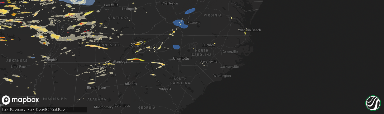
Hail Map in North Carolina on May 26, 2024
The weather event in North Carolina on May 26, 2024 includes Hail, Wind, and Tornado maps. 24 states and 2,056 cities were impacted and suffered possible damage. The total estimated number of properties impacted is 5,550.
Want more than just the map?
Turn this storm into a full workflow.
- Owner + property data so you know who to knock
- OnDemand branded weather history reports to win the "did we even have hail?" argument
- RoofTrace estimate so reps stop guessing numbers at the door
Bought this map? Upgrade within 7 days and we'll credit the $230. (10-15 min setup call)
Hail
Wind
Tornado
5,550
Estimated number of impacted properties by a 1.00" hail or larger1,800
Estimated number of impacted properties by a 1.75" hail or larger0
Estimated number of impacted properties by a 2.50" hail or largerStorm reports in North Carolina
North Carolina
| Date | Description |
|---|---|
| 05/26/20246:59 PM CDT | The surry county 911 center reported that a tree was down blocking the exit ramp lane on u.s. 52/interstate 74 at exit no. 131... Which is the exit to pilot mountain st |
| 05/26/20246:59 PM CDT | The surry county 911 center reported that a large tree was down in the 1700 block of bryant road on the northeast side of mt. Airy... Very near the virginia state borde |
| 05/26/20246:58 PM CDT | The surry county 911 center reported that a tree was down on slate road on the northeast side of mt. Airy. |
| 05/26/20246:54 PM CDT | The surry county 911 center reported that a tree was down near the intersection of city view drive and hamburg street just east of downtown mt. Airy. Incident time obta |
| 05/26/20246:48 PM CDT | The surry county 911 center reported that power lines were down in the 2700 block of siloam road in mount airy at the farm house. |
| 05/26/20246:38 PM CDT | Tree down across romie snow road. Time estimated from radar. |
| 05/26/20246:28 PM CDT | The surry county 911 center reported that a tree was down with minor damage to the dobson church on christ road. |
| 05/26/20246:23 PM CDT | The surry county 911 center reported that a large tree was down at the intersection of abe mayes road and swift lane in the thurmond area. Incident time estimated from |
| 05/26/20245:53 PM CDT | The surry county 911 center reported that a large tree was down blocking one lane of traffic in the 400 block of city view drive... Just east of downtown mt. Airy. Inci |
| 05/26/20245:50 PM CDT | The surry county 911 reported that a large tree was down at the intersection of newsome street and garden terrace in mt. Airy blocking both lanes of traffic. Incident t |
| 05/26/20245:35 PM CDT | Dime to quarter size hail fell at a campground on w old murphy rd near hwy 64. |
| 05/26/20245:22 PM CDT | Dispatch report of quarter size hail and strong gusty winds a few miles north of shooting creek. No reports of downed trees at this time. |
| 05/26/20245:22 PM CDT | Dispatch report of quarter size hail and strong gu |
| 05/26/20245:17 PM CDT | Several trees down around nantahala lake. |
| 05/26/20245:10 PM CDT | Multiple roadways with trees blocking driving lanes via 911 call center. |
| 05/26/20244:54 PM CDT | Quarter size hail report near marble north carolina passed along by ham operators. |
| 05/26/20244:35 PM CDT | Public report of ping pong sized hail near hiawasse dam. |
| 05/26/20244:15 PM CDT | Trees reported blown down near the grassy creek community. |
| 05/26/20244:11 PM CDT | Trees reported blown down near crumpler community. |
| 05/26/20244:00 PM CDT | Nickel to quarter size hail observed near the french broad river between marshall and hot springs. |
| 05/26/20243:53 PM CDT | Picture of ping pong ball size hail in the burnsville area. |
| 05/26/20243:46 PM CDT | 3 trees down near green mountain... Nc. |
| 05/26/20243:08 PM CDT | Social media report of trees down in the weaverville area. |
| 05/26/20243:06 PM CDT | Social media video of a couple dozen trees downed in alexander. |
| 05/26/20243:00 PM CDT | Trees down on house with extensive damage via pictures on social media. |
| 05/26/20243:00 PM CDT | Social media picture of a tree down on power lines in leicester. |
| 05/26/20242:58 PM CDT | Trees and powerlines down near the french broad river in the woodfin area. |
| 05/26/20245:05 AM CDT | A couple of trees blown down in the roadway along with a few power lines. |
| 05/26/20244:55 AM CDT | Lots of down trees. |
| 05/26/20244:46 AM CDT | A large tree down blocking front door. |
| 05/26/20244:45 AM CDT | *** 1 fatal *** clay county em reported that an 18 year old died when a tree fell on a trailer. |
| 05/26/20244:30 AM CDT | Some trees down. |
| 05/25/202410:13 PM CDT | A tree was blown down on olde south rd.... Near the intersection of penny rd. Time estimated from radar. |
| 05/25/202410:13 PM CDT | Report from mping: trees uprooted or snapped; roof blown off. |
| 05/25/202410:09 PM CDT | Tree down in youngsville. |
| 05/25/202410:03 PM CDT | Branches... The largest of which was 6-8 inches in diameter... Were snapped from a maple tree on flint point ln. Time estimated by radar. |
| 05/25/202410:01 PM CDT | A tree was blown down onto powerlines along us-401 near rawls church rd. Time estimated. |
| 05/25/20249:55 PM CDT | A tree was blown down onto powerlines along s. Main st. Near stevens ave. Time estimated. |
| 05/25/20249:54 PM CDT | A tree was blown down onto powerlines along new hill olive chapel rd near humie olive rd. Time estimated. |
| 05/25/20249:35 PM CDT | Widespread reports of downed trees and powerlines across chatham county. |
| 05/25/20249:19 PM CDT | A tree was blown down onto powerlines along bonlee bennett rd near glenn adams dr. Time estimated. |
| 05/25/20248:47 PM CDT | A tree was blown down onto powerlines along swaim st in randleman. Time estimated. |
| 05/25/20248:47 PM CDT | A tree was blown down onto powerlines along business 220 near w. River dr in randleman. Time estimated. |
| 05/25/20248:40 PM CDT | A tree was blown down near the intersection of brantley gordon rd and sandstone tr. |
| 05/25/20248:33 PM CDT | A tree was blown down onto flat swamp rd near summerville church rd. Time estimated. |
| 05/25/20248:30 PM CDT | Several trees and powerlines were blown down across davidson county. |
| 05/25/20248:16 PM CDT | Tree down at the intersection of ashland road and bethesda church road. |
| 05/25/20248:14 PM CDT | Trees down in the china grove area. |
| 05/25/20248:02 PM CDT | Trees down across western rowan county. |
| 05/25/20248:01 PM CDT | Trees down on utility equipment. |
| 05/25/20247:53 PM CDT | Trees down in the cleveland area. |
| 05/25/20247:53 PM CDT | Trees down on utility equipment. |
| 05/25/20247:46 PM CDT | Tree down along i-77 near mile marker 47. |
| 05/25/20247:44 PM CDT | Tree down blocking road... Bluewater drive and hickory hwy. |
| 05/25/20247:42 PM CDT | Tree down on a house at 431 jennings rd... Statesville nc. |
| 05/25/20247:38 PM CDT | Trees down near the intersection of abner rd and liberty hill rd. |
| 05/25/20247:32 PM CDT | Trees across the road near the intersection of old shelby rd and rhoney farm rd. |
| 05/25/20247:21 PM CDT | Multiple trees and powerlines down in taylorsville. |
| 05/25/20247:15 PM CDT | Davis weather station measured a 60mph wind gust near the intersection of devil track rd and hwy 127. |
| 05/25/20247:10 PM CDT | Multiple trees down around morganton. |
| 05/25/20247:10 PM CDT | 911 call center reported a tree blocking roadway on farirview road. |
| 05/25/20247:05 PM CDT | The surry county 911 center reported that a large tree was down in the 510 block of the east u.s. Highway 52 bypass near pilot mountain. The downed tree was blocking bo |
| 05/25/20247:05 PM CDT | The surry county 911 center reported that yet another tree was down on the u.s. Highway 52 bypass... This time on the west side bypass at its intersection with thompson |
All States Impacted by Hail Map on May 26, 2024
Cities Impacted by Hail Map on May 26, 2024
- Pawnee City, NE
- Omaha, NE
- Crescent, IA
- Council Bluffs, IA
- Carter Lake, IA
- McClelland, IA
- Honey Creek, IA
- Underwood, IA
- Holcomb, MO
- Qulin, MO
- Knobel, AR
- Gideon, MO
- Corning, AR
- Pollard, AR
- Lafe, AR
- Delaplaine, AR
- Lilbourn, MO
- Rector, AR
- Malden, MO
- Gibson, MO
- Greenway, AR
- Paragould, AR
- Saint Francis, AR
- Parma, MO
- Bernie, MO
- Dexter, MO
- Campbell, MO
- Portageville, MO
- Catron, MO
- Piggott, AR
- Clarkton, MO
- Neelyville, MO
- Dudley, MO
- Poplar Bluff, MO
- Broseley, MO
- Fisk, MO
- Puxico, MO
- Bloomfield, MO
- San Saba, TX
- Richland Springs, TX
- Purmela, TX
- Evant, TX
- Gatesville, TX
- Thebes, IL
- Wardell, MO
- Essex, MO
- Kennett, MO
- Benton, MO
- Vanduser, MO
- Oran, MO
- Sikeston, MO
- New Madrid, MO
- Marston, MO
- Bell City, MO
- Canalou, MO
- Matthews, MO
- Goldthwaite, TX
- East Prairie, MO
- Charleston, MO
- Bragg City, MO
- Lometa, TX
- Crawford, TX
- Valley Mills, TX
- Woodway, TX
- China Spring, TX
- Hayti, MO
- Tiptonville, TN
- Jonesboro, TX
- Scott City, MO
- Olive Branch, IL
- Tamms, IL
- Miller City, IL
- Bertrand, MO
- Cairo, IL
- Union City, TN
- Hickman, KY
- Anniston, MO
- Ridgely, TN
- Hornbeak, TN
- Mounds, IL
- Troy, TN
- Pulaski, IL
- Mound City, IL
- La Center, KY
- Villa Ridge, IL
- Olmsted, IL
- Arlington, KY
- Clinton, KY
- Kevil, KY
- Grand Chain, IL
- Wickliffe, KY
- Barlow, KY
- Columbus, KY
- Bardwell, KY
- McGregor, TX
- Waco, TX
- Fulton, KY
- South Fulton, TN
- Rives, TN
- Fancy Farm, KY
- Wingo, KY
- Metropolis, IL
- Paducah, KY
- West Paducah, KY
- Cunningham, KY
- Melber, KY
- Hickory, KY
- Water Valley, KY
- Mayfield, KY
- Lampasas, TX
- Obion, TN
- Rantoul, IL
- Boaz, KY
- Brookport, IL
- Martin, TN
- Dukedom, TN
- Sedalia, KY
- Calvert City, KY
- Benton, KY
- Tiline, KY
- Palmersville, TN
- Smithland, KY
- Ledbetter, KY
- Burna, KY
- Golconda, IL
- Symsonia, KY
- Kenton, TN
- Sharon, TN
- Fort Hood, TX
- Summersville, MO
- Salem, KY
- Farmington, KY
- Grand Rivers, KY
- Marion, KY
- Kirksey, KY
- Gilbertsville, KY
- Fredonia, KY
- Kuttawa, KY
- Dexter, KY
- Eddyville, KY
- Hardin, KY
- Almo, KY
- Murray, KY
- Hazel, KY
- Puryear, TN
- Cottage Grove, TN
- Dresden, TN
- Princeton, KY
- New Concord, KY
- Buchanan, TN
- Cadiz, KY
- Olney, IL
- Noble, IL
- Moody, TX
- Greenfield, TN
- Providence, KY
- Big Rock, TN
- Dawson Springs, KY
- Dover, TN
- Bumpus Mills, TN
- Stewart, TN
- Gracey, KY
- Fort Campbell, KY
- La Fayette, KY
- Hopkinsville, KY
- Herndon, KY
- Cerulean, KY
- Nebo, KY
- Indian Mound, TN
- Paris, TN
- Temple, TX
- Killeen, TX
- Fremont, MO
- Gleason, TN
- Ellsinore, MO
- Oglesby, TX
- McKenzie, TN
- Henry, TN
- Saint Charles, KY
- Manitou, KY
- Hanson, KY
- Earlington, KY
- Madisonville, KY
- Nortonville, KY
- Crofton, KY
- Cumberland City, TN
- Woodlawn, TN
- Tennessee Ridge, TN
- Mortons Gap, KY
- Pembroke, KY
- Trenton, KY
- Elkton, KY
- Oak Grove, KY
- Clarksville, TN
- Palmyra, TN
- White Plains, KY
- Greenville, MO
- Copperas Cove, TX
- Mill Spring, MO
- Van Buren, MO
- Williamsville, MO
- Troy, TX
- Eddy, TX
- Bruceville, TX
- Lorena, TX
- Piedmont, MO
- Flat Rock, IL
- Kempner, TX
- Springville, TN
- Wappapello, MO
- Kankakee, IL
- Bonfield, IL
- Chilton, TX
- Grandin, MO
- Big Sandy, TN
- Adams, TN
- Cedar Hill, TN
- Cunningham, TN
- Southside, TN
- Ashland City, TN
- Chapmansboro, TN
- Springfield, TN
- Cumberland Furnace, TN
- Pleasant View, TN
- Guthrie, KY
- Olmstead, KY
- Powderly, KY
- Sharon Grove, KY
- Rumsey, KY
- Dunmor, KY
- Browder, KY
- Belton, KY
- Beechmont, KY
- Adairville, KY
- Russellville, KY
- Drakesboro, KY
- Graham, KY
- Centertown, KY
- Island, KY
- Greenville, KY
- Central City, KY
- Sacramento, KY
- Beech Creek, KY
- Allensville, KY
- Lewisburg, KY
- Bremen, KY
- Calhoun, KY
- Owensboro, KY
- Utica, KY
- Livermore, KY
- Philpot, KY
- Slaughters, KY
- Zalma, MO
- Marlin, TX
- Yorktown, AR
- Bourbonnais, IL
- McGee, MO
- Manteno, IL
- Cross Plains, TN
- Orlinda, TN
- Greenbrier, TN
- Morgantown, KY
- Franklin, KY
- Rochester, KY
- Woodburn, KY
- Beaver Dam, KY
- Cottontown, TN
- McHenry, KY
- Hartford, KY
- Rockport, KY
- Portland, TN
- Rockfield, KY
- White House, TN
- Auburn, KY
- Fordsville, KY
- Cromwell, KY
- Whitesville, KY
- Bowling Green, KY
- Olaton, KY
- Dundee, KY
- Rosine, KY
- Hawesville, KY
- Horse Branch, KY
- Reynolds Station, KY
- Caneyville, KY
- Falls Of Rough, KY
- Cloverport, KY
- Marble Hill, MO
- Advance, MO
- Grady, AR
- Milford, IL
- Thornton, TX
- Hardinsburg, KY
- Scottsville, KY
- Alvaton, KY
- Adolphus, KY
- Westmoreland, TN
- Bethpage, TN
- Watseka, IL
- Lott, TX
- Holland, KY
- Lafayette, TN
- De Witt, AR
- Rosebud, TX
- Gallatin, TN
- Reagan, TX
- Saint Charles, AR
- Ethel, AR
- Elaine, AR
- Holly Grove, AR
- Red Boiling Springs, TN
- Moss, TN
- Hartsville, TN
- Lake City, AR
- Harned, KY
- Guston, KY
- Webster, KY
- Irvington, KY
- McDaniels, KY
- Hudson, KY
- Garfield, KY
- Custer, KY
- Westview, KY
- Big Clifty, KY
- Rineyville, KY
- Cecilia, KY
- Clarkson, KY
- Vine Grove, KY
- Millwood, KY
- Eastview, KY
- Leitchfield, KY
- Elizabeth, IN
- Fort Knox, KY
- West Point, KY
- Charlestown, IN
- Ekron, KY
- Jeffersonville, IN
- Clarksville, IN
- New Albany, IN
- Muldraugh, KY
- Laconia, IN
- Shepherdsville, KY
- Sellersburg, IN
- Radcliff, KY
- Brandenburg, KY
- Louisville, KY
- Elizabethtown, KY
- Fisherville, KY
- Fairdale, KY
- Finchville, KY
- Glenview, KY
- Lebanon Junction, KY
- Taylorsville, KY
- Simpsonville, KY
- Coxs Creek, KY
- Prospect, KY
- Boston, KY
- Mount Washington, KY
- Masonic Home, KY
- Clermont, KY
- Brooks, KY
- Springfield, KY
- Bloomfield, KY
- Fairfield, KY
- Willisburg, KY
- Bardstown, KY
- Tompkinsville, KY
- Hestand, KY
- New Washington, IN
- Buckner, KY
- Goshen, KY
- Crestwood, KY
- Nabb, IN
- La Grange, KY
- Pewee Valley, KY
- Marysville, IN
- White Mills, KY
- Loretto, KY
- New Haven, KY
- Hodgenville, KY
- Sonora, KY
- Glendale, KY
- Westport, KY
- Shelbyville, KY
- Harrodsburg, KY
- Chaplin, KY
- Lawrenceburg, KY
- Smithfield, KY
- Mount Eden, KY
- Salvisa, KY
- Waddy, KY
- Sulphur, KY
- Bagdad, KY
- Bedford, KY
- Bethlehem, IN
- Pendleton, KY
- New Castle, KY
- Eminence, KY
- Milton, KY
- Hanover, IN
- Campbellsburg, KY
- Pleasureville, KY
- Frankfort, KY
- Byrdstown, TN
- Pall Mall, TN
- Livingston, TN
- Monroe, TN
- Lancaster, KY
- Wilmore, KY
- Burgin, KY
- Versailles, KY
- Mackville, KY
- Perryville, KY
- Danville, KY
- Stanford, KY
- Saint Catharine, KY
- Lebanon, KY
- Lockport, KY
- Vevay, IN
- Bethlehem, KY
- Sanders, KY
- Worthville, KY
- Madison, IN
- Owenton, KY
- Ghent, KY
- Carrollton, KY
- Perry Park, KY
- Turners Station, KY
- New Liberty, KY
- Midway, KY
- Nicholasville, KY
- Jamestown, TN
- Calvert, TX
- Bremond, TX
- Trimble, TN
- Paint Lick, KY
- Georgetown, KY
- Lexington, KY
- Stamping Ground, KY
- Richmond, KY
- Bennington, IN
- Warsaw, KY
- Franklin, TX
- Crab Orchard, KY
- Patriot, IN
- Union, KY
- Florence, IN
- Glencoe, KY
- Rising Sun, IN
- Verona, KY
- Corinth, KY
- Williamstown, KY
- Jonesville, KY
- Dry Ridge, KY
- Sadieville, KY
- Sparta, KY
- Waco, KY
- Berea, KY
- Cynthiana, KY
- Winchester, KY
- Paris, KY
- Keystone, SD
- Hermosa, SD
- Brodhead, KY
- Crittenden, KY
- Irvine, KY
- Falmouth, KY
- De Mossville, KY
- Berry, KY
- Walton, KY
- Morning View, KY
- Independence, KY
- Carlisle, KY
- Norfolk, VA
- Mount Vernon, KY
- Normangee, TX
- Millersburg, KY
- Mount Sterling, KY
- Alexandria, KY
- Clay City, KY
- North Middletown, KY
- Foster, KY
- Butler, KY
- Latonia, KY
- Brooksville, KY
- Mount Olivet, KY
- Melbourne, KY
- California, KY
- Owingsville, KY
- Jeffersonville, KY
- Ravenna, KY
- Slade, KY
- Stanton, KY
- Sharpsburg, KY
- New Richmond, OH
- Georgetown, OH
- Germantown, KY
- Tollesboro, KY
- Moscow, OH
- Olympia, KY
- Bethel, OH
- Manchester, OH
- Flemingsburg, KY
- Dover, KY
- Maysville, KY
- Salt Lick, KY
- Neville, OH
- Aberdeen, OH
- Hillsboro, KY
- Moorefield, KY
- Mayslick, KY
- Hope, KY
- Vanceburg, KY
- Frenchburg, KY
- Ewing, KY
- Means, KY
- Ripley, OH
- Felicity, OH
- Wallingford, KY
- Hamersville, OH
- Augusta, KY
- Morehead, KY
- West Union, OH
- Russellville, OH
- Amelia, OH
- Parksville, KY
- Wellington, KY
- Junction City, KY
- Saint Francis, KY
- Raywick, KY
- Pine Ridge, KY
- New Hope, KY
- Gravel Switch, KY
- Denniston, KY
- Madisonville, TX
- Erin, TN
- Camden, TN
- Eva, TN
- Waverly, TN
- Kosse, TX
- Clearfield, KY
- Chesapeake, VA
- Portsmouth, VA
- McEwen, TN
- Vanleer, TN
- Midway, TX
- Manchester, KY
- Fairburn, SD
- Goodlettsville, TN
- Joelton, TN
- Hendersonville, TN
- New Johnsonville, TN
- Nashville, TN
- Allen, SD
- Dickson, TN
- Rapid City, SD
- Charlotte, TN
- West Liberty, KY
- Whites Creek, TN
- White Bluff, TN
- Black Hawk, SD
- Cannel City, KY
- Olive Hill, KY
- Sandy Hook, KY
- Warsaw, VA
- Madison, TN
- Old Hickory, TN
- Mize, KY
- Farnham, VA
- Nunnelly, TN
- Pine Ridge, SD
- Grayson, KY
- Flatgap, KY
- Keaton, KY
- Bon Aqua, TN
- Castalian Springs, TN
- Burns, TN
- Scenic, SD
- Nemo, SD
- Lyles, TN
- Albany, KY
- Mount Juliet, TN
- Lebanon, TN
- Interior, SD
- Wanblee, SD
- Philip, SD
- Fairview, TN
- Franklin, TN
- Paintsville, KY
- Sitka, KY
- Stambaugh, KY
- Canton, NC
- Monticello, KY
- Pegram, TN
- Kingston Springs, TN
- Pleasant Shade, TN
- Carthage, TN
- Martin, SD
- Hill City, SD
- Dixon Springs, TN
- Primm Springs, TN
- Kincaid, KS
- Blue Mound, KS
- Mound City, KS
- Whitleyville, TN
- Gainesboro, TN
- Leicester, NC
- Candler, NC
- South Mills, NC
- Fort Yates, ND
- Montrose, MO
- Delaware, OK
- Pleasanton, KS
- Nolensville, TN
- Quinn, SD
- Clinton, MO
- Wall, SD
- Tipton, MO
- Knoxville, TN
- Brush Creek, TN
- Gordonsville, TN
- California, MO
- Clarksburg, MO
- Antioch, TN
- Tuthill, SD
- Hermitage, TN
- La Vergne, TN
- Quincy, MO
- Vinita, OK
- Warsaw, MO
- Centertown, MO
- Foster, MO
- Kyle, SD
- Mapleton, KS
- Prescott, KS
- Fulton, KS
- Weaverville, NC
- Barnardsville, NC
- Lansing, NC
- Whitetop, VA
- Bonnots Mill, MO
- Linn, MO
- Loose Creek, MO
- Arrington, TN
- Troutdale, VA
- Corryton, TN
- Powell, TN
- College Grove, TN
- Buffalo Valley, TN
- Granville, TN
- Chestnut Mound, TN
- Elmwood, TN
- Baxter, TN
- Damascus, VA
- Dunlap, IA
- Asheville, NC
- Alexander, NC
- Lockwood, MO
- Golden City, MO
- Heiskell, TN
- Clinton, TN
- Calhoun, MO
- Laurel Bloomery, TN
- Sugar Grove, VA
- Elk Creek, VA
- Lincoln, MO
- Burnsville, NC
- La Cygne, KS
- Windsor, MO
- Edwards, MO
- Porcupine, SD
- Jefferson City, MO
- Holts Summit, MO
- Hartsburg, MO
- Chamois, MO
- Butler, MO
- Rich Hill, MO
- Hume, MO
- Strafford, MO
- Fair Grove, MO
- Benton, TN
- Reliance, TN
- Smyrna, TN
- Murfreesboro, TN
- Fort Scott, KS
- Rockvale, TN
- Nowata, OK
- Virginia Beach, VA
- Luttrell, TN
- Blaine, TN
- Ocoee, TN
- Gravois Mills, MO
- Delano, TN
- Greenfield, MO
- Earling, IA
- Bloomington Springs, TN
- Pleasant Hope, MO
- Springfield, MO
- Morrison, MO
- Stover, MO
- Climax Springs, MO
- Zuni, VA
- Schell City, MO
- Walker, MO
- Harwood, MO
- New Bloomfield, MO
- Tebbetts, MO
- Rocky Mount, MO
- Eldon, MO
- Barnett, MO
- Hermann, MO
- Everton, MO
- Bridgeville, DE
- Rhineland, MO
- Afton, OK
- Marshall, NC
- Sandston, VA
- Walnut Grove, MO
- Rockville, MO
- Mouth Of Wilson, VA
- Collins, MO
- Weaubleau, MO
- Osceola, MO
- Readyville, TN
- Warrenton, MO
- Wright City, MO
- Marthasville, MO
- Atkins, VA
- Marion, VA
- Portland, MO
- Mokane, MO
- Steedman, MO
- Versailles, MO
- Wheatland, MO
- Appleton City, MO
- Marshfield, MO
- Elkland, MO
- Buffalo, MO
- Ash Grove, MO
- Fairland, OK
- Wyandotte, OK
- Grove, OK
- Berger, MO
- New Haven, MO
- Lake Ozark, MO
- Roach, MO
- Sunrise Beach, MO
- Camdenton, MO
- Osage Beach, MO
- Richards, MO
- Eugene, MO
- Henley, MO
- Lebanon, MO
- Long Lane, MO
- Farner, TN
- Turtletown, TN
- Foristell, MO
- Grassy Creek, NC
- Bland, VA
- El Dorado Springs, MO
- Strawberry Plains, TN
- Oak Ridge, TN
- Cole Camp, MO
- Crockett, VA
- Wytheville, VA
- Woodbury, TN
- Rutledge, TN
- Phillipsburg, MO
- Windyville, MO
- Bakersville, NC
- Green Mountain, NC
- Saint Thomas, MO
- Hermitage, MO
- Bradyville, TN
- Murphy, NC
- Mascot, TN
- Niangua, MO
- Flemington, MO
- Talbott, TN
- Jefferson City, TN
- Morristown, TN
- Washington, MO
- Dow, IL
- Lowry City, MO
- Crumpler, NC
- Florence, MO
- Tuscumbia, MO
- Anderson, MO
- South West City, MO
- Preston, MO
- Linn Creek, MO
- Pearisburg, VA
- Grovespring, MO
- Hartville, MO
- Brighton, MO
- Willard, MO
- Conway, MO
- Kaiser, MO
- Brumley, MO
- Oliver Springs, TN
- Narrows, VA
- Rogersville, MO
- New Market, TN
- Mansfield, MO
- Seymour, MO
- Maynardville, TN
- Cosby, TN
- Fortuna, MO
- Syracuse, MO
- Bluefield, VA
- Falls Mills, VA
- Pocahontas, VA
- Bramwell, WV
- Bluefield, WV
- Montcalm, WV
- Rock, WV
- Princeton, WV
- Kegley, WV
- Freeman, WV
- Bastian, VA
- Rocky Gap, VA
- Staffordsville, VA
- Ripplemead, VA
- Athens, WV
- Glen Lyn, VA
- Peterstown, WV
- Rich Creek, VA
- Pembroke, VA
- Eggleston, VA
- Radford, VA
- Pulaski, VA
- Belspring, VA
- Dublin, VA
- Parrott, VA
- Draper, VA
- Max Meadows, VA
- Morrisville, MO
- Pittsburg, MO
- Tallassee, TN
- Maryville, TN
- Freeburg, MO
- Richland, MO
- Batchtown, IL
- Hardin, IL
- Hartford, TN
- Montreal, MO
- O'Fallon, MO
- Saint Peters, MO
- Sevierville, TN
- Ulman, MO
- Noel, MO
- Lanagan, MO
- Dandridge, TN
- Richmond, VA
- Ballard, WV
- Jay, OK
- Augusta, MO
- Humansville, MO
- Waynesville, NC
- Westphalia, MO
- Saint Charles, MO
- Lake Saint Louis, MO
- Elsberry, MO
- Henrico, VA
- Pineville, MO
- Brighton, IL
- Godfrey, IL
- Jerseyville, IL
- Vonore, TN
- Saint Elizabeth, MO
- Clyde, NC
- Belle, MO
- Tiff City, MO
- Fieldon, IL
- Del Rio, TN
- Newport, TN
- Bolivar, MO
- Half Way, MO
- Urbana, MO
- Polk, MO
- Fair Play, MO
- Dunnegan, MO
- Mountain Grove, MO
- Waynesville, MO
- Laquey, MO
- Christiansburg, VA
- Iberia, MO
- Crocker, MO
- Meta, MO
- Wentzville, MO
- Shipman, IL
- Marble, NC
- Rock Port, MO
- Kadoka, SD
- Stockton, MO
- Macks Creek, MO
- Dixon, MO
- Foley, MO
- Stoutland, MO
- Mullen, NE
- Defiance, MO
- Vanzant, MO
- Koeltztown, MO
- Hot Springs, NC
- Riner, VA
- Indian Valley, VA
- Floyd, VA
- Hiwassee, VA
- Pilot, VA
- Willis, VA
- Owensville, MO
- Gerald, MO
- Union, MO
- Bridgeton, MO
- Earth City, MO
- Bella Vista, AR
- Seligman, MO
- Bentonville, AR
- Pea Ridge, AR
- Hazelwood, MO
- Garfield, AR
- Washburn, MO
- Powell, MO
- Graff, MO
- Labadie, MO
- Villa Ridge, MO
- Fort Leonard Wood, MO
- Saint Robert, MO
- Gray Summit, MO
- Louisburg, MO
- Florissant, MO
- Andrews, NC
- Hayesville, NC
- Franklin, NC
- Olean, MO
- Carlinville, IL
- Gillespie, IL
- Bland, MO
- Plato, MO
- Cabool, MO
- Huggins, MO
- Bucyrus, MO
- Pacific, MO
- Leslie, MO
- Willow Springs, MO
- Tunas, MO
- Saint Louis, MO
- Grafton, IL
- Elsah, IL
- Portage Des Sioux, MO
- Maryland Heights, MO
- Bunker Hill, IL
- Eagleville, TN
- Sunset, SC
- Salem, SC
- Cross Timbers, MO
- Saint Albans, MO
- Townsend, TN
- Walland, TN
- Wildwood, MO
- Devils Elbow, MO
- Houston, MO
- Chesterfield, MO
- Ballwin, MO
- Eureka Springs, AR
- Pickens, SC
- Litchfield, IL
- Salem, MO
- Eminence, MO
- Hartshorn, MO
- Rosebud, MO
- Duke, MO
- Newburg, MO
- Eureka, MO
- High Ridge, MO
- Rogers, AR
- Saint Ann, MO
- Elk Creek, MO
- Beaufort, MO
- Yukon, MO
- Eldridge, MO
- Salem, VA
- Vienna, MO
- Mountain View, MO
- Fenton, MO
- Valley Park, MO
- Granite City, IL
- Edwardsville, IL
- Collinsville, IL
- Maryville, IL
- Glen Carbon, IL
- Janesville, WI
- Troy, IL
- Hartwell, GA
- Dewy Rose, GA
- Bowman, GA
- Alton, IL
- Lynchburg, MO
- Norwood, MO
- Eagle Rock, MO
- Glenwood, IA
- Pacific Junction, IA
- Solo, MO
- Drury, MO
- Madison, IL
- Eunice, MO
- Gatlinburg, TN
- Milton, WI
- Whitewater, WI
- Fort Atkinson, WI
- Elberton, GA
- Berryville, AR
- Birch Tree, MO
- Saint Jacob, IL
- East Carondelet, IL
- Marine, IL
- Old Monroe, MO
- Winfield, MO
- Brussels, IL
- Falcon, MO
- Saint Clair, MO
- Sullivan, MO
- Jadwin, MO
- Rolla, MO
- Marietta, SC
- Easley, SC
- Travelers Rest, SC
- House Springs, MO
- Raymondville, MO
- East Alton, IL
- Hartford, IL
- Bunker, MO
- Venice, IL
- South Roxana, IL
- Roxana, IL
- Greenville, SC
- Highland, IL
- Edgar Springs, MO
- Arnold, MO
- Green Forest, AR
- East Saint Louis, IL
- Millstadt, IL
- Dupo, IL
- Ronceverte, WV
- Lewisburg, WV
- Asbury, WV
- White Sulphur Springs, WV
- Renick, WV
- Caldwell, WV
- Frankford, WV
- Maxwelton, WV
- Covington, VA
- Hot Springs, VA
- Alderson, WV
- Belleville, IL
- Saint James, MO
- Boss, MO
- Lonedell, MO
- Traphill, NC
- Imperial, MO
- Winona, MO
- Bixby, MO
- Grubville, MO
- Robertsville, MO
- Elkin, NC
- Viburnum, MO
- Alhambra, IL
- Catawissa, MO
- Steelville, MO
- Potosi, MO
- Fairview Heights, IL
- O'Fallon, IL
- Iva, SC
- Otto, NC
- Omaha, AR
- Lovejoy, IL
- Lebanon, IL
- Anderson, SC
- Pocahontas, IL
- Mars Hill, NC
- Sorento, IL
- Greenville, IL
- Caseyville, IL
- Ellington, MO
- Cook Sta, MO
- Davisville, MO
- Taylors, SC
- Hillsboro, MO
- Pevely, MO
- Cedar Hill, MO
- Dittmer, MO
- Barnhart, MO
- Columbia, IL
- Huntsville, AR
- Licking, MO
- Success, MO
- State Road, NC
- Pigeon Forge, TN
- Scott Air Force Base, IL
- Goreville, IL
- Alpena, AR
- Yellville, AR
- Walshville, IL
- Donnellson, IL
- West Alton, MO
- Belgrade, MO
- Wilsonville, IL
- Staunton, IL
- Marion, IL
- Carbondale, IL
- Waterloo, IL
- Valmeyer, IL
- New Athens, IL
- Pierce City, MO
- Cherryville, MO
- Greer, SC
- Redford, MO
- Mascoutah, IL
- Trenton, IL
- Creal Springs, IL
- Williamston, SC
- Roby, MO
- De Soto, MO
- Harrison, AR
- Griswold, IA
- Billings, MO
- Republic, MO
- Makanda, IL
- Fults, IL
- Piedmont, SC
- Pelzer, SC
- Freeburg, IL
- Smithton, IL
- Tampa, KS
- Marion, KS
- Aviston, IL
- Mount Carmel, IL
- Bartelso, IL
- Germantown, IL
- Beckemeyer, IL
- Albers, IL
- Carlyle, IL
- Breese, IL
- Festus, MO
- Merriman, NE
- Bellmont, IL
- Browns, IL
- Summerfield, IL
- Centerville, MO
- Blackwell, MO
- Bonne Terre, MO
- Albion, IL
- Verona, MO
- Monett, MO
- New Baden, IL
- Brookline, MO
- Nixa, MO
- Clever, MO
- Duncan, SC
- Woodruff, SC
- Moore, SC
- Carrier Mills, IL
- Stonefort, IL
- Harrisburg, IL
- Vandalia, IL
- Mulberry Grove, IL
- Ozark, MO
- Bois D Arc, MO
- Morganton, NC
- Marion, NC
- Keyesport, IL
- Sandoval, IL
- Centralia, IL
- Patoka, IL
- North Platte, NE
- Aurora, MO
- Simpsonville, SC
- Marionville, MO
- Allendale, IL
- Villisca, IA
- Nodaway, IA
- Addieville, IL
- Marissa, IL
- Decker, IN
- Smithboro, IL
- Grayville, IL
- Vincennes, IN
- Galatia, IL
- Eldorado, IL
- Corning, IA
- Salem, IL
- Kinmundy, IL
- Alma, IL
- Odin, IL
- Crane, MO
- Roebuck, SC
- Evansville, IL
- Walsh, IL
- Sparta, IL
- Ellis Grove, IL
- Sainte Genevieve, MO
- Brownstown, IL
- Annapolis, MO
- Fredericktown, MO
- Marquand, MO
- Vernon, IL
- Junction, IL
- Shawneetown, IL
- Shobonier, IL
- Fordland, MO
- Rural Retreat, VA
- Sparta, MO
- Fountain Inn, SC
- Bruner, MO
- Oldfield, MO
- Patton, MO
- Mount Vernon, IL
- Corydon, KY
- Herod, IL
- Equality, IL
- Woodlawn, IL
- Waltonville, IL
- Vulcan, MO
- Doniphan, MO
- Abbeville, SC
- Morganfield, KY
- Perryville, MO
- Sedgewickville, MO
- Iuka, IL
- Farina, IL
- Saint Peter, IL
- Afton, IA
- Maxwell, NE
- Nashville, IL
- Saint Mary, MO
- Louisville, IL
- Xenia, IL
- Glenallen, MO
- Tamaroa, IL
- Du Bois, IL
- Galena, MO
- Highlandville, MO
- Pomona, IL
- Macomb, MO
- Spartanburg, SC
- Pauline, SC
- Florence, KS
- Mason, IL
- Edgewood, IL
- Texico, IL
- Johnsonville, IL
- Kell, IL
- Walnut Hill, IL
- Bluford, IL
- Keenes, IL
- Dix, IL
- Hoffman, IL
- Hoyleton, IL
- Watson, IL
- Ingraham, IL
- Dieterich, IL
- Newton, IL
- Rinard, IL
- Clay City, IL
- Flora, IL
- Wheeler, IL
- Dundas, IL
- Sailor Springs, IL
- Grand Tower, IL
- New Florence, MO
- Jasper, AR
- Vendor, AR
- Neoga, IL
- Toledo, IL
- Greenup, IL
- Bonnie, IL
- Opdyke, IL
- Ava, MO
- Mulkeytown, IL
- Leopold, MO
- Belle Rive, IL
- Henderson, KY
- Robards, KY
- Du Quoin, IL
- Hidalgo, IL
- Scheller, IL
- Uniontown, MO
- Oak Ridge, MO
- Altenburg, MO
- Friedheim, MO
- Old Appleton, MO
- Frohna, MO
- Montgomery City, MO
- Ponce De Leon, MO
- Spokane, MO
- Sturgis, KY
- Jonesburg, MO
- Taylorsville, NC
- Moravian Falls, NC
- Lenoir, NC
- Granite Falls, NC
- Statesville, NC
- Hickory, NC
- Hiddenite, NC
- Conover, NC
- Claremont, NC
- Stony Point, NC
- Catawba, NC
- Reed, KY
- Spottsville, KY
- Casey, IL
- Washington, IN
- Connelly Springs, NC
- Valdese, NC
- Wheatland, IN
- Wayne City, IL
- Macedonia, IL
- Dahlgren, IL
- Ewing, IL
- Thompsonville, IL
- Benton, IL
- Sesser, IL
- Elkville, IL
- Royalton, IL
- Cisne, IL
- Geff, IL
- Sims, IL
- Fairfield, IL
- Clay, KY
- Millersville, MO
- Yale, IL
- Buckner, IL
- Saint Elmo, IL
- Altamont, IL
- Pittsburg, IL
- Uniontown, KY
- Ridgway, IL
- Alto Pass, IL
- Wolf Lake, IL
- Ina, IL
- Cape Girardeau, MO
- McLeansboro, IL
- Broughton, IL
- Martinsville, IL
- Ellston, IA
- Tingley, IA
- Grand River, IA
- Lamoni, IA
- Kellerton, IA
- Parkersburg, IL
- Calhoun, IL
- Jonesboro, IL
- McClure, IL
- Jackson, MO
- Sumner, IL
- Claremont, IL
- Elizabethtown, IL
- Cobden, IL
- Mount Vernon, IN
- Waverly, KY
- Golden Gate, IL
- Barnhill, IL
- Mount Erie, IL
- West Salem, IL
- Decatur, IA
- Leon, IA
- Elwood, NE
- Bertrand, NE
- Chaffee, MO
- Oaktown, IN
- Monroe City, IN
- Montgomery, IN
- Ellery, IL
- Bone Gap, IL
- West Liberty, IL
- Willow Hill, IL
- Oblong, IL
- Richland, IN
- Rockport, IN
- Bridgeport, IL
- Robinson, IL
- Hazleton, IN
- Princeton, IN
- Owensville, IN
- Bicknell, IN
- Francisco, IN
- Bruceville, IN
- Lawrenceville, IL
- Saint Francisville, IL
- Petersburg, IN
- Fort Branch, IN
- Patoka, IN
- Lynnville, IN
- Ragsdale, IN
- Spurgeon, IN
- Winslow, IN
- Haubstadt, IN
- Oakland City, IN
- Elberfeld, IN
- Norris City, IL
- Enfield, IL
- Elliott, IA
- Grant, IA
- Davis City, IA
- Ullin, IL
- Asheboro, NC
- Trinity, NC
- Sophia, NC
- Simpson, IL
- Dongola, IL
- Cypress, IL
- Lineville, IA
- Annapolis, IL
- Marshall, IL
- West York, IL
- West Union, IL
- Williams, IN
- Bedford, IN
- Harviell, MO
- Loogootee, IN
- Burfordville, MO
- Crane, IN
- Odon, IN
- Anna, IL
- Whitewater, MO
- Evansville, IN
- Eddyville, IL
- Cave In Rock, IL
- Ozark, IL
- Cynthiana, IN
- Griffin, IN
- Poseyville, IN
- Cainsville, MO
- Mercer, MO
- Diagonal, IA
- Mammoth Spring, AR
- Thayer, IA
- Fairdealing, MO
- Newburgh, IN
- Valley Springs, AR
- Maceo, KY
- Heltonville, IN
- Dixon, KY
- Sheridan, MO
- Princeton, MO
- Buncombe, IL
- Vienna, IL
- Norman, IN
- Oolitic, IN
- Avoca, IN
- Springville, IN
- Ravenden, AR
- Pocahontas, AR
- Couch, MO
- Myrtle, MO
- Ravenden Springs, AR
- Gatewood, MO
- Hampton, KY
- Rosiclare, IL
- Grantsburg, IL
- Sebree, KY
- Silva, MO
- Edwardsport, IN
- Lucerne, MO
- Newtown, MO
- Harris, MO
- Milan, MO
- Hildreth, NE
- Martinsburg, WV
- Mount Ayr, IA
- Gentry, MO
- Worth, MO
- Powersville, MO
- Plainville, IN
- Sandborn, IN
- Westphalia, IN
- Bloomington, NE
- Berryville, VA
- Lewisport, KY
- Warm Springs, AR
- Gipsy, MO
- Naylor, MO
- Lowndes, MO
- Elnora, IN
- Jasper, IN
- Otwell, IN
- Velpen, IN
- Cannelburg, IN
- Stendal, IN
- Holland, IN
- Huntingburg, IN
- Youngsville, NC
- New Boston, MO
- Cannelton, IN
- Rome, IN
- Kearneysville, WV
- Cassoday, KS
- Maynard, AR
- Summit Point, WV
- Pollock, MO
- Oxly, MO
- Shenandoah, IA
- Charles Town, WV
- Ranson, WV
- Tonganoxie, KS
- Linwood, KS
- Success, AR
- Searcy, AR
- Judsonia, AR
- McLouth, KS
- Franklinton, NC
- Green City, MO
- New Hampton, MO
- Green Castle, MO
- Oskaloosa, KS
- Albany, MO
- Mount Olive, IL
- Herculaneum, MO
- Seymour, IN
- Dorsey, IL
- Jonesville, IN
- Columbus, IN
- Elizabethtown, IN
- Mineral Point, MO
- Valles Mines, MO
- Cadet, MO
- French Village, MO
- McFall, MO
- Golden Eagle, IL
- Pomona, MO
- Biggers, AR
- Des Arc, MO
- Lesterville, MO
- Hecker, IL
- Lenzburg, IL
- Red Bud, IL
- Luebbering, MO
- Raymond, IL
- Bald Knob, AR
- Datto, AR
- Browning, MO
- Caledonia, MO
- Saint Libory, IL
- Pattonsburg, MO
- Bethany, MO
- New Douglas, IL
- New Burnside, IL
- Callao, MO
- Elmer, MO
- Sturdivant, MO
- Peach Orchard, AR
- High Hill, MO
- Ethel, MO
- Winigan, MO
- Bevier, MO
- Macon, MO
- Bonner Springs, KS
- Olathe, KS
- Lenexa, KS
- De Soto, KS
- Walnut Ridge, AR
- Shannon City, IA
- Cookville, TX
- Omaha, TX
- Jetson, KY
- Roundhill, KY
- Beech Grove, AR
- Cosby, MO
- Saint Joseph, MO
- Ramsey, IL
- Jameson, MO
- Overland Park, KS
- Stilwell, KS
- Gallatin, MO
- Brownsville, KY
- Clarence, MO
- Anabel, MO
- New Cambria, MO
- Oakland, KY
- Smiths Grove, KY
- Naples, TX
- Somerville, OH
- Park City, KY
- Easton, MO
- Madison, MO
- Bucklin, MO
- Atlanta, MO
- Wynne, AR
- Cherry Valley, AR
- Excello, MO
- Okolona, AR
- Rocky Hill, KY
- Marmaduke, AR
- Jamesport, MO
- Lock Springs, MO
- Stewartsville, MO
- Gower, MO
- Glasgow, KY
- Cardwell, MO
- Arbyrd, MO
- Jonesboro, AR
- Lucas, KY
- Etoile, KY
- Fountain Run, KY
- Austin, KY
- Bradford, AR
- Arkadelphia, AR
- Plattsburg, MO
- Holliday, MO
- Parkin, AR
- Gurdon, AR
- Jacksonville, MO
- Senath, MO
- Malvern, AR
- Cave City, KY
- Summer Shade, KY
- Eighty Eight, KY
- Paris, MO
- Burkesville, KY
- Beaumont, KY
- Edmonton, KY
- Leola, AR
- Earle, AR
- Hornersville, MO
- Sheridan, AR
- Lathrop, MO
- Turney, MO
- Newport, AR
- Cotton Plant, AR
- Steele, MO
- Sparkman, AR
- Richmond, MO
- Santa Fe, MO
- Crawfordsville, AR
- Leachville, AR
- Mexico, MO
- Monette, AR
- Allons, TN
- Augusta, AR
- McCrory, AR
- Doddridge, AR
- Grapevine, AR
- Turrell, AR
- Marion, AR
- Laddonia, MO
- Brinkley, AR
- Wheatley, AR
- Stanton, TN
- Widener, AR
- Heth, AR
- Leeton, MO
- Bells, TN
- Alamo, TN
- Polo, MO
- Rayville, MO
- Palestine, AR
- Bivins, TX
- Rodessa, LA
- Ida, LA
- Proctor, AR
- Humboldt, TN
- Gadsden, TN
- Cowgill, MO
- Rush Hill, MO
- Alpha, KY
- Norborne, MO
- Pine Bluff, AR
- Dover, MO
- Moro, AR
- Waverly, MO
- Concordia, MO
- Sweet Springs, MO
- Martinsburg, MO
- Rison, AR
- Brownsville, TN
- Marianna, AR
- Blackburn, MO
- Alma, MO
- Malta Bend, MO
- Olla, LA
- Cedar Grove, TN
- Jackson, TN
- Mercer, TN
- Denmark, TN
- Houstonia, MO
- Chidester, AR
- Town Creek, AL
- Athens, AL
- Rogersville, AL
- Courtland, AL
- Horn Lake, MS
- Walls, MS
- Medon, TN
- Kelly, LA
- Grayson, LA
- Camden, AR
- Hughesville, MO
- New Edinburg, AR
- Beech Bluff, TN
- Nelson, MO
- Byhalia, MS
- Olive Branch, MS
- Sedalia, MO
- Harrisonburg, LA
- Columbia, LA
- Enterprise, LA
- Winnsboro, LA
- Nesbit, MS
- Hernando, MS
- Williamsburg, KY
- Lexington, TN
- Thornton, AR
- Warren, AR
- Wilmar, AR
- Smithton, MO
- Bearden, AR
- Jellico, TN
- Lake Cormorant, MS
- Southaven, MS
- Monticello, AR
- Finger, TN
- Bethel Springs, TN
- Enville, TN
- Henderson, TN
- Fort Necessity, LA
- Wisner, LA
- Sicily Island, LA
- Toney, AL
- Pilot Grove, MO
- Otterville, MO
- Lascassas, TN
- Mora, MO
- Holly Springs, MS
- Huntsville, AL
- Winchester, AR
- Tillar, AR
- Huron, TN
- Luray, TN
- Red Banks, MS
- Harvest, AL
- New Market, AL
- Meridianville, AL
- Hazel Green, AL
- Lowmansville, KY
- River, KY
- Hampton, AR
- Clayton, LA
- Gilbert, LA
- Gurley, AL
- Princeton, AL
- Hollytree, AL
- Dermott, AR
- Aimwell, LA
- Lamar, MS
- Russellville, AL
- Tunica, MS
- Adamsville, TN
- Milledgeville, TN
- Sardis, TN
- Fordyce, AR
- Hamilton, AL
- Tremont, MS
- Vina, AL
- Hughes, AR
- Estillfork, AL
- Scottsboro, AL
- Saint Joseph, LA
- Spruce Pine, AL
- Latham, MO
- Hodges, AL
- Coldwater, MS
- Trinity, AL
- Hillsboro, AL
- Moulton, AL
- Russellville, MO
- Waterford, MS
- Decatur, AL
- Stevenson, AL
- Phil Campbell, AL
- Marston, NC
- Laurel Hill, NC
- Waterproof, LA
- Potts Camp, MS
- Belvidere, TN
- Lorman, MS
- Hackleburg, AL
- Huntland, TN
- Utica, MS
- Raymond, MS
- Fackler, AL
- Lake Village, AR
- Flora, MS
- Bridgeport, AL
- Sherwood, TN
- Hickory Flat, MS
- Tanner, AL
- Madison, AL
- Senatobia, MS
- Madison, MS
- Eudora, AR
- Portland, AR
- Bryant, AL
- Flat Rock, AL
- Myrtle, MS
- South Pittsburg, TN
- Canton, MS
- Danville, AL
- Greenville, MS
- Mount Hope, AL
- Terry, MS
- Parrottsville, TN
- Pisgah, AL
- Ider, AL
- Henagar, AL
- Etta, MS
- Como, MS
- Jasper, AL
- Crane Hill, AL
- Hollywood, AL
- Byram, MS
- Raeford, NC
- Hollandale, MS
- Brandon, MS
- New Albany, MS
- Blue Mountain, MS
- Morton, MS
- Pelahatchie, MS
- Maxton, NC
- Higdon, AL
- Trenton, GA
- Rising Fawn, GA
- Lena, MS
- Forest, MS
- Brownsboro, AL
- Owens Cross Roads, AL
- Chatham, MS
- Hartselle, AL
- Glen Allan, MS
- Bentonia, MS
- Arley, AL
- Bremen, AL
- Red Springs, NC
- Chickamauga, GA
- Blue Springs, MS
- Logan, AL
- Woodville, AL
- Decatur, MS
- Conehatta, MS
- Union, MS
- Jonesville, LA
- Braxton, MS
- Mendenhall, MS
- Guntown, MS
- Little Rock, MS
- Paint Rock, AL
- Laceys Spring, AL
- Camden, MS
- Carthage, MS
- Rock Spring, GA
- Ringgold, GA
- La Fayette, GA
- Big Creek, MS
- New Hope, AL
- Monterey, LA
- Somerville, AL
- Walnut Grove, MS
- Gore Springs, MS
- Grenada, MS
- Grant, AL
- Rocky Face, GA
- Eva, AL
- Valhermoso Springs, AL
- Calhoun City, MS
- Dalton, GA
- Cullman, AL
- Collinsville, MS
- Chunky, MS
- Bailey, MS
- Meridian, MS
- Tunnel Hill, GA
- Arab, AL
- Holly Pond, AL
- Joppa, AL
- Union Grove, AL
- Shannon, NC
- Saint Pauls, NC
- Section, AL
- Dutton, AL
- Baileyton, AL
- Langston, AL
- Daleville, MS
- Lauderdale, MS
- De Kalb, MS
- Parrish, AL
- Oakman, AL
- Albertville, AL
- Crossville, AL
- Guntersville, AL
- Fyffe, AL
- Chatsworth, GA
- Porterville, MS
- Philadelphia, MS
- Falkville, AL
- Houston, MS
- Geraldine, AL
- Resaca, GA
- Horton, AL
- Blountsville, AL
- Rainsville, AL
- Cordova, AL
- Copperhill, TN
- Cedarbluff, MS
- Pheba, MS
- Okolona, MS
- Dawson, AL
- Collinsville, AL
- Groveoak, AL
- Vidalia, LA
- West Point, MS
- Dora, AL
- Sumiton, AL
- Empire, AL
- Woodville, MS
- Valley Head, AL
- Vinemont, AL
- Ellijay, GA
- Epes, AL
- Warrior, AL
- Fort Payne, AL
- Cedar Bluff, AL
- Gaylesville, AL
- Sylvania, AL
- Boaz, AL
- Akron, AL
- Greenwood Springs, MS
- Amory, MS
- Boligee, AL
- Natchez, MS
- Aberdeen, MS
- Tilden, IL
- Baldwin, IL
- Coulterville, IL
- Oakdale, IL
- Crystal City, MO
- Okawville, IL
- Prairie Du Rocher, IL
- Bloomsdale, MO
- Detroit, AL
- Gattman, MS
- Sulligent, AL
- Caledonia, MS
- Rome, GA
- Kimberly, AL
- Pinson, AL
- Trafford, AL
- Remlap, AL
- Jasper, GA
- Talking Rock, GA
- Lyerly, GA
- Ranger, GA
- Summerville, GA
- Moundville, AL
- Oneonta, AL
- Springville, AL
- Crosby, MS
- Roxie, MS
- Dawsonville, GA
- Kingston, GA
- Bay Springs, MS
- Laurel, MS
- Heidelberg, MS
- Rainbow City, AL
- Gadsden, AL
- Carbon Hill, AL
- Marble Hill, GA
- Cottondale, AL
- Jacksonville, AL
- Tate, GA
- Ball Ground, GA
- Piedmont, AL
- Ashville, AL
- Ohatchee, AL
- Attalla, AL
- Gilbertown, AL
- Waynesboro, MS
- Ragland, AL
- Wellington, AL
- Buchanan, GA
- Tallapoosa, GA
- Silas, AL
- Lilburn, GA
- Waleska, GA
- Peachtree Corners, GA
- Norcross, GA
- Roswell, GA
- Alpharetta, GA
- Rydal, GA
- Buford, GA
- Dacula, GA
- Lawrenceville, GA
- Lithonia, GA
- Woodstock, GA
- Suwanee, GA
- Fairmount, GA
- Duluth, GA
- Conyers, GA
- Snellville, GA
- Grayson, GA
- Loganville, GA
- Cumming, GA
- Canton, GA
- Oxford, GA
- Duncanville, AL
- Brent, AL
- Tuscaloosa, AL
- Centreville, AL
- Vance, AL
- West Blocton, AL
- McCalla, AL
- Woodstock, AL
- Brookwood, AL
- Trussville, AL
- Leeds, AL
- Odenville, AL
- Birmingham, AL
- Helena, AL
- Bessemer, AL
- Moody, AL
- Calera, AL
- Alpine, AL
- Brierfield, AL
- Vincent, AL
- Sterrett, AL
- Pell City, AL
- Wilsonville, AL
- Alabaster, AL
- Cropwell, AL
- Pelham, AL
- Childersburg, AL
- Chelsea, AL
- Harpersville, AL
- Columbiana, AL
- Montevallo, AL
- Vandiver, AL
- Talladega, AL
- Sylacauga, AL
- Lincoln, AL
- Riverside, AL
- Eastaboga, AL
- Munford, AL
- Anniston, AL
- Weaver, AL
- Alexandria, AL
- Oxford, AL
- Fosters, AL
- Knoxville, AL


