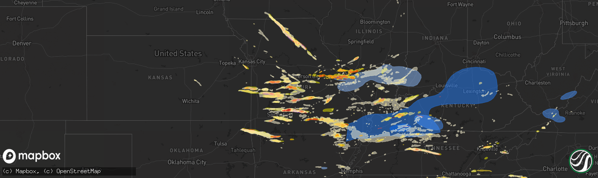
Hail Map in Missouri on May 26, 2024
The weather event in Missouri on May 26, 2024 includes Hail, Wind, and Tornado maps. 24 states and 2,056 cities were impacted and suffered possible damage. The total estimated number of properties impacted is 412,552.
Want more than just the map?
Turn this storm into a full workflow.
- Owner + property data so you know who to knock
- OnDemand branded weather history reports to win the "did we even have hail?" argument
- RoofTrace estimate so reps stop guessing numbers at the door
Bought this map? Upgrade within 7 days and we'll credit the $230. (10-15 min setup call)
Hail
Wind
Tornado
412,552
Estimated number of impacted properties by a 1.00" hail or larger178,471
Estimated number of impacted properties by a 1.75" hail or larger34,957
Estimated number of impacted properties by a 2.50" hail or largerStorm reports in Missouri
Missouri
| Date | Description |
|---|---|
| 05/26/20246:59 PM CDT | Report from mping: quarter |
| 05/26/20246:58 PM CDT | Report from mping: half dollar |
| 05/26/20246:58 PM CDT | Quarter sized hail report from nws employee. |
| 05/26/20246:56 PM CDT | Report from mping: quarter |
| 05/26/20246:56 PM CDT | Report from mping: half dollar |
| 05/26/20246:55 PM CDT | A local report indicates 1.00 inch wind near 4 W Redford |
| 05/26/20246:52 PM CDT | A local report indicates 1.75 inch wind near 1 W Aurora |
| 05/26/20246:35 PM CDT | A local report indicates 1.00 inch wind near 5 WNW Redford |
| 05/26/20246:26 PM CDT | Delayed report. Some trees down in timber area. Time based on radar estimate and location is approximate. |
| 05/26/20246:26 PM CDT | Delayed report. Reports of one inch hail and some trees down in timber area. Time based on radar estimate. |
| 05/26/20246:22 PM CDT | Nws storm survey concluded a brief ef0 tornado with peak winds near 80 mph occurred between birch tree and winona. The tornado travelled east just to the north of highw |
| 05/26/20246:20 PM CDT | Golf ball size hail reported 2 miles north of winona. |
| 05/26/20246:17 PM CDT | Report from social media. Time estimate from radar. |
| 05/26/20246:17 PM CDT | Video confirms a tornado on the ground with debris in the air. |
| 05/26/20246:12 PM CDT | A local report indicates 2.00 inch wind near Viburnum |
| 05/26/20246:12 PM CDT | Nws storm survey concluded an ef2 tornado with peak winds near 125 mph started 2 miles northeast of birch tree and travelled east southeast for 2.5 miles before lifting |
| 05/26/20246:08 PM CDT | Report from mping: 1-inch tree limbs broken; shingles blown off. |
| 05/26/20246:08 PM CDT | Report from social media. |
| 05/26/20246:07 PM CDT | A local report indicates 1.00 inch wind near 2 ENE Affton |
| 05/26/20246:07 PM CDT | Time estimated by radar. |
| 05/26/20246:07 PM CDT | A local report indicates 1.00 inch wind near 4 NNE Lemay |
| 05/26/20246:07 PM CDT | A local report indicates 1.75 inch wind near 3 NE Lemay |
| 05/26/20246:07 PM CDT | Time estimated by radar. |
| 05/26/20246:06 PM CDT | A local report indicates 1.25 inch wind near 3 S Saint Louis |
| 05/26/20246:05 PM CDT | A local report indicates 1.00 inch wind near 2 E Shrewsbury |
| 05/26/20246:05 PM CDT | A local report indicates 1.00 inch wind near 3 ENE Shrewsbury |
| 05/26/20246:05 PM CDT | 4 inch tree limbs down. Time estimated from radar. |
| 05/26/20246:04 PM CDT | A local report indicates 1.25 inch wind near 2 ENE Affton |
| 05/26/20246:03 PM CDT | Report from social media. |
| 05/26/20246:02 PM CDT | A local report indicates 1.00 inch wind near 1 N Webster Groves |
| 05/26/20246:01 PM CDT | A local report indicates 1.00 inch wind near 1 WNW Lakeshire |
| 05/26/20246:01 PM CDT | Report from mping: hen egg |
| 05/26/20246:01 PM CDT | Report from mping: hen egg+ |
| 05/26/20246:01 PM CDT | A local report indicates 1.00 inch wind near 1 NW Lakeshire |
| 05/26/20246:01 PM CDT | A local report indicates 1.75 inch wind near Oakland |
| 05/26/20246:00 PM CDT | A local report indicates 1.75 inch wind near 1 WSW Murphy |
| 05/26/20246:00 PM CDT | A local report indicates 1.75 inch wind near 1 W Webster Groves |
| 05/26/20246:00 PM CDT | Large tree branch down in jefferson barracks state park. |
| 05/26/20246:00 PM CDT | Large tree branches blown down. Time approximate. |
| 05/26/20246:00 PM CDT | Significant damage to shingles... But roof still in place. Possible tornado damage. |
| 05/26/20245:58 PM CDT | Tree down on house. |
| 05/26/20245:58 PM CDT | Report from mping: half dollar |
| 05/26/20245:54 PM CDT | Location and time radar estimate. Report from social media. |
| 05/26/20245:54 PM CDT | Report from mping: half dollar |
| 05/26/20245:54 PM CDT | Report from mping: ping pong ball |
| 05/26/20245:53 PM CDT | Time and location are approximate... Estimated based on radar and report. |
| 05/26/20245:53 PM CDT | Report from mping: ping pong ball |
| 05/26/20245:52 PM CDT | A local report indicates 2.00 inch wind near 1 NW Peerless Park |
| 05/26/20245:52 PM CDT | A local report indicates 1.00 inch wind near 1 E Kirkwood |
| 05/26/20245:52 PM CDT | Report from mping: quarter |
| 05/26/20245:52 PM CDT | Report from mping: quarter |
| 05/26/20245:50 PM CDT | A local report indicates 1.00 inch wind near 1 NW Oakland |
| 05/26/20245:50 PM CDT | A local report indicates 1.75 inch wind near 1 S Maplewood |
| 05/26/20245:50 PM CDT | Report from mping: quarter |
| 05/26/20245:49 PM CDT | Multiple trees down. |
| 05/26/20245:49 PM CDT | A local report indicates 1.00 inch wind near Manchester |
| 05/26/20245:48 PM CDT | A weak ef1 tornado with maximum wind speeds of 97mph tracked through oakville and crossed the mississippi river uprooting trees and snapping large tree branches as well |
| 05/26/20245:48 PM CDT | A local report indicates 1.00 inch wind near 1 WSW Fenton |
| 05/26/20245:46 PM CDT | Some small debris on their vehicle. |
| 05/26/20245:46 PM CDT | Report from mping: ping pong ball |
| 05/26/20245:46 PM CDT | A local report indicates 1.75 inch wind near Valley Park |
| 05/26/20245:46 PM CDT | A local report indicates 1.75 inch wind near Valley Park |
| 05/26/20245:45 PM CDT | 1 foot wide branch snapped from side of the trunk. |
| 05/26/20245:45 PM CDT | A local report indicates 1.00 inch wind near 2 SSW Manchester |
| 05/26/20245:45 PM CDT | A local report indicates 1.75 inch wind near 1 NNW Valley Park |
| 05/26/20245:45 PM CDT | A local report indicates 2.00 inch wind near Peerless Park |
| 05/26/20245:45 PM CDT | Large tree limb down. |
| 05/26/20245:44 PM CDT | Delayed report. Via social media. Quarter to golf ball size hail. Time based on radar estimate. |
| 05/26/20245:44 PM CDT | A local report indicates 1.00 inch wind near 1 NE Valley Park |
| 05/26/20245:43 PM CDT | Report from mping: ping pong ball |
| 05/26/20245:43 PM CDT | Delayed report from public via email with picture of hail. |
| 05/26/20245:43 PM CDT | Time estimate from radar. Report from social media. |
| 05/26/20245:43 PM CDT | A local report indicates 1.00 inch wind near 1 S Fenton |
| 05/26/20245:42 PM CDT | Significant siding damage due to hail. |
| 05/26/20245:42 PM CDT | Multiple large tree limbs downed and wind-driven hail damage to siding and windows. |
| 05/26/20245:42 PM CDT | A local report indicates 1.75 inch wind near 2 S Ballwin |
| 05/26/20245:41 PM CDT | *** 1 inj *** nws storm survey concluded that a low end ef-3 tornado with peak wind speeds near 140 mph started 7 miles west northwest of mountain view and travelled ea |
| 05/26/20245:40 PM CDT | Average hail size was golf ball... With some to tennis ball. Time approximate. |
| 05/26/20245:40 PM CDT | A local report indicates 1.00 inch wind near 2 SSE Ballwin |
| 05/26/20245:40 PM CDT | A local report indicates 1.25 inch wind near 1 NW Valley Park |
| 05/26/20245:40 PM CDT | Multiple trees and large limbs down at the 2000 block of valley park road and in buder park. Tim estimated from radar. |
| 05/26/20245:40 PM CDT | Corrects previous hail report from 1 wsw murphy. |
| 05/26/20245:36 PM CDT | A local report indicates 1.75 inch wind near 5 N Edgar Springs |
| 05/26/20245:35 PM CDT | Corrects previous hail report from 3 n edgar springs. Delayed report. Via social media. Quarter to golf ball size hail. Time based on radar estimate. |
| 05/26/20245:35 PM CDT | Time estimated from report and radar. Several tree limbs down... Metal backyard canopy lofted into neighbors yard. |
| 05/26/20245:33 PM CDT | A local report indicates 1.00 inch wind near 1 ENE Eureka |
| 05/26/20245:32 PM CDT | A local report indicates 1.00 inch wind near Eureka |
| 05/26/20245:31 PM CDT | Time estimate from radar. Report from social media. |
| 05/26/20245:31 PM CDT | A local report indicates 1.75 inch wind near 2 W Eureka |
| 05/26/20245:30 PM CDT | A local report indicates a tornado near 5 NE Willow Springs |
| 05/26/20245:30 PM CDT | A local report indicates 1.75 inch wind near 1 N Eureka |
| 05/26/20245:30 PM CDT | Report received of several houses and campers damaged along highway y to the north of mountain view. Location of report is estimated. |
| 05/26/20245:30 PM CDT | A local report indicates 1.75 inch wind near 2 ESE Wildwood |
| 05/26/20245:28 PM CDT | Multiple trees down. |
| 05/26/20245:28 PM CDT | Large tree limb down. |
| 05/26/20245:26 PM CDT | Multiple large tree limbs and trees down here. |
| 05/26/20245:26 PM CDT | Two large trees topped. |
| 05/26/20245:25 PM CDT | Trees down near hidden valley. |
| 05/26/20245:24 PM CDT | Large branches down in yard. |
| 05/26/20245:21 PM CDT | Tree snapped. Estimated 70 mph. |
| 05/26/20245:20 PM CDT | Time estimated from radar. |
| 05/26/20245:18 PM CDT | Location approximate. |
| 05/26/20245:18 PM CDT | A local report indicates 1.00 inch wind near 2 WNW Hazelwood |
| 05/26/20245:15 PM CDT | A local report indicates 1.00 inch wind near Florissant |
| 05/26/20245:12 PM CDT | A local report indicates 1.50 inch wind near 1 NE Bridgeton |
| 05/26/20245:11 PM CDT | An ef1 tornado with peak wind speeds around 100 mph started 5 miles southwest of bendavis in eastern wright county and tracked east until lifting 7 miles southwest of h |
| 05/26/20245:10 PM CDT | Tree down and nuisance flooding. |
| 05/26/20245:10 PM CDT | Trees down and snapped. |
| 05/26/20245:10 PM CDT | A local report indicates 1.50 inch wind near 2 NNW Bridgeton |
| 05/26/20245:10 PM CDT | Report from mping: baseball |
| 05/26/20245:09 PM CDT | Delayed report. |
| 05/26/20245:08 PM CDT | A local report indicates a tornado near 2 SSW Manes |
| 05/26/20245:07 PM CDT | A local report indicates 1.75 inch wind near 4 NNW Willow Springs |
| 05/26/20245:07 PM CDT | A local report indicates 1.00 inch wind near Ellisville |
| 05/26/20245:06 PM CDT | A local report indicates 2.00 inch wind near 1 E Washington |
| 05/26/20245:06 PM CDT | Report from mping: quarter |
| 05/26/20245:05 PM CDT | A local report indicates 1.50 inch wind near 1 E Saint Charles |
| 05/26/20245:05 PM CDT | A local report indicates 1.50 inch wind near 2 SE Saint Charles |
| 05/26/20245:05 PM CDT | Large tree limb snapped. |
| 05/26/20245:05 PM CDT | Report from mping: quarter |
| 05/26/20245:03 PM CDT | A local report indicates 2.75 inch wind near 2 SE Saint Charles |
| 05/26/20245:01 PM CDT | A local report indicates 1.50 inch wind near 2 ESE Saint Charles |
| 05/26/20245:00 PM CDT | Time approximate from radar. |
| 05/26/20245:00 PM CDT | A local report indicates 2.50 inch wind near 2 E Saint Charles |
| 05/26/20244:59 PM CDT | Numerous 1.5 inch hail and occasional 2 inch hail. |
| 05/26/20244:58 PM CDT | Report from mping: quarter |
| 05/26/20244:57 PM CDT | Large tree down and another snapped in half... Central ac unit blown over. |
| 05/26/20244:57 PM CDT | A local report indicates 1.25 inch wind near 1 SW Saint Charles |
| 05/26/20244:57 PM CDT | Time estimared from radar. |
| 05/26/20244:55 PM CDT | Tree on a house in oakville. |
| 05/26/20244:55 PM CDT | A local report indicates 1.00 inch wind near 2 E Saint Charles |
| 05/26/20244:55 PM CDT | A local report indicates 1.75 inch wind near 1 NE Saint Charles |
| 05/26/20244:55 PM CDT | On us 71 at the ar/mo border; time estimated by radar. |
| 05/26/20244:54 PM CDT | Multiple tree tops and large tree limbs taken off along the 2000 block of kettering drive. Time estimated from radar. |
| 05/26/20244:53 PM CDT | Report from mping: ping pong ball |
| 05/26/20244:50 PM CDT | Tree limbs going down the road. |
| 05/26/20244:50 PM CDT | A local report indicates 1.00 inch wind near 3 ESE Kampville |
| 05/26/20244:50 PM CDT | A local report indicates 1.00 inch wind near Saint Peters |
| 05/26/20244:50 PM CDT | Large tree branch down... Flagpole snapped. |
| 05/26/20244:49 PM CDT | A local report indicates 1.00 inch wind near 3 NE Polk |
| 05/26/20244:48 PM CDT | Large tree uprooted. Time estimated from radar. |
| 05/26/20244:46 PM CDT | A local report indicates 1.00 inch wind near Dutzow |
| 05/26/20244:46 PM CDT | A local report indicates 1.75 inch wind near Collins |
| 05/26/20244:45 PM CDT | A local report indicates 1.00 inch wind near Gerster |
| 05/26/20244:44 PM CDT | A local report indicates 1.75 inch wind near 3 NNW Pittsburg |
| 05/26/20244:41 PM CDT | A local report indicates 1.00 inch wind near Pineville |
| 05/26/20244:40 PM CDT | Delayed report near vista. |
| 05/26/20244:40 PM CDT | Report from mping: quarter |
| 05/26/20244:39 PM CDT | Several downed trees... Fence. Time estimated by radar. |
| 05/26/20244:39 PM CDT | Report from mping: ping pong ball |
| 05/26/20244:38 PM CDT | A local report indicates 1.25 inch wind near 2 W Anderson |
| 05/26/20244:35 PM CDT | Delayed report. |
| 05/26/20244:34 PM CDT | A local report indicates 1.00 inch wind near 3 W Nemo |
| 05/26/20244:32 PM CDT | Delayed report. |
| 05/26/20244:30 PM CDT | Report from mping: quarter |
| 05/26/20244:28 PM CDT | A local report indicates 1.75 inch wind near 6 W Anderson |
| 05/26/20244:25 PM CDT | A local report indicates 1.75 inch wind near 6 N South West City |
| 05/26/20244:25 PM CDT | A local report indicates 2.00 inch wind near 2 WSW Osage Beach |
| 05/26/20244:22 PM CDT | Corrects previous hail report from 1 n lebanon. |
| 05/26/20244:22 PM CDT | A local report indicates 3.00 inch wind near 3 N Lebanon |
| 05/26/20244:20 PM CDT | Report from mping: golf ball |
| 05/26/20244:19 PM CDT | Report from mping: ping pong ball |
| 05/26/20244:18 PM CDT | Report from social media. |
| 05/26/20244:16 PM CDT | Report from mping: baseball |
| 05/26/20244:15 PM CDT | Baseball size hail northern side of marshfield. |
| 05/26/20244:15 PM CDT | Extremely large hail stones measuring 2.00 to 3.00 inches in width. Measured with a tape measure and are the size of a baseball when compared or larger... The largest h |
| 05/26/20244:15 PM CDT | A local report indicates 1.00 inch wind near 4 ESE Bennett Springs |
| 05/26/20244:15 PM CDT | Report from mping: ping pong ball |
| 05/26/20244:15 PM CDT | Several photos of 3 to 4 inch hail just north of marshfield. |
| 05/26/20244:13 PM CDT | Numerous reports of golf ball to two inch size hail in marshfield. |
| 05/26/20244:12 PM CDT | Hail size presumed to be 2 to 3 inches based on a measurement i took from hail stones from the same time and cell in another part of town and damage. Marshfield pizza h |
| 05/26/20244:10 PM CDT | Corrects time from previous hail report from hermann. Report from social media. |
| 05/26/20244:06 PM CDT | Photo of hail estimated to be slightly larger than 2 inches in diameter. |
| 05/26/20244:05 PM CDT | Public report of 1.75 to 2.00 inch hail. |
| 05/26/20244:04 PM CDT | Report from mping: quarter |
| 05/26/20244:03 PM CDT | A local report indicates 1.00 inch wind near Walnut Grove |
| 05/26/20244:02 PM CDT | A local report indicates 2.50 inch wind near Laurie |
| 05/26/20244:00 PM CDT | A local report indicates 1.50 inch wind near 4 NW Northview |
| 05/26/20243:57 PM CDT | A local report indicates 1.50 inch wind near Stover |
| 05/26/20243:55 PM CDT | Report from mping: golf ball |
| 05/26/20243:51 PM CDT | Report from mping: tea cup |
| 05/26/20243:49 PM CDT | Ping pong size hail... Estimated lasted 344pm - 354pm minutes at the phillips 66. |
| 05/26/20243:45 PM CDT | Delayed report northwest of warsaw. |
| 05/26/20243:44 PM CDT | Report from mping: quarter |
| 05/26/20243:36 PM CDT | Trained spotter reported 1 inch hail. Time estimated via radar. |
| 05/26/20243:30 PM CDT | A local report indicates 2.00 inch wind near 3 N Tightwad |
| 05/26/20243:22 PM CDT | Half-dollar sized hail reported by emergency manager in henry county. |
| 05/26/20243:21 PM CDT | Report relayed via social media. Time estimated from radar. |
| 05/26/20243:18 PM CDT | Public reported ping pong sized hail at 15:18 cdt. |
| 05/26/20243:16 PM CDT | Golf ball-sized hail reported by nws employee in clinton... Mo. |
| 05/26/20247:37 AM CDT | Mesonet station moa20 hayward |
| 05/26/20247:31 AM CDT | Multiple trees down in the portageville and new madrid areas. |
| 05/26/20247:25 AM CDT | Taco johns significant roof damage. |
| 05/26/20247:20 AM CDT | Trees uprooted. |
| 05/26/20247:18 AM CDT | Shed destroyed. Possible tornado. |
| 05/26/20247:12 AM CDT | High water reported in multiple locations along business 67 in poplar bluff. Specifically at oak grove rd and 67. Not a typical flood location. |
| 05/26/20247:12 AM CDT | High |
| 05/26/20247:08 AM CDT | Multiple trees down... Lines down and roof ripped off of home south of dexter. |
| 05/26/20247:06 AM CDT | Widespread wind damage across the county. Dexter... Dudley... Puxico... Bloomfield and essex. |
| 05/25/202411:30 PM CDT | Quarter-sized hail reported on the north side of senath. |
| 05/25/202411:20 PM CDT | Tree down over the road on county road 253. |
| 05/25/202411:15 PM CDT | Ef-2 tornado... 115 mph. 38.6 mile track. |
| 05/25/202411:05 PM CDT | Macon county dispatch reports quarter sized hail in macon from the second storm that moved through town. |
| 05/25/202411:05 PM CDT | Macon county dispatch reports estimated 60 mph winds and tree limbs downed in macon with the second storm that came through town. |
| 05/25/202410:38 PM CDT | 50 mph winds accompanied the hail. |
| 05/25/202410:37 PM CDT | A local report indicates 1.00 inch wind near 1 WNW Ethel |
| 05/25/202410:35 PM CDT | Macon county dispatch reports tennis ball hail at samaritan hospital in macon. |
| 05/25/202410:33 PM CDT | Measured 3 inch hailstone in macon. |
| 05/25/20249:55 PM CDT | Cracked windshields. |
| 05/25/20249:51 PM CDT | A local report indicates 2.00 inch wind near 1 NE Milan |
| 05/25/20249:47 PM CDT | A local report indicates 1.75 inch wind near 4 NW Milan |
| 05/25/20249:20 PM CDT | A local report indicates 2.00 inch wind near 5 SE Mercer |
| 05/25/20249:15 PM CDT | A local report indicates 1.50 inch wind near 5 SE Mercer |
| 05/25/20249:12 PM CDT | A local report indicates 60 MPH wind near 5 SE Mercer |
| 05/25/20249:00 PM CDT | A local report indicates 1.00 inch wind near Mercer |
| 05/25/20248:35 PM CDT | Dime... Quarter and ping pong ball sized hail reported in many locations across the county. |
| 05/25/20248:05 PM CDT | Trees uprooted and fell on house. |
| 05/25/20247:55 PM CDT | Photo of quarter size hail on y 521 highway west of ava. |
| 05/25/20247:45 PM CDT | Golf ball size hail on west 14 highway near dogwood. Time estimated from radar. |
| 05/25/20247:40 PM CDT | Trees blown down on vehicles in sam a baker park. |
| 05/25/20247:32 PM CDT | Quarter size hail near bruner for 5 minutes. Time estimated from radar. |
| 05/25/20247:30 PM CDT | Trees down on 2 separate homes near the intersection of county road 840 and highway 00. |
| 05/25/20247:25 PM CDT | Law enforcement reported tree across road at highway m in marquand. Time estimated from radar. |
| 05/25/20247:20 PM CDT | Report from mping: quarter |
| 05/25/20247:18 PM CDT | A large portion of a metal barn roof removed. |
| 05/25/20247:14 PM CDT | Report from mping: half dollar |
| 05/25/20247:14 PM CDT | Report from mping: quarter |
| 05/25/20247:09 PM CDT | Photo of two inch hail in marionville. |
| 05/25/20247:07 PM CDT | Report from mping: half dollar |
| 05/25/20247:07 PM CDT | Quarter size hail reported in nixa via social media. |
| 05/25/20247:05 PM CDT | 1 hail and trees down. |
| 05/25/20247:04 PM CDT | Tree snapped. |
| 05/25/20247:03 PM CDT | A local report indicates 1.25 inch wind near 1 NNW Battlefield |
| 05/25/20247:00 PM CDT | Trees down in van buren. |
| 05/25/20247:00 PM CDT | Report from mping: half dollar |
All States Impacted by Hail Map on May 26, 2024
Cities Impacted by Hail Map on May 26, 2024
- Pawnee City, NE
- Omaha, NE
- Crescent, IA
- Council Bluffs, IA
- Carter Lake, IA
- McClelland, IA
- Honey Creek, IA
- Underwood, IA
- Holcomb, MO
- Qulin, MO
- Knobel, AR
- Gideon, MO
- Corning, AR
- Pollard, AR
- Lafe, AR
- Delaplaine, AR
- Lilbourn, MO
- Rector, AR
- Malden, MO
- Gibson, MO
- Greenway, AR
- Paragould, AR
- Saint Francis, AR
- Parma, MO
- Bernie, MO
- Dexter, MO
- Campbell, MO
- Portageville, MO
- Catron, MO
- Piggott, AR
- Clarkton, MO
- Neelyville, MO
- Dudley, MO
- Poplar Bluff, MO
- Broseley, MO
- Fisk, MO
- Puxico, MO
- Bloomfield, MO
- San Saba, TX
- Richland Springs, TX
- Purmela, TX
- Evant, TX
- Gatesville, TX
- Thebes, IL
- Wardell, MO
- Essex, MO
- Kennett, MO
- Benton, MO
- Vanduser, MO
- Oran, MO
- Sikeston, MO
- New Madrid, MO
- Marston, MO
- Bell City, MO
- Canalou, MO
- Matthews, MO
- Goldthwaite, TX
- East Prairie, MO
- Charleston, MO
- Bragg City, MO
- Lometa, TX
- Crawford, TX
- Valley Mills, TX
- Woodway, TX
- China Spring, TX
- Hayti, MO
- Tiptonville, TN
- Jonesboro, TX
- Scott City, MO
- Olive Branch, IL
- Tamms, IL
- Miller City, IL
- Bertrand, MO
- Cairo, IL
- Union City, TN
- Hickman, KY
- Anniston, MO
- Ridgely, TN
- Hornbeak, TN
- Mounds, IL
- Troy, TN
- Pulaski, IL
- Mound City, IL
- La Center, KY
- Villa Ridge, IL
- Olmsted, IL
- Arlington, KY
- Clinton, KY
- Kevil, KY
- Grand Chain, IL
- Wickliffe, KY
- Barlow, KY
- Columbus, KY
- Bardwell, KY
- McGregor, TX
- Waco, TX
- Fulton, KY
- South Fulton, TN
- Rives, TN
- Fancy Farm, KY
- Wingo, KY
- Metropolis, IL
- Paducah, KY
- West Paducah, KY
- Cunningham, KY
- Melber, KY
- Hickory, KY
- Water Valley, KY
- Mayfield, KY
- Lampasas, TX
- Obion, TN
- Rantoul, IL
- Boaz, KY
- Brookport, IL
- Martin, TN
- Dukedom, TN
- Sedalia, KY
- Calvert City, KY
- Benton, KY
- Tiline, KY
- Palmersville, TN
- Smithland, KY
- Ledbetter, KY
- Burna, KY
- Golconda, IL
- Symsonia, KY
- Kenton, TN
- Sharon, TN
- Fort Hood, TX
- Summersville, MO
- Salem, KY
- Farmington, KY
- Grand Rivers, KY
- Marion, KY
- Kirksey, KY
- Gilbertsville, KY
- Fredonia, KY
- Kuttawa, KY
- Dexter, KY
- Eddyville, KY
- Hardin, KY
- Almo, KY
- Murray, KY
- Hazel, KY
- Puryear, TN
- Cottage Grove, TN
- Dresden, TN
- Princeton, KY
- New Concord, KY
- Buchanan, TN
- Cadiz, KY
- Olney, IL
- Noble, IL
- Moody, TX
- Greenfield, TN
- Providence, KY
- Big Rock, TN
- Dawson Springs, KY
- Dover, TN
- Bumpus Mills, TN
- Stewart, TN
- Gracey, KY
- Fort Campbell, KY
- La Fayette, KY
- Hopkinsville, KY
- Herndon, KY
- Cerulean, KY
- Nebo, KY
- Indian Mound, TN
- Paris, TN
- Temple, TX
- Killeen, TX
- Fremont, MO
- Gleason, TN
- Ellsinore, MO
- Oglesby, TX
- McKenzie, TN
- Henry, TN
- Saint Charles, KY
- Manitou, KY
- Hanson, KY
- Earlington, KY
- Madisonville, KY
- Nortonville, KY
- Crofton, KY
- Cumberland City, TN
- Woodlawn, TN
- Tennessee Ridge, TN
- Mortons Gap, KY
- Pembroke, KY
- Trenton, KY
- Elkton, KY
- Oak Grove, KY
- Clarksville, TN
- Palmyra, TN
- White Plains, KY
- Greenville, MO
- Copperas Cove, TX
- Mill Spring, MO
- Van Buren, MO
- Williamsville, MO
- Troy, TX
- Eddy, TX
- Bruceville, TX
- Lorena, TX
- Piedmont, MO
- Flat Rock, IL
- Kempner, TX
- Springville, TN
- Wappapello, MO
- Kankakee, IL
- Bonfield, IL
- Chilton, TX
- Grandin, MO
- Big Sandy, TN
- Adams, TN
- Cedar Hill, TN
- Cunningham, TN
- Southside, TN
- Ashland City, TN
- Chapmansboro, TN
- Springfield, TN
- Cumberland Furnace, TN
- Pleasant View, TN
- Guthrie, KY
- Olmstead, KY
- Powderly, KY
- Sharon Grove, KY
- Rumsey, KY
- Dunmor, KY
- Browder, KY
- Belton, KY
- Beechmont, KY
- Adairville, KY
- Russellville, KY
- Drakesboro, KY
- Graham, KY
- Centertown, KY
- Island, KY
- Greenville, KY
- Central City, KY
- Sacramento, KY
- Beech Creek, KY
- Allensville, KY
- Lewisburg, KY
- Bremen, KY
- Calhoun, KY
- Owensboro, KY
- Utica, KY
- Livermore, KY
- Philpot, KY
- Slaughters, KY
- Zalma, MO
- Marlin, TX
- Yorktown, AR
- Bourbonnais, IL
- McGee, MO
- Manteno, IL
- Cross Plains, TN
- Orlinda, TN
- Greenbrier, TN
- Morgantown, KY
- Franklin, KY
- Rochester, KY
- Woodburn, KY
- Beaver Dam, KY
- Cottontown, TN
- McHenry, KY
- Hartford, KY
- Rockport, KY
- Portland, TN
- Rockfield, KY
- White House, TN
- Auburn, KY
- Fordsville, KY
- Cromwell, KY
- Whitesville, KY
- Bowling Green, KY
- Olaton, KY
- Dundee, KY
- Rosine, KY
- Hawesville, KY
- Horse Branch, KY
- Reynolds Station, KY
- Caneyville, KY
- Falls Of Rough, KY
- Cloverport, KY
- Marble Hill, MO
- Advance, MO
- Grady, AR
- Milford, IL
- Thornton, TX
- Hardinsburg, KY
- Scottsville, KY
- Alvaton, KY
- Adolphus, KY
- Westmoreland, TN
- Bethpage, TN
- Watseka, IL
- Lott, TX
- Holland, KY
- Lafayette, TN
- De Witt, AR
- Rosebud, TX
- Gallatin, TN
- Reagan, TX
- Saint Charles, AR
- Ethel, AR
- Elaine, AR
- Holly Grove, AR
- Red Boiling Springs, TN
- Moss, TN
- Hartsville, TN
- Lake City, AR
- Harned, KY
- Guston, KY
- Webster, KY
- Irvington, KY
- McDaniels, KY
- Hudson, KY
- Garfield, KY
- Custer, KY
- Westview, KY
- Big Clifty, KY
- Rineyville, KY
- Cecilia, KY
- Clarkson, KY
- Vine Grove, KY
- Millwood, KY
- Eastview, KY
- Leitchfield, KY
- Elizabeth, IN
- Fort Knox, KY
- West Point, KY
- Charlestown, IN
- Ekron, KY
- Jeffersonville, IN
- Clarksville, IN
- New Albany, IN
- Muldraugh, KY
- Laconia, IN
- Shepherdsville, KY
- Sellersburg, IN
- Radcliff, KY
- Brandenburg, KY
- Louisville, KY
- Elizabethtown, KY
- Fisherville, KY
- Fairdale, KY
- Finchville, KY
- Glenview, KY
- Lebanon Junction, KY
- Taylorsville, KY
- Simpsonville, KY
- Coxs Creek, KY
- Prospect, KY
- Boston, KY
- Mount Washington, KY
- Masonic Home, KY
- Clermont, KY
- Brooks, KY
- Springfield, KY
- Bloomfield, KY
- Fairfield, KY
- Willisburg, KY
- Bardstown, KY
- Tompkinsville, KY
- Hestand, KY
- New Washington, IN
- Buckner, KY
- Goshen, KY
- Crestwood, KY
- Nabb, IN
- La Grange, KY
- Pewee Valley, KY
- Marysville, IN
- White Mills, KY
- Loretto, KY
- New Haven, KY
- Hodgenville, KY
- Sonora, KY
- Glendale, KY
- Westport, KY
- Shelbyville, KY
- Harrodsburg, KY
- Chaplin, KY
- Lawrenceburg, KY
- Smithfield, KY
- Mount Eden, KY
- Salvisa, KY
- Waddy, KY
- Sulphur, KY
- Bagdad, KY
- Bedford, KY
- Bethlehem, IN
- Pendleton, KY
- New Castle, KY
- Eminence, KY
- Milton, KY
- Hanover, IN
- Campbellsburg, KY
- Pleasureville, KY
- Frankfort, KY
- Byrdstown, TN
- Pall Mall, TN
- Livingston, TN
- Monroe, TN
- Lancaster, KY
- Wilmore, KY
- Burgin, KY
- Versailles, KY
- Mackville, KY
- Perryville, KY
- Danville, KY
- Stanford, KY
- Saint Catharine, KY
- Lebanon, KY
- Lockport, KY
- Vevay, IN
- Bethlehem, KY
- Sanders, KY
- Worthville, KY
- Madison, IN
- Owenton, KY
- Ghent, KY
- Carrollton, KY
- Perry Park, KY
- Turners Station, KY
- New Liberty, KY
- Midway, KY
- Nicholasville, KY
- Jamestown, TN
- Calvert, TX
- Bremond, TX
- Trimble, TN
- Paint Lick, KY
- Georgetown, KY
- Lexington, KY
- Stamping Ground, KY
- Richmond, KY
- Bennington, IN
- Warsaw, KY
- Franklin, TX
- Crab Orchard, KY
- Patriot, IN
- Union, KY
- Florence, IN
- Glencoe, KY
- Rising Sun, IN
- Verona, KY
- Corinth, KY
- Williamstown, KY
- Jonesville, KY
- Dry Ridge, KY
- Sadieville, KY
- Sparta, KY
- Waco, KY
- Berea, KY
- Cynthiana, KY
- Winchester, KY
- Paris, KY
- Keystone, SD
- Hermosa, SD
- Brodhead, KY
- Crittenden, KY
- Irvine, KY
- Falmouth, KY
- De Mossville, KY
- Berry, KY
- Walton, KY
- Morning View, KY
- Independence, KY
- Carlisle, KY
- Norfolk, VA
- Mount Vernon, KY
- Normangee, TX
- Millersburg, KY
- Mount Sterling, KY
- Alexandria, KY
- Clay City, KY
- North Middletown, KY
- Foster, KY
- Butler, KY
- Latonia, KY
- Brooksville, KY
- Mount Olivet, KY
- Melbourne, KY
- California, KY
- Owingsville, KY
- Jeffersonville, KY
- Ravenna, KY
- Slade, KY
- Stanton, KY
- Sharpsburg, KY
- New Richmond, OH
- Georgetown, OH
- Germantown, KY
- Tollesboro, KY
- Moscow, OH
- Olympia, KY
- Bethel, OH
- Manchester, OH
- Flemingsburg, KY
- Dover, KY
- Maysville, KY
- Salt Lick, KY
- Neville, OH
- Aberdeen, OH
- Hillsboro, KY
- Moorefield, KY
- Mayslick, KY
- Hope, KY
- Vanceburg, KY
- Frenchburg, KY
- Ewing, KY
- Means, KY
- Ripley, OH
- Felicity, OH
- Wallingford, KY
- Hamersville, OH
- Augusta, KY
- Morehead, KY
- West Union, OH
- Russellville, OH
- Amelia, OH
- Parksville, KY
- Wellington, KY
- Junction City, KY
- Saint Francis, KY
- Raywick, KY
- Pine Ridge, KY
- New Hope, KY
- Gravel Switch, KY
- Denniston, KY
- Madisonville, TX
- Erin, TN
- Camden, TN
- Eva, TN
- Waverly, TN
- Kosse, TX
- Clearfield, KY
- Chesapeake, VA
- Portsmouth, VA
- McEwen, TN
- Vanleer, TN
- Midway, TX
- Manchester, KY
- Fairburn, SD
- Goodlettsville, TN
- Joelton, TN
- Hendersonville, TN
- New Johnsonville, TN
- Nashville, TN
- Allen, SD
- Dickson, TN
- Rapid City, SD
- Charlotte, TN
- West Liberty, KY
- Whites Creek, TN
- White Bluff, TN
- Black Hawk, SD
- Cannel City, KY
- Olive Hill, KY
- Sandy Hook, KY
- Warsaw, VA
- Madison, TN
- Old Hickory, TN
- Mize, KY
- Farnham, VA
- Nunnelly, TN
- Pine Ridge, SD
- Grayson, KY
- Flatgap, KY
- Keaton, KY
- Bon Aqua, TN
- Castalian Springs, TN
- Burns, TN
- Scenic, SD
- Nemo, SD
- Lyles, TN
- Albany, KY
- Mount Juliet, TN
- Lebanon, TN
- Interior, SD
- Wanblee, SD
- Philip, SD
- Fairview, TN
- Franklin, TN
- Paintsville, KY
- Sitka, KY
- Stambaugh, KY
- Canton, NC
- Monticello, KY
- Pegram, TN
- Kingston Springs, TN
- Pleasant Shade, TN
- Carthage, TN
- Martin, SD
- Hill City, SD
- Dixon Springs, TN
- Primm Springs, TN
- Kincaid, KS
- Blue Mound, KS
- Mound City, KS
- Whitleyville, TN
- Gainesboro, TN
- Leicester, NC
- Candler, NC
- South Mills, NC
- Fort Yates, ND
- Montrose, MO
- Delaware, OK
- Pleasanton, KS
- Nolensville, TN
- Quinn, SD
- Clinton, MO
- Wall, SD
- Tipton, MO
- Knoxville, TN
- Brush Creek, TN
- Gordonsville, TN
- California, MO
- Clarksburg, MO
- Antioch, TN
- Tuthill, SD
- Hermitage, TN
- La Vergne, TN
- Quincy, MO
- Vinita, OK
- Warsaw, MO
- Centertown, MO
- Foster, MO
- Kyle, SD
- Mapleton, KS
- Prescott, KS
- Fulton, KS
- Weaverville, NC
- Barnardsville, NC
- Lansing, NC
- Whitetop, VA
- Bonnots Mill, MO
- Linn, MO
- Loose Creek, MO
- Arrington, TN
- Troutdale, VA
- Corryton, TN
- Powell, TN
- College Grove, TN
- Buffalo Valley, TN
- Granville, TN
- Chestnut Mound, TN
- Elmwood, TN
- Baxter, TN
- Damascus, VA
- Dunlap, IA
- Asheville, NC
- Alexander, NC
- Lockwood, MO
- Golden City, MO
- Heiskell, TN
- Clinton, TN
- Calhoun, MO
- Laurel Bloomery, TN
- Sugar Grove, VA
- Elk Creek, VA
- Lincoln, MO
- Burnsville, NC
- La Cygne, KS
- Windsor, MO
- Edwards, MO
- Porcupine, SD
- Jefferson City, MO
- Holts Summit, MO
- Hartsburg, MO
- Chamois, MO
- Butler, MO
- Rich Hill, MO
- Hume, MO
- Strafford, MO
- Fair Grove, MO
- Benton, TN
- Reliance, TN
- Smyrna, TN
- Murfreesboro, TN
- Fort Scott, KS
- Rockvale, TN
- Nowata, OK
- Virginia Beach, VA
- Luttrell, TN
- Blaine, TN
- Ocoee, TN
- Gravois Mills, MO
- Delano, TN
- Greenfield, MO
- Earling, IA
- Bloomington Springs, TN
- Pleasant Hope, MO
- Springfield, MO
- Morrison, MO
- Stover, MO
- Climax Springs, MO
- Zuni, VA
- Schell City, MO
- Walker, MO
- Harwood, MO
- New Bloomfield, MO
- Tebbetts, MO
- Rocky Mount, MO
- Eldon, MO
- Barnett, MO
- Hermann, MO
- Everton, MO
- Bridgeville, DE
- Rhineland, MO
- Afton, OK
- Marshall, NC
- Sandston, VA
- Walnut Grove, MO
- Rockville, MO
- Mouth Of Wilson, VA
- Collins, MO
- Weaubleau, MO
- Osceola, MO
- Readyville, TN
- Warrenton, MO
- Wright City, MO
- Marthasville, MO
- Atkins, VA
- Marion, VA
- Portland, MO
- Mokane, MO
- Steedman, MO
- Versailles, MO
- Wheatland, MO
- Appleton City, MO
- Marshfield, MO
- Elkland, MO
- Buffalo, MO
- Ash Grove, MO
- Fairland, OK
- Wyandotte, OK
- Grove, OK
- Berger, MO
- New Haven, MO
- Lake Ozark, MO
- Roach, MO
- Sunrise Beach, MO
- Camdenton, MO
- Osage Beach, MO
- Richards, MO
- Eugene, MO
- Henley, MO
- Lebanon, MO
- Long Lane, MO
- Farner, TN
- Turtletown, TN
- Foristell, MO
- Grassy Creek, NC
- Bland, VA
- El Dorado Springs, MO
- Strawberry Plains, TN
- Oak Ridge, TN
- Cole Camp, MO
- Crockett, VA
- Wytheville, VA
- Woodbury, TN
- Rutledge, TN
- Phillipsburg, MO
- Windyville, MO
- Bakersville, NC
- Green Mountain, NC
- Saint Thomas, MO
- Hermitage, MO
- Bradyville, TN
- Murphy, NC
- Mascot, TN
- Niangua, MO
- Flemington, MO
- Talbott, TN
- Jefferson City, TN
- Morristown, TN
- Washington, MO
- Dow, IL
- Lowry City, MO
- Crumpler, NC
- Florence, MO
- Tuscumbia, MO
- Anderson, MO
- South West City, MO
- Preston, MO
- Linn Creek, MO
- Pearisburg, VA
- Grovespring, MO
- Hartville, MO
- Brighton, MO
- Willard, MO
- Conway, MO
- Kaiser, MO
- Brumley, MO
- Oliver Springs, TN
- Narrows, VA
- Rogersville, MO
- New Market, TN
- Mansfield, MO
- Seymour, MO
- Maynardville, TN
- Cosby, TN
- Fortuna, MO
- Syracuse, MO
- Bluefield, VA
- Falls Mills, VA
- Pocahontas, VA
- Bramwell, WV
- Bluefield, WV
- Montcalm, WV
- Rock, WV
- Princeton, WV
- Kegley, WV
- Freeman, WV
- Bastian, VA
- Rocky Gap, VA
- Staffordsville, VA
- Ripplemead, VA
- Athens, WV
- Glen Lyn, VA
- Peterstown, WV
- Rich Creek, VA
- Pembroke, VA
- Eggleston, VA
- Radford, VA
- Pulaski, VA
- Belspring, VA
- Dublin, VA
- Parrott, VA
- Draper, VA
- Max Meadows, VA
- Morrisville, MO
- Pittsburg, MO
- Tallassee, TN
- Maryville, TN
- Freeburg, MO
- Richland, MO
- Batchtown, IL
- Hardin, IL
- Hartford, TN
- Montreal, MO
- O'Fallon, MO
- Saint Peters, MO
- Sevierville, TN
- Ulman, MO
- Noel, MO
- Lanagan, MO
- Dandridge, TN
- Richmond, VA
- Ballard, WV
- Jay, OK
- Augusta, MO
- Humansville, MO
- Waynesville, NC
- Westphalia, MO
- Saint Charles, MO
- Lake Saint Louis, MO
- Elsberry, MO
- Henrico, VA
- Pineville, MO
- Brighton, IL
- Godfrey, IL
- Jerseyville, IL
- Vonore, TN
- Saint Elizabeth, MO
- Clyde, NC
- Belle, MO
- Tiff City, MO
- Fieldon, IL
- Del Rio, TN
- Newport, TN
- Bolivar, MO
- Half Way, MO
- Urbana, MO
- Polk, MO
- Fair Play, MO
- Dunnegan, MO
- Mountain Grove, MO
- Waynesville, MO
- Laquey, MO
- Christiansburg, VA
- Iberia, MO
- Crocker, MO
- Meta, MO
- Wentzville, MO
- Shipman, IL
- Marble, NC
- Rock Port, MO
- Kadoka, SD
- Stockton, MO
- Macks Creek, MO
- Dixon, MO
- Foley, MO
- Stoutland, MO
- Mullen, NE
- Defiance, MO
- Vanzant, MO
- Koeltztown, MO
- Hot Springs, NC
- Riner, VA
- Indian Valley, VA
- Floyd, VA
- Hiwassee, VA
- Pilot, VA
- Willis, VA
- Owensville, MO
- Gerald, MO
- Union, MO
- Bridgeton, MO
- Earth City, MO
- Bella Vista, AR
- Seligman, MO
- Bentonville, AR
- Pea Ridge, AR
- Hazelwood, MO
- Garfield, AR
- Washburn, MO
- Powell, MO
- Graff, MO
- Labadie, MO
- Villa Ridge, MO
- Fort Leonard Wood, MO
- Saint Robert, MO
- Gray Summit, MO
- Louisburg, MO
- Florissant, MO
- Andrews, NC
- Hayesville, NC
- Franklin, NC
- Olean, MO
- Carlinville, IL
- Gillespie, IL
- Bland, MO
- Plato, MO
- Cabool, MO
- Huggins, MO
- Bucyrus, MO
- Pacific, MO
- Leslie, MO
- Willow Springs, MO
- Tunas, MO
- Saint Louis, MO
- Grafton, IL
- Elsah, IL
- Portage Des Sioux, MO
- Maryland Heights, MO
- Bunker Hill, IL
- Eagleville, TN
- Sunset, SC
- Salem, SC
- Cross Timbers, MO
- Saint Albans, MO
- Townsend, TN
- Walland, TN
- Wildwood, MO
- Devils Elbow, MO
- Houston, MO
- Chesterfield, MO
- Ballwin, MO
- Eureka Springs, AR
- Pickens, SC
- Litchfield, IL
- Salem, MO
- Eminence, MO
- Hartshorn, MO
- Rosebud, MO
- Duke, MO
- Newburg, MO
- Eureka, MO
- High Ridge, MO
- Rogers, AR
- Saint Ann, MO
- Elk Creek, MO
- Beaufort, MO
- Yukon, MO
- Eldridge, MO
- Salem, VA
- Vienna, MO
- Mountain View, MO
- Fenton, MO
- Valley Park, MO
- Granite City, IL
- Edwardsville, IL
- Collinsville, IL
- Maryville, IL
- Glen Carbon, IL
- Janesville, WI
- Troy, IL
- Hartwell, GA
- Dewy Rose, GA
- Bowman, GA
- Alton, IL
- Lynchburg, MO
- Norwood, MO
- Eagle Rock, MO
- Glenwood, IA
- Pacific Junction, IA
- Solo, MO
- Drury, MO
- Madison, IL
- Eunice, MO
- Gatlinburg, TN
- Milton, WI
- Whitewater, WI
- Fort Atkinson, WI
- Elberton, GA
- Berryville, AR
- Birch Tree, MO
- Saint Jacob, IL
- East Carondelet, IL
- Marine, IL
- Old Monroe, MO
- Winfield, MO
- Brussels, IL
- Falcon, MO
- Saint Clair, MO
- Sullivan, MO
- Jadwin, MO
- Rolla, MO
- Marietta, SC
- Easley, SC
- Travelers Rest, SC
- House Springs, MO
- Raymondville, MO
- East Alton, IL
- Hartford, IL
- Bunker, MO
- Venice, IL
- South Roxana, IL
- Roxana, IL
- Greenville, SC
- Highland, IL
- Edgar Springs, MO
- Arnold, MO
- Green Forest, AR
- East Saint Louis, IL
- Millstadt, IL
- Dupo, IL
- Ronceverte, WV
- Lewisburg, WV
- Asbury, WV
- White Sulphur Springs, WV
- Renick, WV
- Caldwell, WV
- Frankford, WV
- Maxwelton, WV
- Covington, VA
- Hot Springs, VA
- Alderson, WV
- Belleville, IL
- Saint James, MO
- Boss, MO
- Lonedell, MO
- Traphill, NC
- Imperial, MO
- Winona, MO
- Bixby, MO
- Grubville, MO
- Robertsville, MO
- Elkin, NC
- Viburnum, MO
- Alhambra, IL
- Catawissa, MO
- Steelville, MO
- Potosi, MO
- Fairview Heights, IL
- O'Fallon, IL
- Iva, SC
- Otto, NC
- Omaha, AR
- Lovejoy, IL
- Lebanon, IL
- Anderson, SC
- Pocahontas, IL
- Mars Hill, NC
- Sorento, IL
- Greenville, IL
- Caseyville, IL
- Ellington, MO
- Cook Sta, MO
- Davisville, MO
- Taylors, SC
- Hillsboro, MO
- Pevely, MO
- Cedar Hill, MO
- Dittmer, MO
- Barnhart, MO
- Columbia, IL
- Huntsville, AR
- Licking, MO
- Success, MO
- State Road, NC
- Pigeon Forge, TN
- Scott Air Force Base, IL
- Goreville, IL
- Alpena, AR
- Yellville, AR
- Walshville, IL
- Donnellson, IL
- West Alton, MO
- Belgrade, MO
- Wilsonville, IL
- Staunton, IL
- Marion, IL
- Carbondale, IL
- Waterloo, IL
- Valmeyer, IL
- New Athens, IL
- Pierce City, MO
- Cherryville, MO
- Greer, SC
- Redford, MO
- Mascoutah, IL
- Trenton, IL
- Creal Springs, IL
- Williamston, SC
- Roby, MO
- De Soto, MO
- Harrison, AR
- Griswold, IA
- Billings, MO
- Republic, MO
- Makanda, IL
- Fults, IL
- Piedmont, SC
- Pelzer, SC
- Freeburg, IL
- Smithton, IL
- Tampa, KS
- Marion, KS
- Aviston, IL
- Mount Carmel, IL
- Bartelso, IL
- Germantown, IL
- Beckemeyer, IL
- Albers, IL
- Carlyle, IL
- Breese, IL
- Festus, MO
- Merriman, NE
- Bellmont, IL
- Browns, IL
- Summerfield, IL
- Centerville, MO
- Blackwell, MO
- Bonne Terre, MO
- Albion, IL
- Verona, MO
- Monett, MO
- New Baden, IL
- Brookline, MO
- Nixa, MO
- Clever, MO
- Duncan, SC
- Woodruff, SC
- Moore, SC
- Carrier Mills, IL
- Stonefort, IL
- Harrisburg, IL
- Vandalia, IL
- Mulberry Grove, IL
- Ozark, MO
- Bois D Arc, MO
- Morganton, NC
- Marion, NC
- Keyesport, IL
- Sandoval, IL
- Centralia, IL
- Patoka, IL
- North Platte, NE
- Aurora, MO
- Simpsonville, SC
- Marionville, MO
- Allendale, IL
- Villisca, IA
- Nodaway, IA
- Addieville, IL
- Marissa, IL
- Decker, IN
- Smithboro, IL
- Grayville, IL
- Vincennes, IN
- Galatia, IL
- Eldorado, IL
- Corning, IA
- Salem, IL
- Kinmundy, IL
- Alma, IL
- Odin, IL
- Crane, MO
- Roebuck, SC
- Evansville, IL
- Walsh, IL
- Sparta, IL
- Ellis Grove, IL
- Sainte Genevieve, MO
- Brownstown, IL
- Annapolis, MO
- Fredericktown, MO
- Marquand, MO
- Vernon, IL
- Junction, IL
- Shawneetown, IL
- Shobonier, IL
- Fordland, MO
- Rural Retreat, VA
- Sparta, MO
- Fountain Inn, SC
- Bruner, MO
- Oldfield, MO
- Patton, MO
- Mount Vernon, IL
- Corydon, KY
- Herod, IL
- Equality, IL
- Woodlawn, IL
- Waltonville, IL
- Vulcan, MO
- Doniphan, MO
- Abbeville, SC
- Morganfield, KY
- Perryville, MO
- Sedgewickville, MO
- Iuka, IL
- Farina, IL
- Saint Peter, IL
- Afton, IA
- Maxwell, NE
- Nashville, IL
- Saint Mary, MO
- Louisville, IL
- Xenia, IL
- Glenallen, MO
- Tamaroa, IL
- Du Bois, IL
- Galena, MO
- Highlandville, MO
- Pomona, IL
- Macomb, MO
- Spartanburg, SC
- Pauline, SC
- Florence, KS
- Mason, IL
- Edgewood, IL
- Texico, IL
- Johnsonville, IL
- Kell, IL
- Walnut Hill, IL
- Bluford, IL
- Keenes, IL
- Dix, IL
- Hoffman, IL
- Hoyleton, IL
- Watson, IL
- Ingraham, IL
- Dieterich, IL
- Newton, IL
- Rinard, IL
- Clay City, IL
- Flora, IL
- Wheeler, IL
- Dundas, IL
- Sailor Springs, IL
- Grand Tower, IL
- New Florence, MO
- Jasper, AR
- Vendor, AR
- Neoga, IL
- Toledo, IL
- Greenup, IL
- Bonnie, IL
- Opdyke, IL
- Ava, MO
- Mulkeytown, IL
- Leopold, MO
- Belle Rive, IL
- Henderson, KY
- Robards, KY
- Du Quoin, IL
- Hidalgo, IL
- Scheller, IL
- Uniontown, MO
- Oak Ridge, MO
- Altenburg, MO
- Friedheim, MO
- Old Appleton, MO
- Frohna, MO
- Montgomery City, MO
- Ponce De Leon, MO
- Spokane, MO
- Sturgis, KY
- Jonesburg, MO
- Taylorsville, NC
- Moravian Falls, NC
- Lenoir, NC
- Granite Falls, NC
- Statesville, NC
- Hickory, NC
- Hiddenite, NC
- Conover, NC
- Claremont, NC
- Stony Point, NC
- Catawba, NC
- Reed, KY
- Spottsville, KY
- Casey, IL
- Washington, IN
- Connelly Springs, NC
- Valdese, NC
- Wheatland, IN
- Wayne City, IL
- Macedonia, IL
- Dahlgren, IL
- Ewing, IL
- Thompsonville, IL
- Benton, IL
- Sesser, IL
- Elkville, IL
- Royalton, IL
- Cisne, IL
- Geff, IL
- Sims, IL
- Fairfield, IL
- Clay, KY
- Millersville, MO
- Yale, IL
- Buckner, IL
- Saint Elmo, IL
- Altamont, IL
- Pittsburg, IL
- Uniontown, KY
- Ridgway, IL
- Alto Pass, IL
- Wolf Lake, IL
- Ina, IL
- Cape Girardeau, MO
- McLeansboro, IL
- Broughton, IL
- Martinsville, IL
- Ellston, IA
- Tingley, IA
- Grand River, IA
- Lamoni, IA
- Kellerton, IA
- Parkersburg, IL
- Calhoun, IL
- Jonesboro, IL
- McClure, IL
- Jackson, MO
- Sumner, IL
- Claremont, IL
- Elizabethtown, IL
- Cobden, IL
- Mount Vernon, IN
- Waverly, KY
- Golden Gate, IL
- Barnhill, IL
- Mount Erie, IL
- West Salem, IL
- Decatur, IA
- Leon, IA
- Elwood, NE
- Bertrand, NE
- Chaffee, MO
- Oaktown, IN
- Monroe City, IN
- Montgomery, IN
- Ellery, IL
- Bone Gap, IL
- West Liberty, IL
- Willow Hill, IL
- Oblong, IL
- Richland, IN
- Rockport, IN
- Bridgeport, IL
- Robinson, IL
- Hazleton, IN
- Princeton, IN
- Owensville, IN
- Bicknell, IN
- Francisco, IN
- Bruceville, IN
- Lawrenceville, IL
- Saint Francisville, IL
- Petersburg, IN
- Fort Branch, IN
- Patoka, IN
- Lynnville, IN
- Ragsdale, IN
- Spurgeon, IN
- Winslow, IN
- Haubstadt, IN
- Oakland City, IN
- Elberfeld, IN
- Norris City, IL
- Enfield, IL
- Elliott, IA
- Grant, IA
- Davis City, IA
- Ullin, IL
- Asheboro, NC
- Trinity, NC
- Sophia, NC
- Simpson, IL
- Dongola, IL
- Cypress, IL
- Lineville, IA
- Annapolis, IL
- Marshall, IL
- West York, IL
- West Union, IL
- Williams, IN
- Bedford, IN
- Harviell, MO
- Loogootee, IN
- Burfordville, MO
- Crane, IN
- Odon, IN
- Anna, IL
- Whitewater, MO
- Evansville, IN
- Eddyville, IL
- Cave In Rock, IL
- Ozark, IL
- Cynthiana, IN
- Griffin, IN
- Poseyville, IN
- Cainsville, MO
- Mercer, MO
- Diagonal, IA
- Mammoth Spring, AR
- Thayer, IA
- Fairdealing, MO
- Newburgh, IN
- Valley Springs, AR
- Maceo, KY
- Heltonville, IN
- Dixon, KY
- Sheridan, MO
- Princeton, MO
- Buncombe, IL
- Vienna, IL
- Norman, IN
- Oolitic, IN
- Avoca, IN
- Springville, IN
- Ravenden, AR
- Pocahontas, AR
- Couch, MO
- Myrtle, MO
- Ravenden Springs, AR
- Gatewood, MO
- Hampton, KY
- Rosiclare, IL
- Grantsburg, IL
- Sebree, KY
- Silva, MO
- Edwardsport, IN
- Lucerne, MO
- Newtown, MO
- Harris, MO
- Milan, MO
- Hildreth, NE
- Martinsburg, WV
- Mount Ayr, IA
- Gentry, MO
- Worth, MO
- Powersville, MO
- Plainville, IN
- Sandborn, IN
- Westphalia, IN
- Bloomington, NE
- Berryville, VA
- Lewisport, KY
- Warm Springs, AR
- Gipsy, MO
- Naylor, MO
- Lowndes, MO
- Elnora, IN
- Jasper, IN
- Otwell, IN
- Velpen, IN
- Cannelburg, IN
- Stendal, IN
- Holland, IN
- Huntingburg, IN
- Youngsville, NC
- New Boston, MO
- Cannelton, IN
- Rome, IN
- Kearneysville, WV
- Cassoday, KS
- Maynard, AR
- Summit Point, WV
- Pollock, MO
- Oxly, MO
- Shenandoah, IA
- Charles Town, WV
- Ranson, WV
- Tonganoxie, KS
- Linwood, KS
- Success, AR
- Searcy, AR
- Judsonia, AR
- McLouth, KS
- Franklinton, NC
- Green City, MO
- New Hampton, MO
- Green Castle, MO
- Oskaloosa, KS
- Albany, MO
- Mount Olive, IL
- Herculaneum, MO
- Seymour, IN
- Dorsey, IL
- Jonesville, IN
- Columbus, IN
- Elizabethtown, IN
- Mineral Point, MO
- Valles Mines, MO
- Cadet, MO
- French Village, MO
- McFall, MO
- Golden Eagle, IL
- Pomona, MO
- Biggers, AR
- Des Arc, MO
- Lesterville, MO
- Hecker, IL
- Lenzburg, IL
- Red Bud, IL
- Luebbering, MO
- Raymond, IL
- Bald Knob, AR
- Datto, AR
- Browning, MO
- Caledonia, MO
- Saint Libory, IL
- Pattonsburg, MO
- Bethany, MO
- New Douglas, IL
- New Burnside, IL
- Callao, MO
- Elmer, MO
- Sturdivant, MO
- Peach Orchard, AR
- High Hill, MO
- Ethel, MO
- Winigan, MO
- Bevier, MO
- Macon, MO
- Bonner Springs, KS
- Olathe, KS
- Lenexa, KS
- De Soto, KS
- Walnut Ridge, AR
- Shannon City, IA
- Cookville, TX
- Omaha, TX
- Jetson, KY
- Roundhill, KY
- Beech Grove, AR
- Cosby, MO
- Saint Joseph, MO
- Ramsey, IL
- Jameson, MO
- Overland Park, KS
- Stilwell, KS
- Gallatin, MO
- Brownsville, KY
- Clarence, MO
- Anabel, MO
- New Cambria, MO
- Oakland, KY
- Smiths Grove, KY
- Naples, TX
- Somerville, OH
- Park City, KY
- Easton, MO
- Madison, MO
- Bucklin, MO
- Atlanta, MO
- Wynne, AR
- Cherry Valley, AR
- Excello, MO
- Okolona, AR
- Rocky Hill, KY
- Marmaduke, AR
- Jamesport, MO
- Lock Springs, MO
- Stewartsville, MO
- Gower, MO
- Glasgow, KY
- Cardwell, MO
- Arbyrd, MO
- Jonesboro, AR
- Lucas, KY
- Etoile, KY
- Fountain Run, KY
- Austin, KY
- Bradford, AR
- Arkadelphia, AR
- Plattsburg, MO
- Holliday, MO
- Parkin, AR
- Gurdon, AR
- Jacksonville, MO
- Senath, MO
- Malvern, AR
- Cave City, KY
- Summer Shade, KY
- Eighty Eight, KY
- Paris, MO
- Burkesville, KY
- Beaumont, KY
- Edmonton, KY
- Leola, AR
- Earle, AR
- Hornersville, MO
- Sheridan, AR
- Lathrop, MO
- Turney, MO
- Newport, AR
- Cotton Plant, AR
- Steele, MO
- Sparkman, AR
- Richmond, MO
- Santa Fe, MO
- Crawfordsville, AR
- Leachville, AR
- Mexico, MO
- Monette, AR
- Allons, TN
- Augusta, AR
- McCrory, AR
- Doddridge, AR
- Grapevine, AR
- Turrell, AR
- Marion, AR
- Laddonia, MO
- Brinkley, AR
- Wheatley, AR
- Stanton, TN
- Widener, AR
- Heth, AR
- Leeton, MO
- Bells, TN
- Alamo, TN
- Polo, MO
- Rayville, MO
- Palestine, AR
- Bivins, TX
- Rodessa, LA
- Ida, LA
- Proctor, AR
- Humboldt, TN
- Gadsden, TN
- Cowgill, MO
- Rush Hill, MO
- Alpha, KY
- Norborne, MO
- Pine Bluff, AR
- Dover, MO
- Moro, AR
- Waverly, MO
- Concordia, MO
- Sweet Springs, MO
- Martinsburg, MO
- Rison, AR
- Brownsville, TN
- Marianna, AR
- Blackburn, MO
- Alma, MO
- Malta Bend, MO
- Olla, LA
- Cedar Grove, TN
- Jackson, TN
- Mercer, TN
- Denmark, TN
- Houstonia, MO
- Chidester, AR
- Town Creek, AL
- Athens, AL
- Rogersville, AL
- Courtland, AL
- Horn Lake, MS
- Walls, MS
- Medon, TN
- Kelly, LA
- Grayson, LA
- Camden, AR
- Hughesville, MO
- New Edinburg, AR
- Beech Bluff, TN
- Nelson, MO
- Byhalia, MS
- Olive Branch, MS
- Sedalia, MO
- Harrisonburg, LA
- Columbia, LA
- Enterprise, LA
- Winnsboro, LA
- Nesbit, MS
- Hernando, MS
- Williamsburg, KY
- Lexington, TN
- Thornton, AR
- Warren, AR
- Wilmar, AR
- Smithton, MO
- Bearden, AR
- Jellico, TN
- Lake Cormorant, MS
- Southaven, MS
- Monticello, AR
- Finger, TN
- Bethel Springs, TN
- Enville, TN
- Henderson, TN
- Fort Necessity, LA
- Wisner, LA
- Sicily Island, LA
- Toney, AL
- Pilot Grove, MO
- Otterville, MO
- Lascassas, TN
- Mora, MO
- Holly Springs, MS
- Huntsville, AL
- Winchester, AR
- Tillar, AR
- Huron, TN
- Luray, TN
- Red Banks, MS
- Harvest, AL
- New Market, AL
- Meridianville, AL
- Hazel Green, AL
- Lowmansville, KY
- River, KY
- Hampton, AR
- Clayton, LA
- Gilbert, LA
- Gurley, AL
- Princeton, AL
- Hollytree, AL
- Dermott, AR
- Aimwell, LA
- Lamar, MS
- Russellville, AL
- Tunica, MS
- Adamsville, TN
- Milledgeville, TN
- Sardis, TN
- Fordyce, AR
- Hamilton, AL
- Tremont, MS
- Vina, AL
- Hughes, AR
- Estillfork, AL
- Scottsboro, AL
- Saint Joseph, LA
- Spruce Pine, AL
- Latham, MO
- Hodges, AL
- Coldwater, MS
- Trinity, AL
- Hillsboro, AL
- Moulton, AL
- Russellville, MO
- Waterford, MS
- Decatur, AL
- Stevenson, AL
- Phil Campbell, AL
- Marston, NC
- Laurel Hill, NC
- Waterproof, LA
- Potts Camp, MS
- Belvidere, TN
- Lorman, MS
- Hackleburg, AL
- Huntland, TN
- Utica, MS
- Raymond, MS
- Fackler, AL
- Lake Village, AR
- Flora, MS
- Bridgeport, AL
- Sherwood, TN
- Hickory Flat, MS
- Tanner, AL
- Madison, AL
- Senatobia, MS
- Madison, MS
- Eudora, AR
- Portland, AR
- Bryant, AL
- Flat Rock, AL
- Myrtle, MS
- South Pittsburg, TN
- Canton, MS
- Danville, AL
- Greenville, MS
- Mount Hope, AL
- Terry, MS
- Parrottsville, TN
- Pisgah, AL
- Ider, AL
- Henagar, AL
- Etta, MS
- Como, MS
- Jasper, AL
- Crane Hill, AL
- Hollywood, AL
- Byram, MS
- Raeford, NC
- Hollandale, MS
- Brandon, MS
- New Albany, MS
- Blue Mountain, MS
- Morton, MS
- Pelahatchie, MS
- Maxton, NC
- Higdon, AL
- Trenton, GA
- Rising Fawn, GA
- Lena, MS
- Forest, MS
- Brownsboro, AL
- Owens Cross Roads, AL
- Chatham, MS
- Hartselle, AL
- Glen Allan, MS
- Bentonia, MS
- Arley, AL
- Bremen, AL
- Red Springs, NC
- Chickamauga, GA
- Blue Springs, MS
- Logan, AL
- Woodville, AL
- Decatur, MS
- Conehatta, MS
- Union, MS
- Jonesville, LA
- Braxton, MS
- Mendenhall, MS
- Guntown, MS
- Little Rock, MS
- Paint Rock, AL
- Laceys Spring, AL
- Camden, MS
- Carthage, MS
- Rock Spring, GA
- Ringgold, GA
- La Fayette, GA
- Big Creek, MS
- New Hope, AL
- Monterey, LA
- Somerville, AL
- Walnut Grove, MS
- Gore Springs, MS
- Grenada, MS
- Grant, AL
- Rocky Face, GA
- Eva, AL
- Valhermoso Springs, AL
- Calhoun City, MS
- Dalton, GA
- Cullman, AL
- Collinsville, MS
- Chunky, MS
- Bailey, MS
- Meridian, MS
- Tunnel Hill, GA
- Arab, AL
- Holly Pond, AL
- Joppa, AL
- Union Grove, AL
- Shannon, NC
- Saint Pauls, NC
- Section, AL
- Dutton, AL
- Baileyton, AL
- Langston, AL
- Daleville, MS
- Lauderdale, MS
- De Kalb, MS
- Parrish, AL
- Oakman, AL
- Albertville, AL
- Crossville, AL
- Guntersville, AL
- Fyffe, AL
- Chatsworth, GA
- Porterville, MS
- Philadelphia, MS
- Falkville, AL
- Houston, MS
- Geraldine, AL
- Resaca, GA
- Horton, AL
- Blountsville, AL
- Rainsville, AL
- Cordova, AL
- Copperhill, TN
- Cedarbluff, MS
- Pheba, MS
- Okolona, MS
- Dawson, AL
- Collinsville, AL
- Groveoak, AL
- Vidalia, LA
- West Point, MS
- Dora, AL
- Sumiton, AL
- Empire, AL
- Woodville, MS
- Valley Head, AL
- Vinemont, AL
- Ellijay, GA
- Epes, AL
- Warrior, AL
- Fort Payne, AL
- Cedar Bluff, AL
- Gaylesville, AL
- Sylvania, AL
- Boaz, AL
- Akron, AL
- Greenwood Springs, MS
- Amory, MS
- Boligee, AL
- Natchez, MS
- Aberdeen, MS
- Tilden, IL
- Baldwin, IL
- Coulterville, IL
- Oakdale, IL
- Crystal City, MO
- Okawville, IL
- Prairie Du Rocher, IL
- Bloomsdale, MO
- Detroit, AL
- Gattman, MS
- Sulligent, AL
- Caledonia, MS
- Rome, GA
- Kimberly, AL
- Pinson, AL
- Trafford, AL
- Remlap, AL
- Jasper, GA
- Talking Rock, GA
- Lyerly, GA
- Ranger, GA
- Summerville, GA
- Moundville, AL
- Oneonta, AL
- Springville, AL
- Crosby, MS
- Roxie, MS
- Dawsonville, GA
- Kingston, GA
- Bay Springs, MS
- Laurel, MS
- Heidelberg, MS
- Rainbow City, AL
- Gadsden, AL
- Carbon Hill, AL
- Marble Hill, GA
- Cottondale, AL
- Jacksonville, AL
- Tate, GA
- Ball Ground, GA
- Piedmont, AL
- Ashville, AL
- Ohatchee, AL
- Attalla, AL
- Gilbertown, AL
- Waynesboro, MS
- Ragland, AL
- Wellington, AL
- Buchanan, GA
- Tallapoosa, GA
- Silas, AL
- Lilburn, GA
- Waleska, GA
- Peachtree Corners, GA
- Norcross, GA
- Roswell, GA
- Alpharetta, GA
- Rydal, GA
- Buford, GA
- Dacula, GA
- Lawrenceville, GA
- Lithonia, GA
- Woodstock, GA
- Suwanee, GA
- Fairmount, GA
- Duluth, GA
- Conyers, GA
- Snellville, GA
- Grayson, GA
- Loganville, GA
- Cumming, GA
- Canton, GA
- Oxford, GA
- Duncanville, AL
- Brent, AL
- Tuscaloosa, AL
- Centreville, AL
- Vance, AL
- West Blocton, AL
- McCalla, AL
- Woodstock, AL
- Brookwood, AL
- Trussville, AL
- Leeds, AL
- Odenville, AL
- Birmingham, AL
- Helena, AL
- Bessemer, AL
- Moody, AL
- Calera, AL
- Alpine, AL
- Brierfield, AL
- Vincent, AL
- Sterrett, AL
- Pell City, AL
- Wilsonville, AL
- Alabaster, AL
- Cropwell, AL
- Pelham, AL
- Childersburg, AL
- Chelsea, AL
- Harpersville, AL
- Columbiana, AL
- Montevallo, AL
- Vandiver, AL
- Talladega, AL
- Sylacauga, AL
- Lincoln, AL
- Riverside, AL
- Eastaboga, AL
- Munford, AL
- Anniston, AL
- Weaver, AL
- Alexandria, AL
- Oxford, AL
- Fosters, AL
- Knoxville, AL


