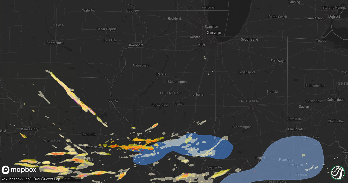
Hail Map in Illinois on May 26, 2024
Get this storm
May 26 map
$229
one time, instant access
Download today. No call, no setup
Keep the $229
Bought the map and want the full workflow? Apply the entire $229 to a subscription within 7 days. None of it is wasted.
Every map, not just this one
This buys you this map. Subscription and you get every map we run, in the markets you choose from a few cities to whole states to nationwide. Plus real-time alerts the moment a storm fires.
Contact data
Name, contact info, occupancy, even credit band for addresses in the footprint. You go from where it hit to who to call.
Become the source they trust
Unlimited branding weather history reports on demand. You already have the documented answer ready for the property owner, and you are the one who showed up with it.
Property data and RoofTrace estimates
Pull up any address you have got, its value and the exact code rules for that jurisdiction, straight from One Click Code. Then RoofTrace estimates the squares, pitch, and roof value, priced the way you price.
Storm reports in Illinois
Illinois
| Date | Description |
|---|---|
| 05/26/20246:53 PM CDT | Photos show the roof removed from one building and the partial destruction of another at beelman trucking. Time estimated from radar. |
| 05/26/20246:50 PM CDT | An ef1 tornado with maximum winds of 97mph touched down north of carlyle and tracked eastward significantly damaging a garage and shed... Removing portions of a roof on |
| 05/26/20246:48 PM CDT | Houses severely damaged. Trailers flipped. |
| 05/26/20246:46 PM CDT | Tornado crossing i-57 south of marion il near lake of egypt. |
| 05/26/20246:45 PM CDT | A local report indicates 1.00 inch wind near 2 ENE Pocahontas |
| 05/26/20246:44 PM CDT | 3ft diameter tree snapped and fell on house. |
| 05/26/20246:43 PM CDT | 12 inch limbs down. Location approximate. |
| 05/26/20246:38 PM CDT | Power pole snapped. Possible tornado. |
| 05/26/20246:38 PM CDT | *** 1 inj *** ef-3 tornado with peak winds at 150 mph. 5-mile track 300-yard width. Trees were debarked and a home suffered extensive damage near highway 37 and orchard |
| 05/26/20246:37 PM CDT | Kblv measured 61 mph. |
| 05/26/20246:37 PM CDT | Siding damage to house. Time estimated by radar. |
| 05/26/20246:34 PM CDT | A weak ef1 tornado with maximum wind speeds of 90mph tracked immediately southwest of new baden and through damiansville occasionally snapping large tree branches... Re |
| 05/26/20246:33 PM CDT | A local report indicates 1.00 inch wind near Highland |
| 05/26/20246:31 PM CDT | A local report indicates 1.00 inch wind near 2 E Fairview Heights |
| 05/26/20246:27 PM CDT | Tree snapped near base and fell on house. Time estimated from radar and public report. |
| 05/26/20246:27 PM CDT | A local report indicates 1.00 inch wind near 1 WNW Swansea |
| 05/26/20246:27 PM CDT | A local report indicates 1.75 inch wind near 2 ESE Belleville |
| 05/26/20246:23 PM CDT | Report from social media. |
| 05/26/20246:22 PM CDT | Report from mping: ping pong ball |
| 05/26/20246:21 PM CDT | Report from mping: ping pong ball |
| 05/26/20246:20 PM CDT | A local report indicates 1.75 inch wind near 1 SW Belleville |
| 05/26/20246:20 PM CDT | Large tree limb down. |
| 05/26/20246:19 PM CDT | Large tree down. Time estimated from radar. |
| 05/26/20246:18 PM CDT | Very large tree blown over... At least 3 ft in diameter. Time estimated by radar. |
| 05/26/20246:16 PM CDT | A local report indicates 1.00 inch wind near Marine |
| 05/26/20246:15 PM CDT | Report from mping: half dollar |
| 05/26/20246:10 PM CDT | Measured with the weather station at an aviation flight park near millstadt. |
| 05/26/20246:10 PM CDT | A local report indicates 1.00 inch wind near 1 SE Cahokia |
| 05/26/20246:07 PM CDT | Time estimate from radar. |
| 05/26/20246:04 PM CDT | Two reports of trees on houses in dupo. |
| 05/26/20246:03 PM CDT | A local report indicates 1.25 inch wind near 2 NNW Saint Jacob |
| 05/26/20246:01 PM CDT | Tree down and damaged fence. Possible tornado damage. |
| 05/26/20245:58 PM CDT | A local report indicates 1.00 inch wind near Saint Jacob |
| 05/26/20245:58 PM CDT | A local report indicates 1.75 inch wind near 1 ESE Troy |
| 05/26/20245:56 PM CDT | A local report indicates 1.25 inch wind near 1 E Troy |
| 05/26/20245:55 PM CDT | A local report indicates 1.25 inch wind near 1 E Troy |
| 05/26/20245:55 PM CDT | Corrects previous hail report from granite city. |
| 05/26/20245:55 PM CDT | A local report indicates 2.00 inch wind near Granite City |
| 05/26/20245:53 PM CDT | A local report indicates 1.00 inch wind near Troy |
| 05/26/20245:50 PM CDT | Report from social media. |
| 05/26/20245:42 PM CDT | Multiple tree limbs down around damiansville. |
| 05/26/20245:34 PM CDT | A local report indicates 1.00 inch wind near 1 S Pontoon Beach |
| 05/26/20245:20 PM CDT | Multiple trees down at the green mount cemetery. Time estimated from radar. |
| 05/26/20245:18 PM CDT | Up to 2.25 inches. |
| 05/26/20247:01 AM CDT | Rv turned over onto its side... Power lines down... And multiple large trees blown over. Roof blown off house. Occurred along coles creek road near carlyle lake. Time e |
| 05/25/20249:00 PM CDT | A few treees uprooted... Carpoort destroyed. Damage to cars from falling carport and trees. Cornstalks blown across road. |
| 05/25/20248:53 PM CDT | A local report indicates 59 MPH wind near Lawrenceville Airport |
| 05/25/20248:42 PM CDT | Roof blown of a shed. |
| 05/25/20248:41 PM CDT | Trees down. |
| 05/25/20248:36 PM CDT | Trees and power lines down south of bridgeport. |
| 05/25/20248:34 PM CDT | A couple large trees were blown down and the power was out in the area. |
| 05/25/20248:30 PM CDT | Trees down and power lines down along 800 n road. |
| 05/25/20248:30 PM CDT | Trees and power lines down along 800 n road. |
| 05/25/20248:29 PM CDT | Power lines down across the county. |
| 05/25/20248:27 PM CDT | Rated ef1... With a peak wind speed of 105 mph. Total path length was 6.87 miles. Touched down along e. 250th ave. North of n. 700th st. And generally moved east- north |
| 05/25/20248:27 PM CDT | A few trees uprooted... A carport damaged... And damaged cars by falling tree debris. Time estimated from radar. |
| 05/25/20248:25 PM CDT | Ef1 tornado... 110 mph maximum winds/ 22.26 mile track for 24 minutes. |
| 05/25/20248:25 PM CDT | Delayed report. Tree limb down over roadway near 1000n and 1600e. |
| 05/25/20248:25 PM CDT | Power lines and tree limbs down across the eastern parts of the county. |
| 05/25/20248:20 PM CDT | Multiple trees down in town. |
| 05/25/20248:15 PM CDT | Several trees down near broughton and dale. |
| 05/25/20248:12 PM CDT | Delayed report. Tree and electrical lines down over the roadway near 700n and 700e. |
| 05/25/20248:05 PM CDT | Trees uprooted. |
| 05/25/20248:05 PM CDT | Trees down. |
| 05/25/20248:03 PM CDT | A local report indicates 62 MPH wind near 2 N Wayne City |
| 05/25/20248:00 PM CDT | Power lines down in stritz. |
| 05/25/20248:00 PM CDT | Estimated 60 mph winds near sims. |
| 05/25/20247:59 PM CDT | Report from mping: trees uprooted or snapped; roof blown off. Time estimated by radar. |
| 05/25/20247:55 PM CDT | A local report indicates 1.00 inch wind near Dahlgren |
| 05/25/20247:53 PM CDT | Large tree limb down. |
| 05/25/20247:50 PM CDT | Trees down and car port damaged. |
| 05/25/20247:48 PM CDT | A local report indicates 1.00 inch wind near 1 W Louisville |
| 05/25/20247:47 PM CDT | A local report indicates 1.00 inch wind near 6 S Murphysboro |
| 05/25/20247:45 PM CDT | Several trees were blown down and the power was out in the area. |
| 05/25/20247:43 PM CDT | A large tree was blown onto a house... Trapping people inside. No injuries were reported. |
| 05/25/20247:42 PM CDT | A tree was snapped and power lines were knocked down. |
| 05/25/20247:42 PM CDT | Tree limbs down onto camper at charlie brown park. |
| 05/25/20247:40 PM CDT | Several trees were blown down. |
| 05/25/20247:40 PM CDT | Numerous trees were blown down... Including one that fell onto a camper at charley brown park. No injuries reported. |
| 05/25/20247:38 PM CDT | Hog barn leveled and several power poles leaning or broken. Debris from the barn was entangled in the power lines. |
| 05/25/20247:38 PM CDT | A local report indicates 65 MPH wind near 3 W Xenia |
| 05/25/20247:38 PM CDT | Numerous trees and power lines were blown down. |
| 05/25/20247:38 PM CDT | A machine shed was damaged and a few trees were blown down in songer township north of xenia. |
| 05/25/20247:35 PM CDT | A large tree and a power line were blown down. |
| 05/25/20247:35 PM CDT | Rated ef2... With a peak wind speed of 130 mph. Total path length was 8.4 miles... Of which 3.6 of them were in clay county. Originally touched down in marion county at |
| 05/25/20247:35 PM CDT | 10 power poles down on 185... 1 mile north of st. Peter... Il. Time estimated by radar. |
| 05/25/20247:35 PM CDT | Pea to quarter sized hail. |
| 05/25/20247:35 PM CDT | A local report indicates 64 MPH wind near 1 NW Salem |
| 05/25/20247:35 PM CDT | A local report indicates 64 MPH wind near 1 NNW Salem |
| 05/25/20247:31 PM CDT | A local report indicates 1.25 inch wind near Harrisburg |
| 05/25/20247:31 PM CDT | Multiple snapped large tree limbs and a light metal carport destroyed between st. Peter and farina. |
| 05/25/20247:31 PM CDT | Lots of trees down and damage around stephen forbes state park. Time estimated by radar. |
| 05/25/20247:29 PM CDT | An ef1 tornado with maximum winds of 90mph touched down and tracked eastward south of forbes lake primarily uprooting and snapping trees along its path. This tornado co |
| 05/25/20247:28 PM CDT | 1 inch sized hail. |
| 05/25/20247:28 PM CDT | A brief ef1 tornado with maximum winds of 104mph touched down just west of forbes lake... Uprooting and snapping several trees. |
| 05/25/20247:25 PM CDT | 7 year old maple snapped at base at the 200 block of country club est. Time estimated from radar. |
| 05/25/20247:25 PM CDT | Tree snapped at base on allmon street at north college. Photo from social media. Time estimated from radar. |
| 05/25/20247:25 PM CDT | Approximately 10 inch in diameter limb broken off and hanging on power line at the 400 block of south pearl street. Photo from social media. Time estimated from radar. |
| 05/25/20247:22 PM CDT | 80 ft oak tree snapped at base on pine tree drive. Photo from social media. Time estimated from radar. |
| 05/25/20247:22 PM CDT | Tree down over road at the corner of lester and south washington. Photo from social media. Time estimated from radar. |
| 05/25/20247:22 PM CDT | Tree snapped about half way up truck on hickory grove. Photo from social media. Time estimated from radar. |
| 05/25/20247:22 PM CDT | Tree snapped approximately half way up truck and lying on house. Photo from social media. Time estimated from radar. |
| 05/25/20247:22 PM CDT | Tree over road on west porter at north walnut. Photo from social media. Time estimated from radar. |
| 05/25/20247:22 PM CDT | Tree snapped at base along north rotan street. Photo from social media. Time estimated from radar. |
| 05/25/20247:22 PM CDT | Light pole on ground at carpenter drive. Photo from social media. Time estimated from radar. |
| 05/25/20247:10 PM CDT | A local report indicates 2.00 inch wind near 6 NW Carrier Mills |
| 05/25/20247:00 PM CDT | A local report indicates 1.00 inch wind near 5 NNE Creal Springs |
All States Impacted by Hail Map on May 26, 2024
Cities Impacted by Hail Map on May 26, 2024
- Pawnee City, NE
- Omaha, NE
- Crescent, IA
- Council Bluffs, IA
- Carter Lake, IA
- McClelland, IA
- Honey Creek, IA
- Underwood, IA
- Holcomb, MO
- Qulin, MO
- Knobel, AR
- Gideon, MO
- Corning, AR
- Pollard, AR
- Lafe, AR
- Delaplaine, AR
- Lilbourn, MO
- Rector, AR
- Malden, MO
- Gibson, MO
- Greenway, AR
- Paragould, AR
- Saint Francis, AR
- Parma, MO
- Bernie, MO
- Dexter, MO
- Campbell, MO
- Portageville, MO
- Catron, MO
- Piggott, AR
- Clarkton, MO
- Neelyville, MO
- Dudley, MO
- Poplar Bluff, MO
- Broseley, MO
- Fisk, MO
- Puxico, MO
- Bloomfield, MO
- San Saba, TX
- Richland Springs, TX
- Purmela, TX
- Evant, TX
- Gatesville, TX
- Thebes, IL
- Wardell, MO
- Essex, MO
- Kennett, MO
- Benton, MO
- Vanduser, MO
- Oran, MO
- Sikeston, MO
- New Madrid, MO
- Marston, MO
- Bell City, MO
- Canalou, MO
- Matthews, MO
- Goldthwaite, TX
- East Prairie, MO
- Charleston, MO
- Bragg City, MO
- Lometa, TX
- Crawford, TX
- Valley Mills, TX
- Woodway, TX
- China Spring, TX
- Hayti, MO
- Tiptonville, TN
- Jonesboro, TX
- Scott City, MO
- Olive Branch, IL
- Tamms, IL
- Miller City, IL
- Bertrand, MO
- Cairo, IL
- Union City, TN
- Hickman, KY
- Anniston, MO
- Ridgely, TN
- Hornbeak, TN
- Mounds, IL
- Troy, TN
- Pulaski, IL
- Mound City, IL
- La Center, KY
- Villa Ridge, IL
- Olmsted, IL
- Arlington, KY
- Clinton, KY
- Kevil, KY
- Grand Chain, IL
- Wickliffe, KY
- Barlow, KY
- Columbus, KY
- Bardwell, KY
- McGregor, TX
- Waco, TX
- Fulton, KY
- South Fulton, TN
- Rives, TN
- Fancy Farm, KY
- Wingo, KY
- Metropolis, IL
- Paducah, KY
- West Paducah, KY
- Cunningham, KY
- Melber, KY
- Hickory, KY
- Water Valley, KY
- Mayfield, KY
- Lampasas, TX
- Obion, TN
- Rantoul, IL
- Boaz, KY
- Brookport, IL
- Martin, TN
- Dukedom, TN
- Sedalia, KY
- Calvert City, KY
- Benton, KY
- Tiline, KY
- Palmersville, TN
- Smithland, KY
- Ledbetter, KY
- Burna, KY
- Golconda, IL
- Symsonia, KY
- Kenton, TN
- Sharon, TN
- Fort Hood, TX
- Summersville, MO
- Salem, KY
- Farmington, KY
- Grand Rivers, KY
- Marion, KY
- Kirksey, KY
- Gilbertsville, KY
- Fredonia, KY
- Kuttawa, KY
- Dexter, KY
- Eddyville, KY
- Hardin, KY
- Almo, KY
- Murray, KY
- Hazel, KY
- Puryear, TN
- Cottage Grove, TN
- Dresden, TN
- Princeton, KY
- New Concord, KY
- Buchanan, TN
- Cadiz, KY
- Olney, IL
- Noble, IL
- Moody, TX
- Greenfield, TN
- Providence, KY
- Big Rock, TN
- Dawson Springs, KY
- Dover, TN
- Bumpus Mills, TN
- Stewart, TN
- Gracey, KY
- Fort Campbell, KY
- La Fayette, KY
- Hopkinsville, KY
- Herndon, KY
- Cerulean, KY
- Nebo, KY
- Indian Mound, TN
- Paris, TN
- Temple, TX
- Killeen, TX
- Fremont, MO
- Gleason, TN
- Ellsinore, MO
- Oglesby, TX
- McKenzie, TN
- Henry, TN
- Saint Charles, KY
- Manitou, KY
- Hanson, KY
- Earlington, KY
- Madisonville, KY
- Nortonville, KY
- Crofton, KY
- Cumberland City, TN
- Woodlawn, TN
- Tennessee Ridge, TN
- Mortons Gap, KY
- Pembroke, KY
- Trenton, KY
- Elkton, KY
- Oak Grove, KY
- Clarksville, TN
- Palmyra, TN
- White Plains, KY
- Greenville, MO
- Copperas Cove, TX
- Mill Spring, MO
- Van Buren, MO
- Williamsville, MO
- Troy, TX
- Eddy, TX
- Bruceville, TX
- Lorena, TX
- Piedmont, MO
- Flat Rock, IL
- Kempner, TX
- Springville, TN
- Wappapello, MO
- Kankakee, IL
- Bonfield, IL
- Chilton, TX
- Grandin, MO
- Big Sandy, TN
- Adams, TN
- Cedar Hill, TN
- Cunningham, TN
- Southside, TN
- Ashland City, TN
- Chapmansboro, TN
- Springfield, TN
- Cumberland Furnace, TN
- Pleasant View, TN
- Guthrie, KY
- Olmstead, KY
- Powderly, KY
- Sharon Grove, KY
- Rumsey, KY
- Dunmor, KY
- Browder, KY
- Belton, KY
- Beechmont, KY
- Adairville, KY
- Russellville, KY
- Drakesboro, KY
- Graham, KY
- Centertown, KY
- Island, KY
- Greenville, KY
- Central City, KY
- Sacramento, KY
- Beech Creek, KY
- Allensville, KY
- Lewisburg, KY
- Bremen, KY
- Calhoun, KY
- Owensboro, KY
- Utica, KY
- Livermore, KY
- Philpot, KY
- Slaughters, KY
- Zalma, MO
- Marlin, TX
- Yorktown, AR
- Bourbonnais, IL
- McGee, MO
- Manteno, IL
- Cross Plains, TN
- Orlinda, TN
- Greenbrier, TN
- Morgantown, KY
- Franklin, KY
- Rochester, KY
- Woodburn, KY
- Beaver Dam, KY
- Cottontown, TN
- McHenry, KY
- Hartford, KY
- Rockport, KY
- Portland, TN
- Rockfield, KY
- White House, TN
- Auburn, KY
- Fordsville, KY
- Cromwell, KY
- Whitesville, KY
- Bowling Green, KY
- Olaton, KY
- Dundee, KY
- Rosine, KY
- Hawesville, KY
- Horse Branch, KY
- Reynolds Station, KY
- Caneyville, KY
- Falls Of Rough, KY
- Cloverport, KY
- Marble Hill, MO
- Advance, MO
- Grady, AR
- Milford, IL
- Thornton, TX
- Hardinsburg, KY
- Scottsville, KY
- Alvaton, KY
- Adolphus, KY
- Westmoreland, TN
- Bethpage, TN
- Watseka, IL
- Lott, TX
- Holland, KY
- Lafayette, TN
- De Witt, AR
- Rosebud, TX
- Gallatin, TN
- Reagan, TX
- Saint Charles, AR
- Ethel, AR
- Elaine, AR
- Holly Grove, AR
- Red Boiling Springs, TN
- Moss, TN
- Hartsville, TN
- Lake City, AR
- Harned, KY
- Guston, KY
- Webster, KY
- Irvington, KY
- McDaniels, KY
- Hudson, KY
- Garfield, KY
- Custer, KY
- Westview, KY
- Big Clifty, KY
- Rineyville, KY
- Cecilia, KY
- Clarkson, KY
- Vine Grove, KY
- Millwood, KY
- Eastview, KY
- Leitchfield, KY
- Elizabeth, IN
- Fort Knox, KY
- West Point, KY
- Charlestown, IN
- Ekron, KY
- Jeffersonville, IN
- Clarksville, IN
- New Albany, IN
- Muldraugh, KY
- Laconia, IN
- Shepherdsville, KY
- Sellersburg, IN
- Radcliff, KY
- Brandenburg, KY
- Louisville, KY
- Elizabethtown, KY
- Fisherville, KY
- Fairdale, KY
- Finchville, KY
- Glenview, KY
- Lebanon Junction, KY
- Taylorsville, KY
- Simpsonville, KY
- Coxs Creek, KY
- Prospect, KY
- Boston, KY
- Mount Washington, KY
- Masonic Home, KY
- Clermont, KY
- Brooks, KY
- Springfield, KY
- Bloomfield, KY
- Fairfield, KY
- Willisburg, KY
- Bardstown, KY
- Tompkinsville, KY
- Hestand, KY
- New Washington, IN
- Buckner, KY
- Goshen, KY
- Crestwood, KY
- Nabb, IN
- La Grange, KY
- Pewee Valley, KY
- Marysville, IN
- White Mills, KY
- Loretto, KY
- New Haven, KY
- Hodgenville, KY
- Sonora, KY
- Glendale, KY
- Westport, KY
- Shelbyville, KY
- Harrodsburg, KY
- Chaplin, KY
- Lawrenceburg, KY
- Smithfield, KY
- Mount Eden, KY
- Salvisa, KY
- Waddy, KY
- Sulphur, KY
- Bagdad, KY
- Bedford, KY
- Bethlehem, IN
- Pendleton, KY
- New Castle, KY
- Eminence, KY
- Milton, KY
- Hanover, IN
- Campbellsburg, KY
- Pleasureville, KY
- Frankfort, KY
- Byrdstown, TN
- Pall Mall, TN
- Livingston, TN
- Monroe, TN
- Lancaster, KY
- Wilmore, KY
- Burgin, KY
- Versailles, KY
- Mackville, KY
- Perryville, KY
- Danville, KY
- Stanford, KY
- Saint Catharine, KY
- Lebanon, KY
- Lockport, KY
- Vevay, IN
- Bethlehem, KY
- Sanders, KY
- Worthville, KY
- Madison, IN
- Owenton, KY
- Ghent, KY
- Carrollton, KY
- Perry Park, KY
- Turners Station, KY
- New Liberty, KY
- Midway, KY
- Nicholasville, KY
- Jamestown, TN
- Calvert, TX
- Bremond, TX
- Trimble, TN
- Paint Lick, KY
- Georgetown, KY
- Lexington, KY
- Stamping Ground, KY
- Richmond, KY
- Bennington, IN
- Warsaw, KY
- Franklin, TX
- Crab Orchard, KY
- Patriot, IN
- Union, KY
- Florence, IN
- Glencoe, KY
- Rising Sun, IN
- Verona, KY
- Corinth, KY
- Williamstown, KY
- Jonesville, KY
- Dry Ridge, KY
- Sadieville, KY
- Sparta, KY
- Waco, KY
- Berea, KY
- Cynthiana, KY
- Winchester, KY
- Paris, KY
- Keystone, SD
- Hermosa, SD
- Brodhead, KY
- Crittenden, KY
- Irvine, KY
- Falmouth, KY
- De Mossville, KY
- Berry, KY
- Walton, KY
- Morning View, KY
- Independence, KY
- Carlisle, KY
- Norfolk, VA
- Mount Vernon, KY
- Normangee, TX
- Millersburg, KY
- Mount Sterling, KY
- Alexandria, KY
- Clay City, KY
- North Middletown, KY
- Foster, KY
- Butler, KY
- Latonia, KY
- Brooksville, KY
- Mount Olivet, KY
- Melbourne, KY
- California, KY
- Owingsville, KY
- Jeffersonville, KY
- Ravenna, KY
- Slade, KY
- Stanton, KY
- Sharpsburg, KY
- New Richmond, OH
- Georgetown, OH
- Germantown, KY
- Tollesboro, KY
- Moscow, OH
- Olympia, KY
- Bethel, OH
- Manchester, OH
- Flemingsburg, KY
- Dover, KY
- Maysville, KY
- Salt Lick, KY
- Neville, OH
- Aberdeen, OH
- Hillsboro, KY
- Moorefield, KY
- Mayslick, KY
- Hope, KY
- Vanceburg, KY
- Frenchburg, KY
- Ewing, KY
- Means, KY
- Ripley, OH
- Felicity, OH
- Wallingford, KY
- Hamersville, OH
- Augusta, KY
- Morehead, KY
- West Union, OH
- Russellville, OH
- Amelia, OH
- Parksville, KY
- Wellington, KY
- Junction City, KY
- Saint Francis, KY
- Raywick, KY
- Pine Ridge, KY
- New Hope, KY
- Gravel Switch, KY
- Denniston, KY
- Madisonville, TX
- Erin, TN
- Camden, TN
- Eva, TN
- Waverly, TN
- Kosse, TX
- Clearfield, KY
- Chesapeake, VA
- Portsmouth, VA
- McEwen, TN
- Vanleer, TN
- Midway, TX
- Manchester, KY
- Fairburn, SD
- Goodlettsville, TN
- Joelton, TN
- Hendersonville, TN
- New Johnsonville, TN
- Nashville, TN
- Allen, SD
- Dickson, TN
- Rapid City, SD
- Charlotte, TN
- West Liberty, KY
- Whites Creek, TN
- White Bluff, TN
- Black Hawk, SD
- Cannel City, KY
- Olive Hill, KY
- Sandy Hook, KY
- Warsaw, VA
- Madison, TN
- Old Hickory, TN
- Mize, KY
- Farnham, VA
- Nunnelly, TN
- Pine Ridge, SD
- Grayson, KY
- Flatgap, KY
- Keaton, KY
- Bon Aqua, TN
- Castalian Springs, TN
- Burns, TN
- Scenic, SD
- Nemo, SD
- Lyles, TN
- Albany, KY
- Mount Juliet, TN
- Lebanon, TN
- Interior, SD
- Wanblee, SD
- Philip, SD
- Fairview, TN
- Franklin, TN
- Paintsville, KY
- Sitka, KY
- Stambaugh, KY
- Canton, NC
- Monticello, KY
- Pegram, TN
- Kingston Springs, TN
- Pleasant Shade, TN
- Carthage, TN
- Martin, SD
- Hill City, SD
- Dixon Springs, TN
- Primm Springs, TN
- Kincaid, KS
- Blue Mound, KS
- Mound City, KS
- Whitleyville, TN
- Gainesboro, TN
- Leicester, NC
- Candler, NC
- South Mills, NC
- Fort Yates, ND
- Montrose, MO
- Delaware, OK
- Pleasanton, KS
- Nolensville, TN
- Quinn, SD
- Clinton, MO
- Wall, SD
- Tipton, MO
- Knoxville, TN
- Brush Creek, TN
- Gordonsville, TN
- California, MO
- Clarksburg, MO
- Antioch, TN
- Tuthill, SD
- Hermitage, TN
- La Vergne, TN
- Quincy, MO
- Vinita, OK
- Warsaw, MO
- Centertown, MO
- Foster, MO
- Kyle, SD
- Mapleton, KS
- Prescott, KS
- Fulton, KS
- Weaverville, NC
- Barnardsville, NC
- Lansing, NC
- Whitetop, VA
- Bonnots Mill, MO
- Linn, MO
- Loose Creek, MO
- Arrington, TN
- Troutdale, VA
- Corryton, TN
- Powell, TN
- College Grove, TN
- Buffalo Valley, TN
- Granville, TN
- Chestnut Mound, TN
- Elmwood, TN
- Baxter, TN
- Damascus, VA
- Dunlap, IA
- Asheville, NC
- Alexander, NC
- Lockwood, MO
- Golden City, MO
- Heiskell, TN
- Clinton, TN
- Calhoun, MO
- Laurel Bloomery, TN
- Sugar Grove, VA
- Elk Creek, VA
- Lincoln, MO
- Burnsville, NC
- La Cygne, KS
- Windsor, MO
- Edwards, MO
- Porcupine, SD
- Jefferson City, MO
- Holts Summit, MO
- Hartsburg, MO
- Chamois, MO
- Butler, MO
- Rich Hill, MO
- Hume, MO
- Strafford, MO
- Fair Grove, MO
- Benton, TN
- Reliance, TN
- Smyrna, TN
- Murfreesboro, TN
- Fort Scott, KS
- Rockvale, TN
- Nowata, OK
- Virginia Beach, VA
- Luttrell, TN
- Blaine, TN
- Ocoee, TN
- Gravois Mills, MO
- Delano, TN
- Greenfield, MO
- Earling, IA
- Bloomington Springs, TN
- Pleasant Hope, MO
- Springfield, MO
- Morrison, MO
- Stover, MO
- Climax Springs, MO
- Zuni, VA
- Schell City, MO
- Walker, MO
- Harwood, MO
- New Bloomfield, MO
- Tebbetts, MO
- Rocky Mount, MO
- Eldon, MO
- Barnett, MO
- Hermann, MO
- Everton, MO
- Bridgeville, DE
- Rhineland, MO
- Afton, OK
- Marshall, NC
- Sandston, VA
- Walnut Grove, MO
- Rockville, MO
- Mouth Of Wilson, VA
- Collins, MO
- Weaubleau, MO
- Osceola, MO
- Readyville, TN
- Warrenton, MO
- Wright City, MO
- Marthasville, MO
- Atkins, VA
- Marion, VA
- Portland, MO
- Mokane, MO
- Steedman, MO
- Versailles, MO
- Wheatland, MO
- Appleton City, MO
- Marshfield, MO
- Elkland, MO
- Buffalo, MO
- Ash Grove, MO
- Fairland, OK
- Wyandotte, OK
- Grove, OK
- Berger, MO
- New Haven, MO
- Lake Ozark, MO
- Roach, MO
- Sunrise Beach, MO
- Camdenton, MO
- Osage Beach, MO
- Richards, MO
- Eugene, MO
- Henley, MO
- Lebanon, MO
- Long Lane, MO
- Farner, TN
- Turtletown, TN
- Foristell, MO
- Grassy Creek, NC
- Bland, VA
- El Dorado Springs, MO
- Strawberry Plains, TN
- Oak Ridge, TN
- Cole Camp, MO
- Crockett, VA
- Wytheville, VA
- Woodbury, TN
- Rutledge, TN
- Phillipsburg, MO
- Windyville, MO
- Bakersville, NC
- Green Mountain, NC
- Saint Thomas, MO
- Hermitage, MO
- Bradyville, TN
- Murphy, NC
- Mascot, TN
- Niangua, MO
- Flemington, MO
- Talbott, TN
- Jefferson City, TN
- Morristown, TN
- Washington, MO
- Dow, IL
- Lowry City, MO
- Crumpler, NC
- Florence, MO
- Tuscumbia, MO
- Anderson, MO
- South West City, MO
- Preston, MO
- Linn Creek, MO
- Pearisburg, VA
- Grovespring, MO
- Hartville, MO
- Brighton, MO
- Willard, MO
- Conway, MO
- Kaiser, MO
- Brumley, MO
- Oliver Springs, TN
- Narrows, VA
- Rogersville, MO
- New Market, TN
- Mansfield, MO
- Seymour, MO
- Maynardville, TN
- Cosby, TN
- Fortuna, MO
- Syracuse, MO
- Bluefield, VA
- Falls Mills, VA
- Pocahontas, VA
- Bramwell, WV
- Bluefield, WV
- Montcalm, WV
- Rock, WV
- Princeton, WV
- Kegley, WV
- Freeman, WV
- Bastian, VA
- Rocky Gap, VA
- Staffordsville, VA
- Ripplemead, VA
- Athens, WV
- Glen Lyn, VA
- Peterstown, WV
- Rich Creek, VA
- Pembroke, VA
- Eggleston, VA
- Radford, VA
- Pulaski, VA
- Belspring, VA
- Dublin, VA
- Parrott, VA
- Draper, VA
- Max Meadows, VA
- Morrisville, MO
- Pittsburg, MO
- Tallassee, TN
- Maryville, TN
- Freeburg, MO
- Richland, MO
- Batchtown, IL
- Hardin, IL
- Hartford, TN
- Montreal, MO
- O'Fallon, MO
- Saint Peters, MO
- Sevierville, TN
- Ulman, MO
- Noel, MO
- Lanagan, MO
- Dandridge, TN
- Richmond, VA
- Ballard, WV
- Jay, OK
- Augusta, MO
- Humansville, MO
- Waynesville, NC
- Westphalia, MO
- Saint Charles, MO
- Lake Saint Louis, MO
- Elsberry, MO
- Henrico, VA
- Pineville, MO
- Brighton, IL
- Godfrey, IL
- Jerseyville, IL
- Vonore, TN
- Saint Elizabeth, MO
- Clyde, NC
- Belle, MO
- Tiff City, MO
- Fieldon, IL
- Del Rio, TN
- Newport, TN
- Bolivar, MO
- Half Way, MO
- Urbana, MO
- Polk, MO
- Fair Play, MO
- Dunnegan, MO
- Mountain Grove, MO
- Waynesville, MO
- Laquey, MO
- Christiansburg, VA
- Iberia, MO
- Crocker, MO
- Meta, MO
- Wentzville, MO
- Shipman, IL
- Marble, NC
- Rock Port, MO
- Kadoka, SD
- Stockton, MO
- Macks Creek, MO
- Dixon, MO
- Foley, MO
- Stoutland, MO
- Mullen, NE
- Defiance, MO
- Vanzant, MO
- Koeltztown, MO
- Hot Springs, NC
- Riner, VA
- Indian Valley, VA
- Floyd, VA
- Hiwassee, VA
- Pilot, VA
- Willis, VA
- Owensville, MO
- Gerald, MO
- Union, MO
- Bridgeton, MO
- Earth City, MO
- Bella Vista, AR
- Seligman, MO
- Bentonville, AR
- Pea Ridge, AR
- Hazelwood, MO
- Garfield, AR
- Washburn, MO
- Powell, MO
- Graff, MO
- Labadie, MO
- Villa Ridge, MO
- Fort Leonard Wood, MO
- Saint Robert, MO
- Gray Summit, MO
- Louisburg, MO
- Florissant, MO
- Andrews, NC
- Hayesville, NC
- Franklin, NC
- Olean, MO
- Carlinville, IL
- Gillespie, IL
- Bland, MO
- Plato, MO
- Cabool, MO
- Huggins, MO
- Bucyrus, MO
- Pacific, MO
- Leslie, MO
- Willow Springs, MO
- Tunas, MO
- Saint Louis, MO
- Grafton, IL
- Elsah, IL
- Portage Des Sioux, MO
- Maryland Heights, MO
- Bunker Hill, IL
- Eagleville, TN
- Sunset, SC
- Salem, SC
- Cross Timbers, MO
- Saint Albans, MO
- Townsend, TN
- Walland, TN
- Wildwood, MO
- Devils Elbow, MO
- Houston, MO
- Chesterfield, MO
- Ballwin, MO
- Eureka Springs, AR
- Pickens, SC
- Litchfield, IL
- Salem, MO
- Eminence, MO
- Hartshorn, MO
- Rosebud, MO
- Duke, MO
- Newburg, MO
- Eureka, MO
- High Ridge, MO
- Rogers, AR
- Saint Ann, MO
- Elk Creek, MO
- Beaufort, MO
- Yukon, MO
- Eldridge, MO
- Salem, VA
- Vienna, MO
- Mountain View, MO
- Fenton, MO
- Valley Park, MO
- Granite City, IL
- Edwardsville, IL
- Collinsville, IL
- Maryville, IL
- Glen Carbon, IL
- Janesville, WI
- Troy, IL
- Hartwell, GA
- Dewy Rose, GA
- Bowman, GA
- Alton, IL
- Lynchburg, MO
- Norwood, MO
- Eagle Rock, MO
- Glenwood, IA
- Pacific Junction, IA
- Solo, MO
- Drury, MO
- Madison, IL
- Eunice, MO
- Gatlinburg, TN
- Milton, WI
- Whitewater, WI
- Fort Atkinson, WI
- Elberton, GA
- Berryville, AR
- Birch Tree, MO
- Saint Jacob, IL
- East Carondelet, IL
- Marine, IL
- Old Monroe, MO
- Winfield, MO
- Brussels, IL
- Falcon, MO
- Saint Clair, MO
- Sullivan, MO
- Jadwin, MO
- Rolla, MO
- Marietta, SC
- Easley, SC
- Travelers Rest, SC
- House Springs, MO
- Raymondville, MO
- East Alton, IL
- Hartford, IL
- Bunker, MO
- Venice, IL
- South Roxana, IL
- Roxana, IL
- Greenville, SC
- Highland, IL
- Edgar Springs, MO
- Arnold, MO
- Green Forest, AR
- East Saint Louis, IL
- Millstadt, IL
- Dupo, IL
- Ronceverte, WV
- Lewisburg, WV
- Asbury, WV
- White Sulphur Springs, WV
- Renick, WV
- Caldwell, WV
- Frankford, WV
- Maxwelton, WV
- Covington, VA
- Hot Springs, VA
- Alderson, WV
- Belleville, IL
- Saint James, MO
- Boss, MO
- Lonedell, MO
- Traphill, NC
- Imperial, MO
- Winona, MO
- Bixby, MO
- Grubville, MO
- Robertsville, MO
- Elkin, NC
- Viburnum, MO
- Alhambra, IL
- Catawissa, MO
- Steelville, MO
- Potosi, MO
- Fairview Heights, IL
- O'Fallon, IL
- Iva, SC
- Otto, NC
- Omaha, AR
- Lovejoy, IL
- Lebanon, IL
- Anderson, SC
- Pocahontas, IL
- Mars Hill, NC
- Sorento, IL
- Greenville, IL
- Caseyville, IL
- Ellington, MO
- Cook Sta, MO
- Davisville, MO
- Taylors, SC
- Hillsboro, MO
- Pevely, MO
- Cedar Hill, MO
- Dittmer, MO
- Barnhart, MO
- Columbia, IL
- Huntsville, AR
- Licking, MO
- Success, MO
- State Road, NC
- Pigeon Forge, TN
- Scott Air Force Base, IL
- Goreville, IL
- Alpena, AR
- Yellville, AR
- Walshville, IL
- Donnellson, IL
- West Alton, MO
- Belgrade, MO
- Wilsonville, IL
- Staunton, IL
- Marion, IL
- Carbondale, IL
- Waterloo, IL
- Valmeyer, IL
- New Athens, IL
- Pierce City, MO
- Cherryville, MO
- Greer, SC
- Redford, MO
- Mascoutah, IL
- Trenton, IL
- Creal Springs, IL
- Williamston, SC
- Roby, MO
- De Soto, MO
- Harrison, AR
- Griswold, IA
- Billings, MO
- Republic, MO
- Makanda, IL
- Fults, IL
- Piedmont, SC
- Pelzer, SC
- Freeburg, IL
- Smithton, IL
- Tampa, KS
- Marion, KS
- Aviston, IL
- Mount Carmel, IL
- Bartelso, IL
- Germantown, IL
- Beckemeyer, IL
- Albers, IL
- Carlyle, IL
- Breese, IL
- Festus, MO
- Merriman, NE
- Bellmont, IL
- Browns, IL
- Summerfield, IL
- Centerville, MO
- Blackwell, MO
- Bonne Terre, MO
- Albion, IL
- Verona, MO
- Monett, MO
- New Baden, IL
- Brookline, MO
- Nixa, MO
- Clever, MO
- Duncan, SC
- Woodruff, SC
- Moore, SC
- Carrier Mills, IL
- Stonefort, IL
- Harrisburg, IL
- Vandalia, IL
- Mulberry Grove, IL
- Ozark, MO
- Bois D Arc, MO
- Morganton, NC
- Marion, NC
- Keyesport, IL
- Sandoval, IL
- Centralia, IL
- Patoka, IL
- North Platte, NE
- Aurora, MO
- Simpsonville, SC
- Marionville, MO
- Allendale, IL
- Villisca, IA
- Nodaway, IA
- Addieville, IL
- Marissa, IL
- Decker, IN
- Smithboro, IL
- Grayville, IL
- Vincennes, IN
- Galatia, IL
- Eldorado, IL
- Corning, IA
- Salem, IL
- Kinmundy, IL
- Alma, IL
- Odin, IL
- Crane, MO
- Roebuck, SC
- Evansville, IL
- Walsh, IL
- Sparta, IL
- Ellis Grove, IL
- Sainte Genevieve, MO
- Brownstown, IL
- Annapolis, MO
- Fredericktown, MO
- Marquand, MO
- Vernon, IL
- Junction, IL
- Shawneetown, IL
- Shobonier, IL
- Fordland, MO
- Rural Retreat, VA
- Sparta, MO
- Fountain Inn, SC
- Bruner, MO
- Oldfield, MO
- Patton, MO
- Mount Vernon, IL
- Corydon, KY
- Herod, IL
- Equality, IL
- Woodlawn, IL
- Waltonville, IL
- Vulcan, MO
- Doniphan, MO
- Abbeville, SC
- Morganfield, KY
- Perryville, MO
- Sedgewickville, MO
- Iuka, IL
- Farina, IL
- Saint Peter, IL
- Afton, IA
- Maxwell, NE
- Nashville, IL
- Saint Mary, MO
- Louisville, IL
- Xenia, IL
- Glenallen, MO
- Tamaroa, IL
- Du Bois, IL
- Galena, MO
- Highlandville, MO
- Pomona, IL
- Macomb, MO
- Spartanburg, SC
- Pauline, SC
- Florence, KS
- Mason, IL
- Edgewood, IL
- Texico, IL
- Johnsonville, IL
- Kell, IL
- Walnut Hill, IL
- Bluford, IL
- Keenes, IL
- Dix, IL
- Hoffman, IL
- Hoyleton, IL
- Watson, IL
- Ingraham, IL
- Dieterich, IL
- Newton, IL
- Rinard, IL
- Clay City, IL
- Flora, IL
- Wheeler, IL
- Dundas, IL
- Sailor Springs, IL
- Grand Tower, IL
- New Florence, MO
- Jasper, AR
- Vendor, AR
- Neoga, IL
- Toledo, IL
- Greenup, IL
- Bonnie, IL
- Opdyke, IL
- Ava, MO
- Mulkeytown, IL
- Leopold, MO
- Belle Rive, IL
- Henderson, KY
- Robards, KY
- Du Quoin, IL
- Hidalgo, IL
- Scheller, IL
- Uniontown, MO
- Oak Ridge, MO
- Altenburg, MO
- Friedheim, MO
- Old Appleton, MO
- Frohna, MO
- Montgomery City, MO
- Ponce De Leon, MO
- Spokane, MO
- Sturgis, KY
- Jonesburg, MO
- Taylorsville, NC
- Moravian Falls, NC
- Lenoir, NC
- Granite Falls, NC
- Statesville, NC
- Hickory, NC
- Hiddenite, NC
- Conover, NC
- Claremont, NC
- Stony Point, NC
- Catawba, NC
- Reed, KY
- Spottsville, KY
- Casey, IL
- Washington, IN
- Connelly Springs, NC
- Valdese, NC
- Wheatland, IN
- Wayne City, IL
- Macedonia, IL
- Dahlgren, IL
- Ewing, IL
- Thompsonville, IL
- Benton, IL
- Sesser, IL
- Elkville, IL
- Royalton, IL
- Cisne, IL
- Geff, IL
- Sims, IL
- Fairfield, IL
- Clay, KY
- Millersville, MO
- Yale, IL
- Buckner, IL
- Saint Elmo, IL
- Altamont, IL
- Pittsburg, IL
- Uniontown, KY
- Ridgway, IL
- Alto Pass, IL
- Wolf Lake, IL
- Ina, IL
- Cape Girardeau, MO
- McLeansboro, IL
- Broughton, IL
- Martinsville, IL
- Ellston, IA
- Tingley, IA
- Grand River, IA
- Lamoni, IA
- Kellerton, IA
- Parkersburg, IL
- Calhoun, IL
- Jonesboro, IL
- McClure, IL
- Jackson, MO
- Sumner, IL
- Claremont, IL
- Elizabethtown, IL
- Cobden, IL
- Mount Vernon, IN
- Waverly, KY
- Golden Gate, IL
- Barnhill, IL
- Mount Erie, IL
- West Salem, IL
- Decatur, IA
- Leon, IA
- Elwood, NE
- Bertrand, NE
- Chaffee, MO
- Oaktown, IN
- Monroe City, IN
- Montgomery, IN
- Ellery, IL
- Bone Gap, IL
- West Liberty, IL
- Willow Hill, IL
- Oblong, IL
- Richland, IN
- Rockport, IN
- Bridgeport, IL
- Robinson, IL
- Hazleton, IN
- Princeton, IN
- Owensville, IN
- Bicknell, IN
- Francisco, IN
- Bruceville, IN
- Lawrenceville, IL
- Saint Francisville, IL
- Petersburg, IN
- Fort Branch, IN
- Patoka, IN
- Lynnville, IN
- Ragsdale, IN
- Spurgeon, IN
- Winslow, IN
- Haubstadt, IN
- Oakland City, IN
- Elberfeld, IN
- Norris City, IL
- Enfield, IL
- Elliott, IA
- Grant, IA
- Davis City, IA
- Ullin, IL
- Asheboro, NC
- Trinity, NC
- Sophia, NC
- Simpson, IL
- Dongola, IL
- Cypress, IL
- Lineville, IA
- Annapolis, IL
- Marshall, IL
- West York, IL
- West Union, IL
- Williams, IN
- Bedford, IN
- Harviell, MO
- Loogootee, IN
- Burfordville, MO
- Crane, IN
- Odon, IN
- Anna, IL
- Whitewater, MO
- Evansville, IN
- Eddyville, IL
- Cave In Rock, IL
- Ozark, IL
- Cynthiana, IN
- Griffin, IN
- Poseyville, IN
- Cainsville, MO
- Mercer, MO
- Diagonal, IA
- Mammoth Spring, AR
- Thayer, IA
- Fairdealing, MO
- Newburgh, IN
- Valley Springs, AR
- Maceo, KY
- Heltonville, IN
- Dixon, KY
- Sheridan, MO
- Princeton, MO
- Buncombe, IL
- Vienna, IL
- Norman, IN
- Oolitic, IN
- Avoca, IN
- Springville, IN
- Ravenden, AR
- Pocahontas, AR
- Couch, MO
- Myrtle, MO
- Ravenden Springs, AR
- Gatewood, MO
- Hampton, KY
- Rosiclare, IL
- Grantsburg, IL
- Sebree, KY
- Silva, MO
- Edwardsport, IN
- Lucerne, MO
- Newtown, MO
- Harris, MO
- Milan, MO
- Hildreth, NE
- Martinsburg, WV
- Mount Ayr, IA
- Gentry, MO
- Worth, MO
- Powersville, MO
- Plainville, IN
- Sandborn, IN
- Westphalia, IN
- Bloomington, NE
- Berryville, VA
- Lewisport, KY
- Warm Springs, AR
- Gipsy, MO
- Naylor, MO
- Lowndes, MO
- Elnora, IN
- Jasper, IN
- Otwell, IN
- Velpen, IN
- Cannelburg, IN
- Stendal, IN
- Holland, IN
- Huntingburg, IN
- Youngsville, NC
- New Boston, MO
- Cannelton, IN
- Rome, IN
- Kearneysville, WV
- Cassoday, KS
- Maynard, AR
- Summit Point, WV
- Pollock, MO
- Oxly, MO
- Shenandoah, IA
- Charles Town, WV
- Ranson, WV
- Tonganoxie, KS
- Linwood, KS
- Success, AR
- Searcy, AR
- Judsonia, AR
- McLouth, KS
- Franklinton, NC
- Green City, MO
- New Hampton, MO
- Green Castle, MO
- Oskaloosa, KS
- Albany, MO
- Mount Olive, IL
- Herculaneum, MO
- Seymour, IN
- Dorsey, IL
- Jonesville, IN
- Columbus, IN
- Elizabethtown, IN
- Mineral Point, MO
- Valles Mines, MO
- Cadet, MO
- French Village, MO
- McFall, MO
- Golden Eagle, IL
- Pomona, MO
- Biggers, AR
- Des Arc, MO
- Lesterville, MO
- Hecker, IL
- Lenzburg, IL
- Red Bud, IL
- Luebbering, MO
- Raymond, IL
- Bald Knob, AR
- Datto, AR
- Browning, MO
- Caledonia, MO
- Saint Libory, IL
- Pattonsburg, MO
- Bethany, MO
- New Douglas, IL
- New Burnside, IL
- Callao, MO
- Elmer, MO
- Sturdivant, MO
- Peach Orchard, AR
- High Hill, MO
- Ethel, MO
- Winigan, MO
- Bevier, MO
- Macon, MO
- Bonner Springs, KS
- Olathe, KS
- Lenexa, KS
- De Soto, KS
- Walnut Ridge, AR
- Shannon City, IA
- Cookville, TX
- Omaha, TX
- Jetson, KY
- Roundhill, KY
- Beech Grove, AR
- Cosby, MO
- Saint Joseph, MO
- Ramsey, IL
- Jameson, MO
- Overland Park, KS
- Stilwell, KS
- Gallatin, MO
- Brownsville, KY
- Clarence, MO
- Anabel, MO
- New Cambria, MO
- Oakland, KY
- Smiths Grove, KY
- Naples, TX
- Somerville, OH
- Park City, KY
- Easton, MO
- Madison, MO
- Bucklin, MO
- Atlanta, MO
- Wynne, AR
- Cherry Valley, AR
- Excello, MO
- Okolona, AR
- Rocky Hill, KY
- Marmaduke, AR
- Jamesport, MO
- Lock Springs, MO
- Stewartsville, MO
- Gower, MO
- Glasgow, KY
- Cardwell, MO
- Arbyrd, MO
- Jonesboro, AR
- Lucas, KY
- Etoile, KY
- Fountain Run, KY
- Austin, KY
- Bradford, AR
- Arkadelphia, AR
- Plattsburg, MO
- Holliday, MO
- Parkin, AR
- Gurdon, AR
- Jacksonville, MO
- Senath, MO
- Malvern, AR
- Cave City, KY
- Summer Shade, KY
- Eighty Eight, KY
- Paris, MO
- Burkesville, KY
- Beaumont, KY
- Edmonton, KY
- Leola, AR
- Earle, AR
- Hornersville, MO
- Sheridan, AR
- Lathrop, MO
- Turney, MO
- Newport, AR
- Cotton Plant, AR
- Steele, MO
- Sparkman, AR
- Richmond, MO
- Santa Fe, MO
- Crawfordsville, AR
- Leachville, AR
- Mexico, MO
- Monette, AR
- Allons, TN
- Augusta, AR
- McCrory, AR
- Doddridge, AR
- Grapevine, AR
- Turrell, AR
- Marion, AR
- Laddonia, MO
- Brinkley, AR
- Wheatley, AR
- Stanton, TN
- Widener, AR
- Heth, AR
- Leeton, MO
- Bells, TN
- Alamo, TN
- Polo, MO
- Rayville, MO
- Palestine, AR
- Bivins, TX
- Rodessa, LA
- Ida, LA
- Proctor, AR
- Humboldt, TN
- Gadsden, TN
- Cowgill, MO
- Rush Hill, MO
- Alpha, KY
- Norborne, MO
- Pine Bluff, AR
- Dover, MO
- Moro, AR
- Waverly, MO
- Concordia, MO
- Sweet Springs, MO
- Martinsburg, MO
- Rison, AR
- Brownsville, TN
- Marianna, AR
- Blackburn, MO
- Alma, MO
- Malta Bend, MO
- Olla, LA
- Cedar Grove, TN
- Jackson, TN
- Mercer, TN
- Denmark, TN
- Houstonia, MO
- Chidester, AR
- Town Creek, AL
- Athens, AL
- Rogersville, AL
- Courtland, AL
- Horn Lake, MS
- Walls, MS
- Medon, TN
- Kelly, LA
- Grayson, LA
- Camden, AR
- Hughesville, MO
- New Edinburg, AR
- Beech Bluff, TN
- Nelson, MO
- Byhalia, MS
- Olive Branch, MS
- Sedalia, MO
- Harrisonburg, LA
- Columbia, LA
- Enterprise, LA
- Winnsboro, LA
- Nesbit, MS
- Hernando, MS
- Williamsburg, KY
- Lexington, TN
- Thornton, AR
- Warren, AR
- Wilmar, AR
- Smithton, MO
- Bearden, AR
- Jellico, TN
- Lake Cormorant, MS
- Southaven, MS
- Monticello, AR
- Finger, TN
- Bethel Springs, TN
- Enville, TN
- Henderson, TN
- Fort Necessity, LA
- Wisner, LA
- Sicily Island, LA
- Toney, AL
- Pilot Grove, MO
- Otterville, MO
- Lascassas, TN
- Mora, MO
- Holly Springs, MS
- Huntsville, AL
- Winchester, AR
- Tillar, AR
- Huron, TN
- Luray, TN
- Red Banks, MS
- Harvest, AL
- New Market, AL
- Meridianville, AL
- Hazel Green, AL
- Lowmansville, KY
- River, KY
- Hampton, AR
- Clayton, LA
- Gilbert, LA
- Gurley, AL
- Princeton, AL
- Hollytree, AL
- Dermott, AR
- Aimwell, LA
- Lamar, MS
- Russellville, AL
- Tunica, MS
- Adamsville, TN
- Milledgeville, TN
- Sardis, TN
- Fordyce, AR
- Hamilton, AL
- Tremont, MS
- Vina, AL
- Hughes, AR
- Estillfork, AL
- Scottsboro, AL
- Saint Joseph, LA
- Spruce Pine, AL
- Latham, MO
- Hodges, AL
- Coldwater, MS
- Trinity, AL
- Hillsboro, AL
- Moulton, AL
- Russellville, MO
- Waterford, MS
- Decatur, AL
- Stevenson, AL
- Phil Campbell, AL
- Marston, NC
- Laurel Hill, NC
- Waterproof, LA
- Potts Camp, MS
- Belvidere, TN
- Lorman, MS
- Hackleburg, AL
- Huntland, TN
- Utica, MS
- Raymond, MS
- Fackler, AL
- Lake Village, AR
- Flora, MS
- Bridgeport, AL
- Sherwood, TN
- Hickory Flat, MS
- Tanner, AL
- Madison, AL
- Senatobia, MS
- Madison, MS
- Eudora, AR
- Portland, AR
- Bryant, AL
- Flat Rock, AL
- Myrtle, MS
- South Pittsburg, TN
- Canton, MS
- Danville, AL
- Greenville, MS
- Mount Hope, AL
- Terry, MS
- Parrottsville, TN
- Pisgah, AL
- Ider, AL
- Henagar, AL
- Etta, MS
- Como, MS
- Jasper, AL
- Crane Hill, AL
- Hollywood, AL
- Byram, MS
- Raeford, NC
- Hollandale, MS
- Brandon, MS
- New Albany, MS
- Blue Mountain, MS
- Morton, MS
- Pelahatchie, MS
- Maxton, NC
- Higdon, AL
- Trenton, GA
- Rising Fawn, GA
- Lena, MS
- Forest, MS
- Brownsboro, AL
- Owens Cross Roads, AL
- Chatham, MS
- Hartselle, AL
- Glen Allan, MS
- Bentonia, MS
- Arley, AL
- Bremen, AL
- Red Springs, NC
- Chickamauga, GA
- Blue Springs, MS
- Logan, AL
- Woodville, AL
- Decatur, MS
- Conehatta, MS
- Union, MS
- Jonesville, LA
- Braxton, MS
- Mendenhall, MS
- Guntown, MS
- Little Rock, MS
- Paint Rock, AL
- Laceys Spring, AL
- Camden, MS
- Carthage, MS
- Rock Spring, GA
- Ringgold, GA
- La Fayette, GA
- Big Creek, MS
- New Hope, AL
- Monterey, LA
- Somerville, AL
- Walnut Grove, MS
- Gore Springs, MS
- Grenada, MS
- Grant, AL
- Rocky Face, GA
- Eva, AL
- Valhermoso Springs, AL
- Calhoun City, MS
- Dalton, GA
- Cullman, AL
- Collinsville, MS
- Chunky, MS
- Bailey, MS
- Meridian, MS
- Tunnel Hill, GA
- Arab, AL
- Holly Pond, AL
- Joppa, AL
- Union Grove, AL
- Shannon, NC
- Saint Pauls, NC
- Section, AL
- Dutton, AL
- Baileyton, AL
- Langston, AL
- Daleville, MS
- Lauderdale, MS
- De Kalb, MS
- Parrish, AL
- Oakman, AL
- Albertville, AL
- Crossville, AL
- Guntersville, AL
- Fyffe, AL
- Chatsworth, GA
- Porterville, MS
- Philadelphia, MS
- Falkville, AL
- Houston, MS
- Geraldine, AL
- Resaca, GA
- Horton, AL
- Blountsville, AL
- Rainsville, AL
- Cordova, AL
- Copperhill, TN
- Cedarbluff, MS
- Pheba, MS
- Okolona, MS
- Dawson, AL
- Collinsville, AL
- Groveoak, AL
- Vidalia, LA
- West Point, MS
- Dora, AL
- Sumiton, AL
- Empire, AL
- Woodville, MS
- Valley Head, AL
- Vinemont, AL
- Ellijay, GA
- Epes, AL
- Warrior, AL
- Fort Payne, AL
- Cedar Bluff, AL
- Gaylesville, AL
- Sylvania, AL
- Boaz, AL
- Akron, AL
- Greenwood Springs, MS
- Amory, MS
- Boligee, AL
- Natchez, MS
- Aberdeen, MS
- Tilden, IL
- Baldwin, IL
- Coulterville, IL
- Oakdale, IL
- Crystal City, MO
- Okawville, IL
- Prairie Du Rocher, IL
- Bloomsdale, MO
- Detroit, AL
- Gattman, MS
- Sulligent, AL
- Caledonia, MS
- Rome, GA
- Kimberly, AL
- Pinson, AL
- Trafford, AL
- Remlap, AL
- Jasper, GA
- Talking Rock, GA
- Lyerly, GA
- Ranger, GA
- Summerville, GA
- Moundville, AL
- Oneonta, AL
- Springville, AL
- Crosby, MS
- Roxie, MS
- Dawsonville, GA
- Kingston, GA
- Bay Springs, MS
- Laurel, MS
- Heidelberg, MS
- Rainbow City, AL
- Gadsden, AL
- Carbon Hill, AL
- Marble Hill, GA
- Cottondale, AL
- Jacksonville, AL
- Tate, GA
- Ball Ground, GA
- Piedmont, AL
- Ashville, AL
- Ohatchee, AL
- Attalla, AL
- Gilbertown, AL
- Waynesboro, MS
- Ragland, AL
- Wellington, AL
- Buchanan, GA
- Tallapoosa, GA
- Silas, AL
- Lilburn, GA
- Waleska, GA
- Peachtree Corners, GA
- Norcross, GA
- Roswell, GA
- Alpharetta, GA
- Rydal, GA
- Buford, GA
- Dacula, GA
- Lawrenceville, GA
- Lithonia, GA
- Woodstock, GA
- Suwanee, GA
- Fairmount, GA
- Duluth, GA
- Conyers, GA
- Snellville, GA
- Grayson, GA
- Loganville, GA
- Cumming, GA
- Canton, GA
- Oxford, GA
- Duncanville, AL
- Brent, AL
- Tuscaloosa, AL
- Centreville, AL
- Vance, AL
- West Blocton, AL
- McCalla, AL
- Woodstock, AL
- Brookwood, AL
- Trussville, AL
- Leeds, AL
- Odenville, AL
- Birmingham, AL
- Helena, AL
- Bessemer, AL
- Moody, AL
- Calera, AL
- Alpine, AL
- Brierfield, AL
- Vincent, AL
- Sterrett, AL
- Pell City, AL
- Wilsonville, AL
- Alabaster, AL
- Cropwell, AL
- Pelham, AL
- Childersburg, AL
- Chelsea, AL
- Harpersville, AL
- Columbiana, AL
- Montevallo, AL
- Vandiver, AL
- Talladega, AL
- Sylacauga, AL
- Lincoln, AL
- Riverside, AL
- Eastaboga, AL
- Munford, AL
- Anniston, AL
- Weaver, AL
- Alexandria, AL
- Oxford, AL
- Fosters, AL
- Knoxville, AL


