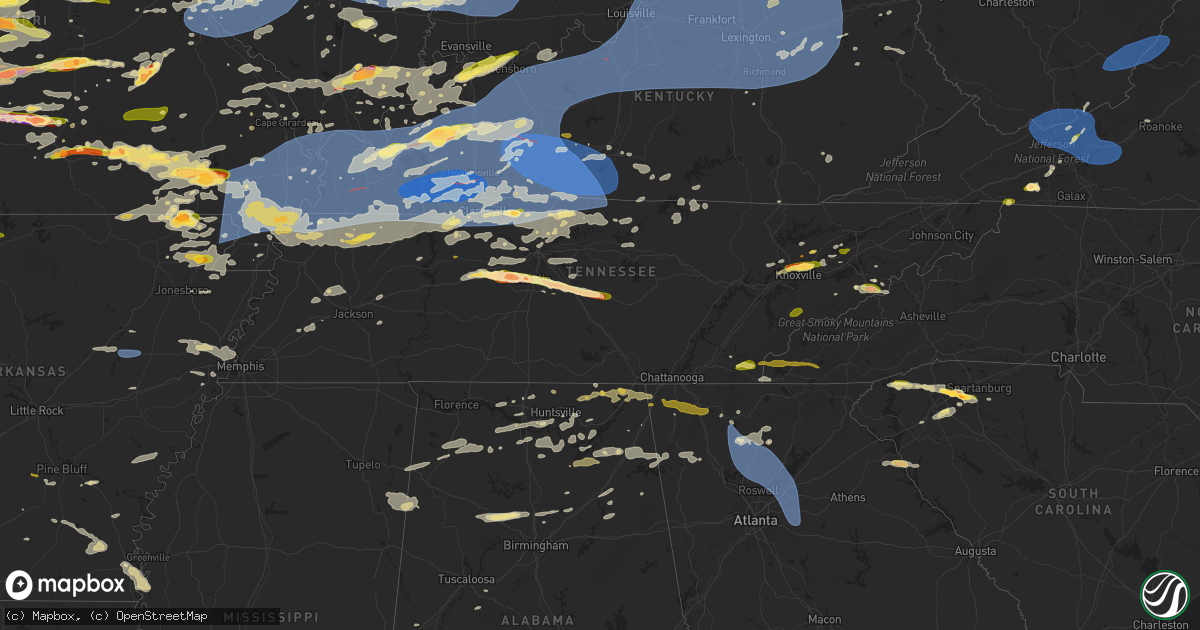
Hail Map in Tennessee on May 26, 2024
Get this storm
May 26 map
$229
one time, instant access
Download today. No call, no setup
Keep the $229
Bought the map and want the full workflow? Apply the entire $229 to a subscription within 7 days. None of it is wasted.
Every map, not just this one
This buys you this map. Subscription and you get every map we run, in the markets you choose from a few cities to whole states to nationwide. Plus real-time alerts the moment a storm fires.
Contact data
Name, contact info, occupancy, even credit band for addresses in the footprint. You go from where it hit to who to call.
Become the source they trust
Unlimited branding weather history reports on demand. You already have the documented answer ready for the property owner, and you are the one who showed up with it.
Property data and RoofTrace estimates
Pull up any address you have got, its value and the exact code rules for that jurisdiction, straight from One Click Code. Then RoofTrace estimates the squares, pitch, and roof value, priced the way you price.
Storm reports in Tennessee
Tennessee
| Date | Description |
|---|---|
| 05/26/20245:40 PM CDT | Dispatch reporting multiple trees down in rocky fork area. |
| 05/26/20245:30 PM CDT | Dispatch relayed a few trees have been reported down across the county. |
| 05/26/20245:30 PM CDT | Dispatch reported a few trees down along conklin road and roy green road. |
| 05/26/20245:08 PM CDT | Report from mping: quarter |
| 05/26/20244:50 PM CDT | Dispatch reported a few trees down in bybee area. |
| 05/26/20244:49 PM CDT | Down tree resulted in down powerlines via knox 911 email alerts. |
| 05/26/20244:45 PM CDT | Dispatch report of quarter size hail in happy valley area. |
| 05/26/20244:44 PM CDT | Trees down blocking both lanes near dry gap pike and cunningham rd via knox 911 email alerts. |
| 05/26/20244:39 PM CDT | Public report of ping pong to golf ball size hail in hartford. Elevation roughly 1800ft. |
| 05/26/20244:37 PM CDT | Couple trees across the entire roadway via knox 911 email alerts. |
| 05/26/20244:30 PM CDT | Corrects previous tstm wnd dmg report from 4 s harrisburg. Dispatch relayed a few trees have been reported down across the county. |
| 05/26/20244:24 PM CDT | Couple of trees down along different parts of dry gap pike... Blocking traffic and downed a couple powerlines via knox 911 email alerts. |
| 05/26/20244:19 PM CDT | Down powerlines from fallen branches via knox 911 email alerts. |
| 05/26/20244:15 PM CDT | Few trees down in north oak ridge. |
| 05/26/20244:10 PM CDT | Tspotter video showed hail up to quarter size fell in the burt area of southwest cannon county. |
| 05/26/20244:10 PM CDT | Relayed from ham radio operators. |
| 05/26/20243:58 PM CDT | Quarter sized hail on clear springs road off mascot rd. |
| 05/26/20243:57 PM CDT | Location approximate. Golf ball sized hail reported near i-40 and asheville highway. |
| 05/26/20243:50 PM CDT | Dispatch passed along report of multiple trees down around benton area. |
| 05/26/20243:45 PM CDT | A local report indicates 1.50 inch wind near 2 SSW Murfreesboro |
| 05/26/20243:45 PM CDT | Multiple public reports of quarter sized hail in the fountain city area. Reports occurred via social media. |
| 05/26/20243:40 PM CDT | A local report indicates 1.25 inch wind near 4 WSW Murfreesboro |
| 05/26/20243:30 PM CDT | Several trees down. |
| 05/26/20243:28 PM CDT | A local report indicates 2.00 inch wind near 4 NE College Grove |
| 05/26/20243:22 PM CDT | A local report indicates 1.00 inch wind near 2 SSW Brentwood |
| 05/26/20243:14 PM CDT | A local report indicates 1.25 inch wind near 1 ESE Franklin |
| 05/26/20243:05 PM CDT | Media reports and photos showed hail up to 3 inches in diameter fell in the leipers fork area. Many vehicles had windows broken or were heavily dented. |
| 05/26/20243:05 PM CDT | A local report indicates 1.75 inch wind near 4 W Franklin |
| 05/26/20242:56 PM CDT | Report from mping: quarter |
| 05/26/20242:56 PM CDT | A local report indicates 1.75 inch wind near 3 ESE Fairview |
| 05/26/20242:49 PM CDT | A local report indicates 1.75 inch wind near Fairview |
| 05/26/20242:48 PM CDT | A local report indicates 1.00 inch wind near 2 SE Fairview |
| 05/26/20242:46 PM CDT | A local report indicates 2.00 inch wind near Fairview |
| 05/26/20242:38 PM CDT | Photos showed hail measured up to 2.25 inches fell in bon aqua. |
| 05/26/20242:33 PM CDT | Received via tspotter. |
| 05/26/20242:31 PM CDT | A local report indicates 1.00 inch wind near 3 N Bon Aqua |
| 05/26/20241:40 PM CDT | Dispatch reported large oak tree across hancock county side of snake hollow rd. Time estimated by radar. |
| 05/26/20241:17 PM CDT | Ping pong ball sized hail falling |
| 05/26/20241:17 PM CDT | Ping pong ball sized hail falling near coopertown. |
| 05/26/20241:02 PM CDT | Large hail fell in adams. |
| 05/26/202412:55 PM CDT | Large hail was reported along i-24 near clarksville. |
| 05/26/202412:18 PM CDT | Dispatch reports numerous trees and utility poles down across northern portions of scott county. Time estimated by radar. |
| 05/26/202411:50 AM CDT | Nws storm survey found a large 2.5 mile wide by 7 mile long downburst with embedded stronger microbursts blew down hundreds of trees across northeast fentress and easte |
| 05/26/202411:46 AM CDT | Widespread trees down in the area of pickett state park. |
| 05/26/202411:44 AM CDT | Widespread trees down... Some power poles down as well. |
| 05/26/202411:40 AM CDT | Trees were blown down along double top road. |
| 05/26/202411:22 AM CDT | Nws storm survey found scattered trees were blown down across central pickett and northern overton counties... Including on jolley road... Iron creek rd... C parker rd. |
| 05/26/202411:20 AM CDT | Numerous trees were blown down along heard ridge road. |
| 05/26/202411:04 AM CDT | Trees down on mitchell street in celina. |
| 05/26/202410:44 AM CDT | Power lines down on hwy 52 in moss. |
| 05/26/20249:58 AM CDT | Nws storm survey found a large 1.5 mile wide by 11 mile long downburst blew down dozens of trees and power lines across northern sumner county... From west of mitchellv |
| 05/26/20249:57 AM CDT | Trees and power lines a |
| 05/26/20249:57 AM CDT | Trees and power lines are down in the center of mitchellville on main st. |
| 05/26/20249:57 AM CDT | Trees and power lines are down in t |
| 05/26/20249:52 AM CDT | Trees down on highland rd east-northeast of orlinda. |
| 05/26/20249:51 AM CDT | Trees down on clay gregory rd northeast of orlinda. |
| 05/26/20249:51 AM CDT | Reports of trees and power lines down in and north of orlinda. |
| 05/26/20249:48 AM CDT | Report from mping: trees uprooted or snapped; roof blown off. |
| 05/26/20249:44 AM CDT | Report from mping: 3-inch tree limbs broken; power poles broken. |
| 05/26/20249:42 AM CDT | Large tree on house reported on the 3200 block of blurr rd... South-southwest of springfield. |
| 05/26/20249:42 AM CDT | Report from mping: 1-inch tree limbs broken; shingles blown off. |
| 05/26/20249:15 AM CDT | Delayed report. Trees and powerlines down... A couple trees fell on houses and one fell on an apartment complex. |
| 05/26/20249:02 AM CDT | Multiple trees down off of jones bend rd. |
| 05/26/20248:59 AM CDT | Spotter reports downed power poles along hwy 641 north of paris. Time is radar estimated. |
| 05/26/20248:55 AM CDT | Trees and power poles down in western and northern portions of the county. |
| 05/26/20248:54 AM CDT | Emergency management reported trees down and power outages on north end of stewart county. |
| 05/26/20248:48 AM CDT | Sportter reported trees and power lines down between mile markers 2-5 on the woodland trace scenic byway in land between the lakes. |
| 05/26/20248:43 AM CDT | Trees also down. |
| 05/26/20248:23 AM CDT | Multiple trees down on houses in martin. |
| 05/26/20248:10 AM CDT | Numerous businesses and homes damaged along reelfoot ave. Along with mobile homes in the green acres community. |
| 05/26/20248:08 AM CDT | Several power poles down in southern portion of the city. |
| 05/26/20247:45 AM CDT | At least 25 utility poles down in the tiptonville area. Widespread tree damage and some structural damage to homes as well. One metal building north of tiptonville lost |
| 05/26/20243:20 AM CDT | Widespread reports of down trees and powerlines throughout the county. |
| 05/26/20243:00 AM CDT | Couple of trees down. Time approximated by radar. |
| 05/26/20242:55 AM CDT | Corrects previous tstm wnd dmg report from 2 ese pigeon forge. Trees down county-wide. Time estimated by radar. |
| 05/26/20242:45 AM CDT | Trees down along s pittsburg mountain rd. Time approximated by radar. |
| 05/26/20242:40 AM CDT | Trees down county-wide. Time estimated by radar. |
| 05/26/20242:40 AM CDT | Multiple trees down on state and county roads. Time estimated by radar. |
| 05/26/20242:35 AM CDT | Trees down county-wide. Time estimated by radar. |
| 05/26/20242:34 AM CDT | Large tree down blocking southbound lanes near oreilly autoparts. Time is radar estimated. |
| 05/26/20242:26 AM CDT | Report of a powerline down on road at busby rd near west point rd. Time is radar estimated. |
| 05/26/20242:20 AM CDT | Lawrenceburg utility systems reports 443 customers without power. Time of wind impact is radar estimated. |
| 05/26/20242:15 AM CDT | Large tree knocked powerlines into a ditch via knox 911 email alerts. Time estimated by radar. |
| 05/26/20241:50 AM CDT | Tree down across bobs landing road. |
| 05/26/20241:35 AM CDT | Powerlines down in la follette. |
| 05/26/20241:26 AM CDT | Tree down near old smithville hwy n and oaklawn cemetery rd. |
| 05/26/20241:16 AM CDT | Tree down on hwy 100 between jacks creek and henderson 2-3 miles east. |
| 05/26/20241:05 AM CDT | Several reports of trees and power lines down on hwy 18 |
| 05/26/202412:56 AM CDT | Trees down near oneida. |
| 05/26/202412:55 AM CDT | An ef1 tornado moved across southern madison county affecting areas south of mercer and medon... Briefly clipping far northeastern hardeman county... And ending in west |
| 05/26/202412:55 AM CDT | A local report indicates 1.00 inch wind near Milan |
| 05/26/202412:47 AM CDT | Several large trees were knocked down off highway 45 three miles south of humboldt. |
| 05/26/202412:38 AM CDT | Trees down over the road near the intersection of lillard and bobbitt road. |
| 05/26/202412:33 AM CDT | Tree down over the road on person road. |
| 05/26/202412:25 AM CDT | Several trees were blown down near the intersection of poplar avenue and galloway in east memphis. Time approximate based on radar. |
| 05/26/202412:25 AM CDT | Downed powerlines in the area of poplar and goodlett. |
| 05/26/202412:15 AM CDT | Pickett county ema reported scattered trees down across the county. |
| 05/25/202411:54 PM CDT | Power outages in white house due to a downed tree on highway 76. |
| 05/25/202411:34 PM CDT | Trees down across prince... Cedar and church roads. |
| 05/25/202411:33 PM CDT | Tree down blocking the roadway in the 5700 block of old paris murray rd. |
| 05/25/202411:30 PM CDT | Large tree down blocking both lanes at highway 52/old highway 52...power out in north portland. |
| 05/25/202411:26 PM CDT | Trees down on licks creek rd. |
| 05/25/202410:54 PM CDT | Report from mping: 1-inch tree limbs broken; shingles blown off. |
All States Impacted by Hail Map on May 26, 2024
Cities Impacted by Hail Map on May 26, 2024
- Pawnee City, NE
- Omaha, NE
- Crescent, IA
- Council Bluffs, IA
- Carter Lake, IA
- McClelland, IA
- Honey Creek, IA
- Underwood, IA
- Holcomb, MO
- Qulin, MO
- Knobel, AR
- Gideon, MO
- Corning, AR
- Pollard, AR
- Lafe, AR
- Delaplaine, AR
- Lilbourn, MO
- Rector, AR
- Malden, MO
- Gibson, MO
- Greenway, AR
- Paragould, AR
- Saint Francis, AR
- Parma, MO
- Bernie, MO
- Dexter, MO
- Campbell, MO
- Portageville, MO
- Catron, MO
- Piggott, AR
- Clarkton, MO
- Neelyville, MO
- Dudley, MO
- Poplar Bluff, MO
- Broseley, MO
- Fisk, MO
- Puxico, MO
- Bloomfield, MO
- San Saba, TX
- Richland Springs, TX
- Purmela, TX
- Evant, TX
- Gatesville, TX
- Thebes, IL
- Wardell, MO
- Essex, MO
- Kennett, MO
- Benton, MO
- Vanduser, MO
- Oran, MO
- Sikeston, MO
- New Madrid, MO
- Marston, MO
- Bell City, MO
- Canalou, MO
- Matthews, MO
- Goldthwaite, TX
- East Prairie, MO
- Charleston, MO
- Bragg City, MO
- Lometa, TX
- Crawford, TX
- Valley Mills, TX
- Woodway, TX
- China Spring, TX
- Hayti, MO
- Tiptonville, TN
- Jonesboro, TX
- Scott City, MO
- Olive Branch, IL
- Tamms, IL
- Miller City, IL
- Bertrand, MO
- Cairo, IL
- Union City, TN
- Hickman, KY
- Anniston, MO
- Ridgely, TN
- Hornbeak, TN
- Mounds, IL
- Troy, TN
- Pulaski, IL
- Mound City, IL
- La Center, KY
- Villa Ridge, IL
- Olmsted, IL
- Arlington, KY
- Clinton, KY
- Kevil, KY
- Grand Chain, IL
- Wickliffe, KY
- Barlow, KY
- Columbus, KY
- Bardwell, KY
- McGregor, TX
- Waco, TX
- Fulton, KY
- South Fulton, TN
- Rives, TN
- Fancy Farm, KY
- Wingo, KY
- Metropolis, IL
- Paducah, KY
- West Paducah, KY
- Cunningham, KY
- Melber, KY
- Hickory, KY
- Water Valley, KY
- Mayfield, KY
- Lampasas, TX
- Obion, TN
- Rantoul, IL
- Boaz, KY
- Brookport, IL
- Martin, TN
- Dukedom, TN
- Sedalia, KY
- Calvert City, KY
- Benton, KY
- Tiline, KY
- Palmersville, TN
- Smithland, KY
- Ledbetter, KY
- Burna, KY
- Golconda, IL
- Symsonia, KY
- Kenton, TN
- Sharon, TN
- Fort Hood, TX
- Summersville, MO
- Salem, KY
- Farmington, KY
- Grand Rivers, KY
- Marion, KY
- Kirksey, KY
- Gilbertsville, KY
- Fredonia, KY
- Kuttawa, KY
- Dexter, KY
- Eddyville, KY
- Hardin, KY
- Almo, KY
- Murray, KY
- Hazel, KY
- Puryear, TN
- Cottage Grove, TN
- Dresden, TN
- Princeton, KY
- New Concord, KY
- Buchanan, TN
- Cadiz, KY
- Olney, IL
- Noble, IL
- Moody, TX
- Greenfield, TN
- Providence, KY
- Big Rock, TN
- Dawson Springs, KY
- Dover, TN
- Bumpus Mills, TN
- Stewart, TN
- Gracey, KY
- Fort Campbell, KY
- La Fayette, KY
- Hopkinsville, KY
- Herndon, KY
- Cerulean, KY
- Nebo, KY
- Indian Mound, TN
- Paris, TN
- Temple, TX
- Killeen, TX
- Fremont, MO
- Gleason, TN
- Ellsinore, MO
- Oglesby, TX
- McKenzie, TN
- Henry, TN
- Saint Charles, KY
- Manitou, KY
- Hanson, KY
- Earlington, KY
- Madisonville, KY
- Nortonville, KY
- Crofton, KY
- Cumberland City, TN
- Woodlawn, TN
- Tennessee Ridge, TN
- Mortons Gap, KY
- Pembroke, KY
- Trenton, KY
- Elkton, KY
- Oak Grove, KY
- Clarksville, TN
- Palmyra, TN
- White Plains, KY
- Greenville, MO
- Copperas Cove, TX
- Mill Spring, MO
- Van Buren, MO
- Williamsville, MO
- Troy, TX
- Eddy, TX
- Bruceville, TX
- Lorena, TX
- Piedmont, MO
- Flat Rock, IL
- Kempner, TX
- Springville, TN
- Wappapello, MO
- Kankakee, IL
- Bonfield, IL
- Chilton, TX
- Grandin, MO
- Big Sandy, TN
- Adams, TN
- Cedar Hill, TN
- Cunningham, TN
- Southside, TN
- Ashland City, TN
- Chapmansboro, TN
- Springfield, TN
- Cumberland Furnace, TN
- Pleasant View, TN
- Guthrie, KY
- Olmstead, KY
- Powderly, KY
- Sharon Grove, KY
- Rumsey, KY
- Dunmor, KY
- Browder, KY
- Belton, KY
- Beechmont, KY
- Adairville, KY
- Russellville, KY
- Drakesboro, KY
- Graham, KY
- Centertown, KY
- Island, KY
- Greenville, KY
- Central City, KY
- Sacramento, KY
- Beech Creek, KY
- Allensville, KY
- Lewisburg, KY
- Bremen, KY
- Calhoun, KY
- Owensboro, KY
- Utica, KY
- Livermore, KY
- Philpot, KY
- Slaughters, KY
- Zalma, MO
- Marlin, TX
- Yorktown, AR
- Bourbonnais, IL
- McGee, MO
- Manteno, IL
- Cross Plains, TN
- Orlinda, TN
- Greenbrier, TN
- Morgantown, KY
- Franklin, KY
- Rochester, KY
- Woodburn, KY
- Beaver Dam, KY
- Cottontown, TN
- McHenry, KY
- Hartford, KY
- Rockport, KY
- Portland, TN
- Rockfield, KY
- White House, TN
- Auburn, KY
- Fordsville, KY
- Cromwell, KY
- Whitesville, KY
- Bowling Green, KY
- Olaton, KY
- Dundee, KY
- Rosine, KY
- Hawesville, KY
- Horse Branch, KY
- Reynolds Station, KY
- Caneyville, KY
- Falls Of Rough, KY
- Cloverport, KY
- Marble Hill, MO
- Advance, MO
- Grady, AR
- Milford, IL
- Thornton, TX
- Hardinsburg, KY
- Scottsville, KY
- Alvaton, KY
- Adolphus, KY
- Westmoreland, TN
- Bethpage, TN
- Watseka, IL
- Lott, TX
- Holland, KY
- Lafayette, TN
- De Witt, AR
- Rosebud, TX
- Gallatin, TN
- Reagan, TX
- Saint Charles, AR
- Ethel, AR
- Elaine, AR
- Holly Grove, AR
- Red Boiling Springs, TN
- Moss, TN
- Hartsville, TN
- Lake City, AR
- Harned, KY
- Guston, KY
- Webster, KY
- Irvington, KY
- McDaniels, KY
- Hudson, KY
- Garfield, KY
- Custer, KY
- Westview, KY
- Big Clifty, KY
- Rineyville, KY
- Cecilia, KY
- Clarkson, KY
- Vine Grove, KY
- Millwood, KY
- Eastview, KY
- Leitchfield, KY
- Elizabeth, IN
- Fort Knox, KY
- West Point, KY
- Charlestown, IN
- Ekron, KY
- Jeffersonville, IN
- Clarksville, IN
- New Albany, IN
- Muldraugh, KY
- Laconia, IN
- Shepherdsville, KY
- Sellersburg, IN
- Radcliff, KY
- Brandenburg, KY
- Louisville, KY
- Elizabethtown, KY
- Fisherville, KY
- Fairdale, KY
- Finchville, KY
- Glenview, KY
- Lebanon Junction, KY
- Taylorsville, KY
- Simpsonville, KY
- Coxs Creek, KY
- Prospect, KY
- Boston, KY
- Mount Washington, KY
- Masonic Home, KY
- Clermont, KY
- Brooks, KY
- Springfield, KY
- Bloomfield, KY
- Fairfield, KY
- Willisburg, KY
- Bardstown, KY
- Tompkinsville, KY
- Hestand, KY
- New Washington, IN
- Buckner, KY
- Goshen, KY
- Crestwood, KY
- Nabb, IN
- La Grange, KY
- Pewee Valley, KY
- Marysville, IN
- White Mills, KY
- Loretto, KY
- New Haven, KY
- Hodgenville, KY
- Sonora, KY
- Glendale, KY
- Westport, KY
- Shelbyville, KY
- Harrodsburg, KY
- Chaplin, KY
- Lawrenceburg, KY
- Smithfield, KY
- Mount Eden, KY
- Salvisa, KY
- Waddy, KY
- Sulphur, KY
- Bagdad, KY
- Bedford, KY
- Bethlehem, IN
- Pendleton, KY
- New Castle, KY
- Eminence, KY
- Milton, KY
- Hanover, IN
- Campbellsburg, KY
- Pleasureville, KY
- Frankfort, KY
- Byrdstown, TN
- Pall Mall, TN
- Livingston, TN
- Monroe, TN
- Lancaster, KY
- Wilmore, KY
- Burgin, KY
- Versailles, KY
- Mackville, KY
- Perryville, KY
- Danville, KY
- Stanford, KY
- Saint Catharine, KY
- Lebanon, KY
- Lockport, KY
- Vevay, IN
- Bethlehem, KY
- Sanders, KY
- Worthville, KY
- Madison, IN
- Owenton, KY
- Ghent, KY
- Carrollton, KY
- Perry Park, KY
- Turners Station, KY
- New Liberty, KY
- Midway, KY
- Nicholasville, KY
- Jamestown, TN
- Calvert, TX
- Bremond, TX
- Trimble, TN
- Paint Lick, KY
- Georgetown, KY
- Lexington, KY
- Stamping Ground, KY
- Richmond, KY
- Bennington, IN
- Warsaw, KY
- Franklin, TX
- Crab Orchard, KY
- Patriot, IN
- Union, KY
- Florence, IN
- Glencoe, KY
- Rising Sun, IN
- Verona, KY
- Corinth, KY
- Williamstown, KY
- Jonesville, KY
- Dry Ridge, KY
- Sadieville, KY
- Sparta, KY
- Waco, KY
- Berea, KY
- Cynthiana, KY
- Winchester, KY
- Paris, KY
- Keystone, SD
- Hermosa, SD
- Brodhead, KY
- Crittenden, KY
- Irvine, KY
- Falmouth, KY
- De Mossville, KY
- Berry, KY
- Walton, KY
- Morning View, KY
- Independence, KY
- Carlisle, KY
- Norfolk, VA
- Mount Vernon, KY
- Normangee, TX
- Millersburg, KY
- Mount Sterling, KY
- Alexandria, KY
- Clay City, KY
- North Middletown, KY
- Foster, KY
- Butler, KY
- Latonia, KY
- Brooksville, KY
- Mount Olivet, KY
- Melbourne, KY
- California, KY
- Owingsville, KY
- Jeffersonville, KY
- Ravenna, KY
- Slade, KY
- Stanton, KY
- Sharpsburg, KY
- New Richmond, OH
- Georgetown, OH
- Germantown, KY
- Tollesboro, KY
- Moscow, OH
- Olympia, KY
- Bethel, OH
- Manchester, OH
- Flemingsburg, KY
- Dover, KY
- Maysville, KY
- Salt Lick, KY
- Neville, OH
- Aberdeen, OH
- Hillsboro, KY
- Moorefield, KY
- Mayslick, KY
- Hope, KY
- Vanceburg, KY
- Frenchburg, KY
- Ewing, KY
- Means, KY
- Ripley, OH
- Felicity, OH
- Wallingford, KY
- Hamersville, OH
- Augusta, KY
- Morehead, KY
- West Union, OH
- Russellville, OH
- Amelia, OH
- Parksville, KY
- Wellington, KY
- Junction City, KY
- Saint Francis, KY
- Raywick, KY
- Pine Ridge, KY
- New Hope, KY
- Gravel Switch, KY
- Denniston, KY
- Madisonville, TX
- Erin, TN
- Camden, TN
- Eva, TN
- Waverly, TN
- Kosse, TX
- Clearfield, KY
- Chesapeake, VA
- Portsmouth, VA
- McEwen, TN
- Vanleer, TN
- Midway, TX
- Manchester, KY
- Fairburn, SD
- Goodlettsville, TN
- Joelton, TN
- Hendersonville, TN
- New Johnsonville, TN
- Nashville, TN
- Allen, SD
- Dickson, TN
- Rapid City, SD
- Charlotte, TN
- West Liberty, KY
- Whites Creek, TN
- White Bluff, TN
- Black Hawk, SD
- Cannel City, KY
- Olive Hill, KY
- Sandy Hook, KY
- Warsaw, VA
- Madison, TN
- Old Hickory, TN
- Mize, KY
- Farnham, VA
- Nunnelly, TN
- Pine Ridge, SD
- Grayson, KY
- Flatgap, KY
- Keaton, KY
- Bon Aqua, TN
- Castalian Springs, TN
- Burns, TN
- Scenic, SD
- Nemo, SD
- Lyles, TN
- Albany, KY
- Mount Juliet, TN
- Lebanon, TN
- Interior, SD
- Wanblee, SD
- Philip, SD
- Fairview, TN
- Franklin, TN
- Paintsville, KY
- Sitka, KY
- Stambaugh, KY
- Canton, NC
- Monticello, KY
- Pegram, TN
- Kingston Springs, TN
- Pleasant Shade, TN
- Carthage, TN
- Martin, SD
- Hill City, SD
- Dixon Springs, TN
- Primm Springs, TN
- Kincaid, KS
- Blue Mound, KS
- Mound City, KS
- Whitleyville, TN
- Gainesboro, TN
- Leicester, NC
- Candler, NC
- South Mills, NC
- Fort Yates, ND
- Montrose, MO
- Delaware, OK
- Pleasanton, KS
- Nolensville, TN
- Quinn, SD
- Clinton, MO
- Wall, SD
- Tipton, MO
- Knoxville, TN
- Brush Creek, TN
- Gordonsville, TN
- California, MO
- Clarksburg, MO
- Antioch, TN
- Tuthill, SD
- Hermitage, TN
- La Vergne, TN
- Quincy, MO
- Vinita, OK
- Warsaw, MO
- Centertown, MO
- Foster, MO
- Kyle, SD
- Mapleton, KS
- Prescott, KS
- Fulton, KS
- Weaverville, NC
- Barnardsville, NC
- Lansing, NC
- Whitetop, VA
- Bonnots Mill, MO
- Linn, MO
- Loose Creek, MO
- Arrington, TN
- Troutdale, VA
- Corryton, TN
- Powell, TN
- College Grove, TN
- Buffalo Valley, TN
- Granville, TN
- Chestnut Mound, TN
- Elmwood, TN
- Baxter, TN
- Damascus, VA
- Dunlap, IA
- Asheville, NC
- Alexander, NC
- Lockwood, MO
- Golden City, MO
- Heiskell, TN
- Clinton, TN
- Calhoun, MO
- Laurel Bloomery, TN
- Sugar Grove, VA
- Elk Creek, VA
- Lincoln, MO
- Burnsville, NC
- La Cygne, KS
- Windsor, MO
- Edwards, MO
- Porcupine, SD
- Jefferson City, MO
- Holts Summit, MO
- Hartsburg, MO
- Chamois, MO
- Butler, MO
- Rich Hill, MO
- Hume, MO
- Strafford, MO
- Fair Grove, MO
- Benton, TN
- Reliance, TN
- Smyrna, TN
- Murfreesboro, TN
- Fort Scott, KS
- Rockvale, TN
- Nowata, OK
- Virginia Beach, VA
- Luttrell, TN
- Blaine, TN
- Ocoee, TN
- Gravois Mills, MO
- Delano, TN
- Greenfield, MO
- Earling, IA
- Bloomington Springs, TN
- Pleasant Hope, MO
- Springfield, MO
- Morrison, MO
- Stover, MO
- Climax Springs, MO
- Zuni, VA
- Schell City, MO
- Walker, MO
- Harwood, MO
- New Bloomfield, MO
- Tebbetts, MO
- Rocky Mount, MO
- Eldon, MO
- Barnett, MO
- Hermann, MO
- Everton, MO
- Bridgeville, DE
- Rhineland, MO
- Afton, OK
- Marshall, NC
- Sandston, VA
- Walnut Grove, MO
- Rockville, MO
- Mouth Of Wilson, VA
- Collins, MO
- Weaubleau, MO
- Osceola, MO
- Readyville, TN
- Warrenton, MO
- Wright City, MO
- Marthasville, MO
- Atkins, VA
- Marion, VA
- Portland, MO
- Mokane, MO
- Steedman, MO
- Versailles, MO
- Wheatland, MO
- Appleton City, MO
- Marshfield, MO
- Elkland, MO
- Buffalo, MO
- Ash Grove, MO
- Fairland, OK
- Wyandotte, OK
- Grove, OK
- Berger, MO
- New Haven, MO
- Lake Ozark, MO
- Roach, MO
- Sunrise Beach, MO
- Camdenton, MO
- Osage Beach, MO
- Richards, MO
- Eugene, MO
- Henley, MO
- Lebanon, MO
- Long Lane, MO
- Farner, TN
- Turtletown, TN
- Foristell, MO
- Grassy Creek, NC
- Bland, VA
- El Dorado Springs, MO
- Strawberry Plains, TN
- Oak Ridge, TN
- Cole Camp, MO
- Crockett, VA
- Wytheville, VA
- Woodbury, TN
- Rutledge, TN
- Phillipsburg, MO
- Windyville, MO
- Bakersville, NC
- Green Mountain, NC
- Saint Thomas, MO
- Hermitage, MO
- Bradyville, TN
- Murphy, NC
- Mascot, TN
- Niangua, MO
- Flemington, MO
- Talbott, TN
- Jefferson City, TN
- Morristown, TN
- Washington, MO
- Dow, IL
- Lowry City, MO
- Crumpler, NC
- Florence, MO
- Tuscumbia, MO
- Anderson, MO
- South West City, MO
- Preston, MO
- Linn Creek, MO
- Pearisburg, VA
- Grovespring, MO
- Hartville, MO
- Brighton, MO
- Willard, MO
- Conway, MO
- Kaiser, MO
- Brumley, MO
- Oliver Springs, TN
- Narrows, VA
- Rogersville, MO
- New Market, TN
- Mansfield, MO
- Seymour, MO
- Maynardville, TN
- Cosby, TN
- Fortuna, MO
- Syracuse, MO
- Bluefield, VA
- Falls Mills, VA
- Pocahontas, VA
- Bramwell, WV
- Bluefield, WV
- Montcalm, WV
- Rock, WV
- Princeton, WV
- Kegley, WV
- Freeman, WV
- Bastian, VA
- Rocky Gap, VA
- Staffordsville, VA
- Ripplemead, VA
- Athens, WV
- Glen Lyn, VA
- Peterstown, WV
- Rich Creek, VA
- Pembroke, VA
- Eggleston, VA
- Radford, VA
- Pulaski, VA
- Belspring, VA
- Dublin, VA
- Parrott, VA
- Draper, VA
- Max Meadows, VA
- Morrisville, MO
- Pittsburg, MO
- Tallassee, TN
- Maryville, TN
- Freeburg, MO
- Richland, MO
- Batchtown, IL
- Hardin, IL
- Hartford, TN
- Montreal, MO
- O'Fallon, MO
- Saint Peters, MO
- Sevierville, TN
- Ulman, MO
- Noel, MO
- Lanagan, MO
- Dandridge, TN
- Richmond, VA
- Ballard, WV
- Jay, OK
- Augusta, MO
- Humansville, MO
- Waynesville, NC
- Westphalia, MO
- Saint Charles, MO
- Lake Saint Louis, MO
- Elsberry, MO
- Henrico, VA
- Pineville, MO
- Brighton, IL
- Godfrey, IL
- Jerseyville, IL
- Vonore, TN
- Saint Elizabeth, MO
- Clyde, NC
- Belle, MO
- Tiff City, MO
- Fieldon, IL
- Del Rio, TN
- Newport, TN
- Bolivar, MO
- Half Way, MO
- Urbana, MO
- Polk, MO
- Fair Play, MO
- Dunnegan, MO
- Mountain Grove, MO
- Waynesville, MO
- Laquey, MO
- Christiansburg, VA
- Iberia, MO
- Crocker, MO
- Meta, MO
- Wentzville, MO
- Shipman, IL
- Marble, NC
- Rock Port, MO
- Kadoka, SD
- Stockton, MO
- Macks Creek, MO
- Dixon, MO
- Foley, MO
- Stoutland, MO
- Mullen, NE
- Defiance, MO
- Vanzant, MO
- Koeltztown, MO
- Hot Springs, NC
- Riner, VA
- Indian Valley, VA
- Floyd, VA
- Hiwassee, VA
- Pilot, VA
- Willis, VA
- Owensville, MO
- Gerald, MO
- Union, MO
- Bridgeton, MO
- Earth City, MO
- Bella Vista, AR
- Seligman, MO
- Bentonville, AR
- Pea Ridge, AR
- Hazelwood, MO
- Garfield, AR
- Washburn, MO
- Powell, MO
- Graff, MO
- Labadie, MO
- Villa Ridge, MO
- Fort Leonard Wood, MO
- Saint Robert, MO
- Gray Summit, MO
- Louisburg, MO
- Florissant, MO
- Andrews, NC
- Hayesville, NC
- Franklin, NC
- Olean, MO
- Carlinville, IL
- Gillespie, IL
- Bland, MO
- Plato, MO
- Cabool, MO
- Huggins, MO
- Bucyrus, MO
- Pacific, MO
- Leslie, MO
- Willow Springs, MO
- Tunas, MO
- Saint Louis, MO
- Grafton, IL
- Elsah, IL
- Portage Des Sioux, MO
- Maryland Heights, MO
- Bunker Hill, IL
- Eagleville, TN
- Sunset, SC
- Salem, SC
- Cross Timbers, MO
- Saint Albans, MO
- Townsend, TN
- Walland, TN
- Wildwood, MO
- Devils Elbow, MO
- Houston, MO
- Chesterfield, MO
- Ballwin, MO
- Eureka Springs, AR
- Pickens, SC
- Litchfield, IL
- Salem, MO
- Eminence, MO
- Hartshorn, MO
- Rosebud, MO
- Duke, MO
- Newburg, MO
- Eureka, MO
- High Ridge, MO
- Rogers, AR
- Saint Ann, MO
- Elk Creek, MO
- Beaufort, MO
- Yukon, MO
- Eldridge, MO
- Salem, VA
- Vienna, MO
- Mountain View, MO
- Fenton, MO
- Valley Park, MO
- Granite City, IL
- Edwardsville, IL
- Collinsville, IL
- Maryville, IL
- Glen Carbon, IL
- Janesville, WI
- Troy, IL
- Hartwell, GA
- Dewy Rose, GA
- Bowman, GA
- Alton, IL
- Lynchburg, MO
- Norwood, MO
- Eagle Rock, MO
- Glenwood, IA
- Pacific Junction, IA
- Solo, MO
- Drury, MO
- Madison, IL
- Eunice, MO
- Gatlinburg, TN
- Milton, WI
- Whitewater, WI
- Fort Atkinson, WI
- Elberton, GA
- Berryville, AR
- Birch Tree, MO
- Saint Jacob, IL
- East Carondelet, IL
- Marine, IL
- Old Monroe, MO
- Winfield, MO
- Brussels, IL
- Falcon, MO
- Saint Clair, MO
- Sullivan, MO
- Jadwin, MO
- Rolla, MO
- Marietta, SC
- Easley, SC
- Travelers Rest, SC
- House Springs, MO
- Raymondville, MO
- East Alton, IL
- Hartford, IL
- Bunker, MO
- Venice, IL
- South Roxana, IL
- Roxana, IL
- Greenville, SC
- Highland, IL
- Edgar Springs, MO
- Arnold, MO
- Green Forest, AR
- East Saint Louis, IL
- Millstadt, IL
- Dupo, IL
- Ronceverte, WV
- Lewisburg, WV
- Asbury, WV
- White Sulphur Springs, WV
- Renick, WV
- Caldwell, WV
- Frankford, WV
- Maxwelton, WV
- Covington, VA
- Hot Springs, VA
- Alderson, WV
- Belleville, IL
- Saint James, MO
- Boss, MO
- Lonedell, MO
- Traphill, NC
- Imperial, MO
- Winona, MO
- Bixby, MO
- Grubville, MO
- Robertsville, MO
- Elkin, NC
- Viburnum, MO
- Alhambra, IL
- Catawissa, MO
- Steelville, MO
- Potosi, MO
- Fairview Heights, IL
- O'Fallon, IL
- Iva, SC
- Otto, NC
- Omaha, AR
- Lovejoy, IL
- Lebanon, IL
- Anderson, SC
- Pocahontas, IL
- Mars Hill, NC
- Sorento, IL
- Greenville, IL
- Caseyville, IL
- Ellington, MO
- Cook Sta, MO
- Davisville, MO
- Taylors, SC
- Hillsboro, MO
- Pevely, MO
- Cedar Hill, MO
- Dittmer, MO
- Barnhart, MO
- Columbia, IL
- Huntsville, AR
- Licking, MO
- Success, MO
- State Road, NC
- Pigeon Forge, TN
- Scott Air Force Base, IL
- Goreville, IL
- Alpena, AR
- Yellville, AR
- Walshville, IL
- Donnellson, IL
- West Alton, MO
- Belgrade, MO
- Wilsonville, IL
- Staunton, IL
- Marion, IL
- Carbondale, IL
- Waterloo, IL
- Valmeyer, IL
- New Athens, IL
- Pierce City, MO
- Cherryville, MO
- Greer, SC
- Redford, MO
- Mascoutah, IL
- Trenton, IL
- Creal Springs, IL
- Williamston, SC
- Roby, MO
- De Soto, MO
- Harrison, AR
- Griswold, IA
- Billings, MO
- Republic, MO
- Makanda, IL
- Fults, IL
- Piedmont, SC
- Pelzer, SC
- Freeburg, IL
- Smithton, IL
- Tampa, KS
- Marion, KS
- Aviston, IL
- Mount Carmel, IL
- Bartelso, IL
- Germantown, IL
- Beckemeyer, IL
- Albers, IL
- Carlyle, IL
- Breese, IL
- Festus, MO
- Merriman, NE
- Bellmont, IL
- Browns, IL
- Summerfield, IL
- Centerville, MO
- Blackwell, MO
- Bonne Terre, MO
- Albion, IL
- Verona, MO
- Monett, MO
- New Baden, IL
- Brookline, MO
- Nixa, MO
- Clever, MO
- Duncan, SC
- Woodruff, SC
- Moore, SC
- Carrier Mills, IL
- Stonefort, IL
- Harrisburg, IL
- Vandalia, IL
- Mulberry Grove, IL
- Ozark, MO
- Bois D Arc, MO
- Morganton, NC
- Marion, NC
- Keyesport, IL
- Sandoval, IL
- Centralia, IL
- Patoka, IL
- North Platte, NE
- Aurora, MO
- Simpsonville, SC
- Marionville, MO
- Allendale, IL
- Villisca, IA
- Nodaway, IA
- Addieville, IL
- Marissa, IL
- Decker, IN
- Smithboro, IL
- Grayville, IL
- Vincennes, IN
- Galatia, IL
- Eldorado, IL
- Corning, IA
- Salem, IL
- Kinmundy, IL
- Alma, IL
- Odin, IL
- Crane, MO
- Roebuck, SC
- Evansville, IL
- Walsh, IL
- Sparta, IL
- Ellis Grove, IL
- Sainte Genevieve, MO
- Brownstown, IL
- Annapolis, MO
- Fredericktown, MO
- Marquand, MO
- Vernon, IL
- Junction, IL
- Shawneetown, IL
- Shobonier, IL
- Fordland, MO
- Rural Retreat, VA
- Sparta, MO
- Fountain Inn, SC
- Bruner, MO
- Oldfield, MO
- Patton, MO
- Mount Vernon, IL
- Corydon, KY
- Herod, IL
- Equality, IL
- Woodlawn, IL
- Waltonville, IL
- Vulcan, MO
- Doniphan, MO
- Abbeville, SC
- Morganfield, KY
- Perryville, MO
- Sedgewickville, MO
- Iuka, IL
- Farina, IL
- Saint Peter, IL
- Afton, IA
- Maxwell, NE
- Nashville, IL
- Saint Mary, MO
- Louisville, IL
- Xenia, IL
- Glenallen, MO
- Tamaroa, IL
- Du Bois, IL
- Galena, MO
- Highlandville, MO
- Pomona, IL
- Macomb, MO
- Spartanburg, SC
- Pauline, SC
- Florence, KS
- Mason, IL
- Edgewood, IL
- Texico, IL
- Johnsonville, IL
- Kell, IL
- Walnut Hill, IL
- Bluford, IL
- Keenes, IL
- Dix, IL
- Hoffman, IL
- Hoyleton, IL
- Watson, IL
- Ingraham, IL
- Dieterich, IL
- Newton, IL
- Rinard, IL
- Clay City, IL
- Flora, IL
- Wheeler, IL
- Dundas, IL
- Sailor Springs, IL
- Grand Tower, IL
- New Florence, MO
- Jasper, AR
- Vendor, AR
- Neoga, IL
- Toledo, IL
- Greenup, IL
- Bonnie, IL
- Opdyke, IL
- Ava, MO
- Mulkeytown, IL
- Leopold, MO
- Belle Rive, IL
- Henderson, KY
- Robards, KY
- Du Quoin, IL
- Hidalgo, IL
- Scheller, IL
- Uniontown, MO
- Oak Ridge, MO
- Altenburg, MO
- Friedheim, MO
- Old Appleton, MO
- Frohna, MO
- Montgomery City, MO
- Ponce De Leon, MO
- Spokane, MO
- Sturgis, KY
- Jonesburg, MO
- Taylorsville, NC
- Moravian Falls, NC
- Lenoir, NC
- Granite Falls, NC
- Statesville, NC
- Hickory, NC
- Hiddenite, NC
- Conover, NC
- Claremont, NC
- Stony Point, NC
- Catawba, NC
- Reed, KY
- Spottsville, KY
- Casey, IL
- Washington, IN
- Connelly Springs, NC
- Valdese, NC
- Wheatland, IN
- Wayne City, IL
- Macedonia, IL
- Dahlgren, IL
- Ewing, IL
- Thompsonville, IL
- Benton, IL
- Sesser, IL
- Elkville, IL
- Royalton, IL
- Cisne, IL
- Geff, IL
- Sims, IL
- Fairfield, IL
- Clay, KY
- Millersville, MO
- Yale, IL
- Buckner, IL
- Saint Elmo, IL
- Altamont, IL
- Pittsburg, IL
- Uniontown, KY
- Ridgway, IL
- Alto Pass, IL
- Wolf Lake, IL
- Ina, IL
- Cape Girardeau, MO
- McLeansboro, IL
- Broughton, IL
- Martinsville, IL
- Ellston, IA
- Tingley, IA
- Grand River, IA
- Lamoni, IA
- Kellerton, IA
- Parkersburg, IL
- Calhoun, IL
- Jonesboro, IL
- McClure, IL
- Jackson, MO
- Sumner, IL
- Claremont, IL
- Elizabethtown, IL
- Cobden, IL
- Mount Vernon, IN
- Waverly, KY
- Golden Gate, IL
- Barnhill, IL
- Mount Erie, IL
- West Salem, IL
- Decatur, IA
- Leon, IA
- Elwood, NE
- Bertrand, NE
- Chaffee, MO
- Oaktown, IN
- Monroe City, IN
- Montgomery, IN
- Ellery, IL
- Bone Gap, IL
- West Liberty, IL
- Willow Hill, IL
- Oblong, IL
- Richland, IN
- Rockport, IN
- Bridgeport, IL
- Robinson, IL
- Hazleton, IN
- Princeton, IN
- Owensville, IN
- Bicknell, IN
- Francisco, IN
- Bruceville, IN
- Lawrenceville, IL
- Saint Francisville, IL
- Petersburg, IN
- Fort Branch, IN
- Patoka, IN
- Lynnville, IN
- Ragsdale, IN
- Spurgeon, IN
- Winslow, IN
- Haubstadt, IN
- Oakland City, IN
- Elberfeld, IN
- Norris City, IL
- Enfield, IL
- Elliott, IA
- Grant, IA
- Davis City, IA
- Ullin, IL
- Asheboro, NC
- Trinity, NC
- Sophia, NC
- Simpson, IL
- Dongola, IL
- Cypress, IL
- Lineville, IA
- Annapolis, IL
- Marshall, IL
- West York, IL
- West Union, IL
- Williams, IN
- Bedford, IN
- Harviell, MO
- Loogootee, IN
- Burfordville, MO
- Crane, IN
- Odon, IN
- Anna, IL
- Whitewater, MO
- Evansville, IN
- Eddyville, IL
- Cave In Rock, IL
- Ozark, IL
- Cynthiana, IN
- Griffin, IN
- Poseyville, IN
- Cainsville, MO
- Mercer, MO
- Diagonal, IA
- Mammoth Spring, AR
- Thayer, IA
- Fairdealing, MO
- Newburgh, IN
- Valley Springs, AR
- Maceo, KY
- Heltonville, IN
- Dixon, KY
- Sheridan, MO
- Princeton, MO
- Buncombe, IL
- Vienna, IL
- Norman, IN
- Oolitic, IN
- Avoca, IN
- Springville, IN
- Ravenden, AR
- Pocahontas, AR
- Couch, MO
- Myrtle, MO
- Ravenden Springs, AR
- Gatewood, MO
- Hampton, KY
- Rosiclare, IL
- Grantsburg, IL
- Sebree, KY
- Silva, MO
- Edwardsport, IN
- Lucerne, MO
- Newtown, MO
- Harris, MO
- Milan, MO
- Hildreth, NE
- Martinsburg, WV
- Mount Ayr, IA
- Gentry, MO
- Worth, MO
- Powersville, MO
- Plainville, IN
- Sandborn, IN
- Westphalia, IN
- Bloomington, NE
- Berryville, VA
- Lewisport, KY
- Warm Springs, AR
- Gipsy, MO
- Naylor, MO
- Lowndes, MO
- Elnora, IN
- Jasper, IN
- Otwell, IN
- Velpen, IN
- Cannelburg, IN
- Stendal, IN
- Holland, IN
- Huntingburg, IN
- Youngsville, NC
- New Boston, MO
- Cannelton, IN
- Rome, IN
- Kearneysville, WV
- Cassoday, KS
- Maynard, AR
- Summit Point, WV
- Pollock, MO
- Oxly, MO
- Shenandoah, IA
- Charles Town, WV
- Ranson, WV
- Tonganoxie, KS
- Linwood, KS
- Success, AR
- Searcy, AR
- Judsonia, AR
- McLouth, KS
- Franklinton, NC
- Green City, MO
- New Hampton, MO
- Green Castle, MO
- Oskaloosa, KS
- Albany, MO
- Mount Olive, IL
- Herculaneum, MO
- Seymour, IN
- Dorsey, IL
- Jonesville, IN
- Columbus, IN
- Elizabethtown, IN
- Mineral Point, MO
- Valles Mines, MO
- Cadet, MO
- French Village, MO
- McFall, MO
- Golden Eagle, IL
- Pomona, MO
- Biggers, AR
- Des Arc, MO
- Lesterville, MO
- Hecker, IL
- Lenzburg, IL
- Red Bud, IL
- Luebbering, MO
- Raymond, IL
- Bald Knob, AR
- Datto, AR
- Browning, MO
- Caledonia, MO
- Saint Libory, IL
- Pattonsburg, MO
- Bethany, MO
- New Douglas, IL
- New Burnside, IL
- Callao, MO
- Elmer, MO
- Sturdivant, MO
- Peach Orchard, AR
- High Hill, MO
- Ethel, MO
- Winigan, MO
- Bevier, MO
- Macon, MO
- Bonner Springs, KS
- Olathe, KS
- Lenexa, KS
- De Soto, KS
- Walnut Ridge, AR
- Shannon City, IA
- Cookville, TX
- Omaha, TX
- Jetson, KY
- Roundhill, KY
- Beech Grove, AR
- Cosby, MO
- Saint Joseph, MO
- Ramsey, IL
- Jameson, MO
- Overland Park, KS
- Stilwell, KS
- Gallatin, MO
- Brownsville, KY
- Clarence, MO
- Anabel, MO
- New Cambria, MO
- Oakland, KY
- Smiths Grove, KY
- Naples, TX
- Somerville, OH
- Park City, KY
- Easton, MO
- Madison, MO
- Bucklin, MO
- Atlanta, MO
- Wynne, AR
- Cherry Valley, AR
- Excello, MO
- Okolona, AR
- Rocky Hill, KY
- Marmaduke, AR
- Jamesport, MO
- Lock Springs, MO
- Stewartsville, MO
- Gower, MO
- Glasgow, KY
- Cardwell, MO
- Arbyrd, MO
- Jonesboro, AR
- Lucas, KY
- Etoile, KY
- Fountain Run, KY
- Austin, KY
- Bradford, AR
- Arkadelphia, AR
- Plattsburg, MO
- Holliday, MO
- Parkin, AR
- Gurdon, AR
- Jacksonville, MO
- Senath, MO
- Malvern, AR
- Cave City, KY
- Summer Shade, KY
- Eighty Eight, KY
- Paris, MO
- Burkesville, KY
- Beaumont, KY
- Edmonton, KY
- Leola, AR
- Earle, AR
- Hornersville, MO
- Sheridan, AR
- Lathrop, MO
- Turney, MO
- Newport, AR
- Cotton Plant, AR
- Steele, MO
- Sparkman, AR
- Richmond, MO
- Santa Fe, MO
- Crawfordsville, AR
- Leachville, AR
- Mexico, MO
- Monette, AR
- Allons, TN
- Augusta, AR
- McCrory, AR
- Doddridge, AR
- Grapevine, AR
- Turrell, AR
- Marion, AR
- Laddonia, MO
- Brinkley, AR
- Wheatley, AR
- Stanton, TN
- Widener, AR
- Heth, AR
- Leeton, MO
- Bells, TN
- Alamo, TN
- Polo, MO
- Rayville, MO
- Palestine, AR
- Bivins, TX
- Rodessa, LA
- Ida, LA
- Proctor, AR
- Humboldt, TN
- Gadsden, TN
- Cowgill, MO
- Rush Hill, MO
- Alpha, KY
- Norborne, MO
- Pine Bluff, AR
- Dover, MO
- Moro, AR
- Waverly, MO
- Concordia, MO
- Sweet Springs, MO
- Martinsburg, MO
- Rison, AR
- Brownsville, TN
- Marianna, AR
- Blackburn, MO
- Alma, MO
- Malta Bend, MO
- Olla, LA
- Cedar Grove, TN
- Jackson, TN
- Mercer, TN
- Denmark, TN
- Houstonia, MO
- Chidester, AR
- Town Creek, AL
- Athens, AL
- Rogersville, AL
- Courtland, AL
- Horn Lake, MS
- Walls, MS
- Medon, TN
- Kelly, LA
- Grayson, LA
- Camden, AR
- Hughesville, MO
- New Edinburg, AR
- Beech Bluff, TN
- Nelson, MO
- Byhalia, MS
- Olive Branch, MS
- Sedalia, MO
- Harrisonburg, LA
- Columbia, LA
- Enterprise, LA
- Winnsboro, LA
- Nesbit, MS
- Hernando, MS
- Williamsburg, KY
- Lexington, TN
- Thornton, AR
- Warren, AR
- Wilmar, AR
- Smithton, MO
- Bearden, AR
- Jellico, TN
- Lake Cormorant, MS
- Southaven, MS
- Monticello, AR
- Finger, TN
- Bethel Springs, TN
- Enville, TN
- Henderson, TN
- Fort Necessity, LA
- Wisner, LA
- Sicily Island, LA
- Toney, AL
- Pilot Grove, MO
- Otterville, MO
- Lascassas, TN
- Mora, MO
- Holly Springs, MS
- Huntsville, AL
- Winchester, AR
- Tillar, AR
- Huron, TN
- Luray, TN
- Red Banks, MS
- Harvest, AL
- New Market, AL
- Meridianville, AL
- Hazel Green, AL
- Lowmansville, KY
- River, KY
- Hampton, AR
- Clayton, LA
- Gilbert, LA
- Gurley, AL
- Princeton, AL
- Hollytree, AL
- Dermott, AR
- Aimwell, LA
- Lamar, MS
- Russellville, AL
- Tunica, MS
- Adamsville, TN
- Milledgeville, TN
- Sardis, TN
- Fordyce, AR
- Hamilton, AL
- Tremont, MS
- Vina, AL
- Hughes, AR
- Estillfork, AL
- Scottsboro, AL
- Saint Joseph, LA
- Spruce Pine, AL
- Latham, MO
- Hodges, AL
- Coldwater, MS
- Trinity, AL
- Hillsboro, AL
- Moulton, AL
- Russellville, MO
- Waterford, MS
- Decatur, AL
- Stevenson, AL
- Phil Campbell, AL
- Marston, NC
- Laurel Hill, NC
- Waterproof, LA
- Potts Camp, MS
- Belvidere, TN
- Lorman, MS
- Hackleburg, AL
- Huntland, TN
- Utica, MS
- Raymond, MS
- Fackler, AL
- Lake Village, AR
- Flora, MS
- Bridgeport, AL
- Sherwood, TN
- Hickory Flat, MS
- Tanner, AL
- Madison, AL
- Senatobia, MS
- Madison, MS
- Eudora, AR
- Portland, AR
- Bryant, AL
- Flat Rock, AL
- Myrtle, MS
- South Pittsburg, TN
- Canton, MS
- Danville, AL
- Greenville, MS
- Mount Hope, AL
- Terry, MS
- Parrottsville, TN
- Pisgah, AL
- Ider, AL
- Henagar, AL
- Etta, MS
- Como, MS
- Jasper, AL
- Crane Hill, AL
- Hollywood, AL
- Byram, MS
- Raeford, NC
- Hollandale, MS
- Brandon, MS
- New Albany, MS
- Blue Mountain, MS
- Morton, MS
- Pelahatchie, MS
- Maxton, NC
- Higdon, AL
- Trenton, GA
- Rising Fawn, GA
- Lena, MS
- Forest, MS
- Brownsboro, AL
- Owens Cross Roads, AL
- Chatham, MS
- Hartselle, AL
- Glen Allan, MS
- Bentonia, MS
- Arley, AL
- Bremen, AL
- Red Springs, NC
- Chickamauga, GA
- Blue Springs, MS
- Logan, AL
- Woodville, AL
- Decatur, MS
- Conehatta, MS
- Union, MS
- Jonesville, LA
- Braxton, MS
- Mendenhall, MS
- Guntown, MS
- Little Rock, MS
- Paint Rock, AL
- Laceys Spring, AL
- Camden, MS
- Carthage, MS
- Rock Spring, GA
- Ringgold, GA
- La Fayette, GA
- Big Creek, MS
- New Hope, AL
- Monterey, LA
- Somerville, AL
- Walnut Grove, MS
- Gore Springs, MS
- Grenada, MS
- Grant, AL
- Rocky Face, GA
- Eva, AL
- Valhermoso Springs, AL
- Calhoun City, MS
- Dalton, GA
- Cullman, AL
- Collinsville, MS
- Chunky, MS
- Bailey, MS
- Meridian, MS
- Tunnel Hill, GA
- Arab, AL
- Holly Pond, AL
- Joppa, AL
- Union Grove, AL
- Shannon, NC
- Saint Pauls, NC
- Section, AL
- Dutton, AL
- Baileyton, AL
- Langston, AL
- Daleville, MS
- Lauderdale, MS
- De Kalb, MS
- Parrish, AL
- Oakman, AL
- Albertville, AL
- Crossville, AL
- Guntersville, AL
- Fyffe, AL
- Chatsworth, GA
- Porterville, MS
- Philadelphia, MS
- Falkville, AL
- Houston, MS
- Geraldine, AL
- Resaca, GA
- Horton, AL
- Blountsville, AL
- Rainsville, AL
- Cordova, AL
- Copperhill, TN
- Cedarbluff, MS
- Pheba, MS
- Okolona, MS
- Dawson, AL
- Collinsville, AL
- Groveoak, AL
- Vidalia, LA
- West Point, MS
- Dora, AL
- Sumiton, AL
- Empire, AL
- Woodville, MS
- Valley Head, AL
- Vinemont, AL
- Ellijay, GA
- Epes, AL
- Warrior, AL
- Fort Payne, AL
- Cedar Bluff, AL
- Gaylesville, AL
- Sylvania, AL
- Boaz, AL
- Akron, AL
- Greenwood Springs, MS
- Amory, MS
- Boligee, AL
- Natchez, MS
- Aberdeen, MS
- Tilden, IL
- Baldwin, IL
- Coulterville, IL
- Oakdale, IL
- Crystal City, MO
- Okawville, IL
- Prairie Du Rocher, IL
- Bloomsdale, MO
- Detroit, AL
- Gattman, MS
- Sulligent, AL
- Caledonia, MS
- Rome, GA
- Kimberly, AL
- Pinson, AL
- Trafford, AL
- Remlap, AL
- Jasper, GA
- Talking Rock, GA
- Lyerly, GA
- Ranger, GA
- Summerville, GA
- Moundville, AL
- Oneonta, AL
- Springville, AL
- Crosby, MS
- Roxie, MS
- Dawsonville, GA
- Kingston, GA
- Bay Springs, MS
- Laurel, MS
- Heidelberg, MS
- Rainbow City, AL
- Gadsden, AL
- Carbon Hill, AL
- Marble Hill, GA
- Cottondale, AL
- Jacksonville, AL
- Tate, GA
- Ball Ground, GA
- Piedmont, AL
- Ashville, AL
- Ohatchee, AL
- Attalla, AL
- Gilbertown, AL
- Waynesboro, MS
- Ragland, AL
- Wellington, AL
- Buchanan, GA
- Tallapoosa, GA
- Silas, AL
- Lilburn, GA
- Waleska, GA
- Peachtree Corners, GA
- Norcross, GA
- Roswell, GA
- Alpharetta, GA
- Rydal, GA
- Buford, GA
- Dacula, GA
- Lawrenceville, GA
- Lithonia, GA
- Woodstock, GA
- Suwanee, GA
- Fairmount, GA
- Duluth, GA
- Conyers, GA
- Snellville, GA
- Grayson, GA
- Loganville, GA
- Cumming, GA
- Canton, GA
- Oxford, GA
- Duncanville, AL
- Brent, AL
- Tuscaloosa, AL
- Centreville, AL
- Vance, AL
- West Blocton, AL
- McCalla, AL
- Woodstock, AL
- Brookwood, AL
- Trussville, AL
- Leeds, AL
- Odenville, AL
- Birmingham, AL
- Helena, AL
- Bessemer, AL
- Moody, AL
- Calera, AL
- Alpine, AL
- Brierfield, AL
- Vincent, AL
- Sterrett, AL
- Pell City, AL
- Wilsonville, AL
- Alabaster, AL
- Cropwell, AL
- Pelham, AL
- Childersburg, AL
- Chelsea, AL
- Harpersville, AL
- Columbiana, AL
- Montevallo, AL
- Vandiver, AL
- Talladega, AL
- Sylacauga, AL
- Lincoln, AL
- Riverside, AL
- Eastaboga, AL
- Munford, AL
- Anniston, AL
- Weaver, AL
- Alexandria, AL
- Oxford, AL
- Fosters, AL
- Knoxville, AL


