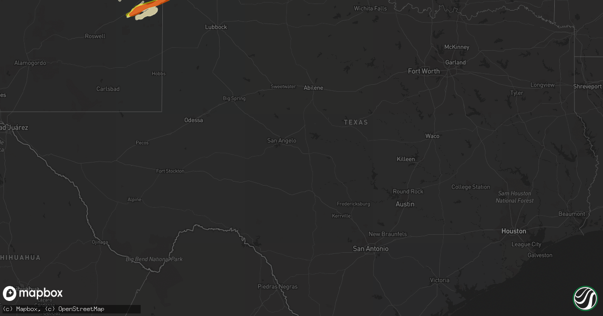
Hail Map in Texas on May 26, 2019
Get this storm
May 26 map
$229
one time, instant access
Download today. No call, no setup
Keep the $229
Bought the map and want the full workflow? Apply the entire $229 to a subscription within 7 days. None of it is wasted.
Every map, not just this one
This buys you this map. Subscription and you get every map we run, in the markets you choose from a few cities to whole states to nationwide. Plus real-time alerts the moment a storm fires.
Contact data
Name, contact info, occupancy, even credit band for addresses in the footprint. You go from where it hit to who to call.
Become the source they trust
Unlimited branding weather history reports on demand. You already have the documented answer ready for the property owner, and you are the one who showed up with it.
Property data and RoofTrace estimates
Pull up any address you have got, its value and the exact code rules for that jurisdiction, straight from One Click Code. Then RoofTrace estimates the squares, pitch, and roof value, priced the way you price.
Storm reports in Texas
Texas
| Date | Description |
|---|---|
| 05/26/20194:04 PM CDT | Late report of thunderstorm wind gust to 60 mph. |
| 05/26/20196:42 AM CDT | At 1142 PM CDT, a severe thunderstorm was located 13 miles northwest of Adrian, or 20 miles southeast of Nara Visa, moving northeast at 40 mph. HAZARD...60 mph wind gusts and half dollar size hail. SOURCE...Radar indicated. IMPACT...Minor damage to roofs, siding, and trees is possible. Hail damage to vehicles is expected. This severe thunderstorm will remain over mainly rural areas of central Oldham and south central Hartley Counties. |
| 05/26/20196:28 AM CDT | At 1127 PM CDT, a severe thunderstorm was located 7 miles southeast of Happy, or 9 miles north of Tulia, moving northeast at 30 mph. HAZARD...Golf ball size hail and 70 mph wind gusts. SOURCE...Radar indicated. IMPACT...People and animals outdoors will be injured. Expect hail damage to roofs, siding, windows, and vehicles. Expect considerable tree damage. Wind damage is also likely to mobile homes, roofs, and outbuildings. This severe thunderstorm will remain over mainly rural areas of northeastern Swisher County. |
| 05/26/20196:21 AM CDT | At 1120 PM CDT, a severe thunderstorm was located 6 miles southeast of Happy, or 10 miles north of Tulia, moving northeast at 40 mph. HAZARD...60 mph wind gusts and half dollar size hail. SOURCE...Radar indicated. IMPACT...Minor damage to roofs, siding, and trees is possible. Hail damage to vehicles is expected. Locations impacted include... Wayside. |
| 05/26/20196:14 AM CDT | At 1113 PM CDT, a severe thunderstorm was located over Vega, moving northeast at 40 mph. HAZARD...60 mph wind gusts and half dollar size hail. SOURCE...Radar indicated. IMPACT...Minor damage to roofs, siding, and trees is possible. Hail damage to vehicles is expected. Locations impacted include... Amarillo, Vega, Boys Ranch, Wildorado and Valley De Oro. |
| 05/26/20195:51 AM CDT | At 1051 PM CDT, a severe thunderstorm was located 10 miles northwest of Simms, or 24 miles southwest of Vega, moving northeast at 30 mph. HAZARD...60 mph wind gusts and half dollar size hail. SOURCE...Radar indicated. IMPACT...Minor damage to roofs, siding, and trees is possible. Hail damage to vehicles is expected. Locations impacted include... Vega, Adrian and Simms. |
| 05/26/20195:38 AM CDT | At 1038 PM CDT, a severe thunderstorm was located 8 miles southwest of Darrouzett, or 11 miles northwest of Lipscomb, moving northeast at 60 mph. HAZARD...60 mph wind gusts and quarter size hail. SOURCE...Radar indicated. IMPACT...Minor damage to roofs, siding, and trees is possible. Hail damage to vehicles is expected. Locations impacted include... Booker, Follett, Darrouzett and Slapout. |
| 05/26/20194:46 AM CDT | At 946 PM CDT, a severe thunderstorm was located over Hereford, moving northeast at 55 mph. HAZARD...60 mph wind gusts and quarter size hail. SOURCE...Radar indicated. IMPACT...Minor damage to roofs, siding, and trees is possible. Hail damage to vehicles is expected. Locations impacted include... Hereford, Dawn and Umbarger. |
| 05/26/20194:42 AM CDT | At 941 PM CDT, severe thunderstorms were located along a line extending from 7 miles northeast of Amarillo to 4 miles southeast of Mescalero Park, moving northeast at 45 mph. HAZARD...60 mph wind gusts and quarter size hail. SOURCE...Emergency management. At 934 PM CDT, quarter size hail was reported in Amarillo. IMPACT...Minor damage to roofs, siding, and trees is possible. Hail damage to vehicles is expected. Locations impacted include... Amarillo, Canyon, Panhandle, Claude, White Deer, Lake Tanglewood, Skellytown, Mescalero Park, Washburn, Goodnight, Timbercreek Canyon and Pantex. |
| 05/26/20193:52 AM CDT | At 851 PM CDT, severe thunderstorms were located along a line extending from 5 miles southwest of Valley De Oro to 3 miles southwest of Wildorado to 7 miles north of Hereford, moving east at 55 mph. HAZARD...70 mph wind gusts and quarter size hail. SOURCE...Radar indicated. IMPACT...Expect some tree damage. Damage is likely to mobile homes, roofs, and outbuildings. Hail damage to vehicles is expected. Locations impacted include... Amarillo, Canyon, Borger, Panhandle, Fritch, Lake Tanglewood, Bushland, Valley De Oro, Washburn, Umbarger, Wildorado, Palo Duro Canyon, Mescalero Park, Dawn, Boys Ranch, Buffalo Lake, Timbercreek Canyon and Pantex. |
| 05/26/20193:05 AM CDT | At 805 PM CDT, severe thunderstorms were located along a line extending from 19 miles southeast of Romero to 10 miles southwest of Adrian to 8 miles west of Bootleg, moving east at 40 mph. HAZARD...60 mph wind gusts and quarter size hail. SOURCE...Radar indicated. IMPACT...Minor damage to roofs, siding, and trees is possible. Hail damage to vehicles is expected. Locations impacted include... Hereford, Vega, Adrian, Buffalo Lake, Bushland, Dawn, Valley De Oro, Boys Ranch, Umbarger, Bootleg, Wildorado and Simms. |
| 05/26/20192:29 AM CDT | A local report indicates 1.00 inch wind near 5 NW HIGGINS |
| 05/26/20192:09 AM CDT | At 709 PM CDT, severe thunderstorms were located along a line extending from 6 miles north of San Jon to near Grady to 8 miles north of Saint Vrain, moving northeast at 60 mph. HAZARD...70 mph wind gusts and quarter size hail. SOURCE...Automated weather equipment. At 654 PM CDT, a 72 mph wind gust was reported in Tucumcari New Mexico. IMPACT...Expect some tree damage. Damage is likely to mobile homes, roofs, and outbuildings. Hail damage to vehicles is expected. Locations impacted include... Hereford, Vega, Adrian, Glenrio, Bootleg, Simms and Wildorado. |
| 05/26/20192:02 AM CDT | At 701 PM CDT, severe thunderstorms were located along a line extending from 6 miles west of Sedan to 7 miles southwest of Amistad to 9 miles north of Logan, moving northeast at 50 mph. HAZARD...70 mph wind gusts and quarter size hail. SOURCE...Radar indicated. IMPACT...Expect some tree damage. Damage is likely to mobile homes, roofs, and outbuildings. Hail damage to vehicles is expected. Locations impacted include... Dalhart, Hartley, Ware and Romero. |
| 05/26/20191:59 AM CDT | Quarter size hail with 50 mph winds. |
| 05/26/20191:49 AM CDT | At 648 PM MDT, severe thunderstorms were located along a line extending from near Bellview to 6 miles south of Kenna, moving east at 35 mph. HAZARD...70 mph wind gusts and quarter size hail. SOURCE...Radar indicated. IMPACT...Hail damage to vehicles is expected. Expect considerable tree damage. Wind damage is also likely to mobile homes, roofs, and outbuildings. Locations impacted include... Clovis, Portales, Texico, Elida, Dora, Floyd, Causey, Ranchvale, Arch and Oasis State Park. |
| 05/26/20191:31 AM CDT | A local report indicates 60 MPH wind near STINNETT |
| 05/26/20191:12 AM CDT | At 612 PM MDT, a severe thunderstorm was located 7 miles southeast of Kenna, or 35 miles southwest of Portales, moving east at 50 mph. HAZARD...70 mph wind gusts and quarter size hail. SOURCE...Radar indicated. IMPACT...Hail damage to vehicles is expected. Expect considerable tree damage. Wind damage is also likely to mobile homes, roofs, and outbuildings. Locations impacted include... Elida, Dora, Causey, Milnesand, Kenna, Lingo, Arch, Pep and Rogers. |
| 05/26/20191:10 AM CDT | Live broadcast showed a brief tornado touchdown that lasted 1 minute. |
| 05/26/201912:53 AM CDT | At 553 PM MDT, severe thunderstorms were located along a line extending from 10 miles south of Ute Lake State Park to 7 miles southeast of Ragland, moving east at 50 mph. HAZARD...70 mph wind gusts and quarter size hail. SOURCE...Radar indicated. IMPACT...Hail damage to vehicles is expected. Expect considerable tree damage. Wind damage is also likely to mobile homes, roofs, and outbuildings. Locations impacted include... Quay, Tucumcari, San Jon, Ragland, Wheatland, Forrest and Bard. This includes Interstate 40 between Mile Markers 332 and 373. |
| 05/26/201912:51 AM CDT | Late report of crosswinds along u.s. Highway 287 up to 60 mph... And 2 inch hail. |
| 05/26/201912:51 AM CDT | Late report of crosswinds along u.s. Highway 287 up to 60 mph... And 2 inch hail. |
| 05/26/201912:51 AM CDT | A local report indicates 1.00 inch wind near FRITCH |
| 05/26/201912:46 AM CDT | At 546 PM MDT, severe thunderstorms were located along a line extending from 9 miles southeast of Ragland to 18 miles northwest of Elida, moving northeast at 50 mph. HAZARD...60 mph wind gusts and half dollar size hail. SOURCE...Radar indicated. IMPACT...Hail damage to vehicles is expected. Expect wind damage to roofs, siding, and trees. Locations impacted include... Clovis, Portales, Farwell, Texico, Melrose, Floyd, Grady, Saint Vrain, Ranchvale and Oasis State Park. |
| 05/26/201912:25 AM CDT | Late report of tornado touchdown... With power flashes noted. |
| 05/26/201912:04 AM CDT | A local report indicates 1.25 inch wind near VALLEY DE ORO |
| 05/26/201912:00 AM CDT | A local report indicates 1.00 inch wind near 1 W VALLEY DE ORO |
| 05/25/201911:42 PM CDT | A local report indicates 1.00 inch wind near GLAZIER |
| 05/25/201911:42 PM CDT | A local report indicates 60 MPH wind near GLAZIER |
| 05/25/201911:26 PM CDT | Late report of 70 mph wind gust that lasted a few minutes. |
| 05/25/201911:24 PM CDT | Late report of ping pong ball size hail on i-40. |
| 05/25/201911:20 PM CDT | Late report of ping pong ball size hail on i-40. |
| 05/25/201911:20 PM CDT | Late report of 70 mph thunderstorm wind gust. Some tree limbs were taken down as a result. |
| 05/25/201911:20 PM CDT | Sheriff reported half dollar size hail. |
| 05/25/201911:15 PM CDT | Report received via facebook. |
| 05/25/201910:46 PM CDT | Late report of wind gust to 60 mph and numerous washed out roads due to 2 to 3 inches of rain in 30 minutes. |
| 05/25/201910:43 PM CDT | At 343 PM CDT, severe thunderstorms were located along a line extending from 14 miles southwest of Hardesty to 12 miles south of Spearman to 6 miles northwest of Skellytown, moving east at 55 mph. HAZARD...70 mph wind gusts and quarter size hail. SOURCE...Radar indicated. IMPACT...Expect some tree damage. Damage is likely to mobile homes, roofs, and outbuildings. Hail damage to vehicles is expected. Locations impacted include... Guymon, Perryton, Spearman, Canadian, Miami, Booker, Gruver, Hardesty, Wolf Creek Park, Elmwood, Farnsworth, Boyd, Waka, Bryans Corner, Lora and Balko. |
| 05/25/201910:42 PM CDT | Tornado confirmed crossing fm 194 between dimmitt and hart. Location is estimated from radar. Tornado was moving northeast. |
| 05/25/201910:35 PM CDT | Small cone tornado sighted... Looking northeast from fm 145 and highway 385. The location is estimated from radar. |
| 05/25/201910:26 PM CDT | Truncated cone tornado observed north of sunnyside by two spotters. The tornado was just west of highway 385. |
| 05/25/201910:11 PM CDT | Ongoing rope tornado north of earth about 4 miles. The spotter was sitting 1 mile north of earth... Looking north... And the tornado was just to the west of fm 1055. |
| 05/25/201910:10 PM CDT | Late report of tree damage and estimated 70 mph wind gusts north of perryton. Time estimated from radar. |
| 05/25/201910:10 PM CDT | Late report of tree damage and estimated 70 mph wind gusts north of perryton. Time estimated from radar. |
| 05/25/20199:57 PM CDT | Tornado being reported between muleshoe and earth just crossing highway 70. Location estimated from radar. |
| 05/25/20199:42 PM CDT | At 242 PM CDT, a severe thunderstorm was located near Amarillo, moving northeast at 40 mph. HAZARD...Quarter size hail. SOURCE...Radar indicated. IMPACT...Damage to vehicles is expected. Locations impacted include... Amarillo, Lake Tanglewood, Mescalero Park, Timbercreek Canyon and Pantex. |
| 05/25/20199:41 PM CDT | Late report of thunderstorm wind gust with squall line of 70 to 80 mph. |
| 05/25/20199:39 PM CDT | Late report of room damage and destroyed patio. Time estimated from radar. |
| 05/25/20199:34 PM CDT | A local report indicates 1.00 inch wind near 4 N AMARILLO |
| 05/25/20199:31 PM CDT | A local report indicates 1.75 inch wind near 4 N AMARILLO |
| 05/25/20199:23 PM CDT | A local report indicates 1.00 inch wind near 7 WNW AMARILLO |
| 05/25/20199:22 PM CDT | Brief tornado touchdown reported near lariat. Tornado was no longer on the ground. |
| 05/25/20199:20 PM CDT | A local report indicates 1.00 inch wind near 8 ESE BUSHLAND |
| 05/25/20199:17 PM CDT | A local report indicates 1.00 inch wind near 1 N BUSHLAND |
| 05/25/20199:14 PM CDT | Late report of wind damage to powerlines. |
| 05/25/20199:12 PM CDT | At 212 PM CDT, a severe thunderstorm was located 14 miles northeast of Ware, or 21 miles north of Dalhart, moving northeast at 50 mph. HAZARD...Half dollar size hail. SOURCE...Radar indicated. IMPACT...Damage to vehicles is expected. Locations impacted include... Boise City and Griggs. |
| 05/25/20198:25 PM CDT | A local report indicates 70 MPH wind near 7 SSW VEGA |
| 05/25/20198:14 PM CDT | Late report from nws employee and storm chaser of 6 minute tornado touchdown 10 miles ese of hartley that later crossed u.s. Highway 87. |
| 05/25/20198:07 PM CDT | Late report from rancher of wind gusts up to 60 mph. |
| 05/25/20198:04 PM CDT | Late report from nws employees and chasers of 3 minute tornado touchdown 7 wnw of hartley. |
| 05/25/20197:22 PM CDT | Late report of tornado damage with a metal cattle feeder larger than a pickup truck was lofted 300 yards. |
All States Impacted by Hail Map on May 26, 2019
Cities Impacted by Hail Map on May 26, 2019
- De Witt, NE
- Smithville, WV
- Big Springs, WV
- Auburn, WV
- Brohard, WV
- Sand Fork, WV
- Harrisville, WV
- Linn, WV
- Big Bend, WV
- Troy, WV
- Coxs Mills, WV
- Burnsville, WV
- Glenville, WV
- Fowler, KS
- Jonestown, PA
- Lebanon, PA
- Myerstown, PA
- The Plains, OH
- Athens, OH
- New Marshfield, OH
- Causey, NM
- Pep, NM
- Aberdeen, ID
- Brashear, MO
- Pampa, TX
- Dumas, TX
- Channing, TX
- Elizabeth, WV
- Palestine, WV
- Perryton, TX
- Canadian, TX
- Lipscomb, TX
- Follett, TX
- Higgins, TX
- Booker, TX
- Hereford, TX
- Mud Butte, SD
- Union Center, SD
- Almena, KS
- Mineral Wells, WV
- Parkersburg, WV
- Davisville, WV
- Walker, WV
- Leoti, KS
- Winona, KS
- Martell, NE
- Firth, NE
- Hallam, NE
- Hickman, NE
- Roca, NE
- Lincoln, NE
- Cortland, NE
- South Bloomingville, OH
- Chillicothe, OH
- Adelphi, OH
- Rockbridge, OH
- Laurelville, OH
- Kingston, OH
- Logan, OH
- Mosquero, NM
- Kirk, CO
- Joes, CO
- Cheyenne, WY
- New Raymer, CO
- McArthur, OH
- Wilkesville, OH
- Albany, OH
- Briggsdale, CO
- Rogers, NM
- Rixeyville, VA
- Culpeper, VA
- Carr, CO
- Reedy, WV
- Wiggins, CO
- Weldona, CO
- Orchard, CO
- Whitewood, SD
- Sturgis, SD
- Belle Fourche, SD
- Morgantown, WV
- Granville, WV
- Springview, NE
- Bladen, NE
- Ayr, NE
- Eads, CO
- Kit Carson, CO
- Sheridan Lake, CO
- Wiley, CO
- Hasty, CO
- Las Animas, CO
- McClave, CO
- Cheyenne Wells, CO
- Kim, CO
- Cedar Vale, KS
- Willow Wood, OH
- Glenwood, WV
- Crown City, OH
- Scottown, OH
- Lesage, WV
- Amarillo, TX
- New Plymouth, OH
- Stewart, OH
- Nelsonville, OH
- Guysville, OH
- Coolville, OH
- Clayton, NM
- Nunn, CO
- Burbank, WA
- Kaycee, WY
- Mayfield, KS
- Milan, KS
- Mcconnelsville, OH
- Caldwell, OH
- Scottsville, VA
- Long Pine, NE
- Mills, NE
- Bassett, NE
- Newport, NE
- Vale, SD
- Trenton, NE
- Padroni, CO
- Myersville, MD
- Colby, KS
- Le Roy, KS
- Westphalia, KS
- Frederick, MD
- Fairplay, MD
- Middletown, MD
- Keedysville, MD
- Williamsport, MD
- Boonsboro, MD
- Funkstown, MD
- Hagerstown, MD
- Dalhart, TX
- Denver, CO
- Aurora, CO
- Norton, KS
- Cumberland, OH
- Malta, OH
- White Hall, MD
- Grenville, NM
- Alzada, MT
- Eaton, CO
- Gill, CO
- Nazareth, TX
- Tulia, TX
- Owensboro, KY
- Lynch, NE
- Chugwater, WY
- Wheatland, WY
- Sterling, CO
- Dix, NE
- Kimball, NE
- Peetz, CO
- Mcalister, NM
- Grady, NM
- San Jon, NM
- Springfield, CO
- Hudson, CO
- Keenesburg, CO
- Pomeroy, OH
- Mason, WV
- Bidwell, OH
- Cheshire, OH
- Middleport, OH
- West Columbia, WV
- Hartford, WV
- Letart, WV
- Racine, OH
- Syracuse, OH
- Conchas Dam, NM
- Tucumcari, NM
- Osage, WV
- Kersey, CO
- Spearville, KS
- Accomac, VA
- Laverne, OK
- Grover, CO
- Roggen, CO
- New Haven, WV
- Milford, DE
- Upper Falls, MD
- Edgewood, MD
- Glen Arm, MD
- Kennedyville, MD
- Dover Afb, DE
- Viola, DE
- Worton, MD
- Kingsville, MD
- Fork, MD
- Hartly, DE
- Sudlersville, MD
- Aberdeen Proving Ground, MD
- Crumpton, MD
- Frederica, DE
- Marydel, DE
- Marydel, MD
- Woodside, DE
- Chestertown, MD
- Fallston, MD
- Clayton, DE
- Barclay, MD
- Hydes, MD
- Felton, DE
- Millington, MD
- Joppa, MD
- Dover, DE
- Galena, MD
- Gunpowder, MD
- Magnolia, DE
- Camden Wyoming, DE
- Baldwin, MD
- Palmyra, VA
- Stuart, NE
- Atkinson, NE
- Bruceton Mills, WV
- Parkton, MD
- Corydon, IN
- Rexford, KS
- Clovis, NM
- Sharon Springs, KS
- Roswell, NM
- Creola, OH
- Kinsley, KS
- Hulett, WY
- Douglass, KS
- Hugo, CO
- Ramah, CO
- Portales, NM
- Elida, NM
- Sudan, TX
- Weskan, KS
- Arapahoe, CO
- Kanorado, KS
- Goodland, KS
- Faith, SD
- Pierce, CO
- White Deer, TX
- Gordonsville, VA
- Troy, VA
- Louisa, VA
- Vona, CO
- Stratton, CO
- Anthony, KS
- Freeport, KS
- Bluff City, KS
- Sterling, KS
- Lyons, KS
- Gallipolis, OH
- Robards, KY
- Carmen, OK
- Goltry, OK
- Jet, OK
- Cherokee, OK
- Helena, OK
- Shattuck, OK
- Gage, OK
- Woodward, OK
- Arnett, OK
- Sharon, OK
- Fargo, OK
- Littleton, CO
- Aladdin, WY
- Minneola, KS
- Commerce City, CO
- English, IN
- Sulphur, IN
- McDonald, KS
- Stratton, NE
- Rush, CO
- Ordway, CO
- Little Hocking, OH
- Petroleum, WV
- Circleville, OH
- Washington, WV
- Point Pleasant, WV
- Montezuma, KS
- Plains, KS
- Bard, NM
- Broadview, NM
- Aylett, VA
- Greeley, CO
- Lake Lynn, PA
- Walkerton, VA
- Ruther Glen, VA
- Saint Stephens Church, VA
- Dodge City, KS
- Meade, KS
- Texline, TX
- Felt, OK
- Boise City, OK
- Olney Springs, CO
- Dimmitt, TX
- Hart, TX
- Ault, CO
- Minden, NE
- Wheeler, TX
- Briscoe, TX
- Lincoln, KS
- Spencer, WV
- Garrett, WY
- Bennett, CO
- Stinnett, TX
- Melrose, NM
- Happy, TX
- Wayside, TX
- Pond Creek, OK
- Watkins, CO
- Earth, TX
- Muleshoe, TX
- Claude, TX
- Weston, WY
- Russell, KS
- Copeland, KS
- Boulder, MT
- Medicine Lodge, KS
- Fritch, TX
- Borger, TX
- Evansville, IN
- Dupree, SD
- Sunray, TX
- Wildorado, TX
- Vega, TX
- Groom, TX
- Naponee, NE
- Republican City, NE
- Alma, NE
- Cimarron, KS
- Jetmore, KS
- Lamar, CO
- Boulder, CO
- Kanopolis, KS
- Ellsworth, KS
- Floyd, NM
- Ashton, NE
- Sylvan Grove, KS
- Hunter, KS
- Touchet, WA
- Fort Lupton, CO
- Wadesville, IN
- Nara Visa, NM
- Englewood, CO
- Sedgwick, KS
- Valley Center, KS
- Nash, OK
- Jennings, KS
- Dresden, KS
- Selden, KS
- Offerle, KS
- Miami, TX
- Atwood, KS
- Bird City, KS
- Ryegate, MT
- Berkeley Springs, WV
- Fredonia, KS
- Mooreland, OK
- Alva, OK
- Freedom, OK
- Blue Hill, NE
- Lawrence, NE
- Geuda Springs, KS
- South Haven, KS
- Panhandle, TX
- Logan, NM
- Onley, VA
- Onancock, VA
- Holdrege, NE
- Whitesville, KY
- Utica, KY
- Hartford, KY
- Texhoma, OK
- Goodwell, OK
- Cooksville, MD
- Woodbine, MD
- Westminster, MD
- Mount Airy, MD
- Sykesville, MD
- Brandenburg, KY
- Fe Warren Afb, WY
- Spencer, NE
- Oneill, NE
- Boyes, MT
- Amanda, OH
- Lancaster, OH
- Tarlton, OH
- Sandyville, WV
- Campo, CO
- Burden, KS
- Cambridge, KS
- Upland, NE
- Cottageville, WV
- Boone, CO
- Hedgesville, WV
- Monument, KS
- Holly, CO
- Cambridge, MD
- Madison, MD
- Manchester, OK
- Medford, OK
- White Owl, SD
- Howes, SD
- Edson, KS
- Corning, OH
- Crooksville, OH
- New Lexington, OH
- Argonia, KS
- Masterson, TX
- Sugar Grove, OH
- Larned, KS
- Roy, NM
- Solano, NM
- Atlanta, KS
- Platteville, CO
- La Salle, CO
- Brighton, CO
- Taylors Island, MD
- Tribune, KS
- Long Island, KS
- Shady Side, MD
- Churchton, MD
- Great Bend, KS
- Claflin, KS
- Ellinwood, KS
- Maidsville, WV
- Pursglove, WV
- Prairie View, KS
- Smithsburg, MD
- Elizabeth, CO
- Waynoka, OK
- Deadwood, SD
- Fort Meade, SD
- Caldwell, KS
- Adrian, TX
- Ward, CO
- Dexter, KS
- Lone Tree, CO
- Catonsville, MD
- Halethorpe, MD
- Baltimore, MD
- Ellicott City, MD
- Amorita, OK
- Phillipsburg, KS
- Bloomington, NE
- Bobtown, PA
- Dilliner, PA
- Greensboro, PA
- Guymon, OK
- Wellington, KS
- Seibert, CO
- Herrin, IL
- Carterville, IL
- Le Roy, WV
- Waldron, KS
- Canyon, TX
- Beaver City, NE
- Flagler, CO
- Arriba, CO
- Karval, CO
- Fowler, CO
- Munday, WV
- Macfarlan, WV
- Mount Alto, WV
- Millwood, WV
- Moorcroft, WY
- Linthicum Heights, MD
- Brooklyn, MD
- Glen Burnie, MD
- Spearman, TX
- Beaver, OK
- Gem, KS
- Burlington, OK
- Creston, WV
- Elm Creek, NE
- Johnstown, NE
- Liberal, KS
- Holstein, NE
- Shade, OH
- Emmitsburg, MD
- Thurmont, MD
- Keymar, MD
- Rocky Ridge, MD
- Franklin, NE
- Hildreth, NE
- Wilcox, NE
- Hooker, OK
- Tyrone, OK
- Mclean, TX
- Carmi, IL
- Genoa, CO
- Two Buttes, CO
- Glenvil, NE
- Roseland, NE
- Grinnell, KS
- Abingdon, MD
- Massey, MD
- Arkansas City, KS
- Maple City, KS
- Shidler, OK
- Campbell, NE
- Shamrock, TX
- Philippi, WV
- Winfield, KS
- Erie, KS
- Saint Paul, KS
- Mobeetie, TX
- Lorraine, KS
- Hallwood, VA
- Temperanceville, VA
- Sanford, VA
- Partlow, VA
- Wright, KS
- Saint Croix, IN
- Leavenworth, IN
- Garden City, KS
- Kents Store, VA
- Keswick, VA
- Wilson, KS
- Parksley, VA
- Bloxom, VA
- Dacoma, OK
- Spearfish, SD
- Clatonia, NE
- New Windsor, MD
- Union Bridge, MD
- Woodstock, MD
- Marriottsville, MD
- New Market, MD
- Newell, SD
- Ray, OH
- Londonderry, OH
- Woodford, VA
- St John, KS
- Union, NE
- Albright, WV
- Jarrettsville, MD
- Monkton, MD
- Oakley, KS
- Geneseo, KS
- Chase, KS
- Webster, KY
- Payneville, KY
- Murdock, KS
- Belleville, WV
- Reedsville, OH
- Ravenswood, WV
- Long Bottom, OH
- Melfa, VA
- Bushton, KS
- Des Moines, NM
- Hardesty, OK
- Fredericksburg, PA
- Annville, PA
- Newmanstown, PA
- Depauw, IN
- Littleton, WV
- Beloit, KS
- Enfield, IL
- Kenton, OK
- Sublette, KS
- Sedan, KS
- Turpin, OK
- Pritchett, CO
- Shawnee, OH
- Lititz, PA
- Schaefferstown, PA
- Ono, PA
- Danbury, NE
- Spotsylvania, VA
- Clarendon, TX
- Clayton, KS
- Oberlin, KS
- Balko, OK
- Lamont, OK
- Nebo, WV
- Chloe, WV
- Wright, WY
- Ainsworth, NE
- Hartley, TX
- Walsenburg, CO
- Sylvia, KS
- Udall, KS
- Mulvane, KS
- Portland, OH
- Leon, WV
- Hudson, KS
- Mankato, KS
- Plainville, KS
- Orleans, NE
- Rockport, WV
- Charlottesville, VA
- Keene, VA
- Esmont, VA
- Bremo Bluff, VA
- Kiowa, KS
- Hays, KS
- Cunningham, KS
- Elbert, CO
- Rose Hill, KS
- Ketchum, ID
- Hailey, ID
- Aberdeen, MD
- Still Pond, MD
- Betterton, MD
- Springlake, TX
- Millfield, OH
- Amesville, OH
- Arvada, WY
- Gillette, WY
- Butte, NE
- Colorado Springs, CO
- Usaf Academy, CO
- Yoder, CO
- Evans, CO
- Louviers, CO
- Livingston, MT
- Rapelje, MT
- Big Timber, MT
- Shepherd, MT
- Billings, MT
- Musselshell, MT
- Roundup, MT
- Crow Agency, MT
- Saint Xavier, MT


