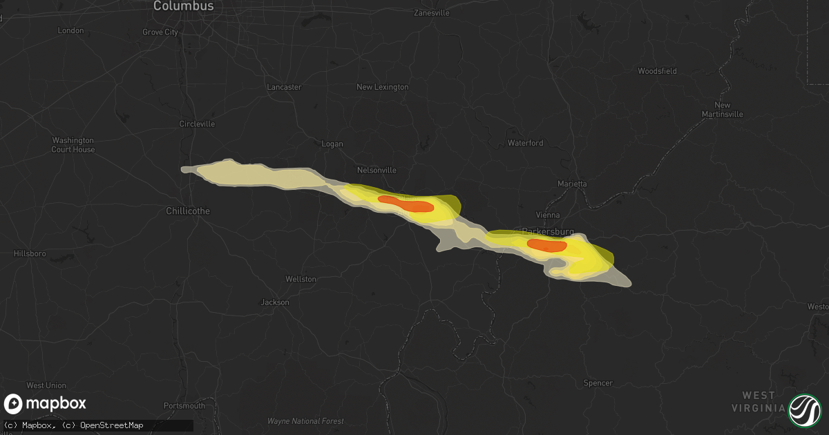
Hail Map in Athens, OH on May 26, 2019
Get this storm
May 26 map
$229
one time, instant access
Download today. No call, no setup
Keep the $229
Bought the map and want the full workflow? Apply the entire $229 to a subscription within 7 days. None of it is wasted.
Every map, not just this one
This buys you this map. Subscription and you get every map we run, in the markets you choose from a few cities to whole states to nationwide. Plus real-time alerts the moment a storm fires.
Contact data
Name, contact info, occupancy, even credit band for addresses in the footprint. You go from where it hit to who to call.
Become the source they trust
Unlimited branding weather history reports on demand. You already have the documented answer ready for the property owner, and you are the one who showed up with it.
Property data and RoofTrace estimates
Pull up any address you have got, its value and the exact code rules for that jurisdiction, straight from One Click Code. Then RoofTrace estimates the squares, pitch, and roof value, priced the way you price.
Storm reports in Athens, OH
Athens, OH
| Date | Description |
|---|---|
| 05/26/20192:55 PM CDT | Multiple trees down due to high wind along angel ridge road. |
| 05/26/20192:23 PM CDT | A local report indicates 1.00 inch wind near ATHENS |
| 05/26/20192:15 PM CDT | 1 tree down on peach ridge road in athens... Ohio. |
| 05/26/20192:15 PM CDT | Golf ball size hail observed by a deputy sheriff in stroud run state park. |
| 05/26/20192:10 PM CDT | Corrected location. Combination of 911 report of trees down in county in past hour... Spotter report of storm and power outage at 310 pm... And radar data. |
| 05/26/20192:03 PM CDT | Quarter size hail reported near route 33 and columbus road. Also pictures submitted of trees down. |
All States Impacted by Hail Map on May 26, 2019
All Cities Impacted by Hail Map on May 26, 2019
- De Witt, NE
- Smithville, WV
- Big Springs, WV
- Auburn, WV
- Brohard, WV
- Sand Fork, WV
- Harrisville, WV
- Linn, WV
- Big Bend, WV
- Troy, WV
- Coxs Mills, WV
- Burnsville, WV
- Glenville, WV
- Fowler, KS
- Jonestown, PA
- Lebanon, PA
- Myerstown, PA
- The Plains, OH
- Athens, OH
- New Marshfield, OH
- Causey, NM
- Pep, NM
- Aberdeen, ID
- Brashear, MO
- Pampa, TX
- Dumas, TX
- Channing, TX
- Elizabeth, WV
- Palestine, WV
- Perryton, TX
- Canadian, TX
- Lipscomb, TX
- Follett, TX
- Higgins, TX
- Booker, TX
- Hereford, TX
- Mud Butte, SD
- Union Center, SD
- Almena, KS
- Mineral Wells, WV
- Parkersburg, WV
- Davisville, WV
- Walker, WV
- Leoti, KS
- Winona, KS
- Martell, NE
- Firth, NE
- Hallam, NE
- Hickman, NE
- Roca, NE
- Lincoln, NE
- Cortland, NE
- South Bloomingville, OH
- Chillicothe, OH
- Adelphi, OH
- Rockbridge, OH
- Laurelville, OH
- Kingston, OH
- Logan, OH
- Mosquero, NM
- Kirk, CO
- Joes, CO
- Cheyenne, WY
- New Raymer, CO
- McArthur, OH
- Wilkesville, OH
- Albany, OH
- Briggsdale, CO
- Rogers, NM
- Rixeyville, VA
- Culpeper, VA
- Carr, CO
- Reedy, WV
- Wiggins, CO
- Weldona, CO
- Orchard, CO
- Whitewood, SD
- Sturgis, SD
- Belle Fourche, SD
- Morgantown, WV
- Granville, WV
- Springview, NE
- Bladen, NE
- Ayr, NE
- Eads, CO
- Kit Carson, CO
- Sheridan Lake, CO
- Wiley, CO
- Hasty, CO
- Las Animas, CO
- McClave, CO
- Cheyenne Wells, CO
- Kim, CO
- Cedar Vale, KS
- Willow Wood, OH
- Glenwood, WV
- Crown City, OH
- Scottown, OH
- Lesage, WV
- Amarillo, TX
- New Plymouth, OH
- Stewart, OH
- Nelsonville, OH
- Guysville, OH
- Coolville, OH
- Clayton, NM
- Nunn, CO
- Burbank, WA
- Kaycee, WY
- Mayfield, KS
- Milan, KS
- Mcconnelsville, OH
- Caldwell, OH
- Scottsville, VA
- Long Pine, NE
- Mills, NE
- Bassett, NE
- Newport, NE
- Vale, SD
- Trenton, NE
- Padroni, CO
- Myersville, MD
- Colby, KS
- Le Roy, KS
- Westphalia, KS
- Frederick, MD
- Fairplay, MD
- Middletown, MD
- Keedysville, MD
- Williamsport, MD
- Boonsboro, MD
- Funkstown, MD
- Hagerstown, MD
- Dalhart, TX
- Denver, CO
- Aurora, CO
- Norton, KS
- Cumberland, OH
- Malta, OH
- White Hall, MD
- Grenville, NM
- Alzada, MT
- Eaton, CO
- Gill, CO
- Nazareth, TX
- Tulia, TX
- Owensboro, KY
- Lynch, NE
- Chugwater, WY
- Wheatland, WY
- Sterling, CO
- Dix, NE
- Kimball, NE
- Peetz, CO
- Mcalister, NM
- Grady, NM
- San Jon, NM
- Springfield, CO
- Hudson, CO
- Keenesburg, CO
- Pomeroy, OH
- Mason, WV
- Bidwell, OH
- Cheshire, OH
- Middleport, OH
- West Columbia, WV
- Hartford, WV
- Letart, WV
- Racine, OH
- Syracuse, OH
- Conchas Dam, NM
- Tucumcari, NM
- Osage, WV
- Kersey, CO
- Spearville, KS
- Accomac, VA
- Laverne, OK
- Grover, CO
- Roggen, CO
- New Haven, WV
- Milford, DE
- Upper Falls, MD
- Edgewood, MD
- Glen Arm, MD
- Kennedyville, MD
- Dover Afb, DE
- Viola, DE
- Worton, MD
- Kingsville, MD
- Fork, MD
- Hartly, DE
- Sudlersville, MD
- Aberdeen Proving Ground, MD
- Crumpton, MD
- Frederica, DE
- Marydel, DE
- Marydel, MD
- Woodside, DE
- Chestertown, MD
- Fallston, MD
- Clayton, DE
- Barclay, MD
- Hydes, MD
- Felton, DE
- Millington, MD
- Joppa, MD
- Dover, DE
- Galena, MD
- Gunpowder, MD
- Magnolia, DE
- Camden Wyoming, DE
- Baldwin, MD
- Palmyra, VA
- Stuart, NE
- Atkinson, NE
- Bruceton Mills, WV
- Parkton, MD
- Corydon, IN
- Rexford, KS
- Clovis, NM
- Sharon Springs, KS
- Roswell, NM
- Creola, OH
- Kinsley, KS
- Hulett, WY
- Douglass, KS
- Hugo, CO
- Ramah, CO
- Portales, NM
- Elida, NM
- Sudan, TX
- Weskan, KS
- Arapahoe, CO
- Kanorado, KS
- Goodland, KS
- Faith, SD
- Pierce, CO
- White Deer, TX
- Gordonsville, VA
- Troy, VA
- Louisa, VA
- Vona, CO
- Stratton, CO
- Anthony, KS
- Freeport, KS
- Bluff City, KS
- Sterling, KS
- Lyons, KS
- Gallipolis, OH
- Robards, KY
- Carmen, OK
- Goltry, OK
- Jet, OK
- Cherokee, OK
- Helena, OK
- Shattuck, OK
- Gage, OK
- Woodward, OK
- Arnett, OK
- Sharon, OK
- Fargo, OK
- Littleton, CO
- Aladdin, WY
- Minneola, KS
- Commerce City, CO
- English, IN
- Sulphur, IN
- McDonald, KS
- Stratton, NE
- Rush, CO
- Ordway, CO
- Little Hocking, OH
- Petroleum, WV
- Circleville, OH
- Washington, WV
- Point Pleasant, WV
- Montezuma, KS
- Plains, KS
- Bard, NM
- Broadview, NM
- Aylett, VA
- Greeley, CO
- Lake Lynn, PA
- Walkerton, VA
- Ruther Glen, VA
- Saint Stephens Church, VA
- Dodge City, KS
- Meade, KS
- Texline, TX
- Felt, OK
- Boise City, OK
- Olney Springs, CO
- Dimmitt, TX
- Hart, TX
- Ault, CO
- Minden, NE
- Wheeler, TX
- Briscoe, TX
- Lincoln, KS
- Spencer, WV
- Garrett, WY
- Bennett, CO
- Stinnett, TX
- Melrose, NM
- Happy, TX
- Wayside, TX
- Pond Creek, OK
- Watkins, CO
- Earth, TX
- Muleshoe, TX
- Claude, TX
- Weston, WY
- Russell, KS
- Copeland, KS
- Boulder, MT
- Medicine Lodge, KS
- Fritch, TX
- Borger, TX
- Evansville, IN
- Dupree, SD
- Sunray, TX
- Wildorado, TX
- Vega, TX
- Groom, TX
- Naponee, NE
- Republican City, NE
- Alma, NE
- Cimarron, KS
- Jetmore, KS
- Lamar, CO
- Boulder, CO
- Kanopolis, KS
- Ellsworth, KS
- Floyd, NM
- Ashton, NE
- Sylvan Grove, KS
- Hunter, KS
- Touchet, WA
- Fort Lupton, CO
- Wadesville, IN
- Nara Visa, NM
- Englewood, CO
- Sedgwick, KS
- Valley Center, KS
- Nash, OK
- Jennings, KS
- Dresden, KS
- Selden, KS
- Offerle, KS
- Miami, TX
- Atwood, KS
- Bird City, KS
- Ryegate, MT
- Berkeley Springs, WV
- Fredonia, KS
- Mooreland, OK
- Alva, OK
- Freedom, OK
- Blue Hill, NE
- Lawrence, NE
- Geuda Springs, KS
- South Haven, KS
- Panhandle, TX
- Logan, NM
- Onley, VA
- Onancock, VA
- Holdrege, NE
- Whitesville, KY
- Utica, KY
- Hartford, KY
- Texhoma, OK
- Goodwell, OK
- Cooksville, MD
- Woodbine, MD
- Westminster, MD
- Mount Airy, MD
- Sykesville, MD
- Brandenburg, KY
- Fe Warren Afb, WY
- Spencer, NE
- Oneill, NE
- Boyes, MT
- Amanda, OH
- Lancaster, OH
- Tarlton, OH
- Sandyville, WV
- Campo, CO
- Burden, KS
- Cambridge, KS
- Upland, NE
- Cottageville, WV
- Boone, CO
- Hedgesville, WV
- Monument, KS
- Holly, CO
- Cambridge, MD
- Madison, MD
- Manchester, OK
- Medford, OK
- White Owl, SD
- Howes, SD
- Edson, KS
- Corning, OH
- Crooksville, OH
- New Lexington, OH
- Argonia, KS
- Masterson, TX
- Sugar Grove, OH
- Larned, KS
- Roy, NM
- Solano, NM
- Atlanta, KS
- Platteville, CO
- La Salle, CO
- Brighton, CO
- Taylors Island, MD
- Tribune, KS
- Long Island, KS
- Shady Side, MD
- Churchton, MD
- Great Bend, KS
- Claflin, KS
- Ellinwood, KS
- Maidsville, WV
- Pursglove, WV
- Prairie View, KS
- Smithsburg, MD
- Elizabeth, CO
- Waynoka, OK
- Deadwood, SD
- Fort Meade, SD
- Caldwell, KS
- Adrian, TX
- Ward, CO
- Dexter, KS
- Lone Tree, CO
- Catonsville, MD
- Halethorpe, MD
- Baltimore, MD
- Ellicott City, MD
- Amorita, OK
- Phillipsburg, KS
- Bloomington, NE
- Bobtown, PA
- Dilliner, PA
- Greensboro, PA
- Guymon, OK
- Wellington, KS
- Seibert, CO
- Herrin, IL
- Carterville, IL
- Le Roy, WV
- Waldron, KS
- Canyon, TX
- Beaver City, NE
- Flagler, CO
- Arriba, CO
- Karval, CO
- Fowler, CO
- Munday, WV
- Macfarlan, WV
- Mount Alto, WV
- Millwood, WV
- Moorcroft, WY
- Linthicum Heights, MD
- Brooklyn, MD
- Glen Burnie, MD
- Spearman, TX
- Beaver, OK
- Gem, KS
- Burlington, OK
- Creston, WV
- Elm Creek, NE
- Johnstown, NE
- Liberal, KS
- Holstein, NE
- Shade, OH
- Emmitsburg, MD
- Thurmont, MD
- Keymar, MD
- Rocky Ridge, MD
- Franklin, NE
- Hildreth, NE
- Wilcox, NE
- Hooker, OK
- Tyrone, OK
- Mclean, TX
- Carmi, IL
- Genoa, CO
- Two Buttes, CO
- Glenvil, NE
- Roseland, NE
- Grinnell, KS
- Abingdon, MD
- Massey, MD
- Arkansas City, KS
- Maple City, KS
- Shidler, OK
- Campbell, NE
- Shamrock, TX
- Philippi, WV
- Winfield, KS
- Erie, KS
- Saint Paul, KS
- Mobeetie, TX
- Lorraine, KS
- Hallwood, VA
- Temperanceville, VA
- Sanford, VA
- Partlow, VA
- Wright, KS
- Saint Croix, IN
- Leavenworth, IN
- Garden City, KS
- Kents Store, VA
- Keswick, VA
- Wilson, KS
- Parksley, VA
- Bloxom, VA
- Dacoma, OK
- Spearfish, SD
- Clatonia, NE
- New Windsor, MD
- Union Bridge, MD
- Woodstock, MD
- Marriottsville, MD
- New Market, MD
- Newell, SD
- Ray, OH
- Londonderry, OH
- Woodford, VA
- St John, KS
- Union, NE
- Albright, WV
- Jarrettsville, MD
- Monkton, MD
- Oakley, KS
- Geneseo, KS
- Chase, KS
- Webster, KY
- Payneville, KY
- Murdock, KS
- Belleville, WV
- Reedsville, OH
- Ravenswood, WV
- Long Bottom, OH
- Melfa, VA
- Bushton, KS
- Des Moines, NM
- Hardesty, OK
- Fredericksburg, PA
- Annville, PA
- Newmanstown, PA
- Depauw, IN
- Littleton, WV
- Beloit, KS
- Enfield, IL
- Kenton, OK
- Sublette, KS
- Sedan, KS
- Turpin, OK
- Pritchett, CO
- Shawnee, OH
- Lititz, PA
- Schaefferstown, PA
- Ono, PA
- Danbury, NE
- Spotsylvania, VA
- Clarendon, TX
- Clayton, KS
- Oberlin, KS
- Balko, OK
- Lamont, OK
- Nebo, WV
- Chloe, WV
- Wright, WY
- Ainsworth, NE
- Hartley, TX
- Walsenburg, CO
- Sylvia, KS
- Udall, KS
- Mulvane, KS
- Portland, OH
- Leon, WV
- Hudson, KS
- Mankato, KS
- Plainville, KS
- Orleans, NE
- Rockport, WV
- Charlottesville, VA
- Keene, VA
- Esmont, VA
- Bremo Bluff, VA
- Kiowa, KS
- Hays, KS
- Cunningham, KS
- Elbert, CO
- Rose Hill, KS
- Ketchum, ID
- Hailey, ID
- Aberdeen, MD
- Still Pond, MD
- Betterton, MD
- Springlake, TX
- Millfield, OH
- Amesville, OH
- Arvada, WY
- Gillette, WY
- Butte, NE
- Colorado Springs, CO
- Usaf Academy, CO
- Yoder, CO
- Evans, CO
- Louviers, CO
- Livingston, MT
- Rapelje, MT
- Big Timber, MT
- Shepherd, MT
- Billings, MT
- Musselshell, MT
- Roundup, MT
- Crow Agency, MT
- Saint Xavier, MT


