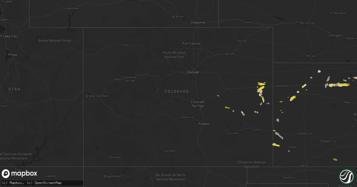
Hail Map in Colorado on May 24, 2018
Get this storm
May 24 map
$229
one time, instant access
Download today. No call, no setup
Keep the $229
Bought the map and want the full workflow? Apply the entire $229 to a subscription within 7 days. None of it is wasted.
Every map, not just this one
This buys you this map. Subscription and you get every map we run, in the markets you choose from a few cities to whole states to nationwide. Plus real-time alerts the moment a storm fires.
Contact data
Name, contact info, occupancy, even credit band for addresses in the footprint. You go from where it hit to who to call.
Become the source they trust
Unlimited branding weather history reports on demand. You already have the documented answer ready for the property owner, and you are the one who showed up with it.
Property data and RoofTrace estimates
Pull up any address you have got, its value and the exact code rules for that jurisdiction, straight from One Click Code. Then RoofTrace estimates the squares, pitch, and roof value, priced the way you price.
Storm reports in Colorado
Colorado
| Date | Description |
|---|---|
| 05/24/20186:27 PM CDT | Hail reported 3 miles west and 1 and half mile south of hwy 24. |
| 05/24/20187:29 AM CDT | At 1227 PM MDT, a severe thunderstorm was located 9 miles south of Kutch, or 36 miles south of Limon, moving east at 10 mph. HAZARD...60 mph wind gusts and quarter size hail. SOURCE...Radar indicated. IMPACT...Expect damage to roofs, siding, and trees. Hail damage to vehicles is expected. Locations impacted include... Forder. |
| 05/24/20181:41 AM CDT | At 639 PM MDT, a severe thunderstorm was located 9 miles north of Stratton, moving east at 25 mph. HAZARD...60 mph wind gusts and quarter size hail. SOURCE...Radar indicated. IMPACT...Hail damage to vehicles is expected. Expect wind damage to roofs, siding, and trees. Locations impacted include... Burlington.This includes the following highways... Interstate 70 in Colorado between mile markers 442 and 447. Highway 385 between mile markers 189 and 205, and near mile marker211. |
| 05/24/201812:58 AM CDT | At 558 PM MDT, a severe thunderstorm was located near Burlington, moving east at 20 mph. HAZARD...60 mph wind gusts and quarter size hail. SOURCE...Radar indicated. IMPACT...Hail damage to vehicles is expected. Expect wind damage to roofs, siding, and trees. Locations impacted include... Burlington, Stratton and Bethune. This includes the following highways... Interstate 70 in Colorado between mile markers 419 and 450. Highway 385 between mile markers 181 and 202. |
| 05/24/201812:28 AM CDT | At 527 PM MDT, a severe thunderstorm was located near Bethune, or 7 miles east of Stratton, moving northeast at 20 mph. HAZARD...60 mph wind gusts and quarter size hail. SOURCE...Radar indicated. IMPACT...Hail damage to vehicles is expected. Expect wind damage to roofs, siding, and trees. Locations impacted include... Burlington, Stratton and Bethune. This includes the following highways... Interstate 70 in Colorado between mile markers 420 and 440. Highway 385 between mile markers 179 and 192. |
| 05/24/201812:00 AM CDT | At 459 PM MDT, a severe thunderstorm was located 12 miles south of Stratton, moving northeast at 20 mph. HAZARD...60 mph wind gusts and quarter size hail. SOURCE...Radar indicated. IMPACT...Hail damage to vehicles is expected. Expect wind damage to roofs, siding, and trees. Locations impacted include... Burlington and Bethune. This includes the following highways... Interstate 70 in Colorado between mile markers 423 and 440. Highway 385 between mile markers 170 and 193. |
| 05/23/201811:57 PM CDT | At 457 PM MDT, a severe thunderstorm was located 9 miles east of Cheyenne Wells, moving east at 20 mph. HAZARD...60 mph wind gusts and quarter size hail. SOURCE...Radar indicated. IMPACT...Hail damage to vehicles is expected. Expect wind damage to roofs, siding, and trees. Locations impacted include... Sharon Springs, Weskan and Arapahoe. |
| 05/23/201811:14 PM CDT | At 413 PM MDT, a severe thunderstorm was located 14 miles north of Brandon, or 14 miles southwest of Cheyenne Wells, moving east at 35 mph. HAZARD...60 mph wind gusts and quarter size hail. SOURCE...Radar indicated. IMPACT...Hail damage to vehicles is expected. Expect wind damage to roofs, siding, and trees. Locations impacted include... Cheyenne Wells and Firstview. This includes Highway 385 between mile markers 136 and 149. |
| 05/23/201810:57 PM CDT | At 357 PM MDT, a severe thunderstorm was located 14 miles north of Cheyenne Wells, moving southeast at 15 mph. HAZARD...60 mph wind gusts and quarter size hail. SOURCE...Radar indicated. IMPACT...Hail damage to vehicles is expected. Expect wind damage to roofs, siding, and trees. This severe thunderstorm will remain over mainly rural areas of northeastern Cheyenne and southeastern Kit Carson Counties in east central Colorado.This includes Highway 385 between mile markers 156 and 176. |
| 05/23/201810:52 PM CDT | At 352 PM MDT, a severe thunderstorm was located 9 miles northeast of Eads, or 23 miles southwest of Cheyenne Wells, moving east at 5 mph. HAZARD...60 mph wind gusts and quarter size hail. SOURCE...Radar indicated. IMPACT...Hail damage to vehicles is expected. Expect wind damage to roofs, siding, and trees. Locations impacted include... rural areas of north central Kiowa county. |
| 05/23/201810:51 PM CDT | At 351 PM MDT, a severe thunderstorm was located 9 miles northeast of Eads, or 23 miles southwest of Cheyenne Wells, moving southeast at 20 mph. HAZARD...60 mph wind gusts and quarter size hail. SOURCE...Radar indicated. IMPACT...Hail damage to vehicles is expected. Expect wind damage to roofs, siding, and trees. This severe thunderstorm will remain over mainly rural areas of south central Cheyenne County in east central Colorado. |
| 05/23/201810:01 PM CDT | At 300 PM MDT, a severe thunderstorm was located 7 miles north of Haswell, or 43 miles northwest of Lamar, moving southeast at 30 mph. HAZARD...60 mph wind gusts and quarter size hail. SOURCE...Radar indicated. IMPACT...Hail damage to vehicles is expected. Expect wind damage to roofs, siding, and trees. Locations impacted include... Haswell. |
| 05/23/20187:25 PM CDT | A local report indicates 1.00 inch wind near 8 N BETHUNE |
All States Impacted by Hail Map on May 24, 2018
Cities Impacted by Hail Map on May 24, 2018
- Crookston, MN
- Centerville, SD
- Lennox, SD
- Bird Island, MN
- Hector, MN
- Olivia, MN
- Winona, KS
- Wallace, KS
- Wales, ND
- Alsen, ND
- Munich, ND
- Maida, ND
- Langdon, ND
- Colby, KS
- Tyndall, SD
- Marion Junction, AL
- Stratton, CO
- Winner, SD
- Colome, SD
- Dallas, SD
- Saint Charles, SD
- Bonesteel, SD
- Wayzata, MN
- Trent, TX
- Minden, NV
- Clarkfield, MN
- Minneota, MN
- Deer River, MN
- Sweetwater, TX
- International Falls, MN
- Damar, KS
- Faribault, MN
- Clinton, MN
- Fort Davis, TX
- Alpine, TX
- Haswell, CO
- Saluda, SC
- Troy, SC
- Newfolden, MN
- Thief River Falls, MN
- Goodridge, MN
- Karval, CO
- Syracuse, KS
- Kendall, KS
- Flaxton, ND
- Gardnerville, NV
- Bigfork, MN
- Hamel, MN
- Minneapolis, MN
- Long Lake, MN
- Ashford, AL
- Cottonwood, MN
- Renville, MN
- Redwood Falls, MN
- Belview, MN
- Vermillion, SD
- Gayville, SD
- Northfield, MN
- Nerstrand, MN
- Marcell, MN
- Ulysses, KS
- Hurley, WI
- Ramsay, MI
- Wakefield, MI
- Ironwood, MI
- Bessemer, MI
- Gregory, SD
- Moundville, AL
- Ainsworth, NE
- Johnstown, NE
- Catherine, AL
- Safford, AL
- Uniontown, AL
- Hill City, KS
- Penokee, KS
- Bogue, KS
- Worthing, SD
- Beresford, SD
- Presque Isle, WI
- Manitowish Waters, WI
- Bemidji, MN
- Marathon, TX
- Defuniak Springs, FL
- Titonka, IA
- Gibbon, MN
- New Ulm, MN
- Dante, SD
- Wagner, SD
- Niobrara, NE
- Avon, SD
- Hampden, ND
- Hannah, ND
- Starkweather, ND
- Waldron, AR
- Cherry Valley, AR
- Palisade, MN
- Rockford, AL
- Saint Paul, MN
- Cheyenne Wells, CO
- Oberlin, KS
- Burnsville, MN
- Savage, MN
- Rolfe, IA
- Mallard, IA
- Sparks, NE
- Bethune, CO
- Burlington, CO
- Edgefield, SC
- Warsaw, MN
- Morristown, MN
- Danube, MN
- Sacred Heart, MN
- Rib Lake, WI
- Medford, WI
- Wiggins, MS
- Kirwin, KS
- Stockton, KS
- Bowlus, MN
- Holdingford, MN
- Scotland, SD
- Olivet, SD
- Tripp, SD
- Woodruff, WI
- Red Lake Falls, MN
- Rush, CO
- Morland, KS
- Coffee Springs, AL
- Woodston, KS
- Hamlin, TX
- Sugartown, LA
- Dothan, AL
- Butternut, WI
- Granite Falls, MN
- Jordan, MN
- Prior Lake, MN
- Shakopee, MN
- Snellville, GA
- Conyers, GA
- Loganville, GA
- Glencoe, MN
- Alton, KS
- Gaylord, KS
- Samson, AL
- Boulder Junction, WI
- Saint Germain, WI
- Sayner, WI
- Brooks, MN
- Hayward, WI
- Van Horn, TX
- Beltrami, MN
- Venice, FL
- Oakley, KS
- Weogufka, AL
- Marbury, AL
- Hopkins, MN
- Eden Prairie, MN
- Tribune, KS
- Plummer, MN
- Mizpah, MN
- Glenwood, MN
- Stone Mountain, GA
- La Pine, OR
- Waterford, MS
- Springview, NE
- Littlefork, MN
- Lebanon, MO
- Phillipsburg, MO
- Emmetsburg, IA
- Cylinder, IA
- Silverstreet, SC
- Mills, NE
- Manter, KS
- Lawley, AL
- Randolph, AL
- Strathcona, MN
- Sarles, ND
- Spring Lake, MN
- Talmoon, MN
- Knapp, WI
- Dundas, MN
- Laurel Hill, FL
- Crestview, FL
- Merrill, WI
- Cass Lake, MN
- Walker, MN
- Akeley, MN
- Laporte, MN
- Trenton, FL
- Pitkin, LA
- Napoleonville, LA
- Selden, KS
- Climax, MN
- Pinellas Park, FL
- Saint Petersburg, FL
- Valentine, NE
- Earle, AR
- Norcatur, KS
- Evergreen, AL
- Ideal, SD
- Nevis, MN
- Houma, LA
- Simla, CO
- Robertsdale, AL
- New Germany, MN
- Mayer, MN
- Lester Prairie, MN
- Northport, AL
- Magee, MS
- Mount Olive, MS
- Brooklyn, MS
- Albany, MN
- Royalton, MN
- Freeport, MN
- Rocklake, ND
- Calvin, ND
- Sulphur Springs, AR
- Hill City, MN
- Swatara, MN
- Merkel, TX
- Jay, FL
- Lynch, NE
- Camden, AL
- Villard, MN
- Sugar Land, TX
- Milton, FL
- Baker, FL
- Newton, AL
- Bronson, FL
- Newberry, FL
- Volin, SD
- Coolidge, KS
- Orovada, NV
- Eads, CO
- Woodville, WI
- Baldwin, WI
- Wellington, NV
- Havelock, IA
- Laurens, IA
- Arapahoe, CO
- Mentor, MN
- Rexford, KS
- South Saint Paul, MN
- Inver Grove Heights, MN
- Bonifay, FL
- Big Falls, MN
- Montevallo, AL
- Clontarf, MN
- Danvers, MN
- Forest Home, AL
- Greenville, AL
- Sibley, IA
- Wakonda, SD
- Lonsdale, MN
- Farmington, MN
- Randolph, MN
- Kennebec, SD
- Minocqua, WI
- Lac Du Flambeau, WI
- Hamill, SD
- Kelliher, MN
- West Fork, AR
- Winslow, AR
- Fertile, MN
- Geneva, AL
- Lockport, LA
- Chancellor, AL
- Burke, SD
- Parkin, AR
- Atkinson, NE
- Holloway, MN
- Hancock, MN
- Lenora, KS
- Fenton, IA
- Buffalo Lake, MN
- Morton, MN
- Melrose, MN
- Plato, MN
- Hartford, AL
- Meridian, MS
- Cook, MN
- Beatrice, AL
- Vredenburgh, AL
- Pine Apple, AL
- Greensboro, AL
- Sylacauga, AL
- Clanton, AL
- Maplesville, AL
- Henderson, NE
- Dawson, MN
- Bassett, NE
- Glenwood City, WI
- Bowbells, ND
- Sharon Springs, KS
- Ashland, KS
- Kingfisher, OK
- Okarche, OK


