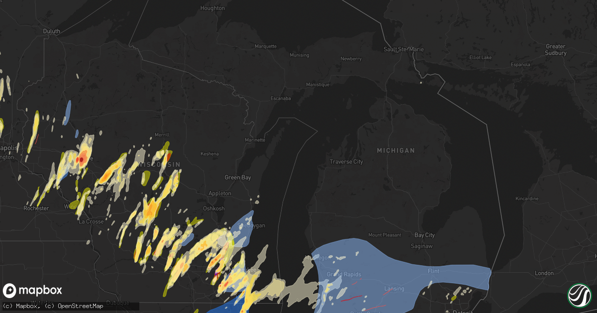
Hail Map in Michigan on May 15, 2025
Get this storm
May 15 map
$229
one time, instant access
Download today. No call, no setup
Keep the $229
Bought the map and want the full workflow? Apply the entire $229 to a subscription within 7 days. None of it is wasted.
Every map, not just this one
This buys you this map. Subscription and you get every map we run, in the markets you choose from a few cities to whole states to nationwide. Plus real-time alerts the moment a storm fires.
Contact data
Name, contact info, occupancy, even credit band for addresses in the footprint. You go from where it hit to who to call.
Become the source they trust
Unlimited branding weather history reports on demand. You already have the documented answer ready for the property owner, and you are the one who showed up with it.
Property data and RoofTrace estimates
Pull up any address you have got, its value and the exact code rules for that jurisdiction, straight from One Click Code. Then RoofTrace estimates the squares, pitch, and roof value, priced the way you price.
Storm reports in Michigan
Michigan
| Date | Description |
|---|---|
| 05/15/202510:09 AM CDT | Large healthy tree down. Time estimated from radar. |
| 05/15/202512:35 AM CDT | Large tree limb downed. Photo shared via social media. |
| 05/15/202512:26 AM CDT | Trees and power lines reported down in bridgehampton and delaware townships. |
| 05/15/202512:16 AM CDT | Numerous large trees down near mayer rd and rattle run rd. |
| 05/15/202512:11 AM CDT | Large tree downed across roadway. Photo shared via social media. |
| 05/15/202512:10 AM CDT | Tree reported blown down. |
| 05/14/202511:52 PM CDT | Trees sheared and wires down. |
| 05/14/202511:47 PM CDT | Sporadic isolated trees reported down across northwest washtenaw county. |
| 05/14/202511:37 PM CDT | Photo of tree down near usps on e flint st. |
| 05/14/202511:35 PM CDT | Nws damage survey confirmed an ef-0 tornado touched down northeast of atlas and was on the ground 3 minutes before lifting north of goodrich. |
| 05/14/202511:33 PM CDT | Photos of trees down and large branches |
| 05/14/202511:32 PM CDT | Damage reported south of the eaton rapids area near m-50 from holmes highway to bellevue highway. |
| 05/14/202511:27 PM CDT | Report of two large trees down |
| 05/14/202511:27 PM CDT | A swath of uprooted trees and trees down from downtown holly to holly village mobile home park. Peak winds estimated up to 70 mph. |
| 05/14/202511:24 PM CDT | A local report indicates 59 MPH wind near Flint Bishop Intl Airpo |
| 05/14/202511:23 PM CDT | Jackson county emergency manager reports two homes sustained structural damage from falling trees in liberty township. Another home had window and siding damage. A crus |
| 05/14/202511:20 PM CDT | Report of trees and wires down |
| 05/14/202511:18 PM CDT | Several large tree limbs down. |
| 05/14/202511:18 PM CDT | Report of trees and wires down |
| 05/14/202511:10 PM CDT | Outbuilding damage and power pole damage. |
| 05/14/202511:10 PM CDT | Tree down on byron rd near cohoctah. |
| 05/14/202511:05 PM CDT | Shingles and roofing partially removed from home. Tree damage on property. Wnem report. Time estimated from radar. |
| 05/14/202511:05 PM CDT | Trees down and a barn suffered damage... Which included parts of the roof. Wind damage occured as prior confirmed tornado dissipated. |
| 05/14/202511:05 PM CDT | Nws damage survey confirmed an ef-0 tornado touched down just west of st charles and was on the ground for 5 minutes before lifting in st charles. |
| 05/14/202511:03 PM CDT | Nws damage survey confirmed a brief ef-1 tornado touched down between stockbridge and gregory being on the ground for a couple minutes before gusting out over gregory. |
| 05/14/202511:02 PM CDT | Report of trees and wires down |
| 05/14/202510:46 PM CDT | Semi truck flipped over on us 127 near barnes st south of mason. Time estimated from radar. |
| 05/14/202510:46 PM CDT | Semi truck flipped over on us 127 near barnes st south of mas |
| 05/14/202510:46 PM CDT | Multiple trees down. |
| 05/14/202510:46 PM CDT | Semi truck flipped over on us 127 near barnes st south of mason. Time estimated f |
| 05/14/202510:46 PM CDT | Numerous trees snapped and fallen in okemos. Wlns report. Time estimated from radar. |
| 05/14/202510:46 PM CDT | A few trees down off kensington rd. |
| 05/14/202510:46 PM CDT | Report of trees and wires down |
| 05/14/202510:43 PM CDT | Tree on house. |
| 05/14/202510:42 PM CDT | Lansing asos. |
| 05/14/202510:40 PM CDT | Multiple trees down. |
| 05/14/202510:40 PM CDT | Spotter reports power flashes near the meijer distribution center off creyts rd. Tornado debris signature on radar. |
| 05/14/202510:39 PM CDT | Video of structural damage to the gm facility off mt. Hope highway in lansing. A large section of a wall was removed... Exposing the inside of the facility. Time estima |
| 05/14/202510:36 PM CDT | Structural damage to business with wall removed and debris blown into vehicles. Wlns report. Time estimated from radar. |
| 05/14/202510:36 PM CDT | Semi truck overturned on millet highway between south canal rd and south creyts rd. Location is within the tornado debris signature on radar. Time is approximate. |
| 05/14/202510:36 PM CDT | Semi truck overturned on millet highway between south canal rd and south creyts rd. Location is within the tornado debris signature on radar. Time is appro |
| 05/14/202510:35 PM CDT | Awos station khai three rivers. |
| 05/14/202510:32 PM CDT | Report of multiple mature trees down and broken branches 2 blocks north and west of capitol ave and columbia ave. |
| 05/14/202510:30 PM CDT | Emergency manager reports trees and power lines down from three river to mendon. Time estimated via radar. |
| 05/14/202510:30 PM CDT | Emergency manager reports tree limbs and powerlines down from three rivers to mendon. Time estimated via radar. |
| 05/14/202510:28 PM CDT | Numerous trees down... Multiple trees on houses. |
| 05/14/202510:27 PM CDT | Trees and wires down. Tree across roadway. |
| 05/14/202510:25 PM CDT | Tree and structure damage occurred along the path of this ef1 tornado. A number of homes had roofing material ripped away and several outbuildings were heavily damaged. |
| 05/14/202510:23 PM CDT | Damage along w baseline highway near pine lake. Barn roof removed... Power lines down... And trees down. Time estimated from radar. |
| 05/14/202510:23 PM CDT | Roof removed from barn and tree damage on property. Woodtv report. Time estimated from radar. |
| 05/14/202510:16 PM CDT | Barn damaged. Woodtv report. Time estimated. |
| 05/14/202510:16 PM CDT | Trees snapped with multiple trees across roads. |
| 05/14/202510:13 PM CDT | Wires down. Time estimated. |
| 05/14/202510:13 PM CDT | Several uprooted trees along w tuttle rd. |
| 05/14/202510:13 PM CDT | Trees down across road. Time estimated. |
| 05/14/202510:11 PM CDT | The ef0 tornado resulted in mostly tree damage along its 8.5 mile path. It began just west of saint marys lak |
| 05/14/202510:11 PM CDT | The ef0 tornado resulted in mostly tree damage along its 8.5 mile path. It began just west of saint marys lake and traveled just south of the lake and remained very clo |
| 05/14/202510:10 PM CDT | Boat flipped on fine lake... Southeast of delton. Woodtv report. Time estimated. |
| 05/14/202510:10 PM CDT | Several trees down at hubbard st and waubascon rd. Time estimated. |
| 05/14/202510:09 PM CDT | Peak gust at battle creek asos before going offline. |
| 05/14/202510:09 PM CDT | Corrects time for vestaburg report. Large healthy tree down. Time estimated from radar. |
| 05/14/202510:07 PM CDT | Kalamazoo asos. |
| 05/14/202510:06 PM CDT | Several trees down... 12-20 inch diameter. Time estimated from radar. |
| 05/14/202510:06 PM CDT | Trees down south of leroy. Time estimated. |
| 05/14/202510:00 PM CDT | Shingles torn off roof. |
| 05/14/202510:00 PM CDT | Delayed report. Two trees uprooted and large tree branches downed. Time estimated from radar. |
| 05/14/202510:00 PM CDT | Public report of trees down across red arrow highway near s 1st street close to the van buren/kalamazoo county line. |
| 05/14/202510:00 PM CDT | Public report of trees down across red arrow highway near s 1st street close to the va |
| 05/14/20259:59 PM CDT | The ef0 tornado resulted in mainly tree damage along its 10 mile path. More concentrated tree damage occurred near the beginning and the end of the path with intermitte |
| 05/14/20259:59 PM CDT | Tree on house near freeport. Woodtv report. Time estimated from radar. |
| 05/14/20259:58 PM CDT | Trees and wires down across road. |
| 05/14/20259:56 PM CDT | Gerald r ford international. |
| 05/14/20259:55 PM CDT | Trees down. |
| 05/14/20259:53 PM CDT | Tree on home. Woodtv report. Time estimated from radar. |
| 05/14/20259:50 PM CDT | Woodtv reports the comerica bank building in downtown kalamazoo had some paneling and insulation removed. Time estimated from radar. |
| 05/14/20259:50 PM CDT | Trees down. Time estimated. |
| 05/14/20259:49 PM CDT | Shingles off of gazebo. |
| 05/14/20259:49 PM CDT | Tree across road. |
| 05/14/20259:47 PM CDT | Boat flipped on gun lake. Woodtv report. |
| 05/14/20259:47 PM CDT | Trees snapped and uprooted in caledonia. Woodtv report. Time estimated from radar. |
| 05/14/20259:47 PM CDT | Large tree branch on house... 60th and kalamazoo. Some damage to siding. Woodtv report. Time estimated from radar. |
| 05/14/20259:44 PM CDT | Trees and wires down in the city of big rapids. Pemberton and elm... Mecosta and chestnut streets were impacted. |
| 05/14/20259:44 PM CDT | Tree fell on a vehicle. Woodtv report. Time estimated. |
| 05/14/20259:41 PM CDT | Corrects previous tstm wnd dmg report from 3 wsw martin. Schnable lake area west of martin sustained damage with at least one camper flipped over. Woodtv report. Time e |
| 05/14/20259:41 PM CDT | Schnable lake area west of martin sustained damage with multiple trees snapped or down... At least one boat flipped out of the water... And at least one camper flipped |
| 05/14/20259:38 PM CDT | Extensive structural damage to house from a falling tree. Woodtv report. Time estimated from radar. |
| 05/14/20259:37 PM CDT | Numerous healthy trees down in dorr township. Time estimated from radar. |
| 05/14/20259:37 PM CDT | Eight large pine trees down on a property in dorr. Location is within a tds on radar. Time is estimated. |
| 05/14/20259:34 PM CDT | Several trees and large limbs down across paw paw. Delayed report. Time estimated via radar. |
| 05/14/20259:28 PM CDT | Reports of large trees downed. Time estimated from radar. |
| 05/14/20259:25 PM CDT | Asos station kbeh benton harbor. |
| 05/14/20259:25 PM CDT | Very large healthy tree snapped. Woodtv report. Time estimated from radar. |
| 05/14/20259:25 PM CDT | Reports of large trees downed. Time estimated from radar. |
| 05/14/20259:23 PM CDT | Corrects time for previous tstm wnd dmg report from 1 n drenthe. Barn destroyed. |
| 05/14/20259:22 PM CDT | A tree snapped at the base and landed on a building... Damaging a deck. |
| 05/14/20259:20 PM CDT | Large 3 foot diameter tree downed onto a house. Time estimated from radar. |
| 05/14/20259:19 PM CDT | Trees down on butternut dr north and south of quincy st near holland. |
| 05/14/20259:13 PM CDT | A local report indicates 61 MPH wind near 1 N Benton Heights |
| 05/14/20259:12 PM CDT | Numerous trees snapped or uprooted across saugatuck and saugatuck township. Woodtv report. Time estimated from radar. |
| 05/14/20259:12 PM CDT | Holland asos. |
| 05/14/20259:07 PM CDT | Several large branches down... Time estimated via radar. Delayed report. |
| 05/14/20259:06 PM CDT | Trees down throughout waukazoo woods. Multiple trees through homes on post avenue and oakwood ave. |
| 05/14/20258:56 PM CDT | A local report indicates 72 MPH wind near 1 NW Norton Shores |
| 05/14/20258:55 PM CDT | Asos station kmkg muskegon county airport. |
| 05/14/20258:54 PM CDT | Trees uprooted and siding torn off of home. |
| 05/14/20258:54 PM CDT | Spring lake yacht club. Time estimated. |
| 05/14/20258:46 PM CDT | Time estimated. |
| 05/14/20258:42 PM CDT | Multiple trees uprooted. |
| 05/14/20258:23 PM CDT | Barn destroyed. |
| 05/14/20257:47 PM CDT | Dispatch reports large tree down at us-45 and himanka hill road. |
| 05/14/20257:30 PM CDT | Dispatch reports several trees down at us-2 and beatons lake road. |
All States Impacted by Hail Map on May 15, 2025
Cities Impacted by Hail Map on May 15, 2025
- Broken Bow, OK
- Silver Lake, MN
- Lester Prairie, MN
- Glencoe, MN
- Watson, OK
- Cove, AR
- Wickes, AR
- Lake Crystal, MN
- Vandervoort, AR
- Mena, AR
- Elk River, MN
- Big Lake, MN
- Zimmerman, MN
- Princeton, MN
- Anoka, MN
- Saint Francis, MN
- Cambridge, MN
- Isanti, MN
- Stanchfield, MN
- Dalbo, MN
- Ogilvie, MN
- Braham, MN
- Mora, MN
- Grasston, MN
- Brook Park, MN
- Howe, OK
- Poteau, OK
- Cleveland, MN
- Elysian, MN
- Hackett, AR
- Heavener, OK
- Midland, AR
- Mansfield, AR
- Huntington, AR
- Hartford, AR
- Magazine, AR
- Paris, AR
- Subiaco, AR
- Brockwell, AR
- Delaware, AR
- London, AR
- Knoxville, AR
- Hagarville, AR
- Deer, AR
- New Blaine, AR
- Russellville, AR
- Dover, AR
- Witts Springs, AR
- Marshall, AR
- Wiseman, AR
- Horseshoe Bend, AR
- Ash Flat, AR
- Violet Hill, AR
- Lamar, AR
- Scranton, AR
- Mount Judea, AR
- Franklin, AR
- Pelsor, AR
- Cherokee Village, AR
- Hardy, AR
- Sage, AR
- Evening Shade, AR
- Jerusalem, AR
- Hector, AR
- Scotland, AR
- Clinton, AR
- Leslie, AR
- Ravenden Springs, AR
- Ravenden, AR
- Harriet, AR
- Big Flat, AR
- Timbo, AR
- Onia, AR
- Dennard, AR
- Pocahontas, AR
- Williford, AR
- Oronoco, MN
- Rochester, MN
- Zumbro Falls, MN
- Mazeppa, MN
- Maynard, AR
- Long Lake, MN
- Hamel, MN
- Doniphan, MO
- Byron, MN
- Fox, AR
- Shirley, AR
- New London, MN
- Belgrade, MN
- Mountain View, AR
- Melbourne, AR
- Fifty Six, AR
- Warm Springs, AR
- Cannon Falls, MN
- Elgin, MN
- Imboden, AR
- Pollocksville, NC
- Pine Island, MN
- Marcella, AR
- Batesville, AR
- Edgemont, AR
- South Saint Paul, MN
- Inver Grove Heights, MN
- Locust Grove, AR
- Welch, MN
- Minneapolis, MN
- Mount Pleasant, AR
- Guion, AR
- Millville, MN
- Andover, MN
- Nelson, WI
- Cedar, MN
- Bethel, MN
- New Bern, NC
- Paynesville, MN
- Melrose, MN
- Houston, MN
- Wabasha, MN
- Stillwater, MN
- Onamia, MN
- Cottage Grove, MN
- Saint Paul, MN
- Winona, MN
- Trempealeau, WI
- Galesville, WI
- Arcadia, WI
- Fountain City, WI
- Dodge, WI
- Durand, WI
- Freeport, MN
- Selma, NC
- Kenly, NC
- Alma, WI
- Lake City, MN
- Wyoming, MN
- Pepin, WI
- Kellogg, MN
- Stockholm, WI
- Dakota, MN
- Albany, MN
- Lake Elmo, MN
- Prescott, WI
- River Falls, WI
- Hastings, MN
- Arkansaw, WI
- Plum City, WI
- Avoca, WI
- Highland, WI
- Eau Galle, WI
- Menomonie, WI
- Ettrick, WI
- Independence, WI
- Blair, WI
- Bock, MN
- Milaca, MN
- Isle, MN
- Spring Green, WI
- Lone Rock, WI
- Lansing, IA
- Waukon, IA
- Pine City, MN
- Hudson, WI
- Roberts, WI
- New Richmond, WI
- Reads Landing, MN
- Elmwood, WI
- Hillpoint, WI
- Plain, WI
- Cazenovia, WI
- La Valle, WI
- Reedsburg, WI
- Deer Park, WI
- Sauk City, WI
- Amery, WI
- Star Prairie, WI
- Dodgeville, WI
- McGrath, MN
- Richland Center, WI
- Mondovi, WI
- Cochrane, WI
- New Albin, IA
- Aitkin, MN
- Bee Branch, AR
- Holmen, WI
- Eleva, WI
- Eau Claire, WI
- Whitehall, WI
- Wonewoc, WI
- North Freedom, WI
- Loganville, WI
- Rock Springs, WI
- Dalton, MN
- Ashby, MN
- Fergus Falls, MN
- Underwood, MN
- Battle Lake, MN
- Erhard, MN
- Pelican Rapids, MN
- Dent, MN
- Evansville, MN
- Brooklyn, WI
- Oregon, WI
- Mazomanie, WI
- Bemidji, MN
- Quitman, AR
- Heber Springs, AR
- Damascus, AR
- Elk Mound, WI
- Pikeville, NC
- Fremont, NC
- Dresser, WI
- Osceola, WI
- Hinckley, MN
- Eitzen, MN
- Balsam Lake, WI
- Saint Croix Falls, WI
- Hillsboro, WI
- Viola, WI
- Lucama, NC
- Belleville, WI
- Monticello, WI
- Albany, WI
- Mauston, WI
- Verona, WI
- Madison, WI
- Ferrum, VA
- Rocky Mount, VA
- Henry, VA
- Stoughton, WI
- Mcfarland, WI
- Milltown, WI
- Centuria, WI
- Fall Creek, WI
- Friendship, WI
- Mcgregor, MN
- Floral, AR
- Lowland, NC
- Hobucken, NC
- Turtle Lake, WI
- Manns Harbor, NC
- Prairie Du Sac, WI
- New Lisbon, WI
- Adams, WI
- Strum, WI
- Altoona, WI
- Wilburn, AR
- Tumbling Shoals, AR
- Drasco, AR
- Lime Ridge, WI
- Sulphur Rock, AR
- Sparta, WI
- Rockland, WI
- Cushing, WI
- Viroqua, WI
- Chaseburg, WI
- Baraboo, WI
- Charlotte, AR
- Hixton, WI
- Alma Center, WI
- Taylor, WI
- Black River Falls, WI
- Merrimac, WI
- Clayton, WI
- Clear Lake, WI
- Ontario, WI
- Wheeler, WI
- Ridgeland, WI
- Kendall, WI
- La Farge, WI
- Rose Bud, AR
- Manteo, NC
- Nags Head, NC
- Colfax, WI
- Cottage Grove, WI
- Chippewa Falls, WI
- Cross Plains, WI
- Middleton, WI
- Waunakee, WI
- Dane, WI
- Deforest, WI
- Lodi, WI
- Barron, WI
- Dallas, WI
- Elroy, WI
- Rocky Mount, NC
- Oil Trough, AR
- Wilton, WI
- Finlayson, MN
- Comstock, WI
- Fairchild, WI
- Humbird, WI
- Merrillan, WI
- Necedah, WI
- Arkdale, WI
- Cashton, WI
- Warrens, WI
- Pleasant Plains, AR
- Rosie, AR
- Tomah, WI
- Camp Douglas, WI
- Windsor, WI
- Cord, AR
- Tuckerman, AR
- Newark, AR
- Bradford, AR
- Thida, AR
- Magness, AR
- Newport, AR
- Pangburn, AR
- Westby, WI
- Havelock, NC
- Almena, WI
- Bloomer, WI
- Poynette, WI
- Osseo, WI
- Sun Prairie, WI
- Cameron, WI
- Chetek, WI
- Rice Lake, WI
- Willard, WI
- Arlington, WI
- Jim Falls, WI
- Hayward, WI
- Davis Junction, IL
- Stillman Valley, IL
- Valliant, OK
- Tarboro, NC
- Macclesfield, NC
- Lyndon Station, WI
- Wisconsin Dells, WI
- Portage, WI
- Norwalk, WI
- Lewiston Woodville, NC
- Nekoosa, WI
- Barneveld, WI
- Neillsville, WI
- Pardeeville, WI
- Wanchese, NC
- Swifton, AR
- Wright City, OK
- Cadott, WI
- Cornell, WI
- Rio, WI
- Savanna, IL
- Cash, AR
- Endeavor, WI
- Montello, WI
- Greenwood, WI
- Chili, WI
- Marshfield, WI
- Granton, WI
- Eagle, WI
- Palmyra, WI
- East Troy, WI
- Pittsville, WI
- Elizabeth, IL
- Hanover, IL
- Windsor, NC
- Elkhorn, WI
- Whitewater, WI
- Deerfield, WI
- Columbia, NC
- Rockford, IL
- Monroe Center, IL
- Oneida, IL
- Columbus, WI
- Albany, IL
- Minong, WI
- Marshall, WI
- Hancock, WI
- Wyocena, WI
- Cambria, WI
- Altona, IL
- Woodhull, IL
- Galva, IL
- Bishop Hill, IL
- Cambridge, IL
- Kewanee, IL
- Backus, MN
- Waterloo, WI
- Bethel, NC
- Greenville, NC
- Harrisonburg, VA
- Erie, IL
- Fenton, IL
- Holcombe, WI
- Fulton, IL
- Morrison, IL
- Wisconsin Rapids, WI
- Oak City, NC
- Cordova, IL
- Aulander, NC
- Robersonville, NC
- Stumpy Point, NC
- Weiner, AR
- Hillsdale, IL
- Hobgood, NC
- Loyal, WI
- Owen, WI
- Hamilton, NC
- Markesan, WI
- Dalton, WI
- Cherry Valley, IL
- Poplar Grove, IL
- Belvidere, IL
- Loves Park, IL
- Caledonia, IL
- Fall River, WI
- Doylestown, WI
- Bancroft, WI
- Plainfield, WI
- Randolph, WI
- Atkinson, IL
- Annawan, IL
- Friesland, WI
- Prophetstown, IL
- Tampico, IL
- Mineral, IL
- Dousman, WI
- Oconomowoc, WI
- Williamston, NC
- Waukesha, WI
- Wales, WI
- Stokes, NC
- Delafield, WI
- Hartland, WI
- Elkton, VA
- Colby, WI
- Dayton, VA
- Broadway, VA
- Rudolph, WI
- Reeseville, WI
- Capron, IL
- Beaver Dam, WI
- Port Edwards, WI
- Nashotah, WI
- Pewaukee, WI
- Hartford, WI
- Colgate, WI
- Lowell, WI
- Watertown, WI
- Juneau, WI
- Briggsville, WI
- Unity, WI
- Spencer, WI
- Stratford, WI
- Wahkon, MN
- Sheffield, IL
- Port Republic, VA
- McGaheysville, VA
- Penn Laird, VA
- Arpin, WI
- Vesper, WI
- Abbotsford, WI
- Dorchester, WI
- Athens, WI
- Edgar, WI
- Babcock, WI
- Curtiss, WI
- Stevens Point, WI
- Sussex, WI
- Oxford, WI
- Deer Grove, IL
- Harmon, IL
- Rock Falls, IL
- Dixon, IL
- Keezletown, VA
- Monroe, WI
- Hubertus, WI
- North Prairie, WI
- Washington, NC
- Richfield, WI
- Slinger, WI
- Colerain, NC
- Burnett, WI
- Junction City, WI
- Creswell, NC
- Kingston, WI
- Merry Hill, NC
- Ahoskie, NC
- Helenville, WI
- Lake Geneva, WI
- Edenton, NC
- Horicon, WI
- Sterling, IL
- Plover, WI
- Burlington, WI
- Mukwonago, WI
- Crozet, VA
- Free Union, VA
- Waterford, WI
- Big Bend, WI
- Allenton, WI
- West Bend, WI
- Kewaskum, WI
- Sullivan, WI
- Princeton, IL
- Ohio, IL
- Ixonia, WI
- Oregon, IL
- Franklin Grove, IL
- Alexander, IL
- Mayville, WI
- Lebanon, WI
- Iron Ridge, WI
- Theresa, WI
- Rubicon, WI
- Ashippun, WI
- Neosho, WI
- Mosinee, WI
- Neshkoro, WI
- Springfield, WI
- Ashton, IL
- Chana, IL
- Grottoes, VA
- Chocowinity, NC
- Lomira, WI
- Brownsville, WI
- Pleasant Plains, IL
- Petersburg, IL
- Tallula, IL
- Athens, IL
- Blounts Creek, NC
- Franklin, IL
- Jacksonville, IL
- New Berlin, IL
- Waverly, IL
- Springfield, IL
- Greenview, IL
- Campbellsport, WI
- Fond Du Lac, WI
- Eden, WI
- Dalzell, IL
- Lowpoint, IL
- Tremont, IL
- Morton, IL
- Lacon, IL
- Magnolia, IL
- Peru, IL
- Groveland, IL
- East Peoria, IL
- Washburn, IL
- Pekin, IL
- San Jose, IL
- Delavan, IL
- Spring Valley, IL
- Metamora, IL
- Washington, IL
- Mason City, IL
- McNabb, IL
- Mendota, IL
- Green Valley, IL
- Granville, IL
- Varna, IL
- New Holland, IL
- Middletown, IL
- Kirkland, IL
- Holcomb, IL
- Rochelle, IL
- Wautoma, WI
- Ashland, IL
- Schofield, WI
- Rothschild, WI
- Barrington, IL
- Lake Zurich, IL
- Palatine, IL
- Muskego, WI
- Coloma, WI
- Brandon, WI
- Ripon, WI
- Manlius, IL
- Walnut, IL
- Milwaukee, WI
- Greendale, WI
- La Moille, IL
- Oakfield, WI
- Hustisford, WI
- Ringle, WI
- Hanna City, IL
- Glasford, IL
- Mapleton, IL
- Peoria, IL
- Peoria Heights, IL
- Princeton, WI
- Elkhart, IL
- Green Lake, WI
- Cantrall, IL
- Sherman, IL
- Franksville, WI
- Clare, IL
- Malta, IL
- Esmond, IL
- Lindenwood, IL
- Kingston, IL
- Sycamore, IL
- Charlottesville, VA
- Garden Prairie, IL
- Gurnee, IL
- Waukegan, IL
- New Berlin, WI
- Franklin, WI
- Hales Corners, WI
- Zion, IL
- Wadsworth, IL
- Pleasant Prairie, WI
- Salem, WI
- Menomonee Falls, WI
- Antioch, IL
- Lincoln, IL
- Wausau, WI
- Marathon, WI
- Union Grove, WI
- Mequon, WI
- Amherst, WI
- Almond, WI
- Lake Bluff, IL
- Vernon Hills, IL
- Libertyville, IL
- North Chicago, IL
- Mundelein, IL
- Kansasville, WI
- Custer, WI
- Rosholt, WI
- Germantown, WI
- Wild Rose, WI
- Fairwater, WI
- Lannon, WI
- Kenosha, WI
- Jackson, WI
- Grafton, WI
- Oak Creek, WI
- Racine, WI
- Winthrop Harbor, IL
- Sturtevant, WI
- Caledonia, WI
- Atlanta, IL
- Lawndale, IL
- Edward, NC
- Amherst Junction, WI
- Armington, IL
- McLean, IL
- Stanford, IL
- Shirley, IL
- Bloomington, IL
- Normal, IL
- Williamsville, IL
- Butler, WI
- Brookfield, WI
- Random Lake, WI
- Adell, WI
- Shiloh, NC
- Shawboro, NC
- Hartsburg, IL
- Waldo, WI
- Saint Cloud, WI
- Glenbeulah, WI
- Paw Paw, IL
- Twin Lakes, WI
- Genoa City, WI
- Bristol, WI
- La Rose, IL
- Elm Grove, WI
- Emden, IL
- Nelsonville, WI
- Cedarburg, WI
- South Milwaukee, WI
- Towanda, IL
- Lexington, IL
- Hudson, IL
- Saint Francis, WI
- Cudahy, WI
- Aurora, NC
- Aydlett, NC
- Grandy, NC
- Coinjock, NC
- Poplar Branch, NC
- Rochester, WI
- Cedar Grove, WI
- Oostburg, WI
- Plymouth, WI
- Girard, IL
- Palmyra, IL
- Riverton, IL
- Redgranite, WI
- Virden, IL
- Saukville, WI
- Mount Pulaski, IL
- Grantsboro, NC
- Cascade, WI
- Elizabeth City, NC
- Linville, VA
- Shenandoah, VA
- Divernon, IL
- Auburn, IL
- Merrill, WI
- Carlinville, IL
- Dawson, IL
- Buffalo, IL
- Port Washington, WI
- Belgium, WI
- Hinton, VA
- Mchenry, IL
- Iola, WI
- Waynesville, IL
- Fredonia, WI
- Gridley, IL
- Chenoa, IL
- Fairbury, IL
- Lombard, IL
- Glen Ellyn, IL
- Sheboygan Falls, WI
- Latham, IL
- Maroa, IL
- Edinburg, IL
- Rochester, IL
- Pawnee, IL
- Sheboygan, WI
- Cleveland, WI
- Heyworth, IL
- Corolla, NC
- Manitowoc, WI
- Finland, MN
- Illiopolis, IL
- Mount Calvary, WI
- Naperville, IL
- Mechanicsburg, IL
- Kenney, IL
- Chestnut, IL
- Waggoner, IL
- Streator, IL
- Grand Ridge, IL
- Great Lakes, IL
- Odell, IL
- Cornell, IL
- Ringwood, IL
- Farmersville, IL
- Grayslake, IL
- Villa Park, IL
- Elmhurst, IL
- Berkeley, IL
- Addison, IL
- Lake Forest, IL
- Melrose Park, IL
- Chicago, IL
- Franklin Park, IL
- River Grove, IL
- Stone Park, IL
- Schiller Park, IL
- Pontiac, IL
- Saunemin, IL
- Forrest, IL
- Harwood Heights, IL
- Mount Auburn, IL
- Flanagan, IL
- Gardner, IL
- Dwight, IL
- Downs, IL
- Ellsworth, IL
- Two Rivers, WI
- Downers Grove, IL
- Oak Brook, IL
- Kohler, WI
- Elwood, IL
- Lisle, IL
- Blue Mound, IL
- Warrensburg, IL
- Niantic, IL
- Decatur, IL
- Campus, IL
- Reddick, IL
- Buckingham, IL
- Cullom, IL
- Cabery, IL
- Emington, IL
- Kempton, IL
- Herscher, IL
- Braceville, IL
- New Lenox, IL
- Joliet, IL
- Woodridge, IL
- Darien, IL
- Lemont, IL
- Braidwood, IL
- Wilmington, IL
- Willowbrook, IL
- Homer Glen, IL
- Orland Park, IL
- Lockport, IL
- Mokena, IL
- Skokie, IL
- Elmwood Park, IL
- Hillside, IL
- Lincolnwood, IL
- Evanston, IL
- Forsyth, IL
- Oreana, IL
- Bolingbrook, IL
- New Auburn, WI
- Tinley Park, IL
- Palos Heights, IL
- Oak Forest, IL
- Palos Park, IL
- Crestwood, IL
- Midlothian, IL
- Wheaton, IL
- River Forest, IL
- Maywood, IL
- Bellwood, IL
- Oak Park, IL
- Bensenville, IL
- Morton Grove, IL
- Niles, IL
- Park Ridge, IL
- Fulks Run, VA
- Haugen, WI
- Sarona, WI
- Birchwood, WI
- Frankfort, IL
- Monee, IL
- Oak Lawn, IL
- Alsip, IL
- Willow Springs, IL
- La Grange, IL
- Union Hill, IL
- Bonfield, IL
- Manhattan, IL
- Macon, IL
- Boody, IL
- Monticello, IL
- Bridgeview, IL
- Summit Argo, IL
- Burbank, IL
- Justice, IL
- Essex, IL
- Climax, MN
- Singers Glen, VA
- Reynolds, ND
- Grand Forks, ND
- Thompson, ND
- Creve Coeur, IL
- East Grand Forks, MN
- Fisher, MN
- Hometown, IL
- Evergreen Park, IL
- Markham, IL
- Country Club Hills, IL
- Hazel Crest, IL
- Ivesdale, IL
- Sadorus, IL
- Posen, IL
- Blue Island, IL
- Harvey, IL
- Matteson, IL
- Robbins, IL
- Kankakee, IL
- Bradley, IL
- Bourbonnais, IL
- Spring Lake, MI
- Grand Haven, MI
- South Wilmington, IL
- Coal City, IL
- Mazon, IL
- Luck, WI
- Manteno, IL
- Peotone, IL
- Lowell, IN
- Cedar Lake, IN
- Beecher, IL
- University Park, IL
- Saint John, IN
- Crete, IL
- Crown Point, IN
- Dyer, IN
- Grant Park, IL
- Minnesota City, MN
- Holland, MI
- West Olive, MI
- Macatawa, MI
- Muskegon, MI
- Whitehall, MI
- Coopersville, MI
- Ravenna, MI
- Twin Lake, MI
- Nunica, MI
- Fruitport, MI
- Conklin, MI
- Zeeland, MI
- Allendale, MI
- Fennville, MI
- Pullman, MI
- Success, AR
- Hudsonville, MI
- Jenison, MI
- Marne, MI
- Casnovia, MI
- Grand Rapids, MI
- Sparta, MI
- Grant, MI
- Holton, MI
- Newaygo, MI
- Fremont, MI
- Bailey, MI
- Kent City, MI
- Auburndale, WI
- Milladore, WI
- Saugatuck, MI
- Douglas, MI
- South Haven, MI
- Coloma, MI
- Covert, MI
- Saint Joseph, MI
- Benton Harbor, MI
- Hamilton, MI
- Bangor, MI
- Grand Junction, MI
- Watervliet, MI
- Hartford, MI
- Cedar Springs, MI
- Comstock Park, MI
- Howard City, MI
- Sand Lake, MI
- White Cloud, MI
- Port Byron, IL
- Neponset, IL
- Wyanet, IL
- Morley, MI
- Pierson, MI
- Rockford, MI
- Grandville, MI
- Coral, MI
- Belmont, MI
- Trufant, MI
- Byron Center, MI
- Wyoming, MI
- Dorr, MI
- Ada, MI
- Shelbyville, MI
- Wayland, MI
- Lawrence, MI
- Caledonia, MI
- Hopkins, MI
- Allegan, MI
- Bloomingdale, MI
- Gobles, MI
- Otsego, MI
- Mattawan, MI
- Decatur, MI
- Paw Paw, MI
- Dowagiac, MI
- Sodus, MI
- Eau Claire, MI
- Grand Marsh, WI
- Martin, MI
- Plainwell, MI
- Anderson, SC
- Buchanan, MI
- Baroda, MI
- Berrien Springs, MI
- Lakeview, MI
- Stanton, MI
- Six Lakes, MI
- Edmore, MI
- Alto, MI
- Belding, MI
- Greenville, MI
- Lowell, MI
- Middleville, MI
- Sidney, MI
- Gowen, MI
- Sheridan, MI
- Lawton, MI
- Portage, MI
- Kalamazoo, MI
- Delton, MI
- Pendleton, SC
- Richland, MI
- Hastings, MI
- Fenwick, MI
- Saranac, MI
- Orleans, MI
- Freeport, MI
- Camden, NC
- Galesburg, MI
- Battle Creek, MI
- Taylorville, IL
- Stonington, IL
- South Bend, IN
- Granger, IN
- Niles, MI
- Bellevue, MI
- Elwell, MI
- Vestaburg, MI
- Riverdale, MI
- Sumner, MI
- Blanchard, MI
- Saint Louis, MI
- Crystal, MI
- Alma, MI
- Middleton, MI
- Ionia, MI
- Ithaca, MI
- Hubbardston, MI
- Carson City, MI
- Muir, MI
- Sunfield, MI
- Portland, MI
- Lake Odessa, MI
- Pewamo, MI
- Clarksville, MI
- Perrinton, MI
- Lyons, MI
- Fowler, MI
- Westphalia, MI
- Woodland, MI
- Grand Ledge, MI
- Mulliken, MI
- Charlotte, MI
- Vermontville, MI
- Nashville, MI
- Olivet, MI
- Climax, MI
- Hickory Corners, MI
- Ceresco, MI
- Dowling, MI
- Marshall, MI
- Augusta, MI
- Schoolcraft, MI
- Burlington, MI
- Marcellus, MI
- Athens, MI
- East Leroy, MI
- Vicksburg, MI
- Fulton, MI
- Scotts, MI
- Gotham, WI
- Potterville, MI
- Eaton Rapids, MI
- Elkhart, IN
- Jones, MI
- Three Rivers, MI
- Edwardsburg, MI
- Osceola, IN
- Mishawaka, IN
- Lansing, MI
- Union City, MI
- Parma, MI
- Homer, MI
- Concord, MI
- Springport, MI
- Tekonsha, MI
- Albion, MI
- Rives Junction, MI
- Mason, MI
- Leslie, MI
- Dimondale, MI
- Okemos, MI
- Eagle, MI
- East Lansing, MI
- Onondaga, MI
- Holt, MI
- Bath, MI
- Saint Johns, MI
- Laingsburg, MI
- Dewitt, MI
- Haslett, MI
- Pompeii, MI
- Maple Rapids, MI
- Ashley, MI
- Elsie, MI
- North Star, MI
- Mendon, MI
- Centreville, MI
- Cassopolis, MI
- Colon, MI
- Sturgis, MI
- Sherwood, MI
- Leonidas, MI
- Constantine, MI
- White Pigeon, MI
- Bristol, IN
- Goshen, IN
- Vandalia, MI
- Ovid, MI
- Owosso, MI
- Oakley, MI
- Bannister, MI
- Henderson, MI
- Jackson, MI
- Bancroft, MI
- Dansville, MI
- Stockbridge, MI
- Fowlerville, MI
- Webberville, MI
- Williamston, MI
- Perry, MI
- Corunna, MI
- Morrice, MI
- Munith, MI
- Grass Lake, MI
- Pleasant Lake, MI
- Middlebury, IN
- Shipshewana, IN
- Howell, MI
- Fenton, MI
- West Bloomfield, MI
- Southfield, MI
- Linden, MI
- Tovey, IL
- Glenarm, IL
- Bronson, MI
- Burr Oak, MI
- Gregory, MI
- Durand, MI
- Byron, MI
- Swartz Creek, MI
- Grand Blanc, MI
- Flint, MI
- Vernon, MI
- Gaines, MI
- Lennon, MI
- Flushing, MI
- New Lothrop, MI
- Burton, MI
- Chesaning, MI
- Holly, MI
- Davison, MI
- Troy, MI
- Pontiac, MI
- Rochester, MI
- Bloomfield Hills, MI
- Auburn Hills, MI
- Franklin, MI
- Waterford, MI
- Spring Arbor, MI
- Ortonville, MI
- Goodrich, MI
- Oxford, MI
- Atlas, MI
- Metamora, MI
- Lapeer, MI
- Hadley, MI
- Horton, MI
- Utica, MI
- Sterling Heights, MI
- Washington, MI
- Jonesville, MI
- Attica, MI
- Dryden, MI
- Imlay City, MI
- Leonard, MI
- Almont, MI
- Capac, MI
- Yale, MI
- Romeo, MI
- Armada, MI
- Allenton, MI
- Emmett, MI
- Ray, MI
- Casco, MI
- Richmond, MI
- Memphis, MI
- New Haven, MI
- Macomb, MI
- Manchester, MI
- North Street, MI
- Port Huron, MI
- Saint Clair, MI
- Goodells, MI
- Fort Gratiot, MI
- Marysville, MI
- Avoca, MI
- Jeddo, MI
- Columbus, MI
- Smiths Creek, MI
- East China, MI
- Fair Haven, MI
- Marine City, MI
- Ann Arbor, MI
- New Baltimore, MI
- Saline, MI
- Ypsilanti, MI
- Milan, MI
- Willis, MI
- Belleville, MI
- Garden City, MI
- Inkster, MI
- Westland, MI
- Livonia, MI
- Dearborn, MI
- De Tour Village, MI
- Erie, MI
- Madison, OH
- Cairo, IL
- Villa Ridge, IL
- Miller City, IL
- Mounds, IL
- Olmsted, IL
- Kevil, KY
- Grand Chain, IL
- La Center, KY
- Grantsburg, IL
- Karnak, IL
- Metropolis, IL
- Belknap, IL
- Golconda, IL
- Smithland, KY
- Hampton, KY
- Marion, KY
- Cave In Rock, IL
- Elizabethtown, IL
- Sturgis, KY
- Clay, KY
- Morganfield, KY
- Huron, OH
- Sandusky, OH
- West Paducah, KY
- Greenbrier, AR
- East Springfield, PA
- Conneaut, OH
- Albion, PA
- Cranesville, PA
- Girard, PA
- West Springfield, PA
- Lake City, PA
- Fairview, PA
- Erie, PA
- Caneyville, KY
- Owensboro, KY
- Wattsburg, PA
- Edinboro, PA
- McKean, PA
- Black Rock, AR
- North East, PA
- Prim, AR
- Hawesville, KY
- Waterford, PA
- Salem, KY
- Vermilion, OH
- Corry, PA
- Clymer, NY
- Concord, AR
- Vienna, IL
- Union City, PA
- Findley Lake, NY
- Sherman, NY
- Burna, KY
- Hodgenville, KY
- Ullin, IL
- Cypress, IL
- Pulaski, IL
- Rosiclare, IL
- Wakeman, OH
- Berlin Heights, OH
- Columbus, PA
- Panama, NY
- Bear Lake, PA
- Corning, AR
- Biggers, AR
- Cassadaga, NY
- Stockton, NY
- Sinclairville, NY
- Dewittville, NY
- Amherst, OH
- Simpson, IL
- Stonefort, IL
- Eddyville, IL
- Cambridge Springs, PA
- Knobel, AR
- Providence, KY
- Dixon, KY
- Pollard, AR
- Qulin, MO
- Strawberry, AR
- Smithville, AR
- Pittsfield, PA
- Youngsville, PA
- Sugar Grove, PA
- Spring Creek, PA
- Jamestown, PA
- Conneaut Lake, PA
- Hartstown, PA
- Bardstown, KY
- Naylor, MO
- Ashville, NY
- Cherry Creek, NY
- Warren, PA
- Irvine, PA
- Powhatan, AR
- Robards, KY
- Shawneetown, IL
- Clarendon, PA
- Tidioute, PA
- Henderson, KY
- Russell, PA
- Corydon, KY
- Sacramento, KY
- Bremen, KY
- Piggott, AR
- Campbell, MO
- Sebree, KY
- Malden, MO
- Greenville, PA
- Hadley, PA
- Horse Branch, KY
- Meadville, PA
- Richmond, KY
- Tiona, PA
- Calico Rock, AR
- Sikeston, MO
- Rector, AR
- Desha, AR
- Lafe, AR
- Rockport, IN
- Dardanelle, AR
- Danville, AR
- Ola, AR
- Pottsville, AR
- Charleston, MO
- Matthews, MO
- Bertrand, MO
- East Prairie, MO
- Parma, MO
- Lewisport, KY
- Stoneboro, PA
- Sandy Lake, PA
- Clarks Mills, PA
- Kane, PA
- Ludlow, PA
- Sheffield, PA
- Millwood, KY
- Leitchfield, KY
- Clarkton, MO
- Gideon, MO
- Saint Francis, AR
- Lewis Run, PA
- Waco, KY
- Cromwell, KY
- Maceo, KY
- Oxford, AR
- Bernie, MO
- Lilbourn, MO
- New Madrid, MO
- Clarkson, KY
- Morrilton, AR
- Atkins, AR
- Saffell, AR
- Cave City, AR
- Catron, MO
- Big Clifty, KY
- Marston, MO
- Portageville, MO
- Bono, AR
- Elizabethtown, KY
- James City, PA
- Sonora, KY
- Paragould, AR
- Jonesboro, AR
- Grandview, IN
- Alicia, AR
- Hoxie, AR
- Walnut Ridge, AR
- White Mills, KY
- Solgohachia, AR
- Springfield, AR
- Wilcox, PA
- Waverly, KY
- Poplar Bluff, MO
- Neelyville, MO
- Broseley, MO
- Lynn, AR
- Glencoe, AR
- Salem, AR
- Mammoth Spring, AR
- Hattieville, AR
- Fordsville, KY
- Cleveland, AR
- Upton, KY
- Glendale, KY
- Cecilia, KY
- Hickman, KY
- Uniontown, KY
- Dexter, MO
- Dudley, MO
- Bristow, IN
- Tell City, IN
- Essex, MO
- Johnsonburg, PA
- Marmaduke, AR
- Campbellsville, KY
- Raywick, KY
- Buffalo, KY
- New Hope, KY
- New Haven, KY
- Falls Of Rough, KY
- Loretto, KY
- Saint Francis, KY
- Plumerville, AR
- Clinton, KY
- Saint Croix, IN
- Branchville, IN
- Mount Sherman, KY
- Magnolia, KY
- English, IN
- Leopold, IN
- Center Ridge, AR
- Westview, KY
- McDaniels, KY
- Hardinsburg, KY
- Smethport, PA
- Newburgh, IN
- Sulphur, IN
- Barlow, KY
- Wickliffe, KY
- Bardwell, KY
- Lebanon, KY
- Garfield, KY
- Hudson, KY
- Guy, AR
- Boaz, KY
- Bradfordsville, KY
- Depauw, IN
- Ramsey, IN
- New Salisbury, IN
- Eastview, KY
- Rumsey, KY
- Gravel Switch, KY
- Hardin, KY
- Cunningham, KY
- Benton, KY
- Almo, KY
- Kuttawa, KY
- Gilbertsville, KY
- Grand Rivers, KY
- Parksville, KY
- Utica, KY
- Whitesville, KY
- Hartford, KY
- Rineyville, KY
- Beech Grove, AR
- Mayfield, KY
- Fancy Farm, KY
- Pekin, IN
- Greenville, IN
- Borden, IN
- Palmyra, IN
- Judsonia, AR
- Delaplaine, AR
- Searcy, AR
- Bald Knob, AR
- Tiline, KY
- Hickory, KY
- Symsonia, KY
- Calvert City, KY
- Paducah, KY
- Cadiz, KY
- Otisco, IN
- Danville, KY
- Junction City, KY
- Stanford, KY
- Kirksey, KY
- Reynolds Station, KY
- Livermore, KY
- Holcomb, MO
- Kennett, MO
- Memphis, IN
- Charlestown, IN
- Marysville, IN
- Henryville, IN
- Fredonia, KY
- Eddyville, KY
- Fulton, KY
- Wardell, MO
- Ida, AR
- Bragg City, MO
- Letona, AR
- Datto, AR
- Calhoun, KY
- Harviell, MO
- Lancaster, KY
- Paint Lick, KY
- Crab Orchard, KY
- Berea, KY
- Greenway, AR
- Milton, KY
- Carrollton, KY
- Hanover, IN
- Bedford, KY
- Lexington, IN
- New Washington, IN
- Nabb, IN
- Crofton, KY
- Nortonville, KY
- Wingo, KY
- Princeton, KY
- Cerulean, KY
- Dawson Springs, KY
- Grand Valley, PA
- Cloverport, KY
- Harned, KY
- White Plains, KY
- Nebo, KY
- Madisonville, KY
- Manitou, KY
- Dekalb, IL
- Cortland, IL
- Maple Park, IL
- Hampshire, IL
- Genoa, IL
- Saint Charles, IL
- Elgin, IL
- Elburn, IL
- Union, IL
- Woodstock, IL
- Burlington, IL
- Huntley, IL
- Gilberts, IL
- Marengo, IL
- Dundee, IL
- Hoffman Estates, IL
- Algonquin, IL
- Streamwood, IL
- Roselle, IL
- Hanover Park, IL
- Wayne, IL
- Carpentersville, IL
- Crystal Lake, IL
- South Elgin, IL
- Lake In The Hills, IL
- Bartlett, IL
- Rolling Meadows, IL
- Carol Stream, IL
- West Chicago, IL
- Schaumburg, IL
- Glendale Heights, IL
- Bloomingdale, IL
- Arlington Heights, IL
- Wasco, IL
- Wood Dale, IL
- Fox River Grove, IL
- Cary, IL
- Elk Grove Village, IL
- Itasca, IL
- Medinah, IL
- Des Plaines, IL
- Mount Prospect, IL
- Prospect Heights, IL
- Golf, IL
- Glenview, IL
- Buffalo Grove, IL
- Wheeling, IL
- Wauconda, IL
- Northbrook, IL
- Westchester, IL
- Kenilworth, IL
- Winnetka, IL
- Wilmette, IL
- Glencoe, IL
- Deerfield, IL
- Fox Lake, IL
- Ingleside, IL
- Wonder Lake, IL
- Highwood, IL
- Lincolnshire, IL
- Round Lake, IL
- Highland Park, IL
- Island Lake, IL
- Lake Villa, IL
- Richmond, IL
- Trevor, WI
- Spring Grove, IL
- Hebron, IL
- Harvard, IL
- Earlville, IL
- Shabbona, IL
- Leland, IL
- Hinckley, IL
- Waterman, IL
- Sandwich, IL
- Somonauk, IL
- Wilmot, WI
- Plano, IL
- Sugar Grove, IL
- Big Rock, IL
- Batavia, IL
- Geneva, IL
- Yorkville, IL
- Montgomery, IL
- Aurora, IL
- North Aurora, IL
- Bristol, IL
- Mooseheart, IL
- Warrenville, IL
- Channahon, IL
- Chicago Ridge, IL
- Palos Hills, IL
- Worth, IL
- Cicero, IL
- Flossmoor, IL
- Olympia Fields, IL
- Berwyn, IL
- Homewood, IL
- Richton Park, IL
- Hickory Hills, IL
- South Holland, IL
- Thornton, IL
- Park Forest, IL
- Riverdale, IL
- Chicago Heights, IL
- Glenwood, IL
- Dolton, IL
- Steger, IL
- Lake Station, IN
- Hammond, IN
- Highland, IN
- Hobart, IN
- Whiting, IN
- Merrillville, IN
- Griffith, IN
- Munster, IN
- Lansing, IL
- Schererville, IN
- Calumet City, IL
- Gary, IN
- East Chicago, IN
- Valparaiso, IN
- Westville, IN
- Michigan City, IN
- La Porte, IN
- Chesterton, IN
- New Carlisle, IN
- Union Pier, MI
- Berrien Center, MI
- Lakeside, MI
- Bridgman, MI
- Sawyer, MI
- Rolling Prairie, IN
- Galien, MI
- Portage, IN
- Harbert, MI
- Beverly Shores, IN
- Three Oaks, MI
- New Buffalo, MI
- New Troy, MI
- Notre Dame, IN
- Elkhart Lake, WI
- Newton, WI
- Birmingham, MI


