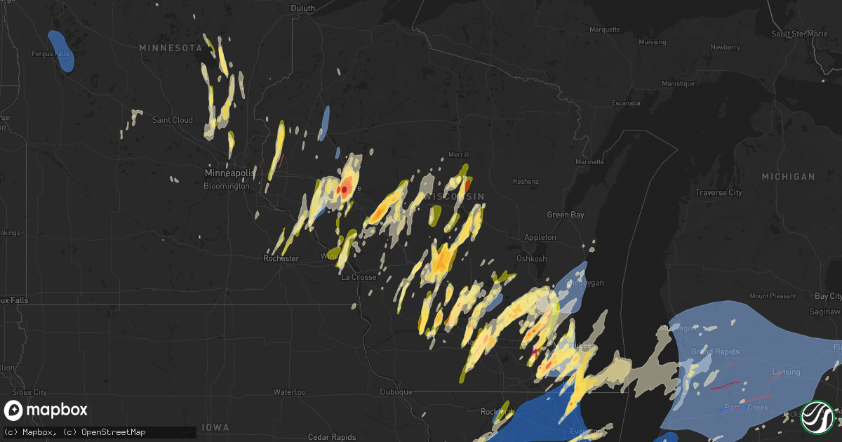
Hail Map in Wisconsin on May 15, 2025
Get this storm
May 15 map
$229
one time, instant access
Download today. No call, no setup
Keep the $229
Bought the map and want the full workflow? Apply the entire $229 to a subscription within 7 days. None of it is wasted.
Every map, not just this one
This buys you this map. Subscription and you get every map we run, in the markets you choose from a few cities to whole states to nationwide. Plus real-time alerts the moment a storm fires.
Contact data
Name, contact info, occupancy, even credit band for addresses in the footprint. You go from where it hit to who to call.
Become the source they trust
Unlimited branding weather history reports on demand. You already have the documented answer ready for the property owner, and you are the one who showed up with it.
Property data and RoofTrace estimates
Pull up any address you have got, its value and the exact code rules for that jurisdiction, straight from One Click Code. Then RoofTrace estimates the squares, pitch, and roof value, priced the way you price.
Storm reports in Wisconsin
Wisconsin
| Date | Description |
|---|---|
| 05/15/20256:58 PM CDT | Report from mping: half dollar |
| 05/15/20256:54 PM CDT | Report from mping: quarter |
| 05/15/20256:54 PM CDT | Multiple calls for wires down and some tree damage. No significant damage. |
| 05/15/20256:53 PM CDT | Picture of 2 inch hail. |
| 05/15/20256:51 PM CDT | Report from mping: quarter |
| 05/15/20256:50 PM CDT | Half dollar size hail on the south side of town. |
| 05/15/20256:50 PM CDT | A local report indicates 1.50 inch wind near 2 WSW Amherst Junction |
| 05/15/20256:49 PM CDT | 2 trees down near highway 51. |
| 05/15/20256:47 PM CDT | A local report indicates 1.75 inch wind near 2 NE Pleasant Prairie |
| 05/15/20256:45 PM CDT | Report from mping: quarter |
| 05/15/20256:45 PM CDT | A local report indicates 1.00 inch wind near 1 SW Wausau |
| 05/15/20256:42 PM CDT | Report from mping: quarter |
| 05/15/20256:42 PM CDT | Largest measured. |
| 05/15/20256:41 PM CDT | Report from mping: quarter |
| 05/15/20256:40 PM CDT | Report from mping: ping pong ball |
| 05/15/20256:38 PM CDT | Report from mping: quarter |
| 05/15/20256:36 PM CDT | A local report indicates 1.00 inch wind near 1 N Muskego |
| 05/15/20256:27 PM CDT | Report from mping: half dollar |
| 05/15/20256:26 PM CDT | Report from mping: hen egg |
| 05/15/20256:24 PM CDT | A local report indicates 1.25 inch wind near 2 SE Hartford |
| 05/15/20256:23 PM CDT | Report from mping: quarter |
| 05/15/20256:22 PM CDT | Report from mping: half dollar |
| 05/15/20256:21 PM CDT | Strong winds caused roof damage. |
| 05/15/20256:21 PM CDT | Report from mping: quarter |
| 05/15/20256:21 PM CDT | Re |
| 05/15/20256:20 PM CDT | A local report indicates 1.25 inch wind near 2 E Evergreen |
| 05/15/20256:19 PM CDT | Report from mping: quarter |
| 05/15/20256:15 PM CDT | Hail ranging from over 0.5 inch diameter to larger than 2 inch diameter at times... Lasted approximately 20 minutes. Wind was generally from the west and south... With |
| 05/15/20256:15 PM CDT | A local report indicates 1.00 inch wind near 4 NE Green Lake |
| 05/15/20256:15 PM CDT | Report from mping: quarter |
| 05/15/20256:15 PM CDT | A local report indicates 1.00 inch wind near 6 S Waupun |
| 05/15/20256:15 PM CDT | Hail ranging from over 0.5 947 corrects location on previous report from broadwell. |
| 05/15/20256:15 PM CDT | Report from mping: quarter |
| 05/15/20256:14 PM CDT | Report from mping: tennis ball |
| 05/15/20256:14 PM CDT | Reported by jefferson county sheriff near co hwy p. |
| 05/15/20256:13 PM CDT | Tennis-baseball sized hail causing significant damage to vehicles in far western waterford near walworth county border. |
| 05/15/20256:12 PM CDT | Report from mping: half dollar |
| 05/15/20256:10 PM CDT | House siding and roof damage. Reported via x. Fox rd and helena rd. Time estimated from radar. |
| 05/15/20256:10 PM CDT | Reported golf ball size hail reported from trained. |
| 05/15/20256:10 PM CDT | Report with photo of top half of large spruce tree snapped and down onto the large branch of a nearby tree... All landing near a house. Time estimated. |
| 05/15/20256:09 PM CDT | Report from mping: quarter |
| 05/15/20256:08 PM CDT | Report from mping: quarter |
| 05/15/20256:08 PM CDT | A local report indicates 2.00 inch wind near East Troy |
| 05/15/20256:06 PM CDT | A local report indicates 1.50 inch wind near 4 NNW Bancroft |
| 05/15/20256:06 PM CDT | A local report indicates 1.00 inch wind near East Troy |
| 05/15/20256:05 PM CDT | A local report indicates 1.25 inch wind near Mukwonago |
| 05/15/20256:05 PM CDT | A local report indicates 1.25 inch wind near Mukwonago |
| 05/15/20256:04 PM CDT | A local report indicates 1.25 inch wind near 3 NE Green Lake |
| 05/15/20256:03 PM CDT | Report from mping: half dollar |
| 05/15/20256:01 PM CDT | Turning north onto county hwy j... From hwy 54... I noticed a large funnel cloud with a small column reaching towards the ground. |
| 05/15/20256:01 PM CDT | Report of debris along clark street near mayville high school. |
| 05/15/20256:01 PM CDT | Numerous reports of tree and outbuilding damage in downtown mayville. Time estimated from radar. |
| 05/15/20256:00 PM CDT | A local report indicates 1.50 inch wind near 4 S East Troy |
| 05/15/20256:00 PM CDT | Shredded leaves off of trees... Did not accumulate much. |
| 05/15/20255:57 PM CDT | Brief tornado reported from public via law enforcement. |
| 05/15/20255:55 PM CDT | Raws site measured on hourly observation. Time estimated from radar. Sensor at 6.1 meters. Sse wind direction. |
| 05/15/20255:53 PM CDT | Dodge co sheriff reported roof off house on west hillcrest rd. |
| 05/15/20255:53 PM CDT | Report from mping: quarter |
| 05/15/20255:52 PM CDT | A local report indicates 1.00 inch wind near 3 SSE Hubertus |
| 05/15/20255:51 PM CDT | Report from mping: quarter |
| 05/15/20255:50 PM CDT | Numerous 4 to 12 inch limbs down and power lines down in minnesota junction. Time estimated from radar. |
| 05/15/20255:45 PM CDT | Report from mping: half dollar |
| 05/15/20255:40 PM CDT | A local report indicates 1.00 inch wind near 3 S Richfield |
| 05/15/20255:40 PM CDT | Strong winds and rain... 2 balsam trees down. |
| 05/15/20255:38 PM CDT | A local report indicates 1.50 inch wind near 1 SE Beaver Dam |
| 05/15/20255:38 PM CDT | Wind instrument 90 feet above ground and above the tree tops. |
| 05/15/20255:37 PM CDT | A local report indicates 1.00 inch wind near 3 NW Reeseville |
| 05/15/20255:37 PM CDT | Report from mping: ping pong ball |
| 05/15/20255:35 PM CDT | Quarter size hail covering the ground. |
| 05/15/20255:33 PM CDT | Multiple uprooted trees. Time estimated from radar. |
| 05/15/20255:31 PM CDT | A local report indicates 1.00 inch wind near 1 NW Nashotah |
| 05/15/20255:30 PM CDT | Tree fell on cabin roof... Twisting and breaking antenna. Time estimated. |
| 05/15/20255:30 PM CDT | One tree down... Light outside furniture and tools tossed around. Wind shredded apart a tarp garage. Time estimated by spotter. |
| 05/15/20255:27 PM CDT | Report from mping: quarter . Inch diameter to larger than 2 inch diameter at times... Lasted approximately 20 minutes. Wind was generally from t |
| 05/15/20255:27 PM CDT | Report from mping: quarter |
| 05/15/20255:25 PM CDT | Hail ranged from quarter to half dollar size. |
| 05/15/20255:25 PM CDT | A local report indicates 1.00 inch wind near 1 W Dousman |
| 05/15/20255:21 PM CDT | This tornado developed in fields west of unity before tracking northeast toward colby. As it moved through rural areas of northeastern clark county... It damaged multip |
| 05/15/20255:18 PM CDT | Relayed via x with photo. |
| 05/15/20255:07 PM CDT | Delayed report... Time estimated from radar. Several twisted and moved docks and downed trees near the dairyland reservoir. |
| 05/15/20255:05 PM CDT | 6 inch tree down over east bound lane of hwy 70. Road crews are on site removing debris. |
| 05/15/20255:05 PM CDT | Delayed report... Time estimated from radar. Several snapped or leaning power poles along county hwy p. |
| 05/15/20255:05 PM CDT | Delayed report... Time estimated from radar. Significant structural damage to a house with loss of soffits and roof damage causing the home to be moved slightly. Straig |
| 05/15/20255:04 PM CDT | Law enforcement reported a tornado on the ground near loyal... Wi. |
| 05/15/20255:04 PM CDT | Delayed report... Time estimated from radar. Multiple reports of trees down and some structural damage. |
| 05/15/20255:04 PM CDT | Pictures of hail to the size of ping pong balls. |
| 05/15/20255:02 PM CDT | A local report indicates 1.00 inch wind near 3 SE Palmyra |
| 05/15/20254:58 PM CDT | Report from mping: half dollar |
| 05/15/20254:58 PM CDT | Report from mping: half dollar |
| 05/15/20254:56 PM CDT | Large healthy tree branches snapped off. Some 5-8 inches in diameter. All blown in one direction from south to north. |
| 05/15/20254:55 PM CDT | This tornado developed in rural areas of clark county... Wi between christie and loyal. As the tornado moved northeast... It damaged multiple trees and removed a portio |
| 05/15/20254:55 PM CDT | Relayed via x with photo. |
| 05/15/20254:55 PM CDT | A few trees knocked down from sudden winds. Lawn furniture tossed and damaged. |
| 05/15/20254:51 PM CDT | Relayed via x with photo of hail stone next to a ruler. |
| 05/15/20254:51 PM CDT | A local report indicates 1.75 inch wind near 2 NE Maple Bluff |
| 05/15/20254:50 PM CDT | Report from mping: hen egg+ |
| 05/15/20254:50 PM CDT | Several branches 6 inch diameter broken off trees. Time estimated from radar. |
| 05/15/20254:48 PM CDT | Delayed report... Time estimated from radar. Several downed trees across a broad area west of the holcombe flowage. Estimated wind speeds near 70 mph. |
| 05/15/20254:47 PM CDT | This short-lived tornado snapped the trunks of a few large trees southwest of christie... Wi. The diameter of the largest tree that was snapped was large enough to supp |
| 05/15/20254:45 PM CDT | Report of multiple birch and aspen trees damaged. These trees were approximately 18 inches in diameter with some uprooted and other snapped. Spotter estimated time of d |
| 05/15/20254:45 PM CDT | Photo sent in via social media showing several trees snapped near the trunk or uprooted. Time of report estimated from radar. |
| 05/15/20254:42 PM CDT | Report from mping: half dollar |
| 05/15/20254:40 PM CDT | Near the town of seif - size estimated. Via social media. |
| 05/15/20254:40 PM CDT | Report from mping: quarter |
| 05/15/20254:40 PM CDT | Delayed report... Time estimated from radar. Downed trees partially blocking the road. |
| 05/15/20254:39 PM CDT | Delayed report... Time estimated from radar. Trees down. |
| 05/15/20254:39 PM CDT | A local report indicates 1.00 inch wind near 1 NNE Camp Douglas |
| 05/15/20254:38 PM CDT | Numerous trees down... Power out for 4 hours. |
| 05/15/20254:38 PM CDT | 4 trees down. One large poplar uprooted... One snapped at the base... One snapped midway to the top... And one medium maple. Neighbors had a medium white pine snap 4-6 |
| 05/15/20254:36 PM CDT | A local report indicates 1.00 inch wind near Sun Prairie |
| 05/15/20254:36 PM CDT | A local report indicates 1.00 inch wind near Portage |
| 05/15/20254:35 PM CDT | A local report indicates 1.75 inch wind near 7 NE Baraboo |
| 05/15/20254:34 PM CDT | A local report indicates 1.50 inch wind near 6 SE Lake Delton |
| 05/15/20254:34 PM CDT | A local report indicates 1.50 inch wind near Camp Douglas |
| 05/15/20254:32 PM CDT | Via social media. |
| 05/15/20254:32 PM CDT | A local report indicates 1.00 inch wind near Camp Douglas |
| 05/15/20254:31 PM CDT | Delayed report... Time estimated from radar. Downed powerline. |
| 05/15/20254:31 PM CDT | Several trees down on road. Power lines down. |
| 05/15/20254:30 PM CDT | Several trees on roadway. |
| 05/15/20254:30 PM CDT | A local report indicates 1.00 inch wind near 3 SSW Plainville |
| 05/15/20254:28 PM CDT | A local report indicates 1.75 inch wind near 3 W Cottage Grove |
| 05/15/20254:28 PM CDT | Tree blocking 18th street near 22 1/2 ave. |
| 05/15/20254:28 PM CDT | A local report indicates 1.75 inch wind near 3 W Cottage Grove |
| 05/15/20254:27 PM CDT | Delayed report... Time estimated from radar. Half dozen tall pines snapped. Other tree damage on neighboring property. |
| 05/15/20254:27 PM CDT | 8 inch diameter tree branch downed across a lane of hwy wi 70. Time estimated from radar. |
| 05/15/20254:26 PM CDT | A local report indicates 1.25 inch wind near Arkdale |
| 05/15/20254:26 PM CDT | A local report indicates 1.00 inch wind near Elroy |
| 05/15/20254:25 PM CDT | Image via social media. |
| 05/15/20254:25 PM CDT | A local report indicates 1.75 inch wind near 1 WNW Arkdale |
| 05/15/20254:25 PM CDT | Report from mping: golf ball |
| 05/15/20254:25 PM CDT | Only viewable damage right now is to tree canopy. |
| 05/15/20254:25 PM CDT | Damage to siding of a house. Time estimated from radar. |
| 05/15/20254:24 PM CDT | A local report indicates 1.00 inch wind near Elroy |
| 05/15/20254:23 PM CDT | Report from mping: hen egg |
| 05/15/20254:22 PM CDT | Tree down blocking a lane on us-53. Hail up to nickel size. Wind speed measured with car anemometer of 65-75mph gusts. |
| 05/15/20254:21 PM CDT | Report from mping: quarter |
| 05/15/20254:21 PM CDT | A local report indicates 1.00 inch wind near Mcfarland |
| 05/15/20254:20 PM CDT | A local report indicates 1.50 inch wind near Monona |
| 05/15/20254:20 PM CDT | Report from mping: quarter |
| 05/15/20254:20 PM CDT | Report from mping: quarter |
| 05/15/20254:20 PM CDT | A local report indicates 2.25 inch wind near 3 NNW Altoona |
| 05/15/20254:20 PM CDT | A local report indicates 1.50 inch wind near 3 W Middleton |
| 05/15/20254:20 PM CDT | Report from mping: half dollar |
| 05/15/20254:19 PM CDT | Delayed report... Time estimated from radar. Trees down in town. |
| 05/15/20254:19 PM CDT | 3 inch diameter hail measured at the weau studios. |
| 05/15/20254:18 PM CDT | Corrects previous hail report from 3 ssw altoona. Corrects previous hail report from 3 ssw altoona. Measured at the wqow studios. |
| 05/15/20254:18 PM CDT | Image via social media. |
| 05/15/20254:18 PM CDT | A local report indicates 1.75 inch wind near 1 E Adams |
| 05/15/20254:18 PM CDT | Report from mping: baseball |
| 05/15/20254:18 PM CDT | A local report indicates 1.00 inch wind near 3 W Middleton |
| 05/15/20254:18 PM CDT | Email with picture. |
| 05/15/20254:17 PM CDT | A local report indicates 1.00 inch wind near Alma Center |
| 05/15/20254:16 PM CDT | Report from mping: half dollar |
| 05/15/20254:16 PM CDT | Damage to siding reported as well. |
| 05/15/20254:16 PM CDT | Report from mping: golf ball |
| 05/15/20254:15 PM CDT | A local report indicates 2.50 inch wind near 1 W Altoona |
| 05/15/20254:15 PM CDT | Relayed with photo by wqow. |
| 05/15/20254:15 PM CDT | A local report indicates 1.00 inch wind near Sparta |
| 05/15/20254:15 PM CDT | Relayed with photo from wqow. |
| 05/15/20254:14 PM CDT | Report from mping: golf ball . |
| 05/15/20254:14 PM CDT | Report from mping: golf ball |
| 05/15/20254:12 PM CDT | Report from mping: ping pong ball |
| 05/15/20254:12 PM CDT | A local report indicates 1.25 inch wind near 1 S Madison |
| 05/15/20254:12 PM CDT | A local report indicates 2.00 inch wind near 5 S Altoona |
| 05/15/20254:11 PM CDT | Picture sent via nwschat. |
| 05/15/20254:10 PM CDT | Via social media. |
| 05/15/20254:09 PM CDT | Measured at the wqow studios. |
| 05/15/20254:09 PM CDT | Delayed report... Time estimated from radar. Tree down. |
| 05/15/20254:08 PM CDT | Report from mping: quarter |
| 05/15/20254:08 PM CDT | Report from mping: hen egg |
| 05/15/20254:08 PM CDT | Report from mping: ping pong ball |
| 05/15/20254:08 PM CDT | Picture via social media. |
| 05/15/20254:08 PM CDT | Report from mping: ping pong ball |
| 05/15/20254:08 PM CDT | Report from mping: golf ball |
| 05/15/20254:08 PM CDT | Report from mping: ping pong ball |
| 05/15/20254:08 PM CDT | A local report indicates 1.50 inch wind near 1 W Oregon |
| 05/15/20254:07 PM CDT | Report from mping: ping pong ball |
| 05/15/20254:06 PM CDT | A local report indicates 1.50 inch wind near Fitchburg |
| 05/15/20254:06 PM CDT | Report from mping: quarter |
| 05/15/20254:05 PM CDT | Delayed report... Time estimated from radar. Tree down. |
| 05/15/20254:05 PM CDT | A local report indicates 1.00 inch wind near 2 SSW Altoona |
| 05/15/20254:04 PM CDT | Delayed report... Time estimated from radar. Tree down. |
| 05/15/20254:03 PM CDT | Report from mping: ping pong ball |
| 05/15/20254:02 PM CDT | Relayed by wisc-tv. Photo of large hail stone next to a hen egg. Time estimated from radar. |
| 05/15/20254:01 PM CDT | Via social media. |
| 05/15/20254:00 PM CDT | Possible tornado. Narrow swath of tree damage reported on their and neighboring properties. |
| 05/15/20253:58 PM CDT | Report from mping: quarter |
| 05/15/20253:50 PM CDT | Delayed report... Time estimated from radar. Tree down. |
| 05/15/20253:50 PM CDT | Picture via social media. |
| 05/15/20253:45 PM CDT | Public report via facebook photo. Time estimated via radar. |
| 05/15/20253:43 PM CDT | Photo via nws chat. |
| 05/15/20253:42 PM CDT | A local report indicates 1.00 inch wind near 1 NE Monroe |
| 05/15/20253:40 PM CDT | Delayed report... Time estimated from radar. Part of a roof blown off a shed. |
| 05/15/20253:35 PM CDT | Picture via social media. |
| 05/15/20253:34 PM CDT | Sent photo of ongoing tornado. |
| 05/15/20253:30 PM CDT | Tornado on the ground 4-5 miles north of house moving nne. |
| 05/15/20253:30 PM CDT | Deputy reported a tornado on the ground north of roberts along 110th. |
| 05/15/20253:28 PM CDT | A local report indicates 1.00 inch wind near Ithaca |
| 05/15/20253:25 PM CDT | A local report indicates 1.00 inch wind near 1 NW Spring Green |
| 05/15/20253:24 PM CDT | County road b and post hollow ln. |
| 05/15/20253:18 PM CDT | A local report indicates 1.00 inch wind near Arcadia |
| 05/15/20253:18 PM CDT | A local report indicates 1.00 inch wind near Arcadia |
| 05/15/20253:16 PM CDT | A local report indicates 1.00 inch wind near Centerville |
| 05/15/20253:13 PM CDT | Report relayed from broadcast media. Time estimated from radar. |
| 05/15/20253:07 PM CDT | Via social media. |
| 05/15/20253:05 PM CDT | Delayed report... Time estimated from radar. Tree down. |
| 05/15/20253:02 PM CDT | A local report indicates 1.00 inch wind near Nelson |
| 05/15/20253:01 PM CDT | A local report indicates 1.00 inch wind near 1 W Trempealeau |
| 05/15/20253:00 PM CDT | Delayed report... Time estimated from radar. Multiple trees down. |
| 05/15/20252:57 PM CDT | Picture via social media. |
| 05/14/20257:20 PM CDT | Report from mping: quarter |
| 05/14/20257:11 PM CDT | Southwest wind sustained at 46 mph. |
| 05/14/20257:05 PM CDT | Last asos observation before power went out for contract observer at general mitchell international airport. |
| 05/14/20257:05 PM CDT | Report from mping: golf ball |
| 05/14/20257:04 PM CDT | Grain bins damaged... Semi trailer rolled over. |
| 05/14/20257:03 PM CDT | Batten international airport in racine. |
| 05/14/20257:01 PM CDT | Report from mping: quarter |
| 05/14/20257:01 PM CDT | Report from mping: quarter |
| 05/14/20257:01 PM CDT | A local report indicates 1.00 inch wind near 1 S South Milwaukee |
| 05/14/20257:00 PM CDT | Power lines down... Uprooted and snapped trees. Hail damage to siding. |
| 05/14/20257:00 PM CDT | Trained storm spotter reported multiple trees down and broken branches up to 12 inches in diameter. Time estimated by radar. |
| 05/14/20257:00 PM CDT | Downtown racine. |
| 05/14/20257:00 PM CDT | Report from mping: half dollar |
| 05/14/20257:00 PM CDT | Trees down in the cascade area. |
| 05/14/20257:00 PM CDT | Several large trees damaged and another tree down on wires in the town of wheatland. Shed... Barn and playset damaged one mile north. Time estimated from radar. |
| 05/14/20257:00 PM CDT | 2 power poles down in paris. Time estimated from radar. Reports of individual trees down scattered across kenosha county. |
All States Impacted by Hail Map on May 15, 2025
Cities Impacted by Hail Map on May 15, 2025
- Broken Bow, OK
- Silver Lake, MN
- Lester Prairie, MN
- Glencoe, MN
- Watson, OK
- Cove, AR
- Wickes, AR
- Lake Crystal, MN
- Vandervoort, AR
- Mena, AR
- Elk River, MN
- Big Lake, MN
- Zimmerman, MN
- Princeton, MN
- Anoka, MN
- Saint Francis, MN
- Cambridge, MN
- Isanti, MN
- Stanchfield, MN
- Dalbo, MN
- Ogilvie, MN
- Braham, MN
- Mora, MN
- Grasston, MN
- Brook Park, MN
- Howe, OK
- Poteau, OK
- Cleveland, MN
- Elysian, MN
- Hackett, AR
- Heavener, OK
- Midland, AR
- Mansfield, AR
- Huntington, AR
- Hartford, AR
- Magazine, AR
- Paris, AR
- Subiaco, AR
- Brockwell, AR
- Delaware, AR
- London, AR
- Knoxville, AR
- Hagarville, AR
- Deer, AR
- New Blaine, AR
- Russellville, AR
- Dover, AR
- Witts Springs, AR
- Marshall, AR
- Wiseman, AR
- Horseshoe Bend, AR
- Ash Flat, AR
- Violet Hill, AR
- Lamar, AR
- Scranton, AR
- Mount Judea, AR
- Franklin, AR
- Pelsor, AR
- Cherokee Village, AR
- Hardy, AR
- Sage, AR
- Evening Shade, AR
- Jerusalem, AR
- Hector, AR
- Scotland, AR
- Clinton, AR
- Leslie, AR
- Ravenden Springs, AR
- Ravenden, AR
- Harriet, AR
- Big Flat, AR
- Timbo, AR
- Onia, AR
- Dennard, AR
- Pocahontas, AR
- Williford, AR
- Oronoco, MN
- Rochester, MN
- Zumbro Falls, MN
- Mazeppa, MN
- Maynard, AR
- Long Lake, MN
- Hamel, MN
- Doniphan, MO
- Byron, MN
- Fox, AR
- Shirley, AR
- New London, MN
- Belgrade, MN
- Mountain View, AR
- Melbourne, AR
- Fifty Six, AR
- Warm Springs, AR
- Cannon Falls, MN
- Elgin, MN
- Imboden, AR
- Pollocksville, NC
- Pine Island, MN
- Marcella, AR
- Batesville, AR
- Edgemont, AR
- South Saint Paul, MN
- Inver Grove Heights, MN
- Locust Grove, AR
- Welch, MN
- Minneapolis, MN
- Mount Pleasant, AR
- Guion, AR
- Millville, MN
- Andover, MN
- Nelson, WI
- Cedar, MN
- Bethel, MN
- New Bern, NC
- Paynesville, MN
- Melrose, MN
- Houston, MN
- Wabasha, MN
- Stillwater, MN
- Onamia, MN
- Cottage Grove, MN
- Saint Paul, MN
- Winona, MN
- Trempealeau, WI
- Galesville, WI
- Arcadia, WI
- Fountain City, WI
- Dodge, WI
- Durand, WI
- Freeport, MN
- Selma, NC
- Kenly, NC
- Alma, WI
- Lake City, MN
- Wyoming, MN
- Pepin, WI
- Kellogg, MN
- Stockholm, WI
- Dakota, MN
- Albany, MN
- Lake Elmo, MN
- Prescott, WI
- River Falls, WI
- Hastings, MN
- Arkansaw, WI
- Plum City, WI
- Avoca, WI
- Highland, WI
- Eau Galle, WI
- Menomonie, WI
- Ettrick, WI
- Independence, WI
- Blair, WI
- Bock, MN
- Milaca, MN
- Isle, MN
- Spring Green, WI
- Lone Rock, WI
- Lansing, IA
- Waukon, IA
- Pine City, MN
- Hudson, WI
- Roberts, WI
- New Richmond, WI
- Reads Landing, MN
- Elmwood, WI
- Hillpoint, WI
- Plain, WI
- Cazenovia, WI
- La Valle, WI
- Reedsburg, WI
- Deer Park, WI
- Sauk City, WI
- Amery, WI
- Star Prairie, WI
- Dodgeville, WI
- McGrath, MN
- Richland Center, WI
- Mondovi, WI
- Cochrane, WI
- New Albin, IA
- Aitkin, MN
- Bee Branch, AR
- Holmen, WI
- Eleva, WI
- Eau Claire, WI
- Whitehall, WI
- Wonewoc, WI
- North Freedom, WI
- Loganville, WI
- Rock Springs, WI
- Dalton, MN
- Ashby, MN
- Fergus Falls, MN
- Underwood, MN
- Battle Lake, MN
- Erhard, MN
- Pelican Rapids, MN
- Dent, MN
- Evansville, MN
- Brooklyn, WI
- Oregon, WI
- Mazomanie, WI
- Bemidji, MN
- Quitman, AR
- Heber Springs, AR
- Damascus, AR
- Elk Mound, WI
- Pikeville, NC
- Fremont, NC
- Dresser, WI
- Osceola, WI
- Hinckley, MN
- Eitzen, MN
- Balsam Lake, WI
- Saint Croix Falls, WI
- Hillsboro, WI
- Viola, WI
- Lucama, NC
- Belleville, WI
- Monticello, WI
- Albany, WI
- Mauston, WI
- Verona, WI
- Madison, WI
- Ferrum, VA
- Rocky Mount, VA
- Henry, VA
- Stoughton, WI
- Mcfarland, WI
- Milltown, WI
- Centuria, WI
- Fall Creek, WI
- Friendship, WI
- Mcgregor, MN
- Floral, AR
- Lowland, NC
- Hobucken, NC
- Turtle Lake, WI
- Manns Harbor, NC
- Prairie Du Sac, WI
- New Lisbon, WI
- Adams, WI
- Strum, WI
- Altoona, WI
- Wilburn, AR
- Tumbling Shoals, AR
- Drasco, AR
- Lime Ridge, WI
- Sulphur Rock, AR
- Sparta, WI
- Rockland, WI
- Cushing, WI
- Viroqua, WI
- Chaseburg, WI
- Baraboo, WI
- Charlotte, AR
- Hixton, WI
- Alma Center, WI
- Taylor, WI
- Black River Falls, WI
- Merrimac, WI
- Clayton, WI
- Clear Lake, WI
- Ontario, WI
- Wheeler, WI
- Ridgeland, WI
- Kendall, WI
- La Farge, WI
- Rose Bud, AR
- Manteo, NC
- Nags Head, NC
- Colfax, WI
- Cottage Grove, WI
- Chippewa Falls, WI
- Cross Plains, WI
- Middleton, WI
- Waunakee, WI
- Dane, WI
- Deforest, WI
- Lodi, WI
- Barron, WI
- Dallas, WI
- Elroy, WI
- Rocky Mount, NC
- Oil Trough, AR
- Wilton, WI
- Finlayson, MN
- Comstock, WI
- Fairchild, WI
- Humbird, WI
- Merrillan, WI
- Necedah, WI
- Arkdale, WI
- Cashton, WI
- Warrens, WI
- Pleasant Plains, AR
- Rosie, AR
- Tomah, WI
- Camp Douglas, WI
- Windsor, WI
- Cord, AR
- Tuckerman, AR
- Newark, AR
- Bradford, AR
- Thida, AR
- Magness, AR
- Newport, AR
- Pangburn, AR
- Westby, WI
- Havelock, NC
- Almena, WI
- Bloomer, WI
- Poynette, WI
- Osseo, WI
- Sun Prairie, WI
- Cameron, WI
- Chetek, WI
- Rice Lake, WI
- Willard, WI
- Arlington, WI
- Jim Falls, WI
- Hayward, WI
- Davis Junction, IL
- Stillman Valley, IL
- Valliant, OK
- Tarboro, NC
- Macclesfield, NC
- Lyndon Station, WI
- Wisconsin Dells, WI
- Portage, WI
- Norwalk, WI
- Lewiston Woodville, NC
- Nekoosa, WI
- Barneveld, WI
- Neillsville, WI
- Pardeeville, WI
- Wanchese, NC
- Swifton, AR
- Wright City, OK
- Cadott, WI
- Cornell, WI
- Rio, WI
- Savanna, IL
- Cash, AR
- Endeavor, WI
- Montello, WI
- Greenwood, WI
- Chili, WI
- Marshfield, WI
- Granton, WI
- Eagle, WI
- Palmyra, WI
- East Troy, WI
- Pittsville, WI
- Elizabeth, IL
- Hanover, IL
- Windsor, NC
- Elkhorn, WI
- Whitewater, WI
- Deerfield, WI
- Columbia, NC
- Rockford, IL
- Monroe Center, IL
- Oneida, IL
- Columbus, WI
- Albany, IL
- Minong, WI
- Marshall, WI
- Hancock, WI
- Wyocena, WI
- Cambria, WI
- Altona, IL
- Woodhull, IL
- Galva, IL
- Bishop Hill, IL
- Cambridge, IL
- Kewanee, IL
- Backus, MN
- Waterloo, WI
- Bethel, NC
- Greenville, NC
- Harrisonburg, VA
- Erie, IL
- Fenton, IL
- Holcombe, WI
- Fulton, IL
- Morrison, IL
- Wisconsin Rapids, WI
- Oak City, NC
- Cordova, IL
- Aulander, NC
- Robersonville, NC
- Stumpy Point, NC
- Weiner, AR
- Hillsdale, IL
- Hobgood, NC
- Loyal, WI
- Owen, WI
- Hamilton, NC
- Markesan, WI
- Dalton, WI
- Cherry Valley, IL
- Poplar Grove, IL
- Belvidere, IL
- Loves Park, IL
- Caledonia, IL
- Fall River, WI
- Doylestown, WI
- Bancroft, WI
- Plainfield, WI
- Randolph, WI
- Atkinson, IL
- Annawan, IL
- Friesland, WI
- Prophetstown, IL
- Tampico, IL
- Mineral, IL
- Dousman, WI
- Oconomowoc, WI
- Williamston, NC
- Waukesha, WI
- Wales, WI
- Stokes, NC
- Delafield, WI
- Hartland, WI
- Elkton, VA
- Colby, WI
- Dayton, VA
- Broadway, VA
- Rudolph, WI
- Reeseville, WI
- Capron, IL
- Beaver Dam, WI
- Port Edwards, WI
- Nashotah, WI
- Pewaukee, WI
- Hartford, WI
- Colgate, WI
- Lowell, WI
- Watertown, WI
- Juneau, WI
- Briggsville, WI
- Unity, WI
- Spencer, WI
- Stratford, WI
- Wahkon, MN
- Sheffield, IL
- Port Republic, VA
- McGaheysville, VA
- Penn Laird, VA
- Arpin, WI
- Vesper, WI
- Abbotsford, WI
- Dorchester, WI
- Athens, WI
- Edgar, WI
- Babcock, WI
- Curtiss, WI
- Stevens Point, WI
- Sussex, WI
- Oxford, WI
- Deer Grove, IL
- Harmon, IL
- Rock Falls, IL
- Dixon, IL
- Keezletown, VA
- Monroe, WI
- Hubertus, WI
- North Prairie, WI
- Washington, NC
- Richfield, WI
- Slinger, WI
- Colerain, NC
- Burnett, WI
- Junction City, WI
- Creswell, NC
- Kingston, WI
- Merry Hill, NC
- Ahoskie, NC
- Helenville, WI
- Lake Geneva, WI
- Edenton, NC
- Horicon, WI
- Sterling, IL
- Plover, WI
- Burlington, WI
- Mukwonago, WI
- Crozet, VA
- Free Union, VA
- Waterford, WI
- Big Bend, WI
- Allenton, WI
- West Bend, WI
- Kewaskum, WI
- Sullivan, WI
- Princeton, IL
- Ohio, IL
- Ixonia, WI
- Oregon, IL
- Franklin Grove, IL
- Alexander, IL
- Mayville, WI
- Lebanon, WI
- Iron Ridge, WI
- Theresa, WI
- Rubicon, WI
- Ashippun, WI
- Neosho, WI
- Mosinee, WI
- Neshkoro, WI
- Springfield, WI
- Ashton, IL
- Chana, IL
- Grottoes, VA
- Chocowinity, NC
- Lomira, WI
- Brownsville, WI
- Pleasant Plains, IL
- Petersburg, IL
- Tallula, IL
- Athens, IL
- Blounts Creek, NC
- Franklin, IL
- Jacksonville, IL
- New Berlin, IL
- Waverly, IL
- Springfield, IL
- Greenview, IL
- Campbellsport, WI
- Fond Du Lac, WI
- Eden, WI
- Dalzell, IL
- Lowpoint, IL
- Tremont, IL
- Morton, IL
- Lacon, IL
- Magnolia, IL
- Peru, IL
- Groveland, IL
- East Peoria, IL
- Washburn, IL
- Pekin, IL
- San Jose, IL
- Delavan, IL
- Spring Valley, IL
- Metamora, IL
- Washington, IL
- Mason City, IL
- McNabb, IL
- Mendota, IL
- Green Valley, IL
- Granville, IL
- Varna, IL
- New Holland, IL
- Middletown, IL
- Kirkland, IL
- Holcomb, IL
- Rochelle, IL
- Wautoma, WI
- Ashland, IL
- Schofield, WI
- Rothschild, WI
- Barrington, IL
- Lake Zurich, IL
- Palatine, IL
- Muskego, WI
- Coloma, WI
- Brandon, WI
- Ripon, WI
- Manlius, IL
- Walnut, IL
- Milwaukee, WI
- Greendale, WI
- La Moille, IL
- Oakfield, WI
- Hustisford, WI
- Ringle, WI
- Hanna City, IL
- Glasford, IL
- Mapleton, IL
- Peoria, IL
- Peoria Heights, IL
- Princeton, WI
- Elkhart, IL
- Green Lake, WI
- Cantrall, IL
- Sherman, IL
- Franksville, WI
- Clare, IL
- Malta, IL
- Esmond, IL
- Lindenwood, IL
- Kingston, IL
- Sycamore, IL
- Charlottesville, VA
- Garden Prairie, IL
- Gurnee, IL
- Waukegan, IL
- New Berlin, WI
- Franklin, WI
- Hales Corners, WI
- Zion, IL
- Wadsworth, IL
- Pleasant Prairie, WI
- Salem, WI
- Menomonee Falls, WI
- Antioch, IL
- Lincoln, IL
- Wausau, WI
- Marathon, WI
- Union Grove, WI
- Mequon, WI
- Amherst, WI
- Almond, WI
- Lake Bluff, IL
- Vernon Hills, IL
- Libertyville, IL
- North Chicago, IL
- Mundelein, IL
- Kansasville, WI
- Custer, WI
- Rosholt, WI
- Germantown, WI
- Wild Rose, WI
- Fairwater, WI
- Lannon, WI
- Kenosha, WI
- Jackson, WI
- Grafton, WI
- Oak Creek, WI
- Racine, WI
- Winthrop Harbor, IL
- Sturtevant, WI
- Caledonia, WI
- Atlanta, IL
- Lawndale, IL
- Edward, NC
- Amherst Junction, WI
- Armington, IL
- McLean, IL
- Stanford, IL
- Shirley, IL
- Bloomington, IL
- Normal, IL
- Williamsville, IL
- Butler, WI
- Brookfield, WI
- Random Lake, WI
- Adell, WI
- Shiloh, NC
- Shawboro, NC
- Hartsburg, IL
- Waldo, WI
- Saint Cloud, WI
- Glenbeulah, WI
- Paw Paw, IL
- Twin Lakes, WI
- Genoa City, WI
- Bristol, WI
- La Rose, IL
- Elm Grove, WI
- Emden, IL
- Nelsonville, WI
- Cedarburg, WI
- South Milwaukee, WI
- Towanda, IL
- Lexington, IL
- Hudson, IL
- Saint Francis, WI
- Cudahy, WI
- Aurora, NC
- Aydlett, NC
- Grandy, NC
- Coinjock, NC
- Poplar Branch, NC
- Rochester, WI
- Cedar Grove, WI
- Oostburg, WI
- Plymouth, WI
- Girard, IL
- Palmyra, IL
- Riverton, IL
- Redgranite, WI
- Virden, IL
- Saukville, WI
- Mount Pulaski, IL
- Grantsboro, NC
- Cascade, WI
- Elizabeth City, NC
- Linville, VA
- Shenandoah, VA
- Divernon, IL
- Auburn, IL
- Merrill, WI
- Carlinville, IL
- Dawson, IL
- Buffalo, IL
- Port Washington, WI
- Belgium, WI
- Hinton, VA
- Mchenry, IL
- Iola, WI
- Waynesville, IL
- Fredonia, WI
- Gridley, IL
- Chenoa, IL
- Fairbury, IL
- Lombard, IL
- Glen Ellyn, IL
- Sheboygan Falls, WI
- Latham, IL
- Maroa, IL
- Edinburg, IL
- Rochester, IL
- Pawnee, IL
- Sheboygan, WI
- Cleveland, WI
- Heyworth, IL
- Corolla, NC
- Manitowoc, WI
- Finland, MN
- Illiopolis, IL
- Mount Calvary, WI
- Naperville, IL
- Mechanicsburg, IL
- Kenney, IL
- Chestnut, IL
- Waggoner, IL
- Streator, IL
- Grand Ridge, IL
- Great Lakes, IL
- Odell, IL
- Cornell, IL
- Ringwood, IL
- Farmersville, IL
- Grayslake, IL
- Villa Park, IL
- Elmhurst, IL
- Berkeley, IL
- Addison, IL
- Lake Forest, IL
- Melrose Park, IL
- Chicago, IL
- Franklin Park, IL
- River Grove, IL
- Stone Park, IL
- Schiller Park, IL
- Pontiac, IL
- Saunemin, IL
- Forrest, IL
- Harwood Heights, IL
- Mount Auburn, IL
- Flanagan, IL
- Gardner, IL
- Dwight, IL
- Downs, IL
- Ellsworth, IL
- Two Rivers, WI
- Downers Grove, IL
- Oak Brook, IL
- Kohler, WI
- Elwood, IL
- Lisle, IL
- Blue Mound, IL
- Warrensburg, IL
- Niantic, IL
- Decatur, IL
- Campus, IL
- Reddick, IL
- Buckingham, IL
- Cullom, IL
- Cabery, IL
- Emington, IL
- Kempton, IL
- Herscher, IL
- Braceville, IL
- New Lenox, IL
- Joliet, IL
- Woodridge, IL
- Darien, IL
- Lemont, IL
- Braidwood, IL
- Wilmington, IL
- Willowbrook, IL
- Homer Glen, IL
- Orland Park, IL
- Lockport, IL
- Mokena, IL
- Skokie, IL
- Elmwood Park, IL
- Hillside, IL
- Lincolnwood, IL
- Evanston, IL
- Forsyth, IL
- Oreana, IL
- Bolingbrook, IL
- New Auburn, WI
- Tinley Park, IL
- Palos Heights, IL
- Oak Forest, IL
- Palos Park, IL
- Crestwood, IL
- Midlothian, IL
- Wheaton, IL
- River Forest, IL
- Maywood, IL
- Bellwood, IL
- Oak Park, IL
- Bensenville, IL
- Morton Grove, IL
- Niles, IL
- Park Ridge, IL
- Fulks Run, VA
- Haugen, WI
- Sarona, WI
- Birchwood, WI
- Frankfort, IL
- Monee, IL
- Oak Lawn, IL
- Alsip, IL
- Willow Springs, IL
- La Grange, IL
- Union Hill, IL
- Bonfield, IL
- Manhattan, IL
- Macon, IL
- Boody, IL
- Monticello, IL
- Bridgeview, IL
- Summit Argo, IL
- Burbank, IL
- Justice, IL
- Essex, IL
- Climax, MN
- Singers Glen, VA
- Reynolds, ND
- Grand Forks, ND
- Thompson, ND
- Creve Coeur, IL
- East Grand Forks, MN
- Fisher, MN
- Hometown, IL
- Evergreen Park, IL
- Markham, IL
- Country Club Hills, IL
- Hazel Crest, IL
- Ivesdale, IL
- Sadorus, IL
- Posen, IL
- Blue Island, IL
- Harvey, IL
- Matteson, IL
- Robbins, IL
- Kankakee, IL
- Bradley, IL
- Bourbonnais, IL
- Spring Lake, MI
- Grand Haven, MI
- South Wilmington, IL
- Coal City, IL
- Mazon, IL
- Luck, WI
- Manteno, IL
- Peotone, IL
- Lowell, IN
- Cedar Lake, IN
- Beecher, IL
- University Park, IL
- Saint John, IN
- Crete, IL
- Crown Point, IN
- Dyer, IN
- Grant Park, IL
- Minnesota City, MN
- Holland, MI
- West Olive, MI
- Macatawa, MI
- Muskegon, MI
- Whitehall, MI
- Coopersville, MI
- Ravenna, MI
- Twin Lake, MI
- Nunica, MI
- Fruitport, MI
- Conklin, MI
- Zeeland, MI
- Allendale, MI
- Fennville, MI
- Pullman, MI
- Success, AR
- Hudsonville, MI
- Jenison, MI
- Marne, MI
- Casnovia, MI
- Grand Rapids, MI
- Sparta, MI
- Grant, MI
- Holton, MI
- Newaygo, MI
- Fremont, MI
- Bailey, MI
- Kent City, MI
- Auburndale, WI
- Milladore, WI
- Saugatuck, MI
- Douglas, MI
- South Haven, MI
- Coloma, MI
- Covert, MI
- Saint Joseph, MI
- Benton Harbor, MI
- Hamilton, MI
- Bangor, MI
- Grand Junction, MI
- Watervliet, MI
- Hartford, MI
- Cedar Springs, MI
- Comstock Park, MI
- Howard City, MI
- Sand Lake, MI
- White Cloud, MI
- Port Byron, IL
- Neponset, IL
- Wyanet, IL
- Morley, MI
- Pierson, MI
- Rockford, MI
- Grandville, MI
- Coral, MI
- Belmont, MI
- Trufant, MI
- Byron Center, MI
- Wyoming, MI
- Dorr, MI
- Ada, MI
- Shelbyville, MI
- Wayland, MI
- Lawrence, MI
- Caledonia, MI
- Hopkins, MI
- Allegan, MI
- Bloomingdale, MI
- Gobles, MI
- Otsego, MI
- Mattawan, MI
- Decatur, MI
- Paw Paw, MI
- Dowagiac, MI
- Sodus, MI
- Eau Claire, MI
- Grand Marsh, WI
- Martin, MI
- Plainwell, MI
- Anderson, SC
- Buchanan, MI
- Baroda, MI
- Berrien Springs, MI
- Lakeview, MI
- Stanton, MI
- Six Lakes, MI
- Edmore, MI
- Alto, MI
- Belding, MI
- Greenville, MI
- Lowell, MI
- Middleville, MI
- Sidney, MI
- Gowen, MI
- Sheridan, MI
- Lawton, MI
- Portage, MI
- Kalamazoo, MI
- Delton, MI
- Pendleton, SC
- Richland, MI
- Hastings, MI
- Fenwick, MI
- Saranac, MI
- Orleans, MI
- Freeport, MI
- Camden, NC
- Galesburg, MI
- Battle Creek, MI
- Taylorville, IL
- Stonington, IL
- South Bend, IN
- Granger, IN
- Niles, MI
- Bellevue, MI
- Elwell, MI
- Vestaburg, MI
- Riverdale, MI
- Sumner, MI
- Blanchard, MI
- Saint Louis, MI
- Crystal, MI
- Alma, MI
- Middleton, MI
- Ionia, MI
- Ithaca, MI
- Hubbardston, MI
- Carson City, MI
- Muir, MI
- Sunfield, MI
- Portland, MI
- Lake Odessa, MI
- Pewamo, MI
- Clarksville, MI
- Perrinton, MI
- Lyons, MI
- Fowler, MI
- Westphalia, MI
- Woodland, MI
- Grand Ledge, MI
- Mulliken, MI
- Charlotte, MI
- Vermontville, MI
- Nashville, MI
- Olivet, MI
- Climax, MI
- Hickory Corners, MI
- Ceresco, MI
- Dowling, MI
- Marshall, MI
- Augusta, MI
- Schoolcraft, MI
- Burlington, MI
- Marcellus, MI
- Athens, MI
- East Leroy, MI
- Vicksburg, MI
- Fulton, MI
- Scotts, MI
- Gotham, WI
- Potterville, MI
- Eaton Rapids, MI
- Elkhart, IN
- Jones, MI
- Three Rivers, MI
- Edwardsburg, MI
- Osceola, IN
- Mishawaka, IN
- Lansing, MI
- Union City, MI
- Parma, MI
- Homer, MI
- Concord, MI
- Springport, MI
- Tekonsha, MI
- Albion, MI
- Rives Junction, MI
- Mason, MI
- Leslie, MI
- Dimondale, MI
- Okemos, MI
- Eagle, MI
- East Lansing, MI
- Onondaga, MI
- Holt, MI
- Bath, MI
- Saint Johns, MI
- Laingsburg, MI
- Dewitt, MI
- Haslett, MI
- Pompeii, MI
- Maple Rapids, MI
- Ashley, MI
- Elsie, MI
- North Star, MI
- Mendon, MI
- Centreville, MI
- Cassopolis, MI
- Colon, MI
- Sturgis, MI
- Sherwood, MI
- Leonidas, MI
- Constantine, MI
- White Pigeon, MI
- Bristol, IN
- Goshen, IN
- Vandalia, MI
- Ovid, MI
- Owosso, MI
- Oakley, MI
- Bannister, MI
- Henderson, MI
- Jackson, MI
- Bancroft, MI
- Dansville, MI
- Stockbridge, MI
- Fowlerville, MI
- Webberville, MI
- Williamston, MI
- Perry, MI
- Corunna, MI
- Morrice, MI
- Munith, MI
- Grass Lake, MI
- Pleasant Lake, MI
- Middlebury, IN
- Shipshewana, IN
- Howell, MI
- Fenton, MI
- West Bloomfield, MI
- Southfield, MI
- Linden, MI
- Tovey, IL
- Glenarm, IL
- Bronson, MI
- Burr Oak, MI
- Gregory, MI
- Durand, MI
- Byron, MI
- Swartz Creek, MI
- Grand Blanc, MI
- Flint, MI
- Vernon, MI
- Gaines, MI
- Lennon, MI
- Flushing, MI
- New Lothrop, MI
- Burton, MI
- Chesaning, MI
- Holly, MI
- Davison, MI
- Troy, MI
- Pontiac, MI
- Rochester, MI
- Bloomfield Hills, MI
- Auburn Hills, MI
- Franklin, MI
- Waterford, MI
- Spring Arbor, MI
- Ortonville, MI
- Goodrich, MI
- Oxford, MI
- Atlas, MI
- Metamora, MI
- Lapeer, MI
- Hadley, MI
- Horton, MI
- Utica, MI
- Sterling Heights, MI
- Washington, MI
- Jonesville, MI
- Attica, MI
- Dryden, MI
- Imlay City, MI
- Leonard, MI
- Almont, MI
- Capac, MI
- Yale, MI
- Romeo, MI
- Armada, MI
- Allenton, MI
- Emmett, MI
- Ray, MI
- Casco, MI
- Richmond, MI
- Memphis, MI
- New Haven, MI
- Macomb, MI
- Manchester, MI
- North Street, MI
- Port Huron, MI
- Saint Clair, MI
- Goodells, MI
- Fort Gratiot, MI
- Marysville, MI
- Avoca, MI
- Jeddo, MI
- Columbus, MI
- Smiths Creek, MI
- East China, MI
- Fair Haven, MI
- Marine City, MI
- Ann Arbor, MI
- New Baltimore, MI
- Saline, MI
- Ypsilanti, MI
- Milan, MI
- Willis, MI
- Belleville, MI
- Garden City, MI
- Inkster, MI
- Westland, MI
- Livonia, MI
- Dearborn, MI
- De Tour Village, MI
- Erie, MI
- Madison, OH
- Cairo, IL
- Villa Ridge, IL
- Miller City, IL
- Mounds, IL
- Olmsted, IL
- Kevil, KY
- Grand Chain, IL
- La Center, KY
- Grantsburg, IL
- Karnak, IL
- Metropolis, IL
- Belknap, IL
- Golconda, IL
- Smithland, KY
- Hampton, KY
- Marion, KY
- Cave In Rock, IL
- Elizabethtown, IL
- Sturgis, KY
- Clay, KY
- Morganfield, KY
- Huron, OH
- Sandusky, OH
- West Paducah, KY
- Greenbrier, AR
- East Springfield, PA
- Conneaut, OH
- Albion, PA
- Cranesville, PA
- Girard, PA
- West Springfield, PA
- Lake City, PA
- Fairview, PA
- Erie, PA
- Caneyville, KY
- Owensboro, KY
- Wattsburg, PA
- Edinboro, PA
- McKean, PA
- Black Rock, AR
- North East, PA
- Prim, AR
- Hawesville, KY
- Waterford, PA
- Salem, KY
- Vermilion, OH
- Corry, PA
- Clymer, NY
- Concord, AR
- Vienna, IL
- Union City, PA
- Findley Lake, NY
- Sherman, NY
- Burna, KY
- Hodgenville, KY
- Ullin, IL
- Cypress, IL
- Pulaski, IL
- Rosiclare, IL
- Wakeman, OH
- Berlin Heights, OH
- Columbus, PA
- Panama, NY
- Bear Lake, PA
- Corning, AR
- Biggers, AR
- Cassadaga, NY
- Stockton, NY
- Sinclairville, NY
- Dewittville, NY
- Amherst, OH
- Simpson, IL
- Stonefort, IL
- Eddyville, IL
- Cambridge Springs, PA
- Knobel, AR
- Providence, KY
- Dixon, KY
- Pollard, AR
- Qulin, MO
- Strawberry, AR
- Smithville, AR
- Pittsfield, PA
- Youngsville, PA
- Sugar Grove, PA
- Spring Creek, PA
- Jamestown, PA
- Conneaut Lake, PA
- Hartstown, PA
- Bardstown, KY
- Naylor, MO
- Ashville, NY
- Cherry Creek, NY
- Warren, PA
- Irvine, PA
- Powhatan, AR
- Robards, KY
- Shawneetown, IL
- Clarendon, PA
- Tidioute, PA
- Henderson, KY
- Russell, PA
- Corydon, KY
- Sacramento, KY
- Bremen, KY
- Piggott, AR
- Campbell, MO
- Sebree, KY
- Malden, MO
- Greenville, PA
- Hadley, PA
- Horse Branch, KY
- Meadville, PA
- Richmond, KY
- Tiona, PA
- Calico Rock, AR
- Sikeston, MO
- Rector, AR
- Desha, AR
- Lafe, AR
- Rockport, IN
- Dardanelle, AR
- Danville, AR
- Ola, AR
- Pottsville, AR
- Charleston, MO
- Matthews, MO
- Bertrand, MO
- East Prairie, MO
- Parma, MO
- Lewisport, KY
- Stoneboro, PA
- Sandy Lake, PA
- Clarks Mills, PA
- Kane, PA
- Ludlow, PA
- Sheffield, PA
- Millwood, KY
- Leitchfield, KY
- Clarkton, MO
- Gideon, MO
- Saint Francis, AR
- Lewis Run, PA
- Waco, KY
- Cromwell, KY
- Maceo, KY
- Oxford, AR
- Bernie, MO
- Lilbourn, MO
- New Madrid, MO
- Clarkson, KY
- Morrilton, AR
- Atkins, AR
- Saffell, AR
- Cave City, AR
- Catron, MO
- Big Clifty, KY
- Marston, MO
- Portageville, MO
- Bono, AR
- Elizabethtown, KY
- James City, PA
- Sonora, KY
- Paragould, AR
- Jonesboro, AR
- Grandview, IN
- Alicia, AR
- Hoxie, AR
- Walnut Ridge, AR
- White Mills, KY
- Solgohachia, AR
- Springfield, AR
- Wilcox, PA
- Waverly, KY
- Poplar Bluff, MO
- Neelyville, MO
- Broseley, MO
- Lynn, AR
- Glencoe, AR
- Salem, AR
- Mammoth Spring, AR
- Hattieville, AR
- Fordsville, KY
- Cleveland, AR
- Upton, KY
- Glendale, KY
- Cecilia, KY
- Hickman, KY
- Uniontown, KY
- Dexter, MO
- Dudley, MO
- Bristow, IN
- Tell City, IN
- Essex, MO
- Johnsonburg, PA
- Marmaduke, AR
- Campbellsville, KY
- Raywick, KY
- Buffalo, KY
- New Hope, KY
- New Haven, KY
- Falls Of Rough, KY
- Loretto, KY
- Saint Francis, KY
- Plumerville, AR
- Clinton, KY
- Saint Croix, IN
- Branchville, IN
- Mount Sherman, KY
- Magnolia, KY
- English, IN
- Leopold, IN
- Center Ridge, AR
- Westview, KY
- McDaniels, KY
- Hardinsburg, KY
- Smethport, PA
- Newburgh, IN
- Sulphur, IN
- Barlow, KY
- Wickliffe, KY
- Bardwell, KY
- Lebanon, KY
- Garfield, KY
- Hudson, KY
- Guy, AR
- Boaz, KY
- Bradfordsville, KY
- Depauw, IN
- Ramsey, IN
- New Salisbury, IN
- Eastview, KY
- Rumsey, KY
- Gravel Switch, KY
- Hardin, KY
- Cunningham, KY
- Benton, KY
- Almo, KY
- Kuttawa, KY
- Gilbertsville, KY
- Grand Rivers, KY
- Parksville, KY
- Utica, KY
- Whitesville, KY
- Hartford, KY
- Rineyville, KY
- Beech Grove, AR
- Mayfield, KY
- Fancy Farm, KY
- Pekin, IN
- Greenville, IN
- Borden, IN
- Palmyra, IN
- Judsonia, AR
- Delaplaine, AR
- Searcy, AR
- Bald Knob, AR
- Tiline, KY
- Hickory, KY
- Symsonia, KY
- Calvert City, KY
- Paducah, KY
- Cadiz, KY
- Otisco, IN
- Danville, KY
- Junction City, KY
- Stanford, KY
- Kirksey, KY
- Reynolds Station, KY
- Livermore, KY
- Holcomb, MO
- Kennett, MO
- Memphis, IN
- Charlestown, IN
- Marysville, IN
- Henryville, IN
- Fredonia, KY
- Eddyville, KY
- Fulton, KY
- Wardell, MO
- Ida, AR
- Bragg City, MO
- Letona, AR
- Datto, AR
- Calhoun, KY
- Harviell, MO
- Lancaster, KY
- Paint Lick, KY
- Crab Orchard, KY
- Berea, KY
- Greenway, AR
- Milton, KY
- Carrollton, KY
- Hanover, IN
- Bedford, KY
- Lexington, IN
- New Washington, IN
- Nabb, IN
- Crofton, KY
- Nortonville, KY
- Wingo, KY
- Princeton, KY
- Cerulean, KY
- Dawson Springs, KY
- Grand Valley, PA
- Cloverport, KY
- Harned, KY
- White Plains, KY
- Nebo, KY
- Madisonville, KY
- Manitou, KY
- Dekalb, IL
- Cortland, IL
- Maple Park, IL
- Hampshire, IL
- Genoa, IL
- Saint Charles, IL
- Elgin, IL
- Elburn, IL
- Union, IL
- Woodstock, IL
- Burlington, IL
- Huntley, IL
- Gilberts, IL
- Marengo, IL
- Dundee, IL
- Hoffman Estates, IL
- Algonquin, IL
- Streamwood, IL
- Roselle, IL
- Hanover Park, IL
- Wayne, IL
- Carpentersville, IL
- Crystal Lake, IL
- South Elgin, IL
- Lake In The Hills, IL
- Bartlett, IL
- Rolling Meadows, IL
- Carol Stream, IL
- West Chicago, IL
- Schaumburg, IL
- Glendale Heights, IL
- Bloomingdale, IL
- Arlington Heights, IL
- Wasco, IL
- Wood Dale, IL
- Fox River Grove, IL
- Cary, IL
- Elk Grove Village, IL
- Itasca, IL
- Medinah, IL
- Des Plaines, IL
- Mount Prospect, IL
- Prospect Heights, IL
- Golf, IL
- Glenview, IL
- Buffalo Grove, IL
- Wheeling, IL
- Wauconda, IL
- Northbrook, IL
- Westchester, IL
- Kenilworth, IL
- Winnetka, IL
- Wilmette, IL
- Glencoe, IL
- Deerfield, IL
- Fox Lake, IL
- Ingleside, IL
- Wonder Lake, IL
- Highwood, IL
- Lincolnshire, IL
- Round Lake, IL
- Highland Park, IL
- Island Lake, IL
- Lake Villa, IL
- Richmond, IL
- Trevor, WI
- Spring Grove, IL
- Hebron, IL
- Harvard, IL
- Earlville, IL
- Shabbona, IL
- Leland, IL
- Hinckley, IL
- Waterman, IL
- Sandwich, IL
- Somonauk, IL
- Wilmot, WI
- Plano, IL
- Sugar Grove, IL
- Big Rock, IL
- Batavia, IL
- Geneva, IL
- Yorkville, IL
- Montgomery, IL
- Aurora, IL
- North Aurora, IL
- Bristol, IL
- Mooseheart, IL
- Warrenville, IL
- Channahon, IL
- Chicago Ridge, IL
- Palos Hills, IL
- Worth, IL
- Cicero, IL
- Flossmoor, IL
- Olympia Fields, IL
- Berwyn, IL
- Homewood, IL
- Richton Park, IL
- Hickory Hills, IL
- South Holland, IL
- Thornton, IL
- Park Forest, IL
- Riverdale, IL
- Chicago Heights, IL
- Glenwood, IL
- Dolton, IL
- Steger, IL
- Lake Station, IN
- Hammond, IN
- Highland, IN
- Hobart, IN
- Whiting, IN
- Merrillville, IN
- Griffith, IN
- Munster, IN
- Lansing, IL
- Schererville, IN
- Calumet City, IL
- Gary, IN
- East Chicago, IN
- Valparaiso, IN
- Westville, IN
- Michigan City, IN
- La Porte, IN
- Chesterton, IN
- New Carlisle, IN
- Union Pier, MI
- Berrien Center, MI
- Lakeside, MI
- Bridgman, MI
- Sawyer, MI
- Rolling Prairie, IN
- Galien, MI
- Portage, IN
- Harbert, MI
- Beverly Shores, IN
- Three Oaks, MI
- New Buffalo, MI
- New Troy, MI
- Notre Dame, IN
- Elkhart Lake, WI
- Newton, WI
- Birmingham, MI


