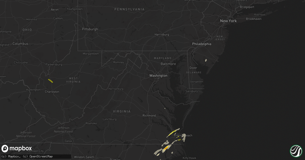
Hail Map in Maryland on April 26, 2019
Get this storm
April 26 map
$229
one time, instant access
Download today. No call, no setup
Keep the $229
Bought the map and want the full workflow? Apply the entire $229 to a subscription within 7 days. None of it is wasted.
Every map, not just this one
This buys you this map. Subscription and you get every map we run, in the markets you choose from a few cities to whole states to nationwide. Plus real-time alerts the moment a storm fires.
Contact data
Name, contact info, occupancy, even credit band for addresses in the footprint. You go from where it hit to who to call.
Become the source they trust
Unlimited branding weather history reports on demand. You already have the documented answer ready for the property owner, and you are the one who showed up with it.
Property data and RoofTrace estimates
Pull up any address you have got, its value and the exact code rules for that jurisdiction, straight from One Click Code. Then RoofTrace estimates the squares, pitch, and roof value, priced the way you price.
Storm reports in Maryland
Maryland
| Date | Description |
|---|---|
| 04/26/20194:09 PM CDT | Raccoon point |
| 04/26/20194:08 PM CDT | Trees down around hebron. |
| 04/26/20194:08 PM CDT | A local report indicates 66 MPH wind near 3 NW MARION STATION |
| 04/26/20194:02 PM CDT | Winds estimated 60 mph or stronger. Boats on trailers overturned. |
| 04/26/20194:00 PM CDT | Roof off a building at sommers cove in crisfield. |
| 04/26/20193:45 PM CDT | Large tree limbs down near the intersection of md-25 falls road and shawan road. |
| 04/26/20193:45 PM CDT | Large portion of a roof lifted off a barn. Delayed report from friday...time estimated from radar. |
| 04/26/20193:36 PM CDT | Emergency services reports trees down around the area. Time estimated from radar. |
| 04/26/20193:32 PM CDT | Tree damage at a home near route 290 and 291. Irrigation system across the street collapsed. |
| 04/26/20193:32 PM CDT | Downed trees and blown debris closed u.s. Highway 301 near dudley conners road. Time estimated from radar. |
| 04/26/20193:30 PM CDT | Several pine trees uprooted. Delayed report from friday...time estimated from radar. |
| 04/26/20193:28 PM CDT | Downed trees and blown debris forced lane restrictions on u.s. Highway 301 at state highway 305. Time estimated from radar. |
| 04/26/20193:26 PM CDT | Tree down on wires on old country club road. Time estimated from radar. |
| 04/26/20193:04 PM CDT | A local report indicates 62 MPH wind near PATUXENT RIVER NAS |
| 04/26/20192:51 PM CDT | Tree limb down on power line outside the north beach volunteer fire department. |
| 04/26/20192:49 PM CDT | Four trees were down and three trees were damaged near the intersection of jones wharf road and drum cliff road. |
| 04/26/20192:40 PM CDT | Tree down along the intersection of maryland route 234 and maryland route 5. |
| 04/26/20192:32 PM CDT | Tree down along the ramp from northbound i-95 to westbound i-695 baltimore beltway inner loop. |
| 04/26/20192:31 PM CDT | Large tree blocking harris mill road north of intersection with bond road. Numerous other trees down in vicinity. |
| 04/26/20192:29 PM CDT | A tree limb fell into a residence along the 4000 block of norrisville road. |
| 04/26/20192:28 PM CDT | Numerous large limbs down. |
| 04/26/20192:25 PM CDT | Pole down near the intersection of md-23 norrisville road and houcks road. |
| 04/26/20192:22 PM CDT | Tree down along monkton road. |
| 04/26/20192:22 PM CDT | A tree was blocking the intersection of natalie lane and carli court. |
| 04/26/20192:22 PM CDT | Multiple trees down in the 2900 block of shepperd road... 2400 block of monkton road... Near the intersection of wilson road and hicks road... And on cuba road between |
| 04/26/20192:21 PM CDT | Large tree snapped near intersection of sweet air rd and fox run ct |
| 04/26/20192:21 PM CDT | Ef-1 tornado confirmed in monkton maryland. 90 mph max winds and 150 yard max path width. Sporadic damage |
| 04/26/20192:19 PM CDT | Wires down along the 15000 block of carroll road. |
| 04/26/20192:15 PM CDT | A tree was down along the 1600 block of preakness drive. |
| 04/26/20192:15 PM CDT | Tree down on power lines on gambrills road. |
| 04/26/20192:09 PM CDT | Large wooden sign blown down on shawan rd between falls rd and i-83 |
| 04/26/20192:06 PM CDT | Two trees down alongside the ramp from i-495 capital beltway inner loop to i-95 northbound. |
| 04/26/20191:55 PM CDT | Tree down on wires. |
| 04/26/20191:55 PM CDT | 18-inch diameter oak tree uprooted alongside the outer loop of i-495 capital beltway just west of i-270 near the bethesda trolley trail. |
| 04/26/20191:55 PM CDT | Numerous trees were down in the lanham area. |
| 04/26/20191:55 PM CDT | Tree down near intersection of md 564 and 98th ave blocking md 564. |
| 04/26/20191:47 PM CDT | Tree down near intersection of glen mill road and boswell court. |
| 04/26/20191:47 PM CDT | Wires down along jones lane. |
| 04/26/20191:22 PM CDT | Tree down along monkton road. |
| 04/26/201912:39 AM CDT | At 539 PM EDT, severe thunderstorms were located along a line extending from Bowers to Milton to Parsonsburg, moving east at 35 mph. HAZARD...60 mph wind gusts. SOURCE...Radar indicated. IMPACT...Damage to roofs, siding, trees, and power lines is possible. Locations impacted include... Georgetown, Cape May, Milford, North Wildwood, Millsboro, Wildwood Crest, Lewes, Milton, Selbyville, Avalon, West Cape May, Stone Harbor, Dagsboro, Millville, Bowers, Henlopen Acres, Scotch Bonnet, Gumboro, Cape Henlopen State Park and North Cape May. |
| 04/26/201912:15 AM CDT | At 514 PM EDT, a severe thunderstorm was located near Newark, or 16 miles northeast of Pocomoke City, moving north at 60 mph. HAZARD...70 mph wind gusts and quarter size hail. SOURCE...Radar indicated. IMPACT...Minor damage to vehicles is possible. Expect considerable tree damage. Wind damage is also likely to mobile homes, roofs, and outbuildings. This severe thunderstorm will be near, Berlin and Cape Isle Of Wight around 525 PM EDT. Ocean Pines around 530 PM EDT.Other locations impacted by this severe thunderstorm include Bishop,West Ocean City, Ocean City Municipality, Cedartown, Bishopville,Public Landing, Ironshire, Showell, Boxiron and Whaleyville. |
| 04/25/201911:19 PM CDT | At 418 PM EDT, a severe thunderstorm was located near Gap, or near New Holland, moving northeast at 45 mph. HAZARD...60 mph wind gusts. SOURCE...Radar indicated. IMPACT...Damage to roofs, siding, trees, and power lines is possible. Locations impacted include... Reading, West Chester, Pottstown, Phoenixville, Coatesville, Westtown, Wyomissing, Downingtown, Kennett Square, Birdsboro, Oxford, Kutztown, Royersford, Hamburg, Fleetwood, Sinking Spring, Laureldale, Parkesburg, West Grove and Womelsdorf. |
| 04/25/201911:12 PM CDT | At 411 PM EDT, severe thunderstorms were located along a line extending from near Langford to near Romancoke to 8 miles southwest of Oxford to 7 miles east of Patuxent River Naval Air Station to 7 miles southeast of Saint Inigoes Creek, moving east at 40 mph. HAZARD...70 mph wind gusts and quarter size hail. SOURCE...Radar indicated. IMPACT...Minor damage to vehicles is possible. Expect considerable tree damage. Wind damage is also likely to mobile homes, roofs, and outbuildings. Severe thunderstorms will be near, University Of Maryland Center For Environmental Studies around 425 PM EDT. Cambridge around 430 PM EDT. Secretary and Deal Island around 445 PM EDT. Hurlock around 455 PM EDT. Federalsburg around 500 PM EDT. Princess Anne around 505 PM EDT. Westover around 510 PM EDT.Other locations impacted by these severe thunderstorms includeWetipquin, Madison, Brookview, Trinity, Eldorado, Kingston, ChurchCreek, Lloyds, Mount Vernon and Linkwood. |
| 04/25/201910:48 PM CDT | At 348 PM EDT, a severe thunderstorm was located over Center Cross, or 9 miles northeast of King And Queen Court House, moving northeast at 35 mph. HAZARD...60 mph wind gusts and quarter size hail. SOURCE...Radar indicated. IMPACT...Minor damage to vehicles is possible. Expect wind damage to trees and powerlines. This severe thunderstorm will be near, Sharps around 355 PM EDT. Morattico around 400 PM EDT. Robley and Farnham around 405 PM EDT. Haynesville around 410 PM EDT. Callao around 415 PM EDT. Heathsville around 420 PM EDT. Lewisetta around 425 PM EDT.Other locations impacted by this severe thunderstorm include Lara,Nesting, Lottsburg, Somers, Village, Alfonso, Avalon, Bowlers Wharf,Moon Corner and Nuttsville. |
| 04/25/201910:37 PM CDT | At 337 PM EDT, severe thunderstorms were located along a line extending from Pasadena to near Bowie, moving northeast at 45 mph. HAZARD...60 mph wind gusts. SOURCE...Radar indicated. IMPACT...Damaging winds will cause some trees and large branches to fall. This could injure those outdoors, as well as damage homes and vehicles. Roadways may become blocked by downed trees. Localized power outages are possible. Unsecured light objects may become projectiles. Locations impacted include... Baltimore, Severn, Annapolis, Crofton, Riviera Beach, Mayo, Shady Side, Naval Academy, Severn River, South River, Fort Smallwood State Park, Gibson Island, Bodkin Point, Sillery Bay, Rhode River, Pinehurst, Glen Burnie, Severna Park, Odenton and Pasadena. |
| 04/25/201910:32 PM CDT | At 332 PM EDT, severe thunderstorms were located along a line extending from near Jarrettsville to Fort Smallwood State Park to Prince Frederick, moving northeast at 40 mph. HAZARD...60 mph wind gusts and penny size hail. SOURCE...Radar indicated. IMPACT...Damage to roofs, siding, trees, and power lines is possible. Locations impacted include... Easton, Elkton, Centerville, Calvert, Talbot, Chestertown, Centreville, North East, Rising Sun, Oakland, Ridgely, Rock Hall, Charlestown, Trappe, St. Michaels, Church Hill, Preston, Cecilton, Oxford and Millington. |
| 04/25/201910:26 PM CDT | At 325 PM EDT, severe thunderstorms were located along a line extending from Pikesville to Severn, moving northeast at 50 mph. HAZARD...60 mph wind gusts. SOURCE...Radar indicated. IMPACT...Damaging winds will cause some trees and large branches to fall. This could injure those outdoors, as well as damage homes and vehicles. Roadways may become blocked by downed trees. Localized power outages are possible. Unsecured light objects may become projectiles. Locations impacted include... Baltimore, Severn, Pikesville, Middle River, Elkridge, Baltimore-Washington Airport, North Point State Park, Back River, Millers Island, Ellicott City, Dundalk, Towson, Catonsville, Essex, Woodlawn, Randallstown, Parkville, Milford Mill, Lochearn and Pasadena. |
| 04/25/201910:23 PM CDT | At 323 PM EDT, severe thunderstorms were located along a line extending from Forestville to near Colonial Beach, moving northeast at 35 mph. HAZARD...60 mph wind gusts. SOURCE...Radar indicated. IMPACT...Damaging winds will cause some trees and large branches to fall. This could injure those outdoors, as well as damage homes and vehicles. Roadways may become blocked by downed trees. Localized power outages are possible. Unsecured light objects may become projectiles. Locations impacted include... Waldorf, Bowie, Annapolis, Clinton, Forestville, Lexington Park, Largo, Chesapeake Ranch Estates, La Plata, Mayo, Shady Side, Chesapeake Beach, Deale, Naval Academy, Leonardtown, Prince Frederick, Piney Point, Upper Marlboro, Tall Timbers and Saint Inigoes Creek. |
| 04/25/201910:20 PM CDT | At 319 PM EDT, a severe thunderstorm was located near Cockeysville, moving northeast at 45 mph. HAZARD...60 mph wind gusts and quarter size hail. SOURCE...Radar indicated. IMPACT...Hail damage to vehicles is expected. Expect wind damage to trees, roofs, and siding. Locations impacted include... Lancaster, Millersville, Willow Street, Parkville, Red Lion, New Holland, Spry, Dallastown, Leola, Paradise, Shrewsbury, Codorus, Strasburg, Quarryville, Stewartstown, Glen Rock, Gap, Jacobus, Windsor and Terre Hill.This includes the following Interstates... The Pennsylvania Turnpike from mile markers 289 to 295. Interstate 83 from mile markers 0 to 13. |
| 04/25/201910:08 PM CDT | At 308 PM EDT, severe thunderstorms were located along a line extending from near Railroad to Pikesville, moving northeast at 40 mph. HAZARD...60 mph wind gusts. SOURCE...Radar indicated. IMPACT...Damaging winds will cause some trees and large branches to fall. This could injure those outdoors, as well as damage homes and vehicles. Roadways may become blocked by downed trees. Localized power outages are possible. Unsecured light objects may become projectiles. Locations impacted include... Baltimore, Pikesville, Cockeysville, Aberdeen, Havre De Grace, Aberdeen Proving Ground, Towson, Bel Air South, Randallstown, Parkville, Owings Mills, Bel Air North, Carney, Milford Mill, Perry Hall, Reisterstown, Lochearn, Rossville, Mays Chapel and Timonium. |
| 04/25/201910:00 PM CDT | At 300 PM EDT, a severe thunderstorm was located over Goddard, or near Greenbelt, moving northeast at 50 mph. HAZARD...60 mph wind gusts. SOURCE...Radar indicated. IMPACT...Damaging winds will cause some trees and large branches to fall. This could injure those outdoors, as well as damage homes and vehicles. Roadways may become blocked by downed trees. Localized power outages are possible. Unsecured light objects may become projectiles. Locations impacted include... Bowie, Severn, Annapolis, College Park, Crofton, Greenbelt, Riviera Beach, Naval Academy, Baltimore-Washington Airport, Severn River, Fort Smallwood State Park, Gibson Island, Bodkin Point, Sillery Bay, Pinehurst, Glen Burnie, Severna Park, Odenton, Pasadena and Arnold. |
| 04/25/20199:59 PM CDT | At 259 PM EDT, a severe thunderstorm was located over Robley, moving northeast at 40 mph. HAZARD...60 mph wind gusts and quarter size hail. SOURCE...Radar indicated. IMPACT...Minor damage to vehicles is possible. Expect wind damage to trees and powerlines. This severe thunderstorm will be near, Heathsville around 310 PM EDT. Callao around 315 PM EDT. Lewisetta and Kinsale around 320 PM EDT.Other locations impacted by this severe thunderstorm include Lara,Browns Store, Lottsburg, Somers, Village, Mollusk, Alfonso, Avalon,Moon Corner and Nuttsville. |
| 04/25/20199:56 PM CDT | At 256 PM EDT, a severe thunderstorm was located near Woodbridge, moving northeast at 50 mph. HAZARD...70 mph wind gusts. SOURCE...Radar indicated. Quantico Marine Base gusted to 61 mph. IMPACT...Damaging winds will cause some trees and large branches to fall. This could injure those outdoors, as well as damage homes and vehicles. Roadways may become blocked by downed trees. Localized power outages are possible. Unsecured light objects may become projectiles. Locations impacted include... Alexandria, Waldorf, Dale City, Annandale, Clinton, Springfield, Fort Washington, Fort Hunt, Groveton, Huntington, La Plata, Fort Belvoir, Woodbridge, National Harbor, Quantico, Lake Ridge, Burke, Lincolnia, Montclair and Camp Springs. |
| 04/25/20199:37 PM CDT | At 237 PM EDT, a severe thunderstorm was located near Sykesville, or 9 miles northwest of Columbia, moving northeast at 35 mph. HAZARD...60 mph wind gusts. SOURCE...Radar indicated. IMPACT...Damaging winds will cause some trees and large branches to fall. This could injure those outdoors, as well as damage homes and vehicles. Roadways may become blocked by downed trees. Localized power outages are possible. Unsecured light objects may become projectiles. Locations impacted include... Baltimore, Columbia, Pikesville, Middle River, Cockeysville, Ellicott City, Dundalk, Towson, Catonsville, Essex, Woodlawn, Randallstown, Parkville, Owings Mills, Eldersburg, Carney, Milford Mill, Reisterstown, Lochearn and Arbutus. |
| 04/25/20199:29 PM CDT | At 228 PM EDT, severe thunderstorms were located along a line extending from 15 miles southeast of Culpeper to 7 miles southwest of Spotsylvania, moving east at 45 mph. HAZARD...60 mph wind gusts. SOURCE...Radar indicated. These storms have a history of downing numerous trees from Albemarle to Orange Counties. IMPACT...Damaging winds will cause some trees and large branches to fall. This could injure those outdoors, as well as damage homes and vehicles. Roadways may become blocked by downed trees. Localized power outages are possible. Unsecured light objects may become projectiles. Locations impacted include... Stafford, Fredericksburg, King George, Dahlgren, Fairview Beach, Aquia Creek, Potomac Creek, Massaponax, Spotsylvania, Falmouth, Passapatanzy, Snell, Ramoth, Partlow, Heflin, Thornburg, Dunavant, White Oak, Sealston and Jersey. |
All States Impacted by Hail Map on April 26, 2019
Cities Impacted by Hail Map on April 26, 2019
- Suffolk, VA
- Newport News, VA
- Carrollton, VA
- Maxwell, NE
- Corinne, UT
- Lexington, NE
- Brady, NE
- Overton, NE
- Elm Creek, NE
- Cozad, NE
- Gothenburg, NE
- Preston, ID
- Stafford Springs, CT
- Monson, MA
- Brimfield, MA
- New Braintree, MA
- Gilbertville, MA
- Barre, MA
- North Brookfield, MA
- Wales, MA
- South Barre, MA
- West Brookfield, MA
- Warren, MA
- Oakham, MA
- Grouse Creek, UT
- Cofield, NC
- Harrellsville, NC
- Gatesville, NC
- Hobbsville, NC
- Corapeake, NC
- Sunbury, NC
- Gates, NC
- Palmer, MA
- Wilbraham, MA
- Hampden, MA
- Callaway, NE
- Snowville, UT
- Chesapeake, VA
- Nephi, UT
- Portage, UT
- Axtell, NE
- Kearney, NE
- Conchas Dam, NM
- Trementina, NM
- Ahoskie, NC
- Aulander, NC
- Aurora, NE
- Hampton, NE
- Brigham City, UT
- Tribune, KS
- Wagon Mound, NM
- Delta, UT
- Holly, CO
- Roxobel, NC
- Winton, NC
- Woodland, NC
- Kelford, NC
- Cornish, UT
- Lewiston, UT
- Virginia Beach, VA
- Odessa, NE
- Cedar Valley, UT
- Lancaster, VA
- Dugway, UT
- Raton, NM
- Millville, NJ
- Vineland, NJ
- Capitan, NM
- Franklin, ID
- Millersville, MD
- Severn, MD
- Gambrills, MD
- Odenton, MD
- Broken Bow, NE
- Mona, UT
- Lakin, KS
- Deerfield, KS
- Yeso, NM
- Vaughn, NM
- Windsor, NC
- Roswell, NM
- Malad City, ID
- Center Cross, VA
- Giltner, NE
- Mantua, UT
- Fillmore, UT
- Willow Island, NE
- Fort Monroe, VA
- Norfolk, VA
- Willington, CT
- Tolland, CT
- Corona, NM
- Tooele, UT
- Goshen, UT
- Hertford, NC
- Eddyville, NE
- Holland, MA
- West Warren, MA
- Paradise, UT
- Henderson, NE
- Baggs, WY
- Dixon, WY
- Hampton, VA
- Solano, NM
- Coventry, CT
- Ripley, WV
- Given, WV
- Kenna, WV
- Evans, WV


