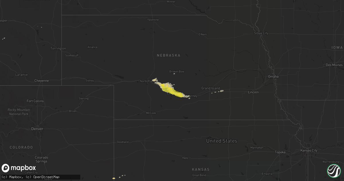
Hail Map on April 26, 2019
Get this storm
April 26 map
$229
one time, instant access
Download today. No call, no setup
Keep the $229
Bought the map and want the full workflow? Apply the entire $229 to a subscription within 7 days. None of it is wasted.
Every map, not just this one
This buys you this map. Subscription and you get every map we run, in the markets you choose from a few cities to whole states to nationwide. Plus real-time alerts the moment a storm fires.
Contact data
Name, contact info, occupancy, even credit band for addresses in the footprint. You go from where it hit to who to call.
Become the source they trust
Unlimited branding weather history reports on demand. You already have the documented answer ready for the property owner, and you are the one who showed up with it.
Property data and RoofTrace estimates
Pull up any address you have got, its value and the exact code rules for that jurisdiction, straight from One Click Code. Then RoofTrace estimates the squares, pitch, and roof value, priced the way you price.
States Impacted by Hail Map on April 26, 2019
Storm reports
Pennsylvania
| Date | Description |
|---|---|
| 04/26/20194:50 PM CDT | Downed tree and wires on pa-132 eastbound at davisville road. One lane is blocked. Time estimated from radar. |
| 04/26/20194:49 PM CDT | Several trees and a few power lines down in warminster. Time estimated from radar. |
| 04/26/20194:45 PM CDT | Downed tree near the intersection of montgomery avenue and central avenue. Time estimated from radar. |
| 04/26/20194:45 PM CDT | Trees down. Time estimated from radar. |
| 04/26/20194:44 PM CDT | Tree uprooted and blocking the roadway near the intersection of twining road and dale road. Time estimated from radar. |
| 04/26/20194:42 PM CDT | Downed trees and power lines near melrose park station. Time estimated from radar. |
| 04/26/20194:40 PM CDT | Downed tree damaged a house in west oak lane. Time estimated from radar. |
| 04/26/20194:33 PM CDT | Downed trees at and near boone park. Time estimated from radar. |
| 04/26/20194:31 PM CDT | Corrects previous tstm wnd gst report from philadelphia international airport. Phl itws measured a wind gust to 54 knots. |
| 04/26/20194:31 PM CDT | Several trees and power lines down in bala cynwyd. Time estimated from radar. |
| 04/26/20194:31 PM CDT | Downed tree near the intersection of forrest avenue and windsor avenue. Time estimated from radar. |
| 04/26/20194:31 PM CDT | Downed tree at midfield road and lakeside road intersection... With roads blocked. Time estimated from radar. |
| 04/26/20194:30 PM CDT | Downed tree blocking the roadway near the intersection of bowman avenue and kenmore road. Time estimated from radar. |
| 04/26/20194:30 PM CDT | Train stuck due to trees and wires down on the septa tracks near bryn mawr. Time estimated from radar. |
| 04/26/20194:29 PM CDT | Downed tree at intersection of manoa road and trent road. Time estimated from radar. |
| 04/26/20194:14 PM CDT | Downed tree on wires near the intersection of middletown road and forge road in middletown twp. Time estimated from radar. |
| 04/26/20194:05 PM CDT | Delayed report. Downed trees in boyertown... Including near the intersection of sunset drive and creamery road. Time estimated from radar. |
| 04/26/20193:44 PM CDT | A large tree damaged a home and trapped two inside. No injuries reported. Time estimated from radar. |
| 04/26/20193:41 PM CDT | Tree down near intersection of ellicott road and cooper road. Time estimated from radar. |
| 04/26/20193:06 PM CDT | Roof partially blown off of barn. Time estimated from radar. |
| 04/26/20193:02 PM CDT | One dozen trees down at back rd and radel rd in wayne twp. Time estimated by radar. |
| 04/26/20193:00 PM CDT | A few dozen trees downed or snapped near camp hebron. Time estimated by radar. |
| 04/26/20192:59 PM CDT | Numerous trees down. Time estimated from radar. |
| 04/26/201912:11 PM CDT | Tree down on route 259 |
| 04/26/201912:02 PM CDT | Tree and wires down on matson rd. |
| 04/26/201911:58 AM CDT | A local report indicates 59 MPH wind near LATROBE |
| 04/26/201911:57 AM CDT | Roof off house on keystone park rd. Numerous trees down in the area. |
| 04/26/201911:50 AM CDT | Tree and wires down on buffenmeyer rd |
| 04/26/201911:47 AM CDT | Trees down at route 119 and cameo ln |
| 04/26/201911:44 AM CDT | Tree down on grove st |
| 04/26/201911:41 AM CDT | Multiple trees down on oakford park rd |
| 04/26/201911:24 AM CDT | Tree and wires down on cedar creek rd |
| 04/26/201912:44 AM CDT | At 544 PM EDT, severe thunderstorms were located along a line extending from Pleasant Valley to near Monroe Township, moving east at 45 mph. HAZARD...60 mph wind gusts. SOURCE...Radar indicated. IMPACT...Damage to roofs, siding, trees, and power lines is possible. Locations impacted include... Philadelphia, Trenton, Bensalem, Evesham, Mount Laurel, Ewing, Willingboro, Medford, Lumberton, Princeton, Florence, Burlington, Bristol, Mount Holly, Perkasie, Doylestown, Byram, Riverside, Palmyra and Tabernacle. |
| 04/26/201912:37 AM CDT | At 537 PM EDT, severe thunderstorms were located along a line extending from near Woodbury Heights to near Laurel Lake to near Big Stone Beach, moving east at 40 mph. HAZARD...60 mph wind gusts. SOURCE...Radar indicated. IMPACT...Damage to roofs, siding, trees, and power lines is possible. Locations impacted include... Camden, Vineland, Millville, Ocean City, Gloucester City, Cape May, Cumberland, Cherry Hill, Evesham, Mount Laurel, Deptford, Voorhees, Medford, West Deptford, Pleasantville, Glassboro, Lindenwold, Hammonton, Bellmawr and Somers Point. |
| 04/26/201912:07 AM CDT | At 507 PM EDT, severe thunderstorms were located along a line extending from Elam to Cheswold to near Federalsburg, moving east at 35 mph. HAZARD...60 mph wind gusts and penny size hail. SOURCE...Radar indicated. IMPACT...Damage to roofs, siding, trees, and power lines is possible. Locations impacted include... Philadelphia, Wilmington, Vineland, Dover, Millville, Bridgeton, Gloucester City, Georgetown, Deptford, West Deptford, Glassboro, Pennsville, Bellmawr, Woodbury, Smyrna, Milford, Pitman, Clayton, Carneys Point and Seaford. |
| 04/25/201910:45 PM CDT | At 345 PM EDT, severe thunderstorms were located along a line extending from near Richfield to New Buffalo to Hogestown, moving northeast at 30 mph. HAZARD...60 mph wind gusts. SOURCE...Radar indicated. IMPACT...Expect damage to trees, roofs, and siding. Locations impacted include... Harrisburg, Colonial Park, Progress, Shamokin, Linglestown, Mount Carmel, Kulpmont, Ashland, Paxtonia, Skyline View, Valley View, Millersburg, Marysville, Elysburg, Pine Grove, Fairview-Ferndale, Trevorton, Lykens, Tremont and Newport.This includes the following Interstates... Interstate 78 from mile markers 0 to 8. Interstate 81 from mile markers 66 to 119. Interstate 83 near mile marker 50. |
| 04/25/20199:54 PM CDT | At 253 PM EDT, a severe thunderstorm was located near Dehart Dam, moving northeast at 35 mph. HAZARD...60 mph wind gusts and quarter size hail. SOURCE...Radar indicated. IMPACT...Hail damage to vehicles is expected. Expect wind damage to trees, roofs, and siding. Locations impacted include... Linglestown, Lykens, Elizabethville, Williamstown, Klingerstown, Dehart Dam, Wiconisco, Gratz, Berrysburg, Pillow and Enders. |
| 04/25/20199:51 PM CDT | At 251 PM EDT, severe thunderstorms were located along a line extending from near Big Spring State Park to near Doylesburg to near Upper Strasburg, moving northeast at 40 mph. HAZARD...60 mph wind gusts. SOURCE...Radar indicated. IMPACT...Expect damage to trees, roofs, and siding. Locations impacted include... Carlisle, Plainfield, Schlusser, Newport, Duncannon, Newville, Honey Grove, New Bloomfield, New Kingstown, East Waterford, Loysville, Hogestown, Ickesburg, Colonel Denning State Park, Willow Hill, Bloserville, Wertzville, Roxbury, Perulack and Big Spring State Park.This includes the following Interstates... The Pennsylvania Turnpike from mile markers 191 to 229. Interstate 81 between mile markers 41 and 46...and from mile markers49 to 62. |
Virginia
| Date | Description |
|---|---|
| 04/26/20195:27 PM CDT | Tree down near the intersection of delaney road and pearson drive. |
| 04/26/20193:03 PM CDT | Trees down. |
| 04/26/20193:00 PM CDT | Several trees down. |
| 04/26/20192:58 PM CDT | Trees down. |
| 04/26/20192:55 PM CDT | Wind of 60 mph or greater reported by spotter. |
| 04/26/20192:54 PM CDT | Mesonet station domv2 dominion terminal. |
| 04/26/20192:46 PM CDT | Mesonet station dw5558 suffolk. |
| 04/26/20192:41 PM CDT | A local report indicates 1.00 inch wind near CRITTENDEN |
| 04/26/20192:12 PM CDT | Trees down. Time estimated from radar. |
| 04/26/20192:09 PM CDT | King george elementary school mesonet. |
| 04/26/20192:08 PM CDT | A tree was down along fort hunt road and paul spring road. A tree limb four inches in diameter was down along the george washington memorial parkway and morningside lan |
| 04/26/20191:56 PM CDT | Tree down near the intersection of delaney road and pearson drive. |
| 04/26/20191:49 PM CDT | Large tree limbs down on the north side of tysons corner. |
| 04/26/20191:48 PM CDT | A local report indicates 61 MPH wind near QUANTICO MARINE CORP |
| 04/26/20191:45 PM CDT | Several large branches down including in the 1100 block of charles street and near the intersection of kenmore avenue and hanover street. |
| 04/26/20191:38 PM CDT | Tree down in the 14600 block of aden road. |
| 04/26/20191:30 PM CDT | Trees down in spotsylvania courthouse |
| 04/26/20191:29 PM CDT | Several large trees down... Including one onto a carport and another on wires that snapped a pole on old block house lane. Several trees down near the intersection of m |
| 04/26/20191:25 PM CDT | Tree down near the intersection of fitzwater drive and bittle lane. |
| 04/26/20191:24 PM CDT | Numerous trees were down in the locust grove area. |
| 04/26/20191:21 PM CDT | Tree down near the intersection of lewiston road and boggs drive. |
| 04/26/20191:18 PM CDT | Tree uprooted and power lines down at the intersection of richmond st. And 1st st. Time estimated from radar. |
| 04/26/20191:16 PM CDT | Trees down along the 6100 block of sumerduck road. |
| 04/26/20191:10 PM CDT | Numerous trees down across orange county. |
| 04/26/20191:05 PM CDT | Tree down on mount pony road. |
| 04/26/201912:58 PM CDT | Tree down along union mills rd |
| 04/26/201912:43 PM CDT | Numerous trees were down in barboursville. |
| 04/26/201912:41 PM CDT | Tree down blocking one lane near intersection of stony point rd and burnly station rd |
| 04/26/201912:28 PM CDT | Tree down on power lines at 1300 polo grounds rd |
| 04/26/201912:25 PM CDT | Nearly 20 large trees... Mostly oak... Were uprooted by thunderstorm winds near the intersection of high school road and fanny white road. An out-building was destroyed |
| 04/26/201912:24 PM CDT | Multiple large trees blown down along james anderson highway in the saint joy area. Time estimated from radar. |
| 04/26/201912:18 PM CDT | Tree down next to driveway of residence. |
| 04/26/201912:10 PM CDT | Trees down. |
| 04/26/201911:20 AM CDT | Trees down carolina rd and routree rd. More reports of trees down across southern suffolk. |
| 04/26/201911:12 AM CDT | Trees down. One on a shed. |
| 04/26/201911:00 AM CDT | Trees down along e griffin st. |
| 04/26/20197:45 AM CDT | At 1244 PM EDT, a severe thunderstorm was located 7 miles east of Grand View, or 8 miles east of Hampton, moving northeast at 40 mph. HAZARD...60 mph wind gusts and penny size hail. SOURCE...Radar indicated. IMPACT...Expect damage to trees and powerlines. This severe thunderstorm will be near, Cape Charles and Bay View around 100 PM EDT. Cheriton around 105 PM EDT.Other locations impacted by this severe thunderstorm includeBirdsnest, Capeville, Kiptopeke State Park, Jamesville, Silver Beach,Eastville, Machipongo, Wardtown, Franktown and Simpkins. |
| 04/26/20197:23 AM CDT | At 1223 PM EDT, severe thunderstorms were located along a line extending from Old Dominion University to 6 miles northwest of South Mills to near Sunbury, moving northeast at 55 mph. HAZARD...60 mph wind gusts and quarter size hail. SOURCE...Radar indicated. IMPACT...Minor damage to vehicles is possible. Expect wind damage to trees and powerlines. Severe thunderstorms will be near, Ocean View, Virginia Wesleyan University, Old Dominion University, Norfolk State University, Downtown Norfolk, Norfolk, Portsmouth, Norfolk International, Norview and Norfolk NAS around 1230 PM EDT. Northwest and Moyock around 1240 PM EDT. Fentress around 100 PM EDT. Back Bay around 105 PM EDT. Princess Anne around 110 PM EDT.Other locations impacted by these severe thunderstorms include SouthNorfolk, Rudee Heights, Portlock, Pierceville, Newsome Store, Savage,Huntersville, Carter, Pungo and Bayside. |
| 04/26/20196:51 AM CDT | At 1151 AM EDT, severe thunderstorms were located along a line extending from near Sedley to near Holland to near Cofield, moving northeast at 50 mph. HAZARD...60 mph wind gusts and quarter size hail. SOURCE...Radar indicated. IMPACT...Minor damage to vehicles is possible. Expect wind damage to trees and powerlines. Severe thunderstorms will be near, Holland and Carrsville around 1155 AM EDT. Zuni around 1200 PM EDT. Windsor, Downtown Suffolk and Isle Of Wight around 1205 PM EDT. Kings Fork, Whaleyville and Corapeake around 1210 PM EDT. Smithfield and Driver around 1215 PM EDT. Crittenden and Rescue around 1220 PM EDT. Christopher Newport University, Churchland, Suffolk, Denbigh, Fort Eustis and Beaconsdale around 1225 PM EDT. Newport News, Hampton, Hampton University, Deep Creek, Chesapeake, Portsmouth, Northampton, Bowers Hill, Fort Monroe and Western Branch around 1230 PM EDT.Other locations impacted by these severe thunderstorms include SouthNorfolk, Portlock, Carrollton, Longview, Savage, Huntersville, Topsy,Dort, Chuckatuck and Wilroy. |
| 04/25/201911:56 PM CDT | At 456 PM EDT, severe thunderstorms were located along a line extending from Smithville to near Lawsonia, moving northeast at 50 mph. HAZARD...60 mph wind gusts and quarter size hail. SOURCE...Radar indicated. IMPACT...Minor damage to vehicles is possible. Expect wind damage to trees and powerlines. Severe thunderstorms will be near, Westover around 515 PM EDT. Princess Anne and University Of Maryland Eastern Shore around 520 PM EDT. Fruitland and Salisbury University around 530 PM EDT. Salisbury around 535 PM EDT. Delmar and Parsonsburg around 540 PM EDT.Other locations impacted by these severe thunderstorms includeWetipquin, Brookview, Trinity, Eldorado, Cokesbury, Goodwill, Eden,Kingston, Shelltown and Longridge. |
| 04/25/201911:29 PM CDT | At 429 PM EDT, a severe thunderstorm was located over Chesapeake, or over Great Bridge, moving northeast at 40 mph. HAZARD...60 mph wind gusts and quarter size hail. SOURCE...Radar indicated. IMPACT...Minor damage to vehicles is possible. Expect wind damage to trees and powerlines. This severe thunderstorm will be near, Fentress around 435 PM EDT. Kempsville and Regent University around 445 PM EDT. Virginia Wesleyan University and Princess Anne around 450 PM EDT. Virginia Beach around 505 PM EDT.Other locations impacted by this severe thunderstorm include SouthNorfolk, Rudee Heights, Portlock, Mount Pleasant, Princess AnnePlaza, Sigma, Sandbridge Beach, Herberts Corner, Oceana NAS andMacons Corner. |
| 04/25/201911:09 PM CDT | At 409 PM EDT, a severe thunderstorm was located 7 miles east of Grand View, or 8 miles east of Hampton, moving northeast at 50 mph. HAZARD...60 mph wind gusts and quarter size hail. SOURCE...Radar indicated. IMPACT...Minor damage to vehicles is possible. Expect wind damage to trees and powerlines. This severe thunderstorm will be near, Cape Charles around 425 PM EDT. Cheriton and Bay View around 430 PM EDT.Other locations impacted by this severe thunderstorm includeCapeville, Townsend, Kiptopeke State Park, Oyster, Cheapside,Kiptopeke, Plantation and Dalbys. |
| 04/25/201910:55 PM CDT | At 354 PM EDT, a severe thunderstorm was located over Hayes, or near Gloucester Courthouse, moving northeast at 35 mph. HAZARD...60 mph wind gusts and quarter size hail. SOURCE...Radar indicated. IMPACT...Minor damage to vehicles is possible. Expect wind damage to trees and powerlines. This severe thunderstorm will be near, Mobjack around 405 PM EDT. Mathews and Blakes around 410 PM EDT. Deltaville and Gwynn around 420 PM EDT.Other locations impacted by this severe thunderstorm include Ruff,Beulah, Moon, Laban, Glass, Naxera, Amburg, Fort Nonsense, North andSoles. |
| 04/25/201910:37 PM CDT | At 336 PM EDT, a severe thunderstorm was located near Driver, or 8 miles west of Churchland, moving northeast at 35 mph. HAZARD...60 mph wind gusts and quarter size hail. SOURCE...Radar indicated. IMPACT...Minor damage to vehicles is possible. Expect wind damage to trees and powerlines. This severe thunderstorm will be near, Crittenden around 345 PM EDT. Portsmouth around 355 PM EDT. Northampton and Norfolk NAS around 400 PM EDT. Hampton University, Ocean View and Fort Monroe around 405 PM EDT. Hampton, Langley AFB and Buckroe Beach around 410 PM EDT. Grand View around 415 PM EDT.Other locations impacted by this severe thunderstorm include FoxHill, Phoebus, Langley View, Longview, Huntersville, Wills Corner,Hilton Village, Chuckatuck, Raleigh Terrace and Hobson. |
| 04/25/201910:24 PM CDT | At 324 PM EDT, a severe thunderstorm was located over Chester, moving northeast at 35 mph. HAZARD...60 mph wind gusts and quarter size hail. SOURCE...Radar indicated. IMPACT...Minor damage to vehicles is possible. Expect wind damage to trees and powerlines. This severe thunderstorm will be near, Highland Springs around 345 PM EDT. Roxbury and Bottoms Bridge around 350 PM EDT. Talleysville around 400 PM EDT. Tunstall around 405 PM EDT. Manquin around 410 PM EDT.Other locations impacted by this severe thunderstorm include Wayside,Richmond Heights, Birchett Estate, Mountcastle, Elko, Jordan PointCountry Club, Cohoke, Petersburg National Battlefield, Sandston andGlendale. |
| 04/25/20198:51 PM CDT | At 150 PM EDT, severe thunderstorms were located along a line extending from 10 miles south of Hume to near Culpeper, moving east at 40 mph. HAZARD...60 mph wind gusts and quarter size hail. SOURCE...Radar indicated. IMPACT...Damaging winds will cause some trees and large branches to fall. This could injure those outdoors, as well as damage homes and vehicles. Roadways may become blocked by downed trees. Localized power outages are possible. Unsecured light objects may become projectiles. Locations impacted include... Culpeper, Warrenton, Linton Hall, Bull Run, Bealeton, Haymarket, The Plains, Sudley, Gainesville, New Baltimore, Marshall, Nokesville, Opal, Remington, Catlett, Calverton, Midland, Castleton, Catharpin and Woolsey. |
| 04/25/20198:33 PM CDT | At 132 PM EDT, severe thunderstorms were located along a line extending from 7 miles southeast of Stanardsville to near Lake Monticello, moving northeast at 40 mph. HAZARD...60 mph wind gusts. SOURCE...Radar indicated. IMPACT...Damaging winds will cause some trees and large branches to fall. This could injure those outdoors, as well as damage homes and vehicles. Roadways may become blocked by downed trees. Localized power outages are possible. Unsecured light objects may become projectiles. Locations impacted include... Culpeper, Orange, Spotsylvania, Gordonsville, Mine Run, Elkwood, Stevensburg, Eheart, Brandy Station, Oakpark, Barboursville, Verdiersville, Everona, Montpelier Station, Locust Grove, Flat Run, Thornhill, Nasons, Winston and Madison Mills. |
| 04/25/20198:27 PM CDT | At 126 PM EDT, a severe thunderstorm was located over Princess Anne, or near Kempsville, moving northeast at 45 mph. HAZARD...60 mph wind gusts and quarter size hail. SOURCE...Radar indicated. IMPACT...Minor damage to vehicles is possible. Expect wind damage to trees and powerlines. This severe thunderstorm will be near, Virginia Beach Oceanfront around 145 PM EDT.Other locations impacted by this severe thunderstorm includeHorseshoe, Rudee Heights, Pierceville, Princess Anne Plaza, Sigma,Tar Corner, Nicanor, Gregory, Sharon and Pungo. |
| 04/25/20198:14 PM CDT | At 113 PM EDT, severe thunderstorms were located along a line extending from Crozet to 10 miles southwest of Charlottesville, moving northeast at 45 mph. HAZARD...60 mph wind gusts. SOURCE...Radar indicated. IMPACT...Damaging winds will cause some trees and large branches to fall. This could injure those outdoors, as well as damage homes and vehicles. Roadways may become blocked by downed trees. Localized power outages are possible. Unsecured light objects may become projectiles. Locations impacted include... Charlottesville, Crozet, Free Union, Campbell, Westmoreland, Hollymead, Ivy, Scottsville, Esmont, North Garden, Stony Point, Flordon, Scott Stadium, Cobham, Cismont, Boonesville, Newcomb Hall, Boyd Tavern, Monticello and Woodridge. |
Massachusetts
| Date | Description |
|---|---|
| 04/26/20192:22 PM CDT | A local report indicates 1.25 inch wind near NEW BRAINTREE |
| 04/26/20192:17 PM CDT | A local report indicates 1.00 inch wind near WEST BROOKFIELD |
| 04/26/20192:12 PM CDT | A local report indicates 1.75 inch wind near WARREN |
| 04/26/20192:04 PM CDT | A local report indicates 1.00 inch wind near BRIMFIELD |
| 04/26/20192:03 PM CDT | A local report indicates 1.50 inch wind near BRIMFIELD |
| 04/25/201910:14 PM CDT | At 313 PM EDT, a severe thunderstorm was located over West Brookfield, or 16 miles west of Worcester, moving north at 45 mph. HAZARD...Quarter size hail. SOURCE...Radar indicated. IMPACT...Damage to vehicles is possible. Locations impacted include... Gardner, Palmer, Spencer, Winchendon, Ware, Templeton, Rutland, Westminster, Barre, Warren, North Brookfield, Hubbardston, West Brookfield, Princeton, Brookfield, Hardwick, Oakham, Phillipston, Petersham and New Braintree. |
Maryland
| Date | Description |
|---|---|
| 04/26/20194:09 PM CDT | Raccoon point |
| 04/26/20194:08 PM CDT | A local report indicates 66 MPH wind near 3 NW MARION STATION |
| 04/26/20194:08 PM CDT | Trees down around hebron. |
| 04/26/20194:02 PM CDT | Winds estimated 60 mph or stronger. Boats on trailers overturned. |
| 04/26/20194:00 PM CDT | Roof off a building at sommers cove in crisfield. |
| 04/26/20193:45 PM CDT | Large portion of a roof lifted off a barn. Delayed report from friday...time estimated from radar. |
| 04/26/20193:45 PM CDT | Large tree limbs down near the intersection of md-25 falls road and shawan road. |
| 04/26/20193:36 PM CDT | Emergency services reports trees down around the area. Time estimated from radar. |
| 04/26/20193:32 PM CDT | Downed trees and blown debris closed u.s. Highway 301 near dudley conners road. Time estimated from radar. |
| 04/26/20193:32 PM CDT | Tree damage at a home near route 290 and 291. Irrigation system across the street collapsed. |
| 04/26/20193:30 PM CDT | Several pine trees uprooted. Delayed report from friday...time estimated from radar. |
| 04/26/20193:28 PM CDT | Downed trees and blown debris forced lane restrictions on u.s. Highway 301 at state highway 305. Time estimated from radar. |
| 04/26/20193:26 PM CDT | Tree down on wires on old country club road. Time estimated from radar. |
| 04/26/20193:04 PM CDT | A local report indicates 62 MPH wind near PATUXENT RIVER NAS |
| 04/26/20192:51 PM CDT | Tree limb down on power line outside the north beach volunteer fire department. |
| 04/26/20192:49 PM CDT | Four trees were down and three trees were damaged near the intersection of jones wharf road and drum cliff road. |
| 04/26/20192:40 PM CDT | Tree down along the intersection of maryland route 234 and maryland route 5. |
| 04/26/20192:32 PM CDT | Tree down along the ramp from northbound i-95 to westbound i-695 baltimore beltway inner loop. |
| 04/26/20192:31 PM CDT | Large tree blocking harris mill road north of intersection with bond road. Numerous other trees down in vicinity. |
| 04/26/20192:29 PM CDT | A tree limb fell into a residence along the 4000 block of norrisville road. |
| 04/26/20192:28 PM CDT | Numerous large limbs down. |
| 04/26/20192:25 PM CDT | Pole down near the intersection of md-23 norrisville road and houcks road. |
| 04/26/20192:22 PM CDT | A tree was blocking the intersection of natalie lane and carli court. |
| 04/26/20192:22 PM CDT | Multiple trees down in the 2900 block of shepperd road... 2400 block of monkton road... Near the intersection of wilson road and hicks road... And on cuba road between |
| 04/26/20192:22 PM CDT | Tree down along monkton road. |
| 04/26/20192:21 PM CDT | Ef-1 tornado confirmed in monkton maryland. 90 mph max winds and 150 yard max path width. Sporadic damage |
| 04/26/20192:21 PM CDT | Large tree snapped near intersection of sweet air rd and fox run ct |
| 04/26/20192:19 PM CDT | Wires down along the 15000 block of carroll road. |
| 04/26/20192:15 PM CDT | Tree down on power lines on gambrills road. |
| 04/26/20192:15 PM CDT | A tree was down along the 1600 block of preakness drive. |
| 04/26/20192:09 PM CDT | Large wooden sign blown down on shawan rd between falls rd and i-83 |
| 04/26/20192:06 PM CDT | Two trees down alongside the ramp from i-495 capital beltway inner loop to i-95 northbound. |
| 04/26/20191:55 PM CDT | Tree down near intersection of md 564 and 98th ave blocking md 564. |
| 04/26/20191:55 PM CDT | Tree down on wires. |
| 04/26/20191:55 PM CDT | 18-inch diameter oak tree uprooted alongside the outer loop of i-495 capital beltway just west of i-270 near the bethesda trolley trail. |
| 04/26/20191:55 PM CDT | Numerous trees were down in the lanham area. |
| 04/26/20191:47 PM CDT | Wires down along jones lane. |
| 04/26/20191:47 PM CDT | Tree down near intersection of glen mill road and boswell court. |
| 04/26/20191:22 PM CDT | Tree down along monkton road. |
| 04/26/201912:39 AM CDT | At 539 PM EDT, severe thunderstorms were located along a line extending from Bowers to Milton to Parsonsburg, moving east at 35 mph. HAZARD...60 mph wind gusts. SOURCE...Radar indicated. IMPACT...Damage to roofs, siding, trees, and power lines is possible. Locations impacted include... Georgetown, Cape May, Milford, North Wildwood, Millsboro, Wildwood Crest, Lewes, Milton, Selbyville, Avalon, West Cape May, Stone Harbor, Dagsboro, Millville, Bowers, Henlopen Acres, Scotch Bonnet, Gumboro, Cape Henlopen State Park and North Cape May. |
| 04/26/201912:15 AM CDT | At 514 PM EDT, a severe thunderstorm was located near Newark, or 16 miles northeast of Pocomoke City, moving north at 60 mph. HAZARD...70 mph wind gusts and quarter size hail. SOURCE...Radar indicated. IMPACT...Minor damage to vehicles is possible. Expect considerable tree damage. Wind damage is also likely to mobile homes, roofs, and outbuildings. This severe thunderstorm will be near, Berlin and Cape Isle Of Wight around 525 PM EDT. Ocean Pines around 530 PM EDT.Other locations impacted by this severe thunderstorm include Bishop,West Ocean City, Ocean City Municipality, Cedartown, Bishopville,Public Landing, Ironshire, Showell, Boxiron and Whaleyville. |
| 04/25/201911:19 PM CDT | At 418 PM EDT, a severe thunderstorm was located near Gap, or near New Holland, moving northeast at 45 mph. HAZARD...60 mph wind gusts. SOURCE...Radar indicated. IMPACT...Damage to roofs, siding, trees, and power lines is possible. Locations impacted include... Reading, West Chester, Pottstown, Phoenixville, Coatesville, Westtown, Wyomissing, Downingtown, Kennett Square, Birdsboro, Oxford, Kutztown, Royersford, Hamburg, Fleetwood, Sinking Spring, Laureldale, Parkesburg, West Grove and Womelsdorf. |
| 04/25/201911:12 PM CDT | At 411 PM EDT, severe thunderstorms were located along a line extending from near Langford to near Romancoke to 8 miles southwest of Oxford to 7 miles east of Patuxent River Naval Air Station to 7 miles southeast of Saint Inigoes Creek, moving east at 40 mph. HAZARD...70 mph wind gusts and quarter size hail. SOURCE...Radar indicated. IMPACT...Minor damage to vehicles is possible. Expect considerable tree damage. Wind damage is also likely to mobile homes, roofs, and outbuildings. Severe thunderstorms will be near, University Of Maryland Center For Environmental Studies around 425 PM EDT. Cambridge around 430 PM EDT. Secretary and Deal Island around 445 PM EDT. Hurlock around 455 PM EDT. Federalsburg around 500 PM EDT. Princess Anne around 505 PM EDT. Westover around 510 PM EDT.Other locations impacted by these severe thunderstorms includeWetipquin, Madison, Brookview, Trinity, Eldorado, Kingston, ChurchCreek, Lloyds, Mount Vernon and Linkwood. |
| 04/25/201910:48 PM CDT | At 348 PM EDT, a severe thunderstorm was located over Center Cross, or 9 miles northeast of King And Queen Court House, moving northeast at 35 mph. HAZARD...60 mph wind gusts and quarter size hail. SOURCE...Radar indicated. IMPACT...Minor damage to vehicles is possible. Expect wind damage to trees and powerlines. This severe thunderstorm will be near, Sharps around 355 PM EDT. Morattico around 400 PM EDT. Robley and Farnham around 405 PM EDT. Haynesville around 410 PM EDT. Callao around 415 PM EDT. Heathsville around 420 PM EDT. Lewisetta around 425 PM EDT.Other locations impacted by this severe thunderstorm include Lara,Nesting, Lottsburg, Somers, Village, Alfonso, Avalon, Bowlers Wharf,Moon Corner and Nuttsville. |
| 04/25/201910:37 PM CDT | At 337 PM EDT, severe thunderstorms were located along a line extending from Pasadena to near Bowie, moving northeast at 45 mph. HAZARD...60 mph wind gusts. SOURCE...Radar indicated. IMPACT...Damaging winds will cause some trees and large branches to fall. This could injure those outdoors, as well as damage homes and vehicles. Roadways may become blocked by downed trees. Localized power outages are possible. Unsecured light objects may become projectiles. Locations impacted include... Baltimore, Severn, Annapolis, Crofton, Riviera Beach, Mayo, Shady Side, Naval Academy, Severn River, South River, Fort Smallwood State Park, Gibson Island, Bodkin Point, Sillery Bay, Rhode River, Pinehurst, Glen Burnie, Severna Park, Odenton and Pasadena. |
| 04/25/201910:32 PM CDT | At 332 PM EDT, severe thunderstorms were located along a line extending from near Jarrettsville to Fort Smallwood State Park to Prince Frederick, moving northeast at 40 mph. HAZARD...60 mph wind gusts and penny size hail. SOURCE...Radar indicated. IMPACT...Damage to roofs, siding, trees, and power lines is possible. Locations impacted include... Easton, Elkton, Centerville, Calvert, Talbot, Chestertown, Centreville, North East, Rising Sun, Oakland, Ridgely, Rock Hall, Charlestown, Trappe, St. Michaels, Church Hill, Preston, Cecilton, Oxford and Millington. |
| 04/25/201910:26 PM CDT | At 325 PM EDT, severe thunderstorms were located along a line extending from Pikesville to Severn, moving northeast at 50 mph. HAZARD...60 mph wind gusts. SOURCE...Radar indicated. IMPACT...Damaging winds will cause some trees and large branches to fall. This could injure those outdoors, as well as damage homes and vehicles. Roadways may become blocked by downed trees. Localized power outages are possible. Unsecured light objects may become projectiles. Locations impacted include... Baltimore, Severn, Pikesville, Middle River, Elkridge, Baltimore-Washington Airport, North Point State Park, Back River, Millers Island, Ellicott City, Dundalk, Towson, Catonsville, Essex, Woodlawn, Randallstown, Parkville, Milford Mill, Lochearn and Pasadena. |
| 04/25/201910:23 PM CDT | At 323 PM EDT, severe thunderstorms were located along a line extending from Forestville to near Colonial Beach, moving northeast at 35 mph. HAZARD...60 mph wind gusts. SOURCE...Radar indicated. IMPACT...Damaging winds will cause some trees and large branches to fall. This could injure those outdoors, as well as damage homes and vehicles. Roadways may become blocked by downed trees. Localized power outages are possible. Unsecured light objects may become projectiles. Locations impacted include... Waldorf, Bowie, Annapolis, Clinton, Forestville, Lexington Park, Largo, Chesapeake Ranch Estates, La Plata, Mayo, Shady Side, Chesapeake Beach, Deale, Naval Academy, Leonardtown, Prince Frederick, Piney Point, Upper Marlboro, Tall Timbers and Saint Inigoes Creek. |
| 04/25/201910:20 PM CDT | At 319 PM EDT, a severe thunderstorm was located near Cockeysville, moving northeast at 45 mph. HAZARD...60 mph wind gusts and quarter size hail. SOURCE...Radar indicated. IMPACT...Hail damage to vehicles is expected. Expect wind damage to trees, roofs, and siding. Locations impacted include... Lancaster, Millersville, Willow Street, Parkville, Red Lion, New Holland, Spry, Dallastown, Leola, Paradise, Shrewsbury, Codorus, Strasburg, Quarryville, Stewartstown, Glen Rock, Gap, Jacobus, Windsor and Terre Hill.This includes the following Interstates... The Pennsylvania Turnpike from mile markers 289 to 295. Interstate 83 from mile markers 0 to 13. |
| 04/25/201910:08 PM CDT | At 308 PM EDT, severe thunderstorms were located along a line extending from near Railroad to Pikesville, moving northeast at 40 mph. HAZARD...60 mph wind gusts. SOURCE...Radar indicated. IMPACT...Damaging winds will cause some trees and large branches to fall. This could injure those outdoors, as well as damage homes and vehicles. Roadways may become blocked by downed trees. Localized power outages are possible. Unsecured light objects may become projectiles. Locations impacted include... Baltimore, Pikesville, Cockeysville, Aberdeen, Havre De Grace, Aberdeen Proving Ground, Towson, Bel Air South, Randallstown, Parkville, Owings Mills, Bel Air North, Carney, Milford Mill, Perry Hall, Reisterstown, Lochearn, Rossville, Mays Chapel and Timonium. |
| 04/25/201910:00 PM CDT | At 300 PM EDT, a severe thunderstorm was located over Goddard, or near Greenbelt, moving northeast at 50 mph. HAZARD...60 mph wind gusts. SOURCE...Radar indicated. IMPACT...Damaging winds will cause some trees and large branches to fall. This could injure those outdoors, as well as damage homes and vehicles. Roadways may become blocked by downed trees. Localized power outages are possible. Unsecured light objects may become projectiles. Locations impacted include... Bowie, Severn, Annapolis, College Park, Crofton, Greenbelt, Riviera Beach, Naval Academy, Baltimore-Washington Airport, Severn River, Fort Smallwood State Park, Gibson Island, Bodkin Point, Sillery Bay, Pinehurst, Glen Burnie, Severna Park, Odenton, Pasadena and Arnold. |
| 04/25/20199:59 PM CDT | At 259 PM EDT, a severe thunderstorm was located over Robley, moving northeast at 40 mph. HAZARD...60 mph wind gusts and quarter size hail. SOURCE...Radar indicated. IMPACT...Minor damage to vehicles is possible. Expect wind damage to trees and powerlines. This severe thunderstorm will be near, Heathsville around 310 PM EDT. Callao around 315 PM EDT. Lewisetta and Kinsale around 320 PM EDT.Other locations impacted by this severe thunderstorm include Lara,Browns Store, Lottsburg, Somers, Village, Mollusk, Alfonso, Avalon,Moon Corner and Nuttsville. |
| 04/25/20199:56 PM CDT | At 256 PM EDT, a severe thunderstorm was located near Woodbridge, moving northeast at 50 mph. HAZARD...70 mph wind gusts. SOURCE...Radar indicated. Quantico Marine Base gusted to 61 mph. IMPACT...Damaging winds will cause some trees and large branches to fall. This could injure those outdoors, as well as damage homes and vehicles. Roadways may become blocked by downed trees. Localized power outages are possible. Unsecured light objects may become projectiles. Locations impacted include... Alexandria, Waldorf, Dale City, Annandale, Clinton, Springfield, Fort Washington, Fort Hunt, Groveton, Huntington, La Plata, Fort Belvoir, Woodbridge, National Harbor, Quantico, Lake Ridge, Burke, Lincolnia, Montclair and Camp Springs. |
| 04/25/20199:37 PM CDT | At 237 PM EDT, a severe thunderstorm was located near Sykesville, or 9 miles northwest of Columbia, moving northeast at 35 mph. HAZARD...60 mph wind gusts. SOURCE...Radar indicated. IMPACT...Damaging winds will cause some trees and large branches to fall. This could injure those outdoors, as well as damage homes and vehicles. Roadways may become blocked by downed trees. Localized power outages are possible. Unsecured light objects may become projectiles. Locations impacted include... Baltimore, Columbia, Pikesville, Middle River, Cockeysville, Ellicott City, Dundalk, Towson, Catonsville, Essex, Woodlawn, Randallstown, Parkville, Owings Mills, Eldersburg, Carney, Milford Mill, Reisterstown, Lochearn and Arbutus. |
| 04/25/20199:29 PM CDT | At 228 PM EDT, severe thunderstorms were located along a line extending from 15 miles southeast of Culpeper to 7 miles southwest of Spotsylvania, moving east at 45 mph. HAZARD...60 mph wind gusts. SOURCE...Radar indicated. These storms have a history of downing numerous trees from Albemarle to Orange Counties. IMPACT...Damaging winds will cause some trees and large branches to fall. This could injure those outdoors, as well as damage homes and vehicles. Roadways may become blocked by downed trees. Localized power outages are possible. Unsecured light objects may become projectiles. Locations impacted include... Stafford, Fredericksburg, King George, Dahlgren, Fairview Beach, Aquia Creek, Potomac Creek, Massaponax, Spotsylvania, Falmouth, Passapatanzy, Snell, Ramoth, Partlow, Heflin, Thornburg, Dunavant, White Oak, Sealston and Jersey. |
Colorado
| Date | Description |
|---|---|
| 04/26/20194:56 PM CDT | Asos station kgjt grand junction rgnl ap. |
| 04/26/20194:06 PM CDT | Awos station khdn yampa valley airport. |
| 04/25/201911:47 PM CDT | At 447 PM MDT, a severe thunderstorm was located over Delta, or 22 miles northwest of Montrose, moving east at 40 mph. HAZARD...60 mph wind gusts. SOURCE...Radar indicated. IMPACT...Expect damage to roofs, siding, and trees. Locations impacted include... Delta, Orchard City, Cory and Austin. This includes the following highways... U.S. Highway 50 in Colorado between mile markers 63 and 79. Colorado 65 between mile markers 1 and 5. Colorado 92 between mile markers 1 and 15. |
| 04/25/20199:52 PM CDT | Corrects previous non-tstm wnd gst report from 4 ne idalia. Mesonet station co047 idalia. |
| 04/25/20199:49 PM CDT | . |
| 04/25/20199:17 PM CDT | Asos station kril garfield county rgnl ap. |
Wyoming
| Date | Description |
|---|---|
| 04/26/20193:52 PM CDT | Public report of a side by side four wheeler blown over relayed by goshen county ema. |
| 04/26/20193:28 PM CDT | Strong wind gusts recorded at coleman north of wheatland. |
| 04/26/20193:27 PM CDT | A small tower was blown down at kycn radio. Winds in excess of 60 mph were estimated by radio station staff. |
| 04/26/20191:30 PM CDT | Ef-0 tornado... Max wind 80 mph... Width 20 yards... Path length 0.10 miles |
| 04/26/20191:36 AM CDT | At 635 PM MDT, a severe thunderstorm was located 10 miles north of Dixon, or 39 miles southeast of Wamsutter, moving east at 45 mph. HAZARD...60 mph wind gusts and quarter size hail. SOURCE...Radar indicated. IMPACT...Hail damage to vehicles is expected. Expect wind damage to roofs, siding, and trees. Locations impacted include... Baggs, Dixon, Battle Creek Campground, Savery and Little Sandstone Creek Campground. |
| 04/26/20191:35 AM CDT | At 634 PM MDT, a severe thunderstorm was located near Elk Mountain, or 45 miles east of Rawlins, moving southeast at 50 mph. HAZARD...70 mph wind gusts. SOURCE...Radar indicated. IMPACT...Expect considerable tree damage. Damage is likely to mobile homes, roofs, and outbuildings. Locations impacted include... Saratoga, Medicine Bow, Rock River, Elk Mountain, Bosler, Brooklyn Lake, Sugar Loaf Campground, Brooklyn Lake Campground, Libby Creek Campground, Bow River Campground, Deep Creek Campground, Centennial, Lincoln Park Campground, Nash Fork Campground, North Fork Campground and Arlington.This includes Interstate 80 in Wyoming between mile markers 254 and303. |
| 04/26/201912:09 AM CDT | At 507 PM MDT, a severe thunderstorm was located 7 miles south of Manville, or 9 miles southwest of Lusk, moving east at 50 mph. HAZARD...70 mph wind gusts and up to quarter size hail. SOURCE...Radar indicated. IMPACT...Hail damage to vehicles is possible. Expect considerable tree damage. Wind damage is also likely to mobile homes, roofs, and outbuildings. Locations impacted include... Lusk, Manville, Prairie Center, Keeline, Rawhide Buttes and Van Tassell. |
| 04/25/201911:42 PM CDT | At 442 PM MDT, a severe thunderstorm was located over Pumpkin Vine, or 19 miles south of Laramie, moving northeast at 55 mph. HAZARD...60 mph wind gusts. SOURCE...Radar indicated. IMPACT...Expect damage to roofs, siding, and trees. Locations impacted include... Tie City Campground, Vedauwoo, Federal, Tie Siding, Crystal Lake Reservoir, Pumpkin Vine, Crystal Lake Campground, Vedauwoo Campground, Buford, Granite Springs Reservoir, North Crow Campground, Granite Springs Campground, The Buttes and Yellow Pine Campground.This includes Interstate 80 in Wyoming between mile markers 322 and353. |
| 04/25/201911:39 PM CDT | At 439 PM MDT, a severe thunderstorm was located 6 miles northwest of Red Feather Lakes, or 29 miles south of Laramie, moving east at 45 mph. HAZARD...60 mph wind gusts. SOURCE...Radar indicated. IMPACT...Expect damage to roofs, siding, and trees. Locations impacted include... Virginia Dale, Cherokee Park and Red Feather Lakes. |
| 04/25/20199:57 PM CDT | At 257 PM MDT, a severe thunderstorm was located near Hawk Springs Campground, or 23 miles southwest of Scottsbluff, moving east at 55 mph. HAZARD...60 mph wind gusts and penny size hail. SOURCE...Radar indicated. IMPACT...Expect damage to roofs, siding, and trees. Locations impacted include... Scottsbluff, Gering, Terrytown, Minatare, La Grange, Wildcat Hills State Recreation Area, Stegall, Wildcat Hills Campground, Scotts Bluff National Monument, Hubbard Hill, Harrisburg, Melbeta and McGrew. |
| 04/25/20199:31 PM CDT | At 231 PM MDT, a severe thunderstorm was located near Guernsey Campground, or 19 miles north of Wheatland, moving southeast at 45 mph. HAZARD...60 mph wind gusts and quarter size hail. SOURCE...Radar indicated. IMPACT...Hail damage to vehicles is expected. Expect wind damage to roofs, siding, and trees. Locations impacted include... Guernsey, Lingle, Fort Laramie, Fort Laramie National Historic Site, Grayrocks Reservoir, Guernsey Campground and Hartville. |
| 04/25/20198:53 PM CDT | At 152 PM MDT, severe thunderstorms were located along a line extending from near Keeline to Windy Peak, moving east at 65 mph. HAZARD...60 mph wind gusts and nickel size hail. SOURCE...Radar indicated. IMPACT...Expect damage to roofs, siding, and trees. Locations impacted include... Lusk, Guernsey, Glendo, Esterbrook, Sibley Peak, Friend Park Campground, Two Moon Campground, Laramie Peak, Esterbrook Campground, Keeline, Windy Peak, Guernsey Campground, Rawhide Buttes, Glendo Reservoir, Harris Park and Hartville.This includes Interstate 25 in Wyoming between mile markers 90 and118. |
| 04/25/20198:31 PM CDT | At 130 PM MDT, a severe thunderstorm was located 8 miles south of Little Medicine School, or 40 miles southeast of Casper, moving east at 50 mph. HAZARD...60 mph wind gusts and penny size hail. SOURCE...Radar indicated. IMPACT...Expect damage to roofs, siding, and trees. Locations impacted include... Friend Park Campground, Curtis Gulch Campground, Little Medicine School, Windy Peak, Laramie Peak and Esterbrook. |
| 04/25/20198:30 PM CDT | Wydot mesonet station cooper cove along i-80. |
| 04/25/20197:43 PM CDT | Severe thunderstorm winds measured at the cow creek raws mesonet site. |
| 04/25/20197:41 PM CDT | Also reported high winds and heavy rainfall but did not have an estimate on speeds for wind. |
| 04/25/20197:30 PM CDT | Wydot mesonet station halleck ridge along i-80. |
Florida
| Date | Description |
|---|---|
| 04/26/20197:36 AM CDT | At 1235 AM EDT, a severe thunderstorm was located 17 miles northwest of Perry, moving northeast at 35 mph. HAZARD...60 mph wind gusts. SOURCE...Radar indicated. IMPACT...Expect damage to roofs, siding, and trees. Locations impacted include... Madison, Perry, Greenville, Lee, Pinland, Jug Island, Ebb, Hamburg, Pinetta, Eridu, Dekle Beach, Jack Lee Island, Foley, Hanson, Perry-Foley Airport, Hampton Springs, Sirmans, Shady Grove, Cedar Island and Fish Creek. |
| 04/26/20197:14 AM CDT | At 1213 AM EDT, a severe thunderstorm was located 15 miles east of Woodville, moving northeast at 35 mph. HAZARD...60 mph wind gusts. SOURCE...Radar indicated. IMPACT...Expect damage to roofs, siding, and trees. Locations impacted include... Monticello, Cody, Hells Half Acre, Lamont, Eridu, Nash, Cabbage Grove, Thomas City, Drifton, Scanlon, Casa Blanco, Waukeenah, Wacissa, Wacissa Springs, Goose Pasture, Iddo, Chaires Crossroads, Aucilla, Baum and Capps. |
Utah
| Date | Description |
|---|---|
| 04/26/20193:18 PM CDT | A local report indicates 59 MPH wind near MOAB CANYONLANDS AIRPOR |
Nebraska
| Date | Description |
|---|---|
| 04/26/20194:48 PM CDT | Video and report received from storm spotter dan fitts. |
| 04/26/20194:48 PM CDT | Relayed from kneb |
| 04/26/20194:46 PM CDT | Relayed from kneb |
| 04/26/20194:42 PM CDT | Severe thunderstorm winds measured at kneb radio broadcast studios in scottsbluff. |
| 04/26/20194:27 PM CDT | Lots of dust reducing visibility being lifted ahead of the thunderstorm and large limbs being broken out of trees. |
| 04/26/20194:25 PM CDT | Video and report received from storm spotter dan fitts. |
| 04/26/20194:21 PM CDT | Tree uprooted by thunderstorm winds south of gering on sandberg road. |
| 04/26/20194:53 AM CDT | At 952 PM CDT, a severe thunderstorm was located near Lexington, moving southeast at 30 mph. HAZARD...Quarter size hail. SOURCE...Radar indicated. IMPACT...Damage to vehicles is expected. This severe thunderstorm will be near... Elm Creek around 1020 PM CDT. Odessa around 1030 PM CDT. Funk around 1045 PM CDT.This includes Interstate 80 between mile markers 255 and 268. |
| 04/26/20194:24 AM CDT | At 924 PM CDT, severe thunderstorms were located along a line extending from 7 miles south of Oconto to near Cozad, moving southeast at 30 mph. HAZARD...60 mph wind gusts and quarter size hail. SOURCE...Radar indicated. IMPACT...Hail damage to vehicles is expected. Expect wind damage to roofs, siding, and trees. Severe thunderstorms will be near... Eddyville around 945 PM CDT. Lexington around 950 PM CDT. Sumner around 955 PM CDT. Overton around 1010 PM CDT.This includes Interstate 80 between mile markers 225 and 254. |
| 04/26/20193:58 AM CDT | At 858 PM MDT/958 PM CDT/, severe thunderstorms were located along a line extending from 7 miles northwest of Haigler to 9 miles south of Bonny Reservoir, moving east at 50 mph. HAZARD...70 mph wind gusts. SOURCE...Public. IMPACT...Expect considerable tree damage. Damage is likely to mobile homes, roofs, and outbuildings. Locations impacted include... Goodland, St. Francis, Benkelman, Kanorado, Ruleton, Bonny Reservoir and Bird City.This includes the following highways... Interstate 70 in Kansas between mile markers 0 and 35. Interstate 70 in Colorado between mile markers 444 and 450. |
| 04/26/20193:47 AM CDT | At 847 PM CDT, a severe thunderstorm was located near Brady, or 26 miles east of North Platte, moving east at 40 mph. HAZARD...60 mph wind gusts and quarter size hail. SOURCE...Radar indicated. IMPACT...Hail damage to vehicles is expected. Expect wind damage to roofs, siding, and trees. This severe thunderstorm will be near... Gothenburg around 900 PM CDT. Cozad and Willow Island around 910 PM CDT. Lexington around 930 PM CDT.This includes Interstate 80 between mile markers 209 and 240. |
| 04/26/20193:02 AM CDT | At 802 PM CDT, a severe thunderstorm was located near North Platte Airport, or 7 miles east of North Platte, moving east at 45 mph. HAZARD...60 mph wind gusts. SOURCE...Radar indicated. IMPACT...Expect damage to roofs, siding, and trees. Locations impacted include... North Platte, Brady, Maxwell, North Platte Airport, Keith, Etna and Vroman.This includes the following highways... Interstate 80 in Nebraska between mile markers 179 and 207. Highway 83 between mile markers 91 and 92. |
| 04/25/201910:33 PM CDT | At 332 PM MDT, a severe thunderstorm was located over Mitchell, or 10 miles northwest of Scottsbluff, moving east at 45 mph. HAZARD...70 mph wind gusts and penny size hail. SOURCE...Radar indicated. IMPACT...Expect considerable tree damage. Damage is likely to mobile homes, roofs, and outbuildings. Locations impacted include... Scottsbluff, Gering, Mitchell, Bayard, Terrytown, Morrill, Minatare, Lake Minatare Campground, Stegall, Scotts Bluff National Monument, Hubbard Hill, Moomaws Corner, Scottsbluff Airport, Lake Minatare, Lake Alice, Melbeta and McGrew. |
| 04/25/201910:24 PM CDT | Report from facebook. |
| 04/25/20199:54 PM CDT | At 253 PM MDT, a severe thunderstorm was located 11 miles northwest of Veteran, or 19 miles west of Torrington, moving east at 55 mph. HAZARD...60 mph wind gusts and penny size hail. SOURCE...Radar indicated. IMPACT...Expect damage to roofs, siding, and trees. Locations impacted include... Torrington, Morrill, Lyman, Yoder, Huntley, Stegall, Veteran and Henry. |
| 04/25/20199:09 PM CDT | Report relayed from dawson county dispatcher. |
Delaware
| Date | Description |
|---|---|
| 04/26/20193:58 PM CDT | Large trees down... Some causing property damage. Time estimated from radar. |
| 04/26/20193:53 PM CDT | Multiple large trees damaged including some trees split. |
| 04/26/20193:52 PM CDT | A local report indicates 59 MPH wind near TOWNSEND |
| 04/26/20193:45 PM CDT | Several trees were blown down in a mobile home park. Time estimated from radar. |
| 04/25/201911:53 PM CDT | At 452 PM EDT, a severe thunderstorm was located near Ashland, or 7 miles south of West Chester, moving northeast at 40 mph. HAZARD...60 mph wind gusts. SOURCE...Radar indicated. IMPACT...Damage to roofs, siding, trees, and power lines is possible. Locations impacted include... Chester, Yeadon, Folcroft, Swarthmore, Paulsboro, East Lansdowne, Darby Township, Cheyney, Elam, Trout Lake, Chelsea, Radnor Township, Gradyville, Broomall, Newtown Square, Chester Township, Drexel Hill, Lima, Nether Providence Township and Philadelphia International Arpt. |
New Jersey
| Date | Description |
|---|---|
| 04/26/20195:19 PM CDT | Small trees and power lines down. Images shared with us on social media. Time estimated from radar. |
| 04/26/20195:17 PM CDT | Large tree down in park. Time estimated from radar. |
| 04/26/20195:12 PM CDT | Tree split and into wires on bayshore road. Time estimated from radar. |
| 04/26/20195:10 PM CDT | Trees and large limbs reported to be down and to have knocked out power lines. Time estimated from radar. |
| 04/26/20194:55 PM CDT | Sporadic tree damage in maple shade twp. One downed tree blocked several lanes of state highway 38 for a time. Time estimated by radar. |
| 04/26/20194:51 PM CDT | Reports of wind damage in the ellisburg area. Trees were uprooted and caused property damage at one residence on maine avenue. Time estimated from radar. |
| 04/26/20194:50 PM CDT | Considerable damage in cherry hill. Thunderstorm winds lifted roofs on three large buildings along a straight path. Trees down... Poles down... And shopping cart corral |
| 04/26/20194:49 PM CDT | Downed tree damaged a car on mackin drive. Time estimated from radar. |
| 04/26/20194:49 PM CDT | Several reports of wind damage between cherry hill and haddonfield... Including at the connect church... On knollwood drive... On cornell avenue... And on massachusetts |
| 04/26/20194:45 PM CDT | Large tree uprooted and fell across rhode island avenue in cherry hill. Time estimated from radar. |
| 04/26/20194:44 PM CDT | Downed trees closed cuthbert boulevard and park boulevard near crowne plaza. Time estimated from radar. |
| 04/26/20194:37 PM CDT | Tree down on us 322 eastbound west of i-295 in logan township. Lanes are blocked. Time estimated from radar. |
| 04/26/20194:28 PM CDT | Multiple trees down and shed destroyed. |
| 04/26/20194:05 PM CDT | Measured at lower alloways creek. |
| 04/26/201912:28 AM CDT | At 528 PM EDT, a severe thunderstorm was located over Morris Park, or near Philadelphia, moving northeast at 45 mph. HAZARD...60 mph wind gusts. SOURCE...Radar indicated. IMPACT...Damage to roofs, siding, trees, and power lines is possible. Locations impacted include... Philadelphia, Camden, Norristown, Lansdale, West Norriton, East Norriton, Yeadon, Conshohocken, Palmyra, Hatboro, Ambler, Jenkintown, Narberth, National Park, Rockledge, Abington, Bryn Athyn, Wissinoming, Morris Park and Bryn Mawr. |
| 04/26/201912:17 AM CDT | At 517 PM EDT, a severe thunderstorm was located over Green Lane, or 17 miles south of Allentown, moving northeast at 30 mph. HAZARD...60 mph wind gusts. SOURCE...Radar indicated. IMPACT...Damage to roofs, siding, trees, and power lines is possible. Locations impacted include... Quakertown, Perkasie, East Greenville, Ferndale, Schwenksville, Riegelsville, Green Lane, Pleasant Valley, Revere, Ottsville, Geryville, Springtown, Spring Mount, Gilbertsville, Telford, Sellersville, Pennsburg, Coopersburg, Red Hill and Richlandtown. |
| 04/25/201911:28 PM CDT | At 428 PM EDT, severe thunderstorms were located along a line extending from Lombard to near Starkey Corner to near University Of Maryland Center For Environmental Studies, moving east at 40 mph. HAZARD...60 mph wind gusts and penny size hail. SOURCE...Radar indicated. IMPACT...Damage to roofs, siding, trees, and power lines is possible. Locations impacted include... Wilmington, Dover, Newark, Middletown, Easton, Elkton, Centerville, Calvert, Pennsville, Smyrna, Carneys Point, Seaford, Elsmere, New Castle, Chestertown, Penns Grove, Salem, Oxford, Denton and Centreville. |
Connecticut
| Date | Description |
|---|---|
| 04/26/20191:44 PM CDT | A local report indicates 1.25 inch wind near STAFFORD |
| 04/26/20191:36 PM CDT | A local report indicates 1.00 inch wind near WILLINGTON |
| 04/26/20191:30 PM CDT | A local report indicates 1.00 inch wind near WILLINGTON |
Kansas
| Date | Description |
|---|---|
| 04/26/20196:07 AM CDT | At 1106 PM CDT, severe thunderstorms were located along a line extending from 3 miles east of Herndon to 11 miles east of Wallace, moving east at 40 mph. HAZARD...70 mph wind gusts. SOURCE...Public. IMPACT...Expect considerable tree damage. Damage is likely to mobile homes, roofs, and outbuildings. Locations impacted include... Colby, Oakley, Oberlin, Hoxie, Atwood, Grinnell and Levant. This includes Interstate 70 in Kansas between mile markers 39 and 93. |
| 04/25/201911:24 PM CDT | Corrects previous non-tstm wnd gst report from 9 sse sharon springs. Mesonet station cw6099 sharon springs. |
| 04/25/201911:18 PM CDT | . |
| 04/25/201911:11 PM CDT | . |
| 04/25/201910:54 PM CDT | . |
| 04/25/201910:19 PM CDT | . |
| 04/25/201910:00 PM CDT | . |
Ohio
| Date | Description |
|---|---|
| 04/26/20191:26 AM CDT | At 626 PM EDT, a severe thunderstorm was located 8 miles west of Ripley, moving southeast at 35 mph. HAZARD...60 mph wind gusts and half dollar size hail. SOURCE...Radar indicated. IMPACT...Hail damage to vehicles is expected. Expect wind damage to roofs, siding, and trees. Locations impacted include... Ripley, Kenna, Cottageville, Mount Alto, Statts Mills, Evans, Given, Kentuck, Liberty and Fairplain.This includes Interstate 77 in West Virginia between mile markers 121and 141. |
Idaho
| Date | Description |
|---|---|
| 04/25/20198:12 PM CDT | At 112 PM MDT, a severe thunderstorm was located 7 miles southwest of Pleasantview or 12 miles southwest of Malad, moving east at 25 mph. HAZARD...60 mph wind gusts and quarter size hail. SOURCE...Radar indicated. IMPACT...Hail damage to vehicles is expected. Expect wind damage to roofs, siding, and trees. Locations impacted include... Malad, Pleasantview, Cherry Creek Rest Area, Dayton, Clifton and Samaria. |
North Carolina
| Date | Description |
|---|---|
| 04/26/20194:41 PM CDT | Trees down along highway 210 in far nw bladen county near the cumberland county border |
| 04/26/20193:47 PM CDT | Edgecombe county 911 received report of 1 tree down across roadway at nc 122 s near lily pad lane in pinetops. |
| 04/26/20193:30 PM CDT | Strong winds lifted up a carport and dropped it down onto a motorcycle and car. |
| 04/26/20193:26 PM CDT | 40 ft tree branch in the road at 1522 branch st. Time estimated from radar. |
| 04/26/20193:02 PM CDT | Johnston county 911 received report of tree down across roadway at 3030 hwy 42e near neuse colony subdivision in clayton. |
| 04/26/20192:53 PM CDT | Johnston county 911 received report of tree down at smith rd and water oak dr west of smithfield. |
| 04/26/20192:20 PM CDT | Tree downed along sam newell rd. |
| 04/26/20192:00 PM CDT | Tree and utility lines downed along tate st |
| 04/26/20191:25 PM CDT | Tree downed across south dekalb st. |
| 04/26/201911:15 AM CDT | Time estimated from radar. |
| 04/26/201911:00 AM CDT | Trees down on water plant rd. In gates... Nc. Time estimated from radar. |
| 04/26/201910:50 AM CDT | Trees down. Reported at cofield... Nc. Time estimated from radar. |
| 04/26/201910:45 AM CDT | Trees down. Reported at tunish rd winton... Nc. Time estimated from radar. |
| 04/26/201910:41 AM CDT | Piney island reports wind gust to 53 knots. |
| 04/26/201910:41 AM CDT | Tree down in bowles place dr. Time estimated from radar. |
| 04/26/201910:35 AM CDT | Several trees down in the beechwood country club area. Time estimated from radar. |
| 04/26/201910:33 AM CDT | Numerous trees down on the golf course north of ahoski. Minor damage to some outbuildings. |
| 04/26/201910:30 AM CDT | Tree blocking lane of traffic on vaughans creek rd. Time estimated from radar. |
| 04/26/201910:25 AM CDT | Estimated 60 mph wind gust with pea size hail. |
| 04/26/20197:53 AM CDT | At 1252 PM EDT, severe thunderstorms were located along a line extending from near Colerain to 6 miles southwest of Valhalla to 7 miles southeast of Windsor, moving northeast at 40 mph. HAZARD...60 mph wind gusts and quarter size hail. SOURCE...Radar indicated. IMPACT...Minor damage to vehicles is possible. Expect wind damage to trees and powerlines. Severe thunderstorms will be near, Ryland, Colerain and Tyner around 100 PM EDT. Valhalla and Rockyhock around 105 PM EDT. Winfall, Belvidere and Cape Colony around 120 PM EDT. Chapanoke around 130 PM EDT. Snug Harbor around 135 PM EDT. Elizabeth City, Hertford and Burgess around 140 PM EDT. Camden, Elizabeth City State University and Nixonton around 145 PM EDT.Other locations impacted by these severe thunderstorms include GoosePond, Bob White Fork, Holiday Island, Arrowhead Beach, Saint Johns,Parkville, Mount Gould, Hancock, Yeopim Station and Pasquotank. |
| 04/26/20196:18 AM CDT | At 1117 AM EDT, severe thunderstorms were located along a line extending from 6 miles northwest of Conway to near Woodland to near Lewiston Woodville, moving northeast at 40 mph. HAZARD...60 mph wind gusts and quarter size hail. SOURCE...Radar indicated. IMPACT...Minor damage to vehicles is possible. Expect wind damage to trees and powerlines. Severe thunderstorms will be near, Boykins and Chowan University around 1130 AM EDT. Murfreesboro around 1135 AM EDT. Newsoms around 1140 AM EDT. Powellsville and Como around 1145 AM EDT. Ahoskie and Courtland around 1150 AM EDT. Franklin around 1155 AM EDT. Winton, Cofield, Harrellsville and Hunterdale around 1200 PM EDT.Other locations impacted by these severe thunderstorms includeEagletown, Milwaukee, Tunis, Kelford, Earleys, Menola, Chowan Beach,Topsy, Mapleton and Dort. |
| 04/26/201912:16 AM CDT | At 515 PM EDT, a severe thunderstorm was located over Tolarsville, or 13 miles northeast of Lumberton, moving east at 45 mph. HAZARD...60 mph wind gusts and quarter size hail. SOURCE...Radar indicated. IMPACT...Minor hail damage to vehicles is possible. Expect wind damage to trees and power lines. Locations impacted include... Tobermory, Howellsville, Ruskin, Tolarsville, Duart, Ammon, White Oak, Jerome, White Lake, Dublin and Tar Heel. |
| 04/25/201911:17 PM CDT | At 416 PM EDT, a severe thunderstorm was located near Bailey, or 16 miles northeast of Smithfield, moving northeast at 50 mph. HAZARD...60 mph wind gusts and penny size hail. SOURCE...Radar indicated. IMPACT...Expect damage to roofs, siding, and trees. Locations impacted include... Rocky Mount, Tarboro, Wilson, Elm City, Dortches, Bailey, Princeville, Sharpsburg, Pinetops and Middlesex. |
District of Columbia
| Date | Description |
|---|---|
| 04/26/20192:10 PM CDT | Tree down blocking sidewalk in the 1200 block of d street northeast. |
| 04/25/20199:25 PM CDT | At 225 PM EDT, a severe thunderstorm was located over Huntington, moving northeast at 45 mph. HAZARD...60 mph wind gusts and quarter size hail. SOURCE...Radar indicated. IMPACT...Damaging winds will cause some trees and large branches to fall. This could injure those outdoors, as well as damage homes and vehicles. Roadways may become blocked by downed trees. Localized power outages are possible. Unsecured light objects may become projectiles. Locations impacted include... Arlington, Alexandria, Bowie, Annandale, Clinton, Olney, Springfield, College Park, Fort Washington, Greenbelt, Fairfax, Langley Park, Beltsville, Fort Hunt, Vienna, Groveton, Forestville, Falls Church, Huntington and Largo. |
| 04/25/20199:20 PM CDT | At 220 PM EDT, severe thunderstorms were located along a line extending from near Brambleton to near South Riding, moving northeast at 50 mph. HAZARD...60 mph wind gusts. SOURCE...Radar indicated. IMPACT...Damaging winds will cause some trees and large branches to fall. This could injure those outdoors, as well as damage homes and vehicles. Roadways may become blocked by downed trees. Localized power outages are possible. Unsecured light objects may become projectiles. Locations impacted include... Germantown, Centreville, Rockville, Bethesda, Gaithersburg, Reston, Leesburg, Olney, South Riding, Herndon, Fairfax, Vienna, Damascus, Broadlands, Lansdowne, Lowes Island, Brambleton, Pimmit Hills, Poolesville and Mclean. |
West Virginia
| Date | Description |
|---|---|
| 04/26/20196:26 PM CDT | Power outage reported due to tree out of row. Reported time was long after storm had passed. Time est via radar. |
| 04/26/20196:25 PM CDT | 91 customers without power north of frame. Official reason given was tree out of row. Time est via radar. |
| 04/26/20196:00 PM CDT | Tree down across puckett ridge rd near parkersburg rd. Time est via radar. |
| 04/26/20198:56 AM CDT | *** corrected time *** damage report corresponds with earlier wind... And not recent convection. |
| 04/26/20191:58 AM CDT | At 658 PM EDT, a severe thunderstorm was located over Kenna, or 10 miles south of Ripley, moving southeast at 35 mph. HAZARD...60 mph wind gusts and quarter size hail. SOURCE...Radar indicated. IMPACT...Hail damage to vehicles is expected. Expect wind damage to roofs, siding, and trees. Locations impacted include... Sissonville, Elkview, Kenna and Kentuck. This includes the following highways... Interstate 79 between mile markers 9 and 19. Interstate 77 in West Virginia between mile markers 115 and 128. |
New Mexico
| Date | Description |
|---|---|
| 04/26/20194:53 PM CDT | Kcqc asos. |
| 04/26/20193:25 PM CDT | A local report indicates 1.00 inch wind near 3 NNE RATON CREWS AIRPO |
| 04/26/20192:16 AM CDT | At 716 PM MDT, severe thunderstorms were located along a line extending from 12 miles north of Bitter Lake Wildlife Refuge to 10 miles west of Dexter, moving east at 65 mph. HAZARD...60 mph wind gusts and quarter size hail. SOURCE...Radar indicated. IMPACT...Hail damage to vehicles is expected. Expect wind damage to roofs, siding, and trees. Locations impacted include... Roswell, Dexter, Hagerman, Lake Arthur, Bitter Lake Wildlife Refuge, Elkins, Bottomless Lakes State Park, Greenfield, Roswell Correctional Facility and Midway.This includes Highway 285 between Mile Markers 81 and 126. |
| 04/26/20191:32 AM CDT | At 632 PM MDT, severe thunderstorms were located along a line extending from 13 miles south of Mesa to 14 miles southwest of Roswell, moving east at 40 mph. HAZARD...60 mph wind gusts and quarter size hail. SOURCE...Radar indicated. IMPACT...Hail damage to vehicles is expected. Expect wind damage to roofs, siding, and trees. Locations impacted include... Roswell, Dexter, Hagerman, Bitter Lake Wildlife Refuge, Elkins, Bottomless Lakes State Park, Greenfield, Roswell Correctional Facility and Midway.This includes Highway 285 between Mile Markers 87 and 149. |
| 04/26/201912:08 AM CDT | At 507 PM MDT, a severe thunderstorm was located near Trujillo, or 30 miles east of Las Vegas, moving east at 25 mph. HAZARD...60 mph wind gusts and half dollar size hail. SOURCE...Radar indicated. IMPACT...Hail damage to vehicles is expected. Expect wind damage to roofs, siding, and trees. Locations impacted include... Trujillo, Trementina and Variadero. |
| 04/25/201911:08 PM CDT | At 407 PM MDT, a severe thunderstorm was located 11 miles northeast of Maes, or 22 miles southeast of Wagon Mound, moving east at 20 mph. HAZARD...60 mph wind gusts and quarter size hail. SOURCE...Radar indicated. IMPACT...Hail damage to vehicles is expected. Expect wind damage to roofs, siding, and trees. Locations impacted include... Solano. |
| 04/25/20199:59 PM CDT | At 256 PM MDT, a severe thunderstorm was located 12 miles southeast of Sugarite, or 12 miles southeast of Raton, moving east at 15 mph. HAZARD...60 mph wind gusts and quarter size hail. SOURCE...Radar indicated. IMPACT...Hail damage to vehicles is expected. Expect wind damage to roofs, siding, and trees. Locations impacted include... Folsom and Capulin and U.S. Highway 84 west of Capulin to mile marker 355. |
| 04/25/20199:08 PM CDT | At 208 PM MDT, a severe thunderstorm was located near Raton, moving east at 20 mph. HAZARD...60 mph wind gusts and quarter size hail. SOURCE...Radar indicated. IMPACT...Hail damage to vehicles is expected. Expect wind damage to roofs, siding, and trees. Locations impacted include... Raton and Raton Crews Airport. This includes Interstate 25 between Mile Markers 440 and 454. |
Cities Impacted by Hail Map on April 26, 2019
- Suffolk, VA
- Newport News, VA
- Carrollton, VA
- Maxwell, NE
- Corinne, UT
- Lexington, NE
- Brady, NE
- Overton, NE
- Elm Creek, NE
- Cozad, NE
- Gothenburg, NE
- Preston, ID
- Stafford Springs, CT
- Monson, MA
- Brimfield, MA
- New Braintree, MA
- Gilbertville, MA
- Barre, MA
- North Brookfield, MA
- Wales, MA
- South Barre, MA
- West Brookfield, MA
- Warren, MA
- Oakham, MA
- Grouse Creek, UT
- Cofield, NC
- Harrellsville, NC
- Gatesville, NC
- Hobbsville, NC
- Corapeake, NC
- Sunbury, NC
- Gates, NC
- Palmer, MA
- Wilbraham, MA
- Hampden, MA
- Callaway, NE
- Snowville, UT
- Chesapeake, VA
- Nephi, UT
- Portage, UT
- Axtell, NE
- Kearney, NE
- Conchas Dam, NM
- Trementina, NM
- Ahoskie, NC
- Aulander, NC
- Aurora, NE
- Hampton, NE
- Brigham City, UT
- Tribune, KS
- Wagon Mound, NM
- Delta, UT
- Holly, CO
- Roxobel, NC
- Winton, NC
- Woodland, NC
- Kelford, NC
- Cornish, UT
- Lewiston, UT
- Virginia Beach, VA
- Odessa, NE
- Cedar Valley, UT
- Lancaster, VA
- Dugway, UT
- Raton, NM
- Millville, NJ
- Vineland, NJ
- Capitan, NM
- Franklin, ID
- Millersville, MD
- Severn, MD
- Gambrills, MD
- Odenton, MD
- Broken Bow, NE
- Mona, UT
- Lakin, KS
- Deerfield, KS
- Yeso, NM
- Vaughn, NM
- Windsor, NC
- Roswell, NM
- Malad City, ID
- Center Cross, VA
- Giltner, NE
- Mantua, UT
- Fillmore, UT
- Willow Island, NE
- Fort Monroe, VA
- Norfolk, VA
- Willington, CT
- Tolland, CT
- Corona, NM
- Tooele, UT
- Goshen, UT
- Hertford, NC
- Eddyville, NE
- Holland, MA
- West Warren, MA
- Paradise, UT
- Henderson, NE
- Baggs, WY
- Dixon, WY
- Hampton, VA
- Solano, NM
- Coventry, CT
- Ripley, WV
- Given, WV
- Kenna, WV
- Evans, WV