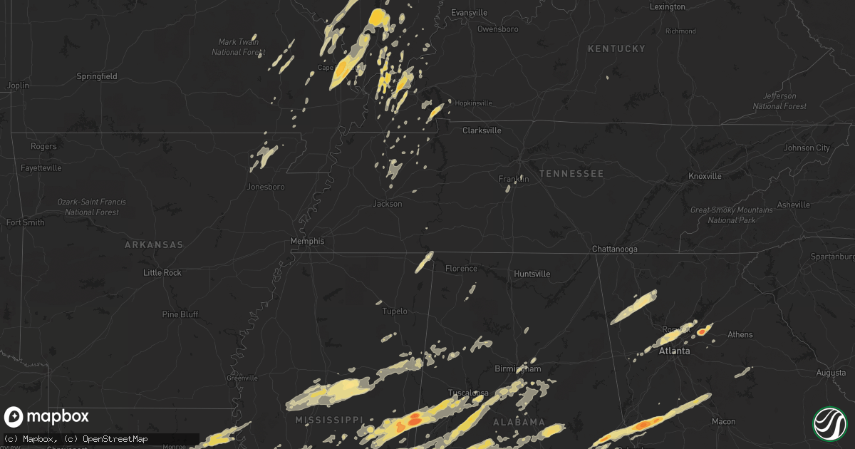
Hail Map in Mississippi on April 15, 2011
Get this storm
April 15 map
$229
one time, instant access
Download today. No call, no setup
Keep the $229
Bought the map and want the full workflow? Apply the entire $229 to a subscription within 7 days. None of it is wasted.
Every map, not just this one
This buys you this map. Subscription and you get every map we run, in the markets you choose from a few cities to whole states to nationwide. Plus real-time alerts the moment a storm fires.
Contact data
Name, contact info, occupancy, even credit band for addresses in the footprint. You go from where it hit to who to call.
Become the source they trust
Unlimited branding weather history reports on demand. You already have the documented answer ready for the property owner, and you are the one who showed up with it.
Property data and RoofTrace estimates
Pull up any address you have got, its value and the exact code rules for that jurisdiction, straight from One Click Code. Then RoofTrace estimates the squares, pitch, and roof value, priced the way you price.
Storm reports in Mississippi
Mississippi
| Date | Description |
|---|---|
| 04/15/20116:30 PM CDT | Golf ball size hail reported on hwy 63 |
| 04/15/20116:27 PM CDT | A local report indicates 1.00 inch wind near QUITMAN |
| 04/15/20116:23 PM CDT | A local report indicates 1.75 inch wind near LUMBERTON |
| 04/15/20116:22 PM CDT | A local report indicates 1.25 inch wind near QUITMAN |
| 04/15/20116:15 PM CDT | A local report indicates 1.00 inch wind near 7 N POPLARVILLE |
| 04/15/20115:54 PM CDT | A few trees were blown down along with numerous large limbs...pea hail also occurred. |
| 04/15/20115:48 PM CDT | Near clarkco state park. Ended around 6 pm. |
| 04/15/20115:45 PM CDT | Firefighter spotted a tornado |
| 04/15/20115:42 PM CDT | Trees down...one on a mobile home |
| 04/15/20115:42 PM CDT | Rain wrapped tornado crossing us hwy 45. Reported by ulm storm chasers. |
| 04/15/20115:42 PM CDT | A local report indicates 1.75 inch wind near QUITMAN |
| 04/15/20115:41 PM CDT | Along with pea hail |
| 04/15/20115:40 PM CDT | A local report indicates 4.25 inch wind near 1 W QUITMAN |
| 04/15/20115:35 PM CDT | Reported in the elwood community |
| 04/15/20115:30 PM CDT | A few trees down across cr 292...possible tornado. |
| 04/15/20115:30 PM CDT | A few trees down across cr 292...possible tornado. |
| 04/15/20115:30 PM CDT | A local report indicates 1.00 inch wind near 5 WSW QUITMAN |
| 04/15/20115:30 PM CDT | Golf ball to hen egg sized hail |
| 04/15/20115:21 PM CDT | 2 miles east of ellistown nickel to quarter size hail. |
| 04/15/20115:18 PM CDT | A roof was blown off a barn along suqualena meehan rd. Debris from the barn caused damage to a nearby house. |
| 04/15/20115:15 PM CDT | Reported at lost gap |
| 04/15/20115:00 PM CDT | Several trees down along cr 1537 with one on a house...possible tornado. |
| 04/15/20115:00 PM CDT | A couple trees down an many large limbs |
| 04/15/20115:00 PM CDT | A local report indicates 1.50 inch wind near 3 NW IMPROVE |
| 04/15/20114:59 PM CDT | This tornado moved just nw of another tornado track almost two hrs later...moving from cr 1519 to cr 1537. A roof was blown off a barn and numerous trees were blown dow |
| 04/15/20114:58 PM CDT | A local report indicates 1.25 inch wind near 5 S HICKORY |
| 04/15/20114:24 PM CDT | Golf ball sized hail reported by emergency manager near hwy 583 and east sunny hill road. |
| 04/15/20114:18 PM CDT | Several trees were downed around mendenhall. Three homes were damaged by fallen trees. Power lines were downed across us highway 49. |
| 04/15/20114:15 PM CDT | Wind damage blown on house reported by pike county civil defense. |
| 04/15/20114:13 PM CDT | A local report indicates 2.50 inch wind near 3 E MCCOMB |
| 04/15/20114:10 PM CDT | Structural damage to homes...trees down...possible tornado |
| 04/15/20114:08 PM CDT | This tornado first touched down along highway 18 and tracked east-northeast to at least county road 421. It is possible that this tornado tracked into alabama since it |
| 04/15/20114:05 PM CDT | Observed large hail at hampton inn in mccomb. |
| 04/15/20114:05 PM CDT | A local report indicates 1.75 inch wind near 1 S RUTH |
| 04/15/20114:00 PM CDT | Large hail with 70 mph wind gusts on interstate 55. |
| 04/15/20113:59 PM CDT | Hail observed on interstate 55 |
| 04/15/20113:58 PM CDT | Dime...quarter...and half dollar size hail fell |
| 04/15/20113:50 PM CDT | Quarter hail reported. |
| 04/15/20113:50 PM CDT | A local report indicates 1.75 inch wind near 5 W QUITMAN |
| 04/15/20113:46 PM CDT | Possible tornado downed 8 trees in thompson community |
| 04/15/20113:46 PM CDT | Baseball sized hail broke some windows out of vehicles. |
| 04/15/20113:46 PM CDT | A local report indicates 1.75 inch wind near HAZLEHURST |
| 04/15/20113:45 PM CDT | A few trees were blown down along cr 121 in the elwood community. |
| 04/15/20113:37 PM CDT | A local report indicates 1.00 inch wind near MCCOOL |
| 04/15/20113:25 PM CDT | A local report indicates 65 MPH wind near MARION |
| 04/15/20113:25 PM CDT | A local report indicates 1.75 inch wind near MARION |
| 04/15/20113:15 PM CDT | Reported by mhp officer |
| 04/15/20113:15 PM CDT | A local report indicates 1.75 inch wind near 3 N MERIDIAN |
| 04/15/20113:10 PM CDT | Trees and powerlines down. One tree down on a house...and another down on a car. |
| 04/15/20113:04 PM CDT | This tornado moved along cr 1519 dowing trees along the path. A second tornado moved just north of this location two hrs later causing overlapping dmg. One home had a t |
| 04/15/20113:00 PM CDT | A local report indicates 1.00 inch wind near MEEHAN |
| 04/15/20112:56 PM CDT | A local report indicates 2.75 inch wind near MEEHAN |
| 04/15/20112:54 PM CDT | A local report indicates 1.75 inch wind near 1 E HICKORY |
| 04/15/20112:52 PM CDT | A local report indicates 2.00 inch wind near 4 NW WEIR |
| 04/15/20112:47 PM CDT | A local report indicates 2.00 inch wind near 4 E SCOOBA |
| 04/15/20112:44 PM CDT | A local report indicates 1.00 inch wind near NEWTON |
| 04/15/20112:40 PM CDT | A local report indicates 1.75 inch wind near FRENCH CAMP |
| 04/15/20112:39 PM CDT | A local report indicates 1.50 inch wind near SCOOBA |
| 04/15/20112:33 PM CDT | An ef0 tornado touched down 3 miles east of hesterville along county road 3232 and uprooted a few trees. As it tracked northeast it crossed over highway 43 and uprooted |
| 04/15/20112:33 PM CDT | Hail just larger than hen egg...2.25 in |
| 04/15/20112:33 PM CDT | Several trees down |
| 04/15/20112:29 PM CDT | A local report indicates 1.50 inch wind near 2 E MENDENHALL |
| 04/15/20112:25 PM CDT | A local report indicates 2.50 inch wind near 3 E MENDENHALL |
| 04/15/20112:23 PM CDT | Tornado touched down along sun road just south of scott/smith county line where it downed limbs and snapped a tree. Tornado tracked into extreme southeast scott county |
| 04/15/20112:23 PM CDT | *** 2 inj *** county sheriff deputy reports tornado on the ground...update...homes damaged in area...1 mobile home destroyed |
| 04/15/20112:22 PM CDT | *** 2 inj *** an ef-2 tornado started from 1 mile southwest of town to 2 miles east of town. A mobile home was destroyed and parts of the home was spread out for 150 ya |
| 04/15/20112:20 PM CDT | Larger than golf ball sized hail |
| 04/15/20112:20 PM CDT | Trees down blocking hwy 39 |
| 04/15/20112:20 PM CDT | Golfball to hen egg size hail was reported. |
| 04/15/20112:16 PM CDT | A local report indicates 1.75 inch wind near D'LO |
| 04/15/20112:15 PM CDT | A swath of straight line wind damage affected the south through east sides of mendenhall between 215 and 230 pm. Numerous trees were uprooted and snapped...a number fel |
| 04/15/20112:11 PM CDT | A large tree was uprooted and laying across highway 12. Several large limbs were also down in the same area. |
| 04/15/20112:10 PM CDT | A local report indicates 1.75 inch wind near 2 E HOMEWOOD |
| 04/15/20112:05 PM CDT | 50-70 mph wind gust as well as pea size hail were reported. |
| 04/15/20111:55 PM CDT | Trees down in powerlines around georgetown and east across the pearl river in simpson county |
| 04/15/20111:54 PM CDT | Tornado downed trees and snapped large limbs along yates and springhill rds. Intensified over highway 17 snapping numerous pines. At intersection of castian springs and |
| 04/15/20111:52 PM CDT | Trees down along highway 18 |
| 04/15/20111:47 PM CDT | Tornado touched down just south of highway 18 near rankin/smith county line where several trees were snapped. North of highway 18 a large barn had part of roof taken of |
| 04/15/20111:39 PM CDT | Baseball hail dented a vehicle on binnsville road near the alabama state line. |
| 04/15/20111:39 PM CDT | Tornado downed a number of trees and large limbs in a convergent pattern along james road and tillmantown lane. Path length 1 mile...max width 200 yd |
| 04/15/20111:35 PM CDT | A local report indicates 1.75 inch wind near 1 S HAZLEHURST |
| 04/15/20111:34 PM CDT | Tornado spotted crossing highway 16 knocking down trees and power lines. |
| 04/15/20111:25 PM CDT | Numerous trees and powerlines down...one home destroyed...in area from north and northeast of de kalb...reported by mhp |
| 04/15/20111:20 PM CDT | Trained msu spotter team reports large tornado on the ground |
| 04/15/20111:15 PM CDT | A local report indicates 1.75 inch wind near 5 SSW STAR |
| 04/15/20111:11 PM CDT | Numerous trees down...one on a house |
| 04/15/20111:11 PM CDT | Numerous trees down...one on a house |
| 04/15/20111:10 PM CDT | House destroyed a couple miles south of highway 16 on hwy 495. Probable tornado. |
| 04/15/20111:06 PM CDT | Numerous trees uprooted and snapped...damage to structures |
| 04/15/20111:00 PM CDT | A local report indicates 1.00 inch wind near 3 SW WHITES |
| 04/15/20111:00 PM CDT | A local report indicates 1.00 inch wind near 4 SSE TERRY |
| 04/15/20111:00 PM CDT | A local report indicates 1.00 inch wind near 4 SE TERRY |
| 04/15/201112:55 PM CDT | Mobile home damaged on county road 729. Possible tornado based on radar. |
| 04/15/201112:55 PM CDT | A local report indicates 1.00 inch wind near 3 NNE CRYSTAL SPRINGS |
| 04/15/201112:53 PM CDT | *** 5 inj *** tornado max winds estimated at 140 mph. Path length 38.5 miles with a max width of .75 miles. Tornado started just west of cr 450 and downed numerous tree |
| 04/15/201112:53 PM CDT | A local report indicates 1.75 inch wind near CRYSTAL SPRINGS |
| 04/15/201112:52 PM CDT | Trees down in central and northern parts of the county. One fell on an 18 wheeler i-55 at mile marker 68 |
| 04/15/201112:52 PM CDT | A local report indicates 1.00 inch wind near FORESTDALE |
| 04/15/201112:05 PM CDT | Trees down across hwy 13 north of lena. Possible tornado based on radar. |
| 04/15/201112:00 PM CDT | Trees down on 2 houses. Roof damage along with several sheds damaged. Power lines down...all along hwy 483 just south of ludlow. Probable tornado. |
| 04/15/201111:58 AM CDT | Tornado touched down west of ms hwy 483...crossing the highway then crossing through the northern portion of the bienville nf before moving into sw leake co. Tornado li |
| 04/15/201111:45 AM CDT | Wood frame house completely destroyed along highway 56. |
| 04/15/201111:44 AM CDT | A storm survey found an ef1 tornado in the pisgah area of rankin county. The survey has not been completed so additional information will be issued later. |
| 04/15/201111:43 AM CDT | Tornado began along ms highway 25....tracking across the pisgah area and ending at the rankin/scott county border along pat holmes rd. The roof of a home was damaged... |
| 04/15/201111:43 AM CDT | Tornado touchdown reported by spotter. Brief touchdown...lifted into funnel cloud on last report. |
| 04/15/201111:35 AM CDT | Update...extensive tree damage...trees down...including trees on houses...and some roof damage in the area around pisgah road...highway 43...and sandhill road. Likely t |
| 04/15/201111:22 AM CDT | This tornado developed over the ross barnett reservoir and traveled northeast coming ashore in rankin county to the wsw of goshen springs. Trees and large limbs were do |
| 04/15/201111:20 AM CDT | Several trees reported down in town. Probable tornado |
| 04/15/201111:20 AM CDT | Tornado sighted moving across ross barnett reservoir by the control tower |
| 04/15/201111:15 AM CDT | Shingles were blown off a roof...large tree fell on a car near the wayne/clark co line just east of matherville. Penny hail also occurred. |
| 04/15/201111:12 AM CDT | Tornado damage in area including cars reported flipped |
| 04/15/201111:05 AM CDT | Trees down across hwy 13 north of lena. Possible tornado based on radar. |
| 04/15/201111:05 AM CDT | Jackson tower reports a tornado was seen from hawkins field |
| 04/15/201110:57 AM CDT | Reservoir tower reports tornado passing across the reservoir to their north |
| 04/15/201110:57 AM CDT | Numerous trees down some on houses in the vicinity of madison heights baptist church. |
| 04/15/201110:57 AM CDT | Trees and powerlines down |
| 04/15/201110:55 AM CDT | Corrected location...reports of tornado on the ground just south of interstate 20 at reynolds and mcraven road. Trees and power lines down and possible house damage. |
| 04/15/201110:55 AM CDT | Reports of tornado on the ground just south of interstate 20 at reynolds and mcraven road. Trees and power lines down and possible house damage. |
| 04/15/201110:51 AM CDT | *** 10 inj *** ef3 damage surveyed with maximum winds of 140 mph estimated...path length 17 miles and a max width of .3 miles. Tornado began along airport road se of cl |
| 04/15/201110:40 AM CDT | Tree downed across champion hill rd near bolton |
| 04/15/201110:20 AM CDT | Tornado reported by ema north of strengthford near the whistler area. |
| 04/15/201110:05 AM CDT | Estimated wind gust with 1 tree down in the vicinity |
| 04/15/201110:03 AM CDT | Power pole down near home depot in vicksburg |
| 04/15/201110:00 AM CDT | Trees were downed along lakewood hill rd |
| 04/15/20119:55 AM CDT | Several trees down in and south of vicksburg. One fell on an 18 wheeler on highway 61 and another fell on a house in oak park |
| 04/15/20119:55 AM CDT | Trees downed blocking us highway 61 in the 7000 block |
| 04/15/20119:48 AM CDT | Showroom window blown out at atwood car lot |
| 04/15/20118:53 AM CDT | A local report indicates 1.25 inch wind near 2 E WEST |
| 04/15/20118:06 AM CDT | Multiple trees down along new salem road. |
| 04/15/20118:00 AM CDT | Several trees down across the southern portions of pontotoc county. |
| 04/15/20118:00 AM CDT | Numerous trees down in the town of van vleet. A roof was blown off a mobile home. The roof of a porch was lifted and blown over a house. A tree fell also fell onto a ho |
| 04/15/20117:44 AM CDT | Tree reported down at the intersection of foot street and washington/polk streets in corinth. |
| 04/15/20117:25 AM CDT | A few trees were downed along old benton rd |
| 04/15/20117:10 AM CDT | Trees downed...blocking gums crossing rd in eastern grenada co. |
| 04/15/20117:00 AM CDT | A tree was downed along jackson ave...and a light pole was partially leaning |
| 04/15/20117:00 AM CDT | A few trees reported down in coffeeville. |
| 04/15/20117:00 AM CDT | A tree was downed along koppers dr |
| 04/14/20118:37 PM CDT | Reported near carnes road and highway 49. |
| 04/14/20117:55 PM CDT | Greene county ema reports several homes destroyed in nw leakesville. Several injuries reported with people being transported to the hospital. |
| 04/14/20117:53 PM CDT | Torando reported on the ground near high school road and highway 57 just west of leakesville. Power out in the city. |
| 04/14/20117:52 PM CDT | Structure damage reported on dean turner road. Trees and power lines also down |
All States Impacted by Hail Map on April 15, 2011
Cities Impacted by Hail Map on April 15, 2011
- Ledbetter, KY
- Brookport, IL
- Jonesboro, IL
- McClure, IL
- Wolf Lake, IL
- Anna, IL
- Cape Girardeau, MO
- Scott City, MO
- Carbondale, IL
- Thebes, IL
- Makanda, IL
- Oran, MO
- Cobden, IL
- Chaffee, MO
- Tamms, IL
- Benton, MO
- Annapolis, MO
- Des Arc, MO
- Sawyerville, AL
- Cadiz, KY
- Murray, KY
- Mccomb, MS
- Tylertown, MS
- Jayess, MS
- Summit, MS
- Monroe, GA
- Jemison, AL
- Thorsby, AL
- Clanton, AL
- Vicksburg, MS
- Edwards, MS
- McIntosh, AL
- Tibbie, AL
- Deer Park, AL
- Grove Hill, AL
- Leroy, AL
- Gainestown, AL
- Wagarville, AL
- Sunflower, AL
- Jackson, AL
- Okolona, MS
- Perryville, MO
- West Paducah, KY
- Metropolis, IL
- Kevil, KY
- Porterville, MS
- Aliceville, AL
- Scooba, MS
- De Kalb, MS
- Emelle, AL
- Macon, MS
- Kilbourne, IL
- Bath, IL
- Sterrett, AL
- Columbiana, AL
- Wilsonville, AL
- Harpersville, AL
- Chelsea, AL
- Sullivan, MO
- Greensboro, GA
- Brookhaven, MS
- Trussville, AL
- Atlanta, GA
- Marietta, GA
- Greenville, AL
- Chandlerville, IL
- Petersburg, IL
- Ashland, IL
- Pleasant Plains, IL
- Tallula, IL
- Orrville, AL
- Marion Junction, AL
- Safford, AL
- Selma, AL
- Louisiana, MO
- Bowling Green, MO
- Tamaroa, IL
- Pinckneyville, IL
- Modesto, IL
- Waverly, IL
- Franklin, IL
- Hamilton, GA
- Pine Mountain Valley, GA
- Saint Louis, MO
- Starkville, MS
- West Point, MS
- Columbus, MS
- Mount Vernon, AL
- New London, MO
- Hannibal, MO
- Freeman Spur, IL
- Johnston City, IL
- Benton, IL
- Mulkeytown, IL
- Christopher, IL
- West Frankfort, IL
- Herrin, IL
- Zeigler, IL
- Buckner, IL
- Orient, IL
- Royalton, IL
- Peterman, AL
- Monroeville, AL
- Gloster, MS
- Pachuta, MS
- Stonewall, MS
- Quitman, MS
- Shubuta, MS
- Enterprise, MS
- Colchester, IL
- Tennessee, IL
- Calvert City, KY
- Virden, IL
- Morris Chapel, TN
- Villa Rica, GA
- Pinola, MS
- Mendenhall, MS
- Butler, AL
- Jachin, AL
- Alpharetta, GA
- Cumming, GA
- Austell, GA
- Roswell, GA
- Smyrna, GA
- Mableton, GA
- Suwanee, GA
- Duluth, GA
- Peachtree Corners, GA
- Waynesboro, MS
- McCool, MS
- French Camp, MS
- Ethel, MS
- Stewart, MS
- Kilmichael, MS
- Weir, MS
- Daleville, AL
- Ackerman, MS
- Vernon, AL
- Sulligent, AL
- Millport, AL
- Ava, IL
- Campbell Hill, IL
- Williamsville, MO
- Sweet Water, AL
- Pennington, AL
- Union, MS
- Angie, LA
- Lumberton, MS
- Franklinton, LA
- Purvis, MS
- Brooklyn, MS
- Hattiesburg, MS
- Poplarville, MS
- Forsyth, GA
- Barnesville, GA
- Carrier Mills, IL
- Harrisburg, IL
- Marquand, MO
- Greenville, MO
- Lodi, MO
- Fredericktown, MO
- Silva, MO
- Little Rock, MS
- Forest, MS
- Bruceton, TN
- Houston, MS
- Eolia, MO
- Baton Rouge, LA
- Sunshine, LA
- Saint Gabriel, LA
- Palmyra, IL
- Bunker Hill, IL
- Dorsey, IL
- Shipman, IL
- Greenfield, TN
- West, MS
- Durant, MS
- Lexington, MS
- Beaufort, MO
- Kinston, AL
- Samson, AL
- Wesson, MS
- Hazlehurst, MS
- Braxton, MS
- Magee, MS
- Salem, KY
- Burna, KY
- Coffeeville, AL
- State Line, MS
- Millry, AL
- Chatom, AL
- Richton, MS
- Frankville, AL
- Fruitdale, AL
- Neely, MS
- Fort Deposit, AL
- Beaumont, MS
- Vinegar Bend, AL
- Vredenburgh, AL
- Franklin, AL
- Beatrice, AL
- Frisco City, AL
- Kentwood, LA
- Mount Hermon, LA
- Pine Apple, AL
- McLain, MS
- Whatley, AL
- Leakesville, MS
- Greensburg, LA
- Forest Home, AL
- New Augusta, MS
- Tiline, KY
- Smithland, KY
- Dacula, GA
- Auburn, GA
- Lawrenceville, GA
- Hoschton, GA
- Buford, GA
- Raleigh, MS
- Louin, MS
- Thomasville, GA
- Tallahassee, FL
- Cairo, GA
- Havana, FL
- Marion, IL
- Creal Springs, IL
- Saint Francisville, LA
- Glenarm, IL
- Pawnee, IL
- Springfield, IL
- Birmingham, AL
- Smithdale, MS
- Seminary, MS
- Sumrall, MS
- Columbia, MS
- Moselle, MS
- Woodville, MS
- Monterey, LA
- Magnolia, MS
- Foxworth, MS
- Kokomo, MS
- Centreville, MS
- Ruth, MS
- Ellisville, MS
- Bassfield, MS
- Liberty, MS
- Ranger, GA
- Hermanville, MS
- Crystal Springs, MS
- Pattison, MS
- Silex, MO
- Frohna, MO
- Natchez, MS
- Fayette, MS
- Sardis, AL
- Fancy Farm, KY
- Cunningham, KY
- Melber, KY
- Monroe City, MO
- Palmyra, MO
- Saint Charles, MO
- Grafton, IL
- Brussels, IL
- Portage Des Sioux, MO
- Opp, AL
- Andalusia, AL
- Elba, AL
- Lindale, GA
- Rome, GA
- Silver Creek, GA
- Carthage, MS
- Wickliffe, KY
- Brewton, AL
- Cottondale, AL
- Meridian, MS
- Toomsuba, MS
- Chunky, MS
- Florence, MS
- Hickory, MS
- Marion, MS
- Decatur, MS
- Lake, MS
- Morton, MS
- Pulaski, MS
- Brandon, MS
- Newton, MS
- Lawrence, MS
- Auburn, AL
- Auburn University, AL
- Opelika, AL
- Thomaston, AL
- Faunsdale, AL
- Liverpool, IL
- Canton, IL
- Topeka, IL
- Lewistown, IL
- Hunnewell, MO
- Bogalusa, LA
- Monticello, FL
- Maryland Heights, MO
- Marthasville, MO
- Union, MO
- Washington, MO
- Augusta, MO
- Breaux Bridge, LA
- Saint Martinville, LA
- Chatham, IL
- Divernon, IL
- Plaucheville, LA
- Boligee, AL
- Bailey, MS
- Daleville, MS
- Philadelphia, MS
- Collinsville, MS
- Buckatunna, MS
- Pine Mountain, GA
- Warm Springs, GA
- Manchester, GA
- West Point, GA
- Shiloh, GA
- Sharon, TN
- Loganville, GA
- Rayville, LA
- Fosters, AL
- Ralph, AL
- Hartford, AL
- East Saint Louis, IL
- Madison, IL
- Granite City, IL
- Hayneville, AL
- Tyler, AL
- Blountsville, AL
- Hayden, AL
- Edinburg, IL
- Adairsville, GA
- Cartersville, GA
- Kingston, GA
- Fairmount, GA
- White, GA
- Calhoun, GA
- Cave Spring, GA
- Rydal, GA
- Middletown, MO
- Cedartown, GA
- Paulding, MS
- Plaquemine, LA
- Grosse Tete, LA
- Port Allen, LA
- Melvin, AL
- Gilbertown, AL
- Taylorsville, MS
- Bay Springs, MS
- Dongola, IL
- Villa Ridge, IL
- Ullin, IL
- Pulaski, IL
- Elmer, LA
- Karnak, IL
- Grand Chain, IL
- Toxey, AL
- Fayette, AL
- Lucedale, MS
- Citronelle, AL
- Jacob, IL
- Gorham, IL
- Saint Ann, MO
- Defiance, MO
- Foristell, MO
- Wentzville, MO
- Lake Saint Louis, MO
- Jackson, MS
- Madison, MS
- Ridgeland, MS
- Franklin, TN
- Valdosta, GA
- Quitman, GA
- Vaiden, MS
- Cantrall, IL
- Lorman, MS
- Union Church, MS
- Broughton, IL
- Hineston, LA
- Sieper, LA
- Alexander, IL
- Vossburg, MS
- Tuskegee, AL
- Mayfield, KY
- Paducah, KY
- Boaz, KY
- Symsonia, KY
- Hickory, KY
- Clinton, LA
- Wilson, LA
- Newhebron, MS
- Georgetown, MS
- Atmore, AL
- Vienna, IL
- Melville, LA
- Bunkie, LA
- Palmetto, LA
- Washington, LA
- Iuka, MS
- Laurel, MS
- Hartford, IL
- Wood River, IL
- East Alton, IL
- Roxana, IL
- Benton, KY
- Hardin, KY
- Equality, AL
- Rockford, AL
- Verbena, AL
- Marbury, AL
- Prattville, AL
- Deatsville, AL
- Titus, AL
- Eclectic, AL
- Wetumpka, AL
- Addis, LA
- Saint Clair, MO
- Golconda, IL
- Eddyville, IL
- Simpson, IL
- Bloomfield, MO
- Puxico, MO
- Dexter, MO
- Lovejoy, IL
- Venice, IL
- Villa Ridge, MO
- Gray Summit, MO
- Pacific, MO
- Caledonia, MS
- Coffee Springs, AL
- Labadie, MO
- Dresden, TN
- Palmersville, TN
- Duncanville, AL
- Knoxville, AL
- Moundville, AL
- Ethel, LA
- Jackson, LA
- Norwood, LA
- Riverton, IL
- Buffalo, IL
- Dawson, IL
- Williamsville, IL
- Ozark, IL
- Pineville, LA
- Center Point, LA
- Effie, LA
- Deville, LA
- Greenview, IL
- Athens, IL
- Camden, AL
- Columbia, IL
- Newellton, LA
- Silas, AL
- Morrisonville, IL
- Hollow Rock, TN
- McKenzie, TN
- Utica, MS
- Terry, MS
- Girard, IL
- Hazelwood, MO
- Bridgeton, MO
- Belknap, IL
- Grantsburg, IL
- Forkland, AL
- Thompsons Station, TN
- Steens, MS
- Goreville, IL
- Pine Hill, AL
- Thomasville, AL
- Kosciusko, MS
- Sallis, MS
- Tchula, MS
- Barlow, KY
- La Center, KY
- Trezevant, TN
- Atwood, TN
- Alto Pass, IL
- Pittsburg, IL
- Energy, IL
- Cambria, IL
- Thompsonville, IL
- Galatia, IL
- Logan, IL
- De Soto, IL
- Carterville, IL
- Pelham, AL
- Minter, AL
- Marion, KY
- Ewing, IL
- Belle Rive, IL
- Coila, MS
- Cruger, MS
- Eutaw, AL
- Batchelor, LA
- Center, MO
- Calera, AL
- Harrisville, MS
- Transylvania, LA
- Lake Providence, LA
- Epps, LA
- Delhi, LA
- Sondheimer, LA
- Pioneer, LA
- Walnut Grove, MS
- Phil Campbell, AL
- Lisman, AL
- Ward, AL
- York, AL
- Demopolis, AL
- Linden, AL
- Jerseyville, IL
- Fieldon, IL
- Kane, IL
- Florala, AL
- Enterprise, AL
- Tallulah, LA
- Earth City, MO
- Greensboro, AL
- Rockbridge, IL
- Rochester, IL
- Plymouth, IL
- Burnsville, MS
- Waterloo, AL
- Jasper, AL
- House Springs, MO
- High Ridge, MO
- Plantersville, AL
- Maplesville, AL
- Marble Hill, MO
- Alabaster, AL
- Helena, AL
- Billingsley, AL
- Salem, AL
- Woodland, GA
- The Rock, GA
- Notasulga, AL
- Meansville, GA
- Valley, AL
- Fortson, GA
- Thomaston, GA
- Molena, GA
- Cusseta, AL
- Cataula, GA
- Attapulgus, GA
- Whigham, GA
- Bellamy, AL
- Livingston, AL
- Carrollton, GA
- Raymond, MS
- Arlington, KY
- Hampton, KY
- Conehatta, MS
- Almo, KY
- Medina, TN
- Milan, TN
- Norcross, GA
- Stone Mountain, GA
- Tucker, GA
- Friedheim, MO
- Millersville, MO
- Daisy, MO
- Uniontown, MO
- Oak Ridge, MO
- Leslie, MO
- Cottage Hills, IL
- Alton, IL
- East Carondelet, IL
- Florissant, MO
- Bethalto, IL
- South Roxana, IL
- Zalma, MO
- Pelahatchie, MS
- Lauderdale, MS
- Cuba, AL
- Denham Springs, LA
- Prairieville, LA
- Gallion, AL
- Herod, IL
- Qulin, MO
- Wiggins, MS
- Hope Hull, AL
- Lowndesboro, AL
- Letohatchee, AL
- Evergreen, AL
- Saint Stephens, AL
- Georgetown, LA
- Winnfield, LA
- Caseyville, IL
- Collinsville, IL
- Akron, AL
- Jacksonville, IL
- Hazel, KY
- Shuqualak, MS
- Buhl, AL
- Tuscaloosa, AL
- Epes, AL
- Preston, MS
- Gainesville, AL
- Clinton, MS
- Bolton, MS
- Kinder, LA
- Welsh, LA
- Jennings, LA
- Woodbury, GA
- Greenville, GA
- Chancellor, AL
- Beech Grove, AR
- Delaplaine, AR
- Murrayville, IL
- Little River, AL
- Uriah, AL
- Sylacauga, AL
- Vincent, AL
- Childersburg, AL
- Eatonton, GA
- Booneville, MS
- Quincy, FL
- Chattahoochee, FL
- Belleview, MO
- Lettsworth, LA
- Simmesport, LA
- O'Fallon, MO
- Robertsville, MO
- Marion, AL
- Douglasville, GA
- Evangeline, LA
- Aberdeen, MS
- Bradford, TN
- Lena, MS
- Needham, AL
- Naylor, MO
- Rose Hill, MS
- McLeansboro, IL
- Belzoni, MS
- Goodman, MS
- Louisville, MS
- Yazoo City, MS
- Mississippi State, MS
- Sturgis, MS
- Dittmer, MO
- Eupora, MS
- Plainville, GA
- Bainbridge, GA
- Bessemer, AL
- West Blocton, AL
- Russellville, AL
- Rockwood, IL
- Altenburg, MO
- Jackson, MO
- Cutler, IL
- Crosby, MS
- Brent, AL
- Woodstock, AL
- Catherine, AL
- Heidelberg, MS
- McCalla, AL
- Vidalia, LA
- Newbern, AL
- Montevallo, AL
- Mize, MS
- Uniontown, AL
- Jones, AL
- Centreville, AL
- Vance, AL
- Ovett, MS
- Brierfield, AL
- Autaugaville, AL
- Corning, AR
- Marksville, LA
- Winston, GA
- Cairo, IL
- Miller City, IL
- Pocahontas, AR
- Grubville, MO
- Cedar Hill, MO
- Medora, IL
- Martin, TN
- Fulton, KY
- South Fulton, TN
- Nauvoo, AL
- Berry, AL
- Townley, AL
- Carbon Hill, AL
- Oakman, AL
- Vaughan, MS
- Slocomb, AL
- Newton, AL
- Geneva, AL
- New Brockton, AL
- Canton, MS
- Raleigh, IL
- Macedonia, IL
- Rector, AR
- Wright City, MO
- Maryville, IL
- Carrollton, IL
- Castleberry, AL
- Repton, AL
- Clinton, KY
- Slaughter, LA
- Iota, LA
- Egan, LA
- Crowley, LA
- Ballwin, MO
- Oakford, IL
- Buncombe, IL
- Mount Hope, AL
- Town Creek, AL
- Peach Orchard, AR
- Fenton, MO
- Leesville, LA
- Otis, LA
- New Berlin, IL
- Stockton, AL
- Eureka, MO
- New Burnside, IL
- Stonefort, IL
- Gleason, TN
- Henry, TN
- Paris, TN
- Alpine, AL
- Flovilla, GA
- Pearl, MS
- Flomaton, AL
- Hamilton, MS
- Waverly Hall, GA
- White Hall, IL
- Roodhouse, IL
- Fisk, MO
- Broseley, MO
- Knobel, AR
- Paragould, AR
- Bono, AR
- Dyer, TN
- Rutherford, TN
- Hettick, IL
- Greenfield, IL
- Fort Rucker, AL
- De Soto, MO
- Festus, MO
- Farmersville, IL
- Sedalia, KY
- Harvel, IL
- Elsah, IL
- Dow, IL
- Junction, IL
- Ridgway, IL
- Luebbering, MO
- Richwoods, MO
- Beaverton, AL
- Farrar, MO
- Ecru, MS
- Pontotoc, MS
- Blue Springs, MS
- Trenton, TN
- Cave In Rock, IL
- Elizabethtown, IL
- Hardin, IL
- Batchtown, IL
- Mansfield, TN
- Carlinville, IL
- Bankston, AL
- Poplar Bluff, MO
- Table Grove, IL
- Golden Eagle, IL
- Hamburg, IL
- Zebulon, GA
- Alexandria, LA
- Shelby, AL
- Kennedy, AL
- Greensburg, KY
- Fort Polk, LA
- Pitkin, LA
- Dry Prong, LA
- Atlanta, LA
- Olla, LA
- Tullos, LA
- Loami, IL
- Powder Springs, GA
- Oberlin, LA
- Madison, GA
- Buckhead, GA
- Warrenton, MO
- Spring Hill, TN
- Wingo, KY
- Buchanan, TN
- Walnut Ridge, AR
- Lexington, TN
- Wildersville, TN
- Clarkdale, GA
- Lithia Springs, GA
- Havana, IL
- Easton, IL
- Hull, IL
- Equality, IL
- Dothan, AL
- Rolling Fork, MS
- Oak Ridge, LA
- Mayersville, MS
- Bardwell, KY
- Edwardsville, IL
- Moro, IL
- Burfordville, MO
- Biggers, AR
- Dudley, MO
- Cottage Grove, TN
- Ironton, MO
- Lilburn, GA
- Gilbert, LA
- Brentwood, TN
- Farmington, KY
- Patterson, MO
- Troy, MO
- Lesterville, MO


