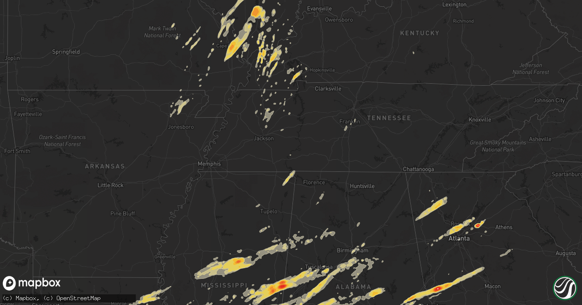
Hail Map on April 15, 2011
Get this storm
April 15 map
$229
one time, instant access
Download today. No call, no setup
Keep the $229
Bought the map and want the full workflow? Apply the entire $229 to a subscription within 7 days. None of it is wasted.
Every map, not just this one
This buys you this map. Subscription and you get every map we run, in the markets you choose from a few cities to whole states to nationwide. Plus real-time alerts the moment a storm fires.
Contact data
Name, contact info, occupancy, even credit band for addresses in the footprint. You go from where it hit to who to call.
Become the source they trust
Unlimited branding weather history reports on demand. You already have the documented answer ready for the property owner, and you are the one who showed up with it.
Property data and RoofTrace estimates
Pull up any address you have got, its value and the exact code rules for that jurisdiction, straight from One Click Code. Then RoofTrace estimates the squares, pitch, and roof value, priced the way you price.
States Impacted by Hail Map on April 15, 2011
Storm reports
Mississippi
| Date | Description |
|---|---|
| 04/15/20116:30 PM CDT | Golf ball size hail reported on hwy 63 |
| 04/15/20116:27 PM CDT | A local report indicates 1.00 inch wind near QUITMAN |
| 04/15/20116:23 PM CDT | A local report indicates 1.75 inch wind near LUMBERTON |
| 04/15/20116:22 PM CDT | A local report indicates 1.25 inch wind near QUITMAN |
| 04/15/20116:15 PM CDT | A local report indicates 1.00 inch wind near 7 N POPLARVILLE |
| 04/15/20115:54 PM CDT | A few trees were blown down along with numerous large limbs...pea hail also occurred. |
| 04/15/20115:48 PM CDT | Near clarkco state park. Ended around 6 pm. |
| 04/15/20115:45 PM CDT | Firefighter spotted a tornado |
| 04/15/20115:42 PM CDT | Trees down...one on a mobile home |
| 04/15/20115:42 PM CDT | Rain wrapped tornado crossing us hwy 45. Reported by ulm storm chasers. |
| 04/15/20115:42 PM CDT | A local report indicates 1.75 inch wind near QUITMAN |
| 04/15/20115:41 PM CDT | Along with pea hail |
| 04/15/20115:40 PM CDT | A local report indicates 4.25 inch wind near 1 W QUITMAN |
| 04/15/20115:35 PM CDT | Reported in the elwood community |
| 04/15/20115:30 PM CDT | A few trees down across cr 292...possible tornado. |
| 04/15/20115:30 PM CDT | Golf ball to hen egg sized hail |
| 04/15/20115:30 PM CDT | A local report indicates 1.00 inch wind near 5 WSW QUITMAN |
| 04/15/20115:30 PM CDT | A few trees down across cr 292...possible tornado. |
| 04/15/20115:21 PM CDT | 2 miles east of ellistown nickel to quarter size hail. |
| 04/15/20115:18 PM CDT | A roof was blown off a barn along suqualena meehan rd. Debris from the barn caused damage to a nearby house. |
| 04/15/20115:15 PM CDT | Reported at lost gap |
| 04/15/20115:00 PM CDT | A couple trees down an many large limbs |
| 04/15/20115:00 PM CDT | Several trees down along cr 1537 with one on a house...possible tornado. |
| 04/15/20115:00 PM CDT | A local report indicates 1.50 inch wind near 3 NW IMPROVE |
| 04/15/20114:59 PM CDT | This tornado moved just nw of another tornado track almost two hrs later...moving from cr 1519 to cr 1537. A roof was blown off a barn and numerous trees were blown dow |
| 04/15/20114:58 PM CDT | A local report indicates 1.25 inch wind near 5 S HICKORY |
| 04/15/20114:24 PM CDT | Golf ball sized hail reported by emergency manager near hwy 583 and east sunny hill road. |
| 04/15/20114:18 PM CDT | Several trees were downed around mendenhall. Three homes were damaged by fallen trees. Power lines were downed across us highway 49. |
| 04/15/20114:15 PM CDT | Wind damage blown on house reported by pike county civil defense. |
| 04/15/20114:13 PM CDT | A local report indicates 2.50 inch wind near 3 E MCCOMB |
| 04/15/20114:10 PM CDT | Structural damage to homes...trees down...possible tornado |
| 04/15/20114:08 PM CDT | This tornado first touched down along highway 18 and tracked east-northeast to at least county road 421. It is possible that this tornado tracked into alabama since it |
| 04/15/20114:05 PM CDT | A local report indicates 1.75 inch wind near 1 S RUTH |
| 04/15/20114:05 PM CDT | Observed large hail at hampton inn in mccomb. |
| 04/15/20114:00 PM CDT | Large hail with 70 mph wind gusts on interstate 55. |
| 04/15/20113:59 PM CDT | Hail observed on interstate 55 |
| 04/15/20113:58 PM CDT | Dime...quarter...and half dollar size hail fell |
| 04/15/20113:50 PM CDT | A local report indicates 1.75 inch wind near 5 W QUITMAN |
| 04/15/20113:50 PM CDT | Quarter hail reported. |
| 04/15/20113:46 PM CDT | A local report indicates 1.75 inch wind near HAZLEHURST |
| 04/15/20113:46 PM CDT | Baseball sized hail broke some windows out of vehicles. |
| 04/15/20113:46 PM CDT | Possible tornado downed 8 trees in thompson community |
| 04/15/20113:45 PM CDT | A few trees were blown down along cr 121 in the elwood community. |
| 04/15/20113:37 PM CDT | A local report indicates 1.00 inch wind near MCCOOL |
| 04/15/20113:25 PM CDT | A local report indicates 65 MPH wind near MARION |
| 04/15/20113:25 PM CDT | A local report indicates 1.75 inch wind near MARION |
| 04/15/20113:15 PM CDT | A local report indicates 1.75 inch wind near 3 N MERIDIAN |
| 04/15/20113:15 PM CDT | Reported by mhp officer |
| 04/15/20113:10 PM CDT | Trees and powerlines down. One tree down on a house...and another down on a car. |
| 04/15/20113:04 PM CDT | This tornado moved along cr 1519 dowing trees along the path. A second tornado moved just north of this location two hrs later causing overlapping dmg. One home had a t |
| 04/15/20113:00 PM CDT | A local report indicates 1.00 inch wind near MEEHAN |
| 04/15/20112:56 PM CDT | A local report indicates 2.75 inch wind near MEEHAN |
| 04/15/20112:54 PM CDT | A local report indicates 1.75 inch wind near 1 E HICKORY |
| 04/15/20112:52 PM CDT | A local report indicates 2.00 inch wind near 4 NW WEIR |
| 04/15/20112:47 PM CDT | A local report indicates 2.00 inch wind near 4 E SCOOBA |
| 04/15/20112:44 PM CDT | A local report indicates 1.00 inch wind near NEWTON |
| 04/15/20112:40 PM CDT | A local report indicates 1.75 inch wind near FRENCH CAMP |
| 04/15/20112:39 PM CDT | A local report indicates 1.50 inch wind near SCOOBA |
| 04/15/20112:33 PM CDT | An ef0 tornado touched down 3 miles east of hesterville along county road 3232 and uprooted a few trees. As it tracked northeast it crossed over highway 43 and uprooted |
| 04/15/20112:33 PM CDT | Several trees down |
| 04/15/20112:33 PM CDT | Hail just larger than hen egg...2.25 in |
| 04/15/20112:29 PM CDT | A local report indicates 1.50 inch wind near 2 E MENDENHALL |
| 04/15/20112:25 PM CDT | A local report indicates 2.50 inch wind near 3 E MENDENHALL |
| 04/15/20112:23 PM CDT | Tornado touched down along sun road just south of scott/smith county line where it downed limbs and snapped a tree. Tornado tracked into extreme southeast scott county |
| 04/15/20112:23 PM CDT | *** 2 inj *** county sheriff deputy reports tornado on the ground...update...homes damaged in area...1 mobile home destroyed |
| 04/15/20112:22 PM CDT | *** 2 inj *** an ef-2 tornado started from 1 mile southwest of town to 2 miles east of town. A mobile home was destroyed and parts of the home was spread out for 150 ya |
| 04/15/20112:20 PM CDT | Golfball to hen egg size hail was reported. |
| 04/15/20112:20 PM CDT | Larger than golf ball sized hail |
| 04/15/20112:20 PM CDT | Trees down blocking hwy 39 |
| 04/15/20112:16 PM CDT | A local report indicates 1.75 inch wind near D'LO |
| 04/15/20112:15 PM CDT | A swath of straight line wind damage affected the south through east sides of mendenhall between 215 and 230 pm. Numerous trees were uprooted and snapped...a number fel |
| 04/15/20112:11 PM CDT | A large tree was uprooted and laying across highway 12. Several large limbs were also down in the same area. |
| 04/15/20112:10 PM CDT | A local report indicates 1.75 inch wind near 2 E HOMEWOOD |
| 04/15/20112:05 PM CDT | 50-70 mph wind gust as well as pea size hail were reported. |
| 04/15/20111:55 PM CDT | Trees down in powerlines around georgetown and east across the pearl river in simpson county |
| 04/15/20111:54 PM CDT | Tornado downed trees and snapped large limbs along yates and springhill rds. Intensified over highway 17 snapping numerous pines. At intersection of castian springs and |
| 04/15/20111:52 PM CDT | Trees down along highway 18 |
| 04/15/20111:47 PM CDT | Tornado touched down just south of highway 18 near rankin/smith county line where several trees were snapped. North of highway 18 a large barn had part of roof taken of |
| 04/15/20111:39 PM CDT | Tornado downed a number of trees and large limbs in a convergent pattern along james road and tillmantown lane. Path length 1 mile...max width 200 yd |
| 04/15/20111:39 PM CDT | Baseball hail dented a vehicle on binnsville road near the alabama state line. |
| 04/15/20111:35 PM CDT | A local report indicates 1.75 inch wind near 1 S HAZLEHURST |
| 04/15/20111:34 PM CDT | Tornado spotted crossing highway 16 knocking down trees and power lines. |
| 04/15/20111:25 PM CDT | Numerous trees and powerlines down...one home destroyed...in area from north and northeast of de kalb...reported by mhp |
| 04/15/20111:20 PM CDT | Trained msu spotter team reports large tornado on the ground |
| 04/15/20111:15 PM CDT | A local report indicates 1.75 inch wind near 5 SSW STAR |
| 04/15/20111:11 PM CDT | Numerous trees down...one on a house |
| 04/15/20111:11 PM CDT | Numerous trees down...one on a house |
| 04/15/20111:10 PM CDT | House destroyed a couple miles south of highway 16 on hwy 495. Probable tornado. |
| 04/15/20111:06 PM CDT | Numerous trees uprooted and snapped...damage to structures |
| 04/15/20111:00 PM CDT | A local report indicates 1.00 inch wind near 4 SSE TERRY |
| 04/15/20111:00 PM CDT | A local report indicates 1.00 inch wind near 4 SE TERRY |
| 04/15/20111:00 PM CDT | A local report indicates 1.00 inch wind near 3 SW WHITES |
| 04/15/201112:55 PM CDT | A local report indicates 1.00 inch wind near 3 NNE CRYSTAL SPRINGS |
| 04/15/201112:55 PM CDT | Mobile home damaged on county road 729. Possible tornado based on radar. |
| 04/15/201112:53 PM CDT | A local report indicates 1.75 inch wind near CRYSTAL SPRINGS |
| 04/15/201112:53 PM CDT | *** 5 inj *** tornado max winds estimated at 140 mph. Path length 38.5 miles with a max width of .75 miles. Tornado started just west of cr 450 and downed numerous tree |
| 04/15/201112:52 PM CDT | A local report indicates 1.00 inch wind near FORESTDALE |
| 04/15/201112:52 PM CDT | Trees down in central and northern parts of the county. One fell on an 18 wheeler i-55 at mile marker 68 |
| 04/15/201112:05 PM CDT | Trees down across hwy 13 north of lena. Possible tornado based on radar. |
| 04/15/201112:00 PM CDT | Trees down on 2 houses. Roof damage along with several sheds damaged. Power lines down...all along hwy 483 just south of ludlow. Probable tornado. |
| 04/15/201111:58 AM CDT | Tornado touched down west of ms hwy 483...crossing the highway then crossing through the northern portion of the bienville nf before moving into sw leake co. Tornado li |
| 04/15/201111:45 AM CDT | Wood frame house completely destroyed along highway 56. |
| 04/15/201111:44 AM CDT | A storm survey found an ef1 tornado in the pisgah area of rankin county. The survey has not been completed so additional information will be issued later. |
| 04/15/201111:43 AM CDT | Tornado began along ms highway 25....tracking across the pisgah area and ending at the rankin/scott county border along pat holmes rd. The roof of a home was damaged... |
| 04/15/201111:43 AM CDT | Tornado touchdown reported by spotter. Brief touchdown...lifted into funnel cloud on last report. |
| 04/15/201111:35 AM CDT | Update...extensive tree damage...trees down...including trees on houses...and some roof damage in the area around pisgah road...highway 43...and sandhill road. Likely t |
| 04/15/201111:22 AM CDT | This tornado developed over the ross barnett reservoir and traveled northeast coming ashore in rankin county to the wsw of goshen springs. Trees and large limbs were do |
| 04/15/201111:20 AM CDT | Several trees reported down in town. Probable tornado |
| 04/15/201111:20 AM CDT | Tornado sighted moving across ross barnett reservoir by the control tower |
| 04/15/201111:15 AM CDT | Shingles were blown off a roof...large tree fell on a car near the wayne/clark co line just east of matherville. Penny hail also occurred. |
| 04/15/201111:12 AM CDT | Tornado damage in area including cars reported flipped |
| 04/15/201111:05 AM CDT | Trees down across hwy 13 north of lena. Possible tornado based on radar. |
| 04/15/201111:05 AM CDT | Jackson tower reports a tornado was seen from hawkins field |
| 04/15/201110:57 AM CDT | Reservoir tower reports tornado passing across the reservoir to their north |
| 04/15/201110:57 AM CDT | Numerous trees down some on houses in the vicinity of madison heights baptist church. |
| 04/15/201110:57 AM CDT | Trees and powerlines down |
| 04/15/201110:55 AM CDT | Corrected location...reports of tornado on the ground just south of interstate 20 at reynolds and mcraven road. Trees and power lines down and possible house damage. |
| 04/15/201110:55 AM CDT | Reports of tornado on the ground just south of interstate 20 at reynolds and mcraven road. Trees and power lines down and possible house damage. |
| 04/15/201110:51 AM CDT | *** 10 inj *** ef3 damage surveyed with maximum winds of 140 mph estimated...path length 17 miles and a max width of .3 miles. Tornado began along airport road se of cl |
| 04/15/201110:40 AM CDT | Tree downed across champion hill rd near bolton |
| 04/15/201110:20 AM CDT | Tornado reported by ema north of strengthford near the whistler area. |
| 04/15/201110:05 AM CDT | Estimated wind gust with 1 tree down in the vicinity |
| 04/15/201110:03 AM CDT | Power pole down near home depot in vicksburg |
| 04/15/201110:00 AM CDT | Trees were downed along lakewood hill rd |
| 04/15/20119:55 AM CDT | Several trees down in and south of vicksburg. One fell on an 18 wheeler on highway 61 and another fell on a house in oak park |
| 04/15/20119:55 AM CDT | Trees downed blocking us highway 61 in the 7000 block |
| 04/15/20119:48 AM CDT | Showroom window blown out at atwood car lot |
| 04/15/20118:53 AM CDT | A local report indicates 1.25 inch wind near 2 E WEST |
| 04/15/20118:06 AM CDT | Multiple trees down along new salem road. |
| 04/15/20118:00 AM CDT | Numerous trees down in the town of van vleet. A roof was blown off a mobile home. The roof of a porch was lifted and blown over a house. A tree fell also fell onto a ho |
| 04/15/20118:00 AM CDT | Several trees down across the southern portions of pontotoc county. |
| 04/15/20117:44 AM CDT | Tree reported down at the intersection of foot street and washington/polk streets in corinth. |
| 04/15/20117:25 AM CDT | A few trees were downed along old benton rd |
| 04/15/20117:10 AM CDT | Trees downed...blocking gums crossing rd in eastern grenada co. |
| 04/15/20117:00 AM CDT | A tree was downed along koppers dr |
| 04/15/20117:00 AM CDT | A few trees reported down in coffeeville. |
| 04/15/20117:00 AM CDT | A tree was downed along jackson ave...and a light pole was partially leaning |
| 04/14/20118:37 PM CDT | Reported near carnes road and highway 49. |
| 04/14/20117:55 PM CDT | Greene county ema reports several homes destroyed in nw leakesville. Several injuries reported with people being transported to the hospital. |
| 04/14/20117:53 PM CDT | Torando reported on the ground near high school road and highway 57 just west of leakesville. Power out in the city. |
| 04/14/20117:52 PM CDT | Structure damage reported on dean turner road. Trees and power lines also down |
Kentucky
| Date | Description |
|---|---|
| 04/15/20116:39 PM CDT | A local report indicates 1.50 inch wind near PADUCAH |
| 04/15/20116:39 PM CDT | Occurred at the national weather service office near barkley regional airport. |
| 04/15/20116:31 PM CDT | Quarter size hail reported at national weather service office. |
| 04/15/20116:25 PM CDT | Quarter size hail reported between gage and kevil. |
| 04/15/20115:54 PM CDT | Quarter size hail and wind gust 50 mph associated with this storm. |
| 04/15/20115:20 PM CDT | Reported just north of town. |
| 04/14/20119:20 PM CDT | Trees down across the county |
| 04/14/20119:15 PM CDT | In etoile...three barns received roof damage. Trees downed |
| 04/14/20118:20 PM CDT | Trees down across the county |
| 04/14/20118:15 PM CDT | Trees down on line street and cerulean road |
| 04/14/20118:14 PM CDT | Ef1 tornado. Began 1.8 sw cadiz at 814 pm and lifted .7 ne cadiz at 818 pm. Peak wind 90 mph. Avg path width 100 yds. Path length 2.5 miles. Approx one dozen trees upro |
| 04/14/20118:12 PM CDT | Ef0 tornado. Peak wind 80 mph. Avg path width less than 100 ft. Path length 1/4 mile. Very brief touchdown with several trees snapped or uprooted in rural trigg county. |
| 04/14/20117:50 PM CDT | Ping pong hail fell near kenlake state park for 2 minutes. |
| 04/14/20117:22 PM CDT | Quarter size hail reported near the community of burham. |
| 04/14/20117:07 PM CDT | Torrential rain reported with the storm. |
Louisiana
| Date | Description |
|---|---|
| 04/15/20115:45 PM CDT | Mayor reported large hail covering the yard. |
| 04/15/20115:13 PM CDT | Several tree downed on lawrence creek road and pea size hail in pine |
| 04/15/20115:05 PM CDT | Several tree downed |
| 04/15/20115:00 PM CDT | Golf ball size hail reported at mall of louisiana along with a rotating wall cloud. |
| 04/15/20114:55 PM CDT | Quarter size hail on jones creek road. |
| 04/15/20114:55 PM CDT | Several tree downed |
| 04/15/20114:51 PM CDT | A local report indicates 1.00 inch wind near ADDIS |
| 04/15/20114:48 PM CDT | Quarter size in riverbend subdivision in baton rouge. |
| 04/15/20114:44 PM CDT | Quarter size in plaquemine near dow chemical. |
| 04/15/20114:36 PM CDT | A local report indicates 1.00 inch wind near GROSSE TETE |
| 04/15/20113:41 PM CDT | Several trees downed and nickel size hail were reported by public. |
| 04/15/20113:20 PM CDT | Nws storm survey found a large intense downburst caused widespread wind damage in and around bayou current. Numerous large trees were snapped or uprooted along highway |
| 04/15/20113:05 PM CDT | Nws storm survey found downburst wind damage along highway 361 about 2 miles north of lebeau. One large tree and several large tree limbs were blown down. Winds estimat |
| 04/15/20112:50 PM CDT | Possible tornado with damage to trees and an out building. |
| 04/15/20119:30 AM CDT | Trees and powerlines down |
| 04/15/20119:00 AM CDT | Quarter size hail between woodworth and alexandria. |
| 04/15/20119:00 AM CDT | Trees down on hwy 288 |
| 04/15/20118:50 AM CDT | Trees down on hwy 288 |
| 04/15/20118:15 AM CDT | Received photos of 2 trees downed near hicks. |
| 04/15/20118:14 AM CDT | Trees down near the community of hicks |
Alabama
| Date | Description |
|---|---|
| 04/15/20116:39 PM CDT | An ef-2 tornado touched down for the second time near nanafalia. Two dozen homes were significantly damaged due to fallen trees and large sections of roofing material w |
| 04/15/20116:36 PM CDT | Power lines down. Cr 45 closed. |
| 04/15/20116:32 PM CDT | Talladega rescue squad reported a tornado on hwy 77 from talladega fire station. |
| 04/15/20116:27 PM CDT | An ef-2 tornado touched down 2.7 miles north of hamburg just west of county road 45. There was some damage to the roof of a barn and several dozen hard and softwood tre |
| 04/15/20116:25 PM CDT | Roof removed from mobile home. Trees and powerlines down. |
| 04/15/20116:20 PM CDT | Tree down across renfroe road. |
| 04/15/20116:16 PM CDT | Tornado damage reports now coming in from red springs area and ararat road area south of butler. Details sketchy at this time...but damage to buildings indicated. |
| 04/15/20116:00 PM CDT | Roof blown off of a trailer and a tree on a house. Both residences located on broad street. Also reports of trees blown down near county road 5 and 7. |
| 04/15/20115:54 PM CDT | University drive |
| 04/15/20115:54 PM CDT | Public reports tornado on hwy 25. |
| 04/15/20115:53 PM CDT | Damage to the fire station. |
| 04/15/20115:50 PM CDT | Trees down on hwy 25. Multiple trees down south of little hope rd completely blocked. Trees down on hwy 82. Tree across road on hwy 5. Friendship road blocked. About 10 |
| 04/15/20115:50 PM CDT | Public reports tornado on hwy 25. Media reported trees down. |
| 04/15/20115:45 PM CDT | An ef-1 tornado toouched down near on largin road...lifting just north of hwy 25 near lay lake inlet. Several trees were snapped and uprooted and there was roof damage |
| 04/15/20115:45 PM CDT | Bethlehem church off of hwy 27 has been destroyed. Only one wall and the podium remain standing. The building was not occupied at the time of the storm. |
| 04/15/20115:40 PM CDT | An ef-1 tornado touched down for a second time near pinhook. The tornado touched down near state highway 28...right at the chickasaw bogue...or 2 miles northwest of lin |
| 04/15/20115:36 PM CDT | An ef-2 tornado touchdown near dayton. The most concentrated damage occured to several homes that had significant roof damage. There were several hundred hard and softw |
| 04/15/20115:30 PM CDT | Skywarn spotter sees large debris field around tornado. Tornado just east of the riley crossing area. |
| 04/15/20115:30 PM CDT | A local report indicates 1.00 inch wind near CHELSEA |
| 04/15/20115:30 PM CDT | Tree on house on ragland road. Power line down on hwy 82 and line down on ragland road. Trees down on house on eoline road. Tree down on house on truman aldrich. |
| 04/15/20115:27 PM CDT | Damage to siding on fire station building. |
| 04/15/20115:25 PM CDT | Nickle to quarter size hail reported in the scottsville subdivision. |
| 04/15/20115:25 PM CDT | Nickle to quarter size hail reported in the scottsdale subdivision. |
| 04/15/20115:22 PM CDT | An ef-2 tornado touched down near pinhook.the majority of damage sustained was to hard and softwood trees being snapped and uprooted. One brick home had the entire roof |
| 04/15/20115:20 PM CDT | Quarter size hail off cr 52 in deering downs subdivision. |
| 04/15/20115:17 PM CDT | A local report indicates 2.50 inch wind near 2 NW HALF ACRE |
| 04/15/20115:17 PM CDT | A local report indicates 1.00 inch wind near PELHAM |
| 04/15/20115:17 PM CDT | A local report indicates 2.75 inch wind near MYRTLEWOOD |
| 04/15/20115:15 PM CDT | Church completely destroyed on robinson creek road. |
| 04/15/20115:10 PM CDT | Quarter size hail in alabaster. |
| 04/15/20115:05 PM CDT | Possible tornado. 20 to 25 homes damaged. Roads closed due to major damage north of greensboro. Several hundred trees down in the county. |
| 04/15/20115:00 PM CDT | Trees down on a couple of homes along near 8th street sw near the fire station. Law enforcement witnessed the tornado. |
| 04/15/20115:00 PM CDT | Trees down on a couple of homes along hwy 31 near the fire station. |
| 04/15/20115:00 PM CDT | A local report indicates 4.25 inch wind near MYRTLEWOOD |
| 04/15/20114:59 PM CDT | An ef-0 tornado touched down in alabaster near evangel church on thompson rd lifting a few minutes later near city hall on hwy 31. Several trees were knocked down...som |
| 04/15/20114:58 PM CDT | Large magnolia tree down along al hwy 150 near the hoover met. |
| 04/15/20114:55 PM CDT | Baseball size hail caused damage to the georgia pacific plant. Winds and sunroofs were busted out of cars in the area. |
| 04/15/20114:50 PM CDT | Quarter size hail in rocky ridge at jct hwys 17 and 58. |
| 04/15/20114:45 PM CDT | Tornado on the ground crossed hwy 43 5 miles north of demopolis. Numerous large trees down and hwy 43 is blocked. |
| 04/15/20114:44 PM CDT | Numerous trees and power lines reported down. |
| 04/15/20114:44 PM CDT | An ef-2 tornado touched down the tornado touched down about 2.2 miles east of forkland along county road 20. The tornado mainly traveled in forest land snapping and upr |
| 04/15/20114:40 PM CDT | A local report indicates 1.00 inch wind near W VERNON |
| 04/15/20114:38 PM CDT | Numerous trees down on hwy 5. |
| 04/15/20114:38 PM CDT | A local report indicates 1.00 inch wind near W VERNON |
| 04/15/20114:38 PM CDT | Very large hail knocked the windshields out of cars. |
| 04/15/20114:35 PM CDT | Tornado produced major structural damage to residence. |
| 04/15/20114:24 PM CDT | Multiple structural damge in magnolia area and south ridge. |
| 04/15/20114:24 PM CDT | Lines and trees snapped and shredded. Hwy 82 blocked. |
| 04/15/20114:23 PM CDT | Trees and powerlines down on hwy 82. |
| 04/15/20114:19 PM CDT | Several trees down and structural damage to homes on loop road in the circlewood baptist church vicinity. Heavy smell of natural gas in the air. |
| 04/15/20114:14 PM CDT | Trees down on hwy 25. Multiple trees down south of little hope rd completely blocked. Trees down on hwy 82. Tree across road on hwy 5. Friendship road blocked. About 10 |
| 04/15/20114:12 PM CDT | Damage at the tokyo restaurant on 69 south. Several trailer homes at a dealership turned over and speedy oil change north of dealership was heavily damaged. On 82 sever |
| 04/15/20114:05 PM CDT | Stuctural damage to several homes in the beach hill area. |
| 04/15/20114:03 PM CDT | Hwy 80 not passable. |
| 04/15/20114:03 PM CDT | Hwy 80 not passable. A few dozen trees were down along a path several miles long. Trees down on highway 17 and cr 13. Trees down in cuba. |
| 04/15/20114:03 PM CDT | Structural damage to skyland park area. Trees down. Houses impacted on 10th avenue east. |
| 04/15/20113:59 PM CDT | An ef-1 tornado touched down along state highway 25...3 miles west of county road 16...where thousands of trees were snapped and uprooted along the path. There was some |
| 04/15/20113:58 PM CDT | An ef-2 tornado touched down near us highway 80 around mile marker 3 moving northeast to near 7 miles south of livingston. Several hundred hard and softwood trees were |
| 04/15/20113:56 PM CDT | Roofs off of houses |
| 04/15/20113:48 PM CDT | Tornado crossed rte 69 and cr 53...trees down or snapped...power lines dow. |
| 04/15/20113:48 PM CDT | Tornado crossed rte 69 and cr 53...trees down or snapped...power lines dow. |
| 04/15/20113:45 PM CDT | Public reports tornado on the ground crossing highway 25 north of greensboro. At least 50 homes damaged and 10 destroyed per ema. |
| 04/15/20113:42 PM CDT | Roofs off of houses north of greensboro. |
| 04/15/20113:42 PM CDT | Stuctural damage to several homes in the beach hill area. |
| 04/15/20113:39 PM CDT | Tree down on power line |
| 04/15/20113:39 PM CDT | Damage at the tokyo restaurant on 69 south. Several trailer homes at a dealership turned over and speedy oil change north of dealership was heavily damaged. On 82 sever |
| 04/15/20113:38 PM CDT | Old daycare center on hwy 69 south recieved major structual damage. Hillcrest center recieved structural damage to signs. |
| 04/15/20113:36 PM CDT | Tuscaloosa fire department reported tornado on the ground on hwy 69 south near shelton state with debris on roadway. |
| 04/15/20113:31 PM CDT | An ef-2 tornado touched down near state highway 14 and lifted near state highway 69. There were no known injuries...but one person was trapped in an overturned mobile h |
| 04/15/20113:16 PM CDT | An ef-3 tornado touched down near ralph in northeast greene county and moved northeast to near 1.5 miles east of university mall in tuscaloosa. Hundreds of trees were s |
| 04/15/20113:03 PM CDT | An ef-2 tornado touched down south of state route 116...six miles west southwest of gainesville...and moved east to near state route 39...one mile south of gainsville. |
| 04/15/20113:00 PM CDT | Ema reported large tree down which fell on house and did extensive damage to a pickup truck. |
| 04/15/20112:45 PM CDT | *** 1 inj *** probable tornado. Tree collapsed roof and ceiling of home pinning elderly woman. Transported to hospital with unknown injuries. |
| 04/15/20112:06 PM CDT | Cuba vfd reports numerous trees down and blocking old bodka road in emelle. Winds estimated 90 mph. |
| 04/15/20112:05 PM CDT | A tree fell on a home at 309 east spruce street in jackson al. |
| 04/15/20112:03 PM CDT | Cuba vfd reports many trees down in the geiger area... Possible tornado. |
| 04/15/20112:00 PM CDT | Home damaged and mobile home destroyed on dan mitchell rd and mobile home destroyed on hwy 39 |
| 04/15/20111:56 PM CDT | Cuba vfd reports numerous trees down and blocking old bodka road near geiger. Winds estimated 90 mph. |
| 04/15/20111:56 PM CDT | Cuba vfd reports numerous trees down and blocking old bodka road near geiger. Winds estimated 90 mph. |
| 04/15/20111:55 PM CDT | Several homes demolished and multiple homes damaged on payne street...old baxter road...kirkland ave...and martin luther king circle. |
| 04/15/20111:50 PM CDT | Tree falling on home caused roof and ceiling to collapse...pinning home owner. |
| 04/15/20111:48 PM CDT | An ef-2 tornado started one mile west southwest of geiger and moves east northeast to near the tombigbee river. One house was destroyed. At its widest...the path was a |
| 04/15/20111:45 PM CDT | An ef-3 tornado continued from kemper county ms moving just south of geiger traveling east northeast to near the tombigbee river. One house was destroyed others were da |
| 04/15/20111:18 PM CDT | Trees doww 3 wsw of freetown. Possible tornado. |
| 04/15/201112:35 PM CDT | Trees down. Tornado seen on the ground by law enforcement. |
| 04/15/201112:34 PM CDT | Quarter size hail along hwy 49. |
| 04/15/201112:30 PM CDT | Few trees down from fern bank to hightogy. |
| 04/15/201112:15 PM CDT | An ef-1 tornado touched down near nanafalia. This small damage path consisted of mainly tree damage...however...the damage path was completely obscured by the nanafalia |
| 04/15/201112:08 PM CDT | Tornado crossed state road 17 near yarbo. Several large trees down. |
| 04/15/201112:05 PM CDT | Golf ball size hail reported. |
| 04/15/201111:56 AM CDT | Large tree down atop a manufactured home. 3 people trapped inside but no reports of injuries at this time. |
| 04/15/201111:51 AM CDT | Report from laton hill area off highway 56 and county road 11. Mobile home completely destroyed. Roof damage to several homes. Numerous trees and power lines down. |
| 04/15/201111:50 AM CDT | Tornado reported in red springs. |
| 04/15/201111:45 AM CDT | Trees reported down and several homes sustained structural damage. |
| 04/15/201111:45 AM CDT | Wood frame house completely destroyed along highway 56. |
| 04/15/201111:14 AM CDT | Tornado damage reported to hunt oil refinery buildings in melvin. Large limbs down. Several trees reported down. |
| 04/15/201111:02 AM CDT | Quarter sized hail in downtown birmingham. |
| 04/15/201111:00 AM CDT | Golfball size hail reported by public. |
| 04/15/201110:37 AM CDT | Large tree down across county road 14 near oakland. |
| 04/15/20112:00 AM CDT | Several trees were blown down with one outbuilding destroyed. |
| 04/15/20112:00 AM CDT | Two residences had minor damage with trees down a power line snapped on county road 20 just off of highway 27 near ewell. |
| 04/15/20111:10 AM CDT | Emergency manager reports 1/2 mile wide path of damage near the bypass on the south end of andalusia. |
| 04/15/20111:10 AM CDT | Numerous trees down in andalusia...kiwanis bldg damaged on s. End of town. |
| 04/15/201112:48 AM CDT | One inch hail reported on lindsey bridge rd. In andalusia. |
| 04/15/201112:27 AM CDT | Large tree fell on home. |
| 04/15/201112:13 AM CDT | Signs in a shopping center blown down in the wadley area. |
| 04/15/201112:10 AM CDT | Tree down on a home with occupants trapped inside at 5416 damascus rd. Vfd working to free occupants. |
| 04/14/201111:55 PM CDT | Trees down along sherling lake rd. North of greenville. Other trees down in area and around the county. |
| 04/14/201111:50 PM CDT | Multiple homes and other structures reported damaged on and near hwy 31 north of brewton near the county line. |
| 04/14/201111:45 PM CDT | Trees and powerlines down near hwy 31. |
| 04/14/201111:45 PM CDT | Trees and powerlines down near hwy 31. |
| 04/14/201111:42 PM CDT | An ef-1 tornado touched down in a wooded area on the east side of lake martin...or 4 miles southwest of jacksons gap. Most of the damage consisted of uprooted and snapp |
| 04/14/201111:40 PM CDT | Numerous trees down in and around wind creek state park. Possible tornado. |
| 04/14/201111:30 PM CDT | Trees down on wildfork rd. In barnett crossroads and in the appleton community. |
| 04/14/201111:25 PM CDT | Significant structure damage near the weoka community one mile south of the county line between state hwy 231 and 9. |
| 04/14/201111:17 PM CDT | An ef-2 tornado touched down 6.4 miles west of central along county road 334 in northern elmore county.the tornado traveled northeast crossing state highway 9 in southe |
| 04/14/201110:50 PM CDT | Windows broken...porches torn...and trees down in mobile home park on cr94. |
| 04/14/201110:49 PM CDT | Trees down and home damaged at cr 57 south of cr 49. |
| 04/14/201110:40 PM CDT | A tree was knocked down along county road 671. |
| 04/14/201110:26 PM CDT | Trees and power line down at highway 21 and 47 just east of beatrice. Beatrice is without power. Probable tornado. |
| 04/14/201110:07 PM CDT | Mobile ema reports roofs off homes and mobile homes damaged. Large trees and power lines down across roads. No known inuries at this time. |
| 04/14/20119:35 PM CDT | 25 trees down at cr9 and al14 w. |
| 04/14/20119:34 PM CDT | An ef-1 tornado was surveyed near mulberry. The tornado touched down near highway 14 and lifted northeast of cr 9. Several dozen hardwood trees were uprooted. The torna |
| 04/14/20119:32 PM CDT | A tree was knocked down at the intersection of highway 75 and highway 40. |
| 04/14/20119:28 PM CDT | An ef-0 tornado touched down just west of grays ferry rd...0.7 miles northeast of titus. From there it traveled northeast crossing grays ferry road lifting in a wooded |
| 04/14/20119:25 PM CDT | *** 1 inj *** multiple homes destroyed. Multiple homes have moderate to severe damage. 1 injury...transported to hospital. Multiple trees and power lines down. |
| 04/14/20119:15 PM CDT | Trees down at cr56 and cr43. Possible tornado. |
| 04/14/20118:50 PM CDT | Trees down at hwy 82 and cr 40 in independence. Possible tornado. |
| 04/14/20118:15 PM CDT | *** 1 inj *** unknown number of injuries in vinegar bend and deer park areas reported by both ema and media. Trees blocking roads and preventing emergency crews from re |
| 04/14/20118:13 PM CDT | An ef-1 tornado touched down west of selma and just south of highway 22 traveling northeast to wildwood dr. The brief damage included soft and hardwood trees snapped an |
| 04/14/20118:12 PM CDT | Downtown selma |
| 04/14/20117:48 PM CDT | An ef-1 tornado touched down north of marion junction along county road 58 traveling northeast to county road 944. Heavy damage was sustained to the roof and walls of a |
| 04/14/20117:26 PM CDT | Tree down on ballard road. |
| 04/14/20117:05 PM CDT | An ef-1 tornado briefly touched down along county road 272 uprooting several soft and hardwood trees. Significant damage was sustained to a mobile home from uprooted tr |
| 04/14/20117:05 PM CDT | Trees down and blocking sr 22. |
| 04/14/20117:00 PM CDT | Spotter observed 75 mph winds on a hand held anemometer 1 mile southeast of suttle...with several trees down. |
Missouri
| Date | Description |
|---|---|
| 04/15/20115:08 PM CDT | A local report indicates 1.00 inch wind near CAPE GIRARDEAU |
| 04/15/20115:04 PM CDT | Spotter reports golf ball sized hail in cape girardeau |
| 04/15/20115:04 PM CDT | Spotter driving along i-55 at mile marker 85 towards scott city reports 1 inch hail |
| 04/15/20114:55 PM CDT | Ping pong to golf ball size hail reported in the downtown area. |
| 04/15/20114:54 PM CDT | Hail in st. Louis city at broadway and hwy 55. |
| 04/15/20114:50 PM CDT | A local report indicates 1.75 inch wind near SCOTT CITY |
| 04/15/20114:47 PM CDT | A local report indicates 1.00 inch wind near SCOTT CITY |
| 04/15/20114:47 PM CDT | ...possible touchdown...reported by off-duty police officer. |
| 04/15/20114:47 PM CDT | ...possible touchdown...double-wide mobile home destroyed. |
| 04/15/20114:47 PM CDT | Em director reports shed destroyed and damage to the under pinning of a double wide near oran on 261. |
| 04/15/20114:13 PM CDT | A local report indicates 1.00 inch wind near FREDERICKTOWN |
| 04/15/20113:56 PM CDT | A local report indicates 1.00 inch wind near HIGH RIDGE |
| 04/15/20113:07 PM CDT | A local report indicates 1.75 inch wind near GRAY SUMMIT |
| 04/15/20113:06 PM CDT | A local report indicates 1.75 inch wind near GRAY SUMMIT |
| 04/15/20112:00 PM CDT | A local report indicates 1.25 inch wind near 1 E MONROE CITY |
| 04/15/20111:42 PM CDT | Brief tornado touchdown on highway 54 near alan t lynn inc....tree damage reported. |
| 04/15/20111:35 PM CDT | A local report indicates 1.00 inch wind near BOWLING GREEN |
| 04/15/20111:35 PM CDT | Significant damage was reported between louisiana and bowling green between highway 54 and county road nn. A trailer home at 277 and nn sustained damage and is no longe |
Tennessee
| Date | Description |
|---|---|
| 04/15/20116:30 PM CDT | Dime to quarter size hail covering the ground. |
| 04/15/20116:28 PM CDT | Pea to quarter size hail reported near the intersection of mulberry road and old hwy 45. |
| 04/15/20114:36 PM CDT | Quarter size hail in dyer. |
| 04/15/20114:30 PM CDT | Quarter size hail reported by ham radio operator in union city. |
| 04/15/20113:45 PM CDT | Quarter size hail. |
| 04/15/20111:42 PM CDT | Tree blown down on a house at ewing blvd and a tree blown down on a car along north walnut st. |
| 04/15/201112:15 PM CDT | Trained spotter rpts trees uprooted and patio furniture blown across roads. |
| 04/15/20117:20 AM CDT | Trees down covering the roads in scotts hill. Also trees reported down in western henderson county. |
| 04/14/20118:40 PM CDT | Wilson county emergency management reported trees and power lines blown down on central pike near lebanon. |
| 04/14/20118:20 PM CDT | Spotter reported a tree blown down in la vergne. |
| 04/14/20118:15 PM CDT | Quarter size hail reported by spotter near brentwood. |
| 04/14/20118:15 PM CDT | Railroad signal gate blown down at stewarts ferry and mc campbell rd. |
| 04/14/20118:00 PM CDT | Pea to nickel size hail...with some pieces as large as quarter. |
| 04/14/20117:28 PM CDT | Quarter size hail in the town of paris. |
Illinois
| Date | Description |
|---|---|
| 04/15/20116:50 PM CDT | Tree down on house |
| 04/15/20116:49 PM CDT | A local report indicates 1.00 inch wind near METROPOLIS |
| 04/15/20116:40 PM CDT | Quarter size hail reported. |
| 04/15/20116:30 PM CDT | A local report indicates 1.00 inch wind near WEST FRANKFORT |
| 04/15/20116:30 PM CDT | A local report indicates 1.00 inch wind near 8 W PETERSBURG |
| 04/15/20116:26 PM CDT | 3-4 inch tree limbs down...many yard items blown 1-2 blocks down street. |
| 04/15/20116:25 PM CDT | Damage to three houses...three large sheds...numerous trees down and a semi trailer damaged. No injuries reported. |
| 04/15/20116:22 PM CDT | At abraham lincoln springfield capital airport |
| 04/15/20116:15 PM CDT | 5 inch diamter tree limbs down. |
| 04/15/20116:12 PM CDT | East side of lake springfield |
| 04/15/20116:10 PM CDT | Wind gusts 50 mph reported with the storm. |
| 04/15/20116:08 PM CDT | Roof partially blown off mobile home |
| 04/15/20116:06 PM CDT | A local report indicates 1.00 inch wind near CHATHAM |
| 04/15/20116:06 PM CDT | A local report indicates 60 MPH wind near DUNFERMLINE |
| 04/15/20116:05 PM CDT | A local report indicates 1.00 inch wind near 3 S ST. DAVID |
| 04/15/20116:03 PM CDT | Quarter size hail reported near the community of johnson city. |
| 04/15/20115:59 PM CDT | Golf ball to hen egg size hail reported. Report from 911 center. |
| 04/15/20115:59 PM CDT | A local report indicates 1.75 inch wind near PAWNEE |
| 04/15/20115:55 PM CDT | A local report indicates 1.75 inch wind near SPRINGFIELD |
| 04/15/20115:53 PM CDT | Measured 60 mph winds associated with this storm. |
| 04/15/20115:53 PM CDT | Quarter size hail with wind gusts estimated 50 to 60 mph. |
| 04/15/20115:49 PM CDT | Quarter size hail covering the ground at intersection of grand avenue and dent street. |
| 04/15/20115:47 PM CDT | Dime size hail reported with the storm at the intersection of hwys 143 and interstate 57. |
| 04/15/20115:47 PM CDT | One half inch hail reported with the storm. |
| 04/15/20115:45 PM CDT | I-55 and toronto road |
| 04/15/20115:45 PM CDT | Wind gusts estimated 50 to 60 mph with dime size hail reported with the storm. |
| 04/15/20115:42 PM CDT | A local report indicates 1.00 inch wind near 10 SW MARION |
| 04/15/20115:40 PM CDT | A local report indicates 1.00 inch wind near 1 S CARBONDALE |
| 04/15/20115:40 PM CDT | Delayed report |
| 04/15/20115:36 PM CDT | A local report indicates 1.00 inch wind near ULLIN |
| 04/15/20115:34 PM CDT | *** 1 inj *** one house damaged with one injury and numerous trees blown down |
| 04/15/20115:33 PM CDT | A local report indicates 1.00 inch wind near MERMET |
| 04/15/20115:30 PM CDT | Things blown over in yards. Downed tree limbs. |
| 04/15/20115:28 PM CDT | Also had dime size hail west side of mounds |
| 04/15/20115:24 PM CDT | Pea size hail reported with the storm. Location is near the intersection of hwys 152 and 157. |
| 04/15/20115:24 PM CDT | Pea size hail reported with the storm. Location is near the intersection of hwys 152 and 157. |
| 04/15/20115:19 PM CDT | Power lines down. |
| 04/15/20115:17 PM CDT | Quarter size hail in wood river and street flooding in alton |
| 04/15/20115:15 PM CDT | A local report indicates 60 MPH wind near 5 SE THEBES |
| 04/15/20115:13 PM CDT | Power lines down at 309 euclid on south side of town. |
| 04/15/20115:11 PM CDT | Tornado on ground 3 e of i-55 at mile post 70. |
| 04/15/20115:03 PM CDT | A local report indicates a tornado near 1 S ATTERBERRY |
| 04/15/20115:03 PM CDT | A local report indicates a tornado near S ATTERBERRY |
| 04/15/20114:04 PM CDT | A local report indicates 1.00 inch wind near 3 S GOLDEN |
| 04/14/20117:42 PM CDT | A local report indicates 1.00 inch wind near 1 E DELAVAN |
Ohio
| Date | Description |
|---|---|
| 04/15/20113:43 AM CDT | Corrected previous report to mph |
Oklahoma
| Date | Description |
|---|---|
| 04/15/20116:19 PM CDT | A local report indicates 58 MPH wind near 1 NNW BETHANY |
Indiana
| Date | Description |
|---|---|
| 04/14/201111:00 PM CDT | 15 to 20 homes damaged in the clear creek housing edition. Mainly vinyl siding and garage door damage reported. No injuries. |
| 04/14/201110:30 PM CDT | 10 homes damaged in the clear creek housing edition. 1 home with major roof damage. Otherwise mainly vinyl siding and garage door damage reported. No injuries. |
Arkansas
| Date | Description |
|---|---|
| 04/15/20115:54 PM CDT | 1 mile west of greenfield pea to quarter size hail. |
| 04/15/20113:46 PM CDT | Quarter size hail reported 2 miles ene of evening star in greene county arkansas. |
Georgia
| Date | Description |
|---|---|
| 04/15/20116:57 PM CDT | A local report indicates 1.00 inch wind near 2 E PINE MOUNTAIN |
| 04/15/20116:57 PM CDT | A local report indicates 1.00 inch wind near 2 E PINE MOUNTAIN VALLE |
| 04/15/20116:55 PM CDT | Trees crashing down |
| 04/15/20116:54 PM CDT | A couple of trees down |
| 04/15/20116:51 PM CDT | A local report indicates 1.00 inch wind near 2 S SMYRNA |
| 04/15/20116:50 PM CDT | A nws storm survey team determined that a brief tornado touched down 5 miles sse of hamilton in harris county. There were about 10 trees with clipped canopies along wit |
| 04/15/20116:44 PM CDT | A local report indicates 2.75 inch wind near HAMILTON |
| 04/15/20116:44 PM CDT | Cobb county 911 relayed a report of county wide tree damage and power lines down. |
| 04/15/20116:42 PM CDT | Harris county relayed a report of trees down across the county. |
| 04/15/20116:35 PM CDT | Hail broke windshield of car. |
| 04/15/20116:30 PM CDT | Harris county 911 relayed a report of numerous trees down in eastern harris county. Tree damage started near highway 185 exit 19 and continued east. |
| 04/15/20116:28 PM CDT | Douglas county ema relayed a report of a building with its roof torn off. |
| 04/15/20116:21 PM CDT | Douglas county 911 relayed a report that the roof of a business collapsed in downtown douglasville. Dispatcher reported that collapse was caused by wind. 911 also state |
| 04/15/20116:00 PM CDT | Several trees down. |
| 04/15/20115:40 PM CDT | Several trees down. |
| 04/15/20115:37 PM CDT | Murray county 911 relayed a report of a tree down north of eton. |
| 04/15/20115:35 PM CDT | Ema relayed a report of a few trees down across southeast union county. |
| 04/15/20115:30 PM CDT | Several trees down. |
| 04/15/20115:30 PM CDT | Several trees down. |
| 04/15/20115:00 PM CDT | 15-20 trees down across the southern end of the county. |
| 04/15/20114:15 PM CDT | A local report indicates 1.25 inch wind near SONORAVILLE |
| 04/15/20114:15 PM CDT | A local report indicates 1.25 inch wind near JASPER |
| 04/15/20114:15 PM CDT | Trees on house and powerline |
| 04/15/20114:11 PM CDT | Gordon county ema relayed a report of widespread tree damage along with some downed power lines in southeast gordon county. |
| 04/15/20114:02 PM CDT | Bartow county 911 relayed a report of numerous trees down in the adairsville area. |
| 04/15/20113:57 PM CDT | Off duty nws meteorologist reported 60 mph winds at exit 305 on i75. The meteorologist also reported 4 trees down. |
| 04/15/20113:57 PM CDT | Amatuer radio relayed a report of pnig pong size hail near adairsville. |
| 04/15/20113:39 PM CDT | A local report indicates 1.00 inch wind near 2 E ROME |
| 04/15/20113:34 PM CDT | Floyd county ema relayed a report of quarter sized hail in rome. Damage to cars has been reported. |
| 04/15/20113:33 PM CDT | A nws storm survey team determined that straight line winds with speeds up to 80 mph hit the rome area. 50 to 100 trees were reported down in the area. Damage was conta |
| 04/15/20115:22 AM CDT | One power line down. |
| 04/15/20115:20 AM CDT | Few trees down. |
| 04/15/20115:10 AM CDT | One tree down on hwy 87. |
| 04/15/20115:02 AM CDT | A nws storm survey team determined that a ef1 tornado with winds around 110 miles an hour touched down 5 miles nw of macon. The tornado lifted 2.6 miles later around 5 |
| 04/15/20113:50 AM CDT | A nws damage survey team determined that a ef1 tornado touched down in fort benning. Winds were estimated to be around 100 mph. The tornado tore down portions of a dorm |
| 04/15/20113:50 AM CDT | A nws damage survey team determined that a ef1 tornado touched down in fort benning. Winds were estimated to be around 100 mph. The tornado tore down portions of a dorm |
| 04/15/20113:47 AM CDT | A nws damage survey team determined that a ef1 tornado touched down on the east portion of fort benning. Winds were estimated to be around 100 mph. The tornado tore dow |
| 04/15/20113:36 AM CDT | Roof torn off building and cars overturned on fort benning. Damage near 8th division road and old cusseta hwy. Possible tornado. |
| 04/15/20112:37 AM CDT | A nws storm survey team determined that straight line winds caused damage 2 miles ne of fortson in harris county. There was one tree with its top clipped off and 3 hous |
| 04/15/20111:49 AM CDT | Reported at the intersection of kings spring road and south cobb drive. 52 mph wind gust also recorded. |
| 04/15/20111:45 AM CDT | At least 11 trees down...4 on houses. Portion of roof torn off at bj warehouse building on east west connector. |
| 04/15/20111:39 AM CDT | Public reports a sign torn down at a strip mall on cobb parkway in vinings along with a downed tree in a neighboring parking lot. |
| 04/15/20111:30 AM CDT | Several trees down on riley road and highway 5. Roof gave in at 6602 bankhead highway. |
| 04/15/20111:30 AM CDT | Several trees down. |
| 04/14/20118:56 PM CDT | Gwinnett county 911 relayed a report of one tree down in the snellville area. |
| 04/14/20118:55 PM CDT | At least six trees twisted and snapped half way up. |
| 04/14/20118:20 PM CDT | Structural fire from lightning...barn...at monroe and butts county line. |
| 04/14/20118:08 PM CDT | Numerous trees down at green forest pkwy. Road closed at so. Cobb dr. And so. Atlanta rd. |
| 04/14/20118:05 PM CDT | Richmond hill subdivision. |
| 04/14/20118:05 PM CDT | A local report indicates 2.75 inch wind near LAWRENCEVILLE |
| 04/14/20117:46 PM CDT | A local report indicates 1.00 inch wind near SUGAR HILL |
| 04/14/20117:45 PM CDT | A local report indicates 1.00 inch wind near 8 E MARIETTA |
| 04/14/20117:15 PM CDT | Near lake shore way...lasting about 10 minutes. |
| 04/14/20117:14 PM CDT | Near riverwood high school |
| 04/14/20117:09 PM CDT | A local report indicates 1.75 inch wind near MANCHESTER |
| 04/14/20117:08 PM CDT | Fulton county ema relayed a report of tree down across the northern and central parts of the county. Also reports that a house has collapsed in the sandy springs area. |
| 04/14/20117:05 PM CDT | At johnson ferry rd. Near fulton-cobb county line. |
Cities Impacted by Hail Map on April 15, 2011
- Ledbetter, KY
- Brookport, IL
- Jonesboro, IL
- McClure, IL
- Wolf Lake, IL
- Anna, IL
- Cape Girardeau, MO
- Scott City, MO
- Carbondale, IL
- Thebes, IL
- Makanda, IL
- Oran, MO
- Cobden, IL
- Chaffee, MO
- Tamms, IL
- Benton, MO
- Annapolis, MO
- Des Arc, MO
- Sawyerville, AL
- Cadiz, KY
- Murray, KY
- Mccomb, MS
- Tylertown, MS
- Jayess, MS
- Summit, MS
- Monroe, GA
- Jemison, AL
- Thorsby, AL
- Clanton, AL
- Vicksburg, MS
- Edwards, MS
- McIntosh, AL
- Tibbie, AL
- Deer Park, AL
- Grove Hill, AL
- Leroy, AL
- Gainestown, AL
- Wagarville, AL
- Sunflower, AL
- Jackson, AL
- Okolona, MS
- Perryville, MO
- West Paducah, KY
- Metropolis, IL
- Kevil, KY
- Porterville, MS
- Aliceville, AL
- Scooba, MS
- De Kalb, MS
- Emelle, AL
- Macon, MS
- Kilbourne, IL
- Bath, IL
- Sterrett, AL
- Columbiana, AL
- Wilsonville, AL
- Harpersville, AL
- Chelsea, AL
- Sullivan, MO
- Greensboro, GA
- Brookhaven, MS
- Trussville, AL
- Atlanta, GA
- Marietta, GA
- Greenville, AL
- Chandlerville, IL
- Petersburg, IL
- Ashland, IL
- Pleasant Plains, IL
- Tallula, IL
- Orrville, AL
- Marion Junction, AL
- Safford, AL
- Selma, AL
- Louisiana, MO
- Bowling Green, MO
- Tamaroa, IL
- Pinckneyville, IL
- Modesto, IL
- Waverly, IL
- Franklin, IL
- Hamilton, GA
- Pine Mountain Valley, GA
- Saint Louis, MO
- Starkville, MS
- West Point, MS
- Columbus, MS
- Mount Vernon, AL
- New London, MO
- Hannibal, MO
- Freeman Spur, IL
- Johnston City, IL
- Benton, IL
- Mulkeytown, IL
- Christopher, IL
- West Frankfort, IL
- Herrin, IL
- Zeigler, IL
- Buckner, IL
- Orient, IL
- Royalton, IL
- Peterman, AL
- Monroeville, AL
- Gloster, MS
- Pachuta, MS
- Stonewall, MS
- Quitman, MS
- Shubuta, MS
- Enterprise, MS
- Colchester, IL
- Tennessee, IL
- Calvert City, KY
- Virden, IL
- Morris Chapel, TN
- Villa Rica, GA
- Pinola, MS
- Mendenhall, MS
- Butler, AL
- Jachin, AL
- Alpharetta, GA
- Cumming, GA
- Austell, GA
- Roswell, GA
- Smyrna, GA
- Mableton, GA
- Suwanee, GA
- Duluth, GA
- Peachtree Corners, GA
- Waynesboro, MS
- McCool, MS
- French Camp, MS
- Ethel, MS
- Stewart, MS
- Kilmichael, MS
- Weir, MS
- Daleville, AL
- Ackerman, MS
- Vernon, AL
- Sulligent, AL
- Millport, AL
- Ava, IL
- Campbell Hill, IL
- Williamsville, MO
- Sweet Water, AL
- Pennington, AL
- Union, MS
- Angie, LA
- Lumberton, MS
- Franklinton, LA
- Purvis, MS
- Brooklyn, MS
- Hattiesburg, MS
- Poplarville, MS
- Forsyth, GA
- Barnesville, GA
- Carrier Mills, IL
- Harrisburg, IL
- Marquand, MO
- Greenville, MO
- Lodi, MO
- Fredericktown, MO
- Silva, MO
- Little Rock, MS
- Forest, MS
- Bruceton, TN
- Houston, MS
- Eolia, MO
- Baton Rouge, LA
- Sunshine, LA
- Saint Gabriel, LA
- Palmyra, IL
- Bunker Hill, IL
- Dorsey, IL
- Shipman, IL
- Greenfield, TN
- West, MS
- Durant, MS
- Lexington, MS
- Beaufort, MO
- Kinston, AL
- Samson, AL
- Wesson, MS
- Hazlehurst, MS
- Braxton, MS
- Magee, MS
- Salem, KY
- Burna, KY
- Coffeeville, AL
- State Line, MS
- Millry, AL
- Chatom, AL
- Richton, MS
- Frankville, AL
- Fruitdale, AL
- Neely, MS
- Fort Deposit, AL
- Beaumont, MS
- Vinegar Bend, AL
- Vredenburgh, AL
- Franklin, AL
- Beatrice, AL
- Frisco City, AL
- Kentwood, LA
- Mount Hermon, LA
- Pine Apple, AL
- McLain, MS
- Whatley, AL
- Leakesville, MS
- Greensburg, LA
- Forest Home, AL
- New Augusta, MS
- Tiline, KY
- Smithland, KY
- Dacula, GA
- Auburn, GA
- Lawrenceville, GA
- Hoschton, GA
- Buford, GA
- Raleigh, MS
- Louin, MS
- Thomasville, GA
- Tallahassee, FL
- Cairo, GA
- Havana, FL
- Marion, IL
- Creal Springs, IL
- Saint Francisville, LA
- Glenarm, IL
- Pawnee, IL
- Springfield, IL
- Birmingham, AL
- Smithdale, MS
- Seminary, MS
- Sumrall, MS
- Columbia, MS
- Moselle, MS
- Woodville, MS
- Monterey, LA
- Magnolia, MS
- Foxworth, MS
- Kokomo, MS
- Centreville, MS
- Ruth, MS
- Ellisville, MS
- Bassfield, MS
- Liberty, MS
- Ranger, GA
- Hermanville, MS
- Crystal Springs, MS
- Pattison, MS
- Silex, MO
- Frohna, MO
- Natchez, MS
- Fayette, MS
- Sardis, AL
- Fancy Farm, KY
- Cunningham, KY
- Melber, KY
- Monroe City, MO
- Palmyra, MO
- Saint Charles, MO
- Grafton, IL
- Brussels, IL
- Portage Des Sioux, MO
- Opp, AL
- Andalusia, AL
- Elba, AL
- Lindale, GA
- Rome, GA
- Silver Creek, GA
- Carthage, MS
- Wickliffe, KY
- Brewton, AL
- Cottondale, AL
- Meridian, MS
- Toomsuba, MS
- Chunky, MS
- Florence, MS
- Hickory, MS
- Marion, MS
- Decatur, MS
- Lake, MS
- Morton, MS
- Pulaski, MS
- Brandon, MS
- Newton, MS
- Lawrence, MS
- Auburn, AL
- Auburn University, AL
- Opelika, AL
- Thomaston, AL
- Faunsdale, AL
- Liverpool, IL
- Canton, IL
- Topeka, IL
- Lewistown, IL
- Hunnewell, MO
- Bogalusa, LA
- Monticello, FL
- Maryland Heights, MO
- Marthasville, MO
- Union, MO
- Washington, MO
- Augusta, MO
- Breaux Bridge, LA
- Saint Martinville, LA
- Chatham, IL
- Divernon, IL
- Plaucheville, LA
- Boligee, AL
- Bailey, MS
- Daleville, MS
- Philadelphia, MS
- Collinsville, MS
- Buckatunna, MS
- Pine Mountain, GA
- Warm Springs, GA
- Manchester, GA
- West Point, GA
- Shiloh, GA
- Sharon, TN
- Loganville, GA
- Rayville, LA
- Fosters, AL
- Ralph, AL
- Hartford, AL
- East Saint Louis, IL
- Madison, IL
- Granite City, IL
- Hayneville, AL
- Tyler, AL
- Blountsville, AL
- Hayden, AL
- Edinburg, IL
- Adairsville, GA
- Cartersville, GA
- Kingston, GA
- Fairmount, GA
- White, GA
- Calhoun, GA
- Cave Spring, GA
- Rydal, GA
- Middletown, MO
- Cedartown, GA
- Paulding, MS
- Plaquemine, LA
- Grosse Tete, LA
- Port Allen, LA
- Melvin, AL
- Gilbertown, AL
- Taylorsville, MS
- Bay Springs, MS
- Dongola, IL
- Villa Ridge, IL
- Ullin, IL
- Pulaski, IL
- Elmer, LA
- Karnak, IL
- Grand Chain, IL
- Toxey, AL
- Fayette, AL
- Lucedale, MS
- Citronelle, AL
- Jacob, IL
- Gorham, IL
- Saint Ann, MO
- Defiance, MO
- Foristell, MO
- Wentzville, MO
- Lake Saint Louis, MO
- Jackson, MS
- Madison, MS
- Ridgeland, MS
- Franklin, TN
- Valdosta, GA
- Quitman, GA
- Vaiden, MS
- Cantrall, IL
- Lorman, MS
- Union Church, MS
- Broughton, IL
- Hineston, LA
- Sieper, LA
- Alexander, IL
- Vossburg, MS
- Tuskegee, AL
- Mayfield, KY
- Paducah, KY
- Boaz, KY
- Symsonia, KY
- Hickory, KY
- Clinton, LA
- Wilson, LA
- Newhebron, MS
- Georgetown, MS
- Atmore, AL
- Vienna, IL
- Melville, LA
- Bunkie, LA
- Palmetto, LA
- Washington, LA
- Iuka, MS
- Laurel, MS
- Hartford, IL
- Wood River, IL
- East Alton, IL
- Roxana, IL
- Benton, KY
- Hardin, KY
- Equality, AL
- Rockford, AL
- Verbena, AL
- Marbury, AL
- Prattville, AL
- Deatsville, AL
- Titus, AL
- Eclectic, AL
- Wetumpka, AL
- Addis, LA
- Saint Clair, MO
- Golconda, IL
- Eddyville, IL
- Simpson, IL
- Bloomfield, MO
- Puxico, MO
- Dexter, MO
- Lovejoy, IL
- Venice, IL
- Villa Ridge, MO
- Gray Summit, MO
- Pacific, MO
- Caledonia, MS
- Coffee Springs, AL
- Labadie, MO
- Dresden, TN
- Palmersville, TN
- Duncanville, AL
- Knoxville, AL
- Moundville, AL
- Ethel, LA
- Jackson, LA
- Norwood, LA
- Riverton, IL
- Buffalo, IL
- Dawson, IL
- Williamsville, IL
- Ozark, IL
- Pineville, LA
- Center Point, LA
- Effie, LA
- Deville, LA
- Greenview, IL
- Athens, IL
- Camden, AL
- Columbia, IL
- Newellton, LA
- Silas, AL
- Morrisonville, IL
- Hollow Rock, TN
- McKenzie, TN
- Utica, MS
- Terry, MS
- Girard, IL
- Hazelwood, MO
- Bridgeton, MO
- Belknap, IL
- Grantsburg, IL
- Forkland, AL
- Thompsons Station, TN
- Steens, MS
- Goreville, IL
- Pine Hill, AL
- Thomasville, AL
- Kosciusko, MS
- Sallis, MS
- Tchula, MS
- Barlow, KY
- La Center, KY
- Trezevant, TN
- Atwood, TN
- Alto Pass, IL
- Pittsburg, IL
- Energy, IL
- Cambria, IL
- Thompsonville, IL
- Galatia, IL
- Logan, IL
- De Soto, IL
- Carterville, IL
- Pelham, AL
- Minter, AL
- Marion, KY
- Ewing, IL
- Belle Rive, IL
- Coila, MS
- Cruger, MS
- Eutaw, AL
- Batchelor, LA
- Center, MO
- Calera, AL
- Harrisville, MS
- Transylvania, LA
- Lake Providence, LA
- Epps, LA
- Delhi, LA
- Sondheimer, LA
- Pioneer, LA
- Walnut Grove, MS
- Phil Campbell, AL
- Lisman, AL
- Ward, AL
- York, AL
- Demopolis, AL
- Linden, AL
- Jerseyville, IL
- Fieldon, IL
- Kane, IL
- Florala, AL
- Enterprise, AL
- Tallulah, LA
- Earth City, MO
- Greensboro, AL
- Rockbridge, IL
- Rochester, IL
- Plymouth, IL
- Burnsville, MS
- Waterloo, AL
- Jasper, AL
- House Springs, MO
- High Ridge, MO
- Plantersville, AL
- Maplesville, AL
- Marble Hill, MO
- Alabaster, AL
- Helena, AL
- Billingsley, AL
- Salem, AL
- Woodland, GA
- The Rock, GA
- Notasulga, AL
- Meansville, GA
- Valley, AL
- Fortson, GA
- Thomaston, GA
- Molena, GA
- Cusseta, AL
- Cataula, GA
- Attapulgus, GA
- Whigham, GA
- Bellamy, AL
- Livingston, AL
- Carrollton, GA
- Raymond, MS
- Arlington, KY
- Hampton, KY
- Conehatta, MS
- Almo, KY
- Medina, TN
- Milan, TN
- Norcross, GA
- Stone Mountain, GA
- Tucker, GA
- Friedheim, MO
- Millersville, MO
- Daisy, MO
- Uniontown, MO
- Oak Ridge, MO
- Leslie, MO
- Cottage Hills, IL
- Alton, IL
- East Carondelet, IL
- Florissant, MO
- Bethalto, IL
- South Roxana, IL
- Zalma, MO
- Pelahatchie, MS
- Lauderdale, MS
- Cuba, AL
- Denham Springs, LA
- Prairieville, LA
- Gallion, AL
- Herod, IL
- Qulin, MO
- Wiggins, MS
- Hope Hull, AL
- Lowndesboro, AL
- Letohatchee, AL
- Evergreen, AL
- Saint Stephens, AL
- Georgetown, LA
- Winnfield, LA
- Caseyville, IL
- Collinsville, IL
- Akron, AL
- Jacksonville, IL
- Hazel, KY
- Shuqualak, MS
- Buhl, AL
- Tuscaloosa, AL
- Epes, AL
- Preston, MS
- Gainesville, AL
- Clinton, MS
- Bolton, MS
- Kinder, LA
- Welsh, LA
- Jennings, LA
- Woodbury, GA
- Greenville, GA
- Chancellor, AL
- Beech Grove, AR
- Delaplaine, AR
- Murrayville, IL
- Little River, AL
- Uriah, AL
- Sylacauga, AL
- Vincent, AL
- Childersburg, AL
- Eatonton, GA
- Booneville, MS
- Quincy, FL
- Chattahoochee, FL
- Belleview, MO
- Lettsworth, LA
- Simmesport, LA
- O'Fallon, MO
- Robertsville, MO
- Marion, AL
- Douglasville, GA
- Evangeline, LA
- Aberdeen, MS
- Bradford, TN
- Lena, MS
- Needham, AL
- Naylor, MO
- Rose Hill, MS
- McLeansboro, IL
- Belzoni, MS
- Goodman, MS
- Louisville, MS
- Yazoo City, MS
- Mississippi State, MS
- Sturgis, MS
- Dittmer, MO
- Eupora, MS
- Plainville, GA
- Bainbridge, GA
- Bessemer, AL
- West Blocton, AL
- Russellville, AL
- Rockwood, IL
- Altenburg, MO
- Jackson, MO
- Cutler, IL
- Crosby, MS
- Brent, AL
- Woodstock, AL
- Catherine, AL
- Heidelberg, MS
- McCalla, AL
- Vidalia, LA
- Newbern, AL
- Montevallo, AL
- Mize, MS
- Uniontown, AL
- Jones, AL
- Centreville, AL
- Vance, AL
- Ovett, MS
- Brierfield, AL
- Autaugaville, AL
- Corning, AR
- Marksville, LA
- Winston, GA
- Cairo, IL
- Miller City, IL
- Pocahontas, AR
- Grubville, MO
- Cedar Hill, MO
- Medora, IL
- Martin, TN
- Fulton, KY
- South Fulton, TN
- Nauvoo, AL
- Berry, AL
- Townley, AL
- Carbon Hill, AL
- Oakman, AL
- Vaughan, MS
- Slocomb, AL
- Newton, AL
- Geneva, AL
- New Brockton, AL
- Canton, MS
- Raleigh, IL
- Macedonia, IL
- Rector, AR
- Wright City, MO
- Maryville, IL
- Carrollton, IL
- Castleberry, AL
- Repton, AL
- Clinton, KY
- Slaughter, LA
- Iota, LA
- Egan, LA
- Crowley, LA
- Ballwin, MO
- Oakford, IL
- Buncombe, IL
- Mount Hope, AL
- Town Creek, AL
- Peach Orchard, AR
- Fenton, MO
- Leesville, LA
- Otis, LA
- New Berlin, IL
- Stockton, AL
- Eureka, MO
- New Burnside, IL
- Stonefort, IL
- Gleason, TN
- Henry, TN
- Paris, TN
- Alpine, AL
- Flovilla, GA
- Pearl, MS
- Flomaton, AL
- Hamilton, MS
- Waverly Hall, GA
- White Hall, IL
- Roodhouse, IL
- Fisk, MO
- Broseley, MO
- Knobel, AR
- Paragould, AR
- Bono, AR
- Dyer, TN
- Rutherford, TN
- Hettick, IL
- Greenfield, IL
- Fort Rucker, AL
- De Soto, MO
- Festus, MO
- Farmersville, IL
- Sedalia, KY
- Harvel, IL
- Elsah, IL
- Dow, IL
- Junction, IL
- Ridgway, IL
- Luebbering, MO
- Richwoods, MO
- Beaverton, AL
- Farrar, MO
- Ecru, MS
- Pontotoc, MS
- Blue Springs, MS
- Trenton, TN
- Cave In Rock, IL
- Elizabethtown, IL
- Hardin, IL
- Batchtown, IL
- Mansfield, TN
- Carlinville, IL
- Bankston, AL
- Poplar Bluff, MO
- Table Grove, IL
- Golden Eagle, IL
- Hamburg, IL
- Zebulon, GA
- Alexandria, LA
- Shelby, AL
- Kennedy, AL
- Greensburg, KY
- Fort Polk, LA
- Pitkin, LA
- Dry Prong, LA
- Atlanta, LA
- Olla, LA
- Tullos, LA
- Loami, IL
- Powder Springs, GA
- Oberlin, LA
- Madison, GA
- Buckhead, GA
- Warrenton, MO
- Spring Hill, TN
- Wingo, KY
- Buchanan, TN
- Walnut Ridge, AR
- Lexington, TN
- Wildersville, TN
- Clarkdale, GA
- Lithia Springs, GA
- Havana, IL
- Easton, IL
- Hull, IL
- Equality, IL
- Dothan, AL
- Rolling Fork, MS
- Oak Ridge, LA
- Mayersville, MS
- Bardwell, KY
- Edwardsville, IL
- Moro, IL
- Burfordville, MO
- Biggers, AR
- Dudley, MO
- Cottage Grove, TN
- Ironton, MO
- Lilburn, GA
- Gilbert, LA
- Brentwood, TN
- Farmington, KY
- Patterson, MO
- Troy, MO
- Lesterville, MO