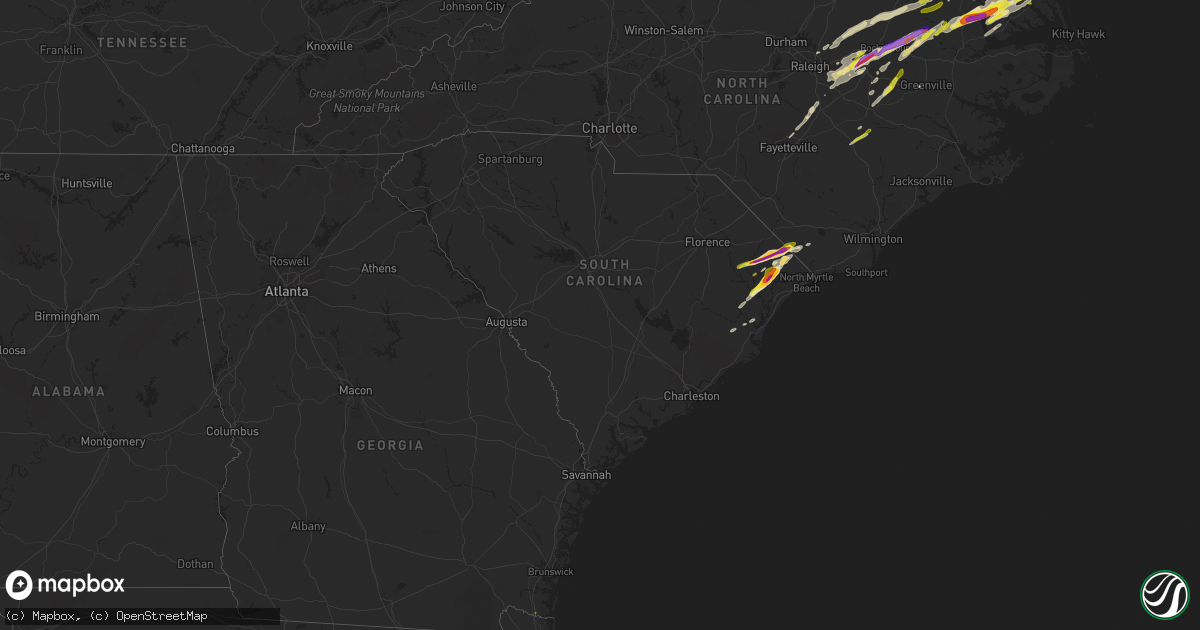
Hail Map in South Carolina on April 7, 2022
Get this storm
April 7 map
$229
one time, instant access
Download today. No call, no setup
Keep the $229
Bought the map and want the full workflow? Apply the entire $229 to a subscription within 7 days. None of it is wasted.
Every map, not just this one
This buys you this map. Subscription and you get every map we run, in the markets you choose from a few cities to whole states to nationwide. Plus real-time alerts the moment a storm fires.
Contact data
Name, contact info, occupancy, even credit band for addresses in the footprint. You go from where it hit to who to call.
Become the source they trust
Unlimited branding weather history reports on demand. You already have the documented answer ready for the property owner, and you are the one who showed up with it.
Property data and RoofTrace estimates
Pull up any address you have got, its value and the exact code rules for that jurisdiction, straight from One Click Code. Then RoofTrace estimates the squares, pitch, and roof value, priced the way you price.
Storm reports in South Carolina
South Carolina
| Date | Description |
|---|---|
| 04/07/20223:34 PM CDT | Sc highway patrol reports power lines down near the intersection of green sea rd and west dogwood rd. |
| 04/07/20223:26 PM CDT | Public reported quarter-sized hail along sc-9 west of loris... Sc. Video shared via social media and relayed to nws via media. |
| 04/07/20223:16 PM CDT | Public reported golf ball sized hail near loris... Sc. Time estimated via radar and pictuers were proivded via social media. |
| 04/07/20223:14 PM CDT | Horry county em reported hail in the homewood area on u.s. 701. |
| 04/07/20223:12 PM CDT | Public reported quarter-sized hail in the keighley estates neighborhood near aynor... Sc. Report was sent to nws via media and social media. Time estimated via radar. |
| 04/07/20223:07 PM CDT | Public reported 2-inch hail near homewood... Sc along sc-319. Photos were provided via social media and relayed to nws via media. |
| 04/07/20223:06 PM CDT | Media reported ping-pong sized hail near conway... Sc. Pictures provided via social media. Time estimated via radar. |
| 04/07/20223:06 PM CDT | Public reported baseball-sized hail and damage to a vehicle near galivants ferry... Sc. Report was sent to nws via media and social media |
| 04/07/20223:06 PM CDT | Media relayed report from individual located on el bethel rd. |
| 04/07/20223:03 PM CDT | Quarter size hail reported on pee dee rd... South of us highway 378. |
| 04/07/20223:03 PM CDT | Sc highway patrol reports tree down on roadway near the intersection of pee dee highway and hendricks short-cut rd. |
| 04/07/20223:03 PM CDT | Reported near intersection of pee dee rd. And jordanville rd. |
| 04/07/20223:03 PM CDT | Public reported quarter-sized hail along dunn shortcut rd. In conway... Sc. Time estimated via radar. |
| 04/07/20223:03 PM CDT | Golf ball sized hail reported at conway-horry county airport. |
| 04/06/202211:22 PM CDT | At 422 PM EDT, a severe thunderstorm was located over Tabor City, or 18 miles southwest of Whiteville, moving east at 45 mph. HAZARD...Two inch hail and 60 mph wind gusts. SOURCE...Radar indicated. IMPACT...People and animals outdoors will be injured. Expect hail damage to roofs, siding, windows, and vehicles. Expect wind damage to trees and power lines. Locations impacted include... Whiteville, Tabor City, Bethel, Lake Waccamaw, Hallsboro, Honey Island, Nakina, Redbug, Old Dock, Mollie, Sidney, Clarendon, Williams, Crusoe Island, Brunswick and Bolton. |
| 04/06/202210:46 PM CDT | At 345 PM EDT, a severe thunderstorm was located near Outland, or 16 miles southwest of Conway, moving northeast at 45 mph. HAZARD...60 mph wind gusts and quarter size hail. SOURCE...Radar indicated. IMPACT...Minor hail damage to vehicles is possible. Expect wind damage to trees and power lines. Locations impacted include... Myrtle Beach, Conway, North Myrtle Beach, Surfside Beach, Myrtle Beach Airport, Socastee, Red Hill, Springmaid Pier, Garden City, North Myrtle Beach Airport, Murrells Inlet, Horry, Loris, Hickory Grove, Homewood, Horry Georgetown Technical College Conway Campus, Adrian, Pee Dee Crossroads, Oatland and Nixonville. |
| 04/06/202210:29 PM CDT | At 329 AM EDT, a severe thunderstorm was located 6 miles northeast of Anderson, or 4 miles northwest of Belton, moving northeast at 55 mph. HAZARD...60 mph wind gusts and quarter size hail. SOURCE...Radar indicated. IMPACT...Minor hail damage to vehicles is expected. Expect wind damage to trees and power lines. Locations impacted include... Anderson, Mauldin, Simpsonville, Fountain Inn, Homeland Park, Piedmont, Belton, Williamston, Northlake and West Pelzer. |
| 04/06/202210:25 PM CDT | At 325 PM EDT, a severe thunderstorm was located near Lambert, or 13 miles west of Georgetown, moving northeast at 40 mph. HAZARD...60 mph wind gusts and quarter size hail. SOURCE...Radar indicated. IMPACT...Minor hail damage to vehicles is possible. Expect wind damage to trees and power lines. Locations impacted include... Georgetown, DeBordieu Colony, Pawleys Island, Andrews, Lambert, Sampit, Plantersville, Graves, Oatland, Litchfield Beach and Georgetown Memorial Hospital. |
| 04/06/202210:20 PM CDT | At 320 AM EDT, a severe thunderstorm was located near Walhalla, moving northeast at 45 mph. HAZARD...60 mph wind gusts and quarter size hail. SOURCE...Radar indicated. IMPACT...Minor hail damage to vehicles is expected. Expect wind damage to trees and power lines. Locations impacted include... Seneca, Walhalla, Central, Liberty, Westminster, Norris, Six Mile, Salem, Lake Keowee and Jocassee Gorges. |
| 04/06/20229:38 PM CDT | At 238 PM EDT, a severe thunderstorm was located near Magnolia Gardens, moving northeast at 55 mph. HAZARD...60 mph wind gusts and quarter size hail. SOURCE...Radar indicated. IMPACT...Minor hail damage to vehicles is possible. Expect wind damage to trees and powerlines. Locations impacted include: North Charleston, Mount Pleasant, Summerville, Goose Creek, Hanahan, McClellanville, Fort Sumter, Downtown Charleston, West Ashley, Daniel Island, Naval Weapons Station Charleston, Johns Island, Ladson, I-26/I-526 Interchange and Hollywood.This warning includes the following interstates: I-26 between mile markers 198 and 221. I-526 between mile markers 11 and 31. |
All States Impacted by Hail Map on April 7, 2022
Cities Impacted by Hail Map on April 7, 2022
- Belvidere, NC
- Tyner, NC
- Loris, SC
- Hobbsville, NC
- Colerain, NC
- Harrellsville, NC
- South Mills, NC
- Edenton, NC
- Cofield, NC
- Hertford, NC
- Ahoskie, NC
- Windsor, NC
- Elizabeth City, NC
- Aulander, NC
- Whitakers, NC
- Middlesex, NC
- Spring Hope, NC
- Scotland Neck, NC
- Elm City, NC
- Hobgood, NC
- Battleboro, NC
- Rocky Mount, NC
- Wilson, NC
- Bailey, NC
- Nashville, NC
- Tarboro, NC
- Galivants Ferry, SC
- Yankeetown, FL
- Inglis, FL
- Crystal River, FL
- Green Sea, SC
- Tabor City, NC
- Nichols, SC
- Kenly, NC
- Sims, NC
- Conway, SC
- Aynor, SC
- Hemingway, SC
- Wendell, NC
- Zebulon, NC
- Clayton, NC
- Selma, NC
- Linden, NC
- Fayetteville, NC
- Dunn, NC
- Erwin, NC
- Cuttyhunk, MA
- Fremont, NC
- Clarendon, NC
- Halifax, NC
- Hollister, NC
- Enfield, NC
- Louisburg, NC
- Castalia, NC
- Stantonsburg, NC
- Coats, NC
- Wake Forest, NC
- Rolesville, NC
- Greenville, NC
- Emporia, VA
- Black Creek, NC
- Dania, FL
- Fort Lauderdale, FL
- Murfreesboro, NC
- Marion, SC
- Yale, VA
- Waverly, VA
- Stony Creek, VA
- Raleigh, NC
- Rio Grande City, TX
- Knotts Island, NC
- Corolla, NC
- Virginia Beach, VA
- Walstonburg, NC
- Snow Hill, NC
- Gresham, SC
- Elkton, FL
- Saint Augustine, FL
- Newport News, VA
- Smithfield, NC
- Lucama, NC
- Georgetown, SC
- Pikeville, NC
- Goldsboro, NC
- Fountain, NC
- Merry Hill, NC
- Benson, NC
- Mount Olive, NC
- Sunbury, NC
- Windsor, VA
- Suffolk, VA
- Hawthorne, FL
- Micanopy, FL
- Pinetops, NC
- Gatesville, NC
- Camden, NC
- Lewiston Woodville, NC
- Oak City, NC
- Kelford, NC
- Faison, NC
- Jackson, NC
- Rich Square, NC
- Conway, NC
- Nakina, NC
- Whiteville, NC
- Chesapeake, VA
- Portsmouth, VA
- Youngsville, NC
- Jarratt, VA
- Zuni, VA
- Carrsville, VA
- Franklin, VA
- Crystal Beach, FL
- Palm Harbor, FL
- Andrews, SC
- Gates, NC
- Corapeake, NC
- Eure, NC
- Jacksonville, FL
- Exmore, VA
- Saint Marys, GA
- Kingsland, GA
- Patrick Afb, FL
- Fort Pierce, FL
- Woodland, NC
- Macclesfield, NC
- Smithfield, VA
- Hampton, VA


