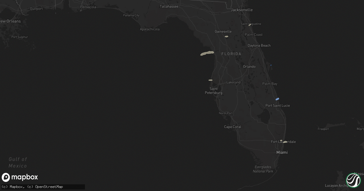
Hail Map in Florida on April 7, 2022
Get this storm
April 7 map
$229
one time, instant access
Download today. No call, no setup
Keep the $229
Bought the map and want the full workflow? Apply the entire $229 to a subscription within 7 days. None of it is wasted.
Every map, not just this one
This buys you this map. Subscription and you get every map we run, in the markets you choose from a few cities to whole states to nationwide. Plus real-time alerts the moment a storm fires.
Contact data
Name, contact info, occupancy, even credit band for addresses in the footprint. You go from where it hit to who to call.
Become the source they trust
Unlimited branding weather history reports on demand. You already have the documented answer ready for the property owner, and you are the one who showed up with it.
Property data and RoofTrace estimates
Pull up any address you have got, its value and the exact code rules for that jurisdiction, straight from One Click Code. Then RoofTrace estimates the squares, pitch, and roof value, priced the way you price.
Storm reports in Florida
Florida
| Date | Description |
|---|---|
| 04/07/20223:50 PM CDT | Corrects previous tstm wnd dmg report from 1 s arlington. Large tree down on road. |
| 04/07/20223:40 PM CDT | Large tree down on road. |
| 04/07/20223:35 PM CDT | Corrects previous tstm wnd gst report from 4 ssw fort caroline. Asos station kcrg jacksonvil craig. |
| 04/07/20223:33 PM CDT | Asos station kcrg jacksonvil craig. |
| 04/07/20223:08 PM CDT | Awos station knrb mayport naval station. |
| 04/07/20223:00 PM CDT | Large tree down along fort caroline road near the intersection of harbour cove dr s. Radar estimated time. |
| 04/07/202212:47 PM CDT | Kfpr asos measures wind gust of 71kt/82mph |
| 04/07/202211:38 AM CDT | Broadcast media relays photos of a metal roof ripped off a portion of a home on gladwin ave in fern park. Time estimated from radar. |
| 04/07/202211:35 AM CDT | Pictures shared via social media of large trees and limbs down near gatlin and orange ave. Time estimated from radar. |
| 04/07/202211:21 AM CDT | Trained spotter reported large branches down on lauren beth ave and nicole ave in ocoee. Estimated winds up to 60 mph. Time estimated by radar. |
| 04/07/20227:13 AM CDT | At 1212 PM EDT, severe thunderstorms were located along a line extending from near Ferndale to near Lake Apopka to near Oakland to near Four Corners to 9 miles northwest of Combee Settlement, moving east at 45 mph. HAZARD...60 mph wind gusts and penny size hail. SOURCE...Radar indicated. IMPACT...Expect damage to roofs, siding, and trees. Locations impacted include... Orlando, Kissimmee, Sanford, Apopka and Altamonte Springs. |
| 04/07/20226:57 AM CDT | At 1152 AM EDT, severe thunderstorms were located along a line extending from near Mascotte to Groveland to Hillsborough River State Park, moving east at 45 mph. HAZARD...60 mph wind gusts and penny size hail. SOURCE...Radar indicated. IMPACT...Expect damage to roofs, siding, and trees. Locations impacted include... Apopka, Ocoee, Winter Garden, Groveland and Mascotte. |
| 04/07/20225:15 AM CDT | At 1014 AM EDT, a severe thunderstorm was located near Andalusia, moving east at 30 mph. HAZARD...60 mph wind gusts and penny size hail. SOURCE...Radar indicated. IMPACT...Expect damage to roofs, siding, and trees. Locations impacted include... Palm Coast, Flagler Beach, Bunnell, Beverly Beach and Espanola. |
| 04/07/20224:22 AM CDT | At 922 AM EDT, a severe thunderstorm was located near Lake Delancy, or near Salt Springs, moving east at 55 mph. HAZARD...60 mph wind gusts and nickel size hail. SOURCE...Radar indicated. IMPACT...Expect damage to roofs, siding, and trees. Locations impacted include... Palatka, Crescent City, Pomona Park, Salt Springs, East Palatka, Andalusia, Lake Delancy, Fruitland, San Mateo and Satsuma. |
| 04/07/20224:00 AM CDT | At 900 AM EDT, a severe thunderstorm was located 18 miles northwest of Crystal River Airport, or 22 miles northwest of Homosassa Springs, moving east at 35 mph. HAZARD...60 mph wind gusts and quarter size hail. SOURCE...Radar indicated. IMPACT...Hail damage to vehicles is expected. Expect wind damage to roofs, siding, and trees. Locations impacted include... Inglis, Lebanon, Citronelle, Crystal Manor and Citrus Springs. |
| 04/07/20223:47 AM CDT | At 847 AM EDT, a severe thunderstorm was located over Cross Creek, or 8 miles northwest of Citra, moving east at 45 mph. HAZARD...60 mph wind gusts. SOURCE...Radar indicated. IMPACT...Expect damage to roofs, siding, and trees. Locations impacted include... Citra, Hawthorne, Cross Creek, Orange Springs, Micanopy, McIntosh, Johnson, Lochloosa and Grove Park. |
| 04/07/20222:04 AM CDT | At 704 AM EDT, a severe thunderstorm was located near Picolata, or 11 miles southeast of Green Cove Springs, moving east at 25 mph. HAZARD...60 mph wind gusts. SOURCE...Radar indicated. IMPACT...Expect damage to roofs, siding, and trees. Locations impacted include... Saint Augustine, World Golf Village, Saint Augustine Beach, South Ponte Vedra, Vilano Beach, Saint Augustine South, Picolata, Saint Augustine Shores, Anastasia and Bakersville. |
| 04/06/202211:45 PM CDT | At 445 PM EDT, a severe thunderstorm was located near Baymeadows, or near Arlington, moving east at 35 mph. HAZARD...60 mph wind gusts and quarter size hail. SOURCE...Radar indicated. IMPACT...Hail damage to vehicles is expected. Expect wind damage to roofs, siding, and trees. Locations impacted include... Unf, Neptune Beach, Craig Field, San Pablo and Baymeadows. |
| 04/06/202211:35 PM CDT | At 435 PM EDT, a severe thunderstorm was located over Craig Field, or near Unf, moving east at 35 mph. HAZARD...60 mph wind gusts and quarter size hail. SOURCE...Radar indicated. IMPACT...Hail damage to vehicles is expected. Expect wind damage to roofs, siding, and trees. Locations impacted include... Neptune Beach, Fort Caroline and Craig Field. |
| 04/06/202211:26 PM CDT | At 426 AM EDT, a severe thunderstorm was located near Little Talbot Island, or 10 miles south of Fernandina Beach, moving east at 20 mph. HAZARD...60 mph wind gusts and quarter size hail. SOURCE...Radar indicated. IMPACT...Hail damage to vehicles is expected. Expect wind damage to roofs, siding, and trees. Locations impacted include... Neptune Beach, Oceanway, Craig Field, Little Talbot Island and Fort Caroline. |
| 04/06/20229:13 PM CDT | At 212 PM EDT, a severe thunderstorm was located near Fort Pierce North, or near Fort Pierce, moving northeast at 30 mph. HAZARD...60 mph wind gusts and penny size hail. SOURCE...Radar indicated. IMPACT...Expect damage to roofs, siding, and trees. Locations impacted include... Fort Pierce, Indrio, Fort Pierce Inlet, Queens Cove and Fort Pierce North. |
| 04/06/20229:07 PM CDT | At 207 AM EDT, severe thunderstorms were located along a line extending from 6 miles northeast of Stephen Foster State Park to 18 miles north of Taylor to 10 miles south of Fargo, moving east at 50 mph. HAZARD...60 mph wind gusts. SOURCE...Radar indicated. IMPACT...Expect damage to roofs, siding, and trees. Locations impacted include... Folkston, Stephen Foster State Park and Homeland. |
| 04/06/20229:02 PM CDT | At 202 PM EDT, a severe thunderstorm was located over Federal Point, or near Hastings, moving northeast at 45 mph. HAZARD...60 mph wind gusts and quarter size hail. SOURCE...Radar indicated. IMPACT...Hail damage to vehicles is expected. Expect wind damage to roofs, siding, and trees. Locations impacted include... Saint Augustine, Hastings, Saint Augustine Beach, Vilano Beach, Federal Point, Saint Augustine Shores, Butler Beach, Saint Augustine South, Crescent Beach and Spuds. |
| 04/06/20229:01 PM CDT | At 201 PM EDT, a severe thunderstorm was located over Twin Lakes, or near Lauderdale-By-The-Sea, moving east at 35 mph. HAZARD...60 mph wind gusts and quarter size hail. SOURCE...Radar indicated. IMPACT...Hail damage to vehicles is expected. Expect wind damage to roofs, siding, and trees. Locations impacted include... Fort Lauderdale, Coral Springs, Pompano Beach, Plantation and Sunrise. |
| 04/06/20228:48 PM CDT | At 148 PM EDT, a severe thunderstorm was located over Lakewood Park, or over Indrio, moving northeast at 30 mph. HAZARD...60 mph wind gusts and penny size hail. SOURCE...Radar indicated. IMPACT...Expect damage to roofs, siding, and trees. Locations impacted include... Fort Pierce, Indrio, Queens Cove, Vero Beach Highland and Fort Pierce North. |
| 04/06/20228:43 PM CDT | At 143 PM EDT, a severe thunderstorm was located over Sunrise, moving northeast at 25 mph. HAZARD...60 mph wind gusts and quarter size hail. SOURCE...Radar indicated. IMPACT...Hail damage to vehicles is expected. Expect wind damage to roofs, siding, and trees. Locations impacted include... Fort Lauderdale, Coral Springs, Pompano Beach, Davie and Plantation. |
| 04/06/20228:00 PM CDT | At 100 AM EDT, a severe thunderstorm was located over Lake Park, moving east at 35 mph. HAZARD...60 mph wind gusts. SOURCE...Radar indicated. IMPACT...Expect damage to roofs, siding, and trees. Locations impacted include... Lake Park, Dasher, I-75 At Exit 5 and Twin Lakes. |
All States Impacted by Hail Map on April 7, 2022
Cities Impacted by Hail Map on April 7, 2022
- Belvidere, NC
- Tyner, NC
- Loris, SC
- Hobbsville, NC
- Colerain, NC
- Harrellsville, NC
- South Mills, NC
- Edenton, NC
- Cofield, NC
- Hertford, NC
- Ahoskie, NC
- Windsor, NC
- Elizabeth City, NC
- Aulander, NC
- Whitakers, NC
- Middlesex, NC
- Spring Hope, NC
- Scotland Neck, NC
- Elm City, NC
- Hobgood, NC
- Battleboro, NC
- Rocky Mount, NC
- Wilson, NC
- Bailey, NC
- Nashville, NC
- Tarboro, NC
- Galivants Ferry, SC
- Yankeetown, FL
- Inglis, FL
- Crystal River, FL
- Green Sea, SC
- Tabor City, NC
- Nichols, SC
- Kenly, NC
- Sims, NC
- Conway, SC
- Aynor, SC
- Hemingway, SC
- Wendell, NC
- Zebulon, NC
- Clayton, NC
- Selma, NC
- Linden, NC
- Fayetteville, NC
- Dunn, NC
- Erwin, NC
- Cuttyhunk, MA
- Fremont, NC
- Clarendon, NC
- Halifax, NC
- Hollister, NC
- Enfield, NC
- Louisburg, NC
- Castalia, NC
- Stantonsburg, NC
- Coats, NC
- Wake Forest, NC
- Rolesville, NC
- Greenville, NC
- Emporia, VA
- Black Creek, NC
- Dania, FL
- Fort Lauderdale, FL
- Murfreesboro, NC
- Marion, SC
- Yale, VA
- Waverly, VA
- Stony Creek, VA
- Raleigh, NC
- Rio Grande City, TX
- Knotts Island, NC
- Corolla, NC
- Virginia Beach, VA
- Walstonburg, NC
- Snow Hill, NC
- Gresham, SC
- Elkton, FL
- Saint Augustine, FL
- Newport News, VA
- Smithfield, NC
- Lucama, NC
- Georgetown, SC
- Pikeville, NC
- Goldsboro, NC
- Fountain, NC
- Merry Hill, NC
- Benson, NC
- Mount Olive, NC
- Sunbury, NC
- Windsor, VA
- Suffolk, VA
- Hawthorne, FL
- Micanopy, FL
- Pinetops, NC
- Gatesville, NC
- Camden, NC
- Lewiston Woodville, NC
- Oak City, NC
- Kelford, NC
- Faison, NC
- Jackson, NC
- Rich Square, NC
- Conway, NC
- Nakina, NC
- Whiteville, NC
- Chesapeake, VA
- Portsmouth, VA
- Youngsville, NC
- Jarratt, VA
- Zuni, VA
- Carrsville, VA
- Franklin, VA
- Crystal Beach, FL
- Palm Harbor, FL
- Andrews, SC
- Gates, NC
- Corapeake, NC
- Eure, NC
- Jacksonville, FL
- Exmore, VA
- Saint Marys, GA
- Kingsland, GA
- Patrick Afb, FL
- Fort Pierce, FL
- Woodland, NC
- Macclesfield, NC
- Smithfield, VA
- Hampton, VA


