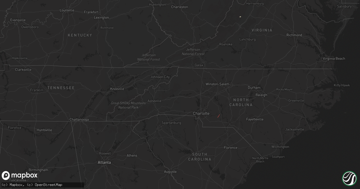
Hail Map in Pennsylvania on March 31, 2022
Get this storm
March 31 map
$229
one time, instant access
Download today. No call, no setup
Keep the $229
Bought the map and want the full workflow? Apply the entire $229 to a subscription within 7 days. None of it is wasted.
Every map, not just this one
This buys you this map. Subscription and you get every map we run, in the markets you choose from a few cities to whole states to nationwide. Plus real-time alerts the moment a storm fires.
Contact data
Name, contact info, occupancy, even credit band for addresses in the footprint. You go from where it hit to who to call.
Become the source they trust
Unlimited branding weather history reports on demand. You already have the documented answer ready for the property owner, and you are the one who showed up with it.
Property data and RoofTrace estimates
Pull up any address you have got, its value and the exact code rules for that jurisdiction, straight from One Click Code. Then RoofTrace estimates the squares, pitch, and roof value, priced the way you price.
Storm reports in Pennsylvania
Pennsylvania
| Date | Description |
|---|---|
| 03/31/20226:55 PM CDT | Trees down on wires. |
| 03/31/20226:44 PM CDT | A tree was reported down in perry twp near zions church rd. Time estimated from radar. |
| 03/31/20226:40 PM CDT | Multiple trees and wires down. |
| 03/31/20225:54 PM CDT | Trees down on wires. |
| 03/31/20225:42 PM CDT | Trees down on wires. |
| 03/31/20225:38 PM CDT | Trees on wires. |
| 03/31/20225:20 PM CDT | Old barn completely destroy at the intersection of cochecton tpk and oregon tpk west of damascus. |
| 03/31/20225:08 PM CDT | Corrects previous tstm wnd dmg report from rush. Tree down at devine ridge road and state route 706. |
| 03/31/20225:00 PM CDT | Trees down on wires. |
| 03/31/20224:44 PM CDT | Trees down on wires. |
| 03/31/20224:41 PM CDT | Tree into a house at 436 philadelphia avenue. |
| 03/31/20224:21 PM CDT | Multiple reports of trees down including on the 3600 block of salem rd in penn township and on fisher rd in monroe township. |
| 03/31/20224:20 PM CDT | Two large pine trees uprooted in sweet valley. |
| 03/31/20224:20 PM CDT | Tree on wire. |
| 03/31/20224:17 PM CDT | Trees down on wires. |
| 03/31/20224:15 PM CDT | Multiple trees down. |
| 03/31/20224:01 PM CDT | Tree down on prospect street in montrose. |
| 03/31/20224:00 PM CDT | Trees down on railroad street next to kelly rd. |
| 03/31/20223:56 PM CDT | Numerous trees down on wires areawide. |
| 03/31/20223:41 PM CDT | Corrects previous tstm wnd dmg report from lairdsville. Several roofs were damaged along lairdsville rd |
| 03/31/20223:41 PM CDT | Reports of numerous trees down... Barn destroyed... House damage in and southwest of lairdsville. |
| 03/31/20223:40 PM CDT | A barn was destroyed at the intersection of old lairdsville rd and pa-118. |
| 03/31/20223:40 PM CDT | Corrects time on previous tstm wnd dmg report from 2 ne mifflintown. Multiple reports of trees down associated with thunderstorm outflow ahead of the rain. |
| 03/31/20223:38 PM CDT | Power poles blown down. |
| 03/31/20223:30 PM CDT | Multiple reports of trees down associated with thunderstorm outflow ahead of the rain. |
| 03/31/20223:28 PM CDT | Several reports of trees and wires down in milton. |
| 03/31/20223:20 PM CDT | Multiple trees reported down in wilmot. |
| 03/31/20223:19 PM CDT | Trees down on wires. |
| 03/31/20223:15 PM CDT | Tree and wires reports down on hatch hill road in new albany. |
| 03/31/20223:10 PM CDT | Trees down on the 10000 block of us-220 near pa-87 in cherry township. |
| 03/31/20223:08 PM CDT | Tree down at devine ridge road and state route 706. |
| 03/31/20222:54 PM CDT | Several trees and wires down in lewistown... Including on the exit ramp from us-322. |
| 03/31/20222:50 PM CDT | Tree on wires at 16750 lincoln highway in east providence township. |
| 03/31/20222:31 PM CDT | Wires down on a house. |
| 03/31/20222:16 PM CDT | Trees and wires down on 6th street. |
| 03/31/20221:45 PM CDT | Trees down along fox hill road near the unv airport. |
| 03/31/20221:45 PM CDT | A local report indicates 1.00 inch wind near 4 E HOWARD |
| 03/31/20221:40 PM CDT | Multiple large pine trees down along i-80. |
| 03/31/20221:17 PM CDT | Numerous reports of trees and wires down in bellefonte including on sunnyside blvd and on high street downtown near the courthouse. |
| 03/31/202211:39 AM CDT | Tree down at the intersection of winterburne rd and anderson creek rd. |
| 03/31/202211:35 AM CDT | Tree down at the intersection of kriner rd and salem rd near luthersburg. |
| 03/31/202211:13 AM CDT | Trees down in the boro. |
| 03/31/202210:59 AM CDT | Trees down along lost hill rd. And fairview rd. |
| 03/31/202210:54 AM CDT | Report of damage to two homes west of dayton. Tbd if possible tornado. |
| 03/31/202210:53 AM CDT | **corrected as it is not a confirmed tornado.** public and 911 call center confirm report of a barn collapse and trees down along state route 1018. Possible tornado. |
| 03/31/202210:53 AM CDT | Public and 911 call center confirm report of a barn collapse and trees down along state route 1018. Possible tornado. |
| 03/31/202210:51 AM CDT | Ef2 tornado damage in wayne township. Additional information in forthcoming public information statement |
| 03/31/202210:45 AM CDT | Trees down on power lines. Appears to be part of rear inflow surge. |
| 03/31/202210:40 AM CDT | Report of downed trees and power lines in apollo. |
| 03/31/202210:40 AM CDT | Report of trees and power lines down around kittanning township. |
| 03/31/202210:38 AM CDT | Tree down along magnolia lane in salem township |
| 03/31/202210:30 AM CDT | Tree down along hartge road in lower burrell |
| 03/31/202210:29 AM CDT | Tree down at route 30 and baker school rd in penn township |
| 03/31/202210:23 AM CDT | Power lines down on a vehicle |
| 03/31/20227:15 AM CDT | At 1213 PM EDT, severe thunderstorms were located along a line extending from Marienville to Punxsutawney, moving northeast at 60 mph. HAZARD...70 mph wind gusts. SOURCE...Radar indicated. IMPACT...Expect considerable tree damage. Damage is likely to mobile homes, roofs, and outbuildings. Locations impacted include... St. Marys, DuBois, Clearfield, Ridgway, Sandy, Curwensville, Johnsonburg, Penfield, Hyde, Plymptonville, Rockton and Wilcox.For those driving on Interstate 80, this includes areas between theDubois and Woodland exits, specifically from mile markers 97 to 120. |
| 03/31/20226:57 AM CDT | At 1156 AM EDT, severe thunderstorms were located along a line extending from 8 miles north of New Bethlehem to 12 miles west of Punxsutawney to 8 miles west of Indiana, moving northeast at 70 mph. HAZARD...70 mph wind gusts. SOURCE...Radar indicated. IMPACT...Trees snapped and uprooted. Power outages. Locations impacted include... Punxsutawney, Brookville, Reynoldsville, Brockway, New Bethlehem, Sykesville, Falls Creek, Rural Valley, West Lebanon, Big Run, Dayton, and Summerville. |
| 03/31/20226:16 AM CDT | At 1116 AM EDT, severe thunderstorms were located along a line extending from near Sarver to near Jefferson Hills, moving east at 40 mph. HAZARD...60 mph wind gusts. SOURCE...Radar indicated. IMPACT...Expect damage to trees and power lines, resulting in some power outages. Locations impacted include... Pittsburgh, Penn Hills, Monroeville, Greensburg, McKeesport, Jeannette, Latrobe, Vandergrift, Kittanning, Apollo, Gastonville, and Shaler Township. |
| 03/31/20223:40 AM CDT | At 839 PM EDT, severe thunderstorms were located along a line extending from near Unionville to near Old Orchard, moving east at 60 mph. HAZARD...60 mph wind gusts and penny size hail. SOURCE...Radar indicated. IMPACT...Damage to roofs, siding, trees, and power lines is possible. Locations impacted include... Easton, Newton, Bethlehem, Dover, Hopatcong, Forks, Hackettstown, Wilson, Wharton, Washington, Rockaway, Blairstown, Hellertown, Mount Arlington, Franklin, Mendham, High Bridge, Stanhope, Hamburg and Netcong.This includes the following highways... Interstate 78 in Pennsylvania between mile markers 64 and 76. Interstate 78 in New Jersey between mile markers 0 and 25. Interstate 80 in New Jersey between mile markers 6 and 38. |
| 03/31/20223:35 AM CDT | At 835 PM EDT, a severe thunderstorm was located over New Holland, moving northeast at 45 mph. HAZARD...60 mph wind gusts and nickel size hail. SOURCE...Radar indicated. IMPACT...Expect damage to roofs, siding, and trees. Locations impacted include... Ephrata, New Holland, Akron, Leola, Reamstown, Rothsville, Adamstown, Terre Hill, Churchtown, Bareville, Leacock and Bowmansville.This includes The Pennsylvania Turnpike from mile markers 285 to 295. |
| 03/31/20223:14 AM CDT | At 813 PM EDT, severe thunderstorms were located along a line extending from near Danielsville to Laureldale, moving northeast at 100 mph. HAZARD...60 mph wind gusts. SOURCE...Law enforcement reported a tree down in Perry Township in Berks County at 7:44 PM. IMPACT...Damage to roofs, siding, trees, and power lines is possible. Locations impacted include... Allentown, Bethlehem, Emmaus, Northampton, Hellertown, Kutztown, Slatington, Fleetwood, Laureldale, Walnutport, Topton, Leesport, Shoemakersville, Bally, Bechtelsville, Lyons, Lenhartsville, Neffs, Coffeetown and Zionsville.This includes the following highways... Northeast Extension between mile markers 48 and 68. Interstate 78 in Pennsylvania between mile markers 38 and 71. |
| 03/31/20223:04 AM CDT | At 803 PM EDT, severe thunderstorms were located along a line extending from near Pecks Pond to Kresgeville, moving northeast at 75 mph. HAZARD...60 mph wind gusts. SOURCE...Radar indicated. IMPACT...Damage to roofs, siding, trees, and power lines is possible. Locations impacted include... Easton, Montague, Bethlehem, Forks, East Stroudsburg, Wilson, Blairstown, Nazareth, Palmerton, Bangor, Slatington, Pen Argyl, Wind Gap, Bath, Belvidere, Walnutport, Belfast, West Easton, Tatamy and East Bangor.This includes the following highways... Interstate 78 in Pennsylvania between mile markers 72 and 73. Interstate 80 in Pennsylvania between mile markers 299 and 314. Interstate 80 in New Jersey between mile markers 0 and 12. |
| 03/31/20222:27 AM CDT | At 726 PM EDT, a severe thunderstorm was located over Strausstown, or 10 miles northeast of Myerstown, moving east at 65 mph. HAZARD...60 mph wind gusts. SOURCE...Radar indicated. IMPACT...Damage to roofs, siding, trees, and power lines is possible. Locations impacted include... Allentown, Reading, Lehighton, Bethlehem, Emmaus, Wyomissing, Northampton, Palmerton, Birdsboro, Kutztown, Jim Thorpe, Hamburg, Slatington, Fleetwood, Sinking Spring, Laureldale, Nesquehoning, Womelsdorf, Wernersville and Walnutport.This includes the following highways... Pennsylvania Turnpike between mile markers 296 and 299. Northeast Extension between mile markers 49 and 83. Interstate 78 in Pennsylvania between mile markers 10 and 66. Interstate 176 in Pennsylvania between mile markers 1 and 11. |
| 03/31/20222:04 AM CDT | At 704 PM EDT, severe thunderstorms were located along a line extending from Littlestown to near Taneytown to near Walkersville, moving east at 45 mph. HAZARD...60 mph wind gusts and quarter size hail. SOURCE...Radar indicated. IMPACT...Damaging winds will cause some trees and large branches to fall. This could injure those outdoors, as well as damage homes and vehicles. Roadways may become blocked by downed trees. Localized power outages are possible. Unsecured light objects may become projectiles. Locations impacted include... Westminster, Taneytown, Hampstead, Manchester, New Windsor, Union Bridge, Lineboro, Linwood, Uniontown, Wagners Mill, Millers, Greenmount, Keymar and Detour. |
| 03/31/20221:13 AM CDT | At 613 PM EDT, a severe thunderstorm was located over Plainfield, moving northeast at 40 mph. HAZARD...60 mph wind gusts and nickel size hail. SOURCE...Radar indicated. IMPACT...Expect damage to roofs, siding, and trees. Locations impacted include... Harrisburg, Carlisle, Linglestown, Colonial Park, Plainfield, Enola, Paxtonia, Schlusser, Skyline View, Marysville, Lykens and Duncannon.This includes the following Interstates... The Pennsylvania Turnpike from mile markers 215 to 229. Interstate 81 between mile markers 37 and 73...and from mile markers75 to 81. |
| 03/31/202212:39 AM CDT | At 538 PM EDT, severe thunderstorms were located along a line extending from Cooperstown Junction to Franklin to Walton to Hancock, moving northeast at 65 mph. HAZARD...60 mph wind gusts and penny size hail. SOURCE...Radar indicated. IMPACT...Expect damage to roofs, siding, and trees. Locations impacted include... Rockland, Oneonta, Walton, Delhi, Davenport, Roxbury, Worcester, Colchester, Maryland and Kortright. |
| 03/31/202212:34 AM CDT | At 534 PM EDT, severe thunderstorms were located along a line extending from Port Trevorton to near Meiserville to Millersburg to Duncannon, moving northeast at 35 mph. HAZARD...60 mph wind gusts and nickel size hail. SOURCE...Radar indicated. IMPACT...Expect damage to roofs, siding, and trees. Locations impacted include... Pottsville, Shamokin, Shenandoah, St. Clair, Mount Carmel, Minersville, Frackville, Kulpmont, Ashland, Millersburg, Fairview-Ferndale and Trevorton.This includes Interstate 81 from mile markers 104 to 126. |
| 03/31/202212:17 AM CDT | At 517 PM EDT, a severe thunderstorm was located over Selinsgrove, moving northeast at 50 mph. HAZARD...60 mph wind gusts. SOURCE...Radar indicated. IMPACT...Expect damage to roofs, siding, and trees. Locations impacted include... Bloomsburg, Sunbury, Shamokin, Selinsgrove, Danville, Northumberland, Winfield, Elysburg, Fairview-Ferndale, Riverside, Trevorton and Shamokin Dam.For those driving on Interstate 80, this includes areas between theLimestoneville and Bloomsburg-Light Street exits, specifically frommile markers 222 to 235. |
| 03/31/202212:06 AM CDT | At 505 PM EDT, severe thunderstorms were located along a line extending from near New Albany to near Ricketts Glen State Park to near Waller, moving northeast at 65 mph. HAZARD...60 mph wind gusts and penny size hail. SOURCE...Radar indicated. IMPACT...Expect damage to roofs, siding, and trees. Locations impacted include... Wilkes-Barre, Falls, Muhlenberg, Kingston, Nanticoke, Plains, Old Forge, Pittston, Plymouth and Exeter. |
| 03/30/202211:55 PM CDT | At 454 PM EDT, a severe thunderstorm was located over Laporte, moving northeast at 45 mph. HAZARD...70 mph wind gusts and nickel size hail. SOURCE...Radar indicated. IMPACT...Expect considerable tree damage. Damage is likely to mobile homes, roofs, and outbuildings. Locations impacted include... Laporte, Dushore, Forksville and Eagles Mere. |
| 03/30/202211:31 PM CDT | At 431 PM EDT, severe thunderstorms were located along a line extending from Walnut to Doylesburg to Willow Hill, moving northeast at 65 mph. HAZARD...60 mph wind gusts. SOURCE...Radar indicated. IMPACT...Expect damage to roofs, siding, and trees. Locations impacted include... Lewistown, Newport, Mifflintown, Honey Grove, New Bloomfield, Mcalisterville, McClure, Port Royal, Spruce Hill, Beaver Springs, Richfield and Mount Pleasant Mills.This includes The Pennsylvania Turnpike from mile markers 189 to 210. |
| 03/30/202211:27 PM CDT | At 427 PM EDT, severe thunderstorms were located along a line extending from near Brushville to Wyalusing to 8 miles northwest of Ricketts Glen State Park, moving northeast at 35 mph. HAZARD...60 mph wind gusts and nickel size hail. SOURCE...Radar indicated. IMPACT...Expect damage to roofs, siding, and trees. Locations impacted include... Rush, Tunkhannock, Springville, Montrose, Dimock, Wilmot, Hollenback, Noxen, Mehoopany and Herrick. |
| 03/30/202211:25 PM CDT | At 424 PM EDT, severe thunderstorms were located along a line extending from Montgomery to Allenwood to Mifflinburg to Troxelville, moving northeast at 45 mph. HAZARD...70 mph wind gusts and nickel size hail. SOURCE...Radar indicated. IMPACT...Expect considerable tree damage. Damage is likely to mobile homes, roofs, and outbuildings. Locations impacted include... Bloomsburg, Berwick, Sunbury, Milton, Lewisburg, Selinsgrove, Danville, Montoursville, Mifflinburg, Laporte, Northumberland and Winfield.For those driving on Interstate 80, this includes areas between theMile Run and Nescopek exits, specifically from mile markers 203 to247.This includes Interstate 180 between mile markers 1 and 20, and nearmile marker 23. |
| 03/30/202211:01 PM CDT | At 401 PM EDT, a severe thunderstorm was located over R.B. Winter State Park, moving northeast at 70 mph. HAZARD...60 mph wind gusts and nickel size hail. SOURCE...Radar indicated. IMPACT...Expect damage to roofs, siding, and trees. Locations impacted include... Williamsport, Lewisburg, Jersey Shore, Mifflinburg, Carroll, Woodward, Montgomery, Linntown, Middleburg, Duboistown, New Columbia and Penns Creek.For those driving on Interstate 80, this includes areas between theLock Haven and Milton-Williamsport exits, specifically from milemarkers 183 to 210.This includes Interstate 180 from mile markers 28 to 29. |
| 03/30/202210:54 PM CDT | At 354 PM EDT, a severe thunderstorm was located over Lincoln Falls, moving northeast at 50 mph. HAZARD...60 mph wind gusts and nickel size hail. SOURCE...Radar indicated. IMPACT...Expect damage to roofs, siding, and trees. Locations impacted include... Laporte, Kettle Creek Gorge, Lincoln Falls, Shunk, Dushore, Forksville, Eagles Mere and Hillsgrove. |
| 03/30/202210:52 PM CDT | At 352 PM EDT, a severe thunderstorm was located over Lincoln Falls, or 13 miles southeast of Canton, moving northeast at 50 mph. HAZARD...60 mph wind gusts and penny size hail. SOURCE...Radar indicated. IMPACT...Expect damage to roofs, siding, and trees. Locations impacted include... Towanda, Wysox, Wilmot, Hollenback, Herrick, Wyalusing, Monroe, New Albany, Overton and Monroeton. |
| 03/30/202210:45 PM CDT | At 345 PM EDT, severe thunderstorms were located along a line extending from Burnham to Strodes Mills to Mount Union, moving northeast at 50 mph. HAZARD...60 mph wind gusts and penny size hail. SOURCE...Radar indicated. IMPACT...Expect damage to roofs, siding, and trees. Locations impacted include... Lewistown, Mifflintown, Mount Union, Burnham, Belleville, Milroy, Highland Park, Mcalisterville, McClure, Port Royal, Millheim and Spruce Hill. |
| 03/30/202210:14 PM CDT | At 313 PM EDT, severe thunderstorms were located along a line extending from Whipple Dam State Park to Raystown Dam to Dudley, moving northeast at 65 mph. HAZARD...60 mph wind gusts and penny size hail. SOURCE...Radar indicated. IMPACT...Expect damage to roofs, siding, and trees. Locations impacted include... Lewistown, Huntingdon, Mount Union, Belleville, Highland Park, Strodes Mills, Allensville, Dudley, Whipple Dam State Park, Raystown Dam, Entriken and Mcalevys Fort. |
| 03/30/20229:55 PM CDT | At 254 PM EDT, a severe thunderstorm was located over Jersey Shore, moving northeast at 55 mph. HAZARD...60 mph wind gusts. SOURCE...Radar indicated. IMPACT...Expect damage to roofs, siding, and trees. Locations impacted include... Williamsport, Montoursville, Jersey Shore, Muncy, Hughesville, Montgomery, Duboistown, Elimsport, Cogan Station, Collomsville, Trout Run and Loyalsockville.This includes Interstate 180 from mile markers 9 to 29. |
| 03/30/20229:37 PM CDT | At 236 PM EDT, a severe thunderstorm was located over Buffalo Mills, moving northeast at 55 mph. HAZARD...60 mph wind gusts and penny size hail. SOURCE...Radar indicated. IMPACT...Expect damage to roofs, siding, and trees. Locations impacted include... Bedford, Breezewood, New Enterprise, Everett, Buffalo Mills, St. Clairsville, Cessna, Hyndman, Saxton, Schellsburg, Manns Choice and Woodbury.This includes the following Interstates... Interstate 70 near mile marker 147. The Pennsylvania Turnpike from mile markers 124 to 159. Interstate 99 from mile markers 0 to 8. |
| 03/30/20229:22 PM CDT | At 221 PM EDT, a severe thunderstorm was located over Zion, moving northeast at 45 mph. HAZARD...70 mph wind gusts and nickel size hail. SOURCE...Radar indicated. IMPACT...Expect considerable tree damage. Damage is likely to mobile homes, roofs, and outbuildings. Locations impacted include... Lock Haven, Bellefonte, Carroll, Pleasant Gap, Lamar, Zion, Mill Hall, Avis, Dunnstown, Flemington, Castanea and Milesburg.For those driving on Interstate 80, this includes areas between theSnow Shoe and Mile Run exits, specifically from mile markers 154 to195.This includes Interstate 99 from mile markers 78 to 85. |
| 03/30/20228:56 PM CDT | At 156 PM EDT, a severe thunderstorm was located over Stormstown, moving northeast at 35 mph. HAZARD...60 mph wind gusts. SOURCE...Radar indicated. IMPACT...Expect damage to roofs, siding, and trees. Locations impacted include... State College, Bellefonte, Park Forest Village, Woodward, Boalsburg, Pleasant Gap, Stormstown, Lemont, Bald Eagle, Zion, Houserville and Warriors Mark.For those driving on Interstate 80, this includes areas between theMilesburg and Lamar exits, specifically from mile markers 159 to 166.This includes Interstate 99 from mile markers 50 to 85. |
| 03/30/20228:50 PM CDT | Wires down at elephant road & bedminster road. Time estimated from kdix. |
| 03/30/20228:50 PM CDT | Wires down with poles snapped in bedminster twp. Trees also snapped and uprooted. Some roads reported impassable. Kdix indicated tds. Probable tornado. Time estimated f |
| 03/30/20228:50 PM CDT | Wires down with poles snapped in bedminster twp. Trees also snapped and uprooted. Some roads reported impassable. Kdix indicated tds. |
| 03/30/20228:20 PM CDT | Tree down at sycamore rd and n church st. Time estimated from radar. |
| 03/30/20228:15 PM CDT | Downed tree or limbs on wires near grace rd at coventryville rd. Time estimated from radar. |
| 03/30/20228:12 PM CDT | At 112 PM EDT, a severe thunderstorm was located near Shinglehouse, or 11 miles southwest of Wellsville, moving northeast at 55 mph. HAZARD...60 mph wind gusts. SOURCE...Radar indicated. IMPACT...Expect damage to trees and power lines. Locations impacted include... Wellsville, Alfred, Whitesville, Scio, Bolivar, Andover, Alma, Almond, Richburg and Stannards.This includes Interstate 86 near exit 33. |
| 03/30/20227:36 PM CDT | Tree limbs down on wires on hecktown rd. Time estimated from radar. |
| 03/30/20227:23 PM CDT | Trees down on wires on greenfield road. |
| 03/30/20227:20 PM CDT | Wires down on route 772. |
| 03/30/20227:13 PM CDT | Tree down on wires on wertman rd. Time estimated from radar. |
All States Impacted by Hail Map on March 31, 2022
Cities Impacted by Hail Map on March 31, 2022
- New Columbia, PA
- Circleville, WV
- Craigsville, VA
- Goshen, VA
- Bellefonte, PA
- Port Saint Joe, FL
- Wewahitchka, FL
- Eastpoint, FL
- Apalachicola, FL
- Norwood, NC
- Polkton, NC
- McLean, VA
- Evansville, IN
- Kittanning, PA
- Dayton, PA
- Lairdsville, PA
- Hughesville, PA
- Muncy, PA
- Westernport, MD
- Keyser, WV
- Rawlings, MD
- Westminster, MD
- Hampstead, MD
- New Windsor, MD
- New Bethlehem, PA
- Vandergrift, PA
- Freeport, PA
- Templeton, PA
- Leechburg, PA
- Brookville, PA
- Punxsutawney, PA
- Knox Dale, PA
- Ford City, PA
- Timblin, PA
- Mayport, PA
- Coolspring, PA
- Sprankle Mills, PA
- Ford Cliff, PA
- McGrann, PA
- Manorville, PA
- Reynoldsville, PA
- Worthville, PA
- Summerville, PA
- Ringgold, PA
- North Apollo, PA
- Spring Church, PA
- Apollo, PA
- Port Allegany, PA
- Shinglehouse, PA
- Lamar, PA
- Williamsport, PA
- Loganton, PA
- Mill Hall, PA
- Jersey Shore, PA
- Howard, PA
- Linden, PA
- Lock Haven, PA
- Montoursville, PA
- Dry Run, PA
- Shade Gap, PA
- Fort Littleton, PA
- Crystal Spring, PA
- Everett, PA
- Waterfall, PA
- Orbisonia, PA
- Doylesburg, PA
- Spring Run, PA
- Neelyton, PA
- Harrisonville, PA
- Three Springs, PA
- Orrstown, PA
- Hustontown, PA
- Wells Tannery, PA
- Willow Hill, PA
- Burnt Cabins, PA
- Fannettsburg, PA
- Breezewood, PA
- Lopez, PA
- Jermyn, PA
- Clarks Summit, PA
- Dushore, PA
- Olyphant, PA
- Falls, PA
- Mehoopany, PA
- Waverly, PA
- Unityville, PA
- Factoryville, PA
- Muncy Valley, PA
- Tunkhannock, PA
- Benton, PA
- Noxen, PA
- Harveys Lake, PA
- Carbondale, PA
- Dalton, PA
- Capon Bridge, WV
- Cross Junction, VA
- Gore, VA
- High View, WV
- Bloomery, WV
- Augusta, WV
- Douglas, GA
- Willacoochee, GA
- Alapaha, GA
- Ambrose, GA
- Broxton, GA
- West Green, GA


