Hail Map on March 31, 2022
Get this storm
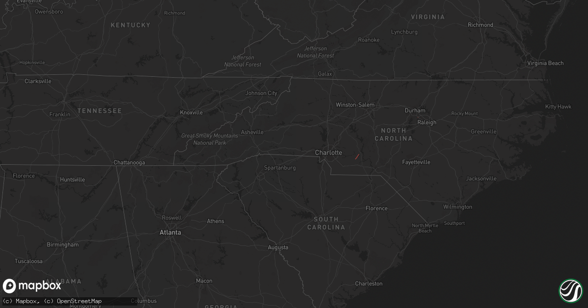
March 31 map
$229
one time, instant access
Download today. No call, no setup
Keep the $229
Bought the map and want the full workflow? Apply the entire $229 to a subscription within 7 days. None of it is wasted.
Every map, not just this one
This buys you this map. Subscription and you get every map we run, in the markets you choose from a few cities to whole states to nationwide. Plus real-time alerts the moment a storm fires.
Contact data
Name, contact info, occupancy, even credit band for addresses in the footprint. You go from where it hit to who to call.
Become the source they trust
Unlimited branding weather history reports on demand. You already have the documented answer ready for the property owner, and you are the one who showed up with it.
Property data and RoofTrace estimates
Pull up any address you have got, its value and the exact code rules for that jurisdiction, straight from One Click Code. Then RoofTrace estimates the squares, pitch, and roof value, priced the way you price.
States Impacted by Hail Map on March 31, 2022
Storm reports
Maryland
| Date | Description |
|---|---|
| 03/31/20226:40 PM CDT | A local report indicates 1.00 inch wind near 1 ENE WAGNERS MILL |
| 03/31/20226:32 PM CDT | Tree down on a home on the 200 block of south main street |
| 03/31/20226:29 PM CDT | Roof damage to residence. |
| 03/31/20226:16 PM CDT | Tree down near the intersection of mill road and woodsboro creagerstown road |
| 03/31/20226:03 PM CDT | Damage to a roof and fencing at a house along roth avenue near route 140 |
| 03/31/20222:27 PM CDT | A tree blew down on sunnyside road near the west virginia state line. |
| 03/31/20222:14 PM CDT | Tree down on the 200 block of carroll street |
| 03/31/20222:13 PM CDT | 2 trees down on the 10000 block of mason dixon view |
| 03/31/20221:18 PM CDT | A tree blew down on sunnyside road near the west virginia state line. |
| 03/31/20221:00 PM CDT | A tree blew down on hetrick road near the pennsylvania border. |
| 03/31/20224:50 AM CDT | At 950 PM EDT, severe thunderstorms were located along a line extending from Purcellville to near Middleburg, moving east at 40 mph. HAZARD...60 mph wind gusts and quarter size hail. SOURCE...Radar indicated. IMPACT...Damaging winds will cause some trees and large branches to fall. This could injure those outdoors, as well as damage homes and vehicles. Roadways may become blocked by downed trees. Localized power outages are possible. Unsecured light objects may become projectiles. Locations impacted include... Germantown, Leesburg, Broadlands, Lansdowne, Lowes Island, Brambleton, Poolesville, Ashburn, Sterling, Countryside, Purcellville, Round Hill, Oatlands, Boyds, Clarksburg, Darnestown, Belmont, Hamilton, Gleedsville and Philomont. |
| 03/31/20223:47 AM CDT | At 846 PM EDT, severe thunderstorms were located along a line extending from near Wyomissing to near Churchtown to near Strasburg to near Wakefield, moving northeast at 50 mph. HAZARD...60 mph wind gusts and penny size hail. SOURCE...Radar indicated. IMPACT...Damage to roofs, siding, trees, and power lines is possible. Locations impacted include... Reading, West Chester, Norristown, Pottstown, Phoenixville, Lansdale, West Norriton, East Norriton, Coatesville, Emmaus, Westtown, Wyomissing, Quakertown, Perkasie, Doylestown, Byram, Downingtown, Souderton, Bedminster and Kennett Square.This includes the following highways... Pennsylvania Turnpike between mile markers 296 and 332. Northeast Extension between mile markers 21 and 52. Interstate 76 in Pennsylvania between mile markers 327 and 329. Interstate 78 in Pennsylvania between mile markers 61 and 63. Interstate 176 in Pennsylvania between mile markers 1 and 11. |
| 03/31/20223:10 AM CDT | At 810 PM EDT, severe thunderstorms were located along a line extending from Stewartstown to 7 miles southeast of Shrewsbury to 8 miles north of Cockeysville, moving east at 40 mph. HAZARD...60 mph wind gusts and quarter size hail. SOURCE...Radar indicated. IMPACT...Damaging winds will cause some trees and large branches to fall. This could injure those outdoors, as well as damage homes and vehicles. Roadways may become blocked by downed trees. Localized power outages are possible. Unsecured light objects may become projectiles. Locations impacted include... Jarrettsville, Rising Sun, Richardsmere, West Nottingham, Octoraro, Conowingo, Rock Springs, Woodlawn, Pylesville, Darlington, Cardiff, Norrisville, Scarboro, Forest Hill, Chrome Hill, Street, Rocks, Whiteford and Hereford. |
| 03/31/20222:52 AM CDT | At 751 PM EDT, a severe thunderstorm was located over Marietta, moving northeast at 45 mph. HAZARD...60 mph wind gusts and penny size hail. SOURCE...Radar indicated. IMPACT...Expect damage to roofs, siding, and trees. Locations impacted include... Lancaster, York, Ephrata, Elizabethtown, Columbia, Lititz, Millersville, Mount Joy, Red Lion, New Holland, Manheim and Akron.This includes the following Interstates... The Pennsylvania Turnpike from mile markers 264 to 294. Interstate 83 from mile markers 0 to 20. |
| 03/31/20222:42 AM CDT | At 742 PM EDT, severe thunderstorms were located along a line extending from 6 miles west of Manchester to Westminster to near Gamber, moving east at 50 mph. HAZARD...60 mph wind gusts and quarter size hail. SOURCE...Radar indicated. IMPACT...Damaging winds will cause some trees and large branches to fall. This could injure those outdoors, as well as damage homes and vehicles. Roadways may become blocked by downed trees. Localized power outages are possible. Unsecured light objects may become projectiles. Locations impacted include... Westminster, Hampstead, Manchester, Glencoe, Carrollton, Upperco, Freeland, Lineboro, Sparks, Boring, Bentley Springs, Patapsco, Reese, Parkton, Hereford, Millers, Greenmount, Butler, Maryland Line and Monkton. |
| 03/31/20222:20 AM CDT | At 720 PM EDT, severe thunderstorms were located along a line extending from Fredericksburg to Littlestown, moving northeast at 65 mph. HAZARD...60 mph wind gusts and nickel size hail. SOURCE...Radar indicated. IMPACT...Expect damage to roofs, siding, and trees. Locations impacted include... Lancaster, York, Lebanon, Hanover, Hershey, Ephrata, Weigelstown, Elizabethtown, Columbia, Lititz, Middletown and Millersville.This includes the following Interstates... The Pennsylvania Turnpike from mile markers 249 to 291. Interstate 78 from mile markers 0 to 8. Interstate 81 from mile markers 84 to 90. Interstate 83 from mile markers 0 to 33. |
| 03/31/20222:13 AM CDT | At 713 PM EDT, severe thunderstorms were located along a line extending from near Clover Hill to Harry Grove Stadium to near Point Of Rocks, moving east at 45 mph. HAZARD...60 mph wind gusts and quarter size hail. SOURCE...Radar indicated. IMPACT...Damaging winds will cause some trees and large branches to fall. This could injure those outdoors, as well as damage homes and vehicles. Roadways may become blocked by downed trees. Localized power outages are possible. Unsecured light objects may become projectiles. Locations impacted include... Frederick, Westminster, Harry Grove Stadium, Eldersburg, Ballenger Creek, Walkersville, New Market, Discovery-Spring Garden, Clover Hill, Linganore-Bartonsville, New Windsor, Woodsboro, Libertytown, Bloomfield, Winfield, Mount Pleasant, New Midway, Ladiesburg, Utica and Reese. |
| 03/31/20221:33 AM CDT | At 632 PM EDT, severe thunderstorms were located along a line extending from near Rockville to Harrisburg to Shiremanstown to Boiling Springs to Aspers to Rouzerville, moving northeast at 65 mph. HAZARD...60 mph wind gusts and penny size hail. SOURCE...Radar indicated. IMPACT...Expect damage to roofs, siding, and trees. Locations impacted include... Harrisburg, York, Lebanon, Hanover, Hershey, Weigelstown, Elizabethtown, Waynesboro, Mechanicsburg, Middletown, Camp Hill and Gettysburg.This includes the following Interstates... The Pennsylvania Turnpike from mile markers 229 to 271. Interstate 78 from mile markers 0 to 8. Interstate 81 near mile marker 48...between mile markers 59 and60...and from mile markers 64 to 97. Interstate 83 from mile markers 14 to 50. Interstate 283 from mile markers 0 to 2. |
| 03/31/202212:40 AM CDT | At 540 PM EDT, a severe thunderstorm was located over Chambersburg, moving northeast at 40 mph. HAZARD...60 mph wind gusts and nickel size hail. SOURCE...Radar indicated. IMPACT...Expect damage to roofs, siding, and trees. Locations impacted include... Chambersburg, Carlisle, Shippensburg, Greencastle, Guilford, Plainfield, St. Thomas, Fayetteville, Mount Holly Springs, Mont Alto, Mercersburg and Scotland.This includes the following Interstates... The Pennsylvania Turnpike from mile markers 205 to 223. Interstate 81 from mile markers 1 to 46. |
| 03/30/202210:48 PM CDT | At 348 PM EDT, severe thunderstorms were located along a line extending from Valley-Hi to Crystal Springs to Locust Grove to Inglesmith to near Barnes Gap, moving northeast at 50 mph. HAZARD...60 mph wind gusts. SOURCE...Radar indicated. IMPACT...Expect damage to roofs, siding, and trees. Locations impacted include... McConnellsburg, Breezewood, Warfordsburg, Mount Union, Clearville, Everett, Harrisonville, Fort Loudon, Big Cove Tannery, Crystal Springs, Waterfall and Rockhill Furnace.This includes the following Interstates... Interstate 70 from mile markers 147 to 170. The Pennsylvania Turnpike from mile markers 155 to 200. |
| 03/30/202210:48 PM CDT | At 347 PM EDT, severe thunderstorms were located along a line extending from near Bel Air to 6 miles southwest of Fort Ashby to near Keyser, moving northeast at 45 mph. HAZARD...60 mph wind gusts and quarter size hail. SOURCE...Radar indicated. IMPACT...Damaging winds will cause some trees and large branches to fall. This could injure those outdoors, as well as damage homes and vehicles. Roadways may become blocked by downed trees. Localized power outages are possible. Unsecured light objects may become projectiles. Locations impacted include... Fort Ashby, Springfield, Green Spring, Oldtown, Spring Gap, Reeses Mill, Patterson Creek, Wagoner, Pumpkin Center and North Branch. |
| 03/30/202210:26 PM CDT | At 324 PM EDT, a severe thunderstorm was located over Rawling, moving northeast at 60 mph. HAZARD...60 mph wind gusts and quarter size hail. SOURCE...Trained weather spotters reported quarter-size hail in Keyser at 320 PM EDT. IMPACT...Damaging winds will cause some trees and large branches to fall. This could injure those outdoors, as well as damage homes and vehicles. Roadways may become blocked by downed trees. Localized power outages are possible. Unsecured light objects may become projectiles. Locations impacted include... Cumberland, Bel Air, La Vale, Fort Ashby, Ridgeley, Cresaptown, Potomac Park, Wiley Ford, Eckhart Mines, Rawlings, Ellerslie, Corriganville, Flintstone, Spring Gap, Patterson Creek, Pleasant Valley, Pinto, Short Gap, North Branch and Brady. |
| 03/30/202210:00 PM CDT | At 259 PM EDT, severe thunderstorms were located along a line extending from New Enterprise to near La Vale, moving northeast at 45 mph. HAZARD...60 mph wind gusts and penny size hail. SOURCE...Radar indicated. IMPACT...Expect damage to roofs, siding, and trees. Locations impacted include... Bedford, Clearville, New Enterprise, Everett, Osterburg, Buffalo Mills, St. Clairsville, Lake Gordon, Cessna, Hyndman, Schellsburg and Manns Choice.This includes the following Interstates... The Pennsylvania Turnpike from mile markers 126 to 158. Interstate 99 from mile markers 0 to 14. |
| 03/30/20228:24 PM CDT | At 124 PM EDT, a severe thunderstorm was located near Grantsville, or near Bittinger, moving northeast at 45 mph. HAZARD...60 mph wind gusts. SOURCE...Radar indicated. IMPACT...Damaging winds will cause some trees and large branches to fall. This could injure those outdoors, as well as damage homes and vehicles. Roadways may become blocked by downed trees. Localized power outages are possible. Unsecured light objects may become projectiles. Locations impacted include... Bittinger, Grantsville, New Germany, Piney Grove and Jennings. |
| 03/30/20228:00 PM CDT | A tree was down along sheridan avenue and hancock avenue. |
| 03/30/20227:59 PM CDT | A tree was down along willow avenue. |
New Jersey
| Date | Description |
|---|---|
| 03/31/20225:23 AM CDT | At 1022 PM EDT, severe thunderstorms were located along a line extending from near New Hope to Elam, moving east at 35 mph. HAZARD...60 mph wind gusts. SOURCE...Radar indicated. IMPACT...Damage to roofs, siding, trees, and power lines is possible. Locations impacted include... Philadelphia, Trenton, Bensalem, Ewing, Norristown, Chester, East Norriton, Princeton, Yeadon, Westtown, Conshohocken, Hatboro, Folcroft, Ambler, Swarthmore, Kennett Square, Jenkintown, Narberth, East Lansdowne and Pennington.This includes the following highways... Pennsylvania Turnpike between mile markers 329 and 357. Northeast Extension between mile markers 21 and 22. Interstate 95 in Pennsylvania between mile markers 5 and 14, andbetween mile markers 22 and 40. Interstate 76 in Pennsylvania between mile markers 328 and 348. Interstate 295 in New Jersey between mile markers 69 and 76. Interstate 676 in Pennsylvania between mile markers 0 and 1. Interstate 476 in Pennsylvania between mile markers 0 and 19. |
| 03/31/20223:53 AM CDT | At 853 PM EDT, severe thunderstorms were located along a line extending from near Middletown to near Vernon Valley to Hamburg, moving east at 45 mph. HAZARD...60 mph wind gusts. SOURCE...Radar indicated. IMPACT...Expect damage to trees and power lines. Severe thunderstorms will be near... Goshen and Florida around 900 PM EDT. Chester and Montgomery around 905 PM EDT. Ringwood and Monroe around 910 PM EDT. Gardnertown and Greenwood Lake around 915 PM EDT. Newburgh and Sloatsburg around 920 PM EDT. West Point around 925 PM EDT. Pomona around 930 PM EDT. |
West Virginia
| Date | Description |
|---|---|
| 03/31/20224:26 PM CDT | 3 trees down near the intersection of falls road and highview farms road |
| 03/31/20223:39 PM CDT | Hail covering the ground. Mostly dimes with a few quarters mixed in. |
| 03/31/20222:35 PM CDT | Trees down. |
| 03/31/20222:17 PM CDT | A local report indicates 1.00 inch wind near MCCOOLE |
| 03/31/202212:13 PM CDT | Tree down on midland trail. |
| 03/31/202212:13 PM CDT | Tree down on deep water mountain road. |
| 03/31/202212:56 AM CDT | At 555 PM EDT, a severe thunderstorm was located over Martinsburg, moving northeast at 55 mph. HAZARD...60 mph wind gusts and quarter size hail. SOURCE...Radar indicated. IMPACT...Damaging winds will cause some trees and large branches to fall. This could injure those outdoors, as well as damage homes and vehicles. Roadways may become blocked by downed trees. Localized power outages are possible. Unsecured light objects may become projectiles. Locations impacted include... Hagerstown, Martinsburg, Thurmont, Emmitsburg, Shepherdstown, Municipal Stadium, Robinwood, Boonsboro, Smithsburg, Williamsport, Mount Aetna, Mount Lena, San Mar, Wolfsville, Saint James, Berkeley, Halfway, Myersville, Cavetown and Keedysville. |
| 03/30/202211:35 PM CDT | At 435 PM EDT, a severe thunderstorm was located over Greenbrier River Trail, or near Lewisburg, moving northeast at 65 mph. HAZARD...60 mph wind gusts and quarter size hail. SOURCE...Radar indicated. IMPACT...Hail damage to vehicles is expected. Expect wind damage to roofs, siding, and trees. Locations impacted include... Lewisburg... White Sulphur Springs... Warm Springs... Neola... Hot Springs... Lake Moomaw... and Greenbrier River Trail. |
| 03/30/202210:11 PM CDT | At 310 PM EDT, a severe thunderstorm was located over Craigsville, or 7 miles northwest of Richwood, moving east at 50 mph. HAZARD...60 mph wind gusts and quarter size hail. SOURCE...Radar indicated. IMPACT...Hail damage to vehicles is expected. Expect wind damage to roofs, siding, and trees. Locations impacted include... Richwood, Marlinton, Webster Springs, Addison (Webster Springs), Camden-On-gauley, Craigsville, Snowshoe, Camden On Gauley, Mingo, Cowen, Monterville, Slaty Fork, Upper Glade, Waneta, Edray, Valley Head and Bergoo. |
| 03/30/20229:50 PM CDT | At 250 PM EDT, severe thunderstorms were located along a line extending from near Frostburg to near Elk Garden, moving east at 30 mph. HAZARD...60 mph wind gusts. SOURCE...Radar indicated. IMPACT...Damaging winds will cause some trees and large branches to fall. This could injure those outdoors, as well as damage homes and vehicles. Roadways may become blocked by downed trees. Localized power outages are possible. Unsecured light objects may become projectiles. Locations impacted include... Cumberland, Frostburg, Keyser, Westernport, Bel Air, La Vale, Fort Ashby, Lonaconing, Piedmont, Ridgeley, Cresaptown, Potomac Park, Wiley Ford, Eckhart Mines, Mount Savage, Rawlings, Ellerslie, Barton, Corriganville and Midland. |
| 03/30/20228:34 PM CDT | At 133 PM EDT, a severe thunderstorm was located near Terra Alta, moving northeast at 45 mph. HAZARD...60 mph wind gusts. SOURCE...Radar indicated. IMPACT...Damaging winds will cause some trees and large branches to fall. This could injure those outdoors, as well as damage homes and vehicles. Roadways may become blocked by downed trees. Localized power outages are possible. Unsecured light objects may become projectiles. Locations impacted include... Bittinger, Grantsville, Friendsville, Accident, Keysers Ridge, Jennings, Mineral Spring, Swallow Falls State Park, McHenry, Selbysport, New Germany, Piney Grove, McComas Beach and Deep Creek Lake State Park. |
South Carolina
| Date | Description |
|---|---|
| 03/31/202211:55 AM CDT | Public reported tree down with transformer damage. |
| 03/31/20227:50 AM CDT | At 1249 PM EDT, a severe thunderstorm was located near Lake Wateree State Park, or 9 miles east of Winnsboro, moving northeast at 40 mph. HAZARD...60 mph wind gusts. SOURCE...Radar indicated. IMPACT...Expect damage to trees and powerlines. Locations impacted include... Kershaw, Heath Springs, Liberty Hill, Lake Wateree State Park, Longtown, Ridgeway, Lake Wateree near Highway 97, Faith Christian School, McDonald Green Elementary School and Winnsboro Mills.This includes Interstate 77 between mile markers 36 and 42. |
| 03/30/20228:42 PM CDT | At 142 PM EDT, a severe thunderstorm was located 7 miles west of Wadesboro, moving northeast at 40 mph. HAZARD...60 mph wind gusts. SOURCE...Radar indicated. IMPACT...Expect damage to roofs, siding, and trees. Locations impacted include... Albemarle, Wadesboro, Ansonville, Polkton, Norwood, Badin, Mount Gilead, Ellerbe, Candor and Lilesville. |
| 03/30/20228:25 PM CDT | At 124 PM EDT, a severe thunderstorm was located near Mt Pisgah, or 17 miles southeast of Lancaster, moving northeast at 40 mph. HAZARD...60 mph wind gusts. SOURCE...Radar indicated. IMPACT...Expect damage to trees and powerlines. Locations impacted include... Pageland, Kershaw, Chesterfield, Mt Pisgah, Jefferson, Ruby, Mount Croghan, Chesterfield Ruby Middle School, High Point Fire Station, Forty Acre Rock Preserve, Taxahaw, Kershaw Correctional Institution and Central High School. |
Mississippi
| Date | Description |
|---|---|
| 03/31/20224:09 PM CDT | Several trees and limbs snapped. Wooden fence knocked over along short road in benton. Possible tornado damage. Reported via twitter. |
Georgia
| Date | Description |
|---|---|
| 03/31/20222:00 PM CDT | Trees down on ramsgate road... In the coffee bluff area. |
| 03/31/20222:00 PM CDT | Trees down around approximately six homes on ramsgate road... In the coffee bluff area. One home sustained some minor damage from an oak tree partially falling on it. |
| 03/31/20227:37 AM CDT | At 1237 PM EDT, a severe thunderstorm was located over Pearson, moving northeast at 55 mph. HAZARD...60 mph wind gusts. SOURCE...Radar indicated. IMPACT...Expect damage to roofs, siding, and trees. Locations impacted include... Alma, Pearson, Nicholls, Dixie Union, Millwood, Axson and Bickley. |
| 03/31/20226:43 AM CDT | At 1142 AM EDT, a severe thunderstorm was located near Douglas, moving northeast at 35 mph. HAZARD...60 mph wind gusts. SOURCE...Radar indicated. IMPACT...Expect damage to roofs, siding, and trees. Locations impacted include... Douglas, Alma, Broxton, Ambrose, Nicholls, Pridgen, West Green, Snipesville and Denton. |
| 03/31/20226:14 AM CDT | At 1114 AM EDT, severe thunderstorms were located along a line extending from 10 miles east of Enigma to near Alapaha to near Nashville, moving northeast at 40 mph. HAZARD...60 mph wind gusts. SOURCE...Radar indicated. IMPACT...Expect damage to roofs, siding, and trees. Locations impacted include... Nashville, Alapaha, Glory and Bannockburn. |
| 03/31/20226:13 AM CDT | At 1112 AM EDT, a severe thunderstorm was located near Alapaha, or 7 miles west of Willacoochee, moving northeast at 55 mph. HAZARD...60 mph wind gusts. SOURCE...Radar indicated. IMPACT...Expect damage to roofs, siding, and trees. Locations impacted include... Douglas, Willacoochee, Broxton, Ambrose and Pridgen. |
| 03/31/20223:54 AM CDT | At 853 AM EDT, severe thunderstorms were located along a line extending from 7 miles northwest of Havana to 14 miles southwest of Apalachicola, moving east at 20 mph. HAZARD...60 mph wind gusts. SOURCE...Radar indicated. IMPACT...Expect damage to roofs, siding, and trees. Locations impacted include... Carrabelle, Eastpoint, Apalachicola, Quincy, Tallahassee, Havana, St. Marks, Midway, Woodville, Crawfordville, St George Island, Florida State University, Tallahassee Comm College, Doak Campbell Stadium, Florida A And M, Wakulla, Franklin, Sopchoppy, Lake Bradford and Jewel Fire Tower. |
| 03/30/202210:54 PM CDT | At 354 AM CDT, severe thunderstorms were located along a line extending from near Graceville to 8 miles northwest of Panama City Beach, moving northeast at 35 mph. HAZARD...60 mph wind gusts. SOURCE...Radar indicated. IMPACT...Expect damage to roofs, siding, and trees. Locations impacted include... Panama City, Lynn Haven, Panama City Beach, Callaway, Vernon, Chipley, Marianna, Springfield, Hiland Park, Tyndall Air Force Base, Bradford, Parker, Malone, Cottondale, Greenwood, Alford, Wausau, Campbellton, Bascom and Moose Pond. |
| 03/30/20228:38 PM CDT | At 138 PM EDT, a severe thunderstorm was located near Surrency, moving northeast at 55 mph. HAZARD...60 mph wind gusts. SOURCE...Radar indicated. IMPACT...Expect damage to roofs, siding, and trees. Locations impacted include... Odum. |
Alabama
| Date | Description |
|---|---|
| 03/31/20227:34 AM CDT | At 1234 AM CDT, a severe thunderstorm was located near Ragland, or 8 miles east of Odenville, moving northeast at 55 mph. HAZARD...60 mph wind gusts. SOURCE...Radar indicated. IMPACT...Expect damage to roofs, siding, and trees. Locations impacted include... Ashville, Ragland, Steele, Neely Henry Lake, Logan Martin Lake, Alabama International Dragway, Wattsville and Neely Henry Dam. |
| 03/31/20227:16 AM CDT | At 1215 AM CDT, severe thunderstorms were located along a line extending from Century to 3 miles west of Ensley to 12 miles southeast of Fort Morgan, moving northeast at 70 mph. HAZARD...70 mph wind gusts. SOURCE...Radar indicated. IMPACT...Expect considerable tree damage. Damage is likely to mobile homes, roofs, and outbuildings. Locations impacted include... Pensacola, Ferry Pass, Brent, West Pensacola, Ensley, Warrington, Crestview, Gonzalez, Gulf Shores, Foley, Pace, Milton, Gulf Breeze, Orange Beach, Goulding, Century, Bagdad, Lillian, Myrtle Grove and Baker. |
| 03/30/20229:48 PM CDT | At 248 AM CDT, severe thunderstorms were located along a line extending from 11 miles northeast of Elba to 8 miles northeast of Samson, moving east at 45 mph. HAZARD...60 mph wind gusts. SOURCE...Radar indicated. IMPACT...Expect damage to roofs, siding, and trees. Locations impacted include... Daleville, Elba, Enterprise, Fort Rucker, Ozark, Dothan, Midland City, Level Plains, Newton, New Brockton, Ariton, Pinckard, Clayhatchee, Mixons Crossroads, Hunt Field, Waterford, Hooper Stage Field, Gerald, Central City and Camp Humming Hills. |
| 03/30/20229:37 PM CDT | At 237 AM CDT, severe thunderstorms were located along a line extending from 8 miles south of Samson to 6 miles east of Destin, moving northeast at 30 mph. HAZARD...60 mph wind gusts. SOURCE...Radar indicated. IMPACT...Expect damage to roofs, siding, and trees. Locations impacted include... Panama City Beach, Vernon, Santa Rosa Beach, De Funiak Springs, Bonifay, Chipley, Graceville, Eglin Air Force Base, Bradford, Union, Live Oak, Freeport, Ponce De Leon, Caryville, Wausau, Esto, Westville, Ebro, Campbellton and Noma. |
| 03/30/20229:34 PM CDT | At 233 AM CDT, a severe thunderstorm was located near Samson, or 14 miles west of Geneva, moving northeast at 35 mph. HAZARD...60 mph wind gusts. SOURCE...Radar indicated. IMPACT...Expect damage to roofs, siding, and trees. Locations impacted include... Geneva, Hartford, Slocomb, Samson, Malvern, Coffee Springs, Black, Chancellor, Kellys Crossroads, Lytle, Marl, Logan Field Municipal A/P, Geneva Municipal A/P, Hendrix Crossroad, Light, Somerset, Earlytown, Hacoda, Spears and Pera. |
| 03/30/20228:43 PM CDT | At 141 AM CDT, a severe thunderstorm was located over Laurel Hill, or 5 miles west of Florala, moving northeast at 55 mph. THIS IS A DESTRUCTIVE STORM FOR southeast Covington county, including Florala and Lockhart. HAZARD...80 mph wind gusts. SOURCE...Radar indicated. IMPACT...Flying debris will be dangerous to those caught without shelter. Mobile homes will be heavily damaged. Expect considerable damage to roofs, windows, and vehicles. Extensive tree damage and power outages are likely. Locations impacted include... Florala and Lockhart. |
| 03/30/20228:15 PM CDT | At 114 AM CDT, severe thunderstorms were located along a line extending from 17 miles east of Riverview to 6 miles south of Baker to Pensacola Beach, moving east at 35 mph. HAZARD...70 mph wind gusts and quarter size hail. SOURCE...Radar indicated. IMPACT...Hail damage to vehicles is expected. Expect considerable tree damage. Wind damage is also likely to mobile homes, roofs, and outbuildings. Locations impacted include... Pensacola, Wright, Fort Walton Beach, Warrington, Crestview, Niceville, Destin, Eglin AFB, Valparaiso, Gulf Breeze, Mary Esther, Ocean City, Lake Lorraine, Baker, Oriole Beach, Navarre, Shalimar, Laurel Hill, Cinco Bayou and Pensacola Beach. |
Delaware
| Date | Description |
|---|---|
| 03/31/20224:36 AM CDT | At 935 PM EDT, severe thunderstorms were located along a line extending from Old Orchard to Souderton to near Lionville-Marchwood to near Oxford, moving east at 45 mph. HAZARD...60 mph wind gusts and penny size hail. SOURCE...Radar indicated. IMPACT...Damage to roofs, siding, trees, and power lines is possible. Locations impacted include... Philadelphia, Trenton, Camden, Easton, West Chester, Bethlehem, Bensalem, Bridgewater, Ewing, Norristown, Dover, Phoenixville, Lansdale, West Norriton, Forks, East Norriton, Coatesville, Yeadon, Westtown and Quakertown.This includes the following highways... Pennsylvania Turnpike between mile markers 309 and 354. Northeast Extension between mile markers 21 and 39. Interstate 95 in Pennsylvania between mile markers 2 and 14, andbetween mile markers 21 and 28. Interstate 76 in Pennsylvania between mile markers 327 and 349. Interstate 78 in Pennsylvania between mile markers 68 and 76. Interstate 78 in New Jersey between mile markers 0 and 32. Interstate 295 in New Jersey between mile markers 71 and 76. Interstate 287 in New Jersey between mile markers 19 and 24. Interstate 676 in Pennsylvania between mile markers 0 and 1. Interstate 476 in Pennsylvania between mile markers 0 and 19. |
Pennsylvania
| Date | Description |
|---|---|
| 03/31/20226:55 PM CDT | Trees down on wires. |
| 03/31/20226:44 PM CDT | A tree was reported down in perry twp near zions church rd. Time estimated from radar. |
| 03/31/20226:40 PM CDT | Multiple trees and wires down. |
| 03/31/20225:54 PM CDT | Trees down on wires. |
| 03/31/20225:42 PM CDT | Trees down on wires. |
| 03/31/20225:38 PM CDT | Trees on wires. |
| 03/31/20225:20 PM CDT | Old barn completely destroy at the intersection of cochecton tpk and oregon tpk west of damascus. |
| 03/31/20225:08 PM CDT | Corrects previous tstm wnd dmg report from rush. Tree down at devine ridge road and state route 706. |
| 03/31/20225:00 PM CDT | Trees down on wires. |
| 03/31/20224:44 PM CDT | Trees down on wires. |
| 03/31/20224:41 PM CDT | Tree into a house at 436 philadelphia avenue. |
| 03/31/20224:21 PM CDT | Multiple reports of trees down including on the 3600 block of salem rd in penn township and on fisher rd in monroe township. |
| 03/31/20224:20 PM CDT | Tree on wire. |
| 03/31/20224:20 PM CDT | Two large pine trees uprooted in sweet valley. |
| 03/31/20224:17 PM CDT | Trees down on wires. |
| 03/31/20224:15 PM CDT | Multiple trees down. |
| 03/31/20224:01 PM CDT | Tree down on prospect street in montrose. |
| 03/31/20224:00 PM CDT | Trees down on railroad street next to kelly rd. |
| 03/31/20223:56 PM CDT | Numerous trees down on wires areawide. |
| 03/31/20223:41 PM CDT | Corrects previous tstm wnd dmg report from lairdsville. Several roofs were damaged along lairdsville rd |
| 03/31/20223:41 PM CDT | Reports of numerous trees down... Barn destroyed... House damage in and southwest of lairdsville. |
| 03/31/20223:40 PM CDT | Corrects time on previous tstm wnd dmg report from 2 ne mifflintown. Multiple reports of trees down associated with thunderstorm outflow ahead of the rain. |
| 03/31/20223:40 PM CDT | A barn was destroyed at the intersection of old lairdsville rd and pa-118. |
| 03/31/20223:38 PM CDT | Power poles blown down. |
| 03/31/20223:30 PM CDT | Multiple reports of trees down associated with thunderstorm outflow ahead of the rain. |
| 03/31/20223:28 PM CDT | Several reports of trees and wires down in milton. |
| 03/31/20223:20 PM CDT | Multiple trees reported down in wilmot. |
| 03/31/20223:19 PM CDT | Trees down on wires. |
| 03/31/20223:15 PM CDT | Tree and wires reports down on hatch hill road in new albany. |
| 03/31/20223:10 PM CDT | Trees down on the 10000 block of us-220 near pa-87 in cherry township. |
| 03/31/20223:08 PM CDT | Tree down at devine ridge road and state route 706. |
| 03/31/20222:54 PM CDT | Several trees and wires down in lewistown... Including on the exit ramp from us-322. |
| 03/31/20222:50 PM CDT | Tree on wires at 16750 lincoln highway in east providence township. |
| 03/31/20222:31 PM CDT | Wires down on a house. |
| 03/31/20222:16 PM CDT | Trees and wires down on 6th street. |
| 03/31/20221:45 PM CDT | A local report indicates 1.00 inch wind near 4 E HOWARD |
| 03/31/20221:45 PM CDT | Trees down along fox hill road near the unv airport. |
| 03/31/20221:40 PM CDT | Multiple large pine trees down along i-80. |
| 03/31/20221:17 PM CDT | Numerous reports of trees and wires down in bellefonte including on sunnyside blvd and on high street downtown near the courthouse. |
| 03/31/202211:39 AM CDT | Tree down at the intersection of winterburne rd and anderson creek rd. |
| 03/31/202211:35 AM CDT | Tree down at the intersection of kriner rd and salem rd near luthersburg. |
| 03/31/202211:13 AM CDT | Trees down in the boro. |
| 03/31/202210:59 AM CDT | Trees down along lost hill rd. And fairview rd. |
| 03/31/202210:54 AM CDT | Report of damage to two homes west of dayton. Tbd if possible tornado. |
| 03/31/202210:53 AM CDT | **corrected as it is not a confirmed tornado.** public and 911 call center confirm report of a barn collapse and trees down along state route 1018. Possible tornado. |
| 03/31/202210:53 AM CDT | Public and 911 call center confirm report of a barn collapse and trees down along state route 1018. Possible tornado. |
| 03/31/202210:51 AM CDT | Ef2 tornado damage in wayne township. Additional information in forthcoming public information statement |
| 03/31/202210:45 AM CDT | Trees down on power lines. Appears to be part of rear inflow surge. |
| 03/31/202210:40 AM CDT | Report of downed trees and power lines in apollo. |
| 03/31/202210:40 AM CDT | Report of trees and power lines down around kittanning township. |
| 03/31/202210:38 AM CDT | Tree down along magnolia lane in salem township |
| 03/31/202210:30 AM CDT | Tree down along hartge road in lower burrell |
| 03/31/202210:29 AM CDT | Tree down at route 30 and baker school rd in penn township |
| 03/31/202210:23 AM CDT | Power lines down on a vehicle |
| 03/31/20227:15 AM CDT | At 1213 PM EDT, severe thunderstorms were located along a line extending from Marienville to Punxsutawney, moving northeast at 60 mph. HAZARD...70 mph wind gusts. SOURCE...Radar indicated. IMPACT...Expect considerable tree damage. Damage is likely to mobile homes, roofs, and outbuildings. Locations impacted include... St. Marys, DuBois, Clearfield, Ridgway, Sandy, Curwensville, Johnsonburg, Penfield, Hyde, Plymptonville, Rockton and Wilcox.For those driving on Interstate 80, this includes areas between theDubois and Woodland exits, specifically from mile markers 97 to 120. |
| 03/31/20226:57 AM CDT | At 1156 AM EDT, severe thunderstorms were located along a line extending from 8 miles north of New Bethlehem to 12 miles west of Punxsutawney to 8 miles west of Indiana, moving northeast at 70 mph. HAZARD...70 mph wind gusts. SOURCE...Radar indicated. IMPACT...Trees snapped and uprooted. Power outages. Locations impacted include... Punxsutawney, Brookville, Reynoldsville, Brockway, New Bethlehem, Sykesville, Falls Creek, Rural Valley, West Lebanon, Big Run, Dayton, and Summerville. |
| 03/31/20226:16 AM CDT | At 1116 AM EDT, severe thunderstorms were located along a line extending from near Sarver to near Jefferson Hills, moving east at 40 mph. HAZARD...60 mph wind gusts. SOURCE...Radar indicated. IMPACT...Expect damage to trees and power lines, resulting in some power outages. Locations impacted include... Pittsburgh, Penn Hills, Monroeville, Greensburg, McKeesport, Jeannette, Latrobe, Vandergrift, Kittanning, Apollo, Gastonville, and Shaler Township. |
| 03/31/20223:40 AM CDT | At 839 PM EDT, severe thunderstorms were located along a line extending from near Unionville to near Old Orchard, moving east at 60 mph. HAZARD...60 mph wind gusts and penny size hail. SOURCE...Radar indicated. IMPACT...Damage to roofs, siding, trees, and power lines is possible. Locations impacted include... Easton, Newton, Bethlehem, Dover, Hopatcong, Forks, Hackettstown, Wilson, Wharton, Washington, Rockaway, Blairstown, Hellertown, Mount Arlington, Franklin, Mendham, High Bridge, Stanhope, Hamburg and Netcong.This includes the following highways... Interstate 78 in Pennsylvania between mile markers 64 and 76. Interstate 78 in New Jersey between mile markers 0 and 25. Interstate 80 in New Jersey between mile markers 6 and 38. |
| 03/31/20223:35 AM CDT | At 835 PM EDT, a severe thunderstorm was located over New Holland, moving northeast at 45 mph. HAZARD...60 mph wind gusts and nickel size hail. SOURCE...Radar indicated. IMPACT...Expect damage to roofs, siding, and trees. Locations impacted include... Ephrata, New Holland, Akron, Leola, Reamstown, Rothsville, Adamstown, Terre Hill, Churchtown, Bareville, Leacock and Bowmansville.This includes The Pennsylvania Turnpike from mile markers 285 to 295. |
| 03/31/20223:14 AM CDT | At 813 PM EDT, severe thunderstorms were located along a line extending from near Danielsville to Laureldale, moving northeast at 100 mph. HAZARD...60 mph wind gusts. SOURCE...Law enforcement reported a tree down in Perry Township in Berks County at 7:44 PM. IMPACT...Damage to roofs, siding, trees, and power lines is possible. Locations impacted include... Allentown, Bethlehem, Emmaus, Northampton, Hellertown, Kutztown, Slatington, Fleetwood, Laureldale, Walnutport, Topton, Leesport, Shoemakersville, Bally, Bechtelsville, Lyons, Lenhartsville, Neffs, Coffeetown and Zionsville.This includes the following highways... Northeast Extension between mile markers 48 and 68. Interstate 78 in Pennsylvania between mile markers 38 and 71. |
| 03/31/20223:04 AM CDT | At 803 PM EDT, severe thunderstorms were located along a line extending from near Pecks Pond to Kresgeville, moving northeast at 75 mph. HAZARD...60 mph wind gusts. SOURCE...Radar indicated. IMPACT...Damage to roofs, siding, trees, and power lines is possible. Locations impacted include... Easton, Montague, Bethlehem, Forks, East Stroudsburg, Wilson, Blairstown, Nazareth, Palmerton, Bangor, Slatington, Pen Argyl, Wind Gap, Bath, Belvidere, Walnutport, Belfast, West Easton, Tatamy and East Bangor.This includes the following highways... Interstate 78 in Pennsylvania between mile markers 72 and 73. Interstate 80 in Pennsylvania between mile markers 299 and 314. Interstate 80 in New Jersey between mile markers 0 and 12. |
| 03/31/20222:27 AM CDT | At 726 PM EDT, a severe thunderstorm was located over Strausstown, or 10 miles northeast of Myerstown, moving east at 65 mph. HAZARD...60 mph wind gusts. SOURCE...Radar indicated. IMPACT...Damage to roofs, siding, trees, and power lines is possible. Locations impacted include... Allentown, Reading, Lehighton, Bethlehem, Emmaus, Wyomissing, Northampton, Palmerton, Birdsboro, Kutztown, Jim Thorpe, Hamburg, Slatington, Fleetwood, Sinking Spring, Laureldale, Nesquehoning, Womelsdorf, Wernersville and Walnutport.This includes the following highways... Pennsylvania Turnpike between mile markers 296 and 299. Northeast Extension between mile markers 49 and 83. Interstate 78 in Pennsylvania between mile markers 10 and 66. Interstate 176 in Pennsylvania between mile markers 1 and 11. |
| 03/31/20222:04 AM CDT | At 704 PM EDT, severe thunderstorms were located along a line extending from Littlestown to near Taneytown to near Walkersville, moving east at 45 mph. HAZARD...60 mph wind gusts and quarter size hail. SOURCE...Radar indicated. IMPACT...Damaging winds will cause some trees and large branches to fall. This could injure those outdoors, as well as damage homes and vehicles. Roadways may become blocked by downed trees. Localized power outages are possible. Unsecured light objects may become projectiles. Locations impacted include... Westminster, Taneytown, Hampstead, Manchester, New Windsor, Union Bridge, Lineboro, Linwood, Uniontown, Wagners Mill, Millers, Greenmount, Keymar and Detour. |
| 03/31/20221:13 AM CDT | At 613 PM EDT, a severe thunderstorm was located over Plainfield, moving northeast at 40 mph. HAZARD...60 mph wind gusts and nickel size hail. SOURCE...Radar indicated. IMPACT...Expect damage to roofs, siding, and trees. Locations impacted include... Harrisburg, Carlisle, Linglestown, Colonial Park, Plainfield, Enola, Paxtonia, Schlusser, Skyline View, Marysville, Lykens and Duncannon.This includes the following Interstates... The Pennsylvania Turnpike from mile markers 215 to 229. Interstate 81 between mile markers 37 and 73...and from mile markers75 to 81. |
| 03/31/202212:39 AM CDT | At 538 PM EDT, severe thunderstorms were located along a line extending from Cooperstown Junction to Franklin to Walton to Hancock, moving northeast at 65 mph. HAZARD...60 mph wind gusts and penny size hail. SOURCE...Radar indicated. IMPACT...Expect damage to roofs, siding, and trees. Locations impacted include... Rockland, Oneonta, Walton, Delhi, Davenport, Roxbury, Worcester, Colchester, Maryland and Kortright. |
| 03/31/202212:34 AM CDT | At 534 PM EDT, severe thunderstorms were located along a line extending from Port Trevorton to near Meiserville to Millersburg to Duncannon, moving northeast at 35 mph. HAZARD...60 mph wind gusts and nickel size hail. SOURCE...Radar indicated. IMPACT...Expect damage to roofs, siding, and trees. Locations impacted include... Pottsville, Shamokin, Shenandoah, St. Clair, Mount Carmel, Minersville, Frackville, Kulpmont, Ashland, Millersburg, Fairview-Ferndale and Trevorton.This includes Interstate 81 from mile markers 104 to 126. |
| 03/31/202212:17 AM CDT | At 517 PM EDT, a severe thunderstorm was located over Selinsgrove, moving northeast at 50 mph. HAZARD...60 mph wind gusts. SOURCE...Radar indicated. IMPACT...Expect damage to roofs, siding, and trees. Locations impacted include... Bloomsburg, Sunbury, Shamokin, Selinsgrove, Danville, Northumberland, Winfield, Elysburg, Fairview-Ferndale, Riverside, Trevorton and Shamokin Dam.For those driving on Interstate 80, this includes areas between theLimestoneville and Bloomsburg-Light Street exits, specifically frommile markers 222 to 235. |
| 03/31/202212:06 AM CDT | At 505 PM EDT, severe thunderstorms were located along a line extending from near New Albany to near Ricketts Glen State Park to near Waller, moving northeast at 65 mph. HAZARD...60 mph wind gusts and penny size hail. SOURCE...Radar indicated. IMPACT...Expect damage to roofs, siding, and trees. Locations impacted include... Wilkes-Barre, Falls, Muhlenberg, Kingston, Nanticoke, Plains, Old Forge, Pittston, Plymouth and Exeter. |
| 03/30/202211:55 PM CDT | At 454 PM EDT, a severe thunderstorm was located over Laporte, moving northeast at 45 mph. HAZARD...70 mph wind gusts and nickel size hail. SOURCE...Radar indicated. IMPACT...Expect considerable tree damage. Damage is likely to mobile homes, roofs, and outbuildings. Locations impacted include... Laporte, Dushore, Forksville and Eagles Mere. |
| 03/30/202211:31 PM CDT | At 431 PM EDT, severe thunderstorms were located along a line extending from Walnut to Doylesburg to Willow Hill, moving northeast at 65 mph. HAZARD...60 mph wind gusts. SOURCE...Radar indicated. IMPACT...Expect damage to roofs, siding, and trees. Locations impacted include... Lewistown, Newport, Mifflintown, Honey Grove, New Bloomfield, Mcalisterville, McClure, Port Royal, Spruce Hill, Beaver Springs, Richfield and Mount Pleasant Mills.This includes The Pennsylvania Turnpike from mile markers 189 to 210. |
| 03/30/202211:27 PM CDT | At 427 PM EDT, severe thunderstorms were located along a line extending from near Brushville to Wyalusing to 8 miles northwest of Ricketts Glen State Park, moving northeast at 35 mph. HAZARD...60 mph wind gusts and nickel size hail. SOURCE...Radar indicated. IMPACT...Expect damage to roofs, siding, and trees. Locations impacted include... Rush, Tunkhannock, Springville, Montrose, Dimock, Wilmot, Hollenback, Noxen, Mehoopany and Herrick. |
| 03/30/202211:25 PM CDT | At 424 PM EDT, severe thunderstorms were located along a line extending from Montgomery to Allenwood to Mifflinburg to Troxelville, moving northeast at 45 mph. HAZARD...70 mph wind gusts and nickel size hail. SOURCE...Radar indicated. IMPACT...Expect considerable tree damage. Damage is likely to mobile homes, roofs, and outbuildings. Locations impacted include... Bloomsburg, Berwick, Sunbury, Milton, Lewisburg, Selinsgrove, Danville, Montoursville, Mifflinburg, Laporte, Northumberland and Winfield.For those driving on Interstate 80, this includes areas between theMile Run and Nescopek exits, specifically from mile markers 203 to247.This includes Interstate 180 between mile markers 1 and 20, and nearmile marker 23. |
| 03/30/202211:01 PM CDT | At 401 PM EDT, a severe thunderstorm was located over R.B. Winter State Park, moving northeast at 70 mph. HAZARD...60 mph wind gusts and nickel size hail. SOURCE...Radar indicated. IMPACT...Expect damage to roofs, siding, and trees. Locations impacted include... Williamsport, Lewisburg, Jersey Shore, Mifflinburg, Carroll, Woodward, Montgomery, Linntown, Middleburg, Duboistown, New Columbia and Penns Creek.For those driving on Interstate 80, this includes areas between theLock Haven and Milton-Williamsport exits, specifically from milemarkers 183 to 210.This includes Interstate 180 from mile markers 28 to 29. |
| 03/30/202210:54 PM CDT | At 354 PM EDT, a severe thunderstorm was located over Lincoln Falls, moving northeast at 50 mph. HAZARD...60 mph wind gusts and nickel size hail. SOURCE...Radar indicated. IMPACT...Expect damage to roofs, siding, and trees. Locations impacted include... Laporte, Kettle Creek Gorge, Lincoln Falls, Shunk, Dushore, Forksville, Eagles Mere and Hillsgrove. |
| 03/30/202210:52 PM CDT | At 352 PM EDT, a severe thunderstorm was located over Lincoln Falls, or 13 miles southeast of Canton, moving northeast at 50 mph. HAZARD...60 mph wind gusts and penny size hail. SOURCE...Radar indicated. IMPACT...Expect damage to roofs, siding, and trees. Locations impacted include... Towanda, Wysox, Wilmot, Hollenback, Herrick, Wyalusing, Monroe, New Albany, Overton and Monroeton. |
| 03/30/202210:45 PM CDT | At 345 PM EDT, severe thunderstorms were located along a line extending from Burnham to Strodes Mills to Mount Union, moving northeast at 50 mph. HAZARD...60 mph wind gusts and penny size hail. SOURCE...Radar indicated. IMPACT...Expect damage to roofs, siding, and trees. Locations impacted include... Lewistown, Mifflintown, Mount Union, Burnham, Belleville, Milroy, Highland Park, Mcalisterville, McClure, Port Royal, Millheim and Spruce Hill. |
| 03/30/202210:14 PM CDT | At 313 PM EDT, severe thunderstorms were located along a line extending from Whipple Dam State Park to Raystown Dam to Dudley, moving northeast at 65 mph. HAZARD...60 mph wind gusts and penny size hail. SOURCE...Radar indicated. IMPACT...Expect damage to roofs, siding, and trees. Locations impacted include... Lewistown, Huntingdon, Mount Union, Belleville, Highland Park, Strodes Mills, Allensville, Dudley, Whipple Dam State Park, Raystown Dam, Entriken and Mcalevys Fort. |
| 03/30/20229:55 PM CDT | At 254 PM EDT, a severe thunderstorm was located over Jersey Shore, moving northeast at 55 mph. HAZARD...60 mph wind gusts. SOURCE...Radar indicated. IMPACT...Expect damage to roofs, siding, and trees. Locations impacted include... Williamsport, Montoursville, Jersey Shore, Muncy, Hughesville, Montgomery, Duboistown, Elimsport, Cogan Station, Collomsville, Trout Run and Loyalsockville.This includes Interstate 180 from mile markers 9 to 29. |
| 03/30/20229:37 PM CDT | At 236 PM EDT, a severe thunderstorm was located over Buffalo Mills, moving northeast at 55 mph. HAZARD...60 mph wind gusts and penny size hail. SOURCE...Radar indicated. IMPACT...Expect damage to roofs, siding, and trees. Locations impacted include... Bedford, Breezewood, New Enterprise, Everett, Buffalo Mills, St. Clairsville, Cessna, Hyndman, Saxton, Schellsburg, Manns Choice and Woodbury.This includes the following Interstates... Interstate 70 near mile marker 147. The Pennsylvania Turnpike from mile markers 124 to 159. Interstate 99 from mile markers 0 to 8. |
| 03/30/20229:22 PM CDT | At 221 PM EDT, a severe thunderstorm was located over Zion, moving northeast at 45 mph. HAZARD...70 mph wind gusts and nickel size hail. SOURCE...Radar indicated. IMPACT...Expect considerable tree damage. Damage is likely to mobile homes, roofs, and outbuildings. Locations impacted include... Lock Haven, Bellefonte, Carroll, Pleasant Gap, Lamar, Zion, Mill Hall, Avis, Dunnstown, Flemington, Castanea and Milesburg.For those driving on Interstate 80, this includes areas between theSnow Shoe and Mile Run exits, specifically from mile markers 154 to195.This includes Interstate 99 from mile markers 78 to 85. |
| 03/30/20228:56 PM CDT | At 156 PM EDT, a severe thunderstorm was located over Stormstown, moving northeast at 35 mph. HAZARD...60 mph wind gusts. SOURCE...Radar indicated. IMPACT...Expect damage to roofs, siding, and trees. Locations impacted include... State College, Bellefonte, Park Forest Village, Woodward, Boalsburg, Pleasant Gap, Stormstown, Lemont, Bald Eagle, Zion, Houserville and Warriors Mark.For those driving on Interstate 80, this includes areas between theMilesburg and Lamar exits, specifically from mile markers 159 to 166.This includes Interstate 99 from mile markers 50 to 85. |
| 03/30/20228:50 PM CDT | Wires down with poles snapped in bedminster twp. Trees also snapped and uprooted. Some roads reported impassable. Kdix indicated tds. |
| 03/30/20228:50 PM CDT | Wires down with poles snapped in bedminster twp. Trees also snapped and uprooted. Some roads reported impassable. Kdix indicated tds. Probable tornado. Time estimated f |
| 03/30/20228:50 PM CDT | Wires down at elephant road & bedminster road. Time estimated from kdix. |
| 03/30/20228:20 PM CDT | Tree down at sycamore rd and n church st. Time estimated from radar. |
| 03/30/20228:15 PM CDT | Downed tree or limbs on wires near grace rd at coventryville rd. Time estimated from radar. |
| 03/30/20228:12 PM CDT | At 112 PM EDT, a severe thunderstorm was located near Shinglehouse, or 11 miles southwest of Wellsville, moving northeast at 55 mph. HAZARD...60 mph wind gusts. SOURCE...Radar indicated. IMPACT...Expect damage to trees and power lines. Locations impacted include... Wellsville, Alfred, Whitesville, Scio, Bolivar, Andover, Alma, Almond, Richburg and Stannards.This includes Interstate 86 near exit 33. |
| 03/30/20227:36 PM CDT | Tree limbs down on wires on hecktown rd. Time estimated from radar. |
| 03/30/20227:23 PM CDT | Trees down on wires on greenfield road. |
| 03/30/20227:20 PM CDT | Wires down on route 772. |
| 03/30/20227:13 PM CDT | Tree down on wires on wertman rd. Time estimated from radar. |
New York
| Date | Description |
|---|---|
| 03/31/20224:25 PM CDT | Tree on wires on evans road. |
| 03/31/202212:44 AM CDT | At 544 PM EDT, severe thunderstorms were located along a line extending from near New Milford to near Dickson City to near Muhlenberg, moving northeast at 65 mph. HAZARD...60 mph wind gusts and nickel size hail. SOURCE...Radar indicated. IMPACT...Expect damage to roofs, siding, and trees. Locations impacted include... Scranton, Wilkes-Barre, Falls, Dunmore, Kingston, Nanticoke, Plains, Carbondale, Old Forge and Pittston. |
| 03/30/202211:56 PM CDT | At 456 PM EDT, severe thunderstorms were located along a line extending from Windsor to near Brackney to near Montrose to Springville, moving northeast at 60 mph. HAZARD...60 mph wind gusts and nickel size hail. SOURCE...Radar indicated. IMPACT...Expect damage to roofs, siding, and trees. Locations impacted include... Kirkwood, Conklin, Jackson, Walton, Sanford, Colchester, Susquehanna, Deposit, Susquehanna Depot and Springville. |
| 03/30/20228:05 PM CDT | At 104 PM EDT, severe thunderstorms were located along a line extending from Shinglehouse to Betula, moving northeast at 55 mph. HAZARD...60 mph wind gusts. SOURCE...Radar indicated. IMPACT...Expect damage to roofs, siding, and trees. Locations impacted include... Coudersport, Port Allegany, Roulette, Shinglehouse, Genesee, Betula, Crosby, Ulysses and Oswayo. |
Florida
| Date | Description |
|---|---|
| 03/31/20229:00 AM CDT | Tree down on dr. Martin luther king jr rd. |
| 03/31/20229:00 AM CDT | Tree down on provo pl. |
| 03/31/20229:00 AM CDT | Tree down on gossett ln. |
| 03/31/20229:00 AM CDT | 2 trees down on coastal hwy. |
| 03/31/20228:47 AM CDT | Power lines and trees down at sunflower road and elgin road. |
| 03/31/20228:40 AM CDT | Tree down in roadway on i-10 e at thomasville rd. |
| 03/31/20228:18 AM CDT | Tree down approx 14 inches diameter whitehouse rd/mamie ln. |
| 03/31/20227:23 AM CDT | At 1223 AM CDT, severe thunderstorms were located along a line extending from 11 miles west of Lowndes County Airport to near Pollard, moving east at 35 mph. HAZARD...60 mph wind gusts. SOURCE...Radar indicated. IMPACT...Expect damage to roofs, siding, and trees. Locations impacted include... Andalusia, Greenville, Brewton, Evergreen, Luverne, Flomaton, East Brewton, Georgiana, Brantley, McKenzie, River Falls, Castleberry, Red Level, Rutledge, Dozier, Heath, Gantt, Glenwood, Pollard and Riverview. |
| 03/31/20222:42 AM CDT | At 742 AM EDT/642 AM CDT/, severe thunderstorms were located along a line extending from Chattahoochee to 13 miles southwest of Port St. Joe, moving east at 20 mph. HAZARD...60 mph wind gusts. SOURCE...Radar indicated. IMPACT...Expect damage to roofs, siding, and trees. Locations impacted include... Eastpoint, Apalachicola, Quincy, Blountstown, Havana, Midway, Port St. Joe, St George Island, Mexico Beach, Stonemill Creek, Chattahoochee, Greensboro, Orange, Franklin, Wewahitchka, Gretna, Bristol, Rock Bluff, Honeyville and Jewel Fire Tower. |
| 03/31/20221:22 AM CDT | At 621 AM EDT/521 AM CDT/, severe thunderstorms were located along a line extending from near Donalsonville to 9 miles south of Panama City, moving east at 30 mph. HAZARD...60 mph wind gusts. SOURCE...Radar indicated. IMPACT...Expect damage to roofs, siding, and trees. Locations impacted include... Panama City, Lynn Haven, Callaway, Blountstown, Bainbridge, Donalsonville, Port St. Joe, Springfield, Mexico Beach, Hiland Park, Stonemill Creek, Chattahoochee, Greensboro, Tyndall Air Force Base, West Bainbridge, Orange, Parker, Wewahitchka, Sneads and Gretna. |
| 03/30/202210:29 PM CDT | At 329 AM CDT, severe thunderstorms were located along a line extending from 6 miles north of Midland City to near Slocomb, moving northeast at 60 mph. HAZARD...60 mph wind gusts. SOURCE...Radar indicated. IMPACT...Expect damage to roofs, siding, and trees. Locations impacted include... Abbeville, Cottonwood, Fort Gaines, Headland, Dothan, Ozark, Taylor, Midland City, Kinsey, Ashford, Slocomb, Cowarts, Newton, Webb, Columbia, Pinckard, Malvern, Rehobeth, Grimes and Avon. |
| 03/30/20229:13 PM CDT | At 212 AM CDT, severe thunderstorms were located along a line extending from 10 miles northwest of Eglin Air Force Base to near Valparaiso to 11 miles south of Navarre Beach, moving east at 40 mph. HAZARD...60 mph wind gusts and quarter size hail. SOURCE...Radar indicated. IMPACT...Hail damage to vehicles is expected. Expect wind damage to roofs, siding, and trees. Locations impacted include... Wright, Fort Walton Beach, Niceville, Destin, Eglin AFB, Valparaiso, Mary Esther, Ocean City, Lake Lorraine, Shalimar and Cinco Bayou. |
| 03/30/20228:29 PM CDT | At 128 AM CDT, severe thunderstorms were located along a line extending from near Highland Home to 14 miles north of Baker, moving east at 30 mph. HAZARD...60 mph wind gusts. SOURCE...Radar indicated. IMPACT...Expect damage to roofs, siding, and trees. Locations impacted include... Andalusia, Opp, Luverne, Florala, Brantley, River Falls, Lockhart, Rutledge, Dozier, Heath, Gantt, Glenwood, Petrey and Highland Home. |
| 03/30/20228:16 PM CDT | At 115 AM CDT, severe thunderstorms were located along a line extending from 17 miles southwest of River Falls to near Oriole Beach, moving northeast at 50 mph. HAZARD...70 mph wind gusts and penny size hail. SOURCE...Radar indicated. IMPACT...Expect considerable tree damage. Damage is likely to mobile homes, roofs, and outbuildings. Locations impacted include... Panama City Beach, Vernon, Santa Rosa Beach, De Funiak Springs, Bonifay, Eglin Air Force Base, Union, Liberty, Live Oak, Freeport, Paxton, Ponce De Leon, Caryville, Esto, Westville, Ebro, Noma, Oakwood Hills, Whitehead Crossroads and Cerrogordo. |
District of Columbia
| Date | Description |
|---|---|
| 03/31/20223:18 AM CDT | At 818 PM EDT, a severe thunderstorm was located over Centreville, moving east at 50 mph. HAZARD...60 mph wind gusts. SOURCE...Radar indicated. IMPACT...Damaging winds will cause some trees and large branches to fall. This could injure those outdoors, as well as damage homes and vehicles. Roadways may become blocked by downed trees. Localized power outages are possible. Unsecured light objects may become projectiles. Locations impacted include... Arlington, Centreville, Bethesda, Reston, Annandale, College Park, Greenbelt, Fairfax, Langley Park, Beltsville, Vienna, Falls Church, Largo, Coral Hills, Bladensburg, Mantua, Pimmit Hills, Mclean, Fedex Field and American Legion Bridge. |
Virginia
| Date | Description |
|---|---|
| 03/31/202212:45 PM CDT | Two trees down from wind. Cleared off the road. |
| 03/31/20223:14 AM CDT | At 814 PM EDT, a severe thunderstorm was located 8 miles southeast of Massanutten, or 15 miles southeast of Harrisonburg, moving northeast at 45 mph. HAZARD...60 mph wind gusts and quarter size hail. SOURCE...Radar indicated. IMPACT...Damaging winds will cause some trees and large branches to fall. This could injure those outdoors, as well as damage homes and vehicles. Roadways may become blocked by downed trees. Localized power outages are possible. Unsecured light objects may become projectiles. Locations impacted include... Madison, Stanardsville, Elkton, Brightwood, Lydia, Haywood, Haneytown, Syria, Banco, Reva, Leon, Shady Grove, Hood, Mcmullen, Criglersville, Slate Mills, Etlan, Nethers, Pratts and Mission Home. |
| 03/31/20222:34 AM CDT | At 734 PM EDT, severe thunderstorms were located along a line extending from 6 miles west of Warrenton to 7 miles north of Culpeper, moving east at 50 mph. HAZARD...60 mph wind gusts and quarter size hail. SOURCE...Radar indicated. IMPACT...Damaging winds will cause some trees and large branches to fall. This could injure those outdoors, as well as damage homes and vehicles. Roadways may become blocked by downed trees. Localized power outages are possible. Unsecured light objects may become projectiles. Locations impacted include... Warrenton, Bealeton, New Baltimore, Opal, Turnbull, Airlie, Broken Hill, Rixeyville and Jeffersonton. |
| 03/31/202212:19 AM CDT | At 519 PM EDT, severe thunderstorms were located along a line extending from 7 miles south of Paw Paw to 8 miles north of Star Tannery to near Wardensville, moving east at 50 mph. HAZARD...60 mph wind gusts and quarter size hail. SOURCE...Radar indicated. IMPACT...Damaging winds will cause some trees and large branches to fall. This could injure those outdoors, as well as damage homes and vehicles. Roadways may become blocked by downed trees. Localized power outages are possible. Unsecured light objects may become projectiles. Locations impacted include... Winchester, Martinsburg, Charles Town, Millwood Pike, Ranson, Berryville, Inwood, Stephens City, Star Tannery, Boyce, Middleway, Capon Bridge, High View, Cedar Grove, Clear Brook, Ridgeway, Bunker Hill, Bloomery, Stephenson and Cross Junction. |
| 03/30/202211:33 PM CDT | At 433 PM EDT, a severe thunderstorm was located 12 miles north of Monterey, moving east at 40 mph. HAZARD...60 mph wind gusts and quarter size hail. SOURCE...Radar indicated. IMPACT...Damaging winds will cause some trees and large branches to fall. This could injure those outdoors, as well as damage homes and vehicles. Roadways may become blocked by downed trees. Localized power outages are possible. Unsecured light objects may become projectiles. Locations impacted include... Franklin, Circleville, Riverton and Cherry Grove. |
| 03/30/202211:18 PM CDT | At 417 PM EDT, a severe thunderstorm was located near Snowshoe, or 7 miles west of Cass Scenic Railroad, moving east at 45 mph. HAZARD...60 mph wind gusts and quarter size hail. SOURCE...Radar indicated. IMPACT...Hail damage to vehicles is expected. Expect wind damage to roofs, siding, and trees. Locations impacted include... Cass Scenic Railroad, Greenbank, Snowshoe, Durbin, Dunmore, Arbovale, Bartow, Slaty Fork and Boyer. |
| 03/30/202210:01 PM CDT | At 301 PM EDT, a severe thunderstorm was located 8 miles northwest of Newsoms, or 8 miles north of Boykins, moving northeast at 45 mph. HAZARD...60 mph wind gusts. SOURCE...Radar indicated. IMPACT...Expect damage to trees and powerlines. This severe thunderstorm will be near... Courtland around 310 PM EDT. Sedley around 320 PM EDT. Wakefield and Ivor around 330 PM EDT.Other locations impacted by this severe thunderstorm includeVicksville, Whitley, Dory, Berlin, Sebrell, Drewryville, Manry,Joyner, Shiloh and Worrell. |
| 03/30/20229:21 PM CDT | At 221 PM EDT, a severe thunderstorm was located near Roanoke Rapids, moving northeast at 60 mph. HAZARD...60 mph wind gusts. SOURCE...Radar indicated. IMPACT...Expect damage to trees and powerlines. This severe thunderstorm will be near... Dahlia and Seaboard around 230 PM EDT. Claresville and Green Plain around 240 PM EDT. Sussex and Homeville around 300 PM EDT.Other locations impacted by this severe thunderstorm includeVicksville, Adams Grove, Grizzard, Lanes Corner, Yale, Lumberton,Bryants Corner, Worrell, Hilda and Dory. |
| 03/30/20229:16 PM CDT | At 216 PM EDT, a severe thunderstorm was located near Bon Air, moving northeast at 60 mph. HAZARD...60 mph wind gusts. SOURCE...Radar indicated. IMPACT...Expect damage to trees and powerlines. This severe thunderstorm will be near... Bon Air, University Of Richmond and Tuckahoe around 225 PM EDT. Richmond, Virginia Union University, Laurel, Lakeside, East Highland Park and Wyndham around 230 PM EDT. Randolph Macon College, Mechanicsville and Glen Allen around 235 PM EDT. Ashland around 240 PM EDT.Other locations impacted by this severe thunderstorm include SolomonsStore, Chamberlayne, Atlee, Ashcake, Greendale, Hanover Airport,Roslyn Hills, Dumbarton, Midlothian and Elmont. |
| 03/30/20228:31 PM CDT | At 130 PM EDT, a severe thunderstorm was located over Kenbridge, moving northeast at 50 mph. HAZARD...60 mph wind gusts. SOURCE...Radar indicated. IMPACT...Expect damage to trees and powerlines. This severe thunderstorm will be near... Nottoway and Fort Pickett around 140 PM EDT. Blackstone around 145 PM EDT. Spainville and Wilsons around 150 PM EDT.Other locations impacted by this severe thunderstorm include NorthWellville, Irby, Earls, Murdocks, Forkland, The Falls, Wellville,Dominy Corner, Clay Store and Blackstone Airport. |
| 03/30/20228:29 PM CDT | At 128 PM EDT, a severe thunderstorm was located over Scotts Fork, or near Mannboro, moving northeast at 50 mph. HAZARD...60 mph wind gusts. SOURCE...Radar indicated. IMPACT...Expect damage to trees and powerlines. This severe thunderstorm will be near... Moseley around 140 PM EDT. Manakin around 155 PM EDT. Bon Air, University Of Richmond and Tuckahoe around 200 PM EDT. Richmond, Lakeside and Wyndham around 205 PM EDT. Mechanicsville, Glen Allen and Laurel around 210 PM EDT.Other locations impacted by this severe thunderstorm includePilkinton, Midlothian, Elmont, Short Pump, Longdale, Skinquarter,Solomons Store, Chamberlayne, Atlee and Greendale. |
| 03/30/20227:43 PM CDT | A ceiling panel became dislodged and landed on the outbound track at tysons corner. |
| 03/30/20227:41 PM CDT | Damage to the roof of a gas station off of chain bridge road. |
| 03/30/20227:41 PM CDT | Damage to the roof of a gas station off of chain bridge road. Metal cover was ripped off of gas pumps. |
Connecticut
| Date | Description |
|---|---|
| 03/31/20224:24 AM CDT | At 923 PM EDT, severe thunderstorms were located along a line extending from Beacon to Cold Spring to near West Point to near Harriman, moving east at 50 mph. HAZARD...60 mph wind gusts. SOURCE...Radar indicated. IMPACT...Expect damage to trees and power lines. Severe thunderstorms will be near... Fahnestock State Park around 930 PM EDT. Mahopac and Lake Carmel around 940 PM EDT. Brewster and Carmel around 945 PM EDT. Sherman and New Fairfield around 950 PM EDT. Danbury around 955 PM EDT. Ridgefield around 1000 PM EDT. Redding around 1005 PM EDT. |
North Carolina
| Date | Description |
|---|---|
| 03/31/20226:29 PM CDT | Trees down in the trent woods area along wedgewood drive. |
| 03/31/20222:49 PM CDT | Several downed trees along and near 540 and slater road likely due to tornado damage. |
| 03/31/202212:30 PM CDT | Possible tornado touchdown on mt zion church rd in cottonville... Stanly county nc. A tds was noted on krax data. A storm survey will be conducted in the area on friday |
| 03/31/202212:30 PM CDT | Possible tornado touchdown on mt zion church rd in cottonville... Stanly county nc. A tds was noted on krax data... And a roof was blown off a residence on hardy rd nea |
| 03/31/202212:30 PM CDT | Anson county em reports several chicken houses destroyed... Along with substantial tree damage and roof damage. Suspected tornado damage... Thus an nws survey will be c |
| 03/31/202212:10 PM CDT | Trees down at highway 205 and highway e 218. |
| 03/31/202210:25 AM CDT | A tree on a house near lake norman on stutts road. |
| 03/31/20227:25 AM CDT | At 1224 PM EDT, a severe thunderstorm was located near Lillington, moving northeast at 55 mph. HAZARD...60 mph wind gusts. SOURCE...Radar indicated. IMPACT...Expect damage to roofs, siding, and trees. Locations impacted include... Raleigh, Cary, Garner, Fuquay-Varina, Angier, Holly Springs, Lake Wheeler, Raven Rock State Park, Lake Benson and Duncan. |
| 03/31/20222:01 AM CDT | At 700 PM EDT, a severe thunderstorm was located near Phillips Crossroads, or 18 miles west of New Bern, moving northeast at 45 mph. HAZARD...60 mph wind gusts. SOURCE...Radar indicated. IMPACT...Expect damage to roofs, siding, and trees. Locations impacted include... New Bern, James City, Trent Woods, River Bend, Blounts Creek, Vanceboro, Askins, Cayton, Fort Barnwell, Jasper, Tuscarora, Rhems, Wilmar, Edward, Grantsboro, Royal, Bonnerton, Cox Crossroads, Riverdale and Olympia. |
| 03/31/20221:33 AM CDT | At 632 PM EDT, a severe thunderstorm was located over Chinquapin, or 13 miles east of Wallace, moving northeast at 40 mph. HAZARD...60 mph wind gusts. SOURCE...Radar indicated. IMPACT...Expect damage to roofs, siding, and trees. Locations impacted include... Jacksonville, Half Moon, Phillips Crossroads, Richlands, Beulaville, Maysville, Kellum, Cypress Creek, Catherine Lake, Comfort, Chinquapin, Belgrade, Potters Hill, Petersburg, Pleasant Hill, Albert J Ellis Airport, Richlands South, Deppe, Lyman and Loco VFD. |
| 03/31/202212:33 AM CDT | At 533 PM EDT, a severe thunderstorm was located 9 miles north of Nashville, moving northeast at 45 mph. HAZARD...60 mph wind gusts. SOURCE...Radar indicated. IMPACT...Expect damage to roofs, siding, and trees. Locations impacted include... Castalia, Glenview, Medoc Mountain State Park and Aventon. |
| 03/30/202210:44 PM CDT | At 343 PM EDT, a severe thunderstorm was located near Cary, moving northeast at 55 mph. HAZARD...60 mph wind gusts. SOURCE...Radar indicated. IMPACT...Expect damage to roofs, siding, and trees. Locations impacted include... Raleigh, Durham, Cary, Creedmoor, Wake Forest, Franklinton, RDU International, Apex, Morrisville and Youngsville. |
| 03/30/202210:16 PM CDT | At 315 PM EDT, severe thunderstorms were located along a line extending from near Carrboro to 7 miles south of Pittsboro to near Sanford, moving northeast at 50 mph. HAZARD...60 mph wind gusts. SOURCE...Radar indicated. IMPACT...Expect damage to roofs, siding, and trees. Locations impacted include... Raleigh, Durham, Cary, Chapel Hill, Sanford, Pittsboro, Garner, Carrboro, Fuquay-Varina and Angier. |
| 03/30/20228:46 PM CDT | At 145 PM EDT, a severe thunderstorm was located near Godwin, or 18 miles northwest of Clinton, moving northeast at 35 mph. HAZARD...60 mph wind gusts. SOURCE...Radar indicated. IMPACT...Expect damage to roofs, siding, and trees. Locations impacted include... Smithfield, Dunn, Benson, Four Oaks, Newton Grove, Falcon and Spivey's Corner. |
Tennessee
| Date | Description |
|---|---|
| 03/30/20229:26 PM CDT | At 225 AM EDT/125 AM CDT/, a severe thunderstorm was located over Pikeville, moving northeast at 50 mph. HAZARD...80 mph wind gusts. SOURCE...Radar indicated. IMPACT...Flying debris will be dangerous to those caught without shelter. Mobile homes will be heavily damaged. Expect considerable damage to roofs, windows, and vehicles. Extensive tree damage and power outages are likely. Locations impacted include... Dayton, Pikeville, Spring City, Evensville, Stinging Fork Falls State Park, Old Washington, Brayton, Piney Falls State Park, Grandview and Melvine. |
| 03/30/20229:10 PM CDT | At 209 AM EDT/109 AM CDT/, a severe thunderstorm was located near Dunlap, moving northeast at 35 mph. HAZARD...70 mph wind gusts. SOURCE...Radar indicated. IMPACT...Expect considerable tree damage. Damage is likely to mobile homes, roofs, and outbuildings. Locations impacted include... Dunlap, Pikeville, Soddy-Daisy, Whitwell, Cartwright, Flat Top Mountain, North Chickamauga Creek Gorge, Palio, Mowbray Mountain and Brayton. |
Cities Impacted by Hail Map on March 31, 2022
- New Columbia, PA
- Circleville, WV
- Craigsville, VA
- Goshen, VA
- Bellefonte, PA
- Port Saint Joe, FL
- Wewahitchka, FL
- Eastpoint, FL
- Apalachicola, FL
- Norwood, NC
- Polkton, NC
- McLean, VA
- Evansville, IN
- Kittanning, PA
- Dayton, PA
- Lairdsville, PA
- Hughesville, PA
- Muncy, PA
- Westernport, MD
- Keyser, WV
- Rawlings, MD
- Westminster, MD
- Hampstead, MD
- New Windsor, MD
- New Bethlehem, PA
- Vandergrift, PA
- Freeport, PA
- Templeton, PA
- Leechburg, PA
- Brookville, PA
- Punxsutawney, PA
- Knox Dale, PA
- Ford City, PA
- Timblin, PA
- Mayport, PA
- Coolspring, PA
- Sprankle Mills, PA
- Ford Cliff, PA
- McGrann, PA
- Manorville, PA
- Reynoldsville, PA
- Worthville, PA
- Summerville, PA
- Ringgold, PA
- North Apollo, PA
- Spring Church, PA
- Apollo, PA
- Port Allegany, PA
- Shinglehouse, PA
- Lamar, PA
- Williamsport, PA
- Loganton, PA
- Mill Hall, PA
- Jersey Shore, PA
- Howard, PA
- Linden, PA
- Lock Haven, PA
- Montoursville, PA
- Dry Run, PA
- Shade Gap, PA
- Fort Littleton, PA
- Crystal Spring, PA
- Everett, PA
- Waterfall, PA
- Orbisonia, PA
- Doylesburg, PA
- Spring Run, PA
- Neelyton, PA
- Harrisonville, PA
- Three Springs, PA
- Orrstown, PA
- Hustontown, PA
- Wells Tannery, PA
- Willow Hill, PA
- Burnt Cabins, PA
- Fannettsburg, PA
- Breezewood, PA
- Lopez, PA
- Jermyn, PA
- Clarks Summit, PA
- Dushore, PA
- Olyphant, PA
- Falls, PA
- Mehoopany, PA
- Waverly, PA
- Unityville, PA
- Factoryville, PA
- Muncy Valley, PA
- Tunkhannock, PA
- Benton, PA
- Noxen, PA
- Harveys Lake, PA
- Carbondale, PA
- Dalton, PA
- Capon Bridge, WV
- Cross Junction, VA
- Gore, VA
- High View, WV
- Bloomery, WV
- Augusta, WV
- Douglas, GA
- Willacoochee, GA
- Alapaha, GA
- Ambrose, GA
- Broxton, GA
- West Green, GA