Hail Map in North Carolina on March 31, 2022
Get this storm
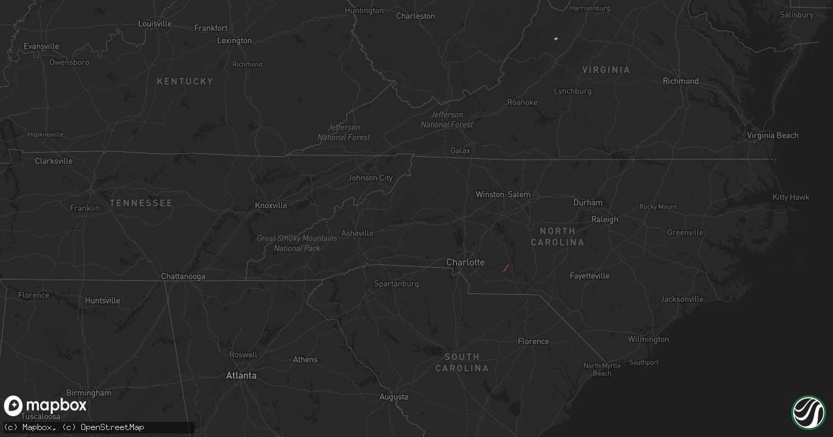
March 31 map
$229
one time, instant access
Download today. No call, no setup
Keep the $229
Bought the map and want the full workflow? Apply the entire $229 to a subscription within 7 days. None of it is wasted.
Every map, not just this one
This buys you this map. Subscription and you get every map we run, in the markets you choose from a few cities to whole states to nationwide. Plus real-time alerts the moment a storm fires.
Contact data
Name, contact info, occupancy, even credit band for addresses in the footprint. You go from where it hit to who to call.
Become the source they trust
Unlimited branding weather history reports on demand. You already have the documented answer ready for the property owner, and you are the one who showed up with it.
Property data and RoofTrace estimates
Pull up any address you have got, its value and the exact code rules for that jurisdiction, straight from One Click Code. Then RoofTrace estimates the squares, pitch, and roof value, priced the way you price.
Storm reports in North Carolina
North Carolina
| Date | Description |
|---|---|
| 03/31/20226:29 PM CDT | Trees down in the trent woods area along wedgewood drive. |
| 03/31/20222:49 PM CDT | Several downed trees along and near 540 and slater road likely due to tornado damage. |
| 03/31/202212:30 PM CDT | Possible tornado touchdown on mt zion church rd in cottonville... Stanly county nc. A tds was noted on krax data. A storm survey will be conducted in the area on friday |
| 03/31/202212:30 PM CDT | Anson county em reports several chicken houses destroyed... Along with substantial tree damage and roof damage. Suspected tornado damage... Thus an nws survey will be c |
| 03/31/202212:30 PM CDT | Possible tornado touchdown on mt zion church rd in cottonville... Stanly county nc. A tds was noted on krax data... And a roof was blown off a residence on hardy rd nea |
| 03/31/202212:10 PM CDT | Trees down at highway 205 and highway e 218. |
| 03/31/202210:25 AM CDT | A tree on a house near lake norman on stutts road. |
| 03/31/20227:25 AM CDT | At 1224 PM EDT, a severe thunderstorm was located near Lillington, moving northeast at 55 mph. HAZARD...60 mph wind gusts. SOURCE...Radar indicated. IMPACT...Expect damage to roofs, siding, and trees. Locations impacted include... Raleigh, Cary, Garner, Fuquay-Varina, Angier, Holly Springs, Lake Wheeler, Raven Rock State Park, Lake Benson and Duncan. |
| 03/31/20222:01 AM CDT | At 700 PM EDT, a severe thunderstorm was located near Phillips Crossroads, or 18 miles west of New Bern, moving northeast at 45 mph. HAZARD...60 mph wind gusts. SOURCE...Radar indicated. IMPACT...Expect damage to roofs, siding, and trees. Locations impacted include... New Bern, James City, Trent Woods, River Bend, Blounts Creek, Vanceboro, Askins, Cayton, Fort Barnwell, Jasper, Tuscarora, Rhems, Wilmar, Edward, Grantsboro, Royal, Bonnerton, Cox Crossroads, Riverdale and Olympia. |
| 03/31/20221:33 AM CDT | At 632 PM EDT, a severe thunderstorm was located over Chinquapin, or 13 miles east of Wallace, moving northeast at 40 mph. HAZARD...60 mph wind gusts. SOURCE...Radar indicated. IMPACT...Expect damage to roofs, siding, and trees. Locations impacted include... Jacksonville, Half Moon, Phillips Crossroads, Richlands, Beulaville, Maysville, Kellum, Cypress Creek, Catherine Lake, Comfort, Chinquapin, Belgrade, Potters Hill, Petersburg, Pleasant Hill, Albert J Ellis Airport, Richlands South, Deppe, Lyman and Loco VFD. |
| 03/31/202212:33 AM CDT | At 533 PM EDT, a severe thunderstorm was located 9 miles north of Nashville, moving northeast at 45 mph. HAZARD...60 mph wind gusts. SOURCE...Radar indicated. IMPACT...Expect damage to roofs, siding, and trees. Locations impacted include... Castalia, Glenview, Medoc Mountain State Park and Aventon. |
| 03/30/202210:44 PM CDT | At 343 PM EDT, a severe thunderstorm was located near Cary, moving northeast at 55 mph. HAZARD...60 mph wind gusts. SOURCE...Radar indicated. IMPACT...Expect damage to roofs, siding, and trees. Locations impacted include... Raleigh, Durham, Cary, Creedmoor, Wake Forest, Franklinton, RDU International, Apex, Morrisville and Youngsville. |
| 03/30/202210:16 PM CDT | At 315 PM EDT, severe thunderstorms were located along a line extending from near Carrboro to 7 miles south of Pittsboro to near Sanford, moving northeast at 50 mph. HAZARD...60 mph wind gusts. SOURCE...Radar indicated. IMPACT...Expect damage to roofs, siding, and trees. Locations impacted include... Raleigh, Durham, Cary, Chapel Hill, Sanford, Pittsboro, Garner, Carrboro, Fuquay-Varina and Angier. |
| 03/30/20228:46 PM CDT | At 145 PM EDT, a severe thunderstorm was located near Godwin, or 18 miles northwest of Clinton, moving northeast at 35 mph. HAZARD...60 mph wind gusts. SOURCE...Radar indicated. IMPACT...Expect damage to roofs, siding, and trees. Locations impacted include... Smithfield, Dunn, Benson, Four Oaks, Newton Grove, Falcon and Spivey's Corner. |
All States Impacted by Hail Map on March 31, 2022
Cities Impacted by Hail Map on March 31, 2022
- New Columbia, PA
- Circleville, WV
- Craigsville, VA
- Goshen, VA
- Bellefonte, PA
- Port Saint Joe, FL
- Wewahitchka, FL
- Eastpoint, FL
- Apalachicola, FL
- Norwood, NC
- Polkton, NC
- McLean, VA
- Evansville, IN
- Kittanning, PA
- Dayton, PA
- Lairdsville, PA
- Hughesville, PA
- Muncy, PA
- Westernport, MD
- Keyser, WV
- Rawlings, MD
- Westminster, MD
- Hampstead, MD
- New Windsor, MD
- New Bethlehem, PA
- Vandergrift, PA
- Freeport, PA
- Templeton, PA
- Leechburg, PA
- Brookville, PA
- Punxsutawney, PA
- Knox Dale, PA
- Ford City, PA
- Timblin, PA
- Mayport, PA
- Coolspring, PA
- Sprankle Mills, PA
- Ford Cliff, PA
- McGrann, PA
- Manorville, PA
- Reynoldsville, PA
- Worthville, PA
- Summerville, PA
- Ringgold, PA
- North Apollo, PA
- Spring Church, PA
- Apollo, PA
- Port Allegany, PA
- Shinglehouse, PA
- Lamar, PA
- Williamsport, PA
- Loganton, PA
- Mill Hall, PA
- Jersey Shore, PA
- Howard, PA
- Linden, PA
- Lock Haven, PA
- Montoursville, PA
- Dry Run, PA
- Shade Gap, PA
- Fort Littleton, PA
- Crystal Spring, PA
- Everett, PA
- Waterfall, PA
- Orbisonia, PA
- Doylesburg, PA
- Spring Run, PA
- Neelyton, PA
- Harrisonville, PA
- Three Springs, PA
- Orrstown, PA
- Hustontown, PA
- Wells Tannery, PA
- Willow Hill, PA
- Burnt Cabins, PA
- Fannettsburg, PA
- Breezewood, PA
- Lopez, PA
- Jermyn, PA
- Clarks Summit, PA
- Dushore, PA
- Olyphant, PA
- Falls, PA
- Mehoopany, PA
- Waverly, PA
- Unityville, PA
- Factoryville, PA
- Muncy Valley, PA
- Tunkhannock, PA
- Benton, PA
- Noxen, PA
- Harveys Lake, PA
- Carbondale, PA
- Dalton, PA
- Capon Bridge, WV
- Cross Junction, VA
- Gore, VA
- High View, WV
- Bloomery, WV
- Augusta, WV
- Douglas, GA
- Willacoochee, GA
- Alapaha, GA
- Ambrose, GA
- Broxton, GA
- West Green, GA


