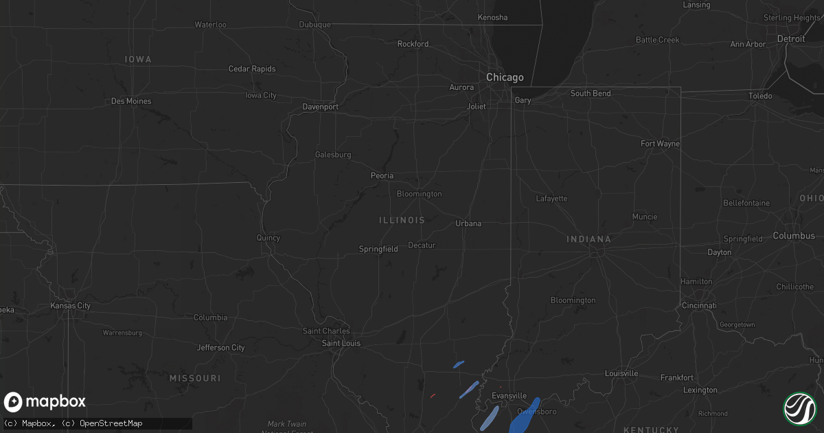
Hail Map in Illinois on March 30, 2022
Get this storm
March 30 map
$229
one time, instant access
Download today. No call, no setup
Keep the $229
Bought the map and want the full workflow? Apply the entire $229 to a subscription within 7 days. None of it is wasted.
Every map, not just this one
This buys you this map. Subscription and you get every map we run, in the markets you choose from a few cities to whole states to nationwide. Plus real-time alerts the moment a storm fires.
Contact data
Name, contact info, occupancy, even credit band for addresses in the footprint. You go from where it hit to who to call.
Become the source they trust
Unlimited branding weather history reports on demand. You already have the documented answer ready for the property owner, and you are the one who showed up with it.
Property data and RoofTrace estimates
Pull up any address you have got, its value and the exact code rules for that jurisdiction, straight from One Click Code. Then RoofTrace estimates the squares, pitch, and roof value, priced the way you price.
Storm reports in Illinois
Illinois
| Date | Description |
|---|---|
| 03/30/20226:30 PM CDT | A few pole barns damaged or destroyed |
| 03/30/20226:20 PM CDT | Lots of trees down across the area. |
| 03/30/20226:11 PM CDT | Ef-1 tornado started 5 miles ene of norris city and ended 0.5 mile ene of carmi. Peak width was 400 yards and path length was 7.9 miles. At least a dozen houses had shi |
| 03/30/20225:50 PM CDT | Tree and power lines down on house. |
| 03/30/20225:30 PM CDT | Roof and siding damage to homes in akin. Also... Two out-buildings completely damaged. |
| 03/30/20222:53 AM CDT | At 752 PM EDT, a severe thunderstorm was located over Mount Carmel, moving northeast at 45 mph. HAZARD...60 mph wind gusts. SOURCE...Radar indicated. IMPACT...Expect damage to roofs, siding, and trees. Locations impacted include... Decker, Monroe City and Wheatland. |
| 03/30/20221:13 AM CDT | At 612 PM CDT, severe thunderstorms were located along a line extending from near Schnell to 6 miles southeast of Norris City, moving east at 35 mph. HAZARD...60 mph wind gusts. SOURCE...Radar indicated. IMPACT...Expect damage to roofs, siding, and trees. Locations impacted include... Mount Vernon, New Harmony, Poseyville and Blairsville.This includes the following highways... Interstate 64 in Indiana between Mile Markers 1 and 19. Interstate 64 in Illinois between Mile Markers 116 and 130. |
| 03/30/20221:12 AM CDT | At 612 PM CDT, a severe thunderstorm was located near Bogota, or 8 miles south of Newton, moving northeast at 45 mph. HAZARD...60 mph wind gusts. SOURCE...Radar indicated. IMPACT...Expect damage to roofs, siding, and trees. This severe thunderstorm will be near... West Liberty and Dundas around 615 PM CDT. Newton around 620 PM CDT. Ste. Marie around 625 PM CDT. Willow Hill around 630 PM CDT.Other locations in the path of this severe thunderstorm includeOblong, Hardinville and Robinson. |
| 03/30/20221:08 AM CDT | At 608 PM CDT, a severe thunderstorm was located 7 miles west of Marion, moving northeast at 55 mph. HAZARD...60 mph wind gusts. SOURCE...Radar indicated. IMPACT...Expect damage to roofs, siding, and trees. This severe thunderstorm will be near... Sturgis around 625 PM CDT. |
| 03/30/202212:35 AM CDT | At 534 PM CDT, a severe thunderstorm was located near Iola, or 10 miles northwest of Flora, moving northeast at 45 mph. HAZARD...60 mph wind gusts. SOURCE...Radar indicated. IMPACT...Expect damage to roofs, siding, and trees. This severe thunderstorm will be near... Bible Grove around 545 PM CDT.Other locations in the path of this severe thunderstorm includeWatson.This includes the following highways... Interstate 57 between mile markers 145 and 159. Interstate 70 between mile markers 90 and 93. |
| 03/30/202212:30 AM CDT | At 530 PM CDT, severe thunderstorms were located along a line extending from near Dixon Springs to 8 miles southwest of Reidland to near Lynnville, moving northeast at 55 mph. HAZARD...60 mph wind gusts. SOURCE...Radar indicated. IMPACT...Expect damage to roofs, siding, and trees. Severe thunderstorms will be near... Reidland around 540 PM CDT. Calvert City and Ledbetter around 545 PM CDT. Murray around 550 PM CDT.Other locations in the path of these severe thunderstorms includeBenton and Salem.This includes the following highways... Interstate 24 in Kentucky between Mile Markers 13 and 33. Interstate 69 in Kentucky between Mile Markers 24 and 51. |
| 03/30/202212:26 AM CDT | At 526 PM CDT, severe thunderstorms were located along a line extending from near Rosiclare to 7 miles south of Salem to 10 miles southeast of Calvert City, moving northeast at 70 mph. HAZARD...60 mph wind gusts. SOURCE...Radar indicated. IMPACT...Expect damage to roofs, siding, and trees. Severe thunderstorms will be near... Marion around 535 PM CDT.Other locations in the path of these severe thunderstorms includeCreswell.This includes the following highways... Interstate 24 in Kentucky between Mile Markers 33 and 44. Interstate 69 in Kentucky between Mile Markers 68 and 74. |
| 03/30/202212:23 AM CDT | At 523 PM CDT, severe thunderstorms were located along a line extending from near Xenia to near Bluford, moving east at 35 mph. HAZARD...60 mph wind gusts. SOURCE...Radar indicated. IMPACT...Expect damage to roofs, siding, and trees. Severe thunderstorms will be near... Wayne City around 535 PM CDT.Other locations in the path of these severe thunderstorms includeFairfield.This includes Interstate 64 in Illinois between Mile Markers 92 and115. |
| 03/30/202212:21 AM CDT | At 520 PM CDT, a severe thunderstorm was located over Xenia, or 10 miles west of Flora, moving northeast at 45 mph. HAZARD...60 mph wind gusts. SOURCE...Radar indicated. IMPACT...Expect damage to roofs, siding, and trees. This severe thunderstorm will be near... Flora around 535 PM CDT. Louisville around 540 PM CDT.Other locations in the path of this severe thunderstorm include ClayCity, Bible Grove, Sailor Springs and Ingraham. |
| 03/29/202211:47 PM CDT | At 447 PM CDT, a severe thunderstorm was located near Sesser, or 7 miles northwest of Rend Lake Area, moving northeast at 40 mph. HAZARD...60 mph wind gusts. SOURCE...Radar indicated. IMPACT...Expect damage to roofs, siding, and trees. This severe thunderstorm will be near... Mount Vernon around 505 PM CDT.Other locations in the path of this severe thunderstorm includeBluford and Wayne City.This includes the following highways... Interstate 57 in Illinois between Mile Markers 81 and 96. Interstate 64 in Illinois between Mile Markers 74 and 100. |
All States Impacted by Hail Map on March 30, 2022
Cities Impacted by Hail Map on March 30, 2022
- Milton, FL
- Cantonment, FL
- Diamondhead, MS
- Port Allen, LA
- Baton Rouge, LA
- Defuniak Springs, FL
- Panama City Beach, FL
- Panama City, FL
- Inlet Beach, FL
- Santa Rosa Beach, FL
- Summerdale, AL
- Vredenburgh, AL
- Franklin, AL
- Peterman, AL
- Beatrice, AL
- Pass Christian, MS
- Bagdad, FL
- Robertsdale, AL
- Holt, FL
- Pensacola, FL
- Elberta, AL
- Lillian, AL
- Seminole, AL
- Eglin Afb, FL
- Whatley, AL
- Jackson, AL
- Grove Hill, AL
- Gainestown, AL
- Theriot, LA
- Freeport, FL
- Ponce De Leon, FL
- Foley, AL
- Pine Apple, AL
- Leakesville, MS
- Niceville, FL
- Westville, FL
- Valparaiso, FL
- Crestview, FL
- Moss Point, MS
- Citronelle, AL
- Deer Park, AL
- Zachary, LA
- Holden, LA
- Greenwell Springs, LA
- Pride, LA
- Amite, LA
- Pine Grove, LA
- Walker, LA
- Denham Springs, LA
- Baker, LA
- Fairhope, AL
- Vancleave, MS
- Gulf Breeze, FL
- Coden, AL
- Bayou La Batre, AL
- Daphne, AL
- Theodore, AL
- Irvington, AL
- Long Beach, MS
- Gulfport, MS
- Waveland, MS
- Kiln, MS
- Pearlington, MS
- Bay Saint Louis, MS
- Slidell, LA
- New Orleans, LA
- Lucedale, MS
- McIntosh, AL
- Sunflower, AL
- Tibbie, AL
- Wagarville, AL
- Vinegar Bend, AL
- Echola, AL
- Eutaw, AL
- Berry, AL
- Aliceville, AL
- Porterville, MS
- Coker, AL
- Northport, AL
- Buhl, AL
- Elrod, AL
- Scooba, MS
- Carrollton, AL
- Gordo, AL
- Emelle, AL
- Epes, AL
- Cuba, AL
- Meridian, MS
- Forkland, AL
- Boligee, AL
- Akron, AL
- Livingston, AL
- Knoxville, AL
- Gainesville, AL
- Moundville, AL
- Toomsuba, MS
- York, AL
- Fosters, AL
- Lawley, AL
- Selma, AL
- Uniontown, AL
- Thomasville, AL
- Randolph, AL
- Marion, AL
- Thomaston, AL
- Marion Junction, AL
- Centreville, AL
- Montevallo, AL
- Brierfield, AL
- Safford, AL
- Catherine, AL
- Arlington, AL
- Pine Hill, AL
- Reform, AL
- Ethelsville, AL
- Shuqualak, MS
- Brooksville, MS
- Macon, MS
- Dennis, MS
- Mantachie, MS
- Tremont, MS
- Vina, AL
- Russellville, AL
- Cherokee, AL
- Muscle Shoals, AL
- Golden, MS
- Belmont, MS
- Town Creek, AL
- Courtland, AL
- Tuscumbia, AL
- Rogersville, AL
- Hillsboro, AL
- Red Bay, AL
- Sheffield, AL
- Fulton, MS
- Killen, AL
- Leighton, AL
- Nettleton, MS
- Dixons Mills, AL
- Campbell, AL
- Faunsdale, AL
- Coffeeville, AL
- Butler, AL
- Buckatunna, MS
- Gilbertown, AL
- Richton, MS
- Toxey, AL
- Magnolia, AL
- Millry, AL
- Waynesboro, MS
- Linden, AL
- Sweet Water, AL
- Newbern, AL
- Silas, AL
- Laurel, MS
- Bremen, AL
- Arley, AL
- Logan, AL
- Falkville, AL
- Cullman, AL
- Jasper, AL
- Vinemont, AL
- Crane Hill, AL
- Alberta, AL
- Orrville, AL
- Wilmer, AL
- Creola, AL
- Semmes, AL
- Eight Mile, AL
- Satsuma, AL
- Mobile, AL
- Bay Minette, AL
- Saraland, AL
- Perdido, AL
- Pascagoula, MS
- Stapleton, AL
- Loxley, AL
- Ocean Springs, MS
- Grand Bay, AL
- Gautier, MS
- Elm Grove, LA
- Shreveport, LA
- Bossier City, LA
- Doyline, LA
- Minden, LA
- Castor, LA
- Ringgold, LA
- Coushatta, LA
- Hall Summit, LA
- Burkeville, TX
- Anacoco, LA
- Florien, LA
- Hornbeck, LA
- Bienville, LA
- Jonesboro, LA
- Ruston, LA
- Choudrant, LA
- Saline, LA
- Quitman, LA
- Chatham, LA
- Eros, LA
- Goldonna, LA
- Simsboro, LA
- Arcadia, LA
- Leesville, LA
- Sieper, LA
- Elmer, LA
- Otis, LA
- Boyce, LA
- West Monroe, LA
- Monroe, LA
- Iowa, LA
- Bell City, LA
- Welsh, LA
- Cheneyville, LA
- Tallulah, LA
- Vicksburg, MS
- Church Point, LA
- Crowley, LA
- Sunset, LA
- Branch, LA
- Rayne, LA
- Iota, LA
- Covington, LA
- Folsom, LA
- Carriere, MS
- Albany, LA
- Springfield, LA
- Poplarville, MS
- Livingston, LA
- Bush, LA
- Hammond, LA
- Ponchatoula, LA
- Picayune, MS
- Franklinton, LA
- Bogalusa, LA
- Tickfaw, LA
- Loranger, LA
- Robert, LA
- Abita Springs, LA
- Roseland, LA
- Columbia, MS
- Mount Hermon, LA
- Purvis, MS
- Hattiesburg, MS
- Independence, LA
- Angie, LA
- Kentwood, LA
- Lumberton, MS
- Tylertown, MS
- Sandy Hook, MS
- Many, LA
- Oakfield, TN
- Mercer, TN
- Lavinia, TN
- Jackson, TN
- Denmark, TN
- Toone, TN
- Moscow, TN
- Arlington, TN
- Milan, TN
- Eads, TN
- Somerville, TN
- Whiteville, TN
- Holly Springs, MS
- Williston, TN
- Rossville, TN
- Cordova, TN
- Medina, TN
- Collierville, TN
- Humboldt, TN
- Oakland, TN
- Byhalia, MS
- Bolivar, TN
- Medon, TN
- Olive Branch, MS
- Memphis, TN
- Germantown, TN
- Horn Lake, MS
- Southaven, MS
- Walls, MS
- Gracey, KY
- Fort Campbell, KY
- Cadiz, KY
- Bumpus Mills, TN
- Cerulean, KY
- Hopkinsville, KY
- Springville, TN
- Herndon, KY
- Crofton, KY
- Stewart, TN
- Paris, TN
- La Fayette, KY
- Big Sandy, TN
- Dover, TN
- Big Rock, TN
- Linden, TN
- Eva, TN
- Waverly, TN
- Sugar Tree, TN
- Holladay, TN
- Lobelville, TN
- Hollow Rock, TN
- New Johnsonville, TN
- Woodlawn, TN
- Cunningham, TN
- Parsons, TN
- Erin, TN
- Vanleer, TN
- Dickson, TN
- Palmyra, TN
- Bruceton, TN
- McEwen, TN
- Nunnelly, TN
- Buena Vista, TN
- Only, TN
- Cumberland City, TN
- Hurricane Mills, TN
- Indian Mound, TN
- Centerville, TN
- Cumberland Furnace, TN
- Tennessee Ridge, TN
- Camden, TN
- Charlotte, TN
- Thompsons Station, TN
- Brentwood, TN
- Franklin, TN
- Minter City, MS
- Itta Bena, MS
- Holcomb, MS
- Greenwood, MS
- Leland, MS
- Charleston, MS
- Philipp, MS
- Chatham, MS
- Sunflower, MS
- Glen Allan, MS
- Inverness, MS
- Schlater, MS
- Hollandale, MS
- Moorhead, MS
- Indianola, MS
- Greenville, MS
- Belzoni, MS
- Sidon, MS
- Isola, MS
- Duncan, MS
- Rosedale, MS
- Mound Bayou, MS
- Tutwiler, MS
- Watson, AR
- Shelby, MS
- Clarksdale, MS
- Gunnison, MS
- Bolton, MS
- Flora, MS
- Bentonia, MS
- Yazoo City, MS
- Benton, MS
- Byram, MS
- Raymond, MS
- Utica, MS
- Terry, MS
- West, MS
- French Camp, MS
- Kilmichael, MS
- Coila, MS
- Durant, MS
- Eupora, MS
- Walthall, MS
- Duck Hill, MS
- Vaiden, MS
- Stewart, MS
- Cruger, MS
- Ackerman, MS
- Ethel, MS
- Winona, MS
- Lexington, MS
- Mathiston, MS
- McCarley, MS
- North Carrollton, MS
- Weir, MS
- Carrollton, MS
- Jackson, MS
- Flowood, MS
- Pearl, MS
- Lena, MS
- Canton, MS
- Brandon, MS
- Stantonville, TN
- Tupelo, MS
- Crump, TN
- Olivehill, TN
- Crenshaw, MS
- Hickory Flat, MS
- Glen, MS
- Thaxton, MS
- Batesville, MS
- Abbeville, MS
- Iuka, MS
- Iron City, TN
- Ecru, MS
- Sardis, MS
- Adamsville, TN
- Burnsville, MS
- Myrtle, MS
- Lutts, TN
- Lamar, MS
- Dundee, MS
- Hernando, MS
- Michigan City, MS
- Ripley, MS
- Selmer, TN
- Shiloh, TN
- Etta, MS
- Blue Springs, MS
- Blue Mountain, MS
- Cypress Inn, TN
- Falkner, MS
- Tiplersville, MS
- Savannah, TN
- Dumas, MS
- Counce, TN
- Senatobia, MS
- Waynesboro, TN
- Baldwyn, MS
- Rienzi, MS
- Florence, AL
- Michie, TN
- Como, MS
- Potts Camp, MS
- Waterford, MS
- Red Banks, MS
- Saltillo, MS
- Coldwater, MS
- Booneville, MS
- Ashland, MS
- Marietta, MS
- Oxford, MS
- Guys, TN
- Sarah, MS
- Waterloo, AL
- Tunica, MS
- Tishomingo, MS
- Ramer, TN
- New Albany, MS
- Collinwood, TN
- Corinth, MS
- Walnut, MS
- Guntown, MS
- McCool, MS
- Sallis, MS
- Carthage, MS
- Starkville, MS
- Kosciusko, MS
- Goodman, MS
- Noxapater, MS
- Philadelphia, MS
- Camden, MS
- Louisville, MS
- Sturgis, MS
- Bruce, MS
- Banner, MS
- Pontotoc, MS
- Randolph, MS
- Mccomb, MS
- Collins, MS
- Taylorsville, MS
- Monticello, MS
- Mendenhall, MS
- Rose Hill, MS
- Bay Springs, MS
- Louin, MS
- Pinola, MS
- Mize, MS
- Oak Vale, MS
- Ruth, MS
- Smithdale, MS
- Soso, MS
- Prentiss, MS
- Mount Olive, MS
- Summit, MS
- Liberty, MS
- Newhebron, MS
- Stringer, MS
- Magee, MS
- Paulding, MS
- Magnolia, MS
- Silver Creek, MS
- Jayess, MS
- Shannon, MS
- Verona, MS
- Mooreville, MS
- Plantersville, MS
- New Site, MS
- Hickory, MS
- Chunky, MS
- Raleigh, MS
- Lawrence, MS
- Enterprise, MS
- Forest, MS
- Newton, MS
- Braxton, MS
- Aberdeen, MS
- Crawford, MS
- Columbus, MS
- Amory, MS
- Brooklyn, MS
- Wiggins, MS
- Petal, MS
- New Augusta, MS
- Fort Deposit, AL
- Lower Peach Tree, AL
- Hayneville, AL
- Minter, AL
- Monroeville, AL
- Letohatchee, AL
- Leroy, AL
- Coy, AL
- Beaumont, MS
- McLain, MS
- Saint Stephens, AL
- Hope Hull, AL
- Fruitdale, AL
- Lowndesboro, AL
- Camden, AL
- Greenville, AL
- Little River, AL
- Frisco City, AL
- Prattville, AL
- Uriah, AL
- Montgomery, AL
- Tyler, AL
- State Line, MS
- Neely, MS
- Dickinson, AL
- Forest Home, AL
- Perkinston, MS
- Rayville, LA
- Lacombe, LA
- Cottondale, AL
- Tuscaloosa, AL
- Columbiana, AL
- Chipley, FL
- Alford, FL
- Cottondale, FL
- Hemphill, TX
- Natchitoches, LA
- Campti, LA
- Winnsboro, LA
- Cleveland, MS
- Courtland, MS
- Pope, MS
- Enid, MS
- Huntingdon, TN
- Thompsonville, IL
- Macedonia, IL
- Carmi, IL
- Evansville, IN
- Fairfield, IL
- Crossville, IL
- Norris City, IL
- Cove, AR
- Hatfield, AR
- Mena, AR
- Paragould, AR
- Bono, AR
- Ripley, TN
- Luxora, AR
- Finley, TN
- Dyersburg, TN
- Lenox, TN
- Halls, TN
- Blytheville, AR
- Henning, TN
- Osceola, AR
- Baker, FL
- Laurel Hill, FL
- Marianna, FL
- Wewahitchka, FL
- Port Saint Joe, FL
- Kevil, KY
- West Paducah, KY
- Paducah, KY
- Boaz, KY
- Hickory, KY
- Fancy Farm, KY
- Melber, KY
- Mayfield, KY
- Uniontown, KY
- Corydon, KY
- Waverly, KY
- Henderson, KY
- Morganfield, KY
- Sturgis, KY
- Owensboro, KY
- Calhoun, KY
- Madisonville, KY
- Sebree, KY
- Rockport, IN
- Hanson, KY
- Slaughters, KY
- Nebo, KY
- Rumsey, KY
- Manitou, KY
- Utica, KY
- Dawson Springs, KY
- Robards, KY
- Richland, IN


