Hail Map in Indiana on February 27, 2011
Get this storm
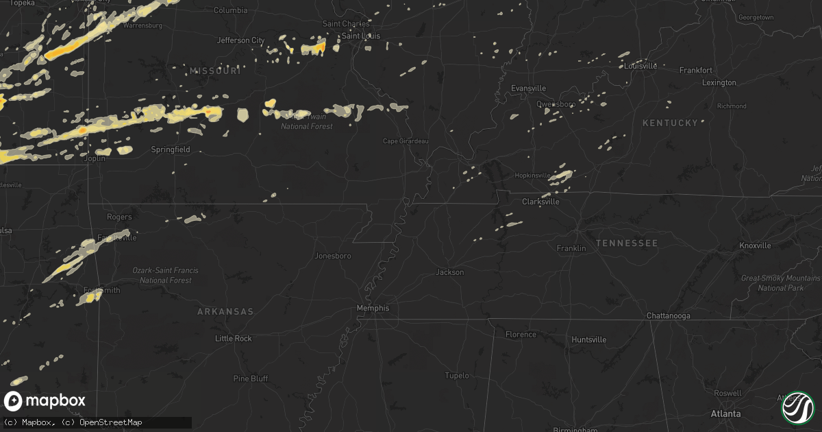
February 27 map
$229
one time, instant access
Download today. No call, no setup
Keep the $229
Bought the map and want the full workflow? Apply the entire $229 to a subscription within 7 days. None of it is wasted.
Every map, not just this one
This buys you this map. Subscription and you get every map we run, in the markets you choose from a few cities to whole states to nationwide. Plus real-time alerts the moment a storm fires.
Contact data
Name, contact info, occupancy, even credit band for addresses in the footprint. You go from where it hit to who to call.
Become the source they trust
Unlimited branding weather history reports on demand. You already have the documented answer ready for the property owner, and you are the one who showed up with it.
Property data and RoofTrace estimates
Pull up any address you have got, its value and the exact code rules for that jurisdiction, straight from One Click Code. Then RoofTrace estimates the squares, pitch, and roof value, priced the way you price.
Storm reports in Indiana
Indiana
| Date | Description |
|---|---|
| 02/27/20114:59 AM CST | Trees and power lines down |
| 02/27/20113:45 AM CST | Many shingles torn off a roof from the high winds. |
| 02/27/20113:31 AM CST | An nws storm damage survey confirmed an ef-1 tornado with maximum wind speeds of 95 to 100 mph touched down 2 miles west of utica indiana...crossed the ohio river...and |
| 02/27/20113:29 AM CST | An nws storm damage survey confirmed an ef-1 tornado with maximum wind speeds of 95 to 100 mph touched down 2 miles west of utica indiana...crossed the ohio river...and |
| 02/27/20113:27 AM CST | Trees and power lines down along with power outages. |
| 02/27/20113:26 AM CST | Power outages reported in jeffersonville. |
| 02/27/20113:22 AM CST | Roof damage to a wal-mart in new albany. |
| 02/27/20113:10 AM CST | Trees down. Time estimated. |
| 02/27/20113:05 AM CST | Three modular homes with roof damage. |
| 02/27/20112:54 AM CST | A local report indicates 65 MPH wind near CURBY |
| 02/27/20112:50 AM CST | State road 66 south of marengo is closed due to power lines down on the road. |
| 02/27/20112:48 AM CST | Dime size hail also reported. |
| 02/27/20112:46 AM CST | Straight line wind damage at 3 separate points just north of valeene. About 2 miles northwest of valeene...an outbuilding was destroyed and a large cedar tree was uproo |
| 02/27/20112:32 AM CST | 4-5 homes damaged or destroyed in ellsworth. Several injuries. |
| 02/27/20112:27 AM CST | Power outages in jasper. Reported by wave and weht. |
| 02/27/20112:27 AM CST | Roof blown off of a house. |
| 02/27/20112:23 AM CST | A local report indicates 65 MPH wind near IRELAND |
| 02/27/20112:19 AM CST | *** 1 inj *** an nws storm damage survey confirmed that an ef-1 tornado touched down about 5.5 miles southwest of jasper damaging several large metal buildings...a larg |
| 02/27/20112:18 AM CST | Viewer reported roof of home blown off. |
| 02/27/20112:18 AM CST | Numerous reports of damage in community and in the southern princeton area. Owensville fire dept is requesting gas company due to several homes damage and check the are |
| 02/27/20112:17 AM CST | 40 to 50 inch diameter pine trees down. |
| 02/27/20112:10 AM CST | An ef0 tornado touched down 2.5 miles southwest of otwell and traveled east for 2 miles to 1 mile south of otwell. Average path width was 150 yards. Peak wind was 85 mp |
| 02/27/20112:05 AM CST | Power lines down. |
| 02/27/20112:03 AM CST | Quarter size hail reported west of town. |
| 02/27/20112:00 AM CST | Numerous power outages. Multiple trees down. Roof blown off of brick building taking down large section of power lines. |
| 02/27/20111:59 AM CST | 14 inch diameter tree down. Community is without power. |
| 02/27/20111:58 AM CST | Multiple homes damaged north and east of the community. |
| 02/27/20111:51 AM CST | An ef2 tornado touched down 2 miles southeast of princeton and travelled east for 19 and a quarter miles to 2 miles west of velpen by 209 am. Peak wind was 115 mph. Ave |
| 02/27/20111:43 AM CST | An ef1 tornado touched down 6 miles west of owensville and traveled east for 22 miles to one half mile east of somerville by 204 am. Peak wind was 105 mph...and the pat |
| 02/27/201112:30 AM CST | Evergreens /40 to 50 foot tall/ knocked over near us 31 and state road 22. |
| 02/27/201112:20 AM CST | House destroyed as a couple of walls were knocked down. |
| 02/27/201112:00 AM CST | Roof blown off of house. |
| 02/26/201111:35 PM CST | Nws damage survey confirms tornado starting near county road 1050s and ending just north of county road 1000s. Path length just over one half mile and path width near 2 |
| 02/26/201110:40 PM CST | Nickel to quarter size hail and gusty winds |
All States Impacted by Hail Map on February 27, 2011
Cities Impacted by Hail Map on February 27, 2011
- Champaign, IL
- Howard, KS
- Eaton, OH
- Richmond, IN
- Higginsville, MO
- Stewart, TN
- Greenfield, MO
- Arcola, MO
- Lockwood, MO
- Goldthwaite, TX
- Hamilton, TX
- Frontenac, KS
- Pittsburg, KS
- East Saint Louis, IL
- Eureka, MO
- Pacific, MO
- Pleasant Hill, MO
- Harrisonville, MO
- Huntsville, MO
- Winchester, IN
- Greenview, IL
- Long Lane, MO
- Buffalo, MO
- Stuart, OK
- Climax Springs, MO
- Edwards, MO
- Wellsville, KS
- Ottawa, KS
- Edgerton, KS
- Boss, MO
- Bixby, MO
- Westville, OK
- Summers, AR
- Proctor, OK
- Nashoba, OK
- Yellville, AR
- Wichita, KS
- Winamac, IN
- Oblong, IL
- Willow Hill, IL
- West Liberty, IL
- Greenwood, IN
- Indianapolis, IN
- Green Valley, IL
- Ballwin, MO
- Chesterfield, MO
- Virgil, KS
- Fall River, KS
- Neal, KS
- Rosalia, KS
- Beaumont, KS
- Leon, KS
- Piedmont, KS
- Toronto, KS
- Severy, KS
- Eureka, KS
- La Grange, MO
- Harmony, IN
- Knightsville, IN
- Reelsville, IN
- Terre Haute, IN
- Cloverdale, IN
- Amo, IN
- Clayton, IN
- Greencastle, IN
- Carbon, IN
- Danville, IN
- Brazil, IN
- Fillmore, IN
- Rosedale, IN
- Coatesville, IN
- Putnamville, IN
- El Dorado, KS
- Cassoday, KS
- Burns, KS
- Princeton, IN
- Frost, TX
- Mcalester, OK
- Mount Sterling, MO
- Hermann, MO
- Linn, MO
- Bland, MO
- Owensville, MO
- Staunton, IL
- Valley Mills, TX
- Jonesboro, TX
- Gatesville, TX
- Mattoon, IL
- Lerna, IL
- Windsor, IL
- Gays, IL
- Cottonwood Falls, KS
- Elmdale, KS
- Gardner, KS
- Spring Hill, KS
- Shelbina, MO
- Deer Creek, OK
- Medford, OK
- Salem, MO
- West Salem, IL
- Avon, IN
- Brownsburg, IN
- Licking, MO
- Raymondville, MO
- Bowie, TX
- Montague, TX
- Meridian, TX
- Clifton, TX
- Petersburg, IL
- Cumby, TX
- Lone Oak, TX
- Brashear, TX
- Campbell, TX
- Benton, KS
- Valley Center, KS
- Centerville, KS
- Jerico Springs, MO
- Augusta, MO
- Coatsburg, IL
- Payson, IL
- Clayton, IL
- Paloma, IL
- Quincy, IL
- Camp Point, IL
- Fowler, IL
- Liberty, IL
- Palmyra, MO
- Lewisburg, OH
- Bolivar, MO
- Half Way, MO
- Bloomington, IL
- Italy, TX
- Milford, TX
- Sherman, TX
- Farmington, MO
- Ashmore, IL
- Charleston, IL
- Trilla, IL
- Neoga, IL
- Saint Louis, MO
- Columbus, KS
- Scammon, KS
- Mode, IL
- Cowden, IL
- Beecher City, IL
- Shelbyville, IL
- Colony, KS
- Westphalia, KS
- Stockton, MO
- Coffeyville, KS
- Dexter, KS
- Shidler, OK
- Maple City, KS
- Peru, KS
- Caney, KS
- Independence, KS
- Cedar Vale, KS
- Niotaze, KS
- Sedan, KS
- Havana, KS
- Lewistown, IL
- Lamar, MO
- Argonia, KS
- Washington, MO
- Labadie, MO
- Gray Summit, MO
- Union, MO
- Villa Ridge, MO
- Lincoln, IL
- New Holland, IL
- Stanford, IL
- Armstrong, MO
- Garnett, KS
- Salisbury, MO
- Bates City, MO
- Blackburn, MO
- Sweet Springs, MO
- Kingsville, MO
- Greenwood, MO
- Mayview, MO
- Freeman, MO
- Peculiar, MO
- Cleveland, MO
- Holden, MO
- Clifton Hill, MO
- Glasgow, MO
- Paola, KS
- Drexel, MO
- Concordia, MO
- Centerview, MO
- Higbee, MO
- Malta Bend, MO
- La Cygne, KS
- Warrensburg, MO
- Miami, MO
- Gilliam, MO
- Fontana, KS
- Raymore, MO
- Dalton, MO
- Greeley, KS
- Fayette, MO
- Parker, KS
- Marshall, MO
- Rantoul, KS
- Strasburg, MO
- Odessa, MO
- Lone Jack, MO
- Lane, KS
- Alma, MO
- Keytesville, MO
- Osawatomie, KS
- Slater, MO
- Richmond, KS
- Louisburg, KS
- Noblesville, IN
- Ashland, IL
- Tallula, IL
- Browning, IL
- Havana, IL
- Astoria, IL
- Rushville, IL
- Vermont, IL
- Kansas City, KS
- Clarksville, TN
- Mill Creek, OK
- Macomb, IL
- Cicero, IN
- Prairie Village, KS
- Madill, OK
- Delavan, IL
- Emden, IL
- Chrisman, IL
- Paris, IL
- Clinton, IN
- Milford Center, OH
- San Jose, IL
- Ipava, IL
- Rolla, MO
- Saint James, MO
- Welda, KS
- Le Roy, KS
- Neosho Falls, KS
- Kincaid, KS
- Girard, KS
- Cherokee, KS
- Liberal, MO
- Mindenmines, MO
- Arcanum, OH
- New Madison, OH
- Ellery, IL
- Albion, IL
- Park Hill, OK
- Vian, OK
- Bunch, OK
- Gore, OK
- Cookson, OK
- Stilwell, OK
- Elk Falls, KS
- Moline, KS
- Congerville, IL
- Antlers, OK
- Boswell, OK
- Rosebud, MO
- Cuba, MO
- Winchester, IL
- Lorena, TX
- Muskogee, OK
- Welling, OK
- Iola, KS
- Lebanon, MO
- Stoutland, MO
- Soper, OK
- Kemp, TX
- Loraine, IL
- Plymouth, IL
- Huntsville, IL
- Golden, IL
- Littleton, IL
- Augusta, IL
- Frederick, IL
- Camden, IL
- Timewell, IL
- La Prairie, IL
- Mendon, IL
- Mount Sterling, IL
- Bowen, IL
- Martinsville, IL
- Casey, IL
- Doe Run, MO
- Pocola, OK
- Arkoma, OK
- Fort Smith, AR
- Grandview, MO
- Kansas City, MO
- Belton, MO
- Midland, PA
- Negley, OH
- Darlington, PA
- East Liverpool, OH
- De Soto, KS
- Greenwich, KS
- Towanda, KS
- Colwich, KS
- Kechi, KS
- Garden Plain, KS
- Goddard, KS
- Maize, KS
- Potwin, KS
- Reeds, MO
- Sarcoxie, MO
- Joplin, MO
- Carthage, MO
- Webb City, MO
- Carterville, MO
- Sparta, IL
- Cutler, IL
- Coulterville, IL
- Boaz, KY
- Hickory, KY
- Symsonia, KY
- Union City, OH
- Greenville, OH
- Ansonia, OH
- Williamsburg, KS
- Waverly, KS
- Aline, OK
- Kenton, OH
- Stilesville, IN
- Burdick, KS
- Lincolnville, KS
- Madison, KS
- Whitney, TX
- Malone, TX
- Forreston, TX
- Itasca, TX
- Mertens, TX
- Abbott, TX
- Aquilla, TX
- Hillsboro, TX
- Penelope, TX
- Bynum, TX
- Shelbyville, MO
- Evant, TX
- McLean, IL
- Urbana, OH
- Russellville, KY
- Adairville, KY
- Hico, TX
- Alpena, AR
- Beaver, PA
- Rogers, OH
- Beaver Falls, PA
- Lisbon, OH
- Industry, PA
- Holliday, MO
- Lewisburg, KY
- Elkton, KY
- Atlanta, IL
- Elizabeth, IN
- Normal, IL
- Berger, MO
- New Haven, MO
- Sidney, OH
- Shirley, IL
- Dana, IN
- Ridge Farm, IL
- Cayuga, IN
- Fishers, IN
- Union City, IN
- Commercial Point, OH
- Orient, OH
- Marshall, IN
- Huntingdon, TN
- Braman, OK
- Goltry, OK
- Nash, OK
- Pond Creek, OK
- Jet, OK
- Crowley, TX
- Hardinsburg, KY
- Greenville, IL
- De Graff, OH
- Rensselaer, IN
- Lenox, MO
- Edgar Springs, MO
- Lampasas, TX
- Morgan, TX
- Lometa, TX
- Purmela, TX
- Star, TX
- Cranfills Gap, TX
- Dadeville, MO
- Aldrich, MO
- Lees Summit, MO
- Lentner, MO
- Excello, MO
- Cairo, MO
- Clarence, MO
- Macon, MO
- Jacksonville, MO
- Anabel, MO
- Nardin, OK
- Arkansas City, KS
- Blackwell, OK
- Newkirk, OK
- Stotts City, MO
- La Russell, MO
- Miller, MO
- Clay City, IN
- English, IN
- Bethalto, IL
- Moro, IL
- Edwardsville, IL
- Heyworth, IL
- Council Grove, KS
- Spiro, OK
- Cannelton, IN
- Cloverport, KY
- Winslow, IN
- Maplewood, OH
- Jackson Center, OH
- Anna, OH
- Marengo, OH
- Centerburg, OH
- Gerald, MO
- Geuda Springs, KS
- Valley View, TX
- Waverly, TN
- Erin, TN
- Tennessee Ridge, TN
- Virginia, IL
- Louisburg, MO
- Wapakoneta, OH
- Garland, KS
- Bronaugh, MO
- Dunnegan, MO
- Fair Play, MO
- Farmington, AR
- Fayetteville, AR
- Argos, IN
- Piqua, KS
- Yates Center, KS
- Tishomingo, OK
- Minier, IL
- Snow, OK
- Rattan, OK
- Mason City, IL
- Easton, IL
- Stringtown, OK
- Griggsville, IL
- Bluffs, IL
- Chambersburg, IL
- Meredosia, IL
- Neodesha, KS
- Erie, KS
- Dennis, KS
- Galesburg, KS
- Cherryvale, KS
- Thayer, KS
- Parsons, KS
- Saint Paul, KS
- Millstadt, IL
- Columbia, IL
- Saint Henry, OH
- Maria Stein, OH
- New Weston, OH
- North Salem, IN
- Ladoga, IN
- Jamestown, IN
- New Ross, IN
- Collinsville, TX
- Tioga, TX
- Atoka, OK
- Oakdale, IL
- Nashville, IL
- Pinckneyville, IL
- Westfield, IL
- Marshall, IL
- Kansas, IL
- Hopedale, IL
- Armington, IL
- Princeton, KS
- Edna, KS
- Baldwin City, KS
- Hamilton, KS
- Gridley, KS
- Peck, KS
- Haysville, KS
- Whitesboro, TX
- Gainesville, TX
- Chapin, IL
- Oswego, KS
- Kinta, OK
- Stigler, OK
- Rockbridge, OH
- Fairfield, IL
- Beardstown, IL
- Lamont, OK
- Elk City, KS
- Bartlett, KS
- Altamont, KS
- Longton, KS
- Liberty, KS
- Helena, OK
- Utica, KY
- Calhoun, KY
- Oronogo, MO
- McCune, KS
- Oglesby, TX
- McGregor, TX
- Osage City, KS
- Fair Grove, MO
- Garden City, MO
- Mays, IN
- Rushville, IN
- Knightstown, IN
- Lebanon, IN
- Madison, MO
- Warner, OK
- Webbers Falls, OK
- Kilbourne, IL
- Pembroke Township, IL
- Sheldon, MO
- Sunset, TX
- Lane, OK
- Richland, MO
- Windyville, MO
- Asbury, MO
- Flemington, MO
- Phillipsburg, MO
- Mound Valley, KS
- Golden City, MO
- Weir, KS
- Mulberry, KS
- Humansville, MO
- Elkland, MO
- Franklin, KS
- Tunas, MO
- Butler, IN
- Auburn, IN
- Industry, IL
- Lewis, IN
- Middle Brook, MO
- Bismarck, MO
- Ironton, MO
- Belleview, MO
- Avilla, MO
- Marion, KS
- Georgetown, IN
- Hartsburg, IL
- Mannsville, OK
- Ardmore, OK
- Lawrence, KS
- Winfield, KS
- Modoc, IN
- Losantville, IN
- Parker City, IN
- Bokoshe, OK
- Muldrow, OK
- Roland, OK
- Demotte, IN
- Wheatfield, IN
- Essex, IL
- Bonfield, IL
- Millersburg, OH
- Garfield, KY
- Harned, KY
- Irvington, KY
- Sunbury, OH
- Belle, MO
- Bluff City, KS
- New Paris, OH
- Depauw, IN
- Eldridge, MO
- Covington, IN
- Veedersburg, IN
- Adair, IL
- Tuscumbia, MO
- Niangua, MO
- Conway, MO
- Mccordsville, IN
- Greenfield, IN
- Albany, IN
- Muncie, IN
- Farmland, IN
- Selma, IN
- Mount Vernon, OH
- Bellville, OH
- Fredericktown, OH
- Butler, OH
- Hannibal, MO
- Celina, OH
- Delaware, OH
- Ashley, OH
- Ridgeville, IN
- Portland, IN
- Patoka, IN
- Clearwater, KS
- Wellington, KS
- Medaryville, IN
- North Judson, IN
- Whitewater, KS
- Andale, KS
- Calvin, OK
- Owensboro, KY
- Cambridge City, IN
- Greens Fork, IN
- Webster, KY
- Danvers, IL
- Trenton, KY
- Ivesdale, IL
- Mayfield, KY
- Cooksville, IL
- College Corner, OH
- Somerville, OH
- Camden, OH
- Westport, IN
- Sadler, TX
- Moundville, MO
- Hanson, KY
- Prairie Grove, AR
- Flora, IL
- Piqua, OH
- Simpson, IL
- Leslie, MO
- Beaufort, MO
- Lynn, IN
- Pomona, KS
- Quenemo, KS
- Melvern, KS
- Crofton, KY
- Kingman, KS
- Newton, KS
- Freeburg, MO
- La Harpe, KS
- Humboldt, KS
- Jacksonville, IL
- Honobia, OK
- Bath, IL
- Polk, MO
- Defiance, MO
- Sheridan, IN
- Westfield, IN
- Belleville, IL
- Freeburg, IL
- Mascoutah, IL
- Paris, MO
- Gravois Mills, MO
- Marysville, OH
- Vandalia, MO
- Roundhill, KY
- Brownsville, KY
- Hillsboro, IL
- Taylor Springs, IL
- Litchfield, IL
- Walshville, IL
- Irving, IL
- Witt, IL
- Reading, KS
- Lebo, KS
- Tahlequah, OK
- Springdale, AR
- Elkins, AR
- Lincoln, AR
- South Haven, KS
- Fredericktown, MO
- Park Hills, MO
- Matfield Green, KS
- Table Grove, IL
- Marietta, IL
- Topeka, IL
- Palestine, OH
- Hollansburg, OH
- Hermitage, MO
- New Castle, IN
- Mooreland, IN
- Monroe City, MO
- Maywood, MO
- Ursa, IL
- Taylor, MO
- Durant, OK
- Caddo, OK
- Maryland Heights, MO
- Carrollton, MO
- Nokomis, IL
- Pana, IL
- Oconee, IL
- Rosamond, IL
- Waxahachie, TX
- Midlothian, TX
- Croton, OH
- Pittsfield, IL
- Jeffersonville, IN
- Lewisville, IN
- Straughn, IN
- Eddy, TX
- Waco, TX
- Riesel, TX
- Bruceville, TX
- Marlin, TX
- Chilton, TX
- Crawford, TX
- Moody, TX
- Hewitt, TX
- Montezuma, IN
- Bloomingdale, IN
- Rockville, IN
- Russellville, IN
- Hillsdale, IN
- Krebs, OK
- Archie, MO
- Lewistown, OH
- Robertsville, MO
- Carl Junction, MO
- Anthony, KS
- Fortville, IN
- Alexandria, IN
- Groveport, OH
- Ashville, OH
- Canal Winchester, OH
- Shawnee, KS
- Fountain City, IN
- Kentland, IN
- Robinson, IL
- Palestine, IL
- Derby, KS
- Mayfield, KS
- Conway Springs, KS
- Milan, KS
- Mountain Grove, MO
- Hartville, MO
- Birdseye, IN
- Poland, IN
- Bowling Green, IN
- Urbana, IL
- Grenola, KS
- Plato, MO
- Waynesville, MO
- Duke, MO
- Fort Leonard Wood, MO
- Newburg, MO
- Burlington, KS
- Saint Paris, OH
- Houston, OH
- Russia, OH
- Koshkonong, MO
- West Plains, MO
- Reynolds Station, KY
- Fordsville, KY
- Bellefontaine, OH
- Cheney, KS
- Murdock, KS
- Mount Carmel, IL
- Fountaintown, IN
- Florence, KS
- Sedgwick, KS
- Reddick, IL
- Bowling Green, MO
- Middletown, MO
- Curryville, MO
- Anderson, IN
- Shirley, IN
- Hudson, IL
- Towanda, IL
- Hawesville, KY
- Mccurtain, OK
- Ashley, IL
- Du Bois, IL
- Russells Point, OH
- Quincy, OH
- Tyro, KS
- Norborne, MO
- Stonewall, OK
- Overland Park, KS
- Falcon, MO
- Jasper, MO
- Versailles, IL
- Augusta, KS
- Big Sandy, TN
- Wheatland, MO
- Lexington, MO
- Montezuma, OH
- Keota, OK
- Eckerty, IN
- Jacob, IL
- Perryville, MO
- Frohna, MO
- Gorham, IL
- Thorntown, IN
- Laura, OH
- Ludlow Falls, OH
- Pitsburg, OH
- Pottsboro, TX
- Denison, TX
- Pierceton, IN
- Warsaw, IN
- Marshfield, MO
- Roachdale, IN
- Saint Jo, TX
- Harrod, OH
- Alger, OH
- Peabody, KS
- Cedar Lake, IN
- New Bremen, OH
- Altamont, IL
- Fletcher, OH
- Emporia, KS
- Olpe, KS
- Huntsville, OH
- Chamois, MO
- Meta, MO
- Saint Elizabeth, MO
- Mound City, KS
- Pleasanton, KS
- Louisville, KY
- Simpsonville, KY
- Marengo, IN
- Fredonia, KS
- Mooresville, IN
- Bainbridge, IN
- Kopperl, TX
- Blum, TX
- Cumberland Furnace, TN
- Vanleer, TN
- Cumberland City, TN
- Highlandville, MO
- Urbana, MO
- Ennis, TX
- Middletown, IN
- Daleville, IN
- Saint Mary, MO
- Woodway, TX
- Laurel, IN
- Rockport, IL
- Munfordville, KY
- Wildwood, MO
- Saint Clair, MO
- Cartwright, OK
- Panama, IL
- Sorento, IL
- Huntsville, AR
- Hindsville, AR
- Danville, KY
- Stanford, KY
- Howe, TX
- Rose Hill, KS
- Ada, OH
- Churubusco, IN
- Albion, IN
- Versailles, OH
- Bradford, OH
- Covington, OH
- Brownstown, IL
- Saint Elmo, IL
- Strawn, IL
- Eudora, KS
- New Knoxville, OH
- Osceola, MO
- Quincy, MO
- Morganfield, KY
- Alton, MO
- Bruceton, TN
- Marthasville, MO
- Hepler, KS
- Uniontown, KS
- Guthrie, KY
- Allensville, KY
- Adams, TN
- Quinton, OK
- Hulbert, OK
- Centerpoint, IN
- Clark, MO
- Walnut, KS
- Manitou, KY
- Ellsworth, IL
- Pendleton, IN
- Jewett, IL
- Greenup, IL
- Fort Recovery, OH
- Coal City, IN
- Sainte Genevieve, MO
- Bunker, MO
- Seymour, MO
- Toledo, IL
- Macks Creek, MO
- Wellington, MO
- Spiceland, IN
- Dunkirk, OH
- Dola, OH
- Arcadia, KS
- Farlington, KS
- Arma, KS
- Woodburn, KY
- Hartford, KS
- Grant, OK
- Hugo, OK
- Williamsburg, IN
- Douglass, KS
- Caney, OK
- Newark, OH
- Granville, OH
- Gilman, IL
- Chatsworth, IL
- Onarga, IL
- Piper City, IL
- Stover, MO
- Lincoln, MO
- Ostrander, OH
- Botkins, OH
- Hartford, IL
- East Alton, IL
- Clarksville, IN
- Falls Of Rough, KY
- Moran, KS
- Heath, OH
- Loose Creek, MO
- New Albany, IN
- Maypearl, TX
- Venus, TX
- Moberly, MO
- Whitesville, KY
- Slaughters, KY
- Rumsey, KY
- Arenzville, IL
- Concord, IL
- New Salem, IL
- New Canton, IL
- Eldon, MO
- Shumway, IL
- Sigel, IL
- Stewardson, IL
- Rushsylvania, OH
- West Mansfield, OH
- Forest, OH
- Philpot, KY
- Conover, OH
- West Terre Haute, IN
- Springfield, KY
- Bardstown, KY
- Harrison, AR
- Lead Hill, AR
- Benton, KY
- Olmstead, KY
- Otwell, IN
- Borden, IN
- Greenville, IN
- Pekin, IN
- Palmyra, IN
- New Salisbury, IN
- Cross Timbers, MO
- Zanesville, OH
- Mount Perry, OH
- Roseville, OH
- Martinton, IL
- Bee Spring, KY
- Sweeden, KY
- Waverly, MO
- Ashkum, IL
- Danforth, IL
- Waveland, IN
- Crawfordsville, IN
- Rankin, IL
- Spivey, KS
- Ridgeway, OH
- Mount Victory, OH
- Coldwater, OH
- Stilwell, KS
- Grain Valley, MO
- Brunswick, MO
- Bucyrus, KS
- Oak Grove, MO
- West Liberty, OH
- Cable, OH
- Howard, OH
- Danville, OH
- Freeport, KS
- Clarkson, KY
- Clifton, IL
- Hagerstown, IN
- Economy, IN
- Corydon, IN
- Red Oak, TX
- Sullivan, MO
- Sparta, MO
- Downs, IL
- Le Roy, IL
- Beaverville, IL
- Saint Anne, IL
- Minster, OH
- Sharon Grove, KY
- Collins, MO
- Morocco, IN
- Lake Village, IN
- Killbuck, OH
- Glenmont, OH
- Yorktown, IN
- Willard, MO
- Walnut Grove, MO
- Morrisville, MO
- Petersburg, IN
- Tipp City, OH
- West Milton, OH
- Bourbonnais, IL
- Albers, IL
- Germantown, IL
- Emden, MO
- Monterey, IN
- Fort Worth, TX
- Galena, KS
- Wilkinson, IN
- Pawhuska, OK
- Checotah, OK
- Brook, IN
- Leawood, KS
- Knob Noster, MO
- Chetopa, KS
- Roundhead, OH
- Lakeview, OH
- Liberty, IN
- Saint Marys, OH
- Sugarcreek, OH
- Baltic, OH


