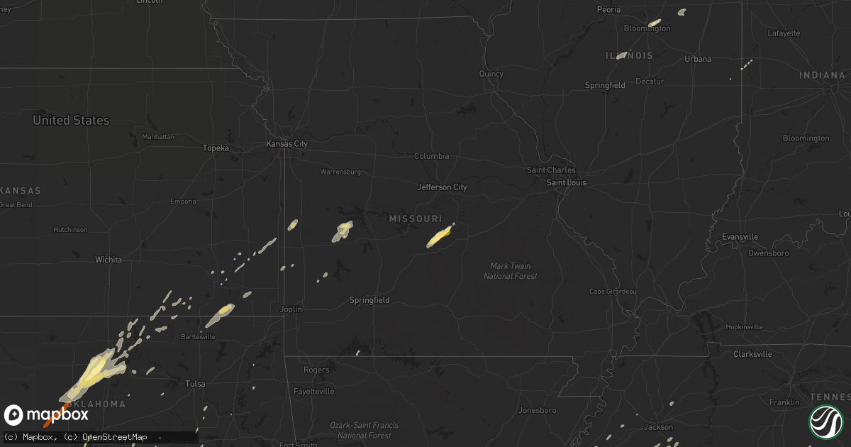
Hail Map in Missouri on January 29, 2013
Get this storm
January 29 map
$229
one time, instant access
Download today. No call, no setup
Keep the $229
Bought the map and want the full workflow? Apply the entire $229 to a subscription within 7 days. None of it is wasted.
Every map, not just this one
This buys you this map. Subscription and you get every map we run, in the markets you choose from a few cities to whole states to nationwide. Plus real-time alerts the moment a storm fires.
Contact data
Name, contact info, occupancy, even credit band for addresses in the footprint. You go from where it hit to who to call.
Become the source they trust
Unlimited branding weather history reports on demand. You already have the documented answer ready for the property owner, and you are the one who showed up with it.
Property data and RoofTrace estimates
Pull up any address you have got, its value and the exact code rules for that jurisdiction, straight from One Click Code. Then RoofTrace estimates the squares, pitch, and roof value, priced the way you price.
Storm reports in Missouri
Missouri
| Date | Description |
|---|---|
| 01/29/20134:59 PM CST | Mesonet site at kimberling city measured a 58 mph wind gust. |
| 01/29/20133:37 PM CST | Three downed trees of 12 inches diameter or more... Also power lines downed |
| 01/29/20133:36 PM CST | Large trees were snapped and uprooted - there was minor damage to homes and power poles were snapped |
| 01/29/20133:29 PM CST | 8 inch tree uprooted and several limbs downed along townview drive |
| 01/29/20133:15 PM CST | Siding damage... 16 foot strips blown one quarter mile downwind... Overhang blew off shed... Picked up water tanks and moved them... Tree tops shredded |
| 01/29/20133:15 PM CST | Several large trees were snapped south of concord hill road. Outbuilding was severely damaged and the debris was thrown up into trees. Some medium to alrge size trees w |
| 01/29/20132:52 PM CST | Wind moved a trampoline over 70 feet and tore out the electric mast off the side of the house. This was caught on the residence security camera. |
| 01/29/20132:20 PM CST | Trees snapped... Shed heavily damaged |
| 01/29/20132:05 PM CST | Public posted a picture of golf ball size hail on a local tv website. Time was estimated. |
| 01/29/20132:01 PM CST | Two trees reported down. One across county road 219 off route 133 and one across county road 216 northeast of route 133. |
| 01/29/20131:39 PM CST | A duplex near grand and fort street substained roof damage. Wood frame roof partial blown off and power lines knocked down. |
| 01/29/20131:07 PM CST | Damage occurred to several outbuildings and barns...along with minor roof damage to homes west of willard...just south of u.s. 160. All debris was blown to the east...w |
| 01/29/20131:05 PM CST | Tree reported down by amateur radio operator. |
| 01/29/20131:00 PM CST | Metal shed blown over into a neighbors yard. |
| 01/29/20131:00 PM CST | Trees down in the general area of ivy bend. Some trees reported down over hwy 135. Minor structural damage also reported. Time estimated from radar. Delayed report. |
| 01/29/201312:53 PM CST | Amateur radio operator reporting 6-7 power poles down in the apache flats area of western jefferson city. |
| 01/29/201312:45 PM CST | Power lines down in the city of saint martins |
| 01/29/201312:02 PM CST | Trees down in the general area of ivy bend. Some trees reported down over hwy 135. Minor structural damage also reported. Time estimated from radar. Delayed report. --t |
| 01/29/201311:57 AM CST | Multiple trees reported blown down near the intersection of webb rd and highway 135. |
| 01/29/201311:25 AM CST | Two trees reported down and blocking route 83. Power lines reported down. Shed also blew across the road. |
| 01/29/201311:20 AM CST | Highway t had numerous trees down some structure damage. Trees blocking side roads. |
| 01/29/201311:20 AM CST | Preliminary report from survey team indicates an ef1 tornado touch down 4 miles northeast of gerster or 5 miles southwest of quincy near highway tt. Winds were estimate |
| 01/29/201311:18 AM CST | A local report indicates 65 MPH wind near OSCEOLA |
| 01/29/201311:11 AM CST | Roof and siding damage at a house. A power pole snapped. Large tree down. |
| 01/29/201311:02 AM CST | Barn and power lines reported down or damaged. |
| 01/29/201311:00 AM CST | A nws survey indicated an ef1 tornado touched down near highway 39 near county road 10500. The path was about 2 miles long and 200 yards wide. The tornado lifted near t |
| 01/29/201310:25 AM CST | Barn blown off foundation near missouri highway k and nw 145th lane. |
| 01/28/201310:05 PM CST | Siding blown off numerous homes in caruthersville |
| 01/28/201310:05 PM CST | A large tree uprooted and caused damage to a nearby home...ripped a hole in the window screen. |
| 01/28/201310:00 PM CST | At i-57 at exit 10...an irrigation rig was turned over. Also a barn was destoyed and strewn across hwy 60 btwn charleston and wyatt. |
| 01/28/20139:55 PM CST | Mobile home blown over. No one inside. Nearby business had the roof blown off. Large loading dock door damaged. |
| 01/28/20139:49 PM CST | Power outages reported. |
| 01/28/20139:44 PM CST | Power lines down throuhout the community. |
| 01/28/20139:15 PM CST | Late report...one home destroyed and several others damaged. |
| 01/28/20139:13 PM CST | Ef-1 tornado began 4.8 miles southwest of jackson to 4.8 miles southeast of jackson. See pnspah for details. |
| 01/28/20139:13 PM CST | Ef-1 tornado began 1.5 miles southwest of delta to 1 mile west of blomeyer. See pnspah for details |
| 01/28/20139:04 PM CST | Tree down. |
| 01/28/20138:55 PM CST | Numerous trees down and across roadways in southeast wayne county near lake wappapello. |
| 01/28/20138:50 PM CST | Damage to two homes and an shed along hwy 21. One homes roof blown into road and shed is gone. Second house had carport blown into nearby trees. Time estimated. |
| 01/28/20138:45 PM CST | Property damage along settlement lane. Travel trailer blown into roadway. Two moblile homes damaged and blown off of their foundations. Time estimated. |
| 01/28/20138:45 PM CST | Roof blown off of home just east of city. |
| 01/28/20138:45 PM CST | Tree fell on a house. It flooded the attic and broke the rafters. |
| 01/28/20138:15 PM CST | Damage to two homes and an shed along hwy 21. One homes roof blown into road and shed is gone. Second house had carport blown into nearby trees. Time estimated. |
| 01/28/20138:15 PM CST | Porch roof ripped off of home with 15 trees down. |
| 01/28/20138:14 PM CST | An ef1 tornado touched down 6 miles northeast of doniphan about 1 mile south of co. Road k-1. Two houses sustained roof damage including partial loss of rafters. A porc |
| 01/28/20137:30 PM CST | Trailer blown from southwest to northeast across railroad tracks and vv highway. Time estimated. |
| 01/28/20137:05 PM CST | Four outbuildings had moderate damage or destroyed. Two of the buildings lost their walls. One wall was brick which was destroyed and bricks scattered in field. The loc |
| 01/28/20136:43 PM CST | An abandoned trailer was blown into near by trees. A few trees were also blown down in the brandsville area. |
| 01/28/20136:34 PM CST | A tree was blown over onto highway uu five miles east of highway 63. |
| 01/28/20136:30 PM CST | Trailer blown from southwest to northeast across railroad tracks and vv highway. Time estimated. |
| 01/28/20136:25 PM CST | Damage reported to barns and other out buildings. Trees and powerlines also reported down. Three separate locations near state highway k. 1. Pin oak rd off k highway. 2 |
All States Impacted by Hail Map on January 29, 2013
Cities Impacted by Hail Map on January 29, 2013
- Decatur, TX
- Comanche, TX
- Neodesha, KS
- Hickory Valley, TN
- Memphis, TN
- Southaven, MS
- Lavinia, TN
- Irving, TX
- Thayer, KS
- Jacksboro, TX
- Poolville, TX
- Weatherford, TX
- Cedar Vale, KS
- Shidler, OK
- Robinsonville, MS
- Osceola, MO
- Dixon, MO
- Vienna, MO
- Scotland, AR
- Rich Hill, MO
- Butler, MO
- Hume, MO
- Desdemona, TX
- Mingus, TX
- Stephenville, TX
- Dublin, TX
- Drumright, OK
- Santo, TX
- Huntsville, TX
- Cleveland, AR
- Bolingbrook, IL
- Romeoville, IL
- Hennessey, OK
- Mineral Wells, TX
- Springtown, TX
- Green Ridge, MO
- Fairbury, IL
- Strawn, IL
- Forrest, IL
- Hico, TX
- Oswego, IL
- Bowie, TX
- Bryson, TX
- Jermyn, TX
- Henrietta, TX
- Bellevue, TX
- Blanket, TX
- May, TX
- Sidney, TX
- De Leon, TX
- Alamo, TN
- Marshall, OK
- Red Rock, OK
- Dover, OK
- Lucien, OK
- Garber, OK
- Perry, OK
- Orlando, OK
- Fairmont, OK
- Covington, OK
- Billings, OK
- Morrison, OK
- Douglas, OK
- Bison, OK
- Crocker, MO
- Peggs, OK
- Graham, TX
- Centertown, MO
- Jefferson City, MO
- Hartsburg, MO
- Sardis, MS
- Rising Star, TX
- Gorman, TX
- Shaw, MS
- Doddsville, MS
- Ruleville, MS
- Indianola, MS
- Perrysville, IN
- Cayuga, IN
- Berryville, AR
- Cameron, TX
- West Memphis, AR
- Paradise, TX
- Bridgeport, TX
- Chico, TX
- Baird, TX
- Cross Plains, TX
- Arcadia, KS
- Mulberry, KS
- Lowry City, MO
- Millington, TN
- Arlington, TN
- Lufkin, TX
- Richland, MO
- Giddings, TX
- Lincoln, TX
- Batesville, MS
- Lexington, TX
- Thrall, TX
- Thorndale, TX
- Rockdale, TX
- Ponca City, OK
- Cleveland, MS
- Boyle, MS
- Electra, TX
- Rattan, OK
- Early, TX
- Brownwood, TX
- Saulsbury, TN
- Grand Junction, TN
- Richards, TX
- Millsap, TX
- Tippecanoe, IN
- Kewanna, IN
- Rochester, IN
- Argos, IN
- Star City, IN
- Mentone, IN
- Bourbon, IN
- Winamac, IN
- Etna Green, IN
- Caledonia, IL
- Poplar Grove, IL
- Lockwood, MO
- Arcola, MO
- Greenfield, MO
- Humboldt, KS
- Savonburg, KS
- Chrisman, IL
- Tunica, MS
- Clyde, TX
- Mount Hope, AL
- Moulton, AL
- Carlton, TX
- Kaw City, OK
- Henderson, TN
- Toone, TN
- Medon, TN
- Dardanelle, AR
- Atkins, AR
- Hattieville, AR
- Sedan, KS
- Peru, KS
- Muskogee, OK
- Apple Springs, TX
- Lampe, MO
- Finger, TN
- Covington, TN
- Mason, TN
- Phil Campbell, AL
- Russellville, AL
- Zephyr, TX
- Somerville, TN
- Tolar, TX
- Perkins, OK
- Altoona, KS
- Hickory Hills, IL
- Joliet, IL
- Town Creek, AL
- Palos Park, IL
- Lemont, IL
- Bloomington, IL
- Towanda, IL
- Normal, IL
- Cooksville, IL
- Hamilton, AL
- Waynesville, MO
- Ryan, OK
- Merigold, MS
- Drew, MS
- Tutwiler, MS
- Parchman, MS
- Courtland, MS
- Lambert, MS
- Holly Springs, MS
- Como, MS
- Crenshaw, MS
- Vance, MS
- Marks, MS
- Benoit, MS
- Senatobia, MS
- Crescent, OK
- Kingfisher, OK
- Tonkawa, OK
- Loyal, OK
- Lamar, MS
- Breckenridge, TX
- Burbank, OK
- Fort Scott, KS
- Redfield, KS
- Uniontown, KS
- Daisy, OK
- Middleton, TN
- Marlin, TX
- Fennville, MI
- Henryetta, OK
- Okmulgee, OK
- Liberty, KS
- Edna, KS
- Coffeyville, KS
- Marland, OK
- Pawnee, OK
- Pawhuska, OK
- Shelbyville, TN
- Wann, OK
- Erie, KS
- Galesburg, KS
- Round Top, TX
- Burton, TX
- Wichita Falls, TX
- Oklahoma City, OK
- Arlington, TX
- Hamilton, TX
- Smithville, TX
- Nauvoo, AL
- Lynn, AL
- Sedalia, MO
- La Monte, MO
- Bastrop, TX
- Palo Pinto, TX
- Gordon, TX
- Lipan, TX
- Hornsby, TN
- Bolivar, TN
- Eufaula, OK
- Shawnee, OK
- Mansfield, TX
- Burleson, TX
- Fort Worth, TX
- Byhalia, MS
- Red Banks, MS
- Rayville, LA
- Boyd, TX
- Fletcher, OK
- Cement, OK
- Coldwater, MS
- Aurora, IL
- Grand Prairie, TX
- Horn Lake, MS
- Nesbit, MS
- Wister, OK
- Amory, MS
- Detroit, AL
- Sulligent, AL
- Greenwood Springs, MS
- Lenapah, OK
- Milano, TX
- Golden City, MO
- Sturgis, MI
- Waurika, OK
- Ringling, OK
- Glencoe, OK
- S Coffeyville, OK
- Altamont, KS
- Moline, KS
- Grenola, KS
- Cordova, TN
- Bixby, OK
- Haskell, OK
- El Dorado Springs, MO
- Collins, MO
- Antlers, OK
- Covington, IN
- Mustang, OK
- Lyon, MS
- Coahoma, MS
- Bethel Springs, TN
- Winfield, AL
- Eldridge, AL
- Elk City, KS
- Oswego, KS
- Parsons, KS
- McCune, KS
- Stark, KS
- Brownsville, TN
- Hackleburg, AL
- Graford, TX
- Lexington, IL
- Duncan, OK
- Boley, OK
- California, MO
- Booneville, AR
- Cropsey, IL
- Atlanta, IL
- Durant, MS
- Groveton, TX
- Lockport, IL
- Homer Glen, IL
- Bear Creek, AL
- Haleyville, AL
- Double Springs, AL
- Tuttle, OK
- Perrin, TX
- Newkirk, OK
- Russellville, MO
- Liberal, MO
- Paige, TX
- Seminole, OK
- Windthorst, TX
- Loving, TX
- Lake Cormorant, MS
- Warsaw, IN
- Morris, IL
- Seneca, IL
- Marseilles, IL
- Dewey, OK
- Spavinaw, OK
- Lincoln, IL
- Chanute, KS
- Talihina, OK
- Geary, OK
- Watonga, OK
- Calumet, OK
- Okarche, OK
- Bethany, OK
- Sentinel, OK
- Canute, OK
- Dill City, OK
- Carter, OK
- Foss, OK


