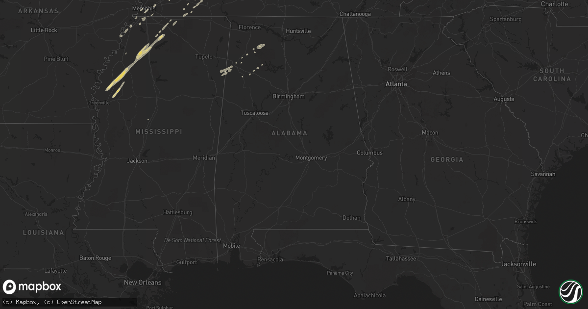
Hail Map in Alabama on January 29, 2013
Get this storm
January 29 map
$229
one time, instant access
Download today. No call, no setup
Keep the $229
Bought the map and want the full workflow? Apply the entire $229 to a subscription within 7 days. None of it is wasted.
Every map, not just this one
This buys you this map. Subscription and you get every map we run, in the markets you choose from a few cities to whole states to nationwide. Plus real-time alerts the moment a storm fires.
Contact data
Name, contact info, occupancy, even credit band for addresses in the footprint. You go from where it hit to who to call.
Become the source they trust
Unlimited branding weather history reports on demand. You already have the documented answer ready for the property owner, and you are the one who showed up with it.
Property data and RoofTrace estimates
Pull up any address you have got, its value and the exact code rules for that jurisdiction, straight from One Click Code. Then RoofTrace estimates the squares, pitch, and roof value, priced the way you price.
Storm reports in Alabama
Alabama
| Date | Description |
|---|---|
| 01/29/20135:56 AM CST | Winds of 100 mph knocked down hundreds of trees south of houston in a swath of damage 1.2 miles long and 1000 yds wide at its widest point. A dozen homes were damaged d |
| 01/29/20135:50 AM CST | The ef1 tornado touched down just west of the intersection of county road 8 and county road 3074. The tornado moved over smith lake and damaged the roofs of six homes n |
| 01/29/20135:41 AM CST | A tree was knocked onto a mobile home on liberty road in the punkin center area. Trees were also blown down onto power lines in this area. Time estimated by radar. |
| 01/29/20135:41 AM CST | Winds of 90 mph downed 150 pine trees in a swath of wind damage 200 yds wide south of nauvoo. |
| 01/29/20135:30 AM CST | Damage to metal roof. Time estimated by radar. |
| 01/29/20135:30 AM CST | Multiple trees down at cr 564 and cr 70 |
| 01/29/20135:21 AM CST | Shed rolled over with poles pulled from ground. Time estimated by radar. |
| 01/29/20135:18 AM CST | An ef1 tornado with winds of 90 mph touched down northwest of fayette and tracked east northeast downing hundreds of trees and causing minor structural damage to severa |
| 01/29/20134:50 AM CST | Roof damage at southern gayles golf course. |
| 01/29/20134:33 AM CST | And ef1 tornado entered alabama from mississippi near the intersection of pleasant hills and state line roads. Tornado was at its widest point here of 300 yards with a |
| 01/29/20134:15 AM CST | Cumberland presbyterian church steeple blown off. Time estimated by radar. |
| 01/29/20134:11 AM CST | Near hwy 172/overton farm rd tree downed. Time estimated by radar. |
| 01/29/20133:54 AM CST | Near hwy 524/41 tree downed. Time estimated by radar. |
| 01/29/20133:52 AM CST | Roof blown off a building on 2nd street in sheffield. Time is radar estimated. |
| 01/29/20133:45 AM CST | Hwy 247/21 tree downed. Time estimated by radar. |
| 01/29/20133:39 AM CST | Tree downed. Time estimated by radar. |
| 01/29/20132:36 AM CST | Tree on house near woodmont dr. |
| 01/29/20132:30 AM CST | Tree on house near elmhurst ave. |
| 01/29/201312:53 AM CST | Trees down on romulus road near sipsy high school. |
All States Impacted by Hail Map on January 29, 2013
Cities Impacted by Hail Map on January 29, 2013
- Decatur, TX
- Comanche, TX
- Neodesha, KS
- Hickory Valley, TN
- Memphis, TN
- Southaven, MS
- Lavinia, TN
- Irving, TX
- Thayer, KS
- Jacksboro, TX
- Poolville, TX
- Weatherford, TX
- Cedar Vale, KS
- Shidler, OK
- Robinsonville, MS
- Osceola, MO
- Dixon, MO
- Vienna, MO
- Scotland, AR
- Rich Hill, MO
- Butler, MO
- Hume, MO
- Desdemona, TX
- Mingus, TX
- Stephenville, TX
- Dublin, TX
- Drumright, OK
- Santo, TX
- Huntsville, TX
- Cleveland, AR
- Bolingbrook, IL
- Romeoville, IL
- Hennessey, OK
- Mineral Wells, TX
- Springtown, TX
- Green Ridge, MO
- Fairbury, IL
- Strawn, IL
- Forrest, IL
- Hico, TX
- Oswego, IL
- Bowie, TX
- Bryson, TX
- Jermyn, TX
- Henrietta, TX
- Bellevue, TX
- Blanket, TX
- May, TX
- Sidney, TX
- De Leon, TX
- Alamo, TN
- Marshall, OK
- Red Rock, OK
- Dover, OK
- Lucien, OK
- Garber, OK
- Perry, OK
- Orlando, OK
- Fairmont, OK
- Covington, OK
- Billings, OK
- Morrison, OK
- Douglas, OK
- Bison, OK
- Crocker, MO
- Peggs, OK
- Graham, TX
- Centertown, MO
- Jefferson City, MO
- Hartsburg, MO
- Sardis, MS
- Rising Star, TX
- Gorman, TX
- Shaw, MS
- Doddsville, MS
- Ruleville, MS
- Indianola, MS
- Perrysville, IN
- Cayuga, IN
- Berryville, AR
- Cameron, TX
- West Memphis, AR
- Paradise, TX
- Bridgeport, TX
- Chico, TX
- Baird, TX
- Cross Plains, TX
- Arcadia, KS
- Mulberry, KS
- Lowry City, MO
- Millington, TN
- Arlington, TN
- Lufkin, TX
- Richland, MO
- Giddings, TX
- Lincoln, TX
- Batesville, MS
- Lexington, TX
- Thrall, TX
- Thorndale, TX
- Rockdale, TX
- Ponca City, OK
- Cleveland, MS
- Boyle, MS
- Electra, TX
- Rattan, OK
- Early, TX
- Brownwood, TX
- Saulsbury, TN
- Grand Junction, TN
- Richards, TX
- Millsap, TX
- Tippecanoe, IN
- Kewanna, IN
- Rochester, IN
- Argos, IN
- Star City, IN
- Mentone, IN
- Bourbon, IN
- Winamac, IN
- Etna Green, IN
- Caledonia, IL
- Poplar Grove, IL
- Lockwood, MO
- Arcola, MO
- Greenfield, MO
- Humboldt, KS
- Savonburg, KS
- Chrisman, IL
- Tunica, MS
- Clyde, TX
- Mount Hope, AL
- Moulton, AL
- Carlton, TX
- Kaw City, OK
- Henderson, TN
- Toone, TN
- Medon, TN
- Dardanelle, AR
- Atkins, AR
- Hattieville, AR
- Sedan, KS
- Peru, KS
- Muskogee, OK
- Apple Springs, TX
- Lampe, MO
- Finger, TN
- Covington, TN
- Mason, TN
- Phil Campbell, AL
- Russellville, AL
- Zephyr, TX
- Somerville, TN
- Tolar, TX
- Perkins, OK
- Altoona, KS
- Hickory Hills, IL
- Joliet, IL
- Town Creek, AL
- Palos Park, IL
- Lemont, IL
- Bloomington, IL
- Towanda, IL
- Normal, IL
- Cooksville, IL
- Hamilton, AL
- Waynesville, MO
- Ryan, OK
- Merigold, MS
- Drew, MS
- Tutwiler, MS
- Parchman, MS
- Courtland, MS
- Lambert, MS
- Holly Springs, MS
- Como, MS
- Crenshaw, MS
- Vance, MS
- Marks, MS
- Benoit, MS
- Senatobia, MS
- Crescent, OK
- Kingfisher, OK
- Tonkawa, OK
- Loyal, OK
- Lamar, MS
- Breckenridge, TX
- Burbank, OK
- Fort Scott, KS
- Redfield, KS
- Uniontown, KS
- Daisy, OK
- Middleton, TN
- Marlin, TX
- Fennville, MI
- Henryetta, OK
- Okmulgee, OK
- Liberty, KS
- Edna, KS
- Coffeyville, KS
- Marland, OK
- Pawnee, OK
- Pawhuska, OK
- Shelbyville, TN
- Wann, OK
- Erie, KS
- Galesburg, KS
- Round Top, TX
- Burton, TX
- Wichita Falls, TX
- Oklahoma City, OK
- Arlington, TX
- Hamilton, TX
- Smithville, TX
- Nauvoo, AL
- Lynn, AL
- Sedalia, MO
- La Monte, MO
- Bastrop, TX
- Palo Pinto, TX
- Gordon, TX
- Lipan, TX
- Hornsby, TN
- Bolivar, TN
- Eufaula, OK
- Shawnee, OK
- Mansfield, TX
- Burleson, TX
- Fort Worth, TX
- Byhalia, MS
- Red Banks, MS
- Rayville, LA
- Boyd, TX
- Fletcher, OK
- Cement, OK
- Coldwater, MS
- Aurora, IL
- Grand Prairie, TX
- Horn Lake, MS
- Nesbit, MS
- Wister, OK
- Amory, MS
- Detroit, AL
- Sulligent, AL
- Greenwood Springs, MS
- Lenapah, OK
- Milano, TX
- Golden City, MO
- Sturgis, MI
- Waurika, OK
- Ringling, OK
- Glencoe, OK
- S Coffeyville, OK
- Altamont, KS
- Moline, KS
- Grenola, KS
- Cordova, TN
- Bixby, OK
- Haskell, OK
- El Dorado Springs, MO
- Collins, MO
- Antlers, OK
- Covington, IN
- Mustang, OK
- Lyon, MS
- Coahoma, MS
- Bethel Springs, TN
- Winfield, AL
- Eldridge, AL
- Elk City, KS
- Oswego, KS
- Parsons, KS
- McCune, KS
- Stark, KS
- Brownsville, TN
- Hackleburg, AL
- Graford, TX
- Lexington, IL
- Duncan, OK
- Boley, OK
- California, MO
- Booneville, AR
- Cropsey, IL
- Atlanta, IL
- Durant, MS
- Groveton, TX
- Lockport, IL
- Homer Glen, IL
- Bear Creek, AL
- Haleyville, AL
- Double Springs, AL
- Tuttle, OK
- Perrin, TX
- Newkirk, OK
- Russellville, MO
- Liberal, MO
- Paige, TX
- Seminole, OK
- Windthorst, TX
- Loving, TX
- Lake Cormorant, MS
- Warsaw, IN
- Morris, IL
- Seneca, IL
- Marseilles, IL
- Dewey, OK
- Spavinaw, OK
- Lincoln, IL
- Chanute, KS
- Talihina, OK
- Geary, OK
- Watonga, OK
- Calumet, OK
- Okarche, OK
- Bethany, OK
- Sentinel, OK
- Canute, OK
- Dill City, OK
- Carter, OK
- Foss, OK


