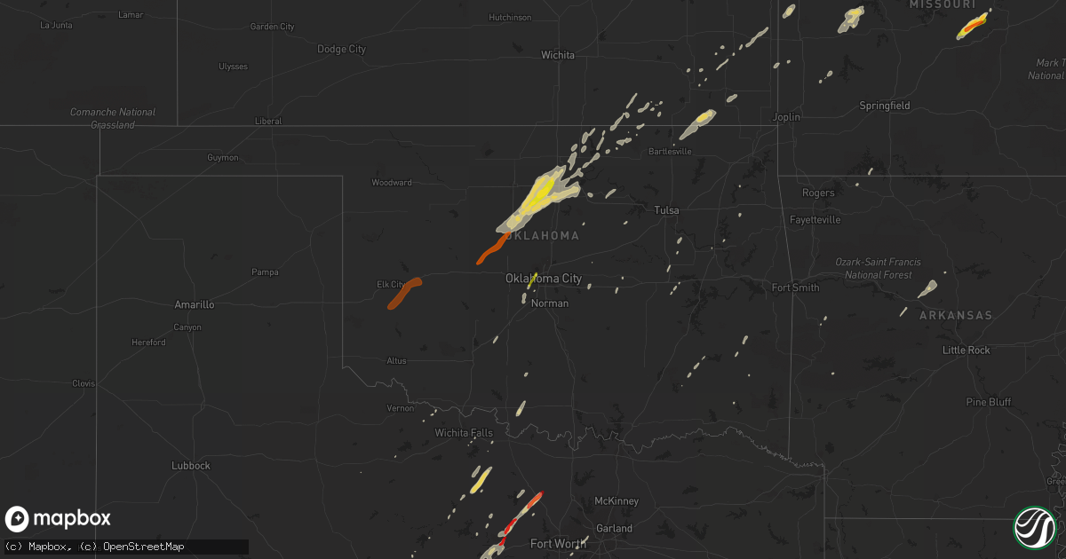
Hail Map on January 29, 2013
Get this storm
January 29 map
$229
one time, instant access
Download today. No call, no setup
Keep the $229
Bought the map and want the full workflow? Apply the entire $229 to a subscription within 7 days. None of it is wasted.
Every map, not just this one
This buys you this map. Subscription and you get every map we run, in the markets you choose from a few cities to whole states to nationwide. Plus real-time alerts the moment a storm fires.
Contact data
Name, contact info, occupancy, even credit band for addresses in the footprint. You go from where it hit to who to call.
Become the source they trust
Unlimited branding weather history reports on demand. You already have the documented answer ready for the property owner, and you are the one who showed up with it.
Property data and RoofTrace estimates
Pull up any address you have got, its value and the exact code rules for that jurisdiction, straight from One Click Code. Then RoofTrace estimates the squares, pitch, and roof value, priced the way you price.
States Impacted by Hail Map on January 29, 2013
Storm reports
Missouri
| Date | Description |
|---|---|
| 01/29/20134:59 PM CST | Mesonet site at kimberling city measured a 58 mph wind gust. |
| 01/29/20133:37 PM CST | Three downed trees of 12 inches diameter or more... Also power lines downed |
| 01/29/20133:36 PM CST | Large trees were snapped and uprooted - there was minor damage to homes and power poles were snapped |
| 01/29/20133:29 PM CST | 8 inch tree uprooted and several limbs downed along townview drive |
| 01/29/20133:15 PM CST | Siding damage... 16 foot strips blown one quarter mile downwind... Overhang blew off shed... Picked up water tanks and moved them... Tree tops shredded |
| 01/29/20133:15 PM CST | Several large trees were snapped south of concord hill road. Outbuilding was severely damaged and the debris was thrown up into trees. Some medium to alrge size trees w |
| 01/29/20132:52 PM CST | Wind moved a trampoline over 70 feet and tore out the electric mast off the side of the house. This was caught on the residence security camera. |
| 01/29/20132:20 PM CST | Trees snapped... Shed heavily damaged |
| 01/29/20132:05 PM CST | Public posted a picture of golf ball size hail on a local tv website. Time was estimated. |
| 01/29/20132:01 PM CST | Two trees reported down. One across county road 219 off route 133 and one across county road 216 northeast of route 133. |
| 01/29/20131:39 PM CST | A duplex near grand and fort street substained roof damage. Wood frame roof partial blown off and power lines knocked down. |
| 01/29/20131:07 PM CST | Damage occurred to several outbuildings and barns...along with minor roof damage to homes west of willard...just south of u.s. 160. All debris was blown to the east...w |
| 01/29/20131:05 PM CST | Tree reported down by amateur radio operator. |
| 01/29/20131:00 PM CST | Trees down in the general area of ivy bend. Some trees reported down over hwy 135. Minor structural damage also reported. Time estimated from radar. Delayed report. |
| 01/29/20131:00 PM CST | Metal shed blown over into a neighbors yard. |
| 01/29/201312:53 PM CST | Amateur radio operator reporting 6-7 power poles down in the apache flats area of western jefferson city. |
| 01/29/201312:45 PM CST | Power lines down in the city of saint martins |
| 01/29/201312:02 PM CST | Trees down in the general area of ivy bend. Some trees reported down over hwy 135. Minor structural damage also reported. Time estimated from radar. Delayed report. --t |
| 01/29/201311:57 AM CST | Multiple trees reported blown down near the intersection of webb rd and highway 135. |
| 01/29/201311:25 AM CST | Two trees reported down and blocking route 83. Power lines reported down. Shed also blew across the road. |
| 01/29/201311:20 AM CST | Preliminary report from survey team indicates an ef1 tornado touch down 4 miles northeast of gerster or 5 miles southwest of quincy near highway tt. Winds were estimate |
| 01/29/201311:20 AM CST | Highway t had numerous trees down some structure damage. Trees blocking side roads. |
| 01/29/201311:18 AM CST | A local report indicates 65 MPH wind near OSCEOLA |
| 01/29/201311:11 AM CST | Roof and siding damage at a house. A power pole snapped. Large tree down. |
| 01/29/201311:02 AM CST | Barn and power lines reported down or damaged. |
| 01/29/201311:00 AM CST | A nws survey indicated an ef1 tornado touched down near highway 39 near county road 10500. The path was about 2 miles long and 200 yards wide. The tornado lifted near t |
| 01/29/201310:25 AM CST | Barn blown off foundation near missouri highway k and nw 145th lane. |
| 01/28/201310:05 PM CST | Siding blown off numerous homes in caruthersville |
| 01/28/201310:05 PM CST | A large tree uprooted and caused damage to a nearby home...ripped a hole in the window screen. |
| 01/28/201310:00 PM CST | At i-57 at exit 10...an irrigation rig was turned over. Also a barn was destoyed and strewn across hwy 60 btwn charleston and wyatt. |
| 01/28/20139:55 PM CST | Mobile home blown over. No one inside. Nearby business had the roof blown off. Large loading dock door damaged. |
| 01/28/20139:49 PM CST | Power outages reported. |
| 01/28/20139:44 PM CST | Power lines down throuhout the community. |
| 01/28/20139:15 PM CST | Late report...one home destroyed and several others damaged. |
| 01/28/20139:13 PM CST | Ef-1 tornado began 1.5 miles southwest of delta to 1 mile west of blomeyer. See pnspah for details |
| 01/28/20139:13 PM CST | Ef-1 tornado began 4.8 miles southwest of jackson to 4.8 miles southeast of jackson. See pnspah for details. |
| 01/28/20139:04 PM CST | Tree down. |
| 01/28/20138:55 PM CST | Numerous trees down and across roadways in southeast wayne county near lake wappapello. |
| 01/28/20138:50 PM CST | Damage to two homes and an shed along hwy 21. One homes roof blown into road and shed is gone. Second house had carport blown into nearby trees. Time estimated. |
| 01/28/20138:45 PM CST | Property damage along settlement lane. Travel trailer blown into roadway. Two moblile homes damaged and blown off of their foundations. Time estimated. |
| 01/28/20138:45 PM CST | Roof blown off of home just east of city. |
| 01/28/20138:45 PM CST | Tree fell on a house. It flooded the attic and broke the rafters. |
| 01/28/20138:15 PM CST | Damage to two homes and an shed along hwy 21. One homes roof blown into road and shed is gone. Second house had carport blown into nearby trees. Time estimated. |
| 01/28/20138:15 PM CST | Porch roof ripped off of home with 15 trees down. |
| 01/28/20138:14 PM CST | An ef1 tornado touched down 6 miles northeast of doniphan about 1 mile south of co. Road k-1. Two houses sustained roof damage including partial loss of rafters. A porc |
| 01/28/20137:30 PM CST | Trailer blown from southwest to northeast across railroad tracks and vv highway. Time estimated. |
| 01/28/20137:05 PM CST | Four outbuildings had moderate damage or destroyed. Two of the buildings lost their walls. One wall was brick which was destroyed and bricks scattered in field. The loc |
| 01/28/20136:43 PM CST | An abandoned trailer was blown into near by trees. A few trees were also blown down in the brandsville area. |
| 01/28/20136:34 PM CST | A tree was blown over onto highway uu five miles east of highway 63. |
| 01/28/20136:30 PM CST | Trailer blown from southwest to northeast across railroad tracks and vv highway. Time estimated. |
| 01/28/20136:25 PM CST | Damage reported to barns and other out buildings. Trees and powerlines also reported down. Three separate locations near state highway k. 1. Pin oak rd off k highway. 2 |
Kentucky
| Date | Description |
|---|---|
| 01/29/201311:53 AM CST | Mobile home with roof torn off...trees down...carport in roadway. |
| 01/29/20135:45 AM CST | Kentucky state police reports trees down on state route 1249 in southern rockcastle county. |
| 01/29/20135:40 AM CST | Few trees reported down in the city. |
| 01/29/20135:36 AM CST | Trees down on highway 461.time estimated off of radar. |
| 01/29/20135:35 AM CST | Somerset pulaski airport reported 64 mph gust. |
| 01/29/20135:34 AM CST | Two barns damaged and several trees down |
| 01/29/20135:33 AM CST | Portions of a barn roof blown off along with several downed trees |
| 01/29/20135:30 AM CST | Trees down on cherry grove road. |
| 01/29/20135:30 AM CST | An ef-0 tornado touched down in the ferguson community near the end of the runway of the lake cumberland regional airport. The tornado traveled a half mile through a re |
| 01/29/20135:26 AM CST | Utility pole down on briar hill road |
| 01/29/20135:24 AM CST | Trees down on highway 328. |
| 01/29/20135:24 AM CST | Trees down on higway 167 and ray hill road. |
| 01/29/20135:21 AM CST | Tin from a barn roof was thrown into the roadway. |
| 01/29/20135:21 AM CST | Sporadic wind damage occured along union mills road between mackey road and highway 1981. Two large barns were destroyed. Several trees were also blown down. |
| 01/29/20135:19 AM CST | A tv tower at the county utility building was blown down. |
| 01/29/20135:15 AM CST | Trees down on green briar loop. |
| 01/29/20135:13 AM CST | Trees down at highway 1275 north and highway 90. |
| 01/29/20135:12 AM CST | Trees down. |
| 01/29/20135:06 AM CST | Trees down at highway 834 and 90. |
| 01/29/20135:03 AM CST | Trees down on highway 789 at camp earl wallace. |
| 01/29/20135:00 AM CST | Mobile home damaged substantially with roof torn off. Time estimated based on radar. |
| 01/29/20134:59 AM CST | Trees down across the county |
| 01/29/20134:57 AM CST | Trees down |
| 01/29/20134:55 AM CST | Trees down along stonehouse road |
| 01/29/20134:52 AM CST | Barn flattened as well as tree damage and gutter damage on a house |
| 01/29/20134:49 AM CST | Several trees down across the county. |
| 01/29/20134:44 AM CST | *** 1 inj *** mobile home damage with at least one injury reported also numerous power lines down. |
| 01/29/20134:42 AM CST | *** 2 inj *** a mobile home was destroyed and a small shed slid off its foundation...ef0 |
| 01/29/20134:40 AM CST | Several trees blown down blocking hwy 1533 |
| 01/29/20134:40 AM CST | *** 2 inj *** mobile home damage reported also numerous power lines down. |
| 01/29/20134:40 AM CST | A few barn rooves down along pitchford ridge road. Partial home roof damage as well as several trees down around the county. |
| 01/29/20134:17 AM CST | Trees and lines down...along with a small outbuilding blown onto a roadway in edmonton. |
| 01/29/20134:16 AM CST | Trees reported down in the city. |
| 01/29/20133:59 AM CST | A local report indicates 59 MPH wind near CAVE CITY |
| 01/29/20133:56 AM CST | Downed telephone pole blocking hwy 1297 north of hwy 31 in glasgow |
| 01/29/20133:55 AM CST | A local report indicates 60 MPH wind near GLASGOW |
| 01/29/20133:55 AM CST | Trees down |
| 01/29/20133:51 AM CST | Barn was blown over with another barn sustaining roof damage. Trres also down along highway 25. |
| 01/29/20133:50 AM CST | Shed blown onto hwy 90 |
| 01/29/20133:49 AM CST | Large barn destroyed. Trees down. Ef1 |
| 01/29/20133:47 AM CST | 50-70 mph winds downed trees. Part of 28 mile long 1 mile wide path of straight line wind damage. |
| 01/29/20133:46 AM CST | 50-70 mph winds downed trees. Part of 28 mile long 1 mile wide path of straight line wind damage. |
| 01/29/20133:45 AM CST | A local report indicates 62 MPH wind near 4 SSE ROSEVILLE |
| 01/29/20133:43 AM CST | Body shop destroyed... 5000 lb tank moved 300 yards... Debris in trees |
| 01/29/20133:42 AM CST | Barn destroyed...trees snapped...outbuildings lost roofs. Ef1 |
| 01/29/20133:42 AM CST | Trees down across the county. |
| 01/29/20133:41 AM CST | 50-70 mph winds downed trees. Part of 28 mile long 1 mile wide path of straight line wind damage. |
| 01/29/20133:40 AM CST | A tree fell and downed a power line in the pewee valley area. Time estimated from radar |
| 01/29/20133:40 AM CST | A few barn rooves down along pitchford ridge road. Partial home roof damage as well as several trees down around the county. |
| 01/29/20133:40 AM CST | Signs blown down...numerous trees and power lines...some structural damage in smiths grove. |
| 01/29/20133:40 AM CST | Metal roof off of an older house...shingles and a door off of a double wide...limbs down |
| 01/29/20133:40 AM CST | Several trees blown down blocking hwy 1533 |
| 01/29/20133:39 AM CST | Barn shifted off of foundation...portions of sheds blown several hundred feet...numerous trees down |
| 01/29/20133:38 AM CST | Three homes lost their roofs and fifteen trees down |
| 01/29/20133:38 AM CST | Grain bins...barn...metal building destroyed. Semi flipped over on interstate 65. Ef2 |
| 01/29/20133:35 AM CST | 50-70 mph winds downed trees. Part of 28 mile long 1 mile wide path of straight line wind damage. |
| 01/29/20133:26 AM CST | Metrosafe report of trees down in the 4500 block of 2nd street. |
| 01/29/20133:21 AM CST | Trees and power lines down. |
| 01/29/20133:19 AM CST | Pine tree snapped... Lots of softwoods damaged... Trampoline blown over... Debris in the area |
| 01/29/20133:17 AM CST | A tornado crossed the ohio river into jefferson county and downed many softwood trees...a pine tree was snapped and a trampoline was blown over. Ef0 |
| 01/29/20133:16 AM CST | A pontoon boat was thrown onto a fence and a few trees were uprooted. A large plastic sign was also damaged. |
| 01/29/20133:15 AM CST | Several trees down across the county. |
| 01/29/20133:15 AM CST | Trees blocking pendleton road |
| 01/29/20133:12 AM CST | A local report indicates 60 MPH wind near FORT KNOX |
| 01/29/20133:10 AM CST | Small garage blown into the road. |
| 01/29/20133:10 AM CST | Numerous trees down in southern half of county |
| 01/29/20133:06 AM CST | Downed power lines near the intersection of highway 1638 and 1248. |
| 01/29/20133:05 AM CST | Ef0 tornado damaged homes and trees along gaines road |
| 01/29/20132:47 AM CST | 50-70 mph winds downed trees. Part of 28 mile long 1 mile wide path of straight line wind damage. |
| 01/29/20132:46 AM CST | 50-70 mph winds downed trees. Part of 28 mile long 1 mile wide path of straight line wind damage. |
| 01/29/20132:45 AM CST | Tree down |
| 01/29/20132:43 AM CST | 50-70 mph winds downed trees and damaged barns. Part of 16 mile long 1.5 mile wide path of straight line wind damage. |
| 01/29/20132:41 AM CST | 50-70 mph winds downed trees. Part of 28 mile long 1 mile wide path of straight line wind damage. |
| 01/29/20132:38 AM CST | Grain bins...barn...metal building destroyed. Semi flipped over on interstate 65. Ef2 |
| 01/29/20132:37 AM CST | Trees down |
| 01/29/20132:37 AM CST | 50-70 mph winds downed trees and damaged barns. Part of 16 mile long 1.5 mile wide path of straight line wind damage. |
| 01/29/20132:35 AM CST | Trees down |
| 01/29/20132:35 AM CST | 50-70 mph winds downed trees. Part of 28 mile long 1 mile wide path of straight line wind damage. |
| 01/29/20132:35 AM CST | Trees down |
| 01/29/20132:30 AM CST | Farm buildings damaged...one roof gone |
| 01/29/20132:30 AM CST | Numerous trees across county |
| 01/29/20132:18 AM CST | Several trees down |
| 01/29/20132:12 AM CST | Power outages reported throughout the community of dunmar. Numerous trees down. One home had roof damage. Moblile home overturned. |
| 01/29/20132:11 AM CST | Trees down in the battletown area. |
| 01/29/20132:00 AM CST | The ef2 tornado began 2 miles southeast of rosewood or 4.5 miles southwest of penrod and ended in penrod. Peak winds were estimated at 120 mph. The average path width w |
| 01/29/20131:57 AM CST | Entire community without power. Considerable amount of debris along hwy 117. |
| 01/29/20131:55 AM CST | Overturned semi-trailer along interstate 24 near mile marker 89. |
| 01/29/20131:53 AM CST | Power outages reported in the community. |
| 01/29/20131:52 AM CST | A path of damage averaging 1/3 mile wide extended from 3 miles northwest of allegre to 1 mile northeast of penrod. Peak winds were estimated at 110 mph. A few thousand |
| 01/29/20131:41 AM CST | Power flashes observed and light debris in the air. Pea size hail reported in hopkinsville. |
| 01/29/20131:41 AM CST | A swath of damage averaging 300 yards wide extended from 4 miles east of hopkinsville to 8 miles east of hopkinsville leveling or heavily damaging a couple barns and ot |
| 01/29/20131:39 AM CST | An ef1 tornado touched down 8 miles south of hopkinsville along u.s. Hwy 41a and traveled northeast for 6.5 miles to pembroke road. The tornado had estimated peak winds |
| 01/29/20131:37 AM CST | Decent size tree limbs down. Wall cloud observed in same area. |
| 01/29/20131:36 AM CST | An ef2 tornado touched down about 3 miles southeast of herndon and tracked northeast about 2 miles. The tornado had estimated peak winds of 120 mph with a 150 yard aver |
| 01/29/20131:35 AM CST | Peak winds were estimated at 100 mph. A swath of damage averaging 1 mile wide extended from 4 miles south of herndon to 9 miles east of herndon or 10 miles southeast of |
| 01/29/20131:34 AM CST | Peak winds estimated at 105 mph. A 300 yard swath of damage extended from 1/2 mile east of herndon to 4 miles east of herndon. The damage included an empty grain bin th |
| 01/29/201312:30 AM CST | A local report indicates 74 MPH wind near PRINCETON |
| 01/29/201312:15 AM CST | Mobile home lost entire roof...and was slightly shifted on its piers. Carport destroyed. Wooden outbuildings shifted or distorted. Underpinning skirts stripped away fro |
| 01/28/201311:57 PM CST | Awning torn off of home and street signs down along hwy 94. |
| 01/28/201311:53 PM CST | Mobile home with roof torn off...trees down...carport in roadway. |
| 01/28/201311:53 PM CST | Windows blown out of home. |
| 01/28/201311:53 PM CST | Windows blown out of home. |
| 01/28/201311:40 PM CST | Late report...light damage to three homes with one power pole snapped at the intersection of hwys 96 and 783. |
| 01/28/201311:36 PM CST | Several outbuildings damaged or destroyed. Dog kennel picked up and destroyed. Some trees uprooted...one snapped. Carport destroyed. Minor roof damage to some homes. Po |
| 01/28/201311:35 PM CST | Minor roof damage to a storage building. Roof off barn. From social media. |
| 01/28/201310:50 PM CST | Well house destroyed and some shingles lost on a house. |
| 01/28/201310:46 PM CST | Property damage reported along hwy 358. |
Kansas
| Date | Description |
|---|---|
| 01/29/201310:01 AM CST | Power pole reported leaning over road due to high winds. |
| 01/29/20139:15 AM CST | Trees down in mound valley. Winds estimated 60 to 70 mph. |
| 01/29/20138:18 AM CST | Via spotter network.org |
Ohio
| Date | Description |
|---|---|
| 01/29/20135:52 AM CST | Tree down along blue road. |
| 01/29/20135:44 AM CST | Tree down near route 323 |
| 01/29/20135:43 AM CST | Tree down along armstrong road. |
| 01/29/20135:30 AM CST | Hay barn destroyed and a snapped power pole |
| 01/29/20135:27 AM CST | Measured gust to 52kt at the nws office |
| 01/29/20135:10 AM CST | Large tree down on crane schoolhouse rd between s bantam rd and moore rd. |
Louisiana
| Date | Description |
|---|---|
| 01/29/20138:53 AM CST | Utility poles were downed in the 3200 block of dearborn street as well as david raines road. |
| 01/29/20134:30 AM CST | 3 trees down along with some power lines |
| 01/29/20131:40 AM CST | 4 power poles broken and lines down along hwy 605. |
| 01/29/201312:27 AM CST | A few power lines down |
| 01/28/201311:45 PM CST | Power lines down in town |
| 01/28/201311:33 PM CST | 64 knot gust at kmlu. |
| 01/28/201311:28 PM CST | Pine tree fell on home and went into childrens bedroom in rocky branch. |
| 01/28/201311:25 PM CST | Tree down on north 3rd street. |
| 01/28/201311:23 PM CST | Numerous trees down and uprooted. |
| 01/28/201311:15 PM CST | Pine tree fell on home and went into childrens bedroom in rocky branch. |
| 01/28/201311:05 PM CST | Several trees downed in calhoun. |
| 01/28/201311:05 PM CST | Power lines and power poles down along hwy 17 outside darnell. |
| 01/28/201311:00 PM CST | Numerous trees down around town and in northern parts of the parish. |
| 01/28/201310:35 PM CST | Power pole down around start. |
| 01/28/201310:10 PM CST | Trees and powerlines down. |
| 01/28/20139:55 PM CST | Numerous trees down. |
| 01/28/20139:53 PM CST | Lines down |
| 01/28/20139:45 PM CST | Reports of a tree down on highway 554 southeast of bastrop. |
| 01/28/20139:40 PM CST | Trees reported down. |
| 01/28/20139:36 PM CST | The tornado removed the roof and knocked down most walls of a house...destroyed several outbuildings...flipped several travel trailers...caused minor roof damage to a f |
| 01/28/20139:36 PM CST | Brick home heavily damaged or destroyed on calvert rd...a barn and outbuilding damaged as well...possible tornado. |
| 01/28/20139:31 PM CST | Mobile home overturned on clear lake rd...possible tornado. |
| 01/28/20139:20 PM CST | Trees down near highway 527. |
| 01/28/20139:18 PM CST | Trees down e of oak ridge |
| 01/28/20138:53 PM CST | Utility poles were downed in the 3200 block of dearborn street as well as david raines road. |
| 01/28/20138:50 PM CST | Large tree fell on a car near walker road. |
| 01/28/20138:45 PM CST | Trees down. |
| 01/28/20137:45 PM CST | A few trees down. |
Mississippi
| Date | Description |
|---|---|
| 01/29/20135:30 AM CST | Tree was blown down and blocking hwy 18 e. |
| 01/29/20134:53 AM CST | Tree on a house in town and a tree across a road just outside of town. |
| 01/29/20134:45 AM CST | Corner of a building was blown out on beacon st. |
| 01/29/20134:30 AM CST | Several large tree limbs down around the county |
| 01/29/20134:30 AM CST | *** 1 inj *** one house received major roof damage. One house received moderate roof damage. Several pine trees down across the eastern part of the county. One individu |
| 01/29/20134:30 AM CST | 3 trees down along with some power lines |
| 01/29/20134:15 AM CST | Trees blown down on a few cars in west starkville. |
| 01/29/20133:50 AM CST | Several trees down with a few across hwy 19. |
| 01/29/20133:30 AM CST | Transformers blown down and lines and lights hanging in the road at luckney and lakeland dr. |
| 01/29/20133:25 AM CST | A couple trees down and the backstop to the ball field at jackson prep was blown over. Also some damage occurred to a large bank plus sign. A couple trees down along la |
| 01/29/20132:50 AM CST | Tree down across bolton-raymond road. |
| 01/29/20132:40 AM CST | Public reports a window blown out of a home in iuka. Report relayed via wtva television meteorologist. |
| 01/29/20132:40 AM CST | A few businesses on mccullough blvd had extensive structural damage. One shop had the entire front torn off. |
| 01/29/20132:05 AM CST | Approximately 5-6 homes with trees laying on them in city of pontotoc. |
| 01/29/20131:45 AM CST | Roof blown off apartments near hwy 8 east. |
| 01/29/20131:40 AM CST | Trees down along holly grove and meeks road off highway 17 |
| 01/29/20131:30 AM CST | A few trees down across oxford with minor flash flooding. Time is estimated. |
| 01/29/20131:25 AM CST | Trees down along pearidge road north of grenada |
| 01/29/20131:20 AM CST | Trees down on highway 35 near holcomb |
| 01/29/20131:10 AM CST | A few power lines down. |
| 01/29/201312:39 AM CST | Tree fell on house near hwy 4 and camille rd. |
| 01/29/201312:20 AM CST | Power line across hwy 448. |
| 01/29/201312:20 AM CST | Several power poles were pushed over or snapped by 80 to 90 mph downburst winds near the community of frazier on highway 448 |
| 01/29/201312:20 AM CST | Two trees down on lake shore drive east of holly springs. |
| 01/29/201312:10 AM CST | Power outtages across the county and one home with minor damage near sardis. |
| 01/29/201312:10 AM CST | Tree down on the delta state campus...a few power lines down across the county. |
| 01/29/201312:10 AM CST | Several trees down on clanton rd near the barr community. |
| 01/29/201312:00 AM CST | Numerous reports of trees down across the county. Time is estimated. |
| 01/28/201311:45 PM CST | Two large trees were snapped near the duncan post office |
| 01/28/201311:40 PM CST | Trailer blown around parking lot in downtown. |
| 01/28/201311:40 PM CST | Tornado reported crossing hwy 6 near sardis. |
| 01/28/201311:40 PM CST | One home with roof damage due to a tree falling |
| 01/28/201311:20 PM CST | Powerlines and trees down in and around tunica. |
| 01/28/201311:20 PM CST | 2 houses and one car received damage from falling tree limbs. |
| 01/28/201311:14 PM CST | A 1 mile stretch of power poles were snapped along shaw-skene rd. Hail also occurred in this area...size unknown. |
| 01/28/201311:10 PM CST | Nws storm survey found an ef1 tornado with maximum winds of 100mph and maximum width of 150 yards. Touched down around 2.5 wsw of skene community and ended on hwy 8 nea |
| 01/28/20137:27 PM CST | Reports that a roof was blown off at lillos restaurant on highway 82 east. |
| 01/28/20136:47 PM CST | Nws storm survey found an ef0 tornado with maximum winds of 75mph. This tornado touched down briefly near the stringtown community and uprooted one large tree and cause |
Indiana
| Date | Description |
|---|---|
| 01/29/20134:25 AM CST | Tree down |
| 01/29/20133:39 AM CST | Barn shifted off of foundation...portions of sheds blown several hundred feet...numerous trees down |
| 01/29/20133:17 AM CST | Spotter estimated 50-60 mph winds. Time estimated based on radar data. |
| 01/29/20133:17 AM CST | Four homes and two barns were damaged along hwy 111...the porch of one home was lifted and thrown 30 feet...the walls of one of the barns collapsed in multiple directio |
| 01/29/20133:15 AM CST | Buildings damaged |
| 01/29/20133:03 AM CST | Power outage reported extending south from state route 58 between walesboro and ogilville |
| 01/29/20133:00 AM CST | Power outage reported extending south from state route 58 between walesboro and ogilville |
| 01/29/20132:28 AM CST | Roof blown off of a residence near state road 160 also 2 barns damaged and power lines down. |
| 01/29/20132:23 AM CST | One tree down |
| 01/29/20132:15 AM CST | Roof blown off of a residence near state road 160 also 2 barns damaged and power lines down. |
| 01/29/20131:48 AM CST | Porch and part of a roof blown off of a house and also trees and power lines down near upper sand hill road. |
| 01/29/20131:45 AM CST | Barn destroyed. |
| 01/29/20131:20 AM CST | Event time is estimated based on radar...damage to a barn and a porch of residence...tree into power lines...wooden lawn furniture blown into roadway |
| 01/29/20131:15 AM CST | Trees downed and minor building damage. |
| 01/29/20131:13 AM CST | State route 43 closed due to power lines across it. Barn destroyed. Time approx. Based on radar. |
| 01/29/20131:04 AM CST | Concrete garage destroyed. |
| 01/29/20131:02 AM CST | Structural damage on a house...including walls down on a garage. Field tanks were also overturned and several trees were downed. Time estimated from radar |
| 01/29/201312:47 AM CST | A home had severe roof damage and its porch was thrown several yards...small twigs driven through the siding of the home...several trees were toppled...ef0 |
| 01/29/201312:45 AM CST | Damage to power lines on east 86th street |
| 01/29/201312:40 AM CST | Barn destroyed...roof landed on pickup truck. |
| 01/29/201312:33 AM CST | A local report indicates 63 MPH wind near TIPTON |
| 01/29/201312:30 AM CST | Roof on concrete garage destroyed. |
| 01/29/201312:30 AM CST | A local report indicates 65 MPH wind near 5 SW BLOOMINGTON |
| 01/29/201312:23 AM CST | A local report indicates 64 MPH wind near BLOOMINGTON |
| 01/29/201312:22 AM CST | A local report indicates 65 MPH wind near 3 S PARAGON |
| 01/29/201312:20 AM CST | Event time approx. Located at twin lakes high school. Report relayed by broadcast media. |
| 01/29/201312:17 AM CST | Several homes damaged and without power between solsbury and hendricksville. Possible tornado. Report received on web eoc. |
| 01/29/201312:13 AM CST | State route 43 closed due to power lines across it. Barn destroyed. Time approx. Based on radar. |
| 01/29/201312:12 AM CST | 2 chopper wagons rolled over and destroyed. Corn crib blown down. Barn door destroyed. Wood from the wagons was blown approx 200 yards se of the wagons. Antenna blown d |
| 01/29/201312:10 AM CST | A local report indicates 70 MPH wind near 2 SE BROWNSBURG |
| 01/29/201312:00 AM CST | Event time estimated from radar imagery |
| 01/28/201311:58 PM CST | Power lines down at oak hill and eastview |
| 01/28/201311:52 PM CST | Cornelius farms lost a machine shed containing combines... Planter... Bean drill and other farm equipment. Debris was strewn out into field east of the farm. Event time |
| 01/28/201311:45 PM CST | A local report indicates 59 MPH wind near GREENCASTLE |
| 01/28/201311:41 PM CST | Tree fell on carpot and power lines down on south gibson road |
| 01/28/201311:35 PM CST | Pieces of aluminum shed blown off into field. Trampoline blown considerable distance into field. Tree limbs blown down and one large chunk of tree blown out at same loc |
| 01/28/201311:31 PM CST | Tree down on 136 east of crawsfordsville...time estimated via radar imagery |
| 01/28/201311:30 PM CST | Window busted out on downtown main st in bicknell at the intersection of 2nd and main street. |
| 01/28/201311:15 PM CST | Tree went through a house. Time estimated from radar and report received on web eoc. |
| 01/28/201311:00 PM CST | A local report indicates 60 MPH wind near TERRE HAUTE |
Illinois
| Date | Description |
|---|---|
| 01/28/201311:15 PM CST | Tree blown down across u.s. 50. |
| 01/28/201311:04 PM CST | Power lines down. Large awning and 2 plate glass windows blown out in downtown area. |
| 01/28/201311:00 PM CST | A local report indicates 60 MPH wind near KEENSBURG |
| 01/28/201310:51 PM CST | A local report indicates 70 MPH wind near CROSSVILLE |
| 01/28/201310:33 PM CST | Trees down near the community along the jackson and williamson county line. |
| 01/28/201310:20 PM CST | *** 2 inj *** numerous trees down within the community. Three individuals trapped in destroyed home have been rescued. Two were injured. Reported by saline county 911. |
| 01/28/201310:10 PM CST | Late report...one home had almost entire roof ripped off. 20 foot metal pole snapped in half and blown into neighbors yard. Nearby home had windows blown out. Some tree |
| 01/28/201310:09 PM CST | A local report indicates 70 MPH wind near 5 S WEST FRANKFORT |
| 01/28/201310:05 PM CST | Large poplar tree down on a car. |
| 01/28/201310:00 PM CST | 1/3 of roof decking blown off a mobile home. |
| 01/28/20139:55 PM CST | Numerous tree limbs down. |
| 01/28/20139:51 PM CST | A local report indicates 70 MPH wind near WEST FRANKFORT |
| 01/28/20139:50 PM CST | Strong thunderstorm winds snapped 64 power poles along illinois route 16 near ashmore. 30 poles were snapped west of ashmore and 34 east of town. The john deere impleme |
| 01/28/20139:50 PM CST | Reported across the northern portion of the county. |
| 01/28/20139:46 PM CST | A local report indicates 63 MPH wind near CARBONDALE |
| 01/28/20139:45 PM CST | Just west of benton on rend city rd and 1 mi north of rt. 14...there was an overturned camper and shingle damage to a home. Several trees down. Mobile office building t |
| 01/28/20139:44 PM CST | Power poles across hwy 154 west of conant road. |
| 01/28/20139:44 PM CST | Reported near the airport. |
| 01/28/20139:43 PM CST | Damage to radio antennas. |
| 01/28/20139:40 PM CST | Carport and awning received moderate damage. |
| 01/28/20139:35 PM CST | A local report indicates 59 MPH wind near MOUNT VERNON |
| 01/28/20139:33 PM CST | Semi trailer blown over on i 57 at mile marker 165 |
| 01/28/20139:30 PM CST | Numerous power lines blown down |
| 01/28/20139:25 PM CST | Correction to time of event |
| 01/28/20139:20 PM CST | Trailer was thrown into another trailer. One of the trailers was destroyed. A double wide mobile home had major damage. |
| 01/28/20139:15 PM CST | Numerous tree limbs down. |
| 01/28/20138:55 PM CST | Two tractor trailers blown down |
Alabama
| Date | Description |
|---|---|
| 01/29/20135:56 AM CST | Winds of 100 mph knocked down hundreds of trees south of houston in a swath of damage 1.2 miles long and 1000 yds wide at its widest point. A dozen homes were damaged d |
| 01/29/20135:50 AM CST | The ef1 tornado touched down just west of the intersection of county road 8 and county road 3074. The tornado moved over smith lake and damaged the roofs of six homes n |
| 01/29/20135:41 AM CST | A tree was knocked onto a mobile home on liberty road in the punkin center area. Trees were also blown down onto power lines in this area. Time estimated by radar. |
| 01/29/20135:41 AM CST | Winds of 90 mph downed 150 pine trees in a swath of wind damage 200 yds wide south of nauvoo. |
| 01/29/20135:30 AM CST | Multiple trees down at cr 564 and cr 70 |
| 01/29/20135:30 AM CST | Damage to metal roof. Time estimated by radar. |
| 01/29/20135:21 AM CST | Shed rolled over with poles pulled from ground. Time estimated by radar. |
| 01/29/20135:18 AM CST | An ef1 tornado with winds of 90 mph touched down northwest of fayette and tracked east northeast downing hundreds of trees and causing minor structural damage to severa |
| 01/29/20134:50 AM CST | Roof damage at southern gayles golf course. |
| 01/29/20134:33 AM CST | And ef1 tornado entered alabama from mississippi near the intersection of pleasant hills and state line roads. Tornado was at its widest point here of 300 yards with a |
| 01/29/20134:15 AM CST | Cumberland presbyterian church steeple blown off. Time estimated by radar. |
| 01/29/20134:11 AM CST | Near hwy 172/overton farm rd tree downed. Time estimated by radar. |
| 01/29/20133:54 AM CST | Near hwy 524/41 tree downed. Time estimated by radar. |
| 01/29/20133:52 AM CST | Roof blown off a building on 2nd street in sheffield. Time is radar estimated. |
| 01/29/20133:45 AM CST | Hwy 247/21 tree downed. Time estimated by radar. |
| 01/29/20133:39 AM CST | Tree downed. Time estimated by radar. |
| 01/29/20132:36 AM CST | Tree on house near woodmont dr. |
| 01/29/20132:30 AM CST | Tree on house near elmhurst ave. |
| 01/29/201312:53 AM CST | Trees down on romulus road near sipsy high school. |
Tennessee
| Date | Description |
|---|---|
| 01/29/20135:45 AM CST | A few trees were downed across the county. |
| 01/29/20135:30 AM CST | Several trees down. Minor roof damage on a building close to the intersection of hwy 41 and hwy 53. |
| 01/29/20135:26 AM CST | Initial damage consisting of snapped trees and a destroyed scoreboard was noted at the coffee county middle school. Intermittent damage...consisting of dozens of snappe |
| 01/29/20135:24 AM CST | Old press box blown off stand at football field in manchester...trees down in the area as well |
| 01/29/20135:15 AM CST | A few trees and power lines were downed across roadways in the western portion of the county. |
| 01/29/20135:11 AM CST | Woods ferry rd. Blocked by trees |
| 01/29/20135:00 AM CST | A few trees were downed across the county. |
| 01/29/20134:53 AM CST | An ef-1 tornado traveled over 5 miles impacting portions of west-central lincoln county tn between the towns of dellrose and fayetteville. The tornado was its strongest |
| 01/29/20134:45 AM CST | A few trees falling on power lines causing power outages across northeast and eastern portions of the county. |
| 01/29/20134:43 AM CST | Trees and power lines down |
| 01/29/20134:38 AM CST | Trees and power lines are down across the following roads...union hill rd.... Mosey purcell rd.... Bakerton pea ridge firetower rd.... Mccormick ridge rd.... And commer |
| 01/29/20134:35 AM CST | Out buildings damaged and a residential trailer blown off its foundation at the 4000 block along gassaway rd. |
| 01/29/20134:33 AM CST | State highway 53 near mile marker 3 is closed due to trees down across the road. |
| 01/29/20134:33 AM CST | Ef-0 tornado touched down 4 miles northeast of woodbury along highway 53. |
| 01/29/20134:30 AM CST | Several trees and power lines down in clay county...also damage to barn roofs and silos |
| 01/29/20134:29 AM CST | Ef-0 tornado touched down 1 mile north of woodbury along doolittle road. Damage included about a hundred snapped or uprooted trees and minor roof and structural damage. |
| 01/29/20134:25 AM CST | Roof off building and debris blocking road at homer scott road in castalian springs |
| 01/29/20134:21 AM CST | Gasline break at highland academy in portland. Student evacuated. |
| 01/29/20134:13 AM CST | Tree on mobile home with people trapped inside on north dickerson chapel road. |
| 01/29/20134:10 AM CST | A large portion of the roof was blown off a local country store called the stagecoach in dickson springs. A small storage barn also collapsed. Numerous trees down acros |
| 01/29/20134:06 AM CST | Roof off house and trees blocking road at 600 block of canoe branch road |
| 01/29/20134:05 AM CST | A lot of trees downed across the county. |
| 01/29/20134:01 AM CST | An nws storm survey team has confirmed ef0 tornado damage in northeast macon county about 7 miles northeast of lafayette. The tornado touched down along owens rd. Just |
| 01/29/20134:00 AM CST | A lot of trees downed across the county especially in and around mount pleasant. |
| 01/29/20133:58 AM CST | Apple barn building with partial roof missing in castalian springs |
| 01/29/20133:58 AM CST | Apple barn building with partial roof missing in castalian springs |
| 01/29/20133:56 AM CST | Partial roof blown off 1400 block of west main street. Wilson county cattle barn. |
| 01/29/20133:54 AM CST | Top floor of 3 story building gone in mount juliet on lebanon road |
| 01/29/20133:52 AM CST | At least 40 homes with roof damage. |
| 01/29/20133:52 AM CST | In trousdale county along hwy 25 there was considerable damage to sheds and outbuildings ...dozens of trees were snapped...and a home had porch columns blown out. This |
| 01/29/20133:51 AM CST | Several trees were downed across the county. |
| 01/29/20133:51 AM CST | Trees down along hickory grove road in walterhill |
| 01/29/20133:51 AM CST | Trees down and roof damage reported in dixon springs |
| 01/29/20133:50 AM CST | Numerous trees uprooted at 11895 highway 25 e near smith county line. |
| 01/29/20133:49 AM CST | Structural damage to second floor of a brick building. Relayed from nws huntsville. |
| 01/29/20133:47 AM CST | Dozens of trees were snapped...a couple older barns were destroyed... And an outbuilding was damaged along an approximate 1 mile path over far southwestern macon county |
| 01/29/20133:46 AM CST | Several buildings damaged along lebanon road in mount juliet |
| 01/29/20133:45 AM CST | Possible tornado damage. A horse farm had building damage. Porch on the house was destroyed. Sheet metal and lumber debris scattered. |
| 01/29/20133:45 AM CST | Tree down on a house at 1413 n. Dickerson chapel rd. About 25 other trees twisted and uprooted. |
| 01/29/20133:43 AM CST | Nws storm survey team found trees twisted and structural damage to house and numerous out buildings and barns the result of straight line wind damage. |
| 01/29/20133:43 AM CST | Tree hit house at 7720 covington rd in cross plains. No power. |
| 01/29/20133:42 AM CST | An ef0 tornado touched down 4 miles east-southeast of bethpage in eastern sumner county before lifting in far northwest trousdale county. Numerous trees were snapped or |
| 01/29/20133:41 AM CST | An nws storm survey found tstm wind damage in smyrna. An apartment complex had minor roof damage on weakley ln and a tree fell on a home on nissan dr. A barn was damage |
| 01/29/20133:41 AM CST | An nws storm survey confirmed an ef1 tornado touched down west of eagleville before lifting northeast of town. Two farm buildings were damaged along hwy 11 and a couple |
| 01/29/20133:40 AM CST | Initial damage was noted along mann road in northern wilson county where numerous trees were snapped and minor roof damage was noted. Intermittent damage consisting of |
| 01/29/20133:40 AM CST | Porches off houses and trees down across roads near the trousdale wilson county line. |
| 01/29/20133:40 AM CST | Trees down along burford rd. Between belotes ferry and cedar grove. |
| 01/29/20133:40 AM CST | Multiple trees down and roof damage at 1410 ardee rd in inglewood |
| 01/29/20133:40 AM CST | Trees down and blocking old laguardo rd |
| 01/29/20133:39 AM CST | A brief weak tornado knocked down a few trees near highway 25 and harsh lane. |
| 01/29/20133:39 AM CST | A brief weak tornado knocked down a few trees. |
| 01/29/20133:38 AM CST | A brief weak tornado knocked down a few trees near the entrance to bledsoe creek state park east of gallatin. |
| 01/29/20133:38 AM CST | A brief weak tornado knocked down a few trees near the entrance to bledsoe creek state park east of gallatin. |
| 01/29/20133:37 AM CST | Trees down in a line on alexander road |
| 01/29/20133:37 AM CST | Woods ferry rd. Blocked by trees |
| 01/29/20133:37 AM CST | An ef0 tornado touched down 2 miles southwest of bethpage along alexander lane then moved east before lifting in far northwest trousdale county east of gravel hill road |
| 01/29/20133:34 AM CST | An ef0 tornado touched down near the intersection of hwy 25 and harsh lane directly impacting the apple market with minor roof damage. As the tornado traveled 1.0 miles |
| 01/29/20133:34 AM CST | An nws storm survey found a two mile long by one half mile wide area of wind damage in far southeast williamson county. A barn was damaged on flat creek rd and two home |
| 01/29/20133:33 AM CST | Trees and power lines down on lock 4 road in gallatin. Also damage reported at gallatin marina. |
| 01/29/20133:30 AM CST | Nws storm survey team has determined that straight line winds caused the damage along nubia road northwest of westmoreland. Majority of the damage was isolated trees th |
| 01/29/20133:30 AM CST | Tree on mobile home and knocked off foundation in hohenwald |
| 01/29/20133:28 AM CST | Along browns ln and woodlake dr... Reports of trees down... Windows broken and roof damage. |
| 01/29/20133:28 AM CST | Nws storm survey team confirmed ef0 tornado damage in the fairview plantation area of southwest gallatin up to the 109 intersection. Most of the damage was a result of |
| 01/29/20133:28 AM CST | At fairview plantation reports of bark ripped off trees... Twisted metal debri... And top story torn off old brick building |
| 01/29/20133:28 AM CST | Damage to cooks methodist church |
| 01/29/20133:28 AM CST | Roof missing on house in white bluff |
| 01/29/20133:25 AM CST | Nws nashville personnel confirmed an ef2 tornado touched down in mount juliet on glenwood drive and lifted near cooks church road. Numerous businesses received minor to |
| 01/29/20133:24 AM CST | A weak tornado began near the intersection of highway 258 and sandy valley road...then continued east to near upper station camp creek road. Some trees were knocked dow |
| 01/29/20133:24 AM CST | Microburst with maximum winds near 85 mph began along meadows road near the west carter road intersection. The last evidence of damage was along fleming road road north |
| 01/29/20133:23 AM CST | An ef0 tornado touched down near the intersection of hwy 31 and shute lane. Numerous trees were uprooted or snapped with some trees falling on homes. Several homes had |
| 01/29/20133:22 AM CST | Trees and power lines down and barns blown down. Large street sign down and other tree debris along centerpoint rd. |
| 01/29/20133:21 AM CST | Four homes with roof and window damage. One home had its garage blown into the road. Many trees were snapped or uprooted. |
| 01/29/20133:20 AM CST | Large trees down in goodlettsville |
| 01/29/20133:20 AM CST | Trees uprooted and back porch damaged in cottontown |
| 01/29/20133:20 AM CST | A nws storm survey found a large area of scattered wind damage from mallory lane to wilson pike. Two schools and several homes received roof damage in the area and scat |
| 01/29/20133:20 AM CST | Report of broken windows... Damaged barn... And walnut tree uprooted |
| 01/29/20133:19 AM CST | An ef0 tornado touched down near the intersection of tyree springs road and sandy valley road destroying two garage buildings. Numerous trees were snapped and uprooted. |
| 01/29/20133:19 AM CST | Numerous trees and power lines down across the county including several trees on homes in the city of franklin. |
| 01/29/20133:18 AM CST | A nws storm survey confirmed an ef0 tornado briefly touched down just east of downtown franklin. Four businesses were damaged along fort granger dr and eddy ln. Several |
| 01/29/20133:15 AM CST | A nws storm survey found a one half mile wide area of wind damage from around 1 mi west of downtown franklin into the downtown area. Scattered trees...power lines...and |
| 01/29/20133:15 AM CST | An ef1 tornado crossed interstate 65 from robertson county and caused numerous snapped and uprooted trees one mile north of the hwy 25 and hwy 31 junction. This tornado |
| 01/29/20133:14 AM CST | An nws storm survey noted scattered downburst wind damage up to 1 mile south of the ef0 east nashville tornado. Scattered trees...tree limbs...and fences were blown dow |
| 01/29/20133:13 AM CST | Ef-0 tornado touchdown occurred near the intersection of dickerson pike and trinity lane. |
| 01/29/20133:12 AM CST | *** 1 inj *** an ef0 tornado touched down northeast of the i-65 and trinity ln interchange and moved eastward before lifting in inglewood near mcgavock pike. Several mo |
| 01/29/20133:10 AM CST | Microburst with maximum winds around 85 mph caused significant roof damage to a residence along ashwood rd and downed approximately 100 trees from ashwood rd to canaan |
| 01/29/20133:10 AM CST | At 7720 covington road...just outside of cross plains...several trees were downed across the area with power lines downed and a barn destroyed. |
| 01/29/20133:09 AM CST | Tree down across jocelyn hollow rd. |
| 01/29/20133:08 AM CST | Large tree and power line down in west nashville along foundry dr and robertson rd. |
| 01/29/20133:08 AM CST | Numerous trees and powerlines down blocking roadways |
| 01/29/20133:08 AM CST | Numerous trees were reported down in fairview. |
| 01/29/20133:07 AM CST | *** 1 fatal *** man was reportedly killed taking shelter in a shed on abernathy road. |
| 01/29/20133:07 AM CST | Numerous trees and power lines downed across the county with also some reports of roof damage across the county too. |
| 01/29/20133:06 AM CST | *** 1 inj *** an ef1 tornado touched down along pinson school road and traveled across possum trot road uprooting and snapping several trees. Once the tornado crossed t |
| 01/29/20133:05 AM CST | *** 1 inj *** robertson county emergency management reported a path of damage from southwest to northeast across southern robertson county. 20 homes and several barns s |
| 01/29/20133:05 AM CST | Tree across hwy 43. Building collapse in lawrenceburg |
| 01/29/20133:05 AM CST | Trees and powerlines down and structural damage to some barns reported along old greenbrier pike |
| 01/29/20133:00 AM CST | Several trees downed across the county with power outages throughout the county with some structure damage especially in hohenwald on rush branch road. |
| 01/29/20133:00 AM CST | An nws storm survey team confirmed ef0 tornado damage near the town of joelton from the january 30th 2013 event. The path began along harper road south of interstate 24 |
| 01/29/20132:59 AM CST | A nws storm survey found wind damage along pinewood rd east of walker hill rd in western williamson county. One barn was damaged and several trees were snapped or uproo |
| 01/29/20132:55 AM CST | A couple of trees down and power outages in the southern portion of the county on morris and long branch road. |
| 01/29/20132:55 AM CST | An ef-0 tornado moved through the joelton area. Damage began along harper rd where large trees were uprooted. Mainly tree damage occurred along the 3.8 mile path that e |
| 01/29/20132:53 AM CST | Power lines down in kingston springs...also a fallen tree reported on a building |
| 01/29/20132:52 AM CST | Trees down and roof damage along walker cemetery rd and shahan rd. |
| 01/29/20132:52 AM CST | Nws damage survey along grinder creek rd and summertown hwy in lewis county revealed a microburst with maximum winds around 85 mph occurred. The damage path was approxi |
| 01/29/20132:52 AM CST | *** 1 inj *** an ef0 tornado briefly touched down in ashland city along gloria circle and stratton blvd. Some minor roof damage occurred and several trees were uprooted |
| 01/29/20132:52 AM CST | 4 foot diameter oak tree completely gone along pine bluff rd. |
| 01/29/20132:51 AM CST | Two trees down and an open air building destroyed. |
| 01/29/20132:47 AM CST | Trees down along hwy 48 in dickson county |
| 01/29/20132:45 AM CST | Nws storm survey team confirmed that an ef0 tornado touched down along white bluff rd in southeast dickson county around 245 am where minor tree and structural damage o |
| 01/29/20132:41 AM CST | Several trees and power lines downed along with roof damage to homes along state highway 48. |
| 01/29/20132:35 AM CST | At least 15 houses damaged....some destroyed along hwy 438....from hwy 50 west to the perry county line |
| 01/29/20132:35 AM CST | An update on damage in the coble community. At least three homes damaged with trees and power lines blocking roads into the area. |
| 01/29/20132:32 AM CST | An ef-1 tornado was surveyed north of waynesboro on harris rd. |
| 01/29/20132:26 AM CST | Nws storm survey confirms an ef-2 tornado in hickman county. The tornado began near wolf creek rd west of the coble community and ended between beaverdam road and hwy 5 |
| 01/29/20132:13 AM CST | A couple trees down in waverly along hwy 230 and hwy 13. |
| 01/29/20132:12 AM CST | Ef-1 tornado surveyed near hurricane mills by nws storm survey. |
| 01/29/20132:10 AM CST | Television media reported significant damage to the loretta lynn ranch and museum in hurricane mills. Several outbuildings were destroyed and the loretta lynn home had |
| 01/29/20132:04 AM CST | Building damage reported on roby drive in erin. Several trees and power lines down in the area as well |
| 01/29/20131:49 AM CST | A loft was blown off a barn and 3 other out buildings damaged or nearly destroyed. Winds estimated at 70 mph. |
| 01/29/20131:45 AM CST | Numerous homes damaged...trees down...power lines down and roads closed...mainly around the center of chester county. Large barn completely destroyed in the jacks creek |
| 01/29/20131:38 AM CST | Possible tornado. A person trapped beneath a mobile home along with several additional persons trapped in homes along south parkway in bethel springs. In addition...a v |
| 01/29/20131:38 AM CST | Possible tornado. Numerous trees and powerlines reported down along with a home on fire in area of wind damage. Rescue unable to reach persons trapped due to impassable |
| 01/29/20131:35 AM CST | Possible tornado near bethel springs in mcnairy county. Trees reported down on a vehicle with occupants trapped. |
| 01/29/20131:25 AM CST | A couple of trees down scattered across the county. |
| 01/29/20131:04 AM CST | Sawmill damaged at 3445 hwy 138. Several buildings damaged or collapsed on site. Also multiple reports of damage in bolivar. Possible tornado. |
| 01/29/201312:45 AM CST | *** 3 inj *** possible tornado went from west to east across county. Numerous trees and power lines down. Structure damage. One home destroyed. Reports of numerous road |
| 01/28/201311:30 PM CST | Estimated 70 mph wind near hwy 385 and us 70. |
| 01/28/201311:30 PM CST | Very large best buy business sign was broken and blown down by wind. Located on west side of germantown road 2755 north germantown road. |
| 01/28/201311:21 PM CST | Tree down on power lines |
| 01/28/201311:15 PM CST | Estimated gust with heavy rains. |
| 01/28/201311:00 PM CST | Several large trees down in the university of memphis area. |
Oklahoma
| Date | Description |
|---|---|
| 01/29/20132:48 PM CST | Tree and power line damage - belfont area |
| 01/29/20132:48 PM CST | Several large oak trees and a power pole down |
| 01/29/20139:12 AM CST | A local report indicates 1.00 inch wind near 2 SSE WARR ACRES |
| 01/29/20139:08 AM CST | A local report indicates 1.00 inch wind near 2 S WARR ACRES |
| 01/29/20138:30 AM CST | A local report indicates 70 MPH wind near 2 ENE COPAN |
| 01/29/20136:44 AM CST | Several trees snapped and toppled. One barn damaged with partial roof removal and other minor structural damage. |
| 01/29/20136:30 AM CST | A local report indicates 1.00 inch wind near PONCA CITY |
| 01/29/20136:15 AM CST | A local report indicates 1.00 inch wind near DOUGLAS |
Arkansas
| Date | Description |
|---|---|
| 01/29/20135:55 PM CST | Extensive damage to farms with barns gone and dead animals found far from farm. |
| 01/29/20135:08 PM CST | Trees and power lines down. |
| 01/29/20135:08 PM CST | Roof was blown off a barn. |
| 01/29/20135:05 PM CST | Trees and power lines blown down. |
| 01/29/20135:03 PM CST | Mobile home moved off foundation |
| 01/29/20135:00 PM CST | Tree damage...wind estimated 60 mph |
| 01/29/20134:35 PM CST | Trees down. |
| 01/29/20134:31 PM CST | Tree and power line damage |
| 01/29/20134:11 PM CST | Tree on a power line on county road 608 |
| 01/29/20134:01 PM CST | Roof damage to a home |
| 01/29/20133:41 PM CST | Several homes with roof damage |
| 01/29/20133:32 PM CST | Nws tulsa survey team confirmed an ef-1 tornado. Partial roof damage on several homes...several barns/chicken houses destroyed...numerous trees down. |
| 01/29/20133:30 PM CST | Several homes with roof damage |
| 01/29/20133:01 PM CST | Spotter reported a tornado ... Dual-pol radar data suggested debris in the air ... Emergency manager reported trees down. |
| 01/28/201311:55 PM CST | Many power lines down across the n part of the county. |
| 01/28/201311:50 PM CST | Lines down |
| 01/28/201311:15 PM CST | Power line down |
| 01/28/201311:00 PM CST | A few trees down in oak grove heights. |
| 01/28/201310:40 PM CST | Telephone pole broken in half nearly halfway up pole. Power lines down. At intersection of hwy 77 and james mill road. |
| 01/28/201310:05 PM CST | Numerous trees fell on a house just southwest of el dorado near parkers chapel. |
| 01/28/20139:57 PM CST | Trees and power lines were downed along highway 130 at almyra. |
| 01/28/20139:48 PM CST | There is a tree on a truck along hwy 153 between de witt and saint charles. There was also a shed and chicken coop destroyed. |
| 01/28/20139:30 PM CST | Trees and power lines were down in and around gillett. |
| 01/28/20139:25 PM CST | Downed power lines. |
| 01/28/20139:25 PM CST | A few large trees blown down in southeast corner of cross county. |
| 01/28/20139:15 PM CST | Several tress down in magnolia and just to the south of town. |
| 01/28/20139:15 PM CST | Downed power lines and poles. Some roof damage. |
| 01/28/20139:08 PM CST | Some trees and power lines were blown down. |
| 01/28/20139:00 PM CST | 500 block. Gutters torn from house. Small metal bldg destroyed. Several 6 inch diameter trees down. Numerous limbs down. Power pole pushed partway over. 40 people witho |
| 01/28/20138:55 PM CST | Tree and power line down blocking highway 138. |
| 01/28/20138:53 PM CST | Tree debris in the along highway 138. |
| 01/28/20138:52 PM CST | A local report indicates 60 MPH wind near MONTICELLO |
| 01/28/20138:51 PM CST | A few trees were blown down. One tree knocked down power lines and broke a utility pole. Several houses had shingle damage. Part of the roof of a mobile home was blown |
| 01/28/20138:50 PM CST | A tree was blown down on old troy road. Two vehicles then ran into the tree. There were no injuries. The event time is based on radar data. |
| 01/28/20138:50 PM CST | A tree was blown down on a house. |
| 01/28/20138:46 PM CST | Trees are down in several areas of monticello. |
| 01/28/20138:45 PM CST | A large metal barn was destroyed on the campus of the university of arkansas at monticello. The event time is based on radar data. |
| 01/28/20138:40 PM CST | Several trees down along highway 84. |
| 01/28/20138:30 PM CST | Mobile home heavily damaged with numerous trees down around the area. |
| 01/28/20138:30 PM CST | Roof blown off a house...numerous trees down and mobile home damaged. |
| 01/28/20138:06 PM CST | A microburst damaged three chicken houses...with one severely damaged. In addition...multiple large trees were blown down. |
| 01/28/20137:57 PM CST | Trees and power lines blown down. |
| 01/28/20137:47 PM CST | Trees were downed along highway 79 north and highway 79 south. Multiple power outages were also reported. |
| 01/28/20137:40 PM CST | Trees down. |
| 01/28/20137:34 PM CST | Power lines down. |
| 01/28/20137:30 PM CST | Trees down. |
| 01/28/20137:23 PM CST | Trees down along highway 65 near state highway 95. |
| 01/28/20137:20 PM CST | A hay barn was destroyed just south of sardis. |
Texas
| Date | Description |
|---|---|
| 01/29/20135:37 PM CST | Roof damage and downed trees in the rural shade community. |
| 01/29/20135:20 PM CST | 100 yards of powerlines and power poles downed and shed blown onto eastridge drive. Roof of shed was also blown off. |
| 01/29/20132:30 PM CST | Roof/trailer damage |
| 01/29/20131:57 PM CST | Quarter size hail in decatur |
| 01/29/20131:38 PM CST | A local report indicates 1.00 inch wind near MILLSAP |
| 01/29/20131:34 PM CST | A local report indicates 1.00 inch wind near 7 SW POOLVILLE |
| 01/29/201311:07 AM CST | Marble sized hail...with a few hailstones just under golfball size. Reported at 1057 am. |
| 01/29/201310:57 AM CST | Marble sized hail...with a few hailstones just under golfball size. Reported at 1057 am. |
| 01/28/201311:23 PM CST | Dime to quarter size hail. |
| 01/28/201310:00 PM CST | Numerous trees down as well as trees falling on a house. A 28 foot travel trailer was flipped over also. |
| 01/28/20139:55 PM CST | A few trees down along highway 103 west of rosevine. |
| 01/28/20139:40 PM CST | A few trees down. |
| 01/28/20139:30 PM CST | Some downed trees reported in the lufkin area. |
| 01/28/20138:40 PM CST | Tree through a wood frame house doing damage to much of the kitchen. |
| 01/28/20137:55 PM CST | Numerous trees and powerlines downed throughout the entire county. Tree down on a house and a shed near town. |
| 01/28/20137:45 PM CST | Several trees downed throughout the county. |
| 01/28/20137:40 PM CST | Trees down near fm 1716 near chalk hill. |
| 01/28/20137:30 PM CST | Tree reported down near sh 42. |
| 01/28/20137:20 PM CST | Numerous trees down across the county with an 18 wheeler blown over as well. |
| 01/28/20137:20 PM CST | *** 1 inj *** two trailers flipped over with a few dumpsters moved. One injury was from person in one of the blown over trailers. |
| 01/28/20137:15 PM CST | 2 barns were destroyed and one vehicle was heavily damaged by the barn debris. No injuried reported. |
| 01/28/20137:05 PM CST | Hail size estimated |
| 01/28/20136:55 PM CST | Numerous trees reported down in smith county. |
| 01/28/20136:45 PM CST | A couple trees down in town. |
| 01/28/20136:45 PM CST | Trees reported down across fm 1519. |
| 01/28/20136:35 PM CST | Tree downed near town. |
| 01/28/20136:20 PM CST | Tree reported down in golden. |
| 01/28/20136:15 PM CST | A brief ef0 tornado touched down along the eastern shore of lake holbrook...snapping tree limbs and peeling the roofs off of a few boat houses. |
| 01/28/20136:15 PM CST | 2 barns were destroyed and one vehicle was heavily damaged by the barn debris. No injuried reported. |
| 01/28/20136:15 PM CST | Carport and front porch blown off a house. A tree fell through the house as well. |
Cities Impacted by Hail Map on January 29, 2013
- Decatur, TX
- Comanche, TX
- Neodesha, KS
- Hickory Valley, TN
- Memphis, TN
- Southaven, MS
- Lavinia, TN
- Irving, TX
- Thayer, KS
- Jacksboro, TX
- Poolville, TX
- Weatherford, TX
- Cedar Vale, KS
- Shidler, OK
- Robinsonville, MS
- Osceola, MO
- Dixon, MO
- Vienna, MO
- Scotland, AR
- Rich Hill, MO
- Butler, MO
- Hume, MO
- Desdemona, TX
- Mingus, TX
- Stephenville, TX
- Dublin, TX
- Drumright, OK
- Santo, TX
- Huntsville, TX
- Cleveland, AR
- Bolingbrook, IL
- Romeoville, IL
- Hennessey, OK
- Mineral Wells, TX
- Springtown, TX
- Green Ridge, MO
- Fairbury, IL
- Strawn, IL
- Forrest, IL
- Hico, TX
- Oswego, IL
- Bowie, TX
- Bryson, TX
- Jermyn, TX
- Henrietta, TX
- Bellevue, TX
- Blanket, TX
- May, TX
- Sidney, TX
- De Leon, TX
- Alamo, TN
- Marshall, OK
- Red Rock, OK
- Dover, OK
- Lucien, OK
- Garber, OK
- Perry, OK
- Orlando, OK
- Fairmont, OK
- Covington, OK
- Billings, OK
- Morrison, OK
- Douglas, OK
- Bison, OK
- Crocker, MO
- Peggs, OK
- Graham, TX
- Centertown, MO
- Jefferson City, MO
- Hartsburg, MO
- Sardis, MS
- Rising Star, TX
- Gorman, TX
- Shaw, MS
- Doddsville, MS
- Ruleville, MS
- Indianola, MS
- Perrysville, IN
- Cayuga, IN
- Berryville, AR
- Cameron, TX
- West Memphis, AR
- Paradise, TX
- Bridgeport, TX
- Chico, TX
- Baird, TX
- Cross Plains, TX
- Arcadia, KS
- Mulberry, KS
- Lowry City, MO
- Millington, TN
- Arlington, TN
- Lufkin, TX
- Richland, MO
- Giddings, TX
- Lincoln, TX
- Batesville, MS
- Lexington, TX
- Thrall, TX
- Thorndale, TX
- Rockdale, TX
- Ponca City, OK
- Cleveland, MS
- Boyle, MS
- Electra, TX
- Rattan, OK
- Early, TX
- Brownwood, TX
- Saulsbury, TN
- Grand Junction, TN
- Richards, TX
- Millsap, TX
- Tippecanoe, IN
- Kewanna, IN
- Rochester, IN
- Argos, IN
- Star City, IN
- Mentone, IN
- Bourbon, IN
- Winamac, IN
- Etna Green, IN
- Caledonia, IL
- Poplar Grove, IL
- Lockwood, MO
- Arcola, MO
- Greenfield, MO
- Humboldt, KS
- Savonburg, KS
- Chrisman, IL
- Tunica, MS
- Clyde, TX
- Mount Hope, AL
- Moulton, AL
- Carlton, TX
- Kaw City, OK
- Henderson, TN
- Toone, TN
- Medon, TN
- Dardanelle, AR
- Atkins, AR
- Hattieville, AR
- Sedan, KS
- Peru, KS
- Muskogee, OK
- Apple Springs, TX
- Lampe, MO
- Finger, TN
- Covington, TN
- Mason, TN
- Phil Campbell, AL
- Russellville, AL
- Zephyr, TX
- Somerville, TN
- Tolar, TX
- Perkins, OK
- Altoona, KS
- Hickory Hills, IL
- Joliet, IL
- Town Creek, AL
- Palos Park, IL
- Lemont, IL
- Bloomington, IL
- Towanda, IL
- Normal, IL
- Cooksville, IL
- Hamilton, AL
- Waynesville, MO
- Ryan, OK
- Merigold, MS
- Drew, MS
- Tutwiler, MS
- Parchman, MS
- Courtland, MS
- Lambert, MS
- Holly Springs, MS
- Como, MS
- Crenshaw, MS
- Vance, MS
- Marks, MS
- Benoit, MS
- Senatobia, MS
- Crescent, OK
- Kingfisher, OK
- Tonkawa, OK
- Loyal, OK
- Lamar, MS
- Breckenridge, TX
- Burbank, OK
- Fort Scott, KS
- Redfield, KS
- Uniontown, KS
- Daisy, OK
- Middleton, TN
- Marlin, TX
- Fennville, MI
- Henryetta, OK
- Okmulgee, OK
- Liberty, KS
- Edna, KS
- Coffeyville, KS
- Marland, OK
- Pawnee, OK
- Pawhuska, OK
- Shelbyville, TN
- Wann, OK
- Erie, KS
- Galesburg, KS
- Round Top, TX
- Burton, TX
- Wichita Falls, TX
- Oklahoma City, OK
- Arlington, TX
- Hamilton, TX
- Smithville, TX
- Nauvoo, AL
- Lynn, AL
- Sedalia, MO
- La Monte, MO
- Bastrop, TX
- Palo Pinto, TX
- Gordon, TX
- Lipan, TX
- Hornsby, TN
- Bolivar, TN
- Eufaula, OK
- Shawnee, OK
- Mansfield, TX
- Burleson, TX
- Fort Worth, TX
- Byhalia, MS
- Red Banks, MS
- Rayville, LA
- Boyd, TX
- Fletcher, OK
- Cement, OK
- Coldwater, MS
- Aurora, IL
- Grand Prairie, TX
- Horn Lake, MS
- Nesbit, MS
- Wister, OK
- Amory, MS
- Detroit, AL
- Sulligent, AL
- Greenwood Springs, MS
- Lenapah, OK
- Milano, TX
- Golden City, MO
- Sturgis, MI
- Waurika, OK
- Ringling, OK
- Glencoe, OK
- S Coffeyville, OK
- Altamont, KS
- Moline, KS
- Grenola, KS
- Cordova, TN
- Bixby, OK
- Haskell, OK
- El Dorado Springs, MO
- Collins, MO
- Antlers, OK
- Covington, IN
- Mustang, OK
- Lyon, MS
- Coahoma, MS
- Bethel Springs, TN
- Winfield, AL
- Eldridge, AL
- Elk City, KS
- Oswego, KS
- Parsons, KS
- McCune, KS
- Stark, KS
- Brownsville, TN
- Hackleburg, AL
- Graford, TX
- Lexington, IL
- Duncan, OK
- Boley, OK
- California, MO
- Booneville, AR
- Cropsey, IL
- Atlanta, IL
- Durant, MS
- Groveton, TX
- Lockport, IL
- Homer Glen, IL
- Bear Creek, AL
- Haleyville, AL
- Double Springs, AL
- Tuttle, OK
- Perrin, TX
- Newkirk, OK
- Russellville, MO
- Liberal, MO
- Paige, TX
- Seminole, OK
- Windthorst, TX
- Loving, TX
- Lake Cormorant, MS
- Warsaw, IN
- Morris, IL
- Seneca, IL
- Marseilles, IL
- Dewey, OK
- Spavinaw, OK
- Lincoln, IL
- Chanute, KS
- Talihina, OK
- Geary, OK
- Watonga, OK
- Calumet, OK
- Okarche, OK
- Bethany, OK
- Sentinel, OK
- Canute, OK
- Dill City, OK
- Carter, OK
- Foss, OK