Hail Map in South Carolina on January 12, 2023
Get this storm
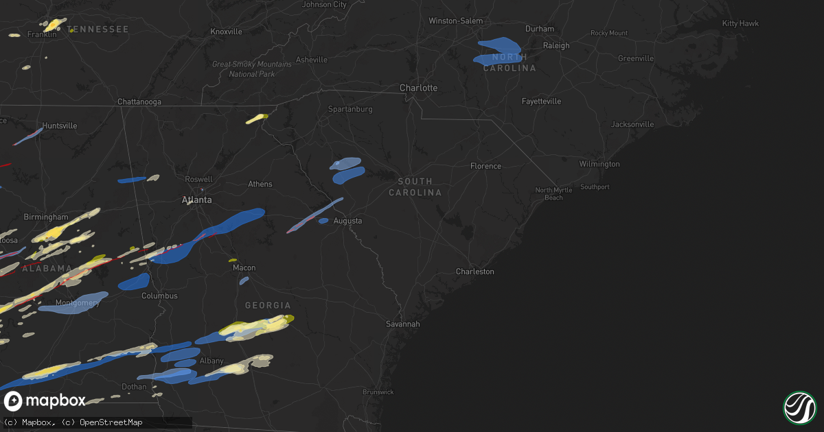
January 12 map
$229
one time, instant access
Download today. No call, no setup
Keep the $229
Bought the map and want the full workflow? Apply the entire $229 to a subscription within 7 days. None of it is wasted.
Every map, not just this one
This buys you this map. Subscription and you get every map we run, in the markets you choose from a few cities to whole states to nationwide. Plus real-time alerts the moment a storm fires.
Contact data
Name, contact info, occupancy, even credit band for addresses in the footprint. You go from where it hit to who to call.
Become the source they trust
Unlimited branding weather history reports on demand. You already have the documented answer ready for the property owner, and you are the one who showed up with it.
Property data and RoofTrace estimates
Pull up any address you have got, its value and the exact code rules for that jurisdiction, straight from One Click Code. Then RoofTrace estimates the squares, pitch, and roof value, priced the way you price.
Storm reports in South Carolina
South Carolina
| Date | Description |
|---|---|
| 01/12/20235:49 PM CST | Trees blocking eastbound lanes on i-26 at mile marker 63. Time estimated by radar. |
| 01/12/20235:45 PM CST | Reports of multiple trees and powerlines down across union county. |
| 01/12/20235:42 PM CST | 911 call center reported numerous trees and powerlines down across laurens county. Highlighted the most damage at hwy 72 and renno rd. |
| 01/12/20235:28 PM CST | 911 call center reports power pole down on salak rd. |
| 01/12/20235:28 PM CST | Social media report of power lines down between york and clover. |
| 01/12/20235:27 PM CST | Emergency manager reports a tree on a house near clover off briarwood drive. |
| 01/12/20235:26 PM CST | Asos reports gust of 65 knots from wsw at 2326z. |
| 01/12/20235:25 PM CST | 911 call center reports an electrical fire due to storm damage at n duncan bypass. |
| 01/12/20235:25 PM CST | 911 call center reports numerous trees and powerlines down across york county. |
| 01/12/20235:24 PM CST | Tornado damage started at deadfall road w where scattered large trees were uprooted or snapped. The tornado then intensified into a low-end ef1 as it crossed cokesbury |
| 01/12/20235:24 PM CST | 911 call center reports numerous trees and powerlines down across greenwood county. |
| 01/12/20235:18 PM CST | Reports of trees down in hodges. |
| 01/12/20235:18 PM CST | 911 call center reports multiple trees powerlines down across abbeville county. |
| 01/12/20235:15 PM CST | Multiple trees down on roadway on old abbeville hwy and stevenson rd. |
| 01/12/20234:46 PM CST | Several trees down near the intersection of hwy 25 and hwy 76. |
| 01/12/20234:42 PM CST | 911 call center reports a large tree blocking roadway on providence creed rd and vermont drive. |
| 01/12/20234:42 PM CST | Corrects previous tornado report from joanna. Tornado touched down in joanna damaging a car wash and fire station garage door. The tornado traveled through hawkins circ |
| 01/12/20234:05 PM CST | Multiple trees and powerlines down across spartanburg county. |
| 01/12/20233:42 PM CST | Tornado touched down in joanna damaging a car wash and fire station garage door. The tornado traveled through hawkins circle and renno road where the intensity increase |
| 01/12/20233:25 PM CST | Structural damage to two residence buildings... One vacant. |
| 01/12/20232:55 PM CST | Reports of quarter sized hail and trees down along highway 107 near mountain rest. |
| 01/11/20237:05 PM CST | A medium size tree fell at 3814 brazelmans bridge rd. Time estimated. |
| 01/11/20236:27 PM CST | Corrects previous tstm wnd dmg report from 7 n newberry. 911 call center reported multiple trees down in the vicinity of old whitmire hwy and felker seltzer rd. Time es |
| 01/11/20236:27 PM CST | 911 call center reported multiple trees down. Time estimated by radar. |
| 01/11/20236:05 PM CST | Corrects previous tstm wnd dmg report from 7 w blair. A medium size tree fell at 3814 brazelmans bridge rd. Time estimated. Corrected time. |
| 01/11/20236:00 PM CST | Correst time of report. Corrects previous tstm wnd dmg report from 7 n newberry. Corrects previous tstm wnd dmg report from 7 n newberry. 911 call center reported multi |
All States Impacted by Hail Map on January 12, 2023
Cities Impacted by Hail Map on January 12, 2023
- Oak Vale, MS
- Monticello, MS
- Prentiss, MS
- Bassfield, MS
- Carson, MS
- Silver Creek, MS
- Jayess, MS
- Carthage, MS
- Aberdeen, MS
- Latham, OH
- Peebles, OH
- Bainbridge, OH
- Waverly, OH
- Hillsboro, OH
- Lewisburg, KY
- Bowling Green, KY
- Morgantown, KY
- Bee Spring, KY
- Leitchfield, KY
- Clarkson, KY
- Meridian, MS
- Collinsville, MS
- Marion, MS
- Emelle, AL
- Scooba, MS
- Springfield, KY
- Harrodsburg, KY
- Wilmore, KY
- Mackville, KY
- Lancaster, KY
- Nicholasville, KY
- Saint Francis, KY
- Perryville, KY
- Lebanon, KY
- Loretto, KY
- Richmond, KY
- Paint Lick, KY
- Danville, KY
- Falmouth, KY
- Dry Ridge, KY
- Williamstown, KY
- Russellville, KY
- Greensburg, KY
- Summersville, KY
- Siler City, NC
- Randleman, NC
- Pittsboro, NC
- Liberty, NC
- Asheboro, NC
- Snow Camp, NC
- Sophia, NC
- Staley, NC
- Franklinville, NC
- Climax, NC
- Ramseur, NC
- Bear Creek, NC
- Bennett, NC
- Goldston, NC
- Seagrove, NC
- Sanford, NC
- Moncure, NC
- Ninety Six, SC
- Chappells, SC
- Mountville, SC
- Kinards, SC
- Greenwood, SC
- Newberry, SC
- Waterloo, SC
- Abbeville, SC
- Silverstreet, SC
- Cross Hill, SC
- Saluda, SC
- Troy, SC
- Bradley, SC
- Decatur, AL
- Moulton, AL
- Trinity, AL
- Tanner, AL
- Madison, AL
- Fayette, AL
- Carbon Hill, AL
- Eldridge, AL
- Boligee, AL
- Akron, AL
- Eutaw, AL
- Knoxville, AL
- Centreville, AL
- Duncanville, AL
- West Blocton, AL
- Gainesville, AL
- Epes, AL
- Moundville, AL
- Waverly, AL
- Auburn University, AL
- Notasulga, AL
- Opelika, AL
- Auburn, AL
- Cusseta, AL
- Salem, AL
- Valley, AL
- Montgomery, AL
- Shorter, AL
- Lowndesboro, AL
- Hope Hull, AL
- Tyler, AL
- Tuskegee, AL
- Hayneville, AL
- Selma, AL
- Cecil, AL
- Pike Road, AL
- Wetumpka, AL
- Tallassee, AL
- Range, AL
- Dozier, AL
- Elba, AL
- Ariton, AL
- Castleberry, AL
- Brantley, AL
- Evergreen, AL
- Atmore, AL
- McKenzie, AL
- Abbeville, AL
- Red Level, AL
- Clio, AL
- Opp, AL
- Repton, AL
- Georgetown, GA
- Morris, GA
- Lenox, AL
- Cuthbert, GA
- Dawson, GA
- Brundidge, AL
- Skipperville, AL
- Coleman, GA
- Louisville, AL
- Clayton, AL
- Eufaula, AL
- Clopton, AL
- Jack, AL
- Andalusia, AL
- Troy, AL
- Fort Gaines, GA
- Brewton, AL
- Shellman, GA
- Glenwood, AL
- Piedmont, AL
- Cedartown, GA
- Morgan, GA
- Headland, AL
- Arlington, GA
- Blakely, GA
- Leary, GA
- Columbia, AL
- Damascus, GA
- Edison, GA
- Bluffton, GA
- Albany, GA
- Belleville, WV
- Mineral Wells, WV
- Washington, WV
- Parkersburg, WV
- Davisville, WV
- Elizabeth, IN
- Laconia, IN
- Antioch, TN
- Nolensville, TN
- La Vergne, TN
- Georgetown, KY
- Columbia, TN
- Culleoka, TN
- Mount Pleasant, TN
- Mammoth Cave, KY
- Cave City, KY
- Phil Campbell, AL
- Nashville, TN
- Brentwood, TN
- Hardyville, KY
- Canmer, KY
- Goodwater, AL
- Sylacauga, AL
- Weogufka, AL
- Cub Run, KY
- Silas, AL
- Caneyville, KY
- Horse Branch, KY
- Cromwell, KY
- Horse Cave, KY
- Munfordville, KY
- Lewisburg, TN
- Elk Horn, KY
- Dunmor, KY
- Jeffersonville, IN
- Franklin, TN
- Hermitage, TN
- Mount Juliet, TN
- Pine Hill, AL
- Sawyerville, AL
- Greensboro, AL
- Anniston, AL
- Lincoln, AL
- Eastaboga, AL
- Thomasville, AL
- Beaverton, AL
- Hamilton, AL
- Haleyville, AL
- Guin, AL
- Bear Creek, AL
- Brilliant, AL
- Cynthiana, KY
- Sadieville, KY
- Magnolia, KY
- Deatsville, AL
- Equality, AL
- Marbury, AL
- Titus, AL
- Rockford, AL
- Five Points, AL
- Lafayette, AL
- Roanoke, AL
- Wadley, AL
- Daviston, AL
- Camp Hill, AL
- Columbiana, AL
- Birmingham, AL
- Pelham, AL
- Chelsea, AL
- Coxs Mills, WV
- Smithville, WV
- Auburn, WV
- Bon Aqua, TN
- Lyles, TN
- Nunnelly, TN
- Brownsville, KY
- Porterville, MS
- De Kalb, MS
- Union, MS
- Taylorsville, MS
- Taylorsville, GA
- Rockmart, GA
- Aragon, GA
- Butler, AL
- Rhine, GA
- Milan, GA
- Eastman, GA
- Chauncey, GA
- Dothan, AL
- Vincent, AL
- Leakesville, MS
- Stanton, TN
- Alpine, AL
- Talladega, AL
- Henderson, TN
- Finger, TN
- Sumner, GA
- Ty Ty, GA
- Doerun, GA
- Sylvester, GA
- Poulan, GA
- Cedarbluff, MS
- West Point, MS
- Jones, AL
- Canton, MS
- Tuscaloosa, AL
- Brookwood, AL
- Vinegar Bend, AL
- Deer Park, AL
- Citronelle, AL
- Clayton, GA
- Tiger, GA
- Jacksons Gap, AL
- Poplarville, MS
- Lebanon, TN
- Lauderdale, MS
- Cuba, AL
- Mercer, TN
- Brownsville, TN
- Medon, TN
- Whiteville, TN
- Childersburg, AL
- Greenville, GA
- Hogansville, GA
- West Point, GA
- Mantee, MS
- Pheba, MS
- York, AL
- Livingston, AL
- Toomsuba, MS
- Cherokee, AL
- Florence, AL
- Waterloo, AL
- Toxey, AL
- Safford, AL
- Linden, AL
- Thomaston, AL
- Catherine, AL
- Magnolia, AL
- Sweet Water, AL
- Dixons Mills, AL
- Jackson, OH
- Beaver, OH
- Hartford, AL
- Slocomb, AL
- Saint Marys, WV
- Waverly, WV
- Mount Vernon, AL
- Lucedale, MS
- Chunchula, AL
- Clarkesville, GA
- Lakemont, GA
- Alabaster, AL
- Prattville, AL
- Pachuta, MS
- Quitman, MS
- Cropwell, AL
- Tifton, GA
- Sterrett, AL
- Folsom, LA
- Ocilla, GA
- Lagrange, GA
- Chattahoochee, FL
- Calera, AL
- Sardinia, OH
- Georgetown, OH
- Millry, AL
- Frankville, AL
- Jackson, AL
- Waynesboro, MS
- Coffeeville, AL
- Buckatunna, MS
- Shubuta, MS
- Smiths Grove, KY
- Sardis, AL
- Orrville, AL
- Minter, AL
- Rochelle, GA
- Pitts, GA
- Vienna, GA
- Chula, GA
- Laurel, MS
- Stringer, MS
- Heidelberg, MS
- Vossburg, MS
- Shuqualak, MS
- Hickory, MS
- Chunky, MS
- Decatur, MS
- Arabi, GA
- Cordele, GA
- Kellyton, AL
- Alexander City, AL
- Lena, MS
- Shelby, AL
- Pineview, GA
- Cobb, GA
- De Soto, GA
- Abbeville, GA
- Billingsley, AL
- Autaugaville, AL
- Marion Junction, AL
- Melvin, AL
- Needham, AL
- Gilbertown, AL
- Sneads, FL
- Lower Peach Tree, AL
- Dickinson, AL
- Grove Hill, AL
- Montevallo, AL
- Helena, AL
- Brierfield, AL
- Randolph, AL
- Wilsonville, AL
- McRae Helena, GA
- Verbena, AL
- Luthersville, GA
- Coy, AL
- Vredenburgh, AL
- Marianna, FL
- Altha, FL
- Quincy, FL
- Grand Ridge, FL
- Harpersville, AL
- Pell City, AL
- Munford, AL
- Oxford, AL
- Fitzgerald, GA
- Camden, AL
- Philadelphia, MS
- Pine Apple, AL
- Franklin, GA
- Cadwell, GA
- Warwick, GA
- Jetson, KY
- Roundhill, KY
- Atlanta, GA
- Brandon, MS
- Walnut Grove, MS
- Samson, AL
- Sharon Grove, KY
- Iron City, TN
- Iuka, MS
- Lanett, AL
- Macon, MS
- Dadeville, AL
- Uniontown, AL
- Bay Springs, MS
- Newton, MS
- Brent, AL
- Marion, AL
- Forkland, AL
- Ovett, MS
- Gordon, AL
- Jakin, GA
- Buhl, AL
- Ralph, AL
- Northport, AL
- Jemison, AL
- Clanton, AL
- Geneva, AL
- Defuniak Springs, FL
- Arlington, AL
- Franklinton, LA
- Loranger, LA
- Sycamore, GA
- Baconton, GA
- Newton, GA
- Ashburn, GA
- Ellisville, MS
- Gay, GA
- Molena, GA
- Monticello, GA
- Mcdonough, GA
- Williamson, GA
- Buckhead, GA
- Jenkinsburg, GA
- Concord, GA
- Rutledge, GA
- Shady Dale, GA
- Mansfield, GA
- Greensboro, GA
- Newborn, GA
- Pine Mountain, GA
- Brooks, GA
- Woodbury, GA
- Warm Springs, GA
- Griffin, GA
- Madison, GA
- Jackson, GA
- Covington, GA
- Hampton, GA
- Locust Grove, GA
- Thomson, GA
- Norwood, GA
- Clarks Hill, SC
- Sparta, GA
- Appling, GA
- Edgefield, SC
- Camak, GA
- Modoc, SC
- Warrenton, GA
- Harlem, GA
- Dearing, GA
- Smithville, GA
- Americus, GA
- Leesburg, GA
- Bronwood, GA
- Leslie, GA
- Centerville, GA
- Macon, GA
- Warner Robins, GA
- Colquitt, GA
- Camilla, GA
- Double Springs, AL
- Pleasureville, KY
- Lithia Springs, GA
- Austell, GA
- Juliette, GA
- Alamo, GA
- Murfreesboro, TN
- Lascassas, TN


