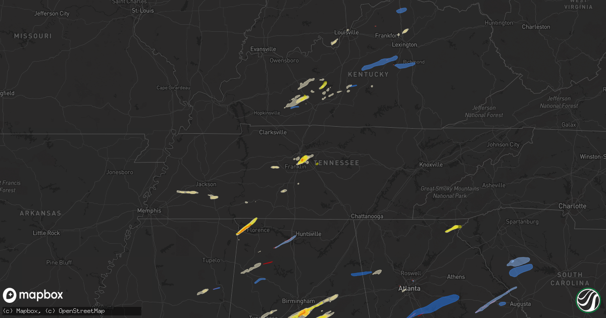
Hail Map on January 12, 2023
Get this storm
January 12 map
$229
one time, instant access
Download today. No call, no setup
Keep the $229
Bought the map and want the full workflow? Apply the entire $229 to a subscription within 7 days. None of it is wasted.
Every map, not just this one
This buys you this map. Subscription and you get every map we run, in the markets you choose from a few cities to whole states to nationwide. Plus real-time alerts the moment a storm fires.
Contact data
Name, contact info, occupancy, even credit band for addresses in the footprint. You go from where it hit to who to call.
Become the source they trust
Unlimited branding weather history reports on demand. You already have the documented answer ready for the property owner, and you are the one who showed up with it.
Property data and RoofTrace estimates
Pull up any address you have got, its value and the exact code rules for that jurisdiction, straight from One Click Code. Then RoofTrace estimates the squares, pitch, and roof value, priced the way you price.
States Impacted by Hail Map on January 12, 2023
Storm reports
Florida
| Date | Description |
|---|---|
| 01/11/20237:15 PM CST | Trees blown onto power lines resulted in a few power outages in northern gadsden county. |
Kentucky
| Date | Description |
|---|---|
| 01/12/20239:40 AM CST | Tree reported down across ky-2491 just east of campton. |
| 01/12/20239:30 AM CST | Quarter |
| 01/12/20239:14 AM CST | Tree blown down during thunderstorm. Long with trees down on the prop |
| 01/12/20239:14 AM CST | Tree blown down during thunderstorm. |
| 01/12/20239:10 AM CST | Report of a tree down across ky-213 heading up furnace mtn. |
| 01/12/20238:48 AM CST | Dispatcher reported several damage reports here. Homes... Trees... Rvs. In the braemar dr... Tazwell dr... And hoover circle area. Time estimated based on radar. |
| 01/12/20238:45 AM CST | Dispatcher reported a barn damaged on runyon grove rd. Time estimated from radar. |
| 01/12/20238:42 AM CST | Ef1 tornado with 105 mph winds. Path width 80 yd. Damage to trees and hay barn northeast of richmond. Roof damage in braemer subdivision. Travel trailer lofted over a s |
| 01/12/20238:40 AM CST | Video via social media shows trees down and limbs across w main street near pin oaks drive in richmond... Ky. |
| 01/12/20238:35 AM CST | Via social media... Images show a car flipped on its side... Trees down along with roof and gutter damage on lakeridge drive in richmond. |
| 01/12/20238:23 AM CST | Roof blown off home on arlington court. Insulation blown onto neighboring house. Time estimated from radar data. |
| 01/12/20238:23 AM CST | Roof damage to warehouse. Time estimated from radar data. |
| 01/12/20238:23 AM CST | Roof damage occurred to a house... Several trees were downed and a warehouse suffered roof damage. |
| 01/12/20238:22 AM CST | Tree reported down across poor ridge pike near sad ln. Time estimated based on radar. |
| 01/12/20238:15 AM CST | Tin roof peeled off a barn at the fairgrounds. |
| 01/12/20238:10 AM CST | Nws storm survey team determined an ef1 tornado with 95 mph winds impacted portions of boyle county on january 12... 2023. The tornado was 0.84 miles in length and was |
| 01/12/20238:07 AM CST | Major damage to new garage... Minor damage to barns... Homes... And trees down near waterworks road outside of danville. |
| 01/12/20238:04 AM CST | Damage to many buildings and trees down in downtown harrodsburg. |
| 01/12/20238:04 AM CST | Damage to homes... Barns... Trees... And fences along portions of cornishville road. |
| 01/12/20238:00 AM CST | Nws storm survey team determined an ef1 tornado with 100 mph winds impacted portions of mercer county on january 12... 2023. The tornado was 2.25 miles in length and wa |
| 01/12/20237:50 AM CST | Damage to a porch roof and playground occurred on atena grove church road. |
| 01/12/20237:47 AM CST | Tornado touched down wnw of pleasureville... Ky and tracked east for 1.27 miles into the town of pleasureville... Ky. Estimated peak wind speeds were 110 mph with a pat |
| 01/12/20237:45 AM CST | Light poles and trees down on the intersection of williams street and main street. |
| 01/12/20237:35 AM CST | Report from k6i2 asos via nws chat of a wind gust of knots. |
| 01/12/20237:30 AM CST | Trees down in raywick. |
| 01/12/20237:28 AM CST | Downed trees on loretto rd near willett distillery. Time estimated from radar. |
| 01/12/20237:25 AM CST | Also trees down on st. Thomas rd. And new haven rd. Time estimated from radar. |
| 01/12/20237:25 AM CST | Tree down on boyds knob rd. Time estimated based on radar. |
| 01/12/20237:19 AM CST | Tree down on old main st. Time estimated from radar. |
| 01/12/20237:12 AM CST | Tree down on old elizabethtown road. |
| 01/12/20236:52 AM CST | Tree down on ky-185 near the warren/butler county line. |
| 01/12/20236:50 AM CST | Tree down on reedyville rd near the butler warren county line. Time estimated based on radar data. |
| 01/12/20236:44 AM CST | Estimated quarter |
| 01/12/20236:30 AM CST | Reports via social media of damage to a house and a grain bin destroyed. |
| 01/12/20236:30 AM CST | Damage to a few barns... A garage... Grain bin... And light poles down on barren bailey road. |
South Carolina
| Date | Description |
|---|---|
| 01/12/20235:49 PM CST | Trees blocking eastbound lanes on i-26 at mile marker 63. Time estimated by radar. |
| 01/12/20235:45 PM CST | Reports of multiple trees and powerlines down across union county. |
| 01/12/20235:42 PM CST | 911 call center reported numerous trees and powerlines down across laurens county. Highlighted the most damage at hwy 72 and renno rd. |
| 01/12/20235:28 PM CST | Social media report of power lines down between york and clover. |
| 01/12/20235:28 PM CST | 911 call center reports power pole down on salak rd. |
| 01/12/20235:27 PM CST | Emergency manager reports a tree on a house near clover off briarwood drive. |
| 01/12/20235:26 PM CST | Asos reports gust of 65 knots from wsw at 2326z. |
| 01/12/20235:25 PM CST | 911 call center reports an electrical fire due to storm damage at n duncan bypass. |
| 01/12/20235:25 PM CST | 911 call center reports numerous trees and powerlines down across york county. |
| 01/12/20235:24 PM CST | 911 call center reports numerous trees and powerlines down across greenwood county. |
| 01/12/20235:24 PM CST | Tornado damage started at deadfall road w where scattered large trees were uprooted or snapped. The tornado then intensified into a low-end ef1 as it crossed cokesbury |
| 01/12/20235:18 PM CST | 911 call center reports multiple trees powerlines down across abbeville county. |
| 01/12/20235:18 PM CST | Reports of trees down in hodges. |
| 01/12/20235:15 PM CST | Multiple trees down on roadway on old abbeville hwy and stevenson rd. |
| 01/12/20234:46 PM CST | Several trees down near the intersection of hwy 25 and hwy 76. |
| 01/12/20234:42 PM CST | Corrects previous tornado report from joanna. Tornado touched down in joanna damaging a car wash and fire station garage door. The tornado traveled through hawkins circ |
| 01/12/20234:42 PM CST | 911 call center reports a large tree blocking roadway on providence creed rd and vermont drive. |
| 01/12/20234:05 PM CST | Multiple trees and powerlines down across spartanburg county. |
| 01/12/20233:42 PM CST | Tornado touched down in joanna damaging a car wash and fire station garage door. The tornado traveled through hawkins circle and renno road where the intensity increase |
| 01/12/20233:25 PM CST | Structural damage to two residence buildings... One vacant. |
| 01/12/20232:55 PM CST | Reports of quarter sized hail and trees down along highway 107 near mountain rest. |
| 01/11/20237:05 PM CST | A medium size tree fell at 3814 brazelmans bridge rd. Time estimated. |
| 01/11/20236:27 PM CST | 911 call center reported multiple trees down. Time estimated by radar. |
| 01/11/20236:27 PM CST | Corrects previous tstm wnd dmg report from 7 n newberry. 911 call center reported multiple trees down in the vicinity of old whitmire hwy and felker seltzer rd. Time es |
| 01/11/20236:05 PM CST | Corrects previous tstm wnd dmg report from 7 w blair. A medium size tree fell at 3814 brazelmans bridge rd. Time estimated. Corrected time. |
| 01/11/20236:00 PM CST | Correst time of report. Corrects previous tstm wnd dmg report from 7 n newberry. Corrects previous tstm wnd dmg report from 7 n newberry. 911 call center reported multi |
Tennessee
| Date | Description |
|---|---|
| 01/12/20233:45 PM CST | Corrects previous non-tstm wnd dmg report from 5 n iron city. Tree down blocking road at 3320 wayland springs rd. |
| 01/12/20231:53 PM CST | Quarter-sized hail reported north of walterhill. Time estimated via radar. |
| 01/12/20231:40 PM CST | Corrects previous non-tstm wnd dmg report from 5 s smyrna. Tspotter report and photo showed a large tree limb fell and crushed a shed on blackman rd. |
| 01/12/20231:22 PM CST | Quarter size hail falling at the corner of harding pike and i-24. Time estimated by radar. |
| 01/12/20231:21 PM CST | Hail slightly larger than a quarter reported in the area of sweetwater drive and little stone drive in brentwood. |
| 01/12/20231:19 PM CST | Corrects previous non-tstm wnd gst report from tri-city airport. Asos station ktri tri-cities airport. |
| 01/12/20231:19 PM CST | Quarter size hail in nippers corner. Time estimated by radar. |
| 01/12/20231:19 PM CST | Twitter photo of half-dollar size hail at nippers corner. |
| 01/12/20231:19 PM CST | Twitter photo showing up to ping pong ball sized hail in nippers corner. Time estimated via radar. |
| 01/12/202312:54 PM CST | Shingles were blown off houses and trees knocked down in the tusculum area. |
| 01/12/202312:33 PM CST | Several reports of trees down county wide. |
| 01/12/202312:26 PM CST | Preliminary storm survey finds a path of ef-0 damage with max winds of 80 mph. Path length of 1 mile and width of 100 yards. |
| 01/12/202312:20 PM CST | Near highway 92. |
| 01/12/202312:20 PM CST | Multiple trees down along mobile road. |
| 01/12/202312:17 PM CST | Shingles missing from roof and one large tree blown down. |
| 01/12/202312:14 PM CST | The tornado developed west of dandridge and crossed deep springs road. It dissipated on the east side of deep springs road near ranch road. |
| 01/12/202312:10 PM CST | Tree down blocking roberts road at sunrise blvd. |
| 01/12/202312:03 PM CST | Report of trees down across blount county. |
| 01/12/202311:55 AM CST | Widespread trees down across the county. |
| 01/12/202311:54 AM CST | Tree was blown down onto power lines and is blocking the road. |
| 01/12/202311:45 AM CST | Corrects previous non-tstm wnd gst report from 2 n alcoa. Asos station ktys knoxville mcghee tyson. |
| 01/12/202311:09 AM CST | Trees down. |
| 01/12/202310:50 AM CST | *** 1 inj *** straight line winds were observed to have caused several downed trees and minor outbuilding damage near decatur creek and goodfield road. A tornado develo |
| 01/12/202310:01 AM CST | Corrects previous tstm wnd dmg report from 5 ne griffith creek. Several reports of trees down county wide. |
Virginia
| Date | Description |
|---|---|
| 01/12/20232:28 PM CST | 6 trees and one power pole down. |
| 01/12/20232:10 PM CST | Tree down on walkers creek road. |
| 01/12/20232:07 PM CST | One tree down on shadow wood road. |
| 01/12/20232:07 PM CST | One tree down across the road on red stone road near the intersection of sugar street. |
| 01/12/20232:04 PM CST | Tree down on saint claires creek road. |
| 01/12/20232:01 PM CST | Tree down on needmore road. |
| 01/12/20231:35 PM CST | Widespread trees down across the county via multiple different reports. |
Alabama
| Date | Description |
|---|---|
| 01/12/20235:57 PM CST | A tree was blown down onto county road 49. |
| 01/12/20235:57 PM CST | A tree was blown down onto county road 30. |
| 01/12/20235:50 PM CST | Three trees were blown down in the hartford area. |
| 01/12/20235:27 PM CST | Tree down in coffee springs. |
| 01/12/20235:03 PM CST | Measured wind gust of 63 mph. |
| 01/12/20233:50 PM CST | Numerous trees and powerlines down across the northern portion of henry county... North of abbeville. 1 home with structural damage. |
| 01/12/20233:45 PM CST | Report of damage at bakerhill school road and cr 79. |
| 01/12/20233:45 PM CST | Four to six trees down in different directions across cr 126. |
| 01/12/20233:41 PM CST | Damage reported along mavis carroll road. |
| 01/12/20233:40 PM CST | Corrects previous tstm wnd dmg report from 3 ne pisgah. Corrects previous tstm wnd dmg report from 3 ne pisgah. Roof or structural damage was reported at this location. |
| 01/12/20233:40 PM CST | Roof or structural damage was reported at this location. |
| 01/12/20233:37 PM CST | Corrects previous tstm wnd dmg report from 3 ne pisgah. Roof or structural damage was reported at this location. |
| 01/12/20233:33 PM CST | Trees down on cr 68 and cr 33. |
| 01/12/20233:33 PM CST | Multiple trees down and structural damage at blue springs state park. Tds observed via radar. |
| 01/12/20233:32 PM CST | Damage along cr 23 near new hope church. Tds observed. |
| 01/12/20233:21 PM CST | River road at barbour county line is closed due to numerous trees and powerlines down. |
| 01/12/20233:21 PM CST | Trees down at sr-123 and county road 120... Blocking both lanes. |
| 01/12/20233:18 PM CST | Trees down across highway 51 and county road 52 near ariton. |
| 01/12/20233:15 PM CST | Numerous large trees down along us 231 and neighboring roads near the pike/coffee county line. Possible tornado. |
| 01/12/20233:01 PM CST | Numerous trees and powerlines down along sr-87 between jack post office and zion chapel school with road blocked. |
| 01/12/20232:41 PM CST | Em report of downed trees and power lines resulting in numerous power outages in opelika. |
| 01/12/20232:41 PM CST | Weather station at auburn university recorded gust of 67 mph. |
| 01/12/20232:40 PM CST | Em reports minor damage to an abandon trailer in the rose hill area on county road 13 with trees also down in the area. |
| 01/12/20232:38 PM CST | Em reports trees down along straughn school rd in rose hill area. Time estimated based on radar. |
| 01/12/20232:35 PM CST | Em reports multiple locations in extreme south crenshaw county with fallen trees and downed power lines. One broken power pole... One location with chicken house damage |
| 01/12/20232:30 PM CST | Reports of trees down near and around gantt lake. Extent of damage unknown at this time. |
| 01/12/20232:24 PM CST | Home destroyed on cr 284 in northeast chambers county. Tds visible via radar. |
| 01/12/20232:19 PM CST | Photo on social media of damage on crystal springs rd in red level... Al next to football stadium. Time estimated based on radar. |
| 01/12/20232:18 PM CST | Em reports damage to a structure on cr 107 and on smiley street in red level area. Time estimated based on radar. |
| 01/12/20232:17 PM CST | Many large pine trees and hardwood trees down across cr 267. Trees on power lines. Tds observed. |
| 01/12/20232:14 PM CST | Quarter-sized hail reported in the clackville community. |
| 01/12/20232:13 PM CST | Trees and lines down in and around tallassee. |
| 01/12/20232:06 PM CST | Asos report of 62 mph gust at dannelly field. |
| 01/12/20232:03 PM CST | Damage reported along hunter lane and camellia drive. |
| 01/12/20232:01 PM CST | Minor tree damage reported. |
| 01/12/20231:56 PM CST | Em reports of trees and power lines down in between castleberry and nymph. |
| 01/12/20231:55 PM CST | Media report of minor structural damage to a plantation home on jay villa rd a near intersection of rowe rd and monroe dr. |
| 01/12/20231:55 PM CST | Media report of minor structural damage to a plantation home on jay villa rd along with trees down on the property. Time estimated based on radar - possible tor. |
| 01/12/20231:54 PM CST | Em reports widespread tree damage due to a possible tor around intersections of cr 85... Cr 87... And cr 29. Numerous large trees uprooted & snapped |
| 01/12/20231:51 PM CST | Social media report of trees and power lines down on horseshoe bend road northeast of jacksons gap. Possible tornado. |
| 01/12/20231:48 PM CST | Trees and lines down in and around dadeville. |
| 01/12/20231:45 PM CST | Reports of roof damage on sandcut rd. Extent of damage unknown at this time. |
| 01/12/20231:42 PM CST | Em reports 4 residential homes and 1 church having structural damage... And 1 large barn was destroyed on appleton rd |
| 01/12/20231:42 PM CST | Multiple structures damaged along us 280 near the lake martin bridge. Tds observed. |
| 01/12/20231:36 PM CST | Quarter-sized hail reported in alexander city. |
| 01/12/20231:32 PM CST | Em reported multiple instances of trees down throughout the county with some on roadways. |
| 01/12/20231:29 PM CST | Trees and lines down. |
| 01/12/20231:22 PM CST | Structural damage reported along cr 14 near equality. |
| 01/12/20231:15 PM CST | Public reports of trees and power lines down in huxford... Al |
| 01/12/20231:09 PM CST | Heavy damage reported along kelly road in the titus community. |
| 01/12/20231:08 PM CST | Wind damage consisting of tree down and or power lines down in at least five communities across the county. |
| 01/12/20231:06 PM CST | Tornado observed crossing lightwood road. Tds observed. Heavy damage at coosa river road. |
| 01/12/20231:06 PM CST | Tornado observed crossing lightwood road. Tds observed. |
| 01/12/20231:02 PM CST | Damage to a church and marbury vfd building. Trees in roadway at highway 143 and cr 68. |
| 01/12/202312:58 PM CST | Severe damage reported along cr 68 in the area of us 31. |
| 01/12/202312:50 PM CST | Heavy damage along numerous roadways in the joffre and old kingston communities. Corrects source of report. |
| 01/12/202312:48 PM CST | Major structural damage reported along us 82. |
| 01/12/202312:42 PM CST | Trees down. Likely due to forward flank downdraft of tornadic supercell. |
| 01/12/202312:41 PM CST | Em shared photos of large hail measuring up to 1.5 inches. |
| 01/12/202312:41 PM CST | Quarter to half dollar size hail reported on the north side of sylacauga. |
| 01/12/202312:40 PM CST | Sporadic areas of single tree down events in the southern part of the county. |
| 01/12/202312:37 PM CST | Structural damage to a residence reported by spring garden fd. |
| 01/12/202312:30 PM CST | Power lines down |
| 01/12/202312:23 PM CST | Tree in roadway along roy webb road. |
| 01/12/202312:22 PM CST | Corrects previous tstm wnd dmg report from 1 e anniston. Tree down near structure along isabell avenue. |
| 01/12/202312:22 PM CST | Tree on structure along isabell avenue. |
| 01/12/202312:22 PM CST | Tree in roadway at intersection of anniston beach road and mcclellan blvd. |
| 01/12/202312:19 PM CST | Tree down along cr 77 near kingdom crossroads. |
| 01/12/202312:19 PM CST | Heavy damage reported at the selma country club. |
| 01/12/202312:18 PM CST | Numerous reports of tornado in selma with tree and structural damage. |
| 01/12/202312:17 PM CST | Tree down on egg and butter road. |
| 01/12/202312:16 PM CST | Tree in roadway along bynum leatherwood road at gate 8 road. |
| 01/12/202312:16 PM CST | Tree in road at intersection of state farm road and mahlep lane. |
| 01/12/202312:14 PM CST | Power lines down along bynum blvd. |
| 01/12/202312:05 PM CST | Calera pd reported quarter-sized hail at the shelby/chilton county line. |
| 01/12/202312:04 PM CST | Trees down along highway 61. |
| 01/12/202312:03 PM CST | Sporadic areas of single tree down events in the northern part of the county. |
| 01/12/202312:01 PM CST | Trees down along howell cove road at glade road and along stemley bridge road. Oke ln and black kettle rd. |
| 01/12/202312:01 PM CST | Trees down along howell cove road at glade road and along stemley bridge road. |
| 01/12/202311:59 AM CST | Em report of tornado along highway 22 west of oroville. |
| 01/12/202311:47 AM CST | Report via media of tornado crossing us 82 southeast of centreville. Tds observed. |
| 01/12/202311:42 AM CST | Tree down across greensport road. |
| 01/12/202311:39 AM CST | Trees down along highway 219 in southern bibb county. Tds observed via radar. |
| 01/12/202311:39 AM CST | Tree down on power lines on hazelwood drive. |
| 01/12/202311:29 AM CST | Tds observed via nws radar tracking into bibb county. |
| 01/12/202311:27 AM CST | Public report of quarter-sized hail. |
| 01/12/202311:25 AM CST | Multiple reports of golf ball-sized hail in the chelsea area. |
| 01/12/202311:21 AM CST | Multiple reports of quarter-size hail in alabaster. |
| 01/12/202311:20 AM CST | Power lines down at 12000 block of highway 273. |
| 01/12/202311:20 AM CST | Tree down into power lines on valley street. Radar estimated winds of 40 mph. |
| 01/12/202311:20 AM CST | Tree down across cr 336 southwest of chelsea. Time estimated. |
| 01/12/202311:16 AM CST | Report of damage along marlowe lane and highway 28 near linden. |
| 01/12/202311:15 AM CST | Quarter-size hail reported at fox valley. |
| 01/12/202311:12 AM CST | Power lines down on home along cr 105 at dekalb county line... Resulting in fire. |
| 01/12/202311:10 AM CST | Tree down at highway 11 and keener gap road. |
| 01/12/202311:02 AM CST | Em report of tornado observed in greensboro. Tree down on home along pear road. |
| 01/12/202311:01 AM CST | Tree down near noccalula road at tuchahoe heights. |
| 01/12/202310:57 AM CST | Significant structural damage south of greensboro. |
| 01/12/202310:55 AM CST | Trees snapped along truman aldrich parkway south of west blocton high school. |
| 01/12/202310:40 AM CST | Social media report of debris on us 82 near hagler. Tds observed. |
| 01/12/202310:24 AM CST | Social media reports of damage to trees and structures south of moundville. Tds observed via radar. |
| 01/12/202310:14 AM CST | Public report of quarter-sized hail just east of livingston. |
| 01/12/202310:10 AM CST | Trees were reported snapped or uprooted at intersection of cr 216 and cr 497. |
| 01/12/202310:07 AM CST | Major structural damage in the oak village area. Trees down along cr 42 north of akron. Tds observed. |
| 01/12/202310:02 AM CST | Trees were snapped or uprooted at this location. |
| 01/12/20239:56 AM CST | Trees were reported uprooted or snapped at this location. |
| 01/12/20239:54 AM CST | Trees and power lines down along mesopotamia street near robert brown middle school. Possible tornado. |
| 01/12/20239:50 AM CST | Tree down along seven bark road. Time estimated via radar. |
| 01/12/20239:41 AM CST | Trees were reported down on power lines. |
| 01/12/20239:37 AM CST | Debris in the road at intersection of highway 39 and cr 24. Tds observed via radar. |
| 01/12/20239:28 AM CST | Tree on house along hammer sumterville road. Tds observed via radar. |
| 01/12/20239:24 AM CST | Damage reported in the area of highway 17. Reports of a mobile home destroyed in emelle. Tds observed via radar. |
| 01/12/20239:16 AM CST | Trees were snapped or uprooted on the 10...000 block of cr 8. |
| 01/12/20239:09 AM CST | Corrects previous report from 1 sw lupton. Trees down along the 1000 block of prospect road. One tree fell on a home. |
| 01/12/20239:05 AM CST | Trees down along the 1000 block of prospect road. |
| 01/12/20238:46 AM CST | Trees and debris in road near fennel ln/fennel rd. |
| 01/12/20238:44 AM CST | Kdcu reports a wind gust to 54 kt. |
| 01/12/20238:44 AM CST | Trees snapped near prior field in tanner. |
| 01/12/20238:44 AM CST | Trees down at calhoun community college. |
| 01/12/20238:40 AM CST | Damage reported at decatur marina. |
| 01/12/20238:36 AM CST | Numerous trees down near gordon terry rd/beltline rd. |
| 01/12/20238:35 AM CST | Multiple reports of damage near linde rd. And al-20. |
| 01/12/20238:16 AM CST | Trees down at highway 195 and cr 6 northwest of double springs. Tds observed on radar. |
| 01/12/20238:14 AM CST | Damage reported at residence along cr3187. |
| 01/12/20238:14 AM CST | Damage reported near hwy 24 and cr 157. Possible tornado. |
| 01/12/20238:14 AM CST | Report of storm damage with people entrapped near delmar in western winston county. |
| 01/12/20238:10 AM CST | Nws damage survey determines ef-1 damage from multi-county tornado. |
| 01/12/20238:10 AM CST | Structure damage southwest of moulton. Possible tornado. |
| 01/12/20238:09 AM CST | Trees and power lines down along cr28 near delmar. Tds observed on radar. |
| 01/12/20238:07 AM CST | Corrects time of previous tornado report from delmar. Report of storm damage with people entrapped near delmar in western winston county. |
| 01/12/20238:02 AM CST | Social media report of tree and structural damage to a farm along cr 19 east of haleyville. |
| 01/12/20237:37 AM CST | Quarter size hail north of florence. |
| 01/12/20237:25 AM CST | Ema reports hail in central lauderdale county near oakland and central communities. |
| 01/12/20237:25 AM CST | Ping pong size hail feel north of cherokee. Near the intersection of north pike road and riverton rose trail. |
| 01/12/20237:25 AM CST | Corrects previous hail report from 5 n cherokee. Corrects previous tstm wnd dmg report from 5 n cherokee. Ping pong size hail feel north of cherokee. Near the intersect |
| 01/11/20236:07 PM CST | A fallen tree resulted in a power outage. |
West Virginia
| Date | Description |
|---|---|
| 01/12/20238:20 AM CST | Several facebook pictures of quarter sized hail in mineral wells. |
Georgia
| Date | Description |
|---|---|
| 01/12/20235:37 PM CST | Trees and powerlines down on acorn pond road. |
| 01/12/20235:30 PM CST | Trees down on sr-266 before bethel church rd. |
| 01/12/20235:30 PM CST | Tree down near the intersection of laramore road and new york road. |
| 01/12/20235:20 PM CST | Powerlines snapped... 15-20 trees down... Brick retaining wall knocked down. |
| 01/12/20235:13 PM CST | Powerlines down near intersection of browning shoals rd and conner spur. |
| 01/12/20235:06 PM CST | Tree and powerlines down near intersection of hd atha rd and youth monroe rd. |
| 01/12/20234:47 PM CST | Tree down near intersection of nunnally farm rd and highgrove dr. |
| 01/12/20234:45 PM CST | Report of tree down near intersection of hawkins academy rd and amber stapp studdard rd. |
| 01/12/20234:34 PM CST | A few trees and powerlines reported down across the county. |
| 01/12/20234:30 PM CST | Report of tree and powerlines down near intersection of hancock dr and darel dr. |
| 01/12/20234:19 PM CST | Power poles broken and several tree limbs also down. |
| 01/12/20234:19 PM CST | Tree down near intersection of knox chapel rd and parkview rd. |
| 01/12/20234:16 PM CST | Tree down near intersection of dry pond rd and gratis rd. |
| 01/12/20234:15 PM CST | Powerlines down on reid station road. |
| 01/12/20234:15 PM CST | Tornado sited 1 mile ne of mayfield on mayfield rd. Debris was blocking mayfield rd after tornado passed. |
| 01/12/20234:14 PM CST | Tree down near intersection of greenwood dr and woodland rd. |
| 01/12/20234:13 PM CST | Tree and powerlines down near intersection of stewart rd and broadnax mill rd. |
| 01/12/20234:05 PM CST | Tree and powerlines down near intersection of hwy 81 and twin lakes dr. |
| 01/12/20234:04 PM CST | Tree down near intersection of e marable st and walton rd. |
| 01/12/20234:04 PM CST | Tree down near intersection of w spring st and mlk jr blvd. |
| 01/12/20234:03 PM CST | Couple of trees down on youth jersey rd near intersections with corinth rd and robertson rd. |
| 01/12/20233:58 PM CST | Two trees down near intersection of michael rd nw and ike stone rd. |
| 01/12/20233:57 PM CST | Tree and powerlines down near intersection of broadnax mill and youth jersey rd. |
| 01/12/20233:56 PM CST | Tree and powerlines down near intersection of hwy 81 and robertson rd. |
| 01/12/20233:53 PM CST | Tree down near the intersection of ammons bridge and alcovy st. |
| 01/12/20233:50 PM CST | Tree down near intersection of e spring st and n hammond dr. |
| 01/12/20233:49 PM CST | Two trees down near intersection of rowe rd and monroe dr. |
| 01/12/20233:49 PM CST | Two trees downg cabarrus nc 3532 8065 social media report of a tree down in harrisburg. |
| 01/12/20233:49 PM CST | Power lines down on rocky creek rd in hannahs mill area of upson. |
| 01/12/20233:47 PM CST | Multiple trees down on union grove rd near southern grove rd. |
| 01/12/20233:45 PM CST | Major structural damage to shopping center across from walmart. Debris on street. |
| 01/12/20233:44 PM CST | Trees down and shingles lifted off roofs along foster sprouse road. |
| 01/12/20233:39 PM CST | Tree down on home near intersection of river falls view and stewart rd. |
| 01/12/20233:33 PM CST | Tree down near intersection near ga hwy 81 and shiloh rd. |
| 01/12/20233:28 PM CST | Tornado touched down just east of griffin on hwy 16 near barrow rd. Numerous trees down and semi flipped. |
| 01/12/20233:28 PM CST | Numerous trees down in road in griffin near jackson road elementary and pinelea rd. |
| 01/12/20233:26 PM CST | Significant damage to the hobby lobby roof in griffin ga. Near riegal st and pine dr. |
| 01/12/20233:26 PM CST | Significant structural damage in the town of griffin. Numerous structures reported damaged or destroyed. |
| 01/12/20233:24 PM CST | Powerlines down near intersection of parkwood rd sw and birchwood trail sw. |
| 01/12/20233:22 PM CST | Report of powerlines down near intersection of beaver ruin rd nw and shady dr nw. |
| 01/12/20233:21 PM CST | Report of powerlines down near intersection of rebecca st nw and charles st nw. |
| 01/12/20233:20 PM CST | Reports of quarter and half dollar sized hail across a good portion of rabun county. |
| 01/12/20233:16 PM CST | Multiple trees down on exit 46... Big springs rd... On i-185. Road completely blocked. |
| 01/12/20233:13 PM CST | Powerline down along woodfield lane. |
| 01/12/20233:13 PM CST | Powerlines down along old morrow road south of battle creek road. |
| 01/12/20233:13 PM CST | Trees down and power lines down at beauregard street and grady avenue. |
| 01/12/20233:11 PM CST | Power line down along lake harbin road. |
| 01/12/20233:10 PM CST | County officials relayed reports of trees down over roadways... Including hwy 74 and acorn rd... Flat creek and peachtree parkway... Robinson rd and peachtree parkway.. |
| 01/12/20233:06 PM CST | Debris blocking hwy 16 just east of i-85. |
| 01/12/20233:06 PM CST | Multiple trees down along and in the woods next to echo ct. |
| 01/12/20233:05 PM CST | Peachtree city officials relayed reports of trees down blocking roadways over north peachtree city... Including hwy 74 and north kedron... Belvedere dr... Peachtree pkw |
| 01/12/20233:03 PM CST | Lines down off of pool rd and johnston rd. |
| 01/12/20233:03 PM CST | Tree fallen on witcher rd near hwy 16. |
| 01/12/20233:01 PM CST | Tree down on building near intersection of buford hwy and roger st. |
| 01/12/20232:59 PM CST | Report of tree and powerlines down near intersection of lexington dr and monfort rd. |
| 01/12/20232:53 PM CST | Tree down on home near intersection of farmbrooke ln and black kettle rd. |
| 01/12/20232:53 PM CST | Tree down on home near intersection of farmbro ga 3378 8378 tree and powerlines down near intersection of hd atha rd and youth monroe rd. |
| 01/12/20232:53 PM CST | Pdk recorded a wind gust of 60mph. |
| 01/12/20232:51 PM CST | Corrects previous tornado report from 1 ne brookhaven. Tree on house near intersection of caldwell rd and redding rd. |
| 01/12/20232:51 PM CST | Tornado spotted on ground from caldwell rd and redding rd. Northside of brookhaven area. |
| 01/12/20232:47 PM CST | Tree down near intersection of jospeh e boone nw and chappell rd. |
| 01/12/20232:47 PM CST | Report of tree down near intersection of campbellton rd sw and county line rd sw. |
| 01/12/20232:45 PM CST | Thousands of trees down starting near intersection of keith rd and evans dr. |
| 01/12/20232:44 PM CST | Tree down near intersection of new hope rd and heartherland dr. |
| 01/12/20232:43 PM CST | Building collapse off oak ridge on cobb side of road. |
| 01/12/20232:42 PM CST | Tree blown over onto powerlines at ann rd and jay dr. |
| 01/12/20232:40 PM CST | The emergency manager reported trees down across multiple roadways... Including duncan road... And e hwy 5... And powerlines down at two locations on ephesus church roa |
| 01/12/20232:37 PM CST | Tornado confirmed by radar and damage reports southeast side of lagrange. Major structural damage and numerous trees downed blocking i85. |
| 01/12/20232:37 PM CST | Tornado reported in area of upper big springs and davis road. |
| 01/12/20232:34 PM CST | Trained spotter reported between quarter and half-dollar sized hail. Reported roads are covered in hail. |
| 01/12/20232:33 PM CST | Tree down on nebo rd at stone creek. |
| 01/12/20232:32 PM CST | Line down with power pole on thornton and oak ridge line. |
| 01/12/20232:31 PM CST | Tree into house at kennesaw dr. And trailwood dr. |
| 01/12/20232:31 PM CST | Tree down along lee road and vulcan road. |
| 01/12/20232:29 PM CST | More than 3 trees down in the area of upper big springs rd and hwy185. |
| 01/12/20232:20 PM CST | Tree down at oak ridge rd and thorton rd. Tree on car near thorton rd and oak ridge rd. |
| 01/12/20232:00 PM CST | Tree down near ivy pointe row and oak ridge rd. |
| 01/12/20232:00 PM CST | Corrects previous tstm wnd dmg report from carrollton. The emergency manager reported trees down on bagwell road... Bethesda church road... Bishop lane... Cedar heights |
| 01/12/20232:00 PM CST | Tree down just west of the intersection of skyview dr/mt vernon rd. |
| 01/12/20231:55 PM CST | The emergency manager reported trees down across multiple roadways... Including bethel church road... Bowdon tyus road... Davenport mill road... Indian creek road and s |
| 01/12/20231:51 PM CST | Tree down on car near intersection of amal dr sw and giben rd sw. |
| 01/12/20231:26 PM CST | Quarter size hail reported near intersection of mission ridge dr sw and euharlee rd. |
| 01/12/20231:01 PM CST | Trees and powerlines downed near the intersection of pine st and w. Girard ave. |
| 01/12/202311:44 AM CST | Report of powerlines down near intersection of state st and selman avenue. |
| 01/11/20239:05 PM CST | Severe structural damage to building on bethany church rd sw near kittery pt sw. |
| 01/11/20238:40 PM CST | Tree down on bm durants rd in glennville. |
| 01/11/20238:30 PM CST | Delayed report - appling county 911/dispatch reports a few large trees downed by strong wind gusts in the vicinity of baxley. Time of damage based on radar data. |
| 01/11/20238:29 PM CST | Tree down on stoney hill church rd near hwy 121. |
| 01/11/20237:55 PM CST | Tree down at ellenton norman park rd. And r.l. Sears rd. Time estimated by radar. |
| 01/11/20237:55 PM CST | Delayed report - coffee county 911/dispatch reports approximately 6 large trees down throughout the county as a result of strong wind gusts. |
| 01/11/20237:50 PM CST | Delayed report - jeff davis county 911 / dispatch reports a few large trees and one powerline topped by strong wind gusts in the southwestern portion of the county. Tim |
| 01/11/20237:46 PM CST | Several trees were blown down across the county. |
| 01/11/20237:40 PM CST | A few trees were blown down in mitchell county. |
| 01/11/20237:26 PM CST | Tree down on charles rufus anderson rd. |
| 01/11/20237:14 PM CST | Large oak tree partially in the roadway on highway 33. Time estimated by radar. |
| 01/11/20237:14 PM CST | Large oak tree partially in the |
| 01/11/20237:00 PM CST | Around 6 trees were blown down in miller county. |
| 01/11/20236:43 PM CST | Tree down on east main street. |
| 01/11/20236:38 PM CST | Report of windows possibly blown out of a home in jakin. |
| 01/11/20236:22 PM CST | Tree and powerlines down near intersection of lakewood dr and w wildwood dr. |
| 01/11/20236:10 PM CST | Powerlines reported down along sr-45. |
Mississippi
| Date | Description |
|---|---|
| 01/12/202311:05 AM CST | Tree down on a house on lynville road |
| 01/12/202310:54 AM CST | Tree downed along county road 371 near beaver meadow church. Report via social media. Time estimated based upon radar. |
| 01/12/202310:52 AM CST | Corrects previous tstm wnd dmg report from 4 se heidelberg. Trees down along county road 6 east of highway 11. |
| 01/12/202310:48 AM CST | Trees down along county road 6 east of highway 11. Tiple trees and powerlines down |
| 01/12/202310:48 AM CST | Trees down along county road 6 east of highway 11. |
| 01/12/202310:48 AM CST | Trees and powerlines down at the intersection of county road 10 and highway 15. |
| 01/12/202310:18 AM CST | Trees down along highway 397. |
| 01/12/202310:17 AM CST | Trees down on county road 6 east of highway 11. |
| 01/12/202310:17 AM CST | Trees and powerlines down at the intersection of county road 10 and highway 15. |
| 01/12/202310:15 AM CST | Corrects previous tstm wnd dmg report from 3 s preston. Tree down on a house on lynville road |
| 01/12/20239:13 AM CST | Golf ball size hail reported just south of scooba. |
| 01/12/20238:46 AM CST | Trees down along hwy 35... North of bassfield. |
| 01/12/20238:30 AM CST | Tree downed along river road to the northwest of oak vale. Time estimated based upon radar. |
| 01/12/20238:18 AM CST | Tree fell on home along hwy 397. Time estimated based upon radar. |
| 01/12/20238:18 AM CST | Corrects previous tstm wnd dmg report from 3 sse preston. Trees down along highway 397. |
| 01/12/20238:15 AM CST | Corrects previous tstm wnd dmg report from 3 s preston. Corrects previous tstm wnd dmg report from 3 s preston. Tree down on a house on lynville road |
| 01/12/20237:29 AM CST | Trees down on highway 488 near standing pine. |
| 01/12/20237:27 AM CST | Trees down on robinson road. |
| 01/12/20236:52 AM CST | Tree and roof damage near sacred heart catholic church. |
| 01/12/20236:51 AM CST | Snapped light poles and roof damage along peace street. Downed trees on cars and roof damage along hickory street. |
| 01/12/20236:45 AM CST | Corrects previous tstm wnd dmg report from 3 sse prairie. A vacant house was damaged near intersection of highways 45a and 25 in muldon. Several power poles were knocke |
| 01/12/20236:40 AM CST | Tree snapped. Some roof and siding damage to a hospital. |
| 01/12/20236:29 AM CST | A brief tornado touched down southeast of the intersection of highways 45a and 25 near muldon. A single family home was heavily damaged. A large workshop behind the hou |
North Carolina
| Date | Description |
|---|---|
| 01/12/20235:58 PM CST | Social media report of a tree down in harrisburg. |
| 01/12/20235:55 PM CST | Falling trees damaged power equipment resulting in a power outage. |
| 01/12/20235:55 PM CST | Emergency manager reports tree down on a house at tall oaks trail. |
| 01/12/20235:53 PM CST | Tree down on stokes ferry rd 4 miles southeast of salisbury. |
| 01/12/20235:30 PM CST | Reports of multiple trees down in wintrow creek rd and shinville rd. |
| 01/12/20235:25 PM CST | Report of tree down blocking highway at the intersection of moose club rd and skyuka rd. |
| 01/12/20235:25 PM CST | Reports of multiple trees down in southern iredell county. |
| 01/12/20235:15 PM CST | Shutters blown off a home in stanley. |
| 01/12/20235:13 PM CST | Power lines down in gastonia. |
| 01/12/20235:12 PM CST | Reports of numerous tress... Powerlines down... And a few blown transformers across gaston county. |
| 01/12/20235:12 PM CST | Reports of multiple trees down at randleman and highway 27 in iron station. |
| 01/12/20235:10 PM CST | An ef0 tornado touched down near old willis school road and tracked east... Crossing highway 27 on the south side of stanley. The storm continued moving east... Eventua |
| 01/12/20235:06 PM CST | 911 call center reports multiple trees down in serenity woods. |
| 01/12/20235:00 PM CST | Reports of numerous trees and powerlines down across lincoln county. |
| 01/12/20234:55 PM CST | Tree fell onto a swing set. |
| 01/12/20234:42 PM CST | 911 call center reports numerous trees and powerlines down across cleveland county and downtown shelby. |
| 01/12/20234:40 PM CST | 911 call center reports road blocked due to large tree. Had to call ncdot to have it removed. |
| 01/12/20234:36 PM CST | *** 1 inj *** 911 call center reports a tree fell on vehicle and lead to one person being injured on the intersection of skinner rd and winter circle. |
| 01/12/20234:36 PM CST | 911 call center reports multiple trees down on goode rd and pebble rd. |
| 01/12/20234:24 PM CST | Corrects previous tstm wnd dmg report from 1 w harris. Reports of numerous trees down and a few powerlines across rutherford county. |
| 01/12/20233:36 PM CST | 911 call center reports multiple trees down across polk county and quarter to half inch sized hail. |
| 01/12/20233:24 PM CST | Reports of numerous trees down and a few powerlines across rutherford county. |
| 01/12/20231:00 PM CST | Tiny home knocked of its base off of nc-212 and multiple trees reported down across madison county. |
| 01/12/20237:05 AM CST | Tree down on powerlines resulting in power outage. Time estimated by radar. |
| 01/12/202312:40 AM CST | Delayed report. |
| 01/11/20238:50 PM CST | Tree down on powerlines. Time estimated by radar. |
| 01/11/20238:40 PM CST | 1 tree down on smithfield rd at wake/johnston county line. |
| 01/11/20238:12 PM CST | Two trees fell and knocked down a powerline. |
| 01/11/20237:49 PM CST | Roof blown off a building near the intersection of n. Lasalle street and hillsborough rd. In durham. |
| 01/11/20237:35 PM CST | Trees down county wide. |
| 01/11/20237:23 PM CST | Trees down county wide. |
| 01/11/20237:17 PM CST | 1 tree down on george p rd. |
| 01/11/20237:15 PM CST | Trees down at clark rd and crutchfield rd. |
| 01/11/20237:15 PM CST | Trees down on tom stevens rd. |
| 01/11/20237:05 PM CST | Corrects previous tstm wnd dmg report from 2 e carr. Tree down on powerlines resulting in power outage. Time estimated by radar. |
| 01/11/20236:46 PM CST | Trees down along caudle rd. |
| 01/11/20236:27 PM CST | Trees down on church st. |
| 01/11/20236:21 PM CST | 1 tree down at nc-8 and dry creek lane. |
| 01/11/20236:10 PM CST | Trees down in the vicinity of miami church rd and mt pleasant rd. |
| 01/11/20236:06 PM CST | Social media picture of a tree down in mint hill. |
| 01/11/20236:05 PM CST | Tree down near intersection of zion church rd and flowes store rd. |
| 01/11/20236:00 PM CST | Tree down near browns summit. Time estimated by radar. |
Ohio
| Date | Description |
|---|---|
| 01/12/20236:53 AM CST | Time estimated from radar. |
Cities Impacted by Hail Map on January 12, 2023
- Oak Vale, MS
- Monticello, MS
- Prentiss, MS
- Bassfield, MS
- Carson, MS
- Silver Creek, MS
- Jayess, MS
- Carthage, MS
- Aberdeen, MS
- Latham, OH
- Peebles, OH
- Bainbridge, OH
- Waverly, OH
- Hillsboro, OH
- Lewisburg, KY
- Bowling Green, KY
- Morgantown, KY
- Bee Spring, KY
- Leitchfield, KY
- Clarkson, KY
- Meridian, MS
- Collinsville, MS
- Marion, MS
- Emelle, AL
- Scooba, MS
- Springfield, KY
- Harrodsburg, KY
- Wilmore, KY
- Mackville, KY
- Lancaster, KY
- Nicholasville, KY
- Saint Francis, KY
- Perryville, KY
- Lebanon, KY
- Loretto, KY
- Richmond, KY
- Paint Lick, KY
- Danville, KY
- Falmouth, KY
- Dry Ridge, KY
- Williamstown, KY
- Russellville, KY
- Greensburg, KY
- Summersville, KY
- Siler City, NC
- Randleman, NC
- Pittsboro, NC
- Liberty, NC
- Asheboro, NC
- Snow Camp, NC
- Sophia, NC
- Staley, NC
- Franklinville, NC
- Climax, NC
- Ramseur, NC
- Bear Creek, NC
- Bennett, NC
- Goldston, NC
- Seagrove, NC
- Sanford, NC
- Moncure, NC
- Ninety Six, SC
- Chappells, SC
- Mountville, SC
- Kinards, SC
- Greenwood, SC
- Newberry, SC
- Waterloo, SC
- Abbeville, SC
- Silverstreet, SC
- Cross Hill, SC
- Saluda, SC
- Troy, SC
- Bradley, SC
- Decatur, AL
- Moulton, AL
- Trinity, AL
- Tanner, AL
- Madison, AL
- Fayette, AL
- Carbon Hill, AL
- Eldridge, AL
- Boligee, AL
- Akron, AL
- Eutaw, AL
- Knoxville, AL
- Centreville, AL
- Duncanville, AL
- West Blocton, AL
- Gainesville, AL
- Epes, AL
- Moundville, AL
- Waverly, AL
- Auburn University, AL
- Notasulga, AL
- Opelika, AL
- Auburn, AL
- Cusseta, AL
- Salem, AL
- Valley, AL
- Montgomery, AL
- Shorter, AL
- Lowndesboro, AL
- Hope Hull, AL
- Tyler, AL
- Tuskegee, AL
- Hayneville, AL
- Selma, AL
- Cecil, AL
- Pike Road, AL
- Wetumpka, AL
- Tallassee, AL
- Range, AL
- Dozier, AL
- Elba, AL
- Ariton, AL
- Castleberry, AL
- Brantley, AL
- Evergreen, AL
- Atmore, AL
- McKenzie, AL
- Abbeville, AL
- Red Level, AL
- Clio, AL
- Opp, AL
- Repton, AL
- Georgetown, GA
- Morris, GA
- Lenox, AL
- Cuthbert, GA
- Dawson, GA
- Brundidge, AL
- Skipperville, AL
- Coleman, GA
- Louisville, AL
- Clayton, AL
- Eufaula, AL
- Clopton, AL
- Jack, AL
- Andalusia, AL
- Troy, AL
- Fort Gaines, GA
- Brewton, AL
- Shellman, GA
- Glenwood, AL
- Piedmont, AL
- Cedartown, GA
- Morgan, GA
- Headland, AL
- Arlington, GA
- Blakely, GA
- Leary, GA
- Columbia, AL
- Damascus, GA
- Edison, GA
- Bluffton, GA
- Albany, GA
- Belleville, WV
- Mineral Wells, WV
- Washington, WV
- Parkersburg, WV
- Davisville, WV
- Elizabeth, IN
- Laconia, IN
- Antioch, TN
- Nolensville, TN
- La Vergne, TN
- Georgetown, KY
- Columbia, TN
- Culleoka, TN
- Mount Pleasant, TN
- Mammoth Cave, KY
- Cave City, KY
- Phil Campbell, AL
- Nashville, TN
- Brentwood, TN
- Hardyville, KY
- Canmer, KY
- Goodwater, AL
- Sylacauga, AL
- Weogufka, AL
- Cub Run, KY
- Silas, AL
- Caneyville, KY
- Horse Branch, KY
- Cromwell, KY
- Horse Cave, KY
- Munfordville, KY
- Lewisburg, TN
- Elk Horn, KY
- Dunmor, KY
- Jeffersonville, IN
- Franklin, TN
- Hermitage, TN
- Mount Juliet, TN
- Pine Hill, AL
- Sawyerville, AL
- Greensboro, AL
- Anniston, AL
- Lincoln, AL
- Eastaboga, AL
- Thomasville, AL
- Beaverton, AL
- Hamilton, AL
- Haleyville, AL
- Guin, AL
- Bear Creek, AL
- Brilliant, AL
- Cynthiana, KY
- Sadieville, KY
- Magnolia, KY
- Deatsville, AL
- Equality, AL
- Marbury, AL
- Titus, AL
- Rockford, AL
- Five Points, AL
- Lafayette, AL
- Roanoke, AL
- Wadley, AL
- Daviston, AL
- Camp Hill, AL
- Columbiana, AL
- Birmingham, AL
- Pelham, AL
- Chelsea, AL
- Coxs Mills, WV
- Smithville, WV
- Auburn, WV
- Bon Aqua, TN
- Lyles, TN
- Nunnelly, TN
- Brownsville, KY
- Porterville, MS
- De Kalb, MS
- Union, MS
- Taylorsville, MS
- Taylorsville, GA
- Rockmart, GA
- Aragon, GA
- Butler, AL
- Rhine, GA
- Milan, GA
- Eastman, GA
- Chauncey, GA
- Dothan, AL
- Vincent, AL
- Leakesville, MS
- Stanton, TN
- Alpine, AL
- Talladega, AL
- Henderson, TN
- Finger, TN
- Sumner, GA
- Ty Ty, GA
- Doerun, GA
- Sylvester, GA
- Poulan, GA
- Cedarbluff, MS
- West Point, MS
- Jones, AL
- Canton, MS
- Tuscaloosa, AL
- Brookwood, AL
- Vinegar Bend, AL
- Deer Park, AL
- Citronelle, AL
- Clayton, GA
- Tiger, GA
- Jacksons Gap, AL
- Poplarville, MS
- Lebanon, TN
- Lauderdale, MS
- Cuba, AL
- Mercer, TN
- Brownsville, TN
- Medon, TN
- Whiteville, TN
- Childersburg, AL
- Greenville, GA
- Hogansville, GA
- West Point, GA
- Mantee, MS
- Pheba, MS
- York, AL
- Livingston, AL
- Toomsuba, MS
- Cherokee, AL
- Florence, AL
- Waterloo, AL
- Toxey, AL
- Safford, AL
- Linden, AL
- Thomaston, AL
- Catherine, AL
- Magnolia, AL
- Sweet Water, AL
- Dixons Mills, AL
- Jackson, OH
- Beaver, OH
- Hartford, AL
- Slocomb, AL
- Saint Marys, WV
- Waverly, WV
- Mount Vernon, AL
- Lucedale, MS
- Chunchula, AL
- Clarkesville, GA
- Lakemont, GA
- Alabaster, AL
- Prattville, AL
- Pachuta, MS
- Quitman, MS
- Cropwell, AL
- Tifton, GA
- Sterrett, AL
- Folsom, LA
- Ocilla, GA
- Lagrange, GA
- Chattahoochee, FL
- Calera, AL
- Sardinia, OH
- Georgetown, OH
- Millry, AL
- Frankville, AL
- Jackson, AL
- Waynesboro, MS
- Coffeeville, AL
- Buckatunna, MS
- Shubuta, MS
- Smiths Grove, KY
- Sardis, AL
- Orrville, AL
- Minter, AL
- Rochelle, GA
- Pitts, GA
- Vienna, GA
- Chula, GA
- Laurel, MS
- Stringer, MS
- Heidelberg, MS
- Vossburg, MS
- Shuqualak, MS
- Hickory, MS
- Chunky, MS
- Decatur, MS
- Arabi, GA
- Cordele, GA
- Kellyton, AL
- Alexander City, AL
- Lena, MS
- Shelby, AL
- Pineview, GA
- Cobb, GA
- De Soto, GA
- Abbeville, GA
- Billingsley, AL
- Autaugaville, AL
- Marion Junction, AL
- Melvin, AL
- Needham, AL
- Gilbertown, AL
- Sneads, FL
- Lower Peach Tree, AL
- Dickinson, AL
- Grove Hill, AL
- Montevallo, AL
- Helena, AL
- Brierfield, AL
- Randolph, AL
- Wilsonville, AL
- McRae Helena, GA
- Verbena, AL
- Luthersville, GA
- Coy, AL
- Vredenburgh, AL
- Marianna, FL
- Altha, FL
- Quincy, FL
- Grand Ridge, FL
- Harpersville, AL
- Pell City, AL
- Munford, AL
- Oxford, AL
- Fitzgerald, GA
- Camden, AL
- Philadelphia, MS
- Pine Apple, AL
- Franklin, GA
- Cadwell, GA
- Warwick, GA
- Jetson, KY
- Roundhill, KY
- Atlanta, GA
- Brandon, MS
- Walnut Grove, MS
- Samson, AL
- Sharon Grove, KY
- Iron City, TN
- Iuka, MS
- Lanett, AL
- Macon, MS
- Dadeville, AL
- Uniontown, AL
- Bay Springs, MS
- Newton, MS
- Brent, AL
- Marion, AL
- Forkland, AL
- Ovett, MS
- Gordon, AL
- Jakin, GA
- Buhl, AL
- Ralph, AL
- Northport, AL
- Jemison, AL
- Clanton, AL
- Geneva, AL
- Defuniak Springs, FL
- Arlington, AL
- Franklinton, LA
- Loranger, LA
- Sycamore, GA
- Baconton, GA
- Newton, GA
- Ashburn, GA
- Ellisville, MS
- Gay, GA
- Molena, GA
- Monticello, GA
- Mcdonough, GA
- Williamson, GA
- Buckhead, GA
- Jenkinsburg, GA
- Concord, GA
- Rutledge, GA
- Shady Dale, GA
- Mansfield, GA
- Greensboro, GA
- Newborn, GA
- Pine Mountain, GA
- Brooks, GA
- Woodbury, GA
- Warm Springs, GA
- Griffin, GA
- Madison, GA
- Jackson, GA
- Covington, GA
- Hampton, GA
- Locust Grove, GA
- Thomson, GA
- Norwood, GA
- Clarks Hill, SC
- Sparta, GA
- Appling, GA
- Edgefield, SC
- Camak, GA
- Modoc, SC
- Warrenton, GA
- Harlem, GA
- Dearing, GA
- Smithville, GA
- Americus, GA
- Leesburg, GA
- Bronwood, GA
- Leslie, GA
- Centerville, GA
- Macon, GA
- Warner Robins, GA
- Colquitt, GA
- Camilla, GA
- Double Springs, AL
- Pleasureville, KY
- Lithia Springs, GA
- Austell, GA
- Juliette, GA
- Alamo, GA
- Murfreesboro, TN
- Lascassas, TN