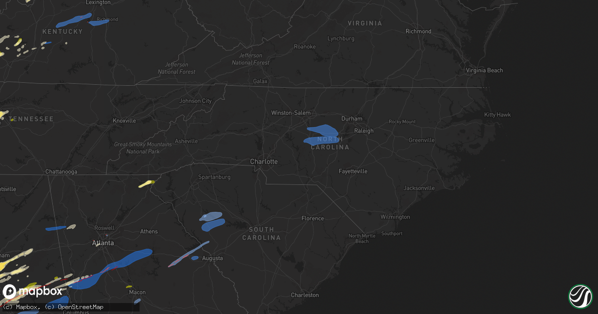
Hail Map in North Carolina on January 12, 2023
Get this storm
January 12 map
$229
one time, instant access
Download today. No call, no setup
Keep the $229
Bought the map and want the full workflow? Apply the entire $229 to a subscription within 7 days. None of it is wasted.
Every map, not just this one
This buys you this map. Subscription and you get every map we run, in the markets you choose from a few cities to whole states to nationwide. Plus real-time alerts the moment a storm fires.
Contact data
Name, contact info, occupancy, even credit band for addresses in the footprint. You go from where it hit to who to call.
Become the source they trust
Unlimited branding weather history reports on demand. You already have the documented answer ready for the property owner, and you are the one who showed up with it.
Property data and RoofTrace estimates
Pull up any address you have got, its value and the exact code rules for that jurisdiction, straight from One Click Code. Then RoofTrace estimates the squares, pitch, and roof value, priced the way you price.
Storm reports in North Carolina
North Carolina
| Date | Description |
|---|---|
| 01/12/20235:58 PM CST | Social media report of a tree down in harrisburg. |
| 01/12/20235:55 PM CST | Falling trees damaged power equipment resulting in a power outage. |
| 01/12/20235:55 PM CST | Emergency manager reports tree down on a house at tall oaks trail. |
| 01/12/20235:53 PM CST | Tree down on stokes ferry rd 4 miles southeast of salisbury. |
| 01/12/20235:30 PM CST | Reports of multiple trees down in wintrow creek rd and shinville rd. |
| 01/12/20235:25 PM CST | Reports of multiple trees down in southern iredell county. |
| 01/12/20235:25 PM CST | Report of tree down blocking highway at the intersection of moose club rd and skyuka rd. |
| 01/12/20235:15 PM CST | Shutters blown off a home in stanley. |
| 01/12/20235:13 PM CST | Power lines down in gastonia. |
| 01/12/20235:12 PM CST | Reports of numerous tress... Powerlines down... And a few blown transformers across gaston county. |
| 01/12/20235:12 PM CST | Reports of multiple trees down at randleman and highway 27 in iron station. |
| 01/12/20235:10 PM CST | An ef0 tornado touched down near old willis school road and tracked east... Crossing highway 27 on the south side of stanley. The storm continued moving east... Eventua |
| 01/12/20235:06 PM CST | 911 call center reports multiple trees down in serenity woods. |
| 01/12/20235:00 PM CST | Reports of numerous trees and powerlines down across lincoln county. |
| 01/12/20234:55 PM CST | Tree fell onto a swing set. |
| 01/12/20234:42 PM CST | 911 call center reports numerous trees and powerlines down across cleveland county and downtown shelby. |
| 01/12/20234:40 PM CST | 911 call center reports road blocked due to large tree. Had to call ncdot to have it removed. |
| 01/12/20234:36 PM CST | *** 1 inj *** 911 call center reports a tree fell on vehicle and lead to one person being injured on the intersection of skinner rd and winter circle. |
| 01/12/20234:36 PM CST | 911 call center reports multiple trees down on goode rd and pebble rd. |
| 01/12/20234:24 PM CST | Corrects previous tstm wnd dmg report from 1 w harris. Reports of numerous trees down and a few powerlines across rutherford county. |
| 01/12/20233:36 PM CST | 911 call center reports multiple trees down across polk county and quarter to half inch sized hail. |
| 01/12/20233:24 PM CST | Reports of numerous trees down and a few powerlines across rutherford county. |
| 01/12/20231:00 PM CST | Tiny home knocked of its base off of nc-212 and multiple trees reported down across madison county. |
| 01/12/20237:05 AM CST | Tree down on powerlines resulting in power outage. Time estimated by radar. |
| 01/12/202312:40 AM CST | Delayed report. |
| 01/11/20238:50 PM CST | Tree down on powerlines. Time estimated by radar. |
| 01/11/20238:40 PM CST | 1 tree down on smithfield rd at wake/johnston county line. |
| 01/11/20238:12 PM CST | Two trees fell and knocked down a powerline. |
| 01/11/20237:49 PM CST | Roof blown off a building near the intersection of n. Lasalle street and hillsborough rd. In durham. |
| 01/11/20237:35 PM CST | Trees down county wide. |
| 01/11/20237:23 PM CST | Trees down county wide. |
| 01/11/20237:17 PM CST | 1 tree down on george p rd. |
| 01/11/20237:15 PM CST | Trees down at clark rd and crutchfield rd. |
| 01/11/20237:15 PM CST | Trees down on tom stevens rd. |
| 01/11/20237:05 PM CST | Corrects previous tstm wnd dmg report from 2 e carr. Tree down on powerlines resulting in power outage. Time estimated by radar. |
| 01/11/20236:46 PM CST | Trees down along caudle rd. |
| 01/11/20236:27 PM CST | Trees down on church st. |
| 01/11/20236:21 PM CST | 1 tree down at nc-8 and dry creek lane. |
| 01/11/20236:10 PM CST | Trees down in the vicinity of miami church rd and mt pleasant rd. |
| 01/11/20236:06 PM CST | Social media picture of a tree down in mint hill. |
| 01/11/20236:05 PM CST | Tree down near intersection of zion church rd and flowes store rd. |
| 01/11/20236:00 PM CST | Tree down near browns summit. Time estimated by radar. |
All States Impacted by Hail Map on January 12, 2023
Cities Impacted by Hail Map on January 12, 2023
- Oak Vale, MS
- Monticello, MS
- Prentiss, MS
- Bassfield, MS
- Carson, MS
- Silver Creek, MS
- Jayess, MS
- Carthage, MS
- Aberdeen, MS
- Latham, OH
- Peebles, OH
- Bainbridge, OH
- Waverly, OH
- Hillsboro, OH
- Lewisburg, KY
- Bowling Green, KY
- Morgantown, KY
- Bee Spring, KY
- Leitchfield, KY
- Clarkson, KY
- Meridian, MS
- Collinsville, MS
- Marion, MS
- Emelle, AL
- Scooba, MS
- Springfield, KY
- Harrodsburg, KY
- Wilmore, KY
- Mackville, KY
- Lancaster, KY
- Nicholasville, KY
- Saint Francis, KY
- Perryville, KY
- Lebanon, KY
- Loretto, KY
- Richmond, KY
- Paint Lick, KY
- Danville, KY
- Falmouth, KY
- Dry Ridge, KY
- Williamstown, KY
- Russellville, KY
- Greensburg, KY
- Summersville, KY
- Siler City, NC
- Randleman, NC
- Pittsboro, NC
- Liberty, NC
- Asheboro, NC
- Snow Camp, NC
- Sophia, NC
- Staley, NC
- Franklinville, NC
- Climax, NC
- Ramseur, NC
- Bear Creek, NC
- Bennett, NC
- Goldston, NC
- Seagrove, NC
- Sanford, NC
- Moncure, NC
- Ninety Six, SC
- Chappells, SC
- Mountville, SC
- Kinards, SC
- Greenwood, SC
- Newberry, SC
- Waterloo, SC
- Abbeville, SC
- Silverstreet, SC
- Cross Hill, SC
- Saluda, SC
- Troy, SC
- Bradley, SC
- Decatur, AL
- Moulton, AL
- Trinity, AL
- Tanner, AL
- Madison, AL
- Fayette, AL
- Carbon Hill, AL
- Eldridge, AL
- Boligee, AL
- Akron, AL
- Eutaw, AL
- Knoxville, AL
- Centreville, AL
- Duncanville, AL
- West Blocton, AL
- Gainesville, AL
- Epes, AL
- Moundville, AL
- Waverly, AL
- Auburn University, AL
- Notasulga, AL
- Opelika, AL
- Auburn, AL
- Cusseta, AL
- Salem, AL
- Valley, AL
- Montgomery, AL
- Shorter, AL
- Lowndesboro, AL
- Hope Hull, AL
- Tyler, AL
- Tuskegee, AL
- Hayneville, AL
- Selma, AL
- Cecil, AL
- Pike Road, AL
- Wetumpka, AL
- Tallassee, AL
- Range, AL
- Dozier, AL
- Elba, AL
- Ariton, AL
- Castleberry, AL
- Brantley, AL
- Evergreen, AL
- Atmore, AL
- McKenzie, AL
- Abbeville, AL
- Red Level, AL
- Clio, AL
- Opp, AL
- Repton, AL
- Georgetown, GA
- Morris, GA
- Lenox, AL
- Cuthbert, GA
- Dawson, GA
- Brundidge, AL
- Skipperville, AL
- Coleman, GA
- Louisville, AL
- Clayton, AL
- Eufaula, AL
- Clopton, AL
- Jack, AL
- Andalusia, AL
- Troy, AL
- Fort Gaines, GA
- Brewton, AL
- Shellman, GA
- Glenwood, AL
- Piedmont, AL
- Cedartown, GA
- Morgan, GA
- Headland, AL
- Arlington, GA
- Blakely, GA
- Leary, GA
- Columbia, AL
- Damascus, GA
- Edison, GA
- Bluffton, GA
- Albany, GA
- Belleville, WV
- Mineral Wells, WV
- Washington, WV
- Parkersburg, WV
- Davisville, WV
- Elizabeth, IN
- Laconia, IN
- Antioch, TN
- Nolensville, TN
- La Vergne, TN
- Georgetown, KY
- Columbia, TN
- Culleoka, TN
- Mount Pleasant, TN
- Mammoth Cave, KY
- Cave City, KY
- Phil Campbell, AL
- Nashville, TN
- Brentwood, TN
- Hardyville, KY
- Canmer, KY
- Goodwater, AL
- Sylacauga, AL
- Weogufka, AL
- Cub Run, KY
- Silas, AL
- Caneyville, KY
- Horse Branch, KY
- Cromwell, KY
- Horse Cave, KY
- Munfordville, KY
- Lewisburg, TN
- Elk Horn, KY
- Dunmor, KY
- Jeffersonville, IN
- Franklin, TN
- Hermitage, TN
- Mount Juliet, TN
- Pine Hill, AL
- Sawyerville, AL
- Greensboro, AL
- Anniston, AL
- Lincoln, AL
- Eastaboga, AL
- Thomasville, AL
- Beaverton, AL
- Hamilton, AL
- Haleyville, AL
- Guin, AL
- Bear Creek, AL
- Brilliant, AL
- Cynthiana, KY
- Sadieville, KY
- Magnolia, KY
- Deatsville, AL
- Equality, AL
- Marbury, AL
- Titus, AL
- Rockford, AL
- Five Points, AL
- Lafayette, AL
- Roanoke, AL
- Wadley, AL
- Daviston, AL
- Camp Hill, AL
- Columbiana, AL
- Birmingham, AL
- Pelham, AL
- Chelsea, AL
- Coxs Mills, WV
- Smithville, WV
- Auburn, WV
- Bon Aqua, TN
- Lyles, TN
- Nunnelly, TN
- Brownsville, KY
- Porterville, MS
- De Kalb, MS
- Union, MS
- Taylorsville, MS
- Taylorsville, GA
- Rockmart, GA
- Aragon, GA
- Butler, AL
- Rhine, GA
- Milan, GA
- Eastman, GA
- Chauncey, GA
- Dothan, AL
- Vincent, AL
- Leakesville, MS
- Stanton, TN
- Alpine, AL
- Talladega, AL
- Henderson, TN
- Finger, TN
- Sumner, GA
- Ty Ty, GA
- Doerun, GA
- Sylvester, GA
- Poulan, GA
- Cedarbluff, MS
- West Point, MS
- Jones, AL
- Canton, MS
- Tuscaloosa, AL
- Brookwood, AL
- Vinegar Bend, AL
- Deer Park, AL
- Citronelle, AL
- Clayton, GA
- Tiger, GA
- Jacksons Gap, AL
- Poplarville, MS
- Lebanon, TN
- Lauderdale, MS
- Cuba, AL
- Mercer, TN
- Brownsville, TN
- Medon, TN
- Whiteville, TN
- Childersburg, AL
- Greenville, GA
- Hogansville, GA
- West Point, GA
- Mantee, MS
- Pheba, MS
- York, AL
- Livingston, AL
- Toomsuba, MS
- Cherokee, AL
- Florence, AL
- Waterloo, AL
- Toxey, AL
- Safford, AL
- Linden, AL
- Thomaston, AL
- Catherine, AL
- Magnolia, AL
- Sweet Water, AL
- Dixons Mills, AL
- Jackson, OH
- Beaver, OH
- Hartford, AL
- Slocomb, AL
- Saint Marys, WV
- Waverly, WV
- Mount Vernon, AL
- Lucedale, MS
- Chunchula, AL
- Clarkesville, GA
- Lakemont, GA
- Alabaster, AL
- Prattville, AL
- Pachuta, MS
- Quitman, MS
- Cropwell, AL
- Tifton, GA
- Sterrett, AL
- Folsom, LA
- Ocilla, GA
- Lagrange, GA
- Chattahoochee, FL
- Calera, AL
- Sardinia, OH
- Georgetown, OH
- Millry, AL
- Frankville, AL
- Jackson, AL
- Waynesboro, MS
- Coffeeville, AL
- Buckatunna, MS
- Shubuta, MS
- Smiths Grove, KY
- Sardis, AL
- Orrville, AL
- Minter, AL
- Rochelle, GA
- Pitts, GA
- Vienna, GA
- Chula, GA
- Laurel, MS
- Stringer, MS
- Heidelberg, MS
- Vossburg, MS
- Shuqualak, MS
- Hickory, MS
- Chunky, MS
- Decatur, MS
- Arabi, GA
- Cordele, GA
- Kellyton, AL
- Alexander City, AL
- Lena, MS
- Shelby, AL
- Pineview, GA
- Cobb, GA
- De Soto, GA
- Abbeville, GA
- Billingsley, AL
- Autaugaville, AL
- Marion Junction, AL
- Melvin, AL
- Needham, AL
- Gilbertown, AL
- Sneads, FL
- Lower Peach Tree, AL
- Dickinson, AL
- Grove Hill, AL
- Montevallo, AL
- Helena, AL
- Brierfield, AL
- Randolph, AL
- Wilsonville, AL
- McRae Helena, GA
- Verbena, AL
- Luthersville, GA
- Coy, AL
- Vredenburgh, AL
- Marianna, FL
- Altha, FL
- Quincy, FL
- Grand Ridge, FL
- Harpersville, AL
- Pell City, AL
- Munford, AL
- Oxford, AL
- Fitzgerald, GA
- Camden, AL
- Philadelphia, MS
- Pine Apple, AL
- Franklin, GA
- Cadwell, GA
- Warwick, GA
- Jetson, KY
- Roundhill, KY
- Atlanta, GA
- Brandon, MS
- Walnut Grove, MS
- Samson, AL
- Sharon Grove, KY
- Iron City, TN
- Iuka, MS
- Lanett, AL
- Macon, MS
- Dadeville, AL
- Uniontown, AL
- Bay Springs, MS
- Newton, MS
- Brent, AL
- Marion, AL
- Forkland, AL
- Ovett, MS
- Gordon, AL
- Jakin, GA
- Buhl, AL
- Ralph, AL
- Northport, AL
- Jemison, AL
- Clanton, AL
- Geneva, AL
- Defuniak Springs, FL
- Arlington, AL
- Franklinton, LA
- Loranger, LA
- Sycamore, GA
- Baconton, GA
- Newton, GA
- Ashburn, GA
- Ellisville, MS
- Gay, GA
- Molena, GA
- Monticello, GA
- Mcdonough, GA
- Williamson, GA
- Buckhead, GA
- Jenkinsburg, GA
- Concord, GA
- Rutledge, GA
- Shady Dale, GA
- Mansfield, GA
- Greensboro, GA
- Newborn, GA
- Pine Mountain, GA
- Brooks, GA
- Woodbury, GA
- Warm Springs, GA
- Griffin, GA
- Madison, GA
- Jackson, GA
- Covington, GA
- Hampton, GA
- Locust Grove, GA
- Thomson, GA
- Norwood, GA
- Clarks Hill, SC
- Sparta, GA
- Appling, GA
- Edgefield, SC
- Camak, GA
- Modoc, SC
- Warrenton, GA
- Harlem, GA
- Dearing, GA
- Smithville, GA
- Americus, GA
- Leesburg, GA
- Bronwood, GA
- Leslie, GA
- Centerville, GA
- Macon, GA
- Warner Robins, GA
- Colquitt, GA
- Camilla, GA
- Double Springs, AL
- Pleasureville, KY
- Lithia Springs, GA
- Austell, GA
- Juliette, GA
- Alamo, GA
- Murfreesboro, TN
- Lascassas, TN


