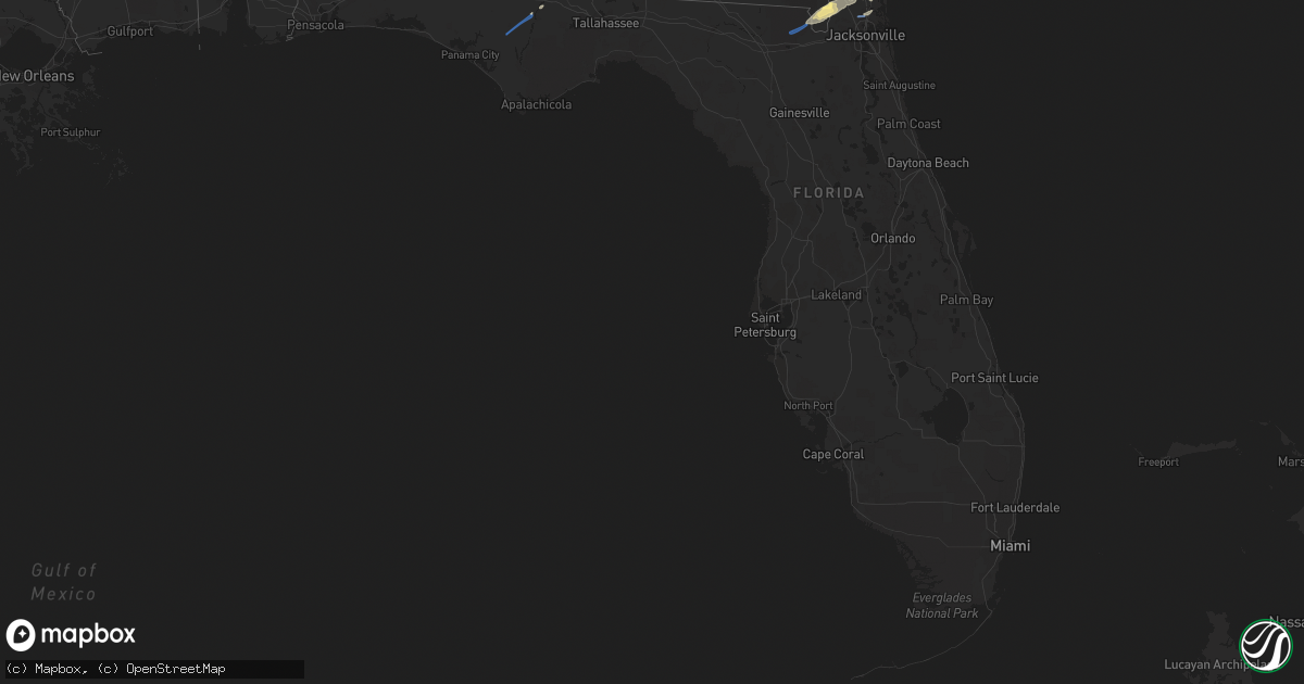
Hail Map in Florida on January 4, 2023
Get this storm
January 4 map
$229
one time, instant access
Download today. No call, no setup
Keep the $229
Bought the map and want the full workflow? Apply the entire $229 to a subscription within 7 days. None of it is wasted.
Every map, not just this one
This buys you this map. Subscription and you get every map we run, in the markets you choose from a few cities to whole states to nationwide. Plus real-time alerts the moment a storm fires.
Contact data
Name, contact info, occupancy, even credit band for addresses in the footprint. You go from where it hit to who to call.
Become the source they trust
Unlimited branding weather history reports on demand. You already have the documented answer ready for the property owner, and you are the one who showed up with it.
Property data and RoofTrace estimates
Pull up any address you have got, its value and the exact code rules for that jurisdiction, straight from One Click Code. Then RoofTrace estimates the squares, pitch, and roof value, priced the way you price.
Storm reports in Florida
Florida
| Date | Description |
|---|---|
| 01/04/20232:30 PM CST | Corrects previous tstm wnd gst report from 2 ne jacksonville inter. Asos station kjax jacksonville intl airport report gust of 65 mph wind. |
| 01/04/20232:25 PM CST | Report of down tree caused by thunderstorm winds. |
| 01/04/20232:05 PM CST | Report of down trees. |
| 01/04/202310:55 AM CST | Jefferson county emergency management reported a downed tree across both lanes on watermill rd. |
| 01/04/20239:55 AM CST | Corrects previous tstm wnd dmg report from 3 nw waukeenah. Jefferson county emergency management reported a downed tree across both lanes on watermill rd. |
| 01/04/20239:20 AM CST | One tree down at the intersection of bloxham cutoff and wakulla springs highway. |
| 01/04/20238:30 AM CST | One tree down along sr-30a. |
| 01/04/20238:25 AM CST | Law enforcement scanner reported a tree down along highway 20 eastbound lane. |
| 01/04/20237:42 AM CST | Two large trees down on highway 71 south of magnolia rd. Several sheets of plywood blown onto the highway from an under construction hotel parking lot. |
| 01/04/20237:41 AM CST | Large tree fell and is covering highway 73 between button ln. And hasty pond rd. |
| 01/04/20237:41 AM CST | Powerline down at pondview ln. |
| 01/04/20237:30 AM CST | One powerline down at the intersection of piney grove rd. And tumblebug ln. Time estimated based off radar. |
| 01/04/20237:00 AM CST | Tree down on a shed. |
| 01/04/20236:45 AM CST | Two large pines reported down across bonita dr. |
| 01/04/20236:14 AM CST | At 1214 PM EST, severe thunderstorms were located along a line extending from 6 miles north of Cogdell to 7 miles east of Mayday to 6 miles east of Jennings to near Blue Springs, moving northeast at 45 mph. HAZARD...60 mph wind gusts and quarter size hail. SOURCE...Radar indicated. IMPACT...Hail damage to vehicles is expected. Expect wind damage to roofs, siding, and trees. Locations impacted include... Jasper, Homerville, Jennings, White Springs, Fargo, Argyle, Statenville, Suwannee River State Park, Suwannee Springs and Du Pont. |
| 01/04/20235:39 AM CST | At 1139 AM EST, severe thunderstorms were located along a line extending from 6 miles south of Lakeland to 6 miles southwest of Madison, moving east at 40 mph. HAZARD...60 mph wind gusts and quarter size hail. SOURCE...Radar indicated. IMPACT...Hail damage to vehicles is expected. Expect wind damage to roofs, siding, and trees. Locations impacted include... Live Oak, Jasper, Jennings, White Springs, Fargo, Statenville, Suwannee River State Park, Suwannee Springs, Mayday and Belmont. |
| 01/04/20233:43 AM CST | At 942 AM EST, severe thunderstorms were located along a line extending from near Newton to 10 miles north of Quincy, moving east at 45 mph. HAZARD...60 mph wind gusts. SOURCE...Radar indicated. IMPACT...Expect damage to roofs, siding, and trees. Locations impacted include... Newton, Moultrie, Thomasville, Cairo, Pelham, Camilla, Doerun, Ochlocknee, Coolidge, Whigham, Riverside, Schley, Funston, Sale City, Capel, Dillon, Rocky Hill, Merrillville, Harrells Still and Calvary. |
| 01/04/20233:17 AM CST | At 916 AM EST/816 AM CST/, severe thunderstorms were located along a line extending from near Blountstown to 6 miles west of Wewahitchka to 7 miles northeast of Mexico Beach to 11 miles southwest of Port St. Joe, moving northeast at 45 mph. HAZARD...60 mph wind gusts. SOURCE...Radar indicated. IMPACT...Expect damage to roofs, siding, and trees. Locations impacted include... Eastpoint, Apalachicola, St George Island, Port St. Joe, Blountstown, Mexico Beach, Stonemill Creek, Orange, Franklin, Wewahitchka, Honeyville, Jewel Fire Tower, Abe Springs, Vilas, Chipola Cutoff, Central City, Cape San Blas, Beverly, Overstreet and Scotts Ferry. |
| 01/04/20233:07 AM CST | At 907 AM EST/807 AM CST/, severe thunderstorms were located along a line extending from near Donalsonville to near Chattahoochee to near Blountstown, moving east at 25 mph. HAZARD...60 mph wind gusts. SOURCE...Radar indicated. IMPACT...Expect damage to roofs, siding, and trees. Locations impacted include... Quincy, Blountstown, Havana, Marianna, Bainbridge, Midway, Chattahoochee, Greensboro, West Bainbridge, Sneads, Gretna, Bristol, Grand Ridge, Greenwood, Altha, Attapulgus, Climax, Brinson, Bascom and Rock Bluff. |
| 01/04/20232:58 AM CST | At 858 AM EST/758 AM CST/, severe thunderstorms were located along a line extending from 12 miles southeast of Columbia to 9 miles west of Donalsonville, moving east at 55 mph. HAZARD...60 mph wind gusts. SOURCE...Radar indicated. IMPACT...Expect damage to roofs, siding, and trees. Locations impacted include... Colquitt, Donalsonville, Gordon, Iron City, Brinson, Jakin, Saffold, Ausmac, Babcock, Crosby, Little Hope, Mayhaw, Boykin, Sharphagen, Donaldsonville A/P, Bellview, Vada, Hopeful, Howards Mill and Davis Park. |
| 01/04/202312:19 AM CST | At 619 AM CST, a severe thunderstorm was located 7 miles south of Eglin Air Force Base, or 8 miles north of Santa Rosa Beach, moving northeast at 45 mph. HAZARD...60 mph wind gusts. SOURCE...Radar indicated. IMPACT...Expect damage to roofs, siding, and trees. Locations impacted include... Vernon, De Funiak Springs, Santa Rosa Beach, Eglin Air Force Base, Live Oak, Freeport, Ponce De Leon, Caryville, Westville, Ebro, Hinsons Crossroads, Portland, Cerrogordo, Rock Hill, Holmes Valley, Millers Ferry, Knox Hill, Hickory Hill, Argyle and Red Bay. |
| 01/03/202311:55 PM CST | At 555 AM CST, a severe thunderstorm was located 4 miles south of Fort Walton Beach, moving northeast at 50 mph. HAZARD...60 mph wind gusts. SOURCE...Radar indicated. IMPACT...Expect damage to roofs, siding, and trees. Locations impacted include... Fort Walton Beach, Niceville, Destin, Eglin AFB, Valparaiso, Mary Esther, Ocean City, Lake Lorraine, Shalimar and Cinco Bayou. |
| 01/03/202311:14 PM CST | At 514 PM EST, a severe thunderstorm was located over Saint Augustine Shores, or 7 miles south of Saint Augustine, moving northeast at 45 mph. HAZARD...60 mph wind gusts and penny size hail. SOURCE...Radar indicated. IMPACT...Expect damage to roofs, siding, and trees. Locations impacted include... Saint Augustine Beach, Marineland, Crescent Beach, Saint Augustine Shores, Butler Beach, Saint Augustine South, Dupont Center and Elkton. |
| 01/03/202310:14 PM CST | At 414 PM EST, severe thunderstorms were located along a line extending from near Mayport to Bayard to near Bardin, moving northeast at 55 mph. HAZARD...60 mph wind gusts and penny size hail. SOURCE...Radar indicated. IMPACT...Expect damage to roofs, siding, and trees. Locations impacted include... Ponte Vedra Beach, Jacksonville Beach, Atlantic Beach, Neptune Beach, World Golf Village, Sawgrass, Mayport, Nocatee, San Pablo and Palm Valley. |
| 01/03/202310:05 PM CST | At 405 AM CST, a severe thunderstorm was located over Prichard, moving northeast at 40 mph. HAZARD...60 mph wind gusts. SOURCE...Radar indicated. IMPACT...Expect damage to roofs, siding, and trees. Locations impacted include... Midtown Mobile, Downtown Mobile, Prichard, Saraland, Bay Minette, Chickasaw, Stapleton, I65 And AL 225, I65 And I165 and I10 And I65. |
| 01/03/20239:57 PM CST | At 357 PM EST, severe thunderstorms were located along a line extending from near Starke to near Hawthorne to 9 miles southwest of Cross Creek, moving east at 55 mph. HAZARD...70 mph wind gusts. SOURCE...Radar indicated. IMPACT...Expect considerable tree damage. Damage is likely to mobile homes, roofs, and outbuildings. Locations impacted include... Palatka, Interlachen, Keystone Heights, Melrose, East Palatka, Citra, Fort McCoy, Hawthorne, Lake Delancy and Florahome. |
| 01/03/20239:44 PM CST | At 344 PM EST, severe thunderstorms were located along a line extending from near Ratliff to near Middleburg to 6 miles north of Gainesville Airport, moving northeast at 55 mph. HAZARD...70 mph wind gusts and penny size hail. SOURCE...Radar indicated. IMPACT...Expect considerable tree damage. Damage is likely to mobile homes, roofs, and outbuildings. Locations impacted include... Orange Park, Green Cove Springs, Starke, Unf, Mandarin, Fruit Cove, Arlington, Middleburg, Baymeadows and Ortega. |
| 01/03/20239:14 PM CST | At 313 PM EST, a severe thunderstorm was located 7 miles south of Alachua, or 10 miles west of Gainesville, moving northeast at 40 mph. HAZARD...70 mph wind gusts and quarter size hail. Possible tornado. SOURCE...Radar indicated. IMPACT...Hail damage to vehicles is expected. Expect considerable tree damage. Wind damage is also likely to mobile homes, roofs, and outbuildings. Locations impacted include... Gainesville, Keystone Heights, Melrose, Citra, Alachua, High Springs, Hawthorne, Archer, University Of Florida and Sparr. |
| 01/03/20238:50 PM CST | At 249 PM EST, severe thunderstorms were located along a line extending from 7 miles west of St. George to near Upland Pines to near High Springs, moving east at 40 mph. HAZARD...60 mph wind gusts and penny size hail. SOURCE...Radar indicated. IMPACT...Expect damage to roofs, siding, and trees. Locations impacted include... Lake Butler, Raiford, Taylor, Macclenny, Glen St. Mary, Palestine Community, Providence, Lulu, Olustee and Sanderson. |
| 01/03/20238:43 PM CST | At 242 PM EST, severe thunderstorms were located along a line extending from 8 miles north of St. George to near Fort White, moving east at 35 mph. HAZARD...60 mph wind gusts and half dollar size hail. SOURCE...Radar indicated. IMPACT...Hail damage to vehicles is expected. Expect wind damage to roofs, siding, and trees. Locations impacted include... Gainesville, Trenton, Worthington Spring, Alachua, High Springs, Archer, Fort White, Worthington Springs, University Of Florida and Groves. |
| 01/03/20238:40 PM CST | At 240 PM EST, severe thunderstorms were located along a line extending from Fort White to Trenton, moving east at 45 mph. HAZARD...60 mph wind gusts and penny size hail. SOURCE...Radar indicated. IMPACT...Expect damage to roofs, siding, and trees. Locations impacted include... Gainesville, Trenton, Worthington Spring, Alachua, High Springs, Archer, Fort White, Worthington Springs, University Of Florida and Groves. |
| 01/03/20238:17 PM CST | At 217 PM EST, severe thunderstorms were located along a line extending from 11 miles northwest of Taylor to 6 miles west of Ichetucknee Spring, moving east at 25 mph. HAZARD...60 mph wind gusts and penny size hail. SOURCE...Radar indicated. IMPACT...Expect damage to roofs, siding, and trees. Locations impacted include... Lake City, Lake Butler, Callahan, Worthington Spring, Ichetucknee Spring, Columbia, Taylor, Macclenny, Fort White and Glen St. Mary. |
| 01/03/20237:47 PM CST | At 147 PM EST, a severe thunderstorm was located 9 miles northeast of Homeland, or 10 miles northeast of Folkston, moving east at 50 mph. HAZARD...60 mph wind gusts and quarter size hail. SOURCE...Radar indicated. IMPACT...Hail damage to vehicles is expected. Expect wind damage to roofs, siding, and trees. Locations impacted include... St. Marys, Kingsland, Woodbine, Kings Bay Base, Jekyll Island, High Point, Tarboro, Harrietts Bluff, Dover Bluff and Dungeness. |
| 01/03/20237:32 PM CST | At 131 PM EST, severe thunderstorms were located along a line extending from 8 miles south of Fargo to White Springs, moving east at 40 mph. HAZARD...60 mph wind gusts and penny size hail. SOURCE...Radar indicated. IMPACT...Expect damage to roofs, siding, and trees. Locations impacted include... White Springs, Taylor, Winfield, Suwannee Valley, St. George and Five Points. |
| 01/03/20237:11 PM CST | At 110 PM EST, severe thunderstorms were located along a line extending from near Screven to near Nahunta to Race Pond to 12 miles northwest of Taylor, moving east at 50 mph. HAZARD...60 mph wind gusts and quarter size hail. SOURCE...Radar indicated. IMPACT...Hail damage to vehicles is expected. Expect wind damage to roofs, siding, and trees. Locations impacted include... Kingsland, Brunswick, Jesup, Hilliard, Folkston, Woodbine, Callahan, Nahunta, Patterson and Dock Junction. |
All States Impacted by Hail Map on January 4, 2023
Cities Impacted by Hail Map on January 4, 2023
- Gordon, AL
- Jakin, GA
- Yulee, FL
- Williamston, NC
- Quitman, GA
- Blountstown, FL
- Blakely, GA
- Saint George, GA
- Hilliard, FL
- Jacksonville, FL
- Woodbine, GA
- White Oak, GA
- Folkston, GA
- Malone, FL
- Marianna, FL
- Callahan, FL
- Bryceville, FL
- Bristol, FL
- Robersonville, NC
- Bethel, NC
- Saint Marys, GA
- Kings Bay, GA
- Sanderson, FL
- Altha, FL
- Clarksville, FL
- Stedman, NC
- Roseboro, NC
- Parkton, NC
- Clinton, NC
- Autryville, NC
- Fayetteville, NC
- Salemburg, NC
- Hope Mills, NC
- Zebulon, NC
- Wendell, NC
- Middlesex, NC
- Stokes, NC
- Fountain, NC
- Walstonburg, NC
- Farmville, NC
- Greenville, NC
- Jackson, SC
- Williston, SC
- Tennille, GA
- Bartow, GA
- Waynesboro, GA
- Windsor, SC
- Louisville, GA
- Sandersville, GA
- Aiken, SC
- New Ellenton, SC
- Stapleton, GA
- Augusta, GA
- Hephzibah, GA
- Wrens, GA
- Blythe, GA
- Springfield, SC
- Avera, GA
- Blackville, SC
- Keysville, GA
- Davisboro, GA
- Swansea, SC
- Wagener, SC
- Salley, SC
- North, SC
- Saint Matthews, SC
- Stockton, GA
- Millwood, GA
- Waycross, GA
- Axson, GA
- Nicholls, GA
- Colquitt, GA
- Lexington, SC
- New Bern, NC
- Aurora, NC
- Waverly, GA


