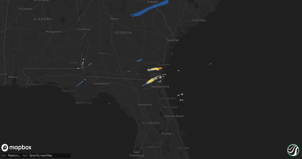
Hail Map on January 4, 2023
Get this storm
January 4 map
$229
one time, instant access
Download today. No call, no setup
Keep the $229
Bought the map and want the full workflow? Apply the entire $229 to a subscription within 7 days. None of it is wasted.
Every map, not just this one
This buys you this map. Subscription and you get every map we run, in the markets you choose from a few cities to whole states to nationwide. Plus real-time alerts the moment a storm fires.
Contact data
Name, contact info, occupancy, even credit band for addresses in the footprint. You go from where it hit to who to call.
Become the source they trust
Unlimited branding weather history reports on demand. You already have the documented answer ready for the property owner, and you are the one who showed up with it.
Property data and RoofTrace estimates
Pull up any address you have got, its value and the exact code rules for that jurisdiction, straight from One Click Code. Then RoofTrace estimates the squares, pitch, and roof value, priced the way you price.
States Impacted by Hail Map on January 4, 2023
Storm reports
South Carolina
| Date | Description |
|---|---|
| 01/04/202312:20 PM CST | Few trees uprooted/snapped and power lines down near the intersection of juniper bay rd and johnson shortcut rd. |
| 01/04/202311:11 AM CST | A tree down along with powerlines was reported in the 1400 block of peirce road. |
| 01/04/202310:00 AM CST | Sc highway patrol reported trees in roadway at mcmillan and cannon bridge road. Time estimated by radar. |
| 01/04/20239:50 AM CST | Incorrect location and after further investigation no damage was found at this location. Damage was found nearby on gator road. Corrects previous tstm wnd dmg report fr |
| 01/04/20239:50 AM CST | Possible tornado. |
| 01/04/20239:50 AM CST | Corrects previous tstm wnd dmg report from 1 wsw south congaree. Incorrect location and will be investigated further. Public report of numerous structures damaged in bl |
| 01/04/20239:50 AM CST | Public report of numerous structures damaged in blue ridge terrace. Tornado possible. Time estimated by radar. |
| 01/04/20239:48 AM CST | Trees down and damage to a carport in the 1400 block of woodford road. Possible tornado damage. |
| 01/04/20239:45 AM CST | Public report of tree damage and missing garbage cans on old orangeburg rd between platt springs rd and 302. Possible tornado. Time estimated from radar. |
| 01/04/20239:45 AM CST | Lexington pd reported trees and power line down along calks ferry road. Tornadoes possible. Time estimated. |
| 01/04/20239:45 AM CST | Lexington pd reported tree down on powerline on liberty hill road. Tornado possible. Time estimated. |
| 01/04/20239:44 AM CST | A national weather service survey team confirmed an ef-0 tornado with peak winds of 75 mph that tracked across central lexington county... North of shuler. The tornado |
| 01/04/20239:43 AM CST | Multiple trees down near the intersection of highway 178 and pools mill road. Possible tornado. Time estimated from radar. |
| 01/04/20239:33 AM CST | Mobile home blown off of foundation on nick street... Trapping a women. No reported injuries. A tin roof was also damaged at a day care in this same general vicinity. |
| 01/04/20239:33 AM CST | Corrects previous tstm wnd dmg report from 1 ne blackville. Mobile home blown off of foundation on nick street... Trapping a women. No reported injuries. About 30 or mo |
| 01/04/20239:33 AM CST | Building collapse and power lines down in sally on depot ave ne. |
| 01/04/20239:28 AM CST | Aiken county em reports damage to property on springflower rd near wagener rd. Possible tornado. |
| 01/04/20239:16 AM CST | Couchton fire district reports outbuilding destroyed on farmer rd and hwy 302. |
| 01/04/20238:55 AM CST | Trees and power lines down in jackson... Sc. |
| 01/04/20238:20 AM CST | Trees and branches. |
| 01/04/20238:17 AM CST | Trees and branches. |
| 01/04/20238:15 AM CST | Trees and branches down. |
| 01/04/20238:15 AM CST | Trees and branches down. |
| 01/04/20238:10 AM CST | Trees and branches down. |
| 01/04/20238:10 AM CST | Trees and branches. |
| 01/04/20238:10 AM CST | Trees and branches. |
| 01/04/20238:07 AM CST | Trees and branches. Time estimated from radar. |
| 01/04/20238:05 AM CST | Trees and branches down. |
| 01/04/20238:00 AM CST | Trees and branches down. |
| 01/04/20237:50 AM CST | Mccormick co sc em reported a tree down across the road on hwy 81 near willington... Exact location not provided. Time estimated. |
| 01/04/20235:34 AM CST | At 1133 AM EST, a severe thunderstorm was located over Reevesville, moving east at 40 mph. HAZARD...60 mph wind gusts. SOURCE...Radar indicated. IMPACT...Expect damage to trees and powerlines. Locations impacted include: Saint George, Dorchester, Colleton, Harleyville, Reevesville, Smoaks, Lodge, Williams, Ruffin, Ashton, Canadys, Islandton and Padgetts.This warning includes the following interstates: I-26 between mile markers 171 and 188. I-95 in South Carolina between mile markers 60 and 85. |
| 01/04/20235:19 AM CST | At 1119 AM EST, a severe thunderstorm was located over Kildare, moving east at 45 mph. HAZARD...60 mph wind gusts. SOURCE...Radar indicated. IMPACT...Expect damage to trees and powerlines. Locations impacted include: Newington, Garnett, Egypt, Shawnee, Pineland, Tarboro, Robertville, Clyo and Kildare. |
| 01/04/20235:17 AM CST | At 1116 AM EST, severe thunderstorms were located along a line extending from 8 miles northeast of McEntire Air Base to 6 miles north of Bowman to near Branchville, moving east at 45 mph. HAZARD...60 mph wind gusts. SOURCE...Radar indicated. Wind damage has been reported with these storms! IMPACT...Expect damage to trees and powerlines. Locations impacted include... Columbia, Sumter, Manning, South Sumter, Shaw Air Base, St. Matthews, Holly Hill, Summerton, Bowman, Eastover, Elloree, Oakland, Santee State Park, Mulberry, Alcolu, Woods Bay State Park, Santee Cooper Regional Airport, Elliott, Sumter County Airport and Gadsden.This includes the following highways... Interstate 26 between mile markers 151 and 169. Interstate 95 between mile markers 85 and 146. |
| 01/04/20235:08 AM CST | At 1108 AM EST, a severe thunderstorm was located over Gifford, moving east at 45 mph. HAZARD...60 mph wind gusts. SOURCE...Radar indicated. IMPACT...Expect damage to trees and powerlines. Locations impacted include: Hampton, Lake Warren State Park, Varnville, Brunson, Gifford, Luray, Crocketville, Miley and Almeda Intersection. |
| 01/04/20234:35 AM CST | At 1034 AM EST, severe thunderstorms were located along a line extending from 9 miles south of Red Bank to near Blackville to near Martin, moving east at 45 mph. HAZARD...70 mph wind gusts. SOURCE...Radar indicated. This storm has a history of producing wind damage. IMPACT...Expect considerable tree damage. Damage is likely to mobile homes, roofs, and outbuildings. Locations impacted include... Orangeburg, Barnwell, Bamberg, Denmark, McEntire Air Base, Brookdale, Blackville, St. Matthews, Gaston, Branchville, Bowman, Eastover, Orangeburg County Airport, Barnwell State Park, Congaree National Park, Hopkins, Claflin College, South Carolina State University, Sandy Run and Gadsden.This includes Interstate 26 between mile markers 118 and 162. |
| 01/04/20234:16 AM CST | At 1016 AM EST, severe thunderstorms were located along a line extending from 9 miles west of Dreher Island State Park to Batesburg-Leesville to 8 miles northeast of Ridge Spring to 10 miles northeast of Aiken Municipal Airport, moving northeast at 65 mph. HAZARD...60 mph wind gusts. SOURCE...Radar indicated. IMPACT...Expect damage to trees and powerlines. Locations impacted include... Columbia, Lexington, West Columbia, Cayce, Irmo, Batesburg-Leesville, Springdale, St. Andrews, Oak Grove, Highway 6 at Lake Murray Dam, Red Bank, South Congaree, Pine Ridge, Columbia International University, Harbison State Forest, West Columbia Riverwalk, Dreher Island State Park, Riverbanks Zoo, SC State Farmer's Market and Columbia Metro Airport.This includes the following highways... Interstate 126 between mile markers 0 and 3. Interstate 20 in South Carolina between mile markers 32 and 69. Interstate 26 between mile markers 91 and 120. Interstate 77 between mile markers 0 and 2. |
| 01/04/20233:41 AM CST | At 941 AM EST, a severe thunderstorm was located 7 miles north of Edgefield, or 23 miles southeast of Greenwood, moving east at 25 mph. HAZARD...60 mph wind gusts. SOURCE...Radar indicated. IMPACT...Expect damage to trees and powerlines. Locations impacted include... Edgefield, Saluda, Johnston, Ridge Spring, Saluda County Airport, Edgefield County Airport, Trenton, Ward, Strom Thurmond High School, Saluda Co Sheriff's Office, Good Hope, Harmony, Pleasant Lane, Mt Vintage, Northside Fire Station Main, Emory, Scurry Airport, Hickory Grove, Edgefield Federal Correction Institution and Saluda High School. |
| 01/04/20233:21 AM CST | At 920 AM EST, severe thunderstorms were located along a line extending from near Harlem to near Wadley, moving east at 45 mph. HAZARD...60 mph wind gusts. SOURCE...Radar indicated. IMPACT...Expect damage to trees and powerlines. Locations impacted include... Aiken, North Augusta, Grovetown, Evans, Waynesboro, Martinez, Fort Gordon, Augusta, Clearwater, Belvedere, Hephzibah, Harlem, Jackson, Midville, Glendale, Gough, South Augusta, Midtown, Summerville and Augusta Mall.This includes the following highways... Interstate 20 in Georgia between mile markers 184 and 201. Interstate 20 in South Carolina between mile markers 0 and 16. Interstate 520 in Georgia between mile markers 1 and 15. Interstate 520 in South Carolina between mile markers 16 and 23. |
| 01/04/20232:02 AM CST | At 802 AM EST, a severe thunderstorm was located near Laurens, moving northeast at 55 mph. HAZARD...60 mph wind gusts. SOURCE...Radar indicated. IMPACT...Expect damage to trees and power lines. Locations impacted include... Laurens, Clinton, Ware Shoals, Gray Court, Princeton, Cross Anchor, Enoree, Hickory Tavern, Ora and Shoals Junction. |
Virginia
| Date | Description |
|---|---|
| 01/03/20238:59 PM CST | At 259 PM EST, a severe thunderstorm was located over Courtland, moving northeast at 40 mph. HAZARD...60 mph wind gusts. SOURCE...Radar indicated. IMPACT...Expect damage to trees and powerlines. This severe thunderstorm will be near... Franklin, Sedley and Hunterdale around 310 PM EST. Ivor and Zuni around 325 PM EST. Windsor around 330 PM EST. Isle Of Wight around 335 PM EST.Other locations impacted by this severe thunderstorm includeVicksville, Pons, Berlin, Bethel Church, Indika, Central Hill,Whitley, Collosse, Comet and Walters. |
| 01/03/20238:14 PM CST | At 214 PM EST, a severe thunderstorm was located over Garysburg, moving northeast at 50 mph. HAZARD...60 mph wind gusts. SOURCE...Radar indicated. IMPACT...Expect damage to trees and powerlines. This severe thunderstorm will be near... Seaboard and Claresville around 225 PM EST. Boykins around 240 PM EST. Newsoms around 245 PM EST. Courtland around 250 PM EST. Franklin around 255 PM EST. Sedley around 300 PM EST.Other locations impacted by this severe thunderstorm includePendleton, Gum Forks, Handsom, Bryants Corner, Worrell, PleasantGrove, Pleasant Hill, Sunbeam, Severn and Margarettsville. |
Florida
| Date | Description |
|---|---|
| 01/04/20232:30 PM CST | Corrects previous tstm wnd gst report from 2 ne jacksonville inter. Asos station kjax jacksonville intl airport report gust of 65 mph wind. |
| 01/04/20232:25 PM CST | Report of down tree caused by thunderstorm winds. |
| 01/04/20232:05 PM CST | Report of down trees. |
| 01/04/202310:55 AM CST | Jefferson county emergency management reported a downed tree across both lanes on watermill rd. |
| 01/04/20239:55 AM CST | Corrects previous tstm wnd dmg report from 3 nw waukeenah. Jefferson county emergency management reported a downed tree across both lanes on watermill rd. |
| 01/04/20239:20 AM CST | One tree down at the intersection of bloxham cutoff and wakulla springs highway. |
| 01/04/20238:30 AM CST | One tree down along sr-30a. |
| 01/04/20238:25 AM CST | Law enforcement scanner reported a tree down along highway 20 eastbound lane. |
| 01/04/20237:42 AM CST | Two large trees down on highway 71 south of magnolia rd. Several sheets of plywood blown onto the highway from an under construction hotel parking lot. |
| 01/04/20237:41 AM CST | Powerline down at pondview ln. |
| 01/04/20237:41 AM CST | Large tree fell and is covering highway 73 between button ln. And hasty pond rd. |
| 01/04/20237:30 AM CST | One powerline down at the intersection of piney grove rd. And tumblebug ln. Time estimated based off radar. |
| 01/04/20237:00 AM CST | Tree down on a shed. |
| 01/04/20236:45 AM CST | Two large pines reported down across bonita dr. |
| 01/04/20236:14 AM CST | At 1214 PM EST, severe thunderstorms were located along a line extending from 6 miles north of Cogdell to 7 miles east of Mayday to 6 miles east of Jennings to near Blue Springs, moving northeast at 45 mph. HAZARD...60 mph wind gusts and quarter size hail. SOURCE...Radar indicated. IMPACT...Hail damage to vehicles is expected. Expect wind damage to roofs, siding, and trees. Locations impacted include... Jasper, Homerville, Jennings, White Springs, Fargo, Argyle, Statenville, Suwannee River State Park, Suwannee Springs and Du Pont. |
| 01/04/20235:39 AM CST | At 1139 AM EST, severe thunderstorms were located along a line extending from 6 miles south of Lakeland to 6 miles southwest of Madison, moving east at 40 mph. HAZARD...60 mph wind gusts and quarter size hail. SOURCE...Radar indicated. IMPACT...Hail damage to vehicles is expected. Expect wind damage to roofs, siding, and trees. Locations impacted include... Live Oak, Jasper, Jennings, White Springs, Fargo, Statenville, Suwannee River State Park, Suwannee Springs, Mayday and Belmont. |
| 01/04/20233:43 AM CST | At 942 AM EST, severe thunderstorms were located along a line extending from near Newton to 10 miles north of Quincy, moving east at 45 mph. HAZARD...60 mph wind gusts. SOURCE...Radar indicated. IMPACT...Expect damage to roofs, siding, and trees. Locations impacted include... Newton, Moultrie, Thomasville, Cairo, Pelham, Camilla, Doerun, Ochlocknee, Coolidge, Whigham, Riverside, Schley, Funston, Sale City, Capel, Dillon, Rocky Hill, Merrillville, Harrells Still and Calvary. |
| 01/04/20233:17 AM CST | At 916 AM EST/816 AM CST/, severe thunderstorms were located along a line extending from near Blountstown to 6 miles west of Wewahitchka to 7 miles northeast of Mexico Beach to 11 miles southwest of Port St. Joe, moving northeast at 45 mph. HAZARD...60 mph wind gusts. SOURCE...Radar indicated. IMPACT...Expect damage to roofs, siding, and trees. Locations impacted include... Eastpoint, Apalachicola, St George Island, Port St. Joe, Blountstown, Mexico Beach, Stonemill Creek, Orange, Franklin, Wewahitchka, Honeyville, Jewel Fire Tower, Abe Springs, Vilas, Chipola Cutoff, Central City, Cape San Blas, Beverly, Overstreet and Scotts Ferry. |
| 01/04/20233:07 AM CST | At 907 AM EST/807 AM CST/, severe thunderstorms were located along a line extending from near Donalsonville to near Chattahoochee to near Blountstown, moving east at 25 mph. HAZARD...60 mph wind gusts. SOURCE...Radar indicated. IMPACT...Expect damage to roofs, siding, and trees. Locations impacted include... Quincy, Blountstown, Havana, Marianna, Bainbridge, Midway, Chattahoochee, Greensboro, West Bainbridge, Sneads, Gretna, Bristol, Grand Ridge, Greenwood, Altha, Attapulgus, Climax, Brinson, Bascom and Rock Bluff. |
| 01/04/20232:58 AM CST | At 858 AM EST/758 AM CST/, severe thunderstorms were located along a line extending from 12 miles southeast of Columbia to 9 miles west of Donalsonville, moving east at 55 mph. HAZARD...60 mph wind gusts. SOURCE...Radar indicated. IMPACT...Expect damage to roofs, siding, and trees. Locations impacted include... Colquitt, Donalsonville, Gordon, Iron City, Brinson, Jakin, Saffold, Ausmac, Babcock, Crosby, Little Hope, Mayhaw, Boykin, Sharphagen, Donaldsonville A/P, Bellview, Vada, Hopeful, Howards Mill and Davis Park. |
| 01/04/202312:19 AM CST | At 619 AM CST, a severe thunderstorm was located 7 miles south of Eglin Air Force Base, or 8 miles north of Santa Rosa Beach, moving northeast at 45 mph. HAZARD...60 mph wind gusts. SOURCE...Radar indicated. IMPACT...Expect damage to roofs, siding, and trees. Locations impacted include... Vernon, De Funiak Springs, Santa Rosa Beach, Eglin Air Force Base, Live Oak, Freeport, Ponce De Leon, Caryville, Westville, Ebro, Hinsons Crossroads, Portland, Cerrogordo, Rock Hill, Holmes Valley, Millers Ferry, Knox Hill, Hickory Hill, Argyle and Red Bay. |
| 01/03/202311:55 PM CST | At 555 AM CST, a severe thunderstorm was located 4 miles south of Fort Walton Beach, moving northeast at 50 mph. HAZARD...60 mph wind gusts. SOURCE...Radar indicated. IMPACT...Expect damage to roofs, siding, and trees. Locations impacted include... Fort Walton Beach, Niceville, Destin, Eglin AFB, Valparaiso, Mary Esther, Ocean City, Lake Lorraine, Shalimar and Cinco Bayou. |
| 01/03/202311:14 PM CST | At 514 PM EST, a severe thunderstorm was located over Saint Augustine Shores, or 7 miles south of Saint Augustine, moving northeast at 45 mph. HAZARD...60 mph wind gusts and penny size hail. SOURCE...Radar indicated. IMPACT...Expect damage to roofs, siding, and trees. Locations impacted include... Saint Augustine Beach, Marineland, Crescent Beach, Saint Augustine Shores, Butler Beach, Saint Augustine South, Dupont Center and Elkton. |
| 01/03/202310:14 PM CST | At 414 PM EST, severe thunderstorms were located along a line extending from near Mayport to Bayard to near Bardin, moving northeast at 55 mph. HAZARD...60 mph wind gusts and penny size hail. SOURCE...Radar indicated. IMPACT...Expect damage to roofs, siding, and trees. Locations impacted include... Ponte Vedra Beach, Jacksonville Beach, Atlantic Beach, Neptune Beach, World Golf Village, Sawgrass, Mayport, Nocatee, San Pablo and Palm Valley. |
| 01/03/202310:05 PM CST | At 405 AM CST, a severe thunderstorm was located over Prichard, moving northeast at 40 mph. HAZARD...60 mph wind gusts. SOURCE...Radar indicated. IMPACT...Expect damage to roofs, siding, and trees. Locations impacted include... Midtown Mobile, Downtown Mobile, Prichard, Saraland, Bay Minette, Chickasaw, Stapleton, I65 And AL 225, I65 And I165 and I10 And I65. |
| 01/03/20239:57 PM CST | At 357 PM EST, severe thunderstorms were located along a line extending from near Starke to near Hawthorne to 9 miles southwest of Cross Creek, moving east at 55 mph. HAZARD...70 mph wind gusts. SOURCE...Radar indicated. IMPACT...Expect considerable tree damage. Damage is likely to mobile homes, roofs, and outbuildings. Locations impacted include... Palatka, Interlachen, Keystone Heights, Melrose, East Palatka, Citra, Fort McCoy, Hawthorne, Lake Delancy and Florahome. |
| 01/03/20239:44 PM CST | At 344 PM EST, severe thunderstorms were located along a line extending from near Ratliff to near Middleburg to 6 miles north of Gainesville Airport, moving northeast at 55 mph. HAZARD...70 mph wind gusts and penny size hail. SOURCE...Radar indicated. IMPACT...Expect considerable tree damage. Damage is likely to mobile homes, roofs, and outbuildings. Locations impacted include... Orange Park, Green Cove Springs, Starke, Unf, Mandarin, Fruit Cove, Arlington, Middleburg, Baymeadows and Ortega. |
| 01/03/20239:14 PM CST | At 313 PM EST, a severe thunderstorm was located 7 miles south of Alachua, or 10 miles west of Gainesville, moving northeast at 40 mph. HAZARD...70 mph wind gusts and quarter size hail. Possible tornado. SOURCE...Radar indicated. IMPACT...Hail damage to vehicles is expected. Expect considerable tree damage. Wind damage is also likely to mobile homes, roofs, and outbuildings. Locations impacted include... Gainesville, Keystone Heights, Melrose, Citra, Alachua, High Springs, Hawthorne, Archer, University Of Florida and Sparr. |
| 01/03/20238:50 PM CST | At 249 PM EST, severe thunderstorms were located along a line extending from 7 miles west of St. George to near Upland Pines to near High Springs, moving east at 40 mph. HAZARD...60 mph wind gusts and penny size hail. SOURCE...Radar indicated. IMPACT...Expect damage to roofs, siding, and trees. Locations impacted include... Lake Butler, Raiford, Taylor, Macclenny, Glen St. Mary, Palestine Community, Providence, Lulu, Olustee and Sanderson. |
| 01/03/20238:43 PM CST | At 242 PM EST, severe thunderstorms were located along a line extending from 8 miles north of St. George to near Fort White, moving east at 35 mph. HAZARD...60 mph wind gusts and half dollar size hail. SOURCE...Radar indicated. IMPACT...Hail damage to vehicles is expected. Expect wind damage to roofs, siding, and trees. Locations impacted include... Gainesville, Trenton, Worthington Spring, Alachua, High Springs, Archer, Fort White, Worthington Springs, University Of Florida and Groves. |
| 01/03/20238:40 PM CST | At 240 PM EST, severe thunderstorms were located along a line extending from Fort White to Trenton, moving east at 45 mph. HAZARD...60 mph wind gusts and penny size hail. SOURCE...Radar indicated. IMPACT...Expect damage to roofs, siding, and trees. Locations impacted include... Gainesville, Trenton, Worthington Spring, Alachua, High Springs, Archer, Fort White, Worthington Springs, University Of Florida and Groves. |
| 01/03/20238:17 PM CST | At 217 PM EST, severe thunderstorms were located along a line extending from 11 miles northwest of Taylor to 6 miles west of Ichetucknee Spring, moving east at 25 mph. HAZARD...60 mph wind gusts and penny size hail. SOURCE...Radar indicated. IMPACT...Expect damage to roofs, siding, and trees. Locations impacted include... Lake City, Lake Butler, Callahan, Worthington Spring, Ichetucknee Spring, Columbia, Taylor, Macclenny, Fort White and Glen St. Mary. |
| 01/03/20237:47 PM CST | At 147 PM EST, a severe thunderstorm was located 9 miles northeast of Homeland, or 10 miles northeast of Folkston, moving east at 50 mph. HAZARD...60 mph wind gusts and quarter size hail. SOURCE...Radar indicated. IMPACT...Hail damage to vehicles is expected. Expect wind damage to roofs, siding, and trees. Locations impacted include... St. Marys, Kingsland, Woodbine, Kings Bay Base, Jekyll Island, High Point, Tarboro, Harrietts Bluff, Dover Bluff and Dungeness. |
| 01/03/20237:32 PM CST | At 131 PM EST, severe thunderstorms were located along a line extending from 8 miles south of Fargo to White Springs, moving east at 40 mph. HAZARD...60 mph wind gusts and penny size hail. SOURCE...Radar indicated. IMPACT...Expect damage to roofs, siding, and trees. Locations impacted include... White Springs, Taylor, Winfield, Suwannee Valley, St. George and Five Points. |
| 01/03/20237:11 PM CST | At 110 PM EST, severe thunderstorms were located along a line extending from near Screven to near Nahunta to Race Pond to 12 miles northwest of Taylor, moving east at 50 mph. HAZARD...60 mph wind gusts and quarter size hail. SOURCE...Radar indicated. IMPACT...Hail damage to vehicles is expected. Expect wind damage to roofs, siding, and trees. Locations impacted include... Kingsland, Brunswick, Jesup, Hilliard, Folkston, Woodbine, Callahan, Nahunta, Patterson and Dock Junction. |
Mississippi
| Date | Description |
|---|---|
| 01/04/20236:54 AM CST | At 1253 AM CST, severe thunderstorms were located along a line extending from 7 miles northeast of Beaumont to near McLain to 13 miles west of Lucedale to 9 miles east of Wiggins, moving northeast at 40 mph. HAZARD...60 mph wind gusts. SOURCE...Radar indicated. IMPACT...Expect damage to roofs, siding, and trees. Locations impacted include... Leakesville, Deer Park, McLain, State Line and Fruitdale. |
| 01/04/20236:25 AM CST | At 1225 AM CST, severe thunderstorms were located along a line extending from Madisonville to 11 miles west of Lacombe, moving east at 45 mph. HAZARD...60 mph wind gusts and nickel size hail. SOURCE...Radar indicated. IMPACT...Expect damage to roofs, siding, and trees. Locations impacted include... Slidell, Covington, Pearl River, Abita Springs, Madisonville, Lacombe and Slidell Airport.This includes the following Interstates... Interstate 10 in Louisiana between mile markers 266 and 269. Interstate 12 between mile markers 58 and 84. Interstate 59 in Louisiana between mile markers 1 and 6. |
Alabama
| Date | Description |
|---|---|
| 01/04/20236:38 AM CST | At 1237 AM CST, a severe thunderstorm was located 6 miles east of Coffeeville, or 12 miles west of Grove Hill, moving east at 45 mph. HAZARD...60 mph wind gusts. SOURCE...Radar indicated. IMPACT...Expect damage to roofs, siding, and trees. Locations impacted include... Grove Hill, Coffeeville and Fulton. |
| 01/04/20236:22 AM CST | Large tree blocking roadway. |
| 01/04/20236:05 AM CST | Tree down across roadway on county road 33 in skipperville alabama. |
| 01/03/202311:46 PM CST | At 546 AM CST, severe thunderstorms were located along a line extending from near Blue Springs State Park to 7 miles southwest of Enterprise, moving east at 25 mph. HAZARD...60 mph wind gusts. SOURCE...Radar indicated. IMPACT...Expect damage to roofs, siding, and trees. Locations impacted include... Daleville, Abbeville, Enterprise, Fort Rucker, Ozark, Headland, Midland City, Level Plains, Newton, New Brockton, Ariton, Pinckard, Grimes, Newville, Napier Field, Hunt Field, Waterford, Hooper Stage Field, Gerald and Clintonville. |
| 01/03/202311:33 PM CST | At 533 AM EST, severe thunderstorms were located along a line extending from Beans Mill to near Bleecker to near Parkmanville, moving east at 40 mph. HAZARD...60 mph wind gusts. SOURCE...Radar indicated. IMPACT...Expect damage to roofs, siding, and trees. Locations impacted include... Columbus, Hamilton, Pine Mountain, Waverly Hall, North Fort Benning, Pine Mountain-Callaway Gardens, Bibb City, Upatoi, Ellerslie, Laurel Hills, F.d. Roosevelt State Park, Green Island Hills, Vista Terrace, Cataula, Columbus Metropolitan Airport, Baughville, Rose Hill, Mountain Hill, Benning Hills and Avondale. |
| 01/03/202311:00 PM CST | At 500 AM CST, severe thunderstorms were located along a line extending from near Brundidge to near Opp, moving east at 60 mph. HAZARD...60 mph wind gusts. SOURCE...Radar indicated. IMPACT...Expect damage to roofs, siding, and trees. Locations impacted include... Daleville, Elba, Enterprise, Fort Rucker, Ozark, Level Plains, New Brockton, Ariton, Lee, Mixons Crossroads, Hunt Field, Curtis, Carl Folsom A/p, Hooper Stage Field, Gerald, Camp Humming Hills, Clintonville, Ewell, Roeton and Dale County Lake. |
| 01/03/202310:44 PM CST | At 444 AM CST, a severe thunderstorm was located 8 miles northeast of Loxley, moving east at 60 mph. HAZARD...60 mph wind gusts. SOURCE...Radar indicated. IMPACT...Expect damage to roofs, siding, and trees. Locations impacted include... Gonzalez, Pace, Robertsdale, Molino, Jay, Pea Ridge and Floridatown. |
| 01/03/202310:32 PM CST | At 432 AM EST, severe thunderstorms were located along a line extending from near R.L. Harris Dam in Alabama to Crystal Lake to Buffalo, moving northeast at 60 mph. HAZARD...60 mph wind gusts. SOURCE...Radar indicated. IMPACT...Expect damage to roofs, siding, and trees. Locations impacted include... Newnan, LaGrange, Carrollton, Franklin, West Point, Hogansville, Grantville, Bowdon, Whitesburg, Ephesus, Centralhatchee, Moreland, Roopville, East Newnan, Corinth, Plant Yates, Cannonville, Louise, Seaton Lake and Dunaway Gardens. |
| 01/03/20238:53 PM CST | At 253 AM CST, severe thunderstorms were located along a line extending from near Highway 9 and Highway 22 to Western Lake Martin to near Eclectic, moving east at 50 mph. HAZARD...60 mph wind gusts and penny size hail. SOURCE...Radar indicated. IMPACT...Expect damage to roofs, siding, and trees. Locations impacted include... Alexander City, Tallassee, Dadeville, Camp Hill, Jacksons' Gap, Waverly, Reeves Airport, Southern Lake Martin, Eastern Lake Martin, Liberty City, Western Lake Martin, Tallapoosa City, Northern Lake Martin, Wind Creek State Park, Still Waters Resort, Daviston, Dare Park, Horseshoe Bend, Susannah Crossing and Maxwell Gunter Recreation Area. |
| 01/03/20238:31 PM CST | At 231 AM CST, severe thunderstorms were located along a line extending from near Welona to near Deatsville to near Lowndesboro to Hayneville, moving east at 50 mph. HAZARD...60 mph wind gusts and penny size hail. SOURCE...Radar indicated. IMPACT...Expect damage to roofs, siding, and trees. Locations impacted include... Montgomery, Prattville, Millbrook, Wetumpka, Tallassee, Equality, Pike Road, Elmore, Coosada, Deatsville, Eclectic, Lowndesboro, Hyundai Motors Of Alabama, Santuck, Auburn University In Montgomery, Autauga County Airport, Titus, Woodcrest, Snowdoun and Ten Cedar Estates. |
| 01/03/20237:48 PM CST | At 148 AM CST, severe thunderstorms were located along a line extending from Tibbie to 9 miles southeast of Chatom to 7 miles east of Deer Park to 3 miles north of Citronelle, moving northeast at 50 mph. HAZARD...60 mph wind gusts. SOURCE...Radar indicated. IMPACT...Expect damage to roofs, siding, and trees. Locations impacted include... Jackson, Grove Hill, Chatom, Saint Stephens, Wagarville, Leroy, Whatley, Tibbie and McIntosh. |
| 01/03/20237:41 PM CST | At 141 AM CST, a severe thunderstorm was located near Dannelly Reservoir, or 15 miles northeast of Camden, moving east at 50 mph. HAZARD...60 mph wind gusts and penny size hail. SOURCE...Radar indicated. IMPACT...Expect damage to roofs, siding, and trees. Locations impacted include... Selma, Selmont-West Selmont, Orrville, Belknap, Gardner Island, Tyler, Dallas Lake, Old Cahaba Park, Memorial Stadium, Dannelly Reservoir, Burnsville, Dallas County Horse Arena, Skyharbor Airport, Tilden, Whites Bluff, Carlowville, Hazen, Minter, Craig Field Aiport and Selma Drag Strip. |
| 01/03/20237:38 PM CST | At 138 AM CST, a severe thunderstorm was located near Paul M Grist State Park, or 9 miles north of Valley Grande, moving east at 50 mph. HAZARD...60 mph wind gusts and penny size hail. SOURCE...Radar indicated. IMPACT...Expect damage to roofs, siding, and trees. Locations impacted include... Clanton, Valley Grande, Jemison, Thorsby, Deatsville, Maplesville, Billingsley, Vida Junction, Gap Of The Mountain, Parnell, Verbena, Plecher, Marbury, Paul M Grist State Park, Lay Lake Dam, Chilton County Motor Sports Park, Higgins Ferry Park, Pooles Crossroads, Mitchell Lake and Lay Lake. |
| 01/03/20237:08 PM CST | At 107 AM CST, a severe thunderstorm was located near Vineland, or 7 miles northeast of Thomasville, moving northeast at 55 mph. HAZARD...60 mph wind gusts. SOURCE...Radar indicated. IMPACT...Expect damage to roofs, siding, and trees. Locations impacted include... Camden, Pine Hill and Yellow Bluff. |
California
| Date | Description |
|---|---|
| 01/04/20234:58 PM CST | High profile vehicle warning... Someone was assigned to the scene. |
| 01/04/20232:42 AM CST | Until 930 PM PST. At 841 PM PST, a severe thunderstorm was located over Point Reyes Station, or 14 miles west of Novato, moving northeast at 25 mph. HAZARD...60 mph wind gusts. SOURCE...Radar indicated. IMPACT...Expect damage to roofs, siding, and trees. |
| 01/03/202310:19 PM CST | Power pole and tree leaning over aguas frias rd. |
| 01/03/202310:15 PM CST | Large tree down on highway 154 near lake cachuma. |
| 01/03/20238:50 PM CST | Mesonet station se678 magic mtn truck trl |
Georgia
| Date | Description |
|---|---|
| 01/04/20231:13 PM CST | Tornado reported. Damage to sheds. |
| 01/04/20231:00 PM CST | Possible tornado reported near highway 17 northbound approaching woodbine. |
| 01/04/202312:41 PM CST | National weather service jacksonville storm survey determined that an ef-0 tornado... With an estimated peak wind speed of 80 mph... Briefly touched down along river ro |
| 01/04/202312:40 PM CST | Start point for northeast charlton county tornado 1/4/23 storm survey. |
| 01/04/202312:09 PM CST | Start point for bristol |
| 01/04/202311:49 AM CST | Trees down in dixie union. Time estimated by radar. |
| 01/04/202311:35 AM CST | Clinch county emergency management shared photos on social media of damaged trailers and sheds... Along with snapped pine trees... Along u.s. Highway 441 in clinch coun |
| 01/04/202310:29 AM CST | Tree down on old tusculum road at standard lane. |
| 01/04/20239:20 AM CST | One tree down at ga-3 and old cassidy rd. |
| 01/04/20239:15 AM CST | Tree limbs on sr-91 southbound at garrett rd. Blocking one lane. |
| 01/04/20239:10 AM CST | One tree down st springhill rd. And us-319. |
| 01/04/20238:46 AM CST | Numerous trees and power lines down on river road and highway 56. |
| 01/04/20238:45 AM CST | Numerous trees and power lines down in general area of old waynesboro road off highway 56. |
| 01/04/20238:40 AM CST | Numerous trees and power lines down in the vicinity of highway 25... Mcmanus road... Hillcrest drive and allen road. |
| 01/04/20238:35 AM CST | Public report of multiple trees down along winter avenue and personal weather station wind gust of 59 mph. Time estimated by radar. |
| 01/04/20238:32 AM CST | Tree down on boggs academy road. |
| 01/04/20238:25 AM CST | One tree down near intersection of burl lane rd. And ed miller rd. Time estimated based off radar. |
| 01/04/20238:25 AM CST | Columbia co ga em reported one tree down at county line rd and sawdust rd... Resulting in a total of 794 customers without power. Time estimated. |
| 01/04/20238:20 AM CST | One power pole down in donalsonville at west 2nd street and south wiley avenue. Time estimated based off radar. |
| 01/04/20238:17 AM CST | Minor damage was observed at the jefferson county middle and high schools... With moderate damage to the buildings around the softball field between the two schools. |
| 01/04/20238:13 AM CST | Trees and powerlines down at hwy 296 near jefferson county middle school. |
| 01/04/20238:12 AM CST | Reports from em state extensivedamage at ostro steel on clarks mill rd with damage to 5 vehicles and several rollup doors dented or inoperable. |
| 01/04/20238:12 AM CST | Trees down at hwy 296 and hwy88. |
| 01/04/20238:07 AM CST | Trees down along hwy171 approximately 4 miles east of hwy 540. |
| 01/04/20237:51 AM CST | *** 1 inj *** reported roof taken off house... House with tree on it... And 18-wheeler flipped. All along hwy 540 between deepstep rd and linton rd. |
| 01/04/20237:38 AM CST | Downed powerline on s main street road. Location estimated. Time based on radar. |
| 01/04/20237:38 AM CST | Tree in powerline on cedar springs rd. Location estimated. |
| 01/04/20237:38 AM CST | Powerline down on jesse johnson ln. |
| 01/04/20237:30 AM CST | Multiple trees down in north baldwin county to the north and northeast of milledgeville; including on/near greystone dr... Long acre rd... And watson reynolds rd. |
| 01/04/20236:51 AM CST | At 1251 PM EST, a severe thunderstorm was located near Jamestown, or 10 miles northwest of Blackshear, moving northeast at 40 mph. HAZARD...60 mph wind gusts and quarter size hail. SOURCE...Radar indicated. IMPACT...Hail damage to vehicles is expected. Expect wind damage to roofs, siding, and trees. Locations impacted include... Waycross, Blackshear, Patterson, Offerman, Boggy Bay, Jamestown, Pebble Hill, Bristol, Braganza and Fort Mudge. |
| 01/04/20236:46 AM CST | At 1245 PM EST, a severe thunderstorm was located 11 miles north of Fargo, moving northeast at 35 mph. HAZARD...60 mph wind gusts and quarter size hail. SOURCE...Radar indicated. IMPACT...Hail damage to vehicles is expected. Expect wind damage to roofs, siding, and trees. Locations impacted include... Stephen Foster State Park. |
| 01/04/20236:20 AM CST | Report of trees down near us 80 and pleasant hill church rd east of salem... Ga. |
| 01/04/20236:06 AM CST | At 1205 PM EST, a severe thunderstorm was located near Mayday, or 10 miles south of Lakeland, moving northeast at 55 mph. HAZARD...60 mph wind gusts. SOURCE...Radar indicated. IMPACT...Expect damage to roofs, siding, and trees. Locations impacted include... Naylor, Greenwood and Stockton. |
| 01/04/20235:42 AM CST | At 1142 AM EST, a severe thunderstorm was located near Lakeland, moving northeast at 45 mph. HAZARD...60 mph wind gusts and quarter size hail. SOURCE...Radar indicated. IMPACT...Hail damage to vehicles is expected. Expect wind damage to roofs, siding, and trees. Locations impacted include... Homerville, Pearson, Willacoochee, Du Pont, Cogdell and Axson. |
| 01/04/20235:01 AM CST | At 1100 AM EST, severe thunderstorms were located along a line extending from 7 miles west of Hahira to 8 miles northeast of Quitman to 13 miles southeast of Boston, moving east at 25 mph. HAZARD...60 mph wind gusts. SOURCE...Radar indicated. IMPACT...Expect damage to roofs, siding, and trees. Locations impacted include... Lake Park, Lakeland, Quitman, Valdosta, Adel, Hahira, Ray City, I-75 At Exit 16, Moody Air Force Base, Remerton, Meigs, Dasher, Morven, Cecil, Barretts, New Lois, Greggs, Hansell, Nankin and Empress. |
| 01/04/20234:31 AM CST | At 1031 AM EST, severe thunderstorms were located along a line extending from near Omega to 7 miles south of Monticello to near Carrabelle, moving northeast at 50 mph. HAZARD...60 mph wind gusts. SOURCE...Radar indicated. IMPACT...Expect damage to roofs, siding, and trees. Locations impacted include... Monticello, Perry, Steinhatchee, Madison, Greenville, Lee, Alma, Pinland, Jug Island, Pinetta, Drifton, Scanlon, Lovett, Foley, Hanson, Perry-Foley Airport, Hampton Springs, Iddo, Moseley Hall and Secotan. |
| 01/04/20234:20 AM CST | At 1020 AM EST, severe thunderstorms were located along a line extending from near Williston to near Sardis, moving east at 40 mph. HAZARD...60 mph wind gusts. SOURCE...Radar indicated. IMPACT...Expect damage to trees and powerlines. Locations impacted include: Allendale, Fairfax, Brunson, Gifford, Sycamore, Luray, Ulmer, Seigling, Martin, Barton, Millett, Appleton and Burtons Ferry Landing. |
| 01/04/20233:56 AM CST | At 956 AM EST, severe thunderstorms were located along a line extending from near Edgefield County Airport to near Jackson to near Perkins, moving east at 45 mph. HAZARD...60 mph wind gusts. SOURCE...Radar indicated. IMPACT...Expect damage to trees and powerlines. Locations impacted include... Aiken, Barnwell, Savannah River Site, Aiken Mall, Plant Vogtle, Williston, Blackville, New Ellenton, Jackson, Sardis, Alexander, USC Aiken, Aiken Municipal Airport, Citizens Park, Gloverville, Aiken State Park, Barnwell State Park, Graniteville, Burnettown and Wagener.This includes Interstate 20 in South Carolina between mile markers 11and 36. |
| 01/04/20233:50 AM CST | At 949 AM EST, severe thunderstorms were located along a line extending from 7 miles south of Bainbridge to 8 miles south of Greensboro to 20 miles east of Stonemill Creek to 11 miles east of Port St. Joe, moving northeast at 70 mph. HAZARD...60 mph wind gusts. SOURCE...Radar indicated. IMPACT...Expect damage to roofs, siding, and trees. Locations impacted include... Carrabelle, Tallahassee, St. Marks, Woodville, Crawfordville, St George Island, Florida State University, Tallahassee Comm College, Doak Campbell Stadium, Florida A And M, Wakulla, Sopchoppy, Lake Bradford, Cody, Jewel Fire Tower, Wakulla Springs, St George Island St Pk, Medart, Tallahassee Mall and Bloxham. |
| 01/04/20233:12 AM CST | At 912 AM EST, a severe thunderstorm was located over Stapletons Crossroads, or 9 miles northwest of Louisville, moving northeast at 55 mph. HAZARD...60 mph wind gusts. SOURCE...Radar indicated. IMPACT...Expect damage to roofs, siding, and trees. Locations impacted include... Louisville, Wrens, Davisboro, Stapleton, Avera, Matthews, Stellaville, Grange, Bastonville and Stapletons Crossroads. |
| 01/04/20232:49 AM CST | At 848 AM EST, a severe thunderstorm was located over Sandersville, moving east at 55 mph. HAZARD...60 mph wind gusts. SOURCE...Radar indicated. IMPACT...Expect damage to roofs, siding, and trees. Locations impacted include... Sandersville, Louisville, Gibson, Wrens, Davisboro, Tennille, Stapleton, Avera, Mitchell, Riddleville, Edge Hill, Edgehill, Downs, Warthen, Grange, Stapletons Crossroads and Agricola. |
| 01/04/20232:19 AM CST | At 819 AM EST/719 AM CST/, a severe thunderstorm was located near Chipley, moving northeast at 45 mph. HAZARD...60 mph wind gusts. SOURCE...Radar indicated. IMPACT...Expect damage to roofs, siding, and trees. Locations impacted include... Vernon, Chipley, Graceville, Bonifay, Blountstown, Marianna, Chattahoochee, Bradford, Malone, Sneads, Cottondale, Grand Ridge, Greenwood, Altha, Alford, Wausau, Esto, Ebro, Campbellton and Noma. |
| 01/04/20232:13 AM CST | At 812 AM EST, a severe thunderstorm was located over Tignall, or 8 miles north of Washington, moving northeast at 30 mph. HAZARD...60 mph wind gusts. SOURCE...Radar indicated. IMPACT...Expect damage to roofs, siding, and trees. Locations impacted include... Washington, Tignall, Jacksons Crossroads, Mallorysville, Newtown, Fishing Creek Public Hunting Area, Delhi, Norman, Danburg, Celeste, Metasville and Floral Hill. |
| 01/03/202311:37 PM CST | At 536 AM EST, severe thunderstorms were located along a line extending from near Campbellton to near Union City to near Fayetteville to near Haralson to near Greenville, moving northeast at 60 mph. HAZARD...60 mph wind gusts. SOURCE...Radar indicated. IMPACT...Expect damage to roofs, siding, and trees. Locations impacted include... Atlanta, Griffin, McDonough, Decatur, Fayetteville, Jonesboro, Zebulon, City of South Fulton, Peachtree City, East Point, Stockbridge, Union City, Forest Park, Riverdale, College Park, Fairburn, Clarkston, Hampton, Tyrone and Morrow. |
| 01/03/20239:57 PM CST | At 357 AM CST, a severe thunderstorm was located near Tuskegee National Forest, or 8 miles south of Auburn, moving east at 45 mph. HAZARD...60 mph wind gusts and penny size hail. SOURCE...Radar indicated. IMPACT...Expect damage to roofs, siding, and trees. Locations impacted include... Auburn, Phenix City, Opelika, Smiths, Smiths Station, Beulah, Beans Mill, Auburn University, Ladonia, Tuskegee National Forest, Beauregard, Society Hill, Bleecker, Griffen Mill, Robert G. Pitts Airport, Monterey Heights, Chewacla State Park, Ladonia Sports Complex, Marvyn and Phenix Drag Strip. |
| 01/03/20239:19 PM CST | At 319 AM CST, severe thunderstorms were located along a line extending from 6 miles northeast of Goldville to near Sparkling Springs to near Waverly, moving northeast at 65 mph. HAZARD...60 mph wind gusts. SOURCE...Radar indicated. IMPACT...Expect damage to roofs, siding, and trees. Locations impacted include... Valley, Lanett, Roanoke, Wedowee, Stroud, Lake Wedowee, Lafayette, La Fayette, Wadley, Woodland, Waverly, Lakeview, Five Points, Cusseta, Sturkie, Trammel Crossroads, Buffalo, Huguley, Fairfax and Crystal Lake. |
| 01/03/20239:15 PM CST | At 315 PM EST, a severe thunderstorm was located 9 miles northeast of Callahan, moving northeast at 40 mph. HAZARD...70 mph wind gusts and quarter size hail. Possible tornado. SOURCE...Radar indicated. IMPACT...Hail damage to vehicles is expected. Expect considerable tree damage. Wind damage is also likely to mobile homes, roofs, and outbuildings. Locations impacted include... St. Marys, Kingsland, Fernandina Beach, Jacksonville International Arpt, Kings Bay Base, Yulee, Cisco Gardens, Amelia City, Little Talbot Island and Jekyll Island. |
| 01/03/20239:11 PM CST | At 310 PM EST, a severe thunderstorm was located near Lake Butler, moving northeast at 50 mph. HAZARD...70 mph wind gusts and quarter size hail. Possible tornado. SOURCE...Radar indicated. IMPACT...Hail damage to vehicles is expected. Expect considerable tree damage. Wind damage is also likely to mobile homes, roofs, and outbuildings. Locations impacted include... Starke, Lake Butler, Callahan, Raiford, Middleburg, Macclenny, Glen St. Mary, Maxville, St. George and Beasley. |
| 01/03/20238:47 PM CST | At 247 PM EST, a severe thunderstorm was located near St. George, or 7 miles southwest of Hilliard, moving northeast at 50 mph. HAZARD...70 mph wind gusts and ping pong ball size hail. Possible tornado. SOURCE...Radar indicated. IMPACT...People and animals outdoors will be injured. Expect hail damage to roofs, siding, windows, and vehicles. Expect considerable tree damage. Wind damage is also likely to mobile homes, roofs, and outbuildings. Locations impacted include... Hilliard, Callahan and Kings Ferry. |
| 01/03/20238:28 PM CST | At 228 PM EST, a severe thunderstorm was located 8 miles southwest of Jekyll Island, or 10 miles southwest of Brunswick, moving east at 30 mph. HAZARD...Ping pong ball size hail and 60 mph wind gusts. SOURCE...Radar indicated. IMPACT...People and animals outdoors will be injured. Expect hail damage to roofs, siding, windows, and vehicles. Expect wind damage to roofs, siding, and trees. Locations impacted include... Jekyll Island, Dover Bluff and High Point. |
| 01/03/20237:18 PM CST | At 117 PM EST, severe thunderstorms were located along a line extending from near Screven to Hickox, moving northeast at 50 mph. HAZARD...60 mph wind gusts. SOURCE...Radar indicated. IMPACT...Expect damage to trees and powerlines. Locations impacted include: Hinesville, Darien, Ludowici, Tibet, Jones, McIntosh, Walthourville, Midway, Riceboro, Flemington, Allenhurst, Harris Neck, Eulonia, Valona and South Newport.This warning includes I-95 in Georgia between mile markers 50 and 84. |
Louisiana
| Date | Description |
|---|---|
| 01/04/20236:32 AM CST | At 1232 AM CST, a severe thunderstorm was located 13 miles southeast of Amelia, or 15 miles west of Houma, moving northeast at 40 mph. HAZARD...60 mph wind gusts and quarter size hail. SOURCE...Radar indicated. IMPACT...Hail damage to vehicles is expected. Expect wind damage to roofs, siding, and trees. Locations impacted include... Houma, Thibodaux, Lockport, Mathews, Schriever, Gray, Raceland, Chackbay, Bayou Cane and South Vacherie. |
| 01/03/20237:12 PM CST | At 111 AM CST, a severe thunderstorm was located over Lockport, or 9 miles east of Houma, moving northeast at 55 mph. HAZARD...60 mph wind gusts and quarter size hail. SOURCE...Radar indicated. IMPACT...Hail damage to vehicles is expected. Expect wind damage to roofs, siding, and trees. Locations impacted include... New Orleans, Houma, Chalmette, Larose, Marrero, Harvey, Timberlane, Belle Chasse, Cut Off, Gretna, Westwego, Lockport, Jean Lafitte, Mathews, Poydras, Estelle, Woodmere, Terrytown, Lafitte and Barataria. |
North Carolina
| Date | Description |
|---|---|
| 01/04/20232:17 PM CST | 911 call center reported multiple trees down along the corner of nc 903 and hassell rd. |
| 01/04/20231:54 PM CST | Sheriffs dept called in to report multiple trees down along hwy 33 between broome rd and guilford station rd with some damage to nearby houses. Multiple power poles dow |
| 01/04/20231:49 PM CST | Law enforcement reported large pines twisted and broken with several powerlines down along bay view rd in bayview. |
| 01/04/20231:43 PM CST | Roof ripped of commercial building in the 1960 block of flat swamp rd. |
| 01/04/20231:43 PM CST | Corrects previous tstm wnd dmg report from gold point. 911 call center reported multiple trees down along the corner of nc 903 and hassell rd. |
| 01/04/20231:38 PM CST | Craven co. Emergency management reported trees down... One on a house... On morgan swamp rd. Northeast of new bern. |
| 01/04/20231:35 PM CST | Nws employee sent in photos of shingles blown off a roof... With a playground blown over and small branches down across residential lawn. Just nw of belvoir. |
| 01/04/20231:35 PM CST | Emergency manager reported multiple trees down with some damage to houses along territorial rd just ne of bridgeton. |
| 01/04/20231:27 PM CST | Pitt county 911 reported trees down on gum swamp church rd. And porter rd. Time based on radar. |
| 01/04/202312:45 PM CST | South lenoir high school gym sustained significant roof damage. |
| 01/04/202312:38 PM CST | Utility company reports multiple trees down on power lines causing power outages. |
| 01/04/202312:34 PM CST | Down tree reported near hwy 70a past country store road. |
| 01/04/202312:20 PM CST | Multiple trees down in the newton grove area. |
| 01/04/202312:18 PM CST | Large metal garage/warehouse structure lifted up and blown into road in the 1200 block of lanefield rd. Several trees down in the area as well. |
| 01/04/202312:15 PM CST | Corrects previous tstm wnd dmg report from 1 ne newton grove. Multiple trees down in the newton grove area. |
| 01/04/202312:13 PM CST | Downed tree reported near reedy prong church road and hwy 50. |
| 01/04/202312:10 PM CST | Skywarn passed along a report of an aluminum carport damaged. |
| 01/04/202311:34 AM CST | Asos station kfay fayetteville. |
| 01/04/202311:32 AM CST | Tree blown down onto the roof of a mobile home on hancock street. |
| 01/04/202311:21 AM CST | Firefighter reported a small building overturned... A porch blown off... And other damage off of parkton tobemory road near i-95 in the parkton area. Downed trees acros |
| 01/04/202310:21 AM CST | Firefighter reported a small building overturned... A porch blown off... And other damage off of parkton tobemory road near i-95 in the parkton area. Downed trees acros |
| 01/04/20236:40 AM CST | At 1239 PM EST, severe thunderstorms were located along a line extending from 6 miles northeast of Fayetteville to 14 miles northeast of Tobermory to near Jerome, moving northeast at 50 mph. HAZARD...60 mph wind gusts. SOURCE...Radar indicated. IMPACT...Expect damage to roofs, siding, and trees. Locations impacted include... Fayetteville, Clinton, Dunn, Benson, Godwin, Erwin, Eastover, Roseboro, Stedman and Newton Grove. |
| 01/03/20239:09 PM CST | At 307 PM EST, severe thunderstorms were located along a line extending from near Hinson to near Rose Bay to near South River, moving east at 60 mph. HAZARD...60 mph wind gusts. SOURCE...Radar indicated. IMPACT...Expect damage to roofs, siding, and trees. Locations impacted include... Plymouth, Stumpy Point, Cedar Island, South River, Belhaven, Killkenny, Manns Harbor, Swindell Fork, Alligator, Sladesville, Ponzer, Scranton, Merrimon, Gull Rock, Gum Neck, Kilkenny, Fairfield, Mashoes, Manteo and Pungo. |
| 01/03/20238:43 PM CST | At 243 PM EST, a severe thunderstorm was located near Williamston, moving northeast at 60 mph. HAZARD...60 mph wind gusts. SOURCE...Radar indicated. IMPACT...Expect damage to trees and powerlines. This severe thunderstorm will be near... Windsor around 255 PM EST. Valhalla, Cape Colony and Rockyhock around 315 PM EST. Hertford, Winfall and Snug Harbor around 325 PM EST.Other locations impacted by this severe thunderstorm include GoosePond, Whites Crossroads, Gliden, Newsome Store, Arrowhead Beach,Saint Johns, Republican, Mount Gould, Hancock and Yeopim Station. |
| 01/03/20238:38 PM CST | At 238 PM EST, a severe thunderstorm was located near Williamston, moving northeast at 70 mph. HAZARD...60 mph wind gusts. SOURCE...Radar indicated. IMPACT...Expect damage to roofs, siding, and trees. Locations impacted include... Williamston, Plymouth, Bethel, Stokes, Robersonville, Westover, Mackeys, Gold Point, Jamesville, Hamilton, Oak City, Parmele, Everetts, Dardens, Hassell and Beargrass. |
| 01/03/20238:31 PM CST | At 231 PM EST, severe thunderstorms were located along a line extending from Black Jack to near Cox Crossroads to Catfish Lake, moving east at 55 mph. HAZARD...60 mph wind gusts. SOURCE...Radar indicated. IMPACT...Expect damage to roofs, siding, and trees. Locations impacted include... Greenville, New Bern, Havelock, Washington, Plymouth, River Road, James City, Trent Woods, Belhaven, Swindell Fork, Sladesville, Ransomville, Ponzer, Scranton, Pinetown, Fairfield, Pungo, New Holland, Blounts Creek and Pamlico Beach. |
| 01/03/20238:02 PM CST | At 202 PM EST, severe thunderstorms were located along a line extending from 7 miles southwest of Halifax to 9 miles east of Fremont, moving northeast at 65 mph. HAZARD...60 mph wind gusts. SOURCE...Radar indicated. IMPACT...Expect damage to roofs, siding, and trees. Locations impacted include... Greenville, Winterville, Williamston, Farmville, Bethel, Stokes, Snow Hill, Bell Arthur, Robersonville, House, Bruce, Maury, Ormondsville, Roundtree, Lizzie, Pitt Greenville Airport, Dowdy Ficklen Stadium, East Carolina University, Gold Point and Fountain. |
| 01/03/20237:28 PM CST | At 128 PM EST, severe thunderstorms were located along a line extending from near Bunn to 7 miles southwest of Bailey to near Smithfield to 14 miles east of Benson, moving east at 40 mph. HAZARD...60 mph wind gusts. SOURCE...Radar indicated. IMPACT...Expect damage to roofs, siding, and trees. Locations impacted include... Rocky Mount, Goldsboro, Smithfield, Nashville, Wilson, Zebulon, Elm City, Fremont, Dortches and Walnut Creek. |
Cities Impacted by Hail Map on January 4, 2023
- Gordon, AL
- Jakin, GA
- Yulee, FL
- Williamston, NC
- Quitman, GA
- Blountstown, FL
- Blakely, GA
- Saint George, GA
- Hilliard, FL
- Jacksonville, FL
- Woodbine, GA
- White Oak, GA
- Folkston, GA
- Malone, FL
- Marianna, FL
- Callahan, FL
- Bryceville, FL
- Bristol, FL
- Robersonville, NC
- Bethel, NC
- Saint Marys, GA
- Kings Bay, GA
- Sanderson, FL
- Altha, FL
- Clarksville, FL
- Stedman, NC
- Roseboro, NC
- Parkton, NC
- Clinton, NC
- Autryville, NC
- Fayetteville, NC
- Salemburg, NC
- Hope Mills, NC
- Zebulon, NC
- Wendell, NC
- Middlesex, NC
- Stokes, NC
- Fountain, NC
- Walstonburg, NC
- Farmville, NC
- Greenville, NC
- Jackson, SC
- Williston, SC
- Tennille, GA
- Bartow, GA
- Waynesboro, GA
- Windsor, SC
- Louisville, GA
- Sandersville, GA
- Aiken, SC
- New Ellenton, SC
- Stapleton, GA
- Augusta, GA
- Hephzibah, GA
- Wrens, GA
- Blythe, GA
- Springfield, SC
- Avera, GA
- Blackville, SC
- Keysville, GA
- Davisboro, GA
- Swansea, SC
- Wagener, SC
- Salley, SC
- North, SC
- Saint Matthews, SC
- Stockton, GA
- Millwood, GA
- Waycross, GA
- Axson, GA
- Nicholls, GA
- Colquitt, GA
- Lexington, SC
- New Bern, NC
- Aurora, NC
- Waverly, GA