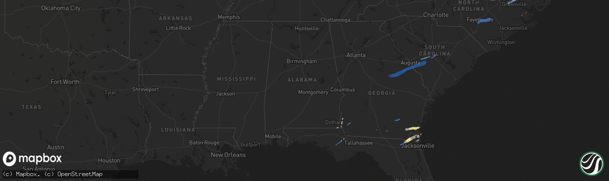
Hail Map in Alabama on January 4, 2023
The weather event in Alabama on January 4, 2023 includes Wind, Tornado, and Hail maps. 5 states and 76 cities were impacted and suffered possible damage. The total estimated number of properties impacted is 0.
Want more than just the map?
Turn this storm into a full workflow.
- Owner + property data so you know who to knock
- OnDemand branded weather history reports to win the "did we even have hail?" argument
- RoofTrace estimate so reps stop guessing numbers at the door
Bought this map? Upgrade within 7 days and we'll credit the $230. (10-15 min setup call)
Wind
Tornado
Hail
0
Estimated number of impacted properties by a 1.00" hail or larger0
Estimated number of impacted properties by a 1.75" hail or larger0
Estimated number of impacted properties by a 2.50" hail or largerStorm reports in Alabama
Alabama
| Date | Description |
|---|---|
| 01/04/20236:38 AM CST | At 1237 AM CST, a severe thunderstorm was located 6 miles east of Coffeeville, or 12 miles west of Grove Hill, moving east at 45 mph. HAZARD...60 mph wind gusts. SOURCE...Radar indicated. IMPACT...Expect damage to roofs, siding, and trees. Locations impacted include... Grove Hill, Coffeeville and Fulton. |
| 01/04/20236:22 AM CST | Large tree blocking roadway. |
| 01/04/20236:05 AM CST | Tree down across roadway on county road 33 in skipperville alabama. |
| 01/03/202311:46 PM CST | At 546 AM CST, severe thunderstorms were located along a line extending from near Blue Springs State Park to 7 miles southwest of Enterprise, moving east at 25 mph. HAZARD...60 mph wind gusts. SOURCE...Radar indicated. IMPACT...Expect damage to roofs, siding, and trees. Locations impacted include... Daleville, Abbeville, Enterprise, Fort Rucker, Ozark, Headland, Midland City, Level Plains, Newton, New Brockton, Ariton, Pinckard, Grimes, Newville, Napier Field, Hunt Field, Waterford, Hooper Stage Field, Gerald and Clintonville. |
| 01/03/202311:33 PM CST | At 533 AM EST, severe thunderstorms were located along a line extending from Beans Mill to near Bleecker to near Parkmanville, moving east at 40 mph. HAZARD...60 mph wind gusts. SOURCE...Radar indicated. IMPACT...Expect damage to roofs, siding, and trees. Locations impacted include... Columbus, Hamilton, Pine Mountain, Waverly Hall, North Fort Benning, Pine Mountain-Callaway Gardens, Bibb City, Upatoi, Ellerslie, Laurel Hills, F.d. Roosevelt State Park, Green Island Hills, Vista Terrace, Cataula, Columbus Metropolitan Airport, Baughville, Rose Hill, Mountain Hill, Benning Hills and Avondale. |
| 01/03/202311:00 PM CST | At 500 AM CST, severe thunderstorms were located along a line extending from near Brundidge to near Opp, moving east at 60 mph. HAZARD...60 mph wind gusts. SOURCE...Radar indicated. IMPACT...Expect damage to roofs, siding, and trees. Locations impacted include... Daleville, Elba, Enterprise, Fort Rucker, Ozark, Level Plains, New Brockton, Ariton, Lee, Mixons Crossroads, Hunt Field, Curtis, Carl Folsom A/p, Hooper Stage Field, Gerald, Camp Humming Hills, Clintonville, Ewell, Roeton and Dale County Lake. |
| 01/03/202310:44 PM CST | At 444 AM CST, a severe thunderstorm was located 8 miles northeast of Loxley, moving east at 60 mph. HAZARD...60 mph wind gusts. SOURCE...Radar indicated. IMPACT...Expect damage to roofs, siding, and trees. Locations impacted include... Gonzalez, Pace, Robertsdale, Molino, Jay, Pea Ridge and Floridatown. |
| 01/03/202310:32 PM CST | At 432 AM EST, severe thunderstorms were located along a line extending from near R.L. Harris Dam in Alabama to Crystal Lake to Buffalo, moving northeast at 60 mph. HAZARD...60 mph wind gusts. SOURCE...Radar indicated. IMPACT...Expect damage to roofs, siding, and trees. Locations impacted include... Newnan, LaGrange, Carrollton, Franklin, West Point, Hogansville, Grantville, Bowdon, Whitesburg, Ephesus, Centralhatchee, Moreland, Roopville, East Newnan, Corinth, Plant Yates, Cannonville, Louise, Seaton Lake and Dunaway Gardens. |
| 01/03/20238:53 PM CST | At 253 AM CST, severe thunderstorms were located along a line extending from near Highway 9 and Highway 22 to Western Lake Martin to near Eclectic, moving east at 50 mph. HAZARD...60 mph wind gusts and penny size hail. SOURCE...Radar indicated. IMPACT...Expect damage to roofs, siding, and trees. Locations impacted include... Alexander City, Tallassee, Dadeville, Camp Hill, Jacksons' Gap, Waverly, Reeves Airport, Southern Lake Martin, Eastern Lake Martin, Liberty City, Western Lake Martin, Tallapoosa City, Northern Lake Martin, Wind Creek State Park, Still Waters Resort, Daviston, Dare Park, Horseshoe Bend, Susannah Crossing and Maxwell Gunter Recreation Area. |
| 01/03/20238:31 PM CST | At 231 AM CST, severe thunderstorms were located along a line extending from near Welona to near Deatsville to near Lowndesboro to Hayneville, moving east at 50 mph. HAZARD...60 mph wind gusts and penny size hail. SOURCE...Radar indicated. IMPACT...Expect damage to roofs, siding, and trees. Locations impacted include... Montgomery, Prattville, Millbrook, Wetumpka, Tallassee, Equality, Pike Road, Elmore, Coosada, Deatsville, Eclectic, Lowndesboro, Hyundai Motors Of Alabama, Santuck, Auburn University In Montgomery, Autauga County Airport, Titus, Woodcrest, Snowdoun and Ten Cedar Estates. |
| 01/03/20237:48 PM CST | At 148 AM CST, severe thunderstorms were located along a line extending from Tibbie to 9 miles southeast of Chatom to 7 miles east of Deer Park to 3 miles north of Citronelle, moving northeast at 50 mph. HAZARD...60 mph wind gusts. SOURCE...Radar indicated. IMPACT...Expect damage to roofs, siding, and trees. Locations impacted include... Jackson, Grove Hill, Chatom, Saint Stephens, Wagarville, Leroy, Whatley, Tibbie and McIntosh. |
| 01/03/20237:41 PM CST | At 141 AM CST, a severe thunderstorm was located near Dannelly Reservoir, or 15 miles northeast of Camden, moving east at 50 mph. HAZARD...60 mph wind gusts and penny size hail. SOURCE...Radar indicated. IMPACT...Expect damage to roofs, siding, and trees. Locations impacted include... Selma, Selmont-West Selmont, Orrville, Belknap, Gardner Island, Tyler, Dallas Lake, Old Cahaba Park, Memorial Stadium, Dannelly Reservoir, Burnsville, Dallas County Horse Arena, Skyharbor Airport, Tilden, Whites Bluff, Carlowville, Hazen, Minter, Craig Field Aiport and Selma Drag Strip. |
| 01/03/20237:38 PM CST | At 138 AM CST, a severe thunderstorm was located near Paul M Grist State Park, or 9 miles north of Valley Grande, moving east at 50 mph. HAZARD...60 mph wind gusts and penny size hail. SOURCE...Radar indicated. IMPACT...Expect damage to roofs, siding, and trees. Locations impacted include... Clanton, Valley Grande, Jemison, Thorsby, Deatsville, Maplesville, Billingsley, Vida Junction, Gap Of The Mountain, Parnell, Verbena, Plecher, Marbury, Paul M Grist State Park, Lay Lake Dam, Chilton County Motor Sports Park, Higgins Ferry Park, Pooles Crossroads, Mitchell Lake and Lay Lake. |
| 01/03/20237:08 PM CST | At 107 AM CST, a severe thunderstorm was located near Vineland, or 7 miles northeast of Thomasville, moving northeast at 55 mph. HAZARD...60 mph wind gusts. SOURCE...Radar indicated. IMPACT...Expect damage to roofs, siding, and trees. Locations impacted include... Camden, Pine Hill and Yellow Bluff. |
All States Impacted by Hail Map on January 4, 2023
Cities Impacted by Hail Map on January 4, 2023
- Gordon, AL
- Jakin, GA
- Yulee, FL
- Williamston, NC
- Quitman, GA
- Blountstown, FL
- Blakely, GA
- Saint George, GA
- Hilliard, FL
- Jacksonville, FL
- Woodbine, GA
- White Oak, GA
- Folkston, GA
- Malone, FL
- Marianna, FL
- Callahan, FL
- Bryceville, FL
- Bristol, FL
- Robersonville, NC
- Bethel, NC
- Saint Marys, GA
- Kings Bay, GA
- Sanderson, FL
- Altha, FL
- Clarksville, FL
- Stedman, NC
- Roseboro, NC
- Parkton, NC
- Clinton, NC
- Autryville, NC
- Fayetteville, NC
- Salemburg, NC
- Hope Mills, NC
- Zebulon, NC
- Wendell, NC
- Middlesex, NC
- Stokes, NC
- Fountain, NC
- Walstonburg, NC
- Farmville, NC
- Greenville, NC
- Jackson, SC
- Williston, SC
- Tennille, GA
- Bartow, GA
- Waynesboro, GA
- Windsor, SC
- Louisville, GA
- Sandersville, GA
- Aiken, SC
- New Ellenton, SC
- Stapleton, GA
- Augusta, GA
- Hephzibah, GA
- Wrens, GA
- Blythe, GA
- Springfield, SC
- Avera, GA
- Blackville, SC
- Keysville, GA
- Davisboro, GA
- Swansea, SC
- Wagener, SC
- Salley, SC
- North, SC
- Saint Matthews, SC
- Stockton, GA
- Millwood, GA
- Waycross, GA
- Axson, GA
- Nicholls, GA
- Colquitt, GA
- Lexington, SC
- New Bern, NC
- Aurora, NC
- Waverly, GA


