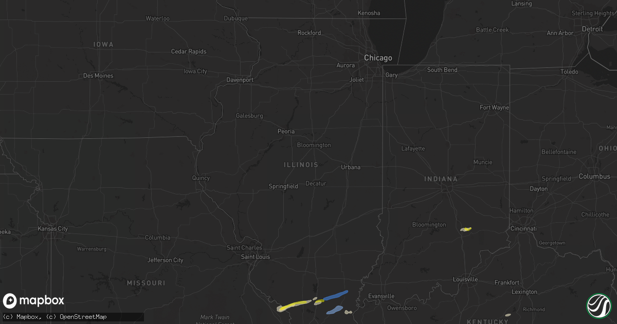
Hail Map in Illinois on December 5, 2021
Get this storm
December 5 map
$229
one time, instant access
Download today. No call, no setup
Keep the $229
Bought the map and want the full workflow? Apply the entire $229 to a subscription within 7 days. None of it is wasted.
Every map, not just this one
This buys you this map. Subscription and you get every map we run, in the markets you choose from a few cities to whole states to nationwide. Plus real-time alerts the moment a storm fires.
Contact data
Name, contact info, occupancy, even credit band for addresses in the footprint. You go from where it hit to who to call.
Become the source they trust
Unlimited branding weather history reports on demand. You already have the documented answer ready for the property owner, and you are the one who showed up with it.
Property data and RoofTrace estimates
Pull up any address you have got, its value and the exact code rules for that jurisdiction, straight from One Click Code. Then RoofTrace estimates the squares, pitch, and roof value, priced the way you price.
Storm reports in Illinois
Illinois
| Date | Description |
|---|---|
| 12/05/20214:50 AM CST | At 1049 PM CST, severe thunderstorms were located along a line extending from Johnston City to near Lake Of Egypt Area to near Anna, moving east at 55 mph. HAZARD...60 mph wind gusts. SOURCE...Radar indicated. IMPACT...Expect damage to roofs, siding, and trees. Severe thunderstorms will be near... Marion, Johnston City, Pittsburg, Creal Springs and Lake Of Egypt Area around 1055 PM CST. Goreville around 1105 PM CST.Other locations in the path of these severe thunderstorms includeVienna, Galatia, Carrier Mills, Harrisburg and Eldorado.This includes the following highways... Interstate 24 in Illinois between Mile Markers 1 and 16. Interstate 57 in Illinois between Mile Markers 27 and 60. |
| 12/05/20213:59 AM CST | At 959 PM CST, a severe thunderstorm was located near Murphysboro, moving east at 45 mph. HAZARD...60 mph wind gusts and quarter size hail. SOURCE...Radar indicated. IMPACT...Hail damage to vehicles is expected. Expect wind damage to roofs, siding, and trees. This severe thunderstorm will be near... De Soto around 1005 PM CST. Elkville around 1010 PM CST. Cambria, Royalton and Hurst around 1015 PM CST.Other locations in the path of this severe thunderstorm includeZeigler, Herrin, Christopher, West Frankfort, Johnston City, WestCity, Benton and Thompsonville.This includes Interstate 57 in Illinois between Mile Markers 58 and72. |
| 12/05/20211:11 AM CST | At 711 PM CST, severe thunderstorms were located along a line extending from near Barlow to 7 miles southwest of Lovelaceville to near Bardwell, moving northeast at 60 mph. HAZARD...60 mph wind gusts and penny size hail. SOURCE...Radar indicated. IMPACT...Expect damage to roofs, siding, and trees. Severe thunderstorms will be near... Lovelaceville around 720 PM CST. West Paducah and Barkley Regional Airport around 725 PM CST. Paducah, Metropolis and Lone Oak around 730 PM CST.Other locations in the path of these severe thunderstorms includeBrookport, Reidland and Ledbetter.This includes the following highways... Interstate 24 in Kentucky between Mile Markers 1 and 17. Interstate 24 in Illinois between Mile Markers 35 and 38. |
| 12/04/202110:45 PM CST | Trees and powerlines down. |
| 12/04/202110:43 PM CST | A local report indicates 65 MPH wind near JONESBORO |
| 12/04/202110:27 PM CST | Trees and powerlines down in west frankfort... Some of downed trees caused structural damage to homes and blocked roads. Time estimated. |
| 12/04/202110:25 PM CST | Roof damage to building ... Says roof blown off bathroom at a stadium/park. |
| 12/04/202110:25 PM CST | Mesonet station up809 3.6 se grand tower |
| 12/04/202110:21 PM CST | Tornado rated ef1 based on damage assessment. Some businesses and homes sustained damage... Especially roof damage. Tree damage along the path. |
All States Impacted by Hail Map on December 5, 2021
Cities Impacted by Hail Map on December 5, 2021
- Eminence, MO
- Blue Eye, MO
- Lampe, MO
- Covington, TN
- Hollister, MO
- Lake City, AR
- Monette, AR
- Fancy Farm, KY
- Arlington, KY
- Bardwell, KY
- Melber, KY
- Cunningham, KY
- Hickory, KY
- Memphis, TN
- Millington, TN
- White Plains, KY
- Graham, KY
- Nortonville, KY
- Dora, MO
- Drury, MO
- Wickliffe, KY
- Pomona, MO
- Mountain View, MO
- Branson, MO
- Shell Knob, MO
- Kimberling City, MO
- Reeds Spring, MO
- Adair, OK
- Linden, TN
- Lobelville, TN
- Marion, KY
- Squires, MO
- Ava, MO
- Paducah, KY
- Wasola, MO
- Kevil, KY
- Perryville, MO
- Ava, IL
- Murphysboro, IL
- Frohna, MO
- Rockwood, IL
- Jacob, IL
- Crofton, KY
- Greenville, KY
- Saint Charles, KY
- Scipio, IN
- Elizabethtown, IN
- Orient, IL
- West Frankfort, IL
- Johnston City, IL
- West Paducah, KY
- Columbus, KY
- East Prairie, MO
- Charleston, MO
- Anniston, MO
- Boaz, KY
- La Center, KY
- Annapolis, MO
- Farmington, KY
- Murray, KY
- Kirksey, KY
- Salem, KY
- Fredonia, KY
- Parsons, TN
- Elkville, IL
- Royalton, IL
- De Soto, IL
- Zeigler, IL
- Catoosa, OK
- Claremore, OK
- Owasso, OK
- Farrar, MO
- Vergennes, IL
- Winona, MO
- Thornfield, MO
- Tulsa, OK
- Medon, TN
- Toone, TN
- Equality, IL
- Junction, IL
- Shawneetown, IL
- Sugar Tree, TN
- Darden, TN
- Drummonds, TN
- Danville, KY
- Willow Springs, MO
- Providence, KY
- Nebo, KY
- Brookport, IL
- Benton, IL
- Dudley, MO
- Walnut Shade, MO
- Birch Tree, MO
- Metropolis, IL
- Essex, MO
- Dexter, MO
- Jenks, OK
- Sand Springs, OK
- Sapulpa, OK
- Broken Arrow, OK
- Bixby, OK
- Henning, TN
- Ellington, MO
- Theodosia, MO
- Cape Fair, MO
- Galena, MO
- Hughes, AR
- Heth, AR
- Lesterville, MO
- New Albany, MS
- Myrtle, MS
- Westport, IN
- North Vernon, IN
- Seymour, IN
- Forsyth, MO
- Kissee Mills, MO
- Bradleyville, MO
- Rueter, MO
- Wilson, AR
- Noble, MO
- Taneyville, MO
- Lexington, TN
- Redford, MO
- Kirbyville, MO
- Patton, MO
- Marble Hill, MO
- Scotts Hill, TN
- Arcadia, MO
- Proctor, AR
- Mason, TN
- Arlington, TN
- Brighton, TN
- Henderson, TN
- Pinson, TN
- Atoka, TN
- Holcomb, MO
- Piggott, AR
- Vanzant, MO
- Norwood, MO
- Luray, TN
- Only, TN
- Huron, TN
- Decaturville, TN
- Centerville, TN
- Hurricane Mills, TN
- Reagan, TN
- Jacks Creek, TN
- Beech Bluff, TN
- Tennessee Ridge, TN
- Almo, KY
- Sedalia, KY
- Adams, TN
- Indian Mound, TN
- Hazel, KY
- Clarksville, TN
- New Concord, KY
- Cadiz, KY
- Palmyra, TN
- Mayfield, KY
- Bumpus Mills, TN
- Big Rock, TN
- Cedar Hill, TN
- Buchanan, TN
- Woodlawn, TN
- Cumberland City, TN
- Dover, TN
- Springfield, TN
- Pleasant View, TN
- Greenbrier, TN
- Inola, OK
- Chouteau, OK
- Harrisburg, IL
- Eldorado, IL
- Carrier Mills, IL
- Stonefort, IL
- Norris City, IL
- Enfield, IL
- Broughton, IL
- Dale, IL
- McLeansboro, IL
- Macedonia, IL
- Thompsonville, IL
- Olmstead, KY
- Guthrie, KY
- Pembroke, KY
- Allensville, KY
- Russellville, KY
- Adairville, KY
- Elkton, KY
- Trenton, KY
- Franklin, KY
- Lewisburg, KY
- Auburn, KY
- Leachville, AR
- Potts Camp, MS
- Guntown, MS
- Hickory Flat, MS
- Dumas, MS
- Blue Springs, MS
- Ecru, MS


