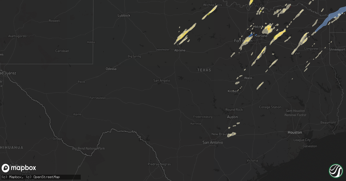
Hail Map in Texas on November 4, 2022
Get this storm
November 4 map
$229
one time, instant access
Download today. No call, no setup
Keep the $229
Bought the map and want the full workflow? Apply the entire $229 to a subscription within 7 days. None of it is wasted.
Every map, not just this one
This buys you this map. Subscription and you get every map we run, in the markets you choose from a few cities to whole states to nationwide. Plus real-time alerts the moment a storm fires.
Contact data
Name, contact info, occupancy, even credit band for addresses in the footprint. You go from where it hit to who to call.
Become the source they trust
Unlimited branding weather history reports on demand. You already have the documented answer ready for the property owner, and you are the one who showed up with it.
Property data and RoofTrace estimates
Pull up any address you have got, its value and the exact code rules for that jurisdiction, straight from One Click Code. Then RoofTrace estimates the squares, pitch, and roof value, priced the way you price.
Storm reports in Texas
Texas
| Date | Description |
|---|---|
| 11/04/20226:51 PM CDT | Significant damage. |
| 11/04/20226:48 PM CDT | Considerable trees uprooted and or snapped across rural county roads to the west and northwest of daingerfield. Tornado debris signature correlates to the damage across |
| 11/04/20226:26 PM CDT | Tree snapped in half... Many power poles down. |
| 11/04/20226:20 PM CDT | Widespread trees uprooted and/or snapped across county roads to the west and north of clarksville... Texas. Storm spotters confirmation of damage caused by a tornado. |
| 11/04/20226:08 PM CDT | Possible tornado damage north of athens. |
| 11/04/20225:55 PM CDT | Reports of trees down around hawkins. |
| 11/04/20225:20 PM CDT | Several reports of a tornado moving toward i-30 near sulphur springs... Tx. |
| 11/04/20225:10 PM CDT | Golf ball size hail reported. |
| 11/04/20225:05 PM CDT | Delayed report: 2 to 2.75 inch size hail fell in point... Tx. |
| 11/04/20224:48 PM CDT | Quarter sized hail reported between quinlan and west tawakoni. |
| 11/04/20224:25 PM CDT | Quarter sized hail reported. |
| 11/04/20224:19 PM CDT | Multiple social media reports of a tornado on the ground near brookston... Tx. |
| 11/04/20224:12 PM CDT | Power poles down at the intersection of 380e and magnolia with a nearby gust measurement of 54 mph. |
| 11/04/20224:07 PM CDT | 55 knot wind gust measured at dfw asos. |
| 11/04/20223:48 PM CDT | 4 inch tree branches downed on foutch road. |
| 11/04/20222:50 PM CDT | Golf ball sized hail reported. |
| 11/04/20222:25 PM CDT | A local report indicates 1.00 inch wind near ARCHER CITY |
| 11/04/20222:24 PM CDT | Measurement from mesonet of 61 mph. |
| 11/04/20221:22 PM CDT | Brief quarter inch hail. |
| 11/04/20221:15 PM CDT | Report of 1 inch hail. |
| 11/04/20221:11 PM CDT | Occasional quarter size hail. |
| 11/04/20226:52 AM CDT | At 1152 AM CDT, a severe thunderstorm was located 5 miles northwest of Odell, moving northeast at 55 mph. HAZARD...Quarter size hail. SOURCE...Radar indicated. IMPACT...Damage to vehicles is expected. Locations impacted include... Altus, Olustee, Martha, Elmer, Headrick, Friendship, Altus Air Force Base, Humphreys and Odell. |
| 11/04/20225:20 AM CDT | At 1019 PM CDT, a severe thunderstorm was located over Rockland, moving northeast at 40 mph. HAZARD...60 mph wind gusts and penny size hail. SOURCE...Radar indicated. IMPACT...Expect damage to roofs, siding, and trees. Locations impacted include... Rockland. |
| 11/04/20225:12 AM CDT | At 1012 PM CDT, severe thunderstorms were located along a line extending from near Shreveport to near Joaquin, moving east at 10 mph. HAZARD...60 mph wind gusts. SOURCE...Radar indicated. IMPACT...Expect damage to roofs, siding, and trees. Locations impacted include... Shreveport, Bossier City, Mansfield, Stonewall, Logansport, Joaquin, South Mansfield, Keachi, Grand Cane, Longstreet, Stanley, Keat Chie, Carmel, Curtis, Grand Bayou, Kingston, Plum Orchard Landing, Loggy Bayou, Koran and Ninock. |
| 11/04/20224:44 AM CDT | At 943 PM CDT, a severe thunderstorm was located near Alabama-Coushatta Reservation, or 11 miles west of Woodville, moving northeast at 35 mph. HAZARD...60 mph wind gusts and penny size hail. SOURCE...Radar indicated. IMPACT...Expect damage to roofs, siding, and trees. Locations impacted include... Woodville, Colmesneil and Chester. |
| 11/04/20224:40 AM CDT | At 940 PM CDT, a severe thunderstorm was located near Alabama-Coushatta Reservation, or 13 miles west of Woodville, moving northeast at 40 mph. HAZARD...60 mph wind gusts and penny size hail. SOURCE...Radar indicated. IMPACT...Expect damage to roofs, siding, and trees. Locations impacted include... Alabama-Coushatta Reservation. |
| 11/04/20224:11 AM CDT | At 911 PM CDT, a severe thunderstorm was located 7 miles northwest of Elysian Fields, or 8 miles southeast of Marshall, moving northeast at 40 mph. HAZARD...70 mph wind gusts and quarter size hail. SOURCE...Radar indicated. IMPACT...Hail damage to vehicles is expected. Expect considerable tree damage. Wind damage is also likely to mobile homes, roofs, and outbuildings. Locations impacted include... Shreveport, Marshall, Greenwood, Blanchard, Waskom, Oil City, Mooringsport, Belcher, Elysian Fields, Scottsville, Dixie, Caddo Lake, Cross Lake, Cavett, Leigh, Jonesville and Bethany. |
| 11/04/20223:40 AM CDT | At 840 PM CDT, severe thunderstorms were located along a line extending from near Fentress to near New Berlin, moving northeast at 25 mph. HAZARD...60 mph wind gusts and quarter size hail. SOURCE...Radar indicated. IMPACT...Hail damage to vehicles is expected. Expect wind damage to roofs, siding, and trees. Locations impacted include... Seguin, Lockhart, Luling, Martindale, Kingsbury, Staples, Fentress, Palmeto State Park, Geronimo, Brownsboro, Tilmon, Joliet, Oak Forest, Stairtown, Belmont, McNeil, McMahan, Ottine, Monthalia and Taylorsville. |
| 11/04/20223:40 AM CDT | At 840 PM CDT, severe thunderstorms were located along a line extending from near Mandeville to near Fouke to Atlanta, moving northeast at 55 mph. HAZARD...70 mph wind gusts and quarter size hail. SOURCE...Radar indicated. IMPACT...Hail damage to vehicles is expected. Expect considerable tree damage. Wind damage is also likely to mobile homes, roofs, and outbuildings. Locations impacted include... Texarkana, Magnolia, Hope, Atlanta, Prescott, Stamps, Waldo, Lewisville, McNeil, Queen City, Fouke, Emmet, Buckner, Perrytown, Rosston, Garland, Fulton, Ogden, Willisville and Bodcaw. |
| 11/04/20223:36 AM CDT | At 836 PM CDT, a severe thunderstorm was located near Cedar Creek, or 7 miles southwest of Bastrop, moving east at 45 mph. HAZARD...60 mph wind gusts and quarter size hail. SOURCE...Radar indicated. IMPACT...Hail damage to vehicles is expected. Expect wind damage to roofs, siding, and trees. Locations impacted include... Bastrop, Giddings, Smithville, Fedor, Paige, Camp Swift, Circle D-KC Estates, Cedar Creek, Wyldwood, Upton, Phelan, Bastrop State Park, Hills Prairie, Northrup, Rockne, Watterson, Buescher State Park, Hills, Lincoln and Nechanitz. |
| 11/04/20222:54 AM CDT | At 754 PM CDT, a severe thunderstorm was located near Uhland, or near Kyle, moving east at 35 mph. HAZARD...60 mph wind gusts and quarter size hail. SOURCE...Radar indicated. IMPACT...Hail damage to vehicles is expected. Expect wind damage to roofs, siding, and trees. Locations impacted include... San Marcos, Kyle, Lockhart, Martindale, Uhland, Mustang Ridge, Niederwald, Cedar Creek, Wyldwood, Rosanky, Rockne, Watterson, San Marcos Regional Airport, Maxwell, Reedville, Red Rock, Lytton Springs, Dale, Bateman and St John Colony. |
| 11/04/20221:08 AM CDT | At 608 PM CDT, severe thunderstorms were located along a line extending from near Dodd City to Greenville Club Lake, moving northeast at 50 mph. HAZARD...60 mph wind gusts and quarter size hail. SOURCE...Radar indicated. IMPACT...Hail damage to vehicles is expected. Expect wind damage to roofs, siding, and trees. Locations impacted include... Greenville, Paris, Sulphur Springs, Commerce, Cooper, Honey Grove, Wolfe City, Cumby, Roxton, Campbell, Lake Crook, Cooper Lake, Lake Gibbons, Big Creek Lake, Greenville Club Lake, Cooper Lake State Park, Lake Sulphur Springs, Klondike, Sumner and Greenville City Lakes.This includes Interstate 30 between mile markers 94 and 120. |
| 11/04/202212:24 AM CDT | At 524 PM CDT, severe thunderstorms were located along a line extending from near Lucas to Sunnyvale, moving northeast at 55 mph. HAZARD...65 mph wind gusts and penny size hail. SOURCE...Radar indicated. IMPACT...Expect damage to roofs, siding, and trees. Locations impacted include... Dallas, Plano, Garland, Mesquite, McKinney, Richardson, Allen, Rowlett, Wylie, Rockwall, Greenville, Balch Springs, Sachse, Murphy, Royse City, Fairview, Heath, Princeton, Fate and Lucas.This includes the following highways... Interstate 20 between mile markers 480 and 482. Interstate 30 between mile markers 58 and 100. |
| 11/03/202211:43 PM CDT | At 443 PM CDT, a severe thunderstorm was located near Bremond, or 10 miles southeast of Marlin, moving northeast at 45 mph. HAZARD...60 mph wind gusts and quarter size hail. SOURCE...Radar indicated. IMPACT...Hail damage to vehicles is expected. Expect wind damage to roofs, siding, and trees. Locations impacted include... Groesbeck, Fort Parker State Park, Lake Limestone, Thornton, Kosse, Highbank, Fallon, Box Church and Reagan. |
| 11/03/202211:28 PM CDT | At 427 PM CDT, a severe thunderstorm was located near Terrell, moving northeast at 60 mph. HAZARD...60 mph wind gusts and quarter size hail. SOURCE...Radar indicated. IMPACT...Hail damage to vehicles is expected. Expect wind damage to roofs, siding, and trees. Locations impacted include... Greenville, Terrell, Kaufman, West Tawakoni, Quinlan, East Tawakoni, Point, Cumby, Campbell, Hawk Cove, Grays Prairie, Lake Tawakoni, Greenville Club Lake, Lake Tawakoni State Park, New Terrell City Lake, Elmo, Oak Grove, Lone Oak, Post Oak Bend City and Union Valley.This includes the following highways... Interstate 20 between mile markers 496 and 510. Interstate 30 between mile markers 80 and 87, and between milemarkers 100 and 115. |
| 11/03/202211:20 PM CDT | At 419 PM CDT, a severe thunderstorm was located 11 miles northeast of Honey Grove, moving northeast at 40 mph. HAZARD...60 mph wind gusts and quarter size hail. SOURCE...Radar indicated. IMPACT...Hail damage to vehicles is expected. Expect wind damage to roofs, siding, and trees. Locations in or near the path include... Hugo... Fort Towson... Sawyer... Goodland... Messer... Hugo Lake State Park... Raymond Gary State Park... Grant... Ord... Fallon... Swink... Frogville... Apple... Huskey... Gay... |
| 11/03/202211:01 PM CDT | At 400 PM CDT, a severe thunderstorm was located near Cartwright, moving northeast at 40 mph. HAZARD...60 mph wind gusts and quarter size hail. SOURCE...Radar indicated. IMPACT...Hail damage to vehicles is expected. Expect wind damage to roofs, siding, and trees. Locations impacted include... Durant, Colbert, Caddo, Achille, Silo, Kenefic, Mead, Armstrong, Cartwright, eastern Lake Texoma and Calera. |
| 11/03/202210:50 PM CDT | At 349 PM CDT, severe thunderstorms were located along a line extending from Pilot Point to near Highland Village, moving northeast at 50 mph. HAZARD...60 mph wind gusts and quarter size hail. SOURCE...Radar indicated. IMPACT...Hail damage to vehicles is expected. Expect wind damage to roofs, siding, and trees. Locations impacted include... Plano, McKinney, Carrollton, Frisco, Denton, Richardson, Lewisville, Allen, Flower Mound, Grapevine, Coppell, Sherman, The Colony, Southlake, Corinth, Highland Village, Lake Dallas, Lake Lewisville, Little Elm and Prosper.This includes Interstate 35E between mile markers 446 and 464. |
| 11/03/202210:43 PM CDT | At 343 AM CDT, a severe thunderstorm was located 10 miles south of Wolf Creek Park, or 17 miles northwest of Canadian, moving northeast at 65 mph. HAZARD...60 mph wind gusts and quarter size hail. SOURCE...Radar indicated. IMPACT...Minor damage to roofs, siding, and trees is possible. Hail damage to vehicles is expected. Locations impacted include... Follett, Darrouzett and Wolf Creek Park. |
| 11/03/202210:42 PM CDT | At 342 PM CDT, a severe thunderstorm was located 5 miles east of Marietta, moving northeast at 50 mph. HAZARD...60 mph wind gusts and quarter size hail. SOURCE...Radar indicated. IMPACT...Hail damage to vehicles is expected. Expect wind damage to roofs, siding, and trees. Locations impacted include... Ardmore, Madill, Tishomingo, Marietta, Dickson, Mannsville, Ravia, Mill Creek, Reagan, Lake Murray, Connerville, Lebanon, Russett, western Lake Texoma and Oakland. |
| 11/03/202210:27 PM CDT | At 327 PM CDT, a severe thunderstorm was located near Waxahachie, moving northeast at 50 mph. HAZARD...60 mph wind gusts and quarter size hail. SOURCE...Radar indicated. IMPACT...Hail damage to vehicles is expected. Expect wind damage to roofs, siding, and trees. Locations impacted include... Dallas, Mesquite, Desoto, Cedar Hill, Lancaster, Waxahachie, Balch Springs, Ennis, Midlothian, Seagoville, Forney, Glenn Heights, Red Oak, Hutchins, Sunnyvale, Wilmer, Ovilla, Crandall, Ferris and Palmer.This includes the following highways... Interstate 35E between mile markers 396 and 420. Interstate 20 between mile markers 465 and 492. Interstate 30 between mile markers 51 and 56. Interstate 45 between mile markers 260 and 281. |
| 11/03/202210:20 PM CDT | At 320 PM CDT, severe thunderstorms were located along a line extending from near Roanoke to near Westworth Village, moving northeast at 50 mph. HAZARD...60 mph wind gusts and quarter size hail. SOURCE...Radar indicated. IMPACT...Hail damage to vehicles is expected. Expect wind damage to roofs, siding, and trees. Locations impacted include... Fort Worth, Arlington, Irving, Grand Prairie, Denton, Lewisville, Flower Mound, Euless, Bedford, Grapevine, Haltom City, Keller, Coppell, Hurst, Southlake, Watauga, Colleyville, Benbrook, Corinth and Saginaw.This includes the following highways... Interstate 35 between mile markers 468 and 471. Interstate 35W between mile markers 48 and 85. Interstate 35E between mile markers 448 and 466. Interstate 20 between mile markers 428 and 432. Interstate 30 between mile markers 7 and 24. |
| 11/03/202210:02 PM CDT | At 302 PM CDT, a severe thunderstorm was located near Pecan Plantation, or 10 miles east of Granbury, moving northeast at 55 mph. HAZARD...60 mph wind gusts and quarter size hail. SOURCE...Radar indicated. IMPACT...Hail damage to vehicles is expected. Expect wind damage to roofs, siding, and trees. Locations impacted include... Fort Worth, Arlington, Mansfield, Burleson, Cleburne, Benbrook, Crowley, Forest Hill, Granbury, Kennedale, Everman, Keene, Joshua, Alvarado, Rendon, Pecan Plantation, Edgecliff Village, Pantego, Godley and Cross Timber.This includes the following highways... Interstate 35W between mile markers 24 and 49. Interstate 20 between mile markers 430 and 448. Interstate 30 between mile markers 20 and 26. |
| 11/03/20229:54 PM CDT | At 253 PM CDT, a severe thunderstorm was located 5 miles northeast of Jolly, moving northeast at 60 mph. HAZARD...60 mph wind gusts and quarter size hail. SOURCE...Radar indicated. IMPACT...Hail damage to vehicles is expected. Expect wind damage to roofs, siding, and trees. Locations impacted include... Henrietta, Waurika, Comanche, Ryan, Petrolia, Byers, Dean, Jolly, Loco, Addington, Sugden and southeastern Waurika Lake. |
| 11/03/20229:29 PM CDT | At 229 PM CDT, a severe thunderstorm was located over Prosper, or 7 miles north of Frisco, moving northeast at 60 mph. HAZARD...60 mph wind gusts and quarter size hail. SOURCE...Radar indicated. IMPACT...Hail damage to vehicles is expected. Expect wind damage to roofs, siding, and trees. Locations impacted include... McKinney, Frisco, Lewisville, The Colony, Lake Lewisville, Little Elm, Prosper, Anna, Celina, Melissa, Pilot Point, Hickory Creek, Van Alstyne, Aubrey, Krugerville, Cross Roads, Hackberry, Oak Point, Weston and Lakewood Village.This includes Interstate 35E near mile marker 451. |
| 11/03/20229:07 PM CDT | At 207 PM CDT, severe thunderstorms were located along a line extending from near Southlake to near Kennedale, moving northeast at 50 mph. HAZARD...60 mph wind gusts and quarter size hail. SOURCE...Radar indicated. IMPACT...Hail damage to vehicles is expected. Expect wind damage to roofs, siding, and trees. Locations impacted include... Dallas, Fort Worth, Arlington, Plano, Garland, Irving, Grand Prairie, Mesquite, McKinney, Carrollton, Frisco, Richardson, Lewisville, Allen, Flower Mound, Rowlett, Euless, Bedford, Grapevine and Wylie.This includes the following highways... Interstate 35E between mile markers 421 and 451. Interstate 20 between mile markers 446 and 461. Interstate 30 between mile markers 24 and 63. Interstate 45 between mile markers 279 and 284. |
| 11/03/20228:41 PM CDT | At 141 PM CDT, severe thunderstorms were located along a line extending from near Edgecliff Village to Joshua, moving northeast at 55 mph. HAZARD...60 mph wind gusts and quarter size hail. SOURCE...Radar indicated. IMPACT...Hail damage to vehicles is expected. Expect wind damage to roofs, siding, and trees. Locations impacted include... Fort Worth, Arlington, Grand Prairie, Mansfield, Euless, Bedford, Grapevine, Haltom City, Keller, Hurst, Burleson, Cleburne, Southlake, Watauga, Colleyville, Benbrook, Saginaw, Crowley, Forest Hill and Trophy Club.This includes the following highways... Interstate 35W between mile markers 26 and 59. Interstate 20 between mile markers 431 and 453. Interstate 30 between mile markers 9 and 31. |
| 11/03/20228:34 PM CDT | At 134 PM CDT, a severe thunderstorm was located near Electra, moving northeast at 45 mph. HAZARD...60 mph wind gusts and quarter size hail. SOURCE...Radar indicated. IMPACT...Hail damage to vehicles is expected. Expect wind damage to roofs, siding, and trees. Locations impacted include... Electra, Geronimo, Grandfield, Chattanooga, Faxon, Loveland and Haynesville. |
| 11/03/20228:21 PM CDT | At 121 PM CDT, a severe thunderstorm was located 7 miles southwest of Hollister, moving northeast at 50 mph. HAZARD...60 mph wind gusts and quarter size hail. SOURCE...Radar indicated. IMPACT...Hail damage to vehicles is expected. Expect wind damage to roofs, siding, and trees. Locations impacted include... Northwestern Lawton, Cache, Chattanooga, Medicine Park, Indiahoma, Hollister, Loveland, Fort Sill, Meers, Lake Lawtonka and Wichita Mountains Wildlife Refuge. |
| 11/03/20228:05 PM CDT | At 104 PM CDT, severe thunderstorms were located along a line extending from Lake Texoma to near Pilot Point, moving northeast at 35 mph. HAZARD...60 mph wind gusts and quarter size hail. SOURCE...Radar indicated. IMPACT...Hail damage to vehicles is expected. Expect wind damage to roofs, siding, and trees. Locations impacted include... Sherman, Whitesboro, Denison, Van Alstyne, Howe, Pottsboro, Collinsville, Whitewright, Gunter, Bells, Tom Bean, Knollwood, Dorchester, Randell Lake, Eisenhower State Park, Valley Lake, Lake Texoma, Preston, Southmayd and Tioga. |
| 11/03/20228:01 PM CDT | At 100 PM CDT, a severe thunderstorm was located over Avoca, moving northeast at 60 mph. HAZARD...60 mph wind gusts and quarter size hail. SOURCE...Radar indicated. IMPACT...Hail damage to vehicles is expected. Expect wind damage to roofs, siding, and trees. This severe thunderstorm will be near... Throckmorton around 135 PM CDT.Other locations impacted by this severe thunderstorm include BigCountry Baptist Assembly, The Intersection Of Us-183 And Us-283, The Intersection Of Us-283 And Ranch Road 209, Lusk, The Intersection Of Us-180 And Farm Road 600 and The Intersection Of Us-380 And Highway 222. |
| 11/03/20227:52 PM CDT | Delayed report of a large double decker billboard toppled on highway 80 near the caldwell and hays county line. Time estimated via radar. |
| 11/03/20227:39 PM CDT | Significant damage inside city limits. |
| 11/03/20227:35 PM CDT | Social media pictures showed significant damage in the new boston area. |
| 11/03/20227:25 PM CDT | Widespread trees downed near and just south of the i-30 corridor south and west of new boston. Tornado debris signature correlates to the damage being a result of a tor |
| 11/03/20227:07 PM CDT | Considerable trees uprooted and/or snapped near naples and just east of naples in extreme northwest cass county. Tornado debris signature correlates to damage being a r |
All States Impacted by Hail Map on November 4, 2022
Cities Impacted by Hail Map on November 4, 2022
- Sun Prairie, WI
- Columbus, WI
- Waterloo, WI
- Marshall, WI
- Verona, WI
- Mount Horeb, WI
- Madison, WI
- Booneville, AR
- Magazine, AR
- Lowden, IA
- Wheatland, IA
- Lost Nation, IA
- Baldwin, IA
- Maquoketa, IA
- Oxford Junction, IA
- Circleville, KS
- Holton, KS
- Soldier, KS
- Havensville, KS
- Coggon, IA
- Central City, IA
- Fairview, OK
- Isabella, OK
- Longdale, OK
- Darlington, WI
- Scales Mound, IL
- Elizabeth, IL
- Gratiot, WI
- Hanover, IL
- South Wayne, WI
- Bellevue, IA
- Argyle, WI
- Shullsburg, WI
- Apple River, IL
- Galena, IL
- Longview, TX
- Seagoville, TX
- Bynum, TX
- Waxahachie, TX
- Frost, TX
- Milford, TX
- Blooming Grove, TX
- Palmer, TX
- Hillsboro, TX
- Italy, TX
- Mertens, TX
- Ferris, TX
- Ennis, TX
- Broken Bow, OK
- Idabel, OK
- Foreman, AR
- Alleene, AR
- Ashdown, AR
- Cumby, TX
- Sulphur Springs, TX
- Brashear, TX
- Wills Point, TX
- Kaufman, TX
- Lone Oak, TX
- Point, TX
- Quinlan, TX
- Terrell, TX
- Chariton, IA
- Pecatonica, IL
- Ridott, IL
- Davis, IL
- Durand, IL
- Rock City, IL
- Avoca, TX
- Lueders, TX
- Throckmorton, TX
- Stamford, TX
- Albany, TX
- Hawley, TX
- Anson, TX
- Caddo Mills, TX
- Nevada, TX
- Farmersville, TX
- Royse City, TX
- Lewisville, TX
- Gilmer, TX
- Aquilla, TX
- Kingsbury, TX
- Piedmont, KS
- Sumner, TX
- Boswell, OK
- Hugo, OK
- Arthur City, TX
- Honobia, OK
- Hodgen, OK
- Muse, OK
- Whitesboro, OK
- Dike, TX
- Rattan, OK
- Spencerville, OK
- Denison, TX
- Cottage Grove, WI
- Cambridge, WI
- Stoughton, WI
- Deerfield, WI
- Detroit, TX
- Celeste, TX
- Little Elm, TX
- Marlin, TX
- Thornton, TX
- Kosse, TX
- Reagan, TX
- Fort Worth, TX
- Humeston, IA
- Garden Grove, IA
- Derby, IA
- Russell, IA
- Holliday, TX
- Henrietta, TX
- Wichita Falls, TX
- Pittsburg, TX
- Big Sandy, TX
- New Boston, TX
- Simms, TX
- De Kalb, TX
- Naples, TX
- Omaha, TX
- Sherman, TX
- Pottsboro, TX
- Temple, TX
- Moody, TX
- Crawford, TX
- Valley Mills, TX
- Junction City, KS
- Manhattan, KS
- Howe, TX
- Whitesboro, TX
- Texarkana, AR
- Queen City, TX
- Karnack, TX
- Mooringsport, LA
- Diana, TX
- Harleton, TX
- Fort Hood, TX
- Killeen, TX
- Greenville, TX
- Carrollton, TX
- Waskom, TX
- Cushing, TX
- Rusk, TX
- Tatum, TX
- Beckville, TX
- Marshall, TX
- Kerens, TX
- Corsicana, TX
- Oil City, LA
- Lena, IL
- Carter, OK
- Vinson, OK
- Willow, OK
- Mangum, OK
- Mcfarland, WI
- Bixby, OK
- Chelsea, OK
- Adair, OK
- Maxwell, TX
- San Marcos, TX
- Lamoni, IA
- Davis City, IA
- Belton, TX
- Arlington, TX
- Euless, TX
- Argyle, TX
- Lanark, IL
- Shannon, IL
- Haltom City, TX
- Burleson, TX
- Irving, TX
- Kennedale, TX
- Godley, TX
- Hurst, TX
- North Richland Hills, TX
- Grand Prairie, TX
- Crowley, TX
- Bedford, TX
- Joshua, TX
- Dallas, TX
- Colleyville, TX
- Wolfe City, TX
- New Berlin, WI
- Dale, TX
- Cedar Creek, TX
- Elk City, OK
- Foss, OK
- Butler, OK
- Clinton, OK
- Dill City, OK
- Canute, OK
- Mabank, TX
- Kemp, TX
- Scotland, TX
- Olney, TX
- Bagwell, TX
- Clarksville, TX
- Wortham, TX
- Luling, TX
- Attica, KS
- Savanna, IL
- Clinton, IA
- De Witt, IA
- Mount Carroll, IL
- Thomson, IL
- Sabula, IA
- Welch, OK
- Leon, IA
- Emmet, AR
- Madill, OK
- Marietta, OK
- Ardmore, OK
- Mannsville, OK
- Commerce, TX
- Abilene, TX
- Henderson, TX
- Aubrey, TX
- Hughes Springs, TX
- Daingerfield, TX
- Lone Star, TX
- Avinger, TX
- Tyler, TX
- Muskego, WI
- Big Bend, WI
- Waukesha, WI
- Harrold, TX
- Davidson, OK
- Marion, IA
- Homestead, IA
- Fairfax, IA
- Oxford, IA
- Ely, IA
- Amana, IA
- Cedar Rapids, IA
- Swisher, IA
- Allen, TX
- Mckinney, TX
- Deport, TX
- Mansfield, AR
- Trinidad, TX
- Malakoff, TX
- Streetman, TX
- Lindale, TX
- Chandler, TX
- Winnsboro, TX
- Hawkins, TX
- Garland City, AR
- Hope, AR
- Fouke, AR
- Lewisville, AR
- Oglesby, TX
- Gatesville, TX
- Bogata, TX
- Lockhart, TX
- Honey Grove, TX
- Brookston, TX
- Laneville, TX
- Dodd City, TX
- Bonham, TX
- Windom, TX
- Telephone, TX
- Denton, TX
- Pryor, OK
- Claremore, OK
- Big Cabin, OK
- Anna, TX
- Blue Ridge, TX
- Haskell, TX
- Wylie, TX
- Sachse, TX
- Lavon, TX
- Princeton, TX
- Plano, TX
- Leonard, TX
- Rockwall, TX
- Pearl City, IL
- Low Moor, IA
- Fulton, IL
- Goose Lake, IA
- Camanche, IA
- Bryant, IA
- McGregor, TX
- Powderly, TX
- Grant, OK
- Petty, TX
- Paris, TX
- Mukwonago, WI
- Reeseville, WI
- Rule, TX
- Oregon, WI
- Brooklyn, WI
- Alba, TX
- Yantis, TX
- Fruitvale, TX
- Quitman, TX
- Grand Saline, TX
- Emmett, KS
- Onaga, KS
- Wyoming, IA
- Center Junction, IA
- Bluejacket, OK
- Chadwick, IL
- Coppell, TX
- Grapevine, TX
- Seguin, TX
- Mounds, OK
- Cleburne, TX
- Granbury, TX
- Glen Rose, TX
- Rainbow, TX
- Maypearl, TX
- Midlothian, TX
- Grapeland, TX
- Addison, TX
- Bartlett, KS
- Chetopa, KS
- Vinita, OK
- Oswego, KS
- Columbus, KS
- Archer City, TX
- Horicon, WI
- Juneau, WI
- Beaver Dam, WI
- Lake Mills, WI
- Hales Corners, WI
- Milwaukee, WI
- Gillham, AR
- Bluffton, AR
- Oden, AR
- Vandervoort, AR
- Mount Ida, AR
- Gravelly, AR
- Harvey, AR
- Pencil Bluff, AR
- Umpire, AR
- Mena, AR
- Wickes, AR
- Grannis, AR
- Dover, AR
- Saint Joe, AR
- Hagarville, AR
- Marshall, AR
- Yellville, AR
- Witts Springs, AR
- Mount Judea, AR
- Pelsor, AR
- Harriet, AR
- Gilbert, AR
- Newport, AR
- Augusta, AR
- Traskwood, AR
- Malvern, AR
- Oil Trough, AR
- Ward, AR
- Jacksonville, AR
- Beebe, AR
- Vilonia, AR
- Bryant, AR
- Lonoke, AR
- Judsonia, AR
- Kensett, AR
- Bismarck, AR
- Alexander, AR
- Romance, AR
- Little Rock, AR
- Cabot, AR
- Lonsdale, AR
- Donaldson, AR
- Des Arc, AR
- Bradford, AR
- Little Rock Air Force Base, AR
- Benton, AR
- McRae, AR
- Bald Knob, AR
- Garner, AR
- Russell, AR
- Griffithville, AR
- Sherwood, AR
- Searcy, AR
- North Little Rock, AR
- Pleasant Plains, AR
- Amity, AR
- El Paso, AR
- Thida, AR
- Arkadelphia, AR
- Higginson, AR
- Hot Springs National Park, AR
- Austin, AR
- Redfield, AR
- Linden, TX
- Gurdon, AR
- Hooks, TX
- Douglassville, TX
- Carthage, AR
- Sheridan, AR
- Jefferson, AR
- England, AR
- Sparkman, AR
- Fulton, AR
- Prattsville, AR
- Atlanta, TX
- Bauxite, AR
- Texarkana, TX
- Marietta, TX
- Prescott, AR
- Ogden, AR
- Poyen, AR
- Maud, TX
- Nash, TX
- Hensley, AR
- Washington, AR
- Leola, AR
- Poteau, OK
- Hartford, AR
- Heavener, OK
- Winona, TX
- Huntington, AR
- Greenwood, AR
- Elkins, AR
- Fayetteville, AR
- Ore City, TX
- Eagletown, OK
- Smithville, OK
- Hartman, AR
- Coal Hill, AR
- Clarksville, AR
- Ozark, AR
- Altus, AR
- Mabelvale, AR
- Athens, TX


