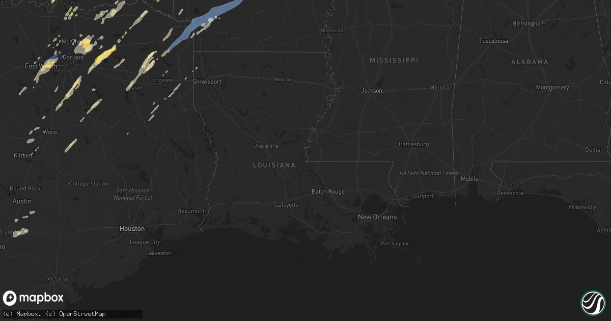
Hail Map in Louisiana on November 4, 2022
Get this storm
November 4 map
$229
one time, instant access
Download today. No call, no setup
Keep the $229
Bought the map and want the full workflow? Apply the entire $229 to a subscription within 7 days. None of it is wasted.
Every map, not just this one
This buys you this map. Subscription and you get every map we run, in the markets you choose from a few cities to whole states to nationwide. Plus real-time alerts the moment a storm fires.
Contact data
Name, contact info, occupancy, even credit band for addresses in the footprint. You go from where it hit to who to call.
Become the source they trust
Unlimited branding weather history reports on demand. You already have the documented answer ready for the property owner, and you are the one who showed up with it.
Property data and RoofTrace estimates
Pull up any address you have got, its value and the exact code rules for that jurisdiction, straight from One Click Code. Then RoofTrace estimates the squares, pitch, and roof value, priced the way you price.
Storm reports in Louisiana
Louisiana
| Date | Description |
|---|---|
| 11/04/202210:13 AM CDT | A few trees down along linwood ave. |
| 11/04/20226:50 AM CDT | At 1150 PM CDT, severe thunderstorms were located along a line extending from 11 miles south of Arcadia to 8 miles northwest of Natchitoches, moving east at 30 mph. HAZARD...60 mph wind gusts. SOURCE...Radar indicated. IMPACT...Expect damage to roofs, siding, and trees. Locations impacted include... Natchitoches, Winnfield, Jonesboro, Campti, Chatham, Clarence, Hodge, Goldonna, North Hodge, Dodson, East Hodge, Saline, Calvin, Quitman, Atlanta, Eros, Sikes, St. Maurice, Friendship and Joyce. |
| 11/04/20225:53 AM CDT | At 1053 PM CDT, severe thunderstorms were located along a line extending from 8 miles south of Doyline to near Converse, moving east at 40 mph. HAZARD...60 mph wind gusts. SOURCE...Radar indicated. IMPACT...Expect damage to roofs, siding, and trees. Locations impacted include... Natchitoches, Coushatta, Ringgold, Campti, Heflin, Allen, Pleasant Hill, Martin, Clarence, Goldonna, Hall Summit, Saline, Lucky, Ashland, Castor, Edgefield, Bienville, Jamestown, Powhatan and Bryceland. |
| 11/04/202212:55 AM CDT | A few trees and power lines down... Scattered across the north end of the parish. |
| 11/04/202212:10 AM CDT | Law enforcement reports multiple trees down along highway 126 in the nw end of winn parish. |
| 11/04/202212:01 AM CDT | Law enforcement reports multiple locations of trees down across the parish... Including locations near heflin. |
| 11/04/202212:01 AM CDT | Law enforcement reports scattered pockets of trees down in various locations across the parish. |
| 11/03/202211:57 PM CDT | Law enforcement reports multiple locations of trees down across the northern portion of the parish. |
| 11/03/202211:57 PM CDT | Law enforcement reports multiple locations of trees and power lines down scattered across the parish. |
| 11/03/202211:48 PM CDT | Report of tree down. |
| 11/03/202211:48 PM CDT | Report of tree and power line down just west of spearsville. |
| 11/03/202211:48 PM CDT | Power lines down on highway 3121 near hunt rd. |
| 11/03/202211:47 PM CDT | Report of tree down on highway 167 and price road north of lillie. |
| 11/03/202211:45 PM CDT | Reports of trees down on patrick church rd in bernice. |
| 11/03/202211:39 PM CDT | Law enforcements reports scattered trees and powerlines down across the western portion of the parish. |
| 11/03/202211:26 PM CDT | Reports of trees down north of la 1 and highway 84. |
| 11/03/202211:01 PM CDT | Corrects previous tstm wnd dmg report from heflin. Cdt to cst for verification purposes. Law enforcement reports multiple locations of trees down across the parish... I |
| 11/03/202210:57 PM CDT | Corrects previous tstm wnd dmg report from 1 nne minden. Cdt to cst for verification purposes law enforcement reports multiple locations of trees and power lines down s |
| 11/03/202210:47 PM CDT | 2 homes damaged by high winds. One home pushed off its blocks and another manufactured home had wall and roof damage. Trees and powerlines were downed along evangeline |
| 11/03/202210:17 PM CDT | Reports of trees down around logansport. |
| 11/03/202210:13 PM CDT | Corrects previous tstm wnd dmg report from 4 ne stonewall. A few trees down along linwood ave. |
| 11/03/20229:43 PM CDT | Multiple trees down along belcher oil city road. |
| 11/03/20229:34 PM CDT | Trees down along the length of old mooringsport road. |
All States Impacted by Hail Map on November 4, 2022
Cities Impacted by Hail Map on November 4, 2022
- Sun Prairie, WI
- Columbus, WI
- Waterloo, WI
- Marshall, WI
- Verona, WI
- Mount Horeb, WI
- Madison, WI
- Booneville, AR
- Magazine, AR
- Lowden, IA
- Wheatland, IA
- Lost Nation, IA
- Baldwin, IA
- Maquoketa, IA
- Oxford Junction, IA
- Circleville, KS
- Holton, KS
- Soldier, KS
- Havensville, KS
- Coggon, IA
- Central City, IA
- Fairview, OK
- Isabella, OK
- Longdale, OK
- Darlington, WI
- Scales Mound, IL
- Elizabeth, IL
- Gratiot, WI
- Hanover, IL
- South Wayne, WI
- Bellevue, IA
- Argyle, WI
- Shullsburg, WI
- Apple River, IL
- Galena, IL
- Longview, TX
- Seagoville, TX
- Bynum, TX
- Waxahachie, TX
- Frost, TX
- Milford, TX
- Blooming Grove, TX
- Palmer, TX
- Hillsboro, TX
- Italy, TX
- Mertens, TX
- Ferris, TX
- Ennis, TX
- Broken Bow, OK
- Idabel, OK
- Foreman, AR
- Alleene, AR
- Ashdown, AR
- Cumby, TX
- Sulphur Springs, TX
- Brashear, TX
- Wills Point, TX
- Kaufman, TX
- Lone Oak, TX
- Point, TX
- Quinlan, TX
- Terrell, TX
- Chariton, IA
- Pecatonica, IL
- Ridott, IL
- Davis, IL
- Durand, IL
- Rock City, IL
- Avoca, TX
- Lueders, TX
- Throckmorton, TX
- Stamford, TX
- Albany, TX
- Hawley, TX
- Anson, TX
- Caddo Mills, TX
- Nevada, TX
- Farmersville, TX
- Royse City, TX
- Lewisville, TX
- Gilmer, TX
- Aquilla, TX
- Kingsbury, TX
- Piedmont, KS
- Sumner, TX
- Boswell, OK
- Hugo, OK
- Arthur City, TX
- Honobia, OK
- Hodgen, OK
- Muse, OK
- Whitesboro, OK
- Dike, TX
- Rattan, OK
- Spencerville, OK
- Denison, TX
- Cottage Grove, WI
- Cambridge, WI
- Stoughton, WI
- Deerfield, WI
- Detroit, TX
- Celeste, TX
- Little Elm, TX
- Marlin, TX
- Thornton, TX
- Kosse, TX
- Reagan, TX
- Fort Worth, TX
- Humeston, IA
- Garden Grove, IA
- Derby, IA
- Russell, IA
- Holliday, TX
- Henrietta, TX
- Wichita Falls, TX
- Pittsburg, TX
- Big Sandy, TX
- New Boston, TX
- Simms, TX
- De Kalb, TX
- Naples, TX
- Omaha, TX
- Sherman, TX
- Pottsboro, TX
- Temple, TX
- Moody, TX
- Crawford, TX
- Valley Mills, TX
- Junction City, KS
- Manhattan, KS
- Howe, TX
- Whitesboro, TX
- Texarkana, AR
- Queen City, TX
- Karnack, TX
- Mooringsport, LA
- Diana, TX
- Harleton, TX
- Fort Hood, TX
- Killeen, TX
- Greenville, TX
- Carrollton, TX
- Waskom, TX
- Cushing, TX
- Rusk, TX
- Tatum, TX
- Beckville, TX
- Marshall, TX
- Kerens, TX
- Corsicana, TX
- Oil City, LA
- Lena, IL
- Carter, OK
- Vinson, OK
- Willow, OK
- Mangum, OK
- Mcfarland, WI
- Bixby, OK
- Chelsea, OK
- Adair, OK
- Maxwell, TX
- San Marcos, TX
- Lamoni, IA
- Davis City, IA
- Belton, TX
- Arlington, TX
- Euless, TX
- Argyle, TX
- Lanark, IL
- Shannon, IL
- Haltom City, TX
- Burleson, TX
- Irving, TX
- Kennedale, TX
- Godley, TX
- Hurst, TX
- North Richland Hills, TX
- Grand Prairie, TX
- Crowley, TX
- Bedford, TX
- Joshua, TX
- Dallas, TX
- Colleyville, TX
- Wolfe City, TX
- New Berlin, WI
- Dale, TX
- Cedar Creek, TX
- Elk City, OK
- Foss, OK
- Butler, OK
- Clinton, OK
- Dill City, OK
- Canute, OK
- Mabank, TX
- Kemp, TX
- Scotland, TX
- Olney, TX
- Bagwell, TX
- Clarksville, TX
- Wortham, TX
- Luling, TX
- Attica, KS
- Savanna, IL
- Clinton, IA
- De Witt, IA
- Mount Carroll, IL
- Thomson, IL
- Sabula, IA
- Welch, OK
- Leon, IA
- Emmet, AR
- Madill, OK
- Marietta, OK
- Ardmore, OK
- Mannsville, OK
- Commerce, TX
- Abilene, TX
- Henderson, TX
- Aubrey, TX
- Hughes Springs, TX
- Daingerfield, TX
- Lone Star, TX
- Avinger, TX
- Tyler, TX
- Muskego, WI
- Big Bend, WI
- Waukesha, WI
- Harrold, TX
- Davidson, OK
- Marion, IA
- Homestead, IA
- Fairfax, IA
- Oxford, IA
- Ely, IA
- Amana, IA
- Cedar Rapids, IA
- Swisher, IA
- Allen, TX
- Mckinney, TX
- Deport, TX
- Mansfield, AR
- Trinidad, TX
- Malakoff, TX
- Streetman, TX
- Lindale, TX
- Chandler, TX
- Winnsboro, TX
- Hawkins, TX
- Garland City, AR
- Hope, AR
- Fouke, AR
- Lewisville, AR
- Oglesby, TX
- Gatesville, TX
- Bogata, TX
- Lockhart, TX
- Honey Grove, TX
- Brookston, TX
- Laneville, TX
- Dodd City, TX
- Bonham, TX
- Windom, TX
- Telephone, TX
- Denton, TX
- Pryor, OK
- Claremore, OK
- Big Cabin, OK
- Anna, TX
- Blue Ridge, TX
- Haskell, TX
- Wylie, TX
- Sachse, TX
- Lavon, TX
- Princeton, TX
- Plano, TX
- Leonard, TX
- Rockwall, TX
- Pearl City, IL
- Low Moor, IA
- Fulton, IL
- Goose Lake, IA
- Camanche, IA
- Bryant, IA
- McGregor, TX
- Powderly, TX
- Grant, OK
- Petty, TX
- Paris, TX
- Mukwonago, WI
- Reeseville, WI
- Rule, TX
- Oregon, WI
- Brooklyn, WI
- Alba, TX
- Yantis, TX
- Fruitvale, TX
- Quitman, TX
- Grand Saline, TX
- Emmett, KS
- Onaga, KS
- Wyoming, IA
- Center Junction, IA
- Bluejacket, OK
- Chadwick, IL
- Coppell, TX
- Grapevine, TX
- Seguin, TX
- Mounds, OK
- Cleburne, TX
- Granbury, TX
- Glen Rose, TX
- Rainbow, TX
- Maypearl, TX
- Midlothian, TX
- Grapeland, TX
- Addison, TX
- Bartlett, KS
- Chetopa, KS
- Vinita, OK
- Oswego, KS
- Columbus, KS
- Archer City, TX
- Horicon, WI
- Juneau, WI
- Beaver Dam, WI
- Lake Mills, WI
- Hales Corners, WI
- Milwaukee, WI
- Gillham, AR
- Bluffton, AR
- Oden, AR
- Vandervoort, AR
- Mount Ida, AR
- Gravelly, AR
- Harvey, AR
- Pencil Bluff, AR
- Umpire, AR
- Mena, AR
- Wickes, AR
- Grannis, AR
- Dover, AR
- Saint Joe, AR
- Hagarville, AR
- Marshall, AR
- Yellville, AR
- Witts Springs, AR
- Mount Judea, AR
- Pelsor, AR
- Harriet, AR
- Gilbert, AR
- Newport, AR
- Augusta, AR
- Traskwood, AR
- Malvern, AR
- Oil Trough, AR
- Ward, AR
- Jacksonville, AR
- Beebe, AR
- Vilonia, AR
- Bryant, AR
- Lonoke, AR
- Judsonia, AR
- Kensett, AR
- Bismarck, AR
- Alexander, AR
- Romance, AR
- Little Rock, AR
- Cabot, AR
- Lonsdale, AR
- Donaldson, AR
- Des Arc, AR
- Bradford, AR
- Little Rock Air Force Base, AR
- Benton, AR
- McRae, AR
- Bald Knob, AR
- Garner, AR
- Russell, AR
- Griffithville, AR
- Sherwood, AR
- Searcy, AR
- North Little Rock, AR
- Pleasant Plains, AR
- Amity, AR
- El Paso, AR
- Thida, AR
- Arkadelphia, AR
- Higginson, AR
- Hot Springs National Park, AR
- Austin, AR
- Redfield, AR
- Linden, TX
- Gurdon, AR
- Hooks, TX
- Douglassville, TX
- Carthage, AR
- Sheridan, AR
- Jefferson, AR
- England, AR
- Sparkman, AR
- Fulton, AR
- Prattsville, AR
- Atlanta, TX
- Bauxite, AR
- Texarkana, TX
- Marietta, TX
- Prescott, AR
- Ogden, AR
- Poyen, AR
- Maud, TX
- Nash, TX
- Hensley, AR
- Washington, AR
- Leola, AR
- Poteau, OK
- Hartford, AR
- Heavener, OK
- Winona, TX
- Huntington, AR
- Greenwood, AR
- Elkins, AR
- Fayetteville, AR
- Ore City, TX
- Eagletown, OK
- Smithville, OK
- Hartman, AR
- Coal Hill, AR
- Clarksville, AR
- Ozark, AR
- Altus, AR
- Mabelvale, AR
- Athens, TX


