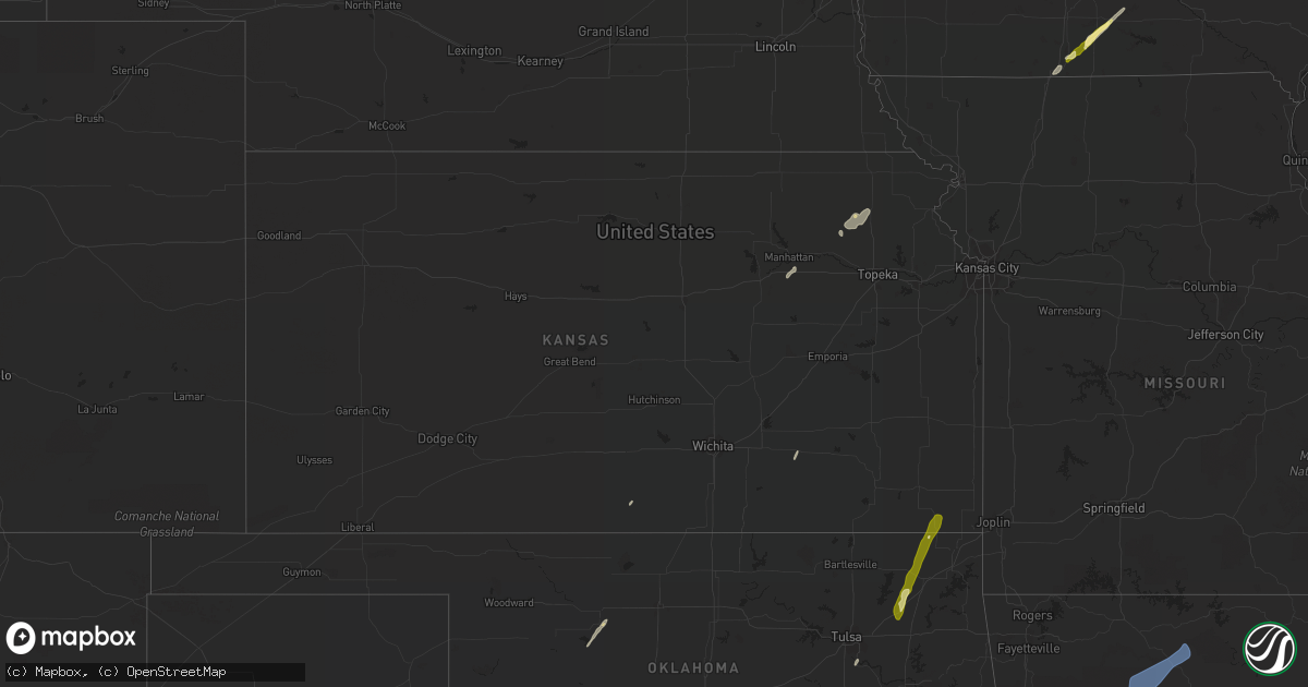
Hail Map in Kansas on November 4, 2022
Get this storm
November 4 map
$229
one time, instant access
Download today. No call, no setup
Keep the $229
Bought the map and want the full workflow? Apply the entire $229 to a subscription within 7 days. None of it is wasted.
Every map, not just this one
This buys you this map. Subscription and you get every map we run, in the markets you choose from a few cities to whole states to nationwide. Plus real-time alerts the moment a storm fires.
Contact data
Name, contact info, occupancy, even credit band for addresses in the footprint. You go from where it hit to who to call.
Become the source they trust
Unlimited branding weather history reports on demand. You already have the documented answer ready for the property owner, and you are the one who showed up with it.
Property data and RoofTrace estimates
Pull up any address you have got, its value and the exact code rules for that jurisdiction, straight from One Click Code. Then RoofTrace estimates the squares, pitch, and roof value, priced the way you price.
Storm reports in Kansas
Kansas
| Date | Description |
|---|---|
| 11/04/20226:22 PM CDT | Delayed report. Time estimated by radar. |
| 11/04/20221:18 AM CDT | At 618 PM CDT, a severe thunderstorm was located over Chetopa, moving northeast at 75 mph. HAZARD...Quarter size hail. SOURCE...Radar indicated. IMPACT...Damage to vehicles is expected. Locations impacted include... Sherman, West Mineral, Faulkner and Hallowell. |
| 11/04/20221:15 AM CDT | At 615 PM CDT, a severe thunderstorm was located 6 miles southwest of Chetopa, moving north at 70 mph. HAZARD...Quarter size hail. SOURCE...Radar indicated. IMPACT...Damage to vehicles is expected. Locations impacted include... Oswego and Chetopa. |
All States Impacted by Hail Map on November 4, 2022
Cities Impacted by Hail Map on November 4, 2022
- Sun Prairie, WI
- Columbus, WI
- Waterloo, WI
- Marshall, WI
- Verona, WI
- Mount Horeb, WI
- Madison, WI
- Booneville, AR
- Magazine, AR
- Lowden, IA
- Wheatland, IA
- Lost Nation, IA
- Baldwin, IA
- Maquoketa, IA
- Oxford Junction, IA
- Circleville, KS
- Holton, KS
- Soldier, KS
- Havensville, KS
- Coggon, IA
- Central City, IA
- Fairview, OK
- Isabella, OK
- Longdale, OK
- Darlington, WI
- Scales Mound, IL
- Elizabeth, IL
- Gratiot, WI
- Hanover, IL
- South Wayne, WI
- Bellevue, IA
- Argyle, WI
- Shullsburg, WI
- Apple River, IL
- Galena, IL
- Longview, TX
- Seagoville, TX
- Bynum, TX
- Waxahachie, TX
- Frost, TX
- Milford, TX
- Blooming Grove, TX
- Palmer, TX
- Hillsboro, TX
- Italy, TX
- Mertens, TX
- Ferris, TX
- Ennis, TX
- Broken Bow, OK
- Idabel, OK
- Foreman, AR
- Alleene, AR
- Ashdown, AR
- Cumby, TX
- Sulphur Springs, TX
- Brashear, TX
- Wills Point, TX
- Kaufman, TX
- Lone Oak, TX
- Point, TX
- Quinlan, TX
- Terrell, TX
- Chariton, IA
- Pecatonica, IL
- Ridott, IL
- Davis, IL
- Durand, IL
- Rock City, IL
- Avoca, TX
- Lueders, TX
- Throckmorton, TX
- Stamford, TX
- Albany, TX
- Hawley, TX
- Anson, TX
- Caddo Mills, TX
- Nevada, TX
- Farmersville, TX
- Royse City, TX
- Lewisville, TX
- Gilmer, TX
- Aquilla, TX
- Kingsbury, TX
- Piedmont, KS
- Sumner, TX
- Boswell, OK
- Hugo, OK
- Arthur City, TX
- Honobia, OK
- Hodgen, OK
- Muse, OK
- Whitesboro, OK
- Dike, TX
- Rattan, OK
- Spencerville, OK
- Denison, TX
- Cottage Grove, WI
- Cambridge, WI
- Stoughton, WI
- Deerfield, WI
- Detroit, TX
- Celeste, TX
- Little Elm, TX
- Marlin, TX
- Thornton, TX
- Kosse, TX
- Reagan, TX
- Fort Worth, TX
- Humeston, IA
- Garden Grove, IA
- Derby, IA
- Russell, IA
- Holliday, TX
- Henrietta, TX
- Wichita Falls, TX
- Pittsburg, TX
- Big Sandy, TX
- New Boston, TX
- Simms, TX
- De Kalb, TX
- Naples, TX
- Omaha, TX
- Sherman, TX
- Pottsboro, TX
- Temple, TX
- Moody, TX
- Crawford, TX
- Valley Mills, TX
- Junction City, KS
- Manhattan, KS
- Howe, TX
- Whitesboro, TX
- Texarkana, AR
- Queen City, TX
- Karnack, TX
- Mooringsport, LA
- Diana, TX
- Harleton, TX
- Fort Hood, TX
- Killeen, TX
- Greenville, TX
- Carrollton, TX
- Waskom, TX
- Cushing, TX
- Rusk, TX
- Tatum, TX
- Beckville, TX
- Marshall, TX
- Kerens, TX
- Corsicana, TX
- Oil City, LA
- Lena, IL
- Carter, OK
- Vinson, OK
- Willow, OK
- Mangum, OK
- Mcfarland, WI
- Bixby, OK
- Chelsea, OK
- Adair, OK
- Maxwell, TX
- San Marcos, TX
- Lamoni, IA
- Davis City, IA
- Belton, TX
- Arlington, TX
- Euless, TX
- Argyle, TX
- Lanark, IL
- Shannon, IL
- Haltom City, TX
- Burleson, TX
- Irving, TX
- Kennedale, TX
- Godley, TX
- Hurst, TX
- North Richland Hills, TX
- Grand Prairie, TX
- Crowley, TX
- Bedford, TX
- Joshua, TX
- Dallas, TX
- Colleyville, TX
- Wolfe City, TX
- New Berlin, WI
- Dale, TX
- Cedar Creek, TX
- Elk City, OK
- Foss, OK
- Butler, OK
- Clinton, OK
- Dill City, OK
- Canute, OK
- Mabank, TX
- Kemp, TX
- Scotland, TX
- Olney, TX
- Bagwell, TX
- Clarksville, TX
- Wortham, TX
- Luling, TX
- Attica, KS
- Savanna, IL
- Clinton, IA
- De Witt, IA
- Mount Carroll, IL
- Thomson, IL
- Sabula, IA
- Welch, OK
- Leon, IA
- Emmet, AR
- Madill, OK
- Marietta, OK
- Ardmore, OK
- Mannsville, OK
- Commerce, TX
- Abilene, TX
- Henderson, TX
- Aubrey, TX
- Hughes Springs, TX
- Daingerfield, TX
- Lone Star, TX
- Avinger, TX
- Tyler, TX
- Muskego, WI
- Big Bend, WI
- Waukesha, WI
- Harrold, TX
- Davidson, OK
- Marion, IA
- Homestead, IA
- Fairfax, IA
- Oxford, IA
- Ely, IA
- Amana, IA
- Cedar Rapids, IA
- Swisher, IA
- Allen, TX
- Mckinney, TX
- Deport, TX
- Mansfield, AR
- Trinidad, TX
- Malakoff, TX
- Streetman, TX
- Lindale, TX
- Chandler, TX
- Winnsboro, TX
- Hawkins, TX
- Garland City, AR
- Hope, AR
- Fouke, AR
- Lewisville, AR
- Oglesby, TX
- Gatesville, TX
- Bogata, TX
- Lockhart, TX
- Honey Grove, TX
- Brookston, TX
- Laneville, TX
- Dodd City, TX
- Bonham, TX
- Windom, TX
- Telephone, TX
- Denton, TX
- Pryor, OK
- Claremore, OK
- Big Cabin, OK
- Anna, TX
- Blue Ridge, TX
- Haskell, TX
- Wylie, TX
- Sachse, TX
- Lavon, TX
- Princeton, TX
- Plano, TX
- Leonard, TX
- Rockwall, TX
- Pearl City, IL
- Low Moor, IA
- Fulton, IL
- Goose Lake, IA
- Camanche, IA
- Bryant, IA
- McGregor, TX
- Powderly, TX
- Grant, OK
- Petty, TX
- Paris, TX
- Mukwonago, WI
- Reeseville, WI
- Rule, TX
- Oregon, WI
- Brooklyn, WI
- Alba, TX
- Yantis, TX
- Fruitvale, TX
- Quitman, TX
- Grand Saline, TX
- Emmett, KS
- Onaga, KS
- Wyoming, IA
- Center Junction, IA
- Bluejacket, OK
- Chadwick, IL
- Coppell, TX
- Grapevine, TX
- Seguin, TX
- Mounds, OK
- Cleburne, TX
- Granbury, TX
- Glen Rose, TX
- Rainbow, TX
- Maypearl, TX
- Midlothian, TX
- Grapeland, TX
- Addison, TX
- Bartlett, KS
- Chetopa, KS
- Vinita, OK
- Oswego, KS
- Columbus, KS
- Archer City, TX
- Horicon, WI
- Juneau, WI
- Beaver Dam, WI
- Lake Mills, WI
- Hales Corners, WI
- Milwaukee, WI
- Gillham, AR
- Bluffton, AR
- Oden, AR
- Vandervoort, AR
- Mount Ida, AR
- Gravelly, AR
- Harvey, AR
- Pencil Bluff, AR
- Umpire, AR
- Mena, AR
- Wickes, AR
- Grannis, AR
- Dover, AR
- Saint Joe, AR
- Hagarville, AR
- Marshall, AR
- Yellville, AR
- Witts Springs, AR
- Mount Judea, AR
- Pelsor, AR
- Harriet, AR
- Gilbert, AR
- Newport, AR
- Augusta, AR
- Traskwood, AR
- Malvern, AR
- Oil Trough, AR
- Ward, AR
- Jacksonville, AR
- Beebe, AR
- Vilonia, AR
- Bryant, AR
- Lonoke, AR
- Judsonia, AR
- Kensett, AR
- Bismarck, AR
- Alexander, AR
- Romance, AR
- Little Rock, AR
- Cabot, AR
- Lonsdale, AR
- Donaldson, AR
- Des Arc, AR
- Bradford, AR
- Little Rock Air Force Base, AR
- Benton, AR
- McRae, AR
- Bald Knob, AR
- Garner, AR
- Russell, AR
- Griffithville, AR
- Sherwood, AR
- Searcy, AR
- North Little Rock, AR
- Pleasant Plains, AR
- Amity, AR
- El Paso, AR
- Thida, AR
- Arkadelphia, AR
- Higginson, AR
- Hot Springs National Park, AR
- Austin, AR
- Redfield, AR
- Linden, TX
- Gurdon, AR
- Hooks, TX
- Douglassville, TX
- Carthage, AR
- Sheridan, AR
- Jefferson, AR
- England, AR
- Sparkman, AR
- Fulton, AR
- Prattsville, AR
- Atlanta, TX
- Bauxite, AR
- Texarkana, TX
- Marietta, TX
- Prescott, AR
- Ogden, AR
- Poyen, AR
- Maud, TX
- Nash, TX
- Hensley, AR
- Washington, AR
- Leola, AR
- Poteau, OK
- Hartford, AR
- Heavener, OK
- Winona, TX
- Huntington, AR
- Greenwood, AR
- Elkins, AR
- Fayetteville, AR
- Ore City, TX
- Eagletown, OK
- Smithville, OK
- Hartman, AR
- Coal Hill, AR
- Clarksville, AR
- Ozark, AR
- Altus, AR
- Mabelvale, AR
- Athens, TX


