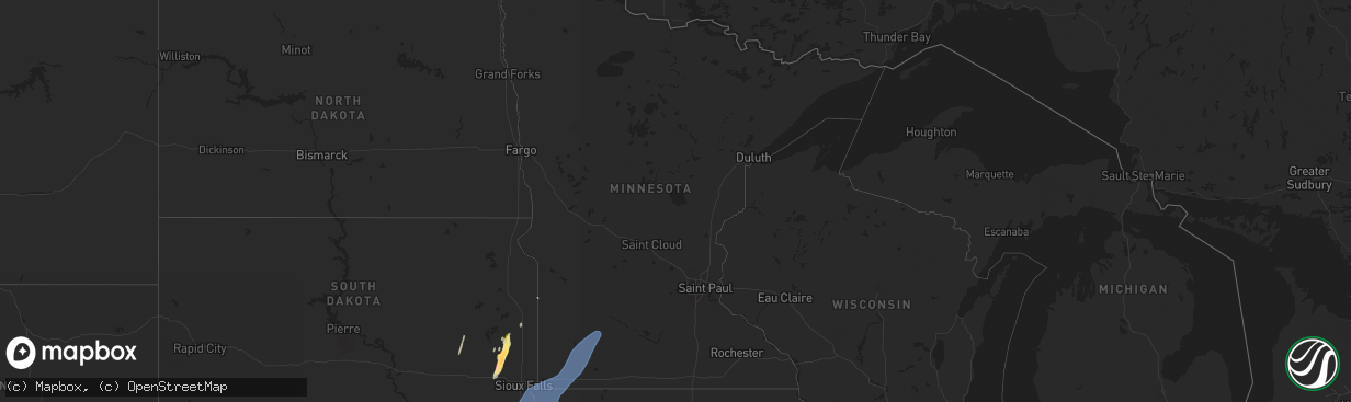
Hail Map in Minnesota on October 23, 2022
The weather event in Minnesota on October 23, 2022 includes Hail and Wind maps. 5 states and 112 cities were impacted and suffered possible damage. The total estimated number of properties impacted is 0.
Want more than just the map?
Turn this storm into a full workflow.
- Owner + property data so you know who to knock
- OnDemand branded weather history reports to win the "did we even have hail?" argument
- RoofTrace estimate so reps stop guessing numbers at the door
Bought this map? Upgrade within 7 days and we'll credit the $230. (10-15 min setup call)
Hail
Wind
0
Estimated number of impacted properties by a 1.00" hail or larger0
Estimated number of impacted properties by a 1.75" hail or larger0
Estimated number of impacted properties by a 2.50" hail or largerStorm reports in Minnesota
Minnesota
| Date | Description |
|---|---|
| 10/23/20223:46 AM CDT | At 846 PM CDT, a severe thunderstorm was located near Lamberton, or 22 miles north of Windom, moving northeast at 75 mph. HAZARD...60 mph wind gusts. SOURCE...Radar indicated. IMPACT...Expect damage to roofs, siding, and trees. This severe thunderstorm will be near... Springfield around 855 PM CDT. Morgan around 905 PM CDT. |
| 10/23/20223:20 AM CDT | At 820 PM CDT, severe thunderstorms were located along a line extending from near Chandler to Fulda to near Worthington, moving northeast at 75 mph. HAZARD...60 mph wind gusts. SOURCE...Radar indicated. IMPACT...Expect damage to roofs, siding, and trees. Severe thunderstorms will be near... Lakefield, Westbrook, Currie and Lake Shetek State Park around 830 PM CDT. Heron Lake, Storden and Dovray around 835 PM CDT. Windom around 840 PM CDT.Other locations in the path of these severe thunderstorms includeJeffers, Bingham Lake, Mountain Lake and Comfrey. |
| 10/22/20229:13 PM CDT | A local report indicates 62 MPH wind near 1 SSE NORTH REDWOOD |
| 10/22/20228:32 PM CDT | Mesonet station mn038 t.h.30 - dovray - mp 49. |
| 10/22/20228:02 PM CDT | Leaves plastered on side of house. Wind knocked out power. |
| 10/22/20227:52 PM CDT | Mesonet station mn147 i-90 - magnolia - mp 21.6. |
All States Impacted by Hail Map on October 23, 2022
Cities Impacted by Hail Map on October 23, 2022
- Brookings, SD
- Nunda, SD
- Madison, SD
- Rock Valley, IA
- Hull, IA
- Newman Grove, NE
- Meadow Grove, NE
- Pierce, NE
- Hoskins, NE
- Albion, NE
- Madison, NE
- Norfolk, NE
- Battle Creek, NE
- Ramona, SD
- Delphos, KS
- Volga, SD
- Arlington, SD
- Sinai, SD
- Canistota, SD
- Wentworth, SD
- Salem, SD
- Montrose, SD
- Rutland, SD
- Marietta, MN
- Canby, MN
- Iroquois, SD
- Artesian, SD
- White, SD
- Aurora, SD
- Colton, SD
- Sioux Center, IA
- Maskell, NE
- Ireton, IA
- Fairview, SD
- Hawarden, IA
- Centerville, SD
- George, IA
- Wynot, NE
- Larchwood, IA
- Hartington, NE
- Primrose, NE
- Luverne, MN
- Avoca, MN
- Walnut Grove, MN
- Reading, MN
- Alcester, SD
- Kanaranzi, MN
- Maurice, IA
- Wilmont, MN
- Belden, NE
- Vermillion, SD
- Tilden, NE
- Allen, NE
- Elk Point, SD
- Kenneth, MN
- Lamberton, MN
- Doon, IA
- Dixon, NE
- Canton, SD
- Storden, MN
- Worthington, MN
- Coleridge, NE
- Dovray, MN
- Hudson, SD
- Revere, MN
- Lismore, MN
- Burbank, SD
- Slayton, MN
- Beresford, SD
- Wanda, MN
- Iona, MN
- Petersburg, NE
- Orange City, IA
- Valley Springs, SD
- Boyden, IA
- Beaver Creek, MN
- Brewster, MN
- Winside, NE
- Wolbach, NE
- Laurel, NE
- Lennox, SD
- Alvord, IA
- Ponca, NE
- Wakonda, SD
- Sanborn, MN
- Steen, MN
- Westfield, IA
- Westbrook, MN
- Sioux Falls, SD
- Lester, IA
- Worthing, SD
- Rushmore, MN
- Cedar Rapids, NE
- Rock Rapids, IA
- Harrisburg, SD
- Randolph, NE
- Carroll, NE
- Gayville, SD
- Currie, MN
- Brandon, SD
- Little Rock, IA
- Magnolia, MN
- Tracy, MN
- Newcastle, NE
- Akron, IA
- Fulda, MN
- Adrian, MN
- Inwood, IA
- Chatsworth, IA
- Ellsworth, MN
- Hills, MN
- Volin, SD


