Hail Map in Tennessee on October 21, 2019
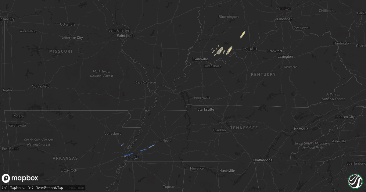
Get this storm
October 21 map
$229
one time, instant access
Download today. No call, no setup
Keep the $229
Bought the map and want the full workflow? Apply the entire $229 to a subscription within 7 days. None of it is wasted.
Every map, not just this one
This buys you this map. Subscription and you get every map we run, in the markets you choose from a few cities to whole states to nationwide. Plus real-time alerts the moment a storm fires.
Contact data
Name, contact info, occupancy, even credit band for addresses in the footprint. You go from where it hit to who to call.
Become the source they trust
Unlimited branding weather history reports on demand. You already have the documented answer ready for the property owner, and you are the one who showed up with it.
Property data and RoofTrace estimates
Pull up any address you have got, its value and the exact code rules for that jurisdiction, straight from One Click Code. Then RoofTrace estimates the squares, pitch, and roof value, priced the way you price.
Storm reports in Tennessee
Tennessee
| Date | Description |
|---|---|
| 10/21/20197:55 AM CDT | Truck blown over on christmasville road and oakfield. Winds estimated at 46 mph. |
| 10/21/20197:35 AM CDT | Large trees down at 2600 thousand oaks blvd north of american way and south of interstate 240. |
| 10/21/20197:30 AM CDT | Power lines down on mount moriah east of mendenhall near gossett kia auto dealership. Winds estimated at 53 mph. |
| 10/21/20197:30 AM CDT | A few trees down and structure damage to cottonwood apartments on cottonwood rd south of american way. |
| 10/21/20197:20 AM CDT | Winds were 53 mph and caused some structural damage at memphis international airport terminal. Some windows were blown out and damage in parking lot and near runway. |
| 10/21/20197:19 AM CDT | A few large tree limbs down around fed ex campus on the west side of airport on airways. |
| 10/21/20197:15 AM CDT | Roof damage to home and a lot of tree damage along sonny road. |
| 10/21/20197:14 AM CDT | Barn destroyed in the 13000 block of macon road. |
| 10/21/20197:03 AM CDT | Numerous trees down in halls. Damage to metal outbuilding. |
| 10/21/20192:08 AM CDT | At 708 AM CDT, severe thunderstorms were located along a line extending from 6 miles southeast of Hunter-Dawson State Historic Site to 6 miles east of Reelfoot Lake State Park to near Dyersburg, moving northeast at 60 mph. HAZARD...60 mph wind gusts. SOURCE...Radar indicated. IMPACT...Expect damage to roofs, siding, and trees. Locations impacted include... New Madrid, Fulton, Hickman, Clinton, Hunter-Dawson State Historic Site, Towosahgy State Historic Site, Big Oak Tree State Park, Cayce, Dorena, Fulgham, Water Valley, Columbus and Boundurant.This includes Interstate 69 in Kentucky between Mile Markers 1 and12. |
| 10/21/201912:44 AM CDT | At 544 AM CDT, severe thunderstorms were located along a line extending from near Trumann to near Parkin, moving northeast at 45 mph. HAZARD...60 mph wind gusts and quarter size hail. SOURCE...Radar indicated. IMPACT...Hail damage to vehicles is expected. Expect wind damage to roofs, siding, and trees. Locations impacted include... Jonesboro, Blytheville, Osceola, Trumann, Marked Tree, Lake City, Lepanto, Bay, Caraway, Luxora, Wilson, Tyronza, Keiser, Joiner, Dyess, Dell, Burdette, Gilmore, Bassett and Marie. |
Cities Impacted by Hail Map on October 21, 2019
- Tell City, IN
- Bristow, IN
- Scottsburg, IN
- Salem, IN
- Leopold, IN
- Grantsburg, IN
- English, IN
- Branchville, IN
- Sulphur, IN
- Gentryville, IN
- Dale, IN
- Holland, IN
- Chrisney, IN
- Santa Claus, IN
- Ferdinand, IN
- Huntingburg, IN
- Jasper, IN
- Saint Meinrad, IN
- Saint Croix, IN
- Birdseye, IN
- Saint Anthony, IN
- Stendal, IN
- Evanston, IN
- Lamar, IN
- Tyronza, AR
- Memphis, TN
- Marion, AR
- West Memphis, AR
- Germantown, TN
- Arlington, TN
- Mason, TN
- Stanton, TN


