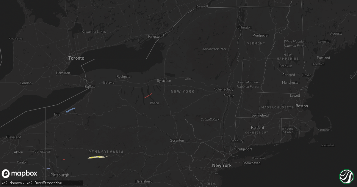
Hail Map in New York on October 15, 2021
Get this storm
October 15 map
$229
one time, instant access
Download today. No call, no setup
Keep the $229
Bought the map and want the full workflow? Apply the entire $229 to a subscription within 7 days. None of it is wasted.
Every map, not just this one
This buys you this map. Subscription and you get every map we run, in the markets you choose from a few cities to whole states to nationwide. Plus real-time alerts the moment a storm fires.
Contact data
Name, contact info, occupancy, even credit band for addresses in the footprint. You go from where it hit to who to call.
Become the source they trust
Unlimited branding weather history reports on demand. You already have the documented answer ready for the property owner, and you are the one who showed up with it.
Property data and RoofTrace estimates
Pull up any address you have got, its value and the exact code rules for that jurisdiction, straight from One Click Code. Then RoofTrace estimates the squares, pitch, and roof value, priced the way you price.
Storm reports in New York
New York
| Date | Description |
|---|---|
| 10/15/20214:10 AM CDT | Tree down on a residence. No injuries repored at this time. Time is estimated by radar. |
| 10/15/20214:01 AM CDT | Outside industrial tent twisted. |
| 10/15/20214:00 AM CDT | Small tree down on non-residential building. |
| 10/15/20213:20 AM CDT | Tree down blocking roadway. Time estimated by radar. |
| 10/15/20211:30 AM CDT | At 630 PM EDT, a severe thunderstorm was located near Lake Erie State Park, or near Fredonia, moving northeast at 20 mph. HAZARD...60 mph wind gusts and penny size hail. SOURCE...Radar indicated. IMPACT...Expect damage to trees and power lines. Locations impacted include... Dunkirk, Fredonia, Silver Creek, Lake Erie State Park, SUNY Fredonia, Portland, Sheridan, Stockton, Brocton and Arkwright.This includes Interstate 90 near exit 59. |
| 10/15/20211:15 AM CDT | At 614 PM EDT, a severe thunderstorm was located over Darien Lakes State Park, moving east at 30 mph. HAZARD...60 mph wind gusts and quarter size hail. SOURCE...Radar indicated. IMPACT...Minor damage to vehicles is possible. Expect wind damage to trees and power lines. Locations impacted include... Batavia, Darien Lakes State Park, Marilla, Le Roy, Pembroke, Bennington, Akron, Alden, Attica and Pavilion.This includes Interstate 90 between exits 48A and 47. |
| 10/15/202112:53 AM CDT | At 552 PM EDT, a severe thunderstorm was located over Westfield, or 17 miles southwest of Fredonia, moving northeast at 25 mph. HAZARD...60 mph wind gusts and penny size hail. SOURCE...Radar indicated. IMPACT...Expect damage to trees and power lines. Locations impacted include... Dunkirk, Fredonia, Westfield, Mayville, Lake Erie State Park, SUNY Fredonia, Portland, Stockton, Brocton and Cassadaga.This includes Interstate 90 near exit 60. |
| 10/14/202111:27 PM CDT | At 427 PM EDT, a severe thunderstorm was located over Niles, or 11 miles southeast of Auburn, moving east at 25 mph. HAZARD...60 mph wind gusts and quarter size hail. SOURCE...Radar indicated. IMPACT...Hail damage to vehicles is expected. Expect wind damage to roofs, siding, and trees. Locations impacted include... Pompey, Manlius, Owasco, Otisco, Preble, Moravia, Niles, Scott, Truxton and Cuyler. |
| 10/14/202111:12 PM CDT | At 412 PM EDT, a severe thunderstorm was located near Grand Valley, moving northeast at 20 mph. HAZARD...60 mph wind gusts and penny size hail. SOURCE...Radar indicated. IMPACT...Expect damage to roofs, siding, and trees. Locations impacted include... Warren, Scandia, Warren South, Kinzua Dam, Chapman State Park, Starbrick and Clarendon. |
| 10/14/202110:45 PM CDT | At 345 PM EDT, a severe thunderstorm was located near Levanna, or 8 miles south of Seneca Falls, moving east at 25 mph. HAZARD...60 mph wind gusts and quarter size hail. SOURCE...Radar indicated. IMPACT...Hail damage to vehicles is expected. Expect wind damage to roofs, siding, and trees. Locations impacted include... Auburn, Romulus, Fayette, Owasco, Fleming, Skaneateles, Ledyard, Moravia, Union Springs and Niles. |
All States Impacted by Hail Map on October 15, 2021
Cities Impacted by Hail Map on October 15, 2021
- Ripley, TN
- Brownsville, TN
- Clearfield, PA
- Curwensville, PA
- Palestine, AR
- Cotton Plant, AR
- Des Arc, AR
- Wilson, AR
- Osceola, AR
- Adona, AR
- Perry, AR
- Houston, AR
- Morrilton, AR
- Sharon, TN
- Newbern, TN
- Kenton, TN
- Dyer, TN
- Rutherford, TN
- Greenfield, TN
- Big Sandy, TN
- Springville, TN
- Bells, TN
- Cabot, AR
- Hanover, IN
- Lexington, IN
- Underwood, IN
- Scottsburg, IN
- Newport, AR
- Plainview, AR
- Paron, AR
- Casa, AR
- Dardanelle, AR
- Bigelow, AR
- Conway, AR
- Scott, AR
- Morrisdale, PA
- West Decatur, PA
- Wallaceton, PA
- Waverly, TN
- McEwen, TN
- Evansville, IN
- Lepanto, AR
- Joiner, AR
- Marked Tree, AR
- Dyess, AR
- Etowah, AR
- Keiser, AR
- Mahaffey, PA
- Lonoke, AR
- Austin, AR
- Jacksonville, AR
- Ward, AR
- Coldwater, MS
- Senatobia, MS
- Holly Springs, MS
- Robinsonville, MS
- Amagon, AR
- Cash, AR
- Nabb, IN
- Henryville, IN
- Perryville, AR
- Philipsburg, PA
- Benton, IL
- Sesser, IL
- Whittington, IL
- Ewing, IL
- Ola, AR
- Danville, AR
- Jackson, TN
- Humboldt, TN
- Cedar Hill, TN
- Adams, TN
- Grampian, PA
- Olanta, PA
- Punxsutawney, PA
- Glen Richey, PA
- Madison, IN
- Marysville, IN
- Trumann, AR
- Bay, AR
- Wheatley, AR
- Brinkley, AR
- Belleville, AR
- Plumerville, AR
- Springfield, TN
- Cross Plains, TN
- England, AR
- Little Rock, AR
- Covington, TN
- Mayflower, AR
- Roland, AR
- Rossiter, PA
- Gadsden, TN
- Alamo, TN
- Forrest City, AR
- Goodwin, AR
- Henning, TN
- Mount Vernon, IN
- Monaca, PA
- Industry, PA
- Hookstown, PA
- Aliquippa, PA
- Midland, PA
- Georgetown, PA
- Shippingport, PA
- Butler, PA
- East Butler, PA
- Westfield, NY
- Mayville, NY
- Dewittville, NY
- Stockton, NY
- Sherman, NY
- Ripley, NY
- King Ferry, NY
- Interlaken, NY
- Lodi, NY
- Boonville, IN
- Chandler, IN
- Newburgh, IN
- Chrisney, IN
- Lamar, IN
- Gentryville, IN
- Pekin, IN
- Rover, AR
- Hickory Plains, AR
- Carlisle, AR
- Lynchburg, OH
- Hillsboro, OH
- Leesburg, OH
- Greenfield, OH
- South Salem, OH
- Chillicothe, OH
- Frankfort, OH
- Laurelville, OH
- Kingston, OH
- Circleville, OH
- Stoutsville, OH
- Amanda, OH
- Lancaster, OH
- Tarlton, OH
- Covington, KY
- Florence, KY
- Latonia, KY
- Ft Mitchell, KY
- Erlanger, KY


