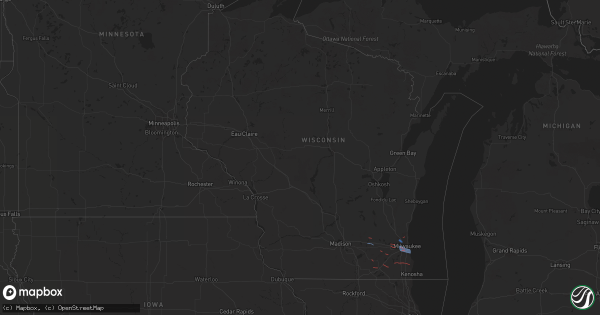
Hail Map in Wisconsin on October 12, 2022
Get this storm
October 12 map
$229
one time, instant access
Download today. No call, no setup
Keep the $229
Bought the map and want the full workflow? Apply the entire $229 to a subscription within 7 days. None of it is wasted.
Every map, not just this one
This buys you this map. Subscription and you get every map we run, in the markets you choose from a few cities to whole states to nationwide. Plus real-time alerts the moment a storm fires.
Contact data
Name, contact info, occupancy, even credit band for addresses in the footprint. You go from where it hit to who to call.
Become the source they trust
Unlimited branding weather history reports on demand. You already have the documented answer ready for the property owner, and you are the one who showed up with it.
Property data and RoofTrace estimates
Pull up any address you have got, its value and the exact code rules for that jurisdiction, straight from One Click Code. Then RoofTrace estimates the squares, pitch, and roof value, priced the way you price.
Storm reports in Wisconsin
Wisconsin
| Date | Description |
|---|---|
| 10/12/20221:00 PM CDT | Large limbs down. Time estimated from radar. |
| 10/12/202212:52 PM CDT | Report from mping: 1-inch tree limbs broken; shingles blown off. |
| 10/12/202212:47 PM CDT | Large tree limb down. Time estimated from radar. |
| 10/12/202212:47 PM CDT | Trees and large branches down. Time estim |
| 10/12/202212:47 PM CDT | Trees and large branches down. Time estimated from radar. |
| 10/12/202212:46 PM CDT | Trees downed 68th & harrison and 65th & cleveland ave milwaukee/west allis border. |
| 10/12/202212:40 PM CDT | A local report indicates a tornado near FRANKSVILLE |
| 10/12/202212:40 PM CDT | Tree branches down along e bolivar ave along with some yard decorations damaged. |
| 10/12/202212:38 PM CDT | Report from mping: 3-inch tree limbs broken; power poles broken. |
| 10/12/202212:34 PM CDT | Peak gust at mitchell international. |
| 10/12/202212:30 PM CDT | 3 inch diameter tree limbs snapped at 2nd street and plainfield avenue. Time estimated from radar. |
| 10/12/202212:30 PM CDT | A local report indicates a tornado near BROWN DEER |
| 10/12/202212:30 PM CDT | Large tree limbs down. Time estimated from radar. |
| 10/12/202212:29 PM CDT | Numerous trees and branches down. |
| 10/12/202212:26 PM CDT | Report from mping: 3-inch tree limbs broken; power poles broken. Estimated 50-60 mph. |
| 10/12/202212:24 PM CDT | Large trees down. Roof damage on a nearby barn. Time estimated from radar. |
| 10/12/202212:24 PM CDT | Large trees down on hayes avenue between 72nd and 74th streets. Power lines down on 72nd street between hayes avenue and beloit road. Time estimated from radar. |
| 10/12/202212:20 PM CDT | Nws damage survey. Ef-0 tornado. Peak winds of 65mph. Multiple eyewitness reports in this area. Main structural damage was to an outbuildings roof. |
| 10/12/202212:19 PM CDT | Limb down. 1.5 foot diameter. |
| 10/12/202212:19 PM CDT | Peak winds around 75 mph... Ended around s 58th st between w stack dr and s 57th st. Lasted less than 10 minutes. Path length about 3 miles. |
| 10/12/202212:17 PM CDT | Nws storm survey. Ef-0 tornado. Peak winds of 65mph. Tornado path started at the cemetery south of state road 50 and tracked to the southeast toward lake ivanhoe. Ended |
| 10/12/202212:14 PM CDT | A local report indicates a tornado near 2 NW BURLINGTON |
| 10/12/202212:10 PM CDT | Large tree down. Time estimated from radar. |
| 10/12/202212:03 PM CDT | A local report indicates a tornado near 2 ESE PEWAUKEE |
| 10/12/202212:01 PM CDT | A local report indicates a tornado near ELKHORN |
| 10/12/202211:55 AM CDT | Straight line wind damage report of an uprooted tree on a house and a pier ripped up on turtle lake. Relayed via delavan fire chief. |
| 10/12/202211:53 AM CDT | Tree snapped and large limbs down. Time estimated from radar. |
| 10/12/202211:48 AM CDT | Nws storm survey. Ef-0 tornado. Peak wind 65mph. Short lived... Weak tornado lofted considerable leaf debris. Multiple public reports of a funnel and debris in the air |
| 10/12/202211:45 AM CDT | Observed rotation/condensation funnel in contact with the ground just south of highway 12 and highway 59. |
| 10/12/202211:45 AM CDT | Relayed via social media. |
| 10/12/202211:43 AM CDT | Reports of multiple trees down and a few powerlines down. Time estimated from radar. |
| 10/12/202211:42 AM CDT | Nws storm survey. Ef-0 tornado with estimated peak winds of 65 mph. Damage path of 0.8 miles. Satellite imagery showed path and ground survey confirmed damage to horse |
| 10/12/202211:39 AM CDT | Mping reports from lac la belle... Oconomowoc and hartland of trees uprooted or snapped. Time estimated from radar. |
| 10/12/202211:36 AM CDT | Several trees and powerlines down in the the city of whitewater. |
| 10/12/202211:18 AM CDT | Nws storm survey. Ef-0 tornado with estimated peak winds of 65 mph. Path lenght of 0.4 miles. Confirmed via satellite imagery and ground survey. Tree and cornfield dama |
| 10/12/202211:13 AM CDT | Nws damage survey. Ef-0 tornado with estimated peak winds of 65 mph. Damage path of 0.5 miles. Track viewed from satellite data and confirmed by ground survey. Damage t |
| 10/12/20229:41 AM CDT | Large branches down. Patio table and chairs blown over. Time estimated from radar. |
| 10/12/20227:14 AM CDT | At 1214 PM CDT, a severe thunderstorm was located near Harvard, moving east at 35 mph. HAZARD...60 mph wind gusts. SOURCE...Radar indicated. IMPACT...Expect damage to roofs, siding, and trees. Locations impacted include... McHenry, Woodstock, Fox Lake, Johnsburg, Lakemoor, Spring Grove, Wonder Lake, Pistakee Highlands, Genoa City, Richmond, Hebron, Bull Valley, McCullom Lake, Ringwood and Greenwood. |
| 10/12/20227:02 AM CDT | At 1202 PM CDT, severe thunderstorms were located along a line extending from near Germantown to near East Troy, moving east at 55 mph. HAZARD...60 mph wind gusts. SOURCE...Radar indicated. IMPACT...Expect damage to roofs, siding, and trees. Locations impacted include... Milwaukee, West Allis, Wauwatosa, Greenfield, Oak Creek, South Milwaukee, Cudahy, Whitefish Bay, Greendale, Brown Deer, St. Francis, Hales Corners, Fox Point, Bayside, West Milwaukee, Franklin, Glendale, River Hills, Milwaukee Hoan Bridge and Shorewood.This includes the following Locations Schlitz Audobon Nature Center,Boerner Botanical Gardens, General Mitchell International Airport,Timmerman Airport, Froedert & the Medical College, and Fiserv Forum. |
| 10/12/20226:49 AM CDT | At 1149 AM CDT, severe thunderstorms were located along a line extending from near Merton to near Palmyra, moving east at 45 mph. HAZARD...60 mph wind gusts. SOURCE...Radar indicated. IMPACT...Expect damage to roofs, siding, and trees. Locations impacted include... Milwaukee, Waukesha, West Allis, Wauwatosa, New Berlin, Brookfield, Greenfield, Menomonee Falls, Oak Creek, Muskego, South Milwaukee, Cudahy, Whitefish Bay, Greendale, Pewaukee, Brown Deer, Sussex, St. Francis, Hartland and Hales Corners.People attending Wambold Dam Construction should seek safe shelterimmediately!This includes the following Locations Schlitz Audobon Nature Center,Boerner Botanical Gardens, General Mitchell International Airport,Timmerman Airport, Froedert & the Medical College, Fiserv Forum,Pewaukee Lake, Ottawa Lake Recreation Area, and Pinewoods Campground. |
| 10/12/20226:41 AM CDT | At 1140 AM CDT, severe thunderstorms were located along a line extending from near Cleveland to near Okauchee Lake, moving east at 35 mph. HAZARD...60 mph wind gusts. SOURCE...Radar indicated. IMPACT...Expect damage to roofs, siding, and trees. Locations impacted include... Sheboygan, West Bend, Mequon, Hartford, Brown Deer, Grafton, Cedarburg, Port Washington, Plymouth, Sheboygan Falls, Jackson, Slinger, Saukville, Bayside, Kewaskum, Thiensville, Howards Grove, Germantown, Oostburg and Belgium. |
All States Impacted by Hail Map on October 12, 2022
Cities Impacted by Hail Map on October 12, 2022
- Judsonia, AR
- Jay, OK
- Jackson, TN
- Ponca, AR
- Parthenon, AR
- Saltillo, TN
- Morris Chapel, TN
- Savannah, TN
- Collinwood, TN
- Lutts, TN
- Olivehill, TN
- Gentry, AR
- Siloam Springs, AR
- Albany, KY
- Alpha, KY
- Burkesville, KY
- Monticello, KY
- Ozark, AR
- Nixa, MO
- Clever, MO
- Billings, MO
- Belden, MS
- Tupelo, MS
- Pontotoc, MS
- Delaplaine, AR
- Hamburg, AR
- Jacksonville, AR
- Pineville, MO
- Anderson, MO
- Vaiden, MS
- Columbus, MS
- Cabot, AR
- Hazlehurst, MS
- Crystal Springs, MS
- Salina, OK
- Saint Paul, AR
- Witter, AR
- Pettigrew, AR
- Cleveland, AR
- Somerville, TN
- South West City, MO
- Afton, OK
- Grove, OK
- Rogersville, MO
- Strafford, MO
- Springfield, MO
- Clinton, AR
- Scotland, AR
- Fort Gay, WV
- Lowmansville, KY
- Crum, WV
- Wittensville, KY
- Inez, KY
- Ulysses, KY
- Tutor Key, KY
- River, KY
- Louisa, KY
- Stambaugh, KY
- Sitka, KY
- Paintsville, KY
- Flatgap, KY
- Oil Springs, KY
- Tomahawk, KY
- Staffordsville, KY
- Mulberry, AR
- Horseshoe Bend, AR
- Salem, AR
- Byhalia, MS
- Hernando, MS
- Coldwater, MS
- Reeds Spring, MO
- Galena, MO
- Cape Fair, MO
- Greenup, KY
- South Point, OH
- Ashland, KY
- Argillite, KY
- Kitts Hill, OH
- Flatwoods, KY
- Ironton, OH
- Noel, MO
- Alicia, AR
- Hoxie, AR
- Brownsville, TN
- Pangburn, AR
- Moro, AR
- Grand Junction, TN
- Hickory Valley, TN
- Marianna, AR
- Palestine, AR
- Benton, AR
- Bismarck, AR
- Courtland, MS
- Pittsboro, MS
- Randolph, MS
- Coffeeville, MS
- Water Valley, MS
- Oakland, MS
- Vance, MS
- Houlka, MS
- Pope, MS
- Big Creek, MS
- Vardaman, MS
- Banner, MS
- Calhoun City, MS
- Batesville, MS
- Coahoma, MS
- Enid, MS
- Lambert, MS
- Marks, MS
- Bruce, MS
- Parsons, TN
- Wildersville, TN
- Lexington, TN
- Darden, TN
- Salyersville, KY
- Hazel Green, KY
- Campton, KY
- Sardis, MS
- Carthage, AR
- Malvern, AR
- Donaldson, AR
- Sparkman, AR
- Leola, AR
- Arkadelphia, AR
- Sidney, AR
- Evening Shade, AR
- Watts, OK
- Colcord, OK
- Cherry Valley, AR
- Thaxton, MS
- Oxford, MS
- Blue Mountain, MS
- Holly Springs, MS
- De Witt, AR
- Gillett, AR
- Tichnor, AR
- Charleston, MS
- Duncan, MS
- Drew, MS
- Holcomb, MS
- Gunnison, MS
- Merigold, MS
- Ruleville, MS
- Snow Lake, AR
- Mound Bayou, MS
- Greenwood, MS
- Shelby, MS
- Schlater, MS
- Minter City, MS
- Philipp, MS
- Aberdeen, MS
- Sparta, MO
- Ozark, MO
- Decatur, AR
- Canehill, AR
- Corning, AR
- Biggers, AR
- McRae, AR
- Searcy, AR
- Hartman, AR
- Clarksville, AR
- Gurdon, AR
- Collierville, TN
- Tutwiler, MS
- Tillatoba, MS
- Sumner, MS
- Half Way, MO
- Forsyth, MO
- Taneyville, MO
- Rogers, AR
- Lowell, AR
- Spokane, MO
- Alligator, MS
- Clarksdale, MS
- Crumrod, AR
- Cookeville, TN
- Saffell, AR
- Sulphur Rock, AR
- Strawberry, AR
- Mount Pleasant, AR
- Cave City, AR
- Lynn, AR
- Batesville, AR
- Mercer, TN
- Denmark, TN
- Fayetteville, AR
- Stanton, TN
- Enville, TN
- Reagan, TN
- Sardis, TN
- Scotts Hill, TN
- Scranton, AR
- New Blaine, AR
- Bolivar, TN
- Aliceville, AL
- Roland, AR
- Mayflower, AR
- Saint Charles, AR
- Hanceville, AL
- Paron, AR
- Oak Grove, LA
- Eudora, AR
- Owingsville, KY
- Morehead, KY
- Hillsboro, KY
- Sharpsburg, KY
- Tatum, TX
- Beckville, TX
- Wiergate, TX
- Jasper, TX
- Wadley, AL
- Tuskegee, AL
- Natchez, MS
- Crosby, MS
- Adamsville, TN
- Selmer, TN
- Bethel Springs, TN
- Stantonville, TN
- New Albany, MS
- El Dorado, AR
- Tallassee, AL
- Broxton, GA
- Jemison, AL
- Shelby, AL
- Columbiana, AL
- Calera, AL
- Taylor, AR
- McNeil, AR
- Bessemer, AL
- McCalla, AL
- Waterford, MS
- Union, MS
- Philadelphia, MS
- Walnut Grove, MS
- Lake, MS
- Princeton, LA
- Haughton, LA
- Sarah, MS
- Senatobia, MS
- Shubuta, MS
- Gilbertown, AL
- Silas, AL
- Waynesboro, MS
- Fulton, MS
- Morton, MS
- Camden, AR
- Converse, LA
- Lena, MS
- Forest, MS
- Como, MS
- Livingston, TX
- Warren, TX
- Woodville, TX
- Plantersville, MS
- Junction City, AR
- Haynesville, LA
- Giddings, TX
- Ledbetter, TX
- Lincoln, TX
- Lorman, MS
- White Hall, AR
- Mantachie, MS
- Frankville, AL
- Sheridan, AR
- Stamps, AR
- Pike Road, AL
- Mathews, AL
- Fitzpatrick, AL
- Union Church, MS
- Quitman, MS
- Butler, AL
- Jachin, AL
- Ward, AL
- Meridian, MS
- Lisman, AL
- Pennington, AL
- Shelbyville, TX
- Homer, LA
- Lisbon, LA
- Summerfield, LA
- Gallion, AL
- Horn Lake, MS
- Memphis, TN
- Southaven, MS
- Lake Providence, LA
- Apple Springs, TX
- Groveton, TX
- Houston, MS
- Okolona, MS
- Portland, AR
- Bentley, LA
- Trout, LA
- Ball, LA
- Boyce, LA
- Dry Prong, LA
- Pineville, LA
- Alexandria, LA
- Jena, LA
- Pollock, LA
- Jonesville, LA
- Olla, LA
- Cecil, AL
- Tunica, MS
- Lake Village, AR
- Montrose, AR
- Ethel, LA
- Pitkin, LA
- Franklin, TX
- Marquez, TX
- Antoine, AR
- Okolona, AR
- Delight, AR
- Enterprise, MS
- Greenwood Springs, MS
- Blue Springs, MS
- Myrtle, MS
- Abbeville, MS
- Baldwyn, MS
- Vina, AL
- Detroit, AL
- Guin, AL
- Booneville, MS
- Marietta, MS
- Mooreville, MS
- Ecru, MS
- Guntown, MS
- Brilliant, AL
- Tremont, MS
- Etta, MS
- Hamilton, AL
- Beaverton, AL
- Winfield, AL
- Nettleton, MS
- Saltillo, MS
- Newton, MS
- Rose Hill, MS
- Chunky, MS
- Hickory, MS
- Linden, AL
- Thomaston, AL
- Minden, LA
- Hampton, AR
- Clayton, AL
- Louisville, AL
- Midway, AL
- Banks, AL
- Shorter, AL
- Eupora, MS
- Walthall, MS
- Thomasville, AL
- Castor, LA
- Marshall, TX
- De Berry, TX
- Saint Francisville, LA
- Jackson, LA
- Roxie, MS
- Bearden, AR
- Jersey, AR
- Prescott, AR
- Chidester, AR
- Louin, MS
- Damascus, AR
- Greenbrier, AR
- Springfield, AR
- Summers, AR
- Farmington, AR
- Prairie Grove, AR
- Lincoln, AR
- Cedarbluff, MS
- Woodland, MS
- West Point, MS
- Paris, AR
- Magazine, AR
- Boligee, AL
- Eutaw, AL
- Lewisville, AR
- Dundee, MS
- Notasulga, AL
- Sulligent, AL
- Lawrence, MS
- Conehatta, MS
- Grapevine, AR
- Pine Bluff, AR
- Troup, TX
- Kosciusko, MS
- Potts Camp, MS
- Mantee, MS
- Liberty, MS
- Gloster, MS
- Stonewall, LA
- Keatchie, LA
- Gloster, LA
- Natchitoches, LA
- Campti, LA
- Garrison, TX
- Springhill, LA
- Winslow, AR
- Mountainburg, AR
- Elkins, AR
- Franklin, TN
- Harrisonburg, LA
- Greensboro, AL
- Demopolis, AL
- Faunsdale, AL
- Durant, MS
- Red Banks, MS
- Reklaw, TX
- Jacksonville, TX
- Elm Grove, LA
- Ringgold, LA
- Sarepta, LA
- Pachuta, MS
- Newbern, AL
- Uniontown, AL
- York, AL
- Stonewall, MS
- Toxey, AL
- Starkville, MS
- Sicily Island, LA
- Gibsland, LA
- Arcadia, LA
- Shuqualak, MS
- Macon, MS
- Moundville, AL
- Crossett, AR
- Fort Gaines, GA
- Abbeville, AL
- Plain Dealing, LA
- Overton, TX
- Anguilla, MS
- Shellman, GA
- Dawson, GA
- Colt, AR
- Morris, GA
- Cuthbert, GA
- Olive Branch, MS
- Walls, MS
- Lake Cormorant, MS
- Nesbit, MS
- Germantown, TN
- Shannon, MS
- Caledonia, MS
- Dermott, AR
- Grayson, KY
- Olive Hill, KY
- Cotton Valley, LA
- Benton, LA
- Forrest City, AR
- Tiplersville, MS
- Walnut, MS
- Falkner, MS
- Ripley, MS
- Ashland, MS
- Sherwood, AR
- England, AR
- Rayville, LA
- Kilgore, TX
- Decatur, MS
- Coushatta, LA
- Daviston, AL
- Goodwater, AL
- Rockford, AL
- Millry, AL
- Kennard, TX
- San Augustine, TX
- Center, TX
- Nacogdoches, TX
- Normangee, TX
- Wilson, LA
- Dumas, MS
- New Site, MS
- Golden, MS
- Eldridge, AL
- Rienzi, MS
- Crenshaw, MS
- Port Gibson, MS
- Russell, KY
- Leesville, LA
- Hamilton, MS
- Saline, LA
- Robeline, LA
- Morrisville, MO
- Shongaloo, LA
- Doyline, LA
- Nashville, GA
- Willacoochee, GA
- Greenville, MS
- Bradley, AR
- Clinton, LA
- Sledge, MS
- Kirby, AR
- Langley, AR
- Fayette, MS
- Clanton, AL
- Wray, GA
- Centreville, MS
- Magnolia, AR
- Stephens, AR
- Simsboro, LA
- Ramer, AL
- Montgomery, AL
- Jamestown, LA
- Cedar Creek, TX
- Lexington, MS
- West, MS
- Alexander City, AL
- Provencal, LA
- Murfreesboro, AR
- Mansfield, LA
- Mount Holly, AR
- Plaucheville, LA
- Moreauville, LA
- Simmesport, LA
- Dadeville, AL
- Athens, LA
- Henderson, TX
- Otis, LA
- Dayton, TX
- Coleman, GA
- Hermitage, AR
- Amity, AR
- Louann, AR
- Bluff City, AR
- Mellwood, AR
- Ashland, LA
- Verbena, AL
- Brookwood, AL
- Coffeeville, AL
- Millport, AL
- Prairie, MS
- Steens, MS
- Sallis, MS
- Emerson, AR
- Napoleonville, LA
- Bolivar, MO
- Brighton, MO
- Willard, MO
- Muldrow, OK
- Needham, AL
- Tuskegee Institute, AL
- Epps, LA
- Grand Cane, LA
- Frierson, LA
- Bossier City, LA
- Pierre Part, LA
- Brookeland, TX
- Deridder, LA
- Newton, TX
- Merryville, LA
- Burkeville, TX
- Pheba, MS
- Maben, MS
- Union Springs, AL
- Hickory Flat, MS
- Scooba, MS
- Hollandale, MS
- Butler, WI
- Menomonee Falls, WI
- Milwaukee, WI
- Oak Creek, WI
- Hales Corners, WI
- Brookfield, WI
- New Berlin, WI
- Greendale, WI
- Saint Francis, WI
- Cudahy, WI
- South Milwaukee, WI
- Watertown, WI
- Johnson Creek, WI
- Helenville, WI
- Dousman, WI
- Mukwonago, WI
- Waukesha, WI
- Whitewater, WI
- Burlington, WI
- Elkhorn, WI
- Pewaukee, WI
- Union Grove, WI
- Sturtevant, WI
- Franksville, WI
- Racine, WI
- Waterford, WI
- Burns, TN
- Fairview, TN
- Dickson, TN
- Kingston Springs, TN
- Nashville, TN
- Brentwood, TN
- Antioch, TN
- Bon Aqua, TN
- Lyles, TN
- Gallatin, TN
- Mount Juliet, TN
- Hendersonville, TN
- Old Hickory, TN
- Lebanon, TN
- Austin, AR


