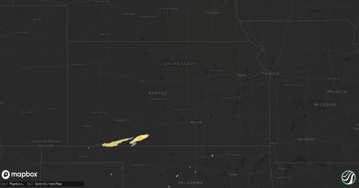
Hail Map in Kansas on October 12, 2014
Get this storm
October 12 map
$229
one time, instant access
Download today. No call, no setup
Keep the $229
Bought the map and want the full workflow? Apply the entire $229 to a subscription within 7 days. None of it is wasted.
Every map, not just this one
This buys you this map. Subscription and you get every map we run, in the markets you choose from a few cities to whole states to nationwide. Plus real-time alerts the moment a storm fires.
Contact data
Name, contact info, occupancy, even credit band for addresses in the footprint. You go from where it hit to who to call.
Become the source they trust
Unlimited branding weather history reports on demand. You already have the documented answer ready for the property owner, and you are the one who showed up with it.
Property data and RoofTrace estimates
Pull up any address you have got, its value and the exact code rules for that jurisdiction, straight from One Click Code. Then RoofTrace estimates the squares, pitch, and roof value, priced the way you price.
Storm reports in Kansas
Kansas
| Date | Description |
|---|---|
| 10/12/20144:45 PM CDT | Hail is covering the ground. |
| 10/12/20144:45 PM CDT | A local report indicates 60 MPH wind near 11 SE MEADE STATE PARK |
| 10/12/20144:25 PM CDT | A local report indicates 1.00 inch wind near MEADE STATE PARK |
| 10/11/20147:57 PM CDT | Hail was the size of golfballs just before he called... Then became quarter size shortly after. |
| 10/11/20147:50 PM CDT | A local report indicates 60 MPH wind near 5 SSW COLDWATER |
All States Impacted by Hail Map on October 12, 2014
Cities Impacted by Hail Map on October 12, 2014
- Hobart, OK
- Roosevelt, OK
- Olney, TX
- Newcastle, TX
- Loving, TX
- Graham, TX
- Edmond, OK
- Oklahoma City, OK
- Arapaho, OK
- Thomas, OK
- Weatherford, OK
- Clinton, OK
- Goodrich, TX
- New Caney, TX
- Livingston, TX
- Splendora, TX
- Chester, TX
- Shepherd, TX
- Dayton, TX
- Cleveland, TX
- Buffalo, OK
- Ashland, KS
- Wanette, OK
- Lexington, OK
- Blanket, TX
- Coldwater, KS
- Colorado City, TX
- Robert Lee, TX
- Follett, TX
- Henagar, AL
- Pisgah, AL
- Ider, AL
- Dutton, AL
- Flat Rock, AL
- Section, AL
- Bend, TX
- Lampasas, TX
- Lometa, TX
- San Saba, TX
- Fluvanna, TX
- Walters, OK
- Glen Allan, MS
- Shamrock, TX
- Wellington, TX
- Texola, OK
- Erick, OK
- Mustang, OK
- Yukon, OK
- Watonga, OK
- Nettleton, MS
- Anson, TX
- Stamford, TX
- Lueders, TX
- Avoca, TX
- Bowie, TX
- Jacksboro, TX
- Bryson, TX
- Vardaman, MS
- Bridgeport, TX
- Paradise, TX
- Jayton, TX
- Rotan, TX
- Snyder, TX
- Aspermont, TX
- Goldsboro, TX
- Novice, TX
- Winters, TX
- Benton, LA
- Shreveport, LA
- Voss, TX
- Ballinger, TX
- Wingate, TX
- Bronte, TX
- Geary, OK
- Calumet, OK
- Paducah, TX
- Seymour, TX
- Knox City, TX
- Old Glory, TX
- Decatur, TX
- Weinert, TX
- Munday, TX
- Hennessey, OK
- Meade, KS
- Watson, OK
- Eudora, AR
- Protection, KS
- Electra, TX
- Ira, TX
- Groveoak, AL
- Crossville, AL
- Albertville, AL
- Horton, AL
- Guntersville, AL
- Alvord, TX
- Chico, TX
- Goree, TX
- Colony, OK
- Cordell, OK
- Wilmore, KS
- Norton, TX
- Carter, OK
- Elk City, OK
- Dawson, AL
- Englewood, KS
- Dodson, LA
- Winnfield, LA
- Homer, LA
- Shongaloo, LA
- Cotton Valley, LA
- Haynesville, LA
- Minden, LA
- Burbank, OK
- Canute, OK
- Lone Wolf, OK
- Hinton, OK
- Dill City, OK
- Foss, OK
- Willow, OK
- Bessie, OK
- Hydro, OK
- Corn, OK
- Sentinel, OK
- Humble, TX
- Kingwood, TX
- Porter, TX
- O'Brien, TX
- Rochester, TX
- Big Spring, TX
- Abilene, TX
- Hooker, OK
- Tupelo, MS
- Pontotoc, MS
- Belden, MS
- Woodson, TX
- Throckmorton, TX
- Plains, KS
- Fyffe, AL
- Collinsville, AL
- Geraldine, AL
- Many, LA
- Jasper, TX
- Newton, TX
- Wiergate, TX
- Hemphill, TX
- Florien, LA
- Hallettsville, TX
- Rule, TX
- Sunflower, MS
- Powderly, TX
- Breckenridge, TX
- Graford, TX
- South Bend, TX
- Carbon Hill, AL
- Oakman, AL
- Jasper, AL
- Townley, AL
- Forgan, OK
- Gate, OK
- Turpin, OK
- Kismet, KS
- Liberal, KS
- Davidson, OK
- Hermleigh, TX
- Rolling Fork, MS
- Hollandale, MS
- Carlsbad, TX
- Gainesboro, TN
- Whitleyville, TN
- Bernice, LA
- Spearsville, LA
- Lillie, LA
- Junction City, AR
- El Dorado, AR
- Granville, TN
- Bloomington Springs, TN
- Buffalo Valley, TN
- Baxter, TN
- Merkel, TX
- Tioga, TX
- Collinsville, TX
- Gunter, TX
- Waco, TX
- China Spring, TX
- Crawford, TX
- Woodway, TX
- Grandfield, OK
- Sumner, TX
- Bellevue, TX
- Coahoma, TX
- Garwood, TX
- Edna, TX
- Copperas Cove, TX
- Sweetwater, TX
- Celina, TN
- Saint Jo, TX
- Nocona, TX
- Rising Star, TX
- Tremont, MS
- Marion, LA
- Canadian, TX
- Gainesville, TX
- Thackerville, OK
- Marshall, TX
- Karnack, TX
- Whitesboro, TX
- Aimwell, LA
- Harrisonburg, LA
- Altus, OK
- Fulton, MS
- Roscoe, TX
- Nolan, TX
- Miles, TX
- San Angelo, TX
- Reform, AL
- Millport, AL
- Gotebo, OK
- Mountain View, OK
- Rudy, AR
- Muenster, TX
- Lindsay, TX
- Oklaunion, TX
- Burkesville, KY
- Tompkinsville, KY
- Silver Point, TN
- Hilham, TN
- Moss, TN
- Doddsville, MS
- Indianola, MS
- Moorhead, MS
- Sadler, TX
- Mooringsport, LA
- Belcher, LA
- Anguilla, MS
- Roby, TX
- Bear Creek, AL
- Hackleburg, AL
- Ranger, TX
- Eastland, TX
- Crowell, TX
- Blackwell, TX
- Fayette, AL
- Bankston, AL
- Boynton, OK
- Hugoton, KS
- Albany, TX
- Fletcher, OK
- Lawton, OK
- Elgin, OK
- Marthaville, LA
- Berry, AL
- Cordova, AL
- Rusk, TX
- Jacksonville, TX
- Plantersville, MS
- Shannon, MS
- Okolona, MS
- Greenfield, TN
- Gleason, TN
- Dresden, TN
- Headrick, OK
- Blair, OK
- Olustee, OK
- Coffeeville, MS
- Grenada, MS
- Ethelsville, AL
- Jermyn, TX
- Oakwood, TX
- Ovalo, TX
- Lawn, TX
- Clyde, TX
- Covington, OK
- Bruce, MS
- Chillicothe, TX
- Vernon, TX
- Gail, TX
- Healdton, OK
- Sawyer, OK
- Colmesneil, TX
- Woodville, TX
- Perrin, TX
- Harrold, TX
- Sanger, TX
- Perry, OK
- Ringling, OK
- Strawn, TX
- Murray, KY
- Magnolia, AR
- Westbrook, TX
- Haskell, TX
- Sylvester, TX
- Oglesby, TX
- McGregor, TX
- Houlka, MS
- Hodgen, OK
- Eldridge, AL
- Mayersville, MS
- Winnsboro, LA
- Lookeba, OK
- Butler, OK
- Gatesville, TX


