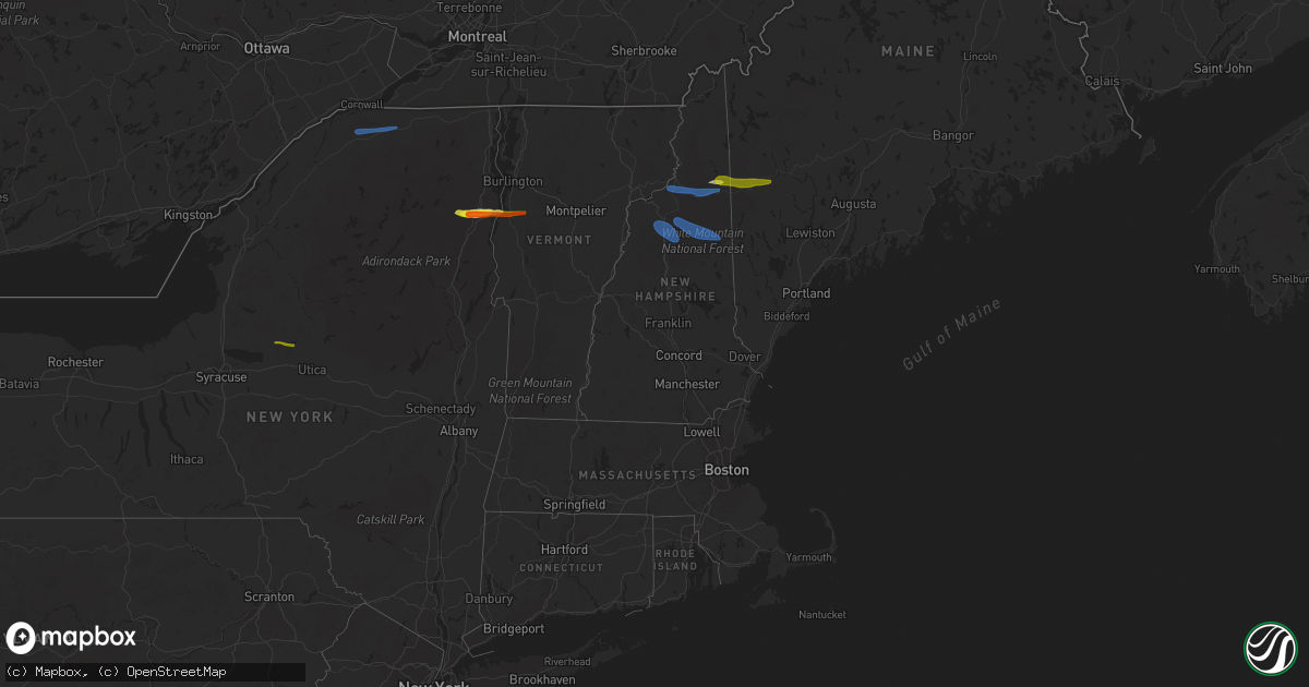
Hail Map in New Hampshire on October 10, 2020
Get this storm
October 10 map
$229
one time, instant access
Download today. No call, no setup
Keep the $229
Bought the map and want the full workflow? Apply the entire $229 to a subscription within 7 days. None of it is wasted.
Every map, not just this one
This buys you this map. Subscription and you get every map we run, in the markets you choose from a few cities to whole states to nationwide. Plus real-time alerts the moment a storm fires.
Contact data
Name, contact info, occupancy, even credit band for addresses in the footprint. You go from where it hit to who to call.
Become the source they trust
Unlimited branding weather history reports on demand. You already have the documented answer ready for the property owner, and you are the one who showed up with it.
Property data and RoofTrace estimates
Pull up any address you have got, its value and the exact code rules for that jurisdiction, straight from One Click Code. Then RoofTrace estimates the squares, pitch, and roof value, priced the way you price.
Storm reports in New Hampshire
New Hampshire
| Date | Description |
|---|---|
| 10/10/20206:40 PM CDT | Largest hailstones slightly larger than 1 inch. Tree limbs down around moose brook state park. Delayed report. |
| 10/10/20206:40 PM CDT | Trees down hill road in bath. |
| 10/10/20206:32 PM CDT | Trees downed on pleasant street. |
| 10/10/20206:25 PM CDT | Delayed report. Time estimated from radar. |
| 10/10/20206:21 PM CDT | A local report indicates 60 MPH wind near 1 ENE RANDOLPH |
| 10/10/20206:00 PM CDT | Numerous trees down in dalton nh. Tree down on state troopers car also. |
| 10/10/20206:00 PM CDT | Damage occurred in dalton south of the intersection of 135/142 additional trees were downed along blakslee road... Mcguinty road... Union road... Far away road also alo |
| 10/10/20203:21 AM CDT | At 820 PM EDT, severe thunderstorms were located along a line extending from near Waterford to 7 miles northwest of Tamworth, moving east at 50 mph. HAZARD...60 mph wind gusts and quarter size hail. SOURCE...Radar indicated. IMPACT...Hail damage to vehicles is expected. Expect wind damage to roofs, siding, and trees. Locations impacted include... Lewiston, Conway, Bridgton, Fryeburg, Mechanic Falls, Naples, Turner, Gray, Hiram, Waterford, Raymond, Tamworth, Standish, Lisbon, Greene, Casco, Limington, Bartlett, Harrison and Madison.This includes Interstate 95 between mile markers 67 and 89. This also includes... Sebago Lake, Mount Chocorua, Pleasant Mountain, Burnt MeadowMountains, and Long Lake. |
| 10/10/20202:57 AM CDT | At 756 PM EDT, severe thunderstorms were located along a line extending from 8 miles west of Lincoln to near Franconia to near Pinkham Notch, moving east at 40 mph. HAZARD...60 mph wind gusts and quarter size hail. SOURCE...Radar indicated. IMPACT...Hail damage to vehicles is expected. Expect wind damage to roofs, siding, and trees. Locations impacted include... Conway, Fryeburg, Bethlehem, Lincoln, Franconia, Woodstock, Pinkham Notch, Mount Washington, Tamworth, Waterford, Sandwich, Carroll, Bartlett, Madison, Brownfield, Freedom, Denmark, Lovell, Greenwood and Jackson.This includes Interstate 93 between mile markers 96 and 113. This also includes... Crawford Notch State Park, Franconia Notch, Mount Moosilauke,Cannon Mountain, and North Twin Mountain. |
| 10/10/20202:27 AM CDT | At 727 PM EDT, a severe thunderstorm was located over Berlin, moving east at 55 mph. HAZARD...60 mph wind gusts and quarter size hail. SOURCE...Radar indicated. IMPACT...Hail damage to vehicles is expected. Expect wind damage to roofs, siding, and trees. Locations impacted include... Berlin, Bethel, Rumford, Dixfield, Andover, Mexico, Grafton, Weld, Gorham, Hartford, Greenwood, Carthage, Hanover, Gilead, Woodstock, Sumner, Riley, Shelburne, Milton and Newry.This also includes... Old Speck Mountain, Moose Brook State Park, Mount Success, ScrewAuger Falls, and Jericho Mountain. |
| 10/10/20202:21 AM CDT | At 721 PM EDT, a severe thunderstorm was located 8 miles southwest of Franconia, or 12 miles southwest of Littleton, moving east at 50 mph. HAZARD...60 mph wind gusts and penny size hail. SOURCE...Radar indicated. IMPACT...Expect damage to roofs, siding, and trees. Locations impacted include... Bethlehem, Lincoln, Haverhill, Franconia, Pinkham Notch, Mount Washington, Woodstock, Carroll, Bartlett, Lisbon, Bath, Jackson, Albany, Benton, Easton, Livermore, Landaff, Hart's Location, Sugar Hill and Lyman.This includes Interstate 93 between mile markers 99 and 119. This also includes... Crawford Notch State Park, Franconia Notch, Mount Moosilauke,Cannon Mountain, and North Twin Mountain. |
| 10/10/20201:27 AM CDT | At 626 PM EDT, a severe thunderstorm was located over Barre, moving east at 65 mph. HAZARD...70 mph wind gusts and half dollar size hail. SOURCE...Radar indicated. IMPACT...Minor hail damage to vehicles is possible. Expect considerable tree damage. Wind damage is also likely to mobile homes, roofs, and outbuildings. Locations impacted include... Barre, Montpelier, Calais, Plainfield, Orange, Waterbury Village, Websterville, East Montpelier, Corinth, Marshfield Village, Waitsfield, Topsham, Berlin, Groton, Middlesex, Marshfield, Lower Waterford, Barre Town, Northfield Village and Topsham Four Corners. |
| 10/10/202012:36 AM CDT | At 536 PM EDT, a severe thunderstorm was located over Westmore, moving east at 70 mph. HAZARD...60 mph wind gusts and quarter size hail. SOURCE...Radar indicated. IMPACT...Minor hail damage to vehicles is possible. Expect wind damage to trees and powerlines. Locations impacted include... Island Pond, Orleans, Charleston, Greensboro, Westmore, Orleans Village, Glover, Brownington, Albany, Brunswick, Sutton, Barton, Averill, Sheffield, Newark, Newark Hollow, Brownington Village, Lemington, Canaan and West Burke Village. |
| 10/09/202011:05 PM CDT | At 404 PM EDT, a severe thunderstorm was located over Lemington, moving east at 55 mph. HAZARD...60 mph wind gusts. SOURCE...Radar indicated. IMPACT...Expect damage to trees and powerlines. Locations impacted include... Canaan, Averill, Lemington, Bloomfield, Lewis, Norton and Beecher Falls. |
| 10/09/20207:25 PM CDT | Branch down in conway. Time estimated. |
| 10/09/20207:15 PM CDT | Multiple trees down in bartlett. Time estimated. |
Cities Impacted by Hail Map on October 10, 2020
- Westport, NY
- Lewis, NY
- Elizabethtown, NY
- Crowell, TX
- New Russia, NY
- Keene, NY
- Ferrisburgh, VT
- Essex, NY
- Milan, NH
- Gorham, NH
- Berlin, NH
- Chillicothe, TX
- Quanah, TX
- Taberg, NY
- Rome, NY
- Lee Center, NY
- Bristol, VT
- North Ferrisburgh, VT
- Keene Valley, NY
- New Haven, VT
- Vergennes, VT
- Newry, ME
- Bryant Pond, ME
- Bethel, ME
- Rumford, ME
- North Bangor, NY
- Moira, NY
- Brasher Falls, NY
- North Lawrence, NY
- Brushton, NY
- Yatesville, GA
- Butler, GA
- Thomaston, GA
- Culloden, GA
- Williamson, GA
- Concord, GA
- Rockmart, GA
- Cedartown, GA
- Rome, GA
- Adairsville, GA
- Plainville, GA
- Kingston, GA
- Taylorsville, GA
- Calhoun, GA
- Covington, GA
- Morrow, GA
- Newnan, GA
- Decatur, GA
- Stone Mountain, GA
- Whitefield, NH
- Lancaster, NH
- Jefferson, NH
- Randolph, NH
- Lincoln, NH
- Franconia, NH
- Bartlett, NH
- North Conway, NH
- Glen, NH


