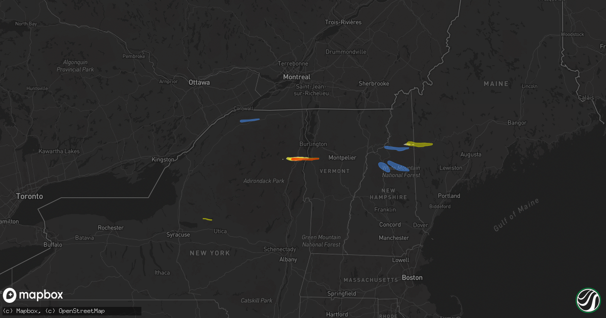
Hail Map on October 10, 2020
Get this storm
October 10 map
$229
one time, instant access
Download today. No call, no setup
Keep the $229
Bought the map and want the full workflow? Apply the entire $229 to a subscription within 7 days. None of it is wasted.
Every map, not just this one
This buys you this map. Subscription and you get every map we run, in the markets you choose from a few cities to whole states to nationwide. Plus real-time alerts the moment a storm fires.
Contact data
Name, contact info, occupancy, even credit band for addresses in the footprint. You go from where it hit to who to call.
Become the source they trust
Unlimited branding weather history reports on demand. You already have the documented answer ready for the property owner, and you are the one who showed up with it.
Property data and RoofTrace estimates
Pull up any address you have got, its value and the exact code rules for that jurisdiction, straight from One Click Code. Then RoofTrace estimates the squares, pitch, and roof value, priced the way you price.
Storm reports
Georgia
| Date | Description |
|---|---|
| 10/10/20206:45 PM CDT | Tree reported down on a home on the 6600 block of morrow rd. No injuries or major damage. |
| 10/10/20206:45 PM CDT | A very brief tornado touched down near maddox road... South of mt. Zion boulevard between morrow and allendale heights in northeast clayton county. The tornado moved no |
| 10/10/20206:33 PM CDT | Powerlines reported down at the 200 block of church st. |
| 10/10/20206:28 PM CDT | Tree reported down on north blanche ave. |
| 10/10/20206:25 PM CDT | Tree reported down at the intersection of e main st and s broad st. |
| 10/10/20205:53 PM CDT | Two trees were reported down near the intersection of hightower falls rd and wood fall rd. |
| 10/10/20205:28 PM CDT | Multiple trees down near the 800th block of bottoms road extending across to west rd. |
| 10/10/20205:25 PM CDT | Two trees reported down... With one causing damage to corner of a home's roof and porch at the 800 block of happy valley cir. Possible tornado. |
| 10/10/20205:23 PM CDT | Trees reported down north of hwy 27 and hwy 100. |
| 10/10/20205:22 PM CDT | Trees down across howard hughes rd making it impassable. |
| 10/10/20205:22 PM CDT | Newnan highschool sustained structural damage from the result of a tornado. |
| 10/10/20205:12 PM CDT | Tree down at panther creek road and strickland town road. |
| 10/10/20205:06 PM CDT | Tree down on the covered bridge along covered bridge road. |
| 10/10/20203:30 PM CDT | *** 2 inj *** a confirmed ef1 tornado tracked from the intersection of washington st sw and walker bend pkwy to woodhaven dr causing tree and structural damage along it |
| 10/10/20203:09 PM CDT | *** 2 inj *** a tornado tracked from the intersection of washing st sw and flat shoals road to turner lake circle causing tree and structural damage along its path. |
| 10/10/20202:26 AM CDT | At 726 PM EDT, a severe thunderstorm was located near Rome, moving north at 35 mph. HAZARD...60 mph wind gusts. SOURCE...Radar indicated. IMPACT...Expect damage to roofs, siding, and trees. Locations impacted include... Rome, Calhoun, Adairsville, Kingston, Plainville, Shannon, Pinson, Oostanaula, Tidings, Armuchee, Everett Springs and Lindale. |
| 10/10/20201:44 AM CDT | At 644 PM EDT, a severe thunderstorm was located over Antioch, or near Cedartown, moving north at 50 mph. HAZARD...60 mph wind gusts. SOURCE...Radar indicated. IMPACT...Expect damage to roofs, siding, and trees. Locations impacted include... Rome, Cedartown, Rockmart, Aragon, Cave Spring, Seney, Fish Creek, Felton, Lindale, Eubank Lake and Antioch. |
| 10/09/20207:51 PM CDT | Trees down near crescent drive and tanglewood drive. |
| 10/09/20207:45 PM CDT | Building sustained damage to a metal roof on the 4100 block of five forks trickum rd sw. Power outage in the building. |
| 10/09/20207:42 PM CDT | Multiple trees down along the 3500th block of lawrenceville hwy. |
| 10/09/20207:42 PM CDT | Multiple trees down along the 3500th block of lawrenceville hwy. |
| 10/09/20207:13 PM CDT | Four large trees were reported down along oak valley road south of glenwood rd. |
New York
| Date | Description |
|---|---|
| 10/10/20204:40 PM CDT | A local report indicates 1.75 inch wind near ELIZABETHTOWN |
| 10/10/20204:28 PM CDT | Tree down on power lines. |
| 10/10/20204:27 PM CDT | Trees and wires across road |
| 10/10/20204:27 PM CDT | Trees and wires down. Wires on fire near trailer park. |
| 10/10/20202:30 PM CDT | Tree and powerline down |
| 10/10/20202:20 PM CDT | Tree fell onto telephone pole. |
| 10/10/20202:20 PM CDT | Power pole knocked down |
| 10/10/20201:41 PM CDT | Multiple trees down. |
| 10/10/20201:08 AM CDT | At 607 PM EDT, a severe thunderstorm was located near Stratford, or 10 miles north of Little Falls, moving east at 40 mph. HAZARD...60 mph wind gusts and quarter size hail. SOURCE...Radar indicated. IMPACT...Hail damage to vehicles is expected. Expect wind damage to roofs, siding, and trees. Locations impacted include... Gloversville, Johnstown, Dolgeville, Stratford, Caroga Lake Public Campground, Caroga Lake, Oppenheim, Fairfield, Berkshire, Bleecker, Arietta, Meco, Curtis, Pinnacle, Lotville, Rasbach Corner, Knappville, Burrell Corners, Fical Corners and Shedd Corners. |
| 10/10/202012:37 AM CDT | At 537 PM EDT, a severe thunderstorm was located near Steuben, or 9 miles northeast of Rome, moving east at 40 mph. HAZARD...60 mph wind gusts and quarter size hail. SOURCE...Radar indicated. IMPACT...Hail damage to vehicles is expected. Expect wind damage to roofs, siding, and trees. Locations impacted include... Ohio, Newport, Stratford, Poland, Cold Brook, Northwood, Russia, Norway, Oregon, Curtis, Farrel Corner, Clockmill Corners, Lotville, Doxtater Corner, Knappville, Burrell Corners, Wilmurt Corners, Shedd Corners, Morehouseville and Hurricane. |
| 10/10/202012:23 AM CDT | At 522 PM EDT, a severe thunderstorm was located over Keene, moving east at 60 mph. HAZARD...60 mph wind gusts and quarter size hail. SOURCE...Radar indicated. IMPACT...Minor hail damage to vehicles is possible. Expect wind damage to trees and powerlines. Locations impacted include... Vergennes, Lake Placid, Essex, Westport, Elizabethtown, Keene, Monkton Ridge, Waterbury Village, Lincoln, Monkton, Monkton Boro, New Haven, Middlesex, Hinesburg, Moretown, Starksboro, Ferrisburg, Charlotte, Waltham and Bristol. |
| 10/10/202012:21 AM CDT | At 521 PM EDT, a severe thunderstorm was located over Hatch Point, moving east at 45 mph. HAZARD...60 mph wind gusts. SOURCE...Radar indicated. IMPACT...Expect damage to trees and powerlines. Locations impacted include... Essex Junction, South Burlington, Burlington International Airport, Burlington, Montpelier, Willsboro, Winooski, Stowe, Waterbury Village, Essex Junction Village, Williston, Worcester, Middlesex, Bolton, Richmond, Jericho, St. George, Jericho Village, Waterbury and Shelburne. |
| 10/10/202012:18 AM CDT | At 518 PM EDT, a severe thunderstorm was located over Lee, or near Rome, moving east at 55 mph. HAZARD...60 mph wind gusts and quarter size hail. SOURCE...Radar indicated. IMPACT...Hail damage to vehicles is expected. Expect wind damage to roofs, siding, and trees. Locations impacted include... Rome, Lee, Vienna, Trenton, Floyd, Camden, Oriskany, Steuben, Remsen and Holland Patent. |
| 10/09/20209:26 PM CDT | At 226 PM EDT, a severe thunderstorm was located over Nicholville, moving east at 65 mph. HAZARD...60 mph wind gusts and nickel size hail. SOURCE...Radar indicated. IMPACT...Expect damage to trees and powerlines. Locations impacted include... Plattsburgh, Beekmantown, Chazy, Altona, Franklin, Sheldon, Georgia, Grand Isle, St. Albans Town, South Alburgh, Alburgh, Alburgh Dunes State Park, North Hero, Bakersfield, Isle La Motte, Merrill, Lake Carmi State Park, Dannemora, Highgate and Georgia Center. |
Alabama
| Date | Description |
|---|---|
| 10/10/20204:14 PM CDT | A brief ef0 tornado touched down along chambers county road 92 at 4:14pm cdt on 10/10/20. The tornado travelled northward and ended along cr 176. Path length was around |
| 10/09/202011:53 PM CDT | At 453 AM CDT, a severe thunderstorm was located over Coden, or over Bayou La Batre, moving northeast at 40 mph. HAZARD...60 mph wind gusts. SOURCE...Radar indicated. IMPACT...Expect damage to roofs, siding, and trees. Locations impacted include... Tillmans Corner, Theodore, Bayou La Batre and Coden. |
New Hampshire
| Date | Description |
|---|---|
| 10/10/20206:40 PM CDT | Largest hailstones slightly larger than 1 inch. Tree limbs down around moose brook state park. Delayed report. |
| 10/10/20206:40 PM CDT | Trees down hill road in bath. |
| 10/10/20206:32 PM CDT | Trees downed on pleasant street. |
| 10/10/20206:25 PM CDT | Delayed report. Time estimated from radar. |
| 10/10/20206:21 PM CDT | A local report indicates 60 MPH wind near 1 ENE RANDOLPH |
| 10/10/20206:00 PM CDT | Numerous trees down in dalton nh. Tree down on state troopers car also. |
| 10/10/20206:00 PM CDT | Damage occurred in dalton south of the intersection of 135/142 additional trees were downed along blakslee road... Mcguinty road... Union road... Far away road also alo |
| 10/10/20203:21 AM CDT | At 820 PM EDT, severe thunderstorms were located along a line extending from near Waterford to 7 miles northwest of Tamworth, moving east at 50 mph. HAZARD...60 mph wind gusts and quarter size hail. SOURCE...Radar indicated. IMPACT...Hail damage to vehicles is expected. Expect wind damage to roofs, siding, and trees. Locations impacted include... Lewiston, Conway, Bridgton, Fryeburg, Mechanic Falls, Naples, Turner, Gray, Hiram, Waterford, Raymond, Tamworth, Standish, Lisbon, Greene, Casco, Limington, Bartlett, Harrison and Madison.This includes Interstate 95 between mile markers 67 and 89. This also includes... Sebago Lake, Mount Chocorua, Pleasant Mountain, Burnt MeadowMountains, and Long Lake. |
| 10/10/20202:57 AM CDT | At 756 PM EDT, severe thunderstorms were located along a line extending from 8 miles west of Lincoln to near Franconia to near Pinkham Notch, moving east at 40 mph. HAZARD...60 mph wind gusts and quarter size hail. SOURCE...Radar indicated. IMPACT...Hail damage to vehicles is expected. Expect wind damage to roofs, siding, and trees. Locations impacted include... Conway, Fryeburg, Bethlehem, Lincoln, Franconia, Woodstock, Pinkham Notch, Mount Washington, Tamworth, Waterford, Sandwich, Carroll, Bartlett, Madison, Brownfield, Freedom, Denmark, Lovell, Greenwood and Jackson.This includes Interstate 93 between mile markers 96 and 113. This also includes... Crawford Notch State Park, Franconia Notch, Mount Moosilauke,Cannon Mountain, and North Twin Mountain. |
| 10/10/20202:27 AM CDT | At 727 PM EDT, a severe thunderstorm was located over Berlin, moving east at 55 mph. HAZARD...60 mph wind gusts and quarter size hail. SOURCE...Radar indicated. IMPACT...Hail damage to vehicles is expected. Expect wind damage to roofs, siding, and trees. Locations impacted include... Berlin, Bethel, Rumford, Dixfield, Andover, Mexico, Grafton, Weld, Gorham, Hartford, Greenwood, Carthage, Hanover, Gilead, Woodstock, Sumner, Riley, Shelburne, Milton and Newry.This also includes... Old Speck Mountain, Moose Brook State Park, Mount Success, ScrewAuger Falls, and Jericho Mountain. |
| 10/10/20202:21 AM CDT | At 721 PM EDT, a severe thunderstorm was located 8 miles southwest of Franconia, or 12 miles southwest of Littleton, moving east at 50 mph. HAZARD...60 mph wind gusts and penny size hail. SOURCE...Radar indicated. IMPACT...Expect damage to roofs, siding, and trees. Locations impacted include... Bethlehem, Lincoln, Haverhill, Franconia, Pinkham Notch, Mount Washington, Woodstock, Carroll, Bartlett, Lisbon, Bath, Jackson, Albany, Benton, Easton, Livermore, Landaff, Hart's Location, Sugar Hill and Lyman.This includes Interstate 93 between mile markers 99 and 119. This also includes... Crawford Notch State Park, Franconia Notch, Mount Moosilauke,Cannon Mountain, and North Twin Mountain. |
| 10/10/20201:27 AM CDT | At 626 PM EDT, a severe thunderstorm was located over Barre, moving east at 65 mph. HAZARD...70 mph wind gusts and half dollar size hail. SOURCE...Radar indicated. IMPACT...Minor hail damage to vehicles is possible. Expect considerable tree damage. Wind damage is also likely to mobile homes, roofs, and outbuildings. Locations impacted include... Barre, Montpelier, Calais, Plainfield, Orange, Waterbury Village, Websterville, East Montpelier, Corinth, Marshfield Village, Waitsfield, Topsham, Berlin, Groton, Middlesex, Marshfield, Lower Waterford, Barre Town, Northfield Village and Topsham Four Corners. |
| 10/10/202012:36 AM CDT | At 536 PM EDT, a severe thunderstorm was located over Westmore, moving east at 70 mph. HAZARD...60 mph wind gusts and quarter size hail. SOURCE...Radar indicated. IMPACT...Minor hail damage to vehicles is possible. Expect wind damage to trees and powerlines. Locations impacted include... Island Pond, Orleans, Charleston, Greensboro, Westmore, Orleans Village, Glover, Brownington, Albany, Brunswick, Sutton, Barton, Averill, Sheffield, Newark, Newark Hollow, Brownington Village, Lemington, Canaan and West Burke Village. |
| 10/09/202011:05 PM CDT | At 404 PM EDT, a severe thunderstorm was located over Lemington, moving east at 55 mph. HAZARD...60 mph wind gusts. SOURCE...Radar indicated. IMPACT...Expect damage to trees and powerlines. Locations impacted include... Canaan, Averill, Lemington, Bloomfield, Lewis, Norton and Beecher Falls. |
| 10/09/20207:25 PM CDT | Branch down in conway. Time estimated. |
| 10/09/20207:15 PM CDT | Multiple trees down in bartlett. Time estimated. |
Vermont
| Date | Description |
|---|---|
| 10/10/20205:58 PM CDT | Trees downed. |
| 10/10/20205:54 PM CDT | Trees down on powerlines |
| 10/10/20205:46 PM CDT | Trees down on powerlines |
| 10/10/20205:42 PM CDT | Trees down on powerlines |
| 10/10/20205:14 PM CDT | Tree down across road |
| 10/10/20205:05 PM CDT | Tree down on wires |
| 10/10/20204:58 PM CDT | Trees down on powerlines |
| 10/10/20204:42 PM CDT | Trees down on powerlines |
| 10/10/20201:48 AM CDT | At 648 PM EDT, a severe thunderstorm was located 9 miles northwest of Littleton, moving east at 55 mph. HAZARD...60 mph wind gusts and quarter size hail. SOURCE...Radar indicated. IMPACT...Hail damage to vehicles is expected. Expect wind damage to roofs, siding, and trees. Locations impacted include... Berlin, Littleton, Lancaster, Bethlehem, Pinkham Notch, Mount Washington, Carroll, Gorham, Jefferson, Dalton, Whitefield, Milan, Shelburne, Randolph, Northumberland and Stark.This also includes... Mount Jefferson, Mount Madison, Moose Brook State Park, MountAdams, and AMC Lake of the Clouds Hut. |
| 10/10/20201:43 AM CDT | At 643 PM EDT, a severe thunderstorm was located over Concord Corner, moving east at 45 mph. HAZARD...60 mph wind gusts and quarter size hail. SOURCE...Radar indicated. IMPACT...Minor hail damage to vehicles is possible. Expect wind damage to trees and powerlines. Locations impacted include... St. Johnsbury, Lyndon, Guildhall, Waterford, Lyndonville Village, Gilman, Kirby, Victory, Concord, Lunenburg, Lower Waterford, Barnet, Granby, St. Johnsbury Center, Concord Corner, West Waterford, Lyndon Center, South Kirby, South Lunenburg and East St. Johnsbury. |
| 10/09/202011:06 PM CDT | At 406 PM EDT, severe thunderstorms were located along a line extending from 18 miles northwest of Pittsburg to 6 miles north of Colebrook to 13 miles northwest of Stratford, moving east at 60 mph. HAZARD...60 mph wind gusts. SOURCE...Radar indicated. IMPACT...Expect damage to roofs, siding, and trees. Locations impacted include... Colebrook, Rangeley, Pittsburg, Dixville, Columbia, Clarksville, Upper Cupsuptic, Adamstown, Oxbow, Parkertown, Lynchtown, Parmachenee, Bowmantown, Lincoln Plantation, Lower Cupsuptic, Stewartstown, Wentworth Location, Magalloway Plantation and Richardsontown.This also includes... First Connecticut Lake, Dixville Notch State Park, Coleman StatePark, Lake Francis State Park, and Magalloway Mountain. |
| 10/09/20209:13 PM CDT | At 212 PM EDT, a severe thunderstorm was located over Brainardsville, moving east at 50 mph. HAZARD...60 mph wind gusts and nickel size hail. SOURCE...Radar indicated. IMPACT...Expect damage to trees and powerlines. Locations impacted include... Chazy, Mooers, Altona, Alburgh Village, Ellenburg Depot, Champlain, Burke, Churubusco, Swanton, South Alburgh, Alburgh, Alburgh Dunes State Park, Swanton Village, Highgate Falls, Isle La Motte, Merrill, Chateaugay, Rouses Point, Highgate and Sheldon. |
South Carolina
| Date | Description |
|---|---|
| 10/10/20205:50 AM CDT | Emergency mngr reported trees blown down on springdale dr. |
| 10/10/20205:30 AM CDT | Emergency mngr reported trees blown down at evelyn st & n harper st. |
| 10/10/20205:15 AM CDT | Emergency mngr reported trees down on arnold ln. |
| 10/10/20205:15 AM CDT | Emergency mngr reported trees blown down on riverfork rd. |
Maine
| Date | Description |
|---|---|
| 10/10/20206:55 PM CDT | A local report indicates 1.00 inch wind near BETHEL |
| 10/10/20206:45 PM CDT | Delayed mping report. |
| 10/10/20203:10 AM CDT | At 810 PM EDT, a severe thunderstorm was located near Canton, or 10 miles southeast of Rumford, moving east at 50 mph. HAZARD...60 mph wind gusts and quarter size hail. SOURCE...Radar indicated. IMPACT...Hail damage to vehicles is expected. Expect wind damage to roofs, siding, and trees. Locations impacted include... Augusta, Waterville, Farmington, Fairfield, Oakland, Turner, Jay, Belgrade, Livermore Falls, Manchester, Dixfield, Canton, Wilton, Winthrop, Mexico, Leeds, Livermore, Chesterville, Hartford and Fayette.This includes Interstate 95 between mile markers 111 and 128. |
| 10/09/20207:24 PM CDT | Trees on wires butterfield rd. |
| 10/09/20207:12 PM CDT | A local report indicates 1.00 inch wind near 1 NNW PERU |
Cities Impacted by Hail Map on October 10, 2020
- Westport, NY
- Lewis, NY
- Elizabethtown, NY
- Crowell, TX
- New Russia, NY
- Keene, NY
- Ferrisburgh, VT
- Essex, NY
- Milan, NH
- Gorham, NH
- Berlin, NH
- Chillicothe, TX
- Quanah, TX
- Taberg, NY
- Rome, NY
- Lee Center, NY
- Bristol, VT
- North Ferrisburgh, VT
- Keene Valley, NY
- New Haven, VT
- Vergennes, VT
- Newry, ME
- Bryant Pond, ME
- Bethel, ME
- Rumford, ME
- North Bangor, NY
- Moira, NY
- Brasher Falls, NY
- North Lawrence, NY
- Brushton, NY
- Yatesville, GA
- Butler, GA
- Thomaston, GA
- Culloden, GA
- Williamson, GA
- Concord, GA
- Rockmart, GA
- Cedartown, GA
- Rome, GA
- Adairsville, GA
- Plainville, GA
- Kingston, GA
- Taylorsville, GA
- Calhoun, GA
- Covington, GA
- Morrow, GA
- Newnan, GA
- Decatur, GA
- Stone Mountain, GA
- Whitefield, NH
- Lancaster, NH
- Jefferson, NH
- Randolph, NH
- Lincoln, NH
- Franconia, NH
- Bartlett, NH
- North Conway, NH
- Glen, NH