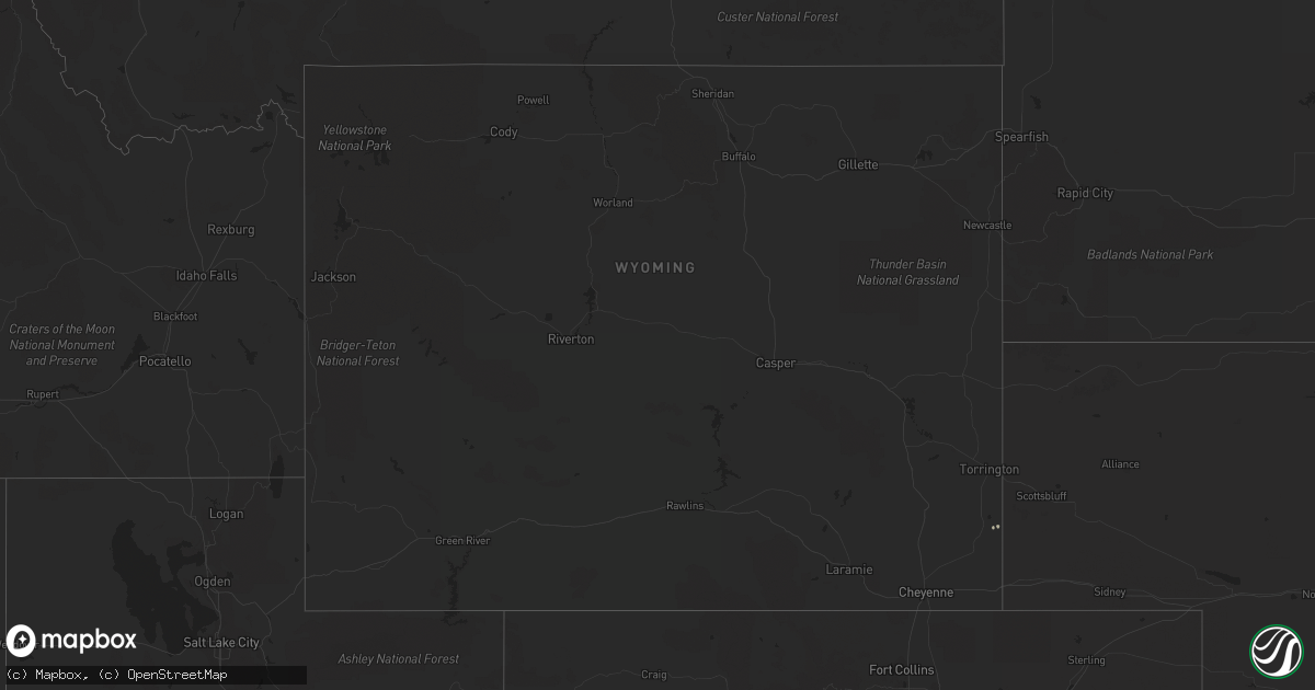
Hail Map in Wyoming on September 6, 2019
Get this storm
September 6 map
$229
one time, instant access
Download today. No call, no setup
Keep the $229
Bought the map and want the full workflow? Apply the entire $229 to a subscription within 7 days. None of it is wasted.
Every map, not just this one
This buys you this map. Subscription and you get every map we run, in the markets you choose from a few cities to whole states to nationwide. Plus real-time alerts the moment a storm fires.
Contact data
Name, contact info, occupancy, even credit band for addresses in the footprint. You go from where it hit to who to call.
Become the source they trust
Unlimited branding weather history reports on demand. You already have the documented answer ready for the property owner, and you are the one who showed up with it.
Property data and RoofTrace estimates
Pull up any address you have got, its value and the exact code rules for that jurisdiction, straight from One Click Code. Then RoofTrace estimates the squares, pitch, and roof value, priced the way you price.
Storm reports in Wyoming
Wyoming
| Date | Description |
|---|---|
| 09/06/20196:52 PM CDT | Trained spotter 24 nw douglas reported shed roof was torn off and 20 ft long stock panels weighting 250 lbs were knocked over. Wind estimated at 80 mph lasting for 10 s |
| 09/06/20196:10 PM CDT | Wydot mesonet station at shirley rim. |
| 09/06/20195:35 PM CDT | Wydot mesonet station halleck ridge along i-80. |
| 09/06/20195:20 PM CDT | Wydot mesonet station dana ridge along i-80. |
| 09/06/20195:00 PM CDT | Wydot mesonet station walcott junction along i-80. |
| 09/06/20194:57 PM CDT | Asos measured wind gust of 56 knots. |
| 09/06/20194:56 PM CDT | Asos measured 63 knots wind gust from thunderstorm outflow. |
| 09/05/201911:44 PM CDT | At 444 PM MDT, a severe thunderstorm was located 17 miles southeast of Pine Tree Junction, or 25 miles south of Wright, moving northeast at 20 mph. HAZARD...60 mph wind gusts and quarter size hail. SOURCE...Radar indicated. IMPACT...Hail damage to vehicles is expected. Expect wind damage to roofs, siding, and trees. Locations impacted include... Bill. |
| 09/05/201911:39 PM CDT | At 438 PM MDT, a severe thunderstorm was located near Glendo, or 21 miles southeast of Douglas, moving northeast at 25 mph. HAZARD...60 mph wind gusts and quarter size hail. SOURCE...Radar indicated. IMPACT...Hail damage to vehicles is expected. Expect wind damage to roofs, siding, and trees. Locations impacted include... Glendo, Sibley Peak, Glendo Reservoir, Two Moon Campground and Lost Springs.This includes Interstate 25 in Wyoming between mile markers 107 and125. |
| 09/05/201911:16 PM CDT | At 415 PM MDT, a severe thunderstorm was located 7 miles northeast of Muddy Gap, which is 24 miles east of Jeffrey City, moving northeast at 35 mph. HAZARD...60 mph wind gusts. SOURCE...Radar indicated. IMPACT...Expect damage to roofs, siding, and trees. This severe thunderstorm will be near... Devil's Gate around 420 PM MDT.Other locations impacted by this severe thunderstorm include AlcovaDam. |
| 09/05/201910:56 PM CDT | At 355 PM MDT, severe thunderstorms were located along a line extending from Green Mountain to 9 miles north of Jack Creek Campground, moving northeast at 40 mph. HAZARD...70 mph wind gusts. SOURCE...Trained weather spotters. IMPACT...Expect considerable tree damage. Damage is likely to mobile homes, roofs, and outbuildings. Locations impacted include... Rawlins, Saratoga, Hanna, Sinclair, Elk Mountain, Seminoe Campground, Seminoe Dam, Separation Lake, Jack Creek Campground, Bow River Campground, Muddy Gap and Teton Reservoir.This includes Interstate 80 in Wyoming between mile markers 200 and258. |
Cities Impacted by Hail Map on September 6, 2019
- Castle Rock, CO
- Larkspur, CO
- Riverside, OR
- Adrian, OR
- Sedalia, CO
- Morrison, CO
- Littleton, CO
- Golden, CO
- Evergreen, CO
- Idledale, CO
- Conifer, CO
- Lagrange, WY
- Central City, CO
- Englewood, CO
- Lone Tree, CO
- Black Hawk, CO
- Hammett, ID
- Glenns Ferry, ID
- Mccall, ID
- Monument, CO
- Prineville, OR
- Murphy, ID
- Laramie, WY
- Buhl, ID
- Broken Bow, NE
- Peyton, CO


