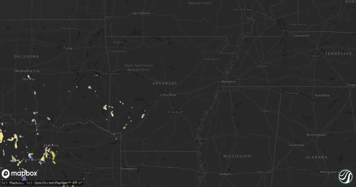
Hail Map in Arkansas on September 4, 2022
Get this storm
September 4 map
$229
one time, instant access
Download today. No call, no setup
Keep the $229
Bought the map and want the full workflow? Apply the entire $229 to a subscription within 7 days. None of it is wasted.
Every map, not just this one
This buys you this map. Subscription and you get every map we run, in the markets you choose from a few cities to whole states to nationwide. Plus real-time alerts the moment a storm fires.
Contact data
Name, contact info, occupancy, even credit band for addresses in the footprint. You go from where it hit to who to call.
Become the source they trust
Unlimited branding weather history reports on demand. You already have the documented answer ready for the property owner, and you are the one who showed up with it.
Property data and RoofTrace estimates
Pull up any address you have got, its value and the exact code rules for that jurisdiction, straight from One Click Code. Then RoofTrace estimates the squares, pitch, and roof value, priced the way you price.
Storm reports in Arkansas
Arkansas
| Date | Description |
|---|---|
| 09/04/20226:41 PM CDT | Power lines down in gillham. |
| 09/04/20221:59 AM CDT | At 659 PM CDT, a severe thunderstorm was located 7 miles southeast of Halfway, or 10 miles southwest of Arkadelphia, moving south at 20 mph. HAZARD...60 mph wind gusts and quarter size hail. SOURCE...Radar indicated. IMPACT...Hail damage to vehicles is expected. Expect wind damage to roofs, siding, and trees. Locations impacted include... Gurdon... Okolona... Whelen Springs... Beirne... Gum Springs in Clark County... Richwoods... Burtsell... Hollywood... Curtis... |
| 09/04/20221:38 AM CDT | At 638 PM CDT, a severe thunderstorm was located 5 miles southwest of Gillham, moving southeast at 45 mph. HAZARD...60 mph wind gusts and quarter size hail. SOURCE...Radar indicated. IMPACT...Hail damage to vehicles is expected. Expect wind damage to roofs, siding, and trees. Locations impacted include... De Queen, Horatio, Lockesburg, Wilton, Gillham, Ben Lomond, Oak Grove, Arden, Geneva, Central, Browntown and Bellview. |
| 09/04/20221:30 AM CDT | At 630 PM CDT, a severe thunderstorm was located near Arkadelphia, moving southeast at 10 mph. HAZARD...60 mph wind gusts and quarter size hail. SOURCE...Radar indicated. IMPACT...Hail damage to vehicles is expected. Expect wind damage to roofs, siding, and trees. Locations impacted include... Arkadelphia... Gurdon... Caddo Valley... Gum Springs in Clark County... Richwoods... Hollywood... Lower Lake Recreation Area... Curtis... Griffithtown... |
| 09/04/202212:35 AM CDT | At 535 PM CDT, a severe thunderstorm was located near Albert Pike Recreation Area, or 13 miles east of Umpire, moving southeast at 10 mph. HAZARD...60 mph wind gusts and penny size hail. SOURCE...Radar indicated. IMPACT...Expect damage to roofs, siding, and trees. Locations impacted include... Albert Pike Recreation Area... New Hope in Pike County... Lodi... Langley... Fancyhill... Kirby... |
| 09/04/202212:01 AM CDT | At 501 PM CDT, a severe thunderstorm was located over Little Missouri Falls Recreation Area, or 14 miles northeast of Umpire, moving south at 5 mph. HAZARD...60 mph wind gusts and nickel size hail. SOURCE...Radar indicated. IMPACT...Expect damage to roofs, siding, and trees. Locations impacted include... Little Missouri Falls Recreatio... Big Fork... |
| 09/03/202211:37 PM CDT | At 437 PM CDT, a severe thunderstorm was located over Opal, or 12 miles east of Mena, moving southeast at 10 mph. HAZARD...60 mph wind gusts and penny size hail. SOURCE...Radar indicated. IMPACT...Expect damage to roofs, siding, and trees. Locations impacted include... Opal... Shady... Big Fork... Board Camp... Cherry Hill in Polk County... |
All States Impacted by Hail Map on September 4, 2022
Cities Impacted by Hail Map on September 4, 2022
- Eagletown, OK
- Rugby, ND
- Castaic, CA
- Burneyville, OK
- Marietta, OK
- Overbrook, OK
- Mena, AR
- Towner, ND
- Thackerville, OK
- Wichita Falls, TX
- Riesel, TX
- Healdton, OK
- Rockwall, TX
- Sachse, TX
- Wylie, TX
- Rowlett, TX
- Garland, TX
- Weatherford, TX
- Jacksboro, TX
- Windthorst, TX
- Olney, TX
- Henrietta, TX
- Lakeview, TX
- Fort Worth, TX
- Haslet, TX
- Bowie, TX
- Breckenridge, TX
- Woodson, TX
- Graham, TX
- Asher, OK
- Wister, OK
- Granbury, TX
- Cleburne, TX
- Lorena, TX
- Waco, TX
- Arkadelphia, AR
- Okolona, AR
- Seymour, TX
- Iowa Park, TX
- Gainesville, TX
- Texarkana, TX
- Azle, TX
- Springtown, TX
- Throckmorton, TX
- Albany, TX
- Fulton, AR
- Saratoga, AR
- Loving, TX
- Cisco, TX
- Eastland, TX
- Irving, TX
- Cedar Hill, TX
- Grand Prairie, TX
- Dallas, TX
- Teague, TX
- Mcalester, OK
- Madill, OK
- Kingston, OK
- Rhome, TX
- Decatur, TX
- Royse City, TX
- Rotan, TX
- Groesbeck, TX
- Athens, TX
- Chico, TX
- Sunset, TX
- Grandview, TX
- Watson, OK
- Kerens, TX
- Larue, TX
- Montalba, TX
- Palestine, TX
- Chilton, TX
- Richardson, TX
- Allen, TX
- Plano, TX
- Godley, TX
- Red Oak, OK
- Memphis, TX
- Frankston, TX
- Burnet, TX
- Millsap, TX
- Graford, TX
- Bryson, TX
- Canyon Country, CA
- De Queen, AR
- Gillham, AR
- Grannis, AR
- Frisco, TX
- Scotland, TX
- Dublin, TX
- Mart, TX
- Vandervoort, AR
- Cove, AR
- Santa Clarita, CA
- Mineral Wells, TX
- Aledo, TX
- Mesquite, TX
- Venus, TX
- Ardmore, OK
- Norman, OK
- Nashville, AR
- Valley View, TX
- Caddo Gap, AR
- Oklahoma City, OK
- Bridgeport, TX
- Mckinney, TX
- Forney, TX
- Sunnyvale, TX
- Holliday, TX
- Bullhead City, AZ
- Golden Valley, AZ
- Newcastle, TX
- Lipan, TX
- Archer City, TX
- Bismarck, AR
- Bullard, TX
- Fairfield, TX
- Streetman, TX
- Westhope, ND
- Seagoville, TX
- McCaskill, AR
- Lone Grove, OK
- Carrollton, TX
- Addison, TX
- The Colony, TX
- Crandall, TX
- Malakoff, TX
- Princeton, TX
- Keota, OK
- Talihina, OK
- Woodway, TX
- Hooks, TX
- Pauls Valley, OK
- Paoli, OK
- Mineral Springs, AR
- Ozan, AR
- Columbus, AR
- Mingus, TX
- Ranger, TX
- Tennessee Colony, TX
- Keller, TX
- Youngstown, OH
- Kopperl, TX
- Morgan, TX


