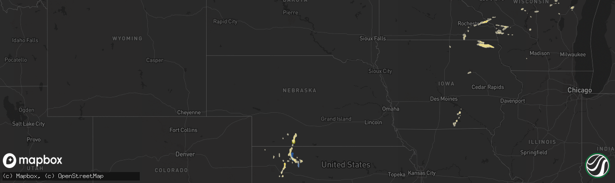
Hail Map in Nebraska on September 2, 2022
The weather event in Nebraska on September 2, 2022 includes Wind and Hail maps. 16 states and 226 cities were impacted and suffered possible damage. The total estimated number of properties impacted is 98.
Want more than just the map?
Turn this storm into a full workflow.
- Owner + property data so you know who to knock
- OnDemand branded weather history reports to win the "did we even have hail?" argument
- RoofTrace estimate so reps stop guessing numbers at the door
Bought this map? Upgrade within 7 days and we'll credit the $230. (10-15 min setup call)
Wind
Hail
98
Estimated number of impacted properties by a 1.00" hail or larger0
Estimated number of impacted properties by a 1.75" hail or larger0
Estimated number of impacted properties by a 2.50" hail or largerStorm reports in Nebraska
Nebraska
| Date | Description |
|---|---|
| 09/02/20224:58 PM CDT | Trained spotter report of quarter size hail. |
| 09/01/202211:55 PM CDT | At 455 PM CDT, a severe thunderstorm was located near Wilsonville, or 23 miles east of McCook, moving south at 20 mph. HAZARD...60 mph wind gusts and quarter size hail. SOURCE...Radar indicated. IMPACT...Hail damage to vehicles is expected. Expect wind damage to roofs, siding, and trees. This severe thunderstorm will be near... Wilsonville around 510 PM CDT. |
| 09/01/202211:08 PM CDT | At 408 PM CDT, a severe thunderstorm was located 7 miles northwest of Holbrook, or 27 miles southeast of Curtis, moving south at 15 mph. HAZARD...60 mph wind gusts and quarter size hail. SOURCE...Radar indicated. IMPACT...Hail damage to vehicles is expected. Expect wind damage to roofs, siding, and trees. Locations impacted include... Cambridge and Holbrook. |
All States Impacted by Hail Map on September 2, 2022
Cities Impacted by Hail Map on September 2, 2022
- Winter, WI
- Marion, WI
- Clintonville, WI
- Ridgeland, WI
- Vesper, WI
- Shawano, WI
- Mosinee, WI
- Weatherford, OK
- Geary, OK
- Green Bay, WI
- Egg Harbor, WI
- Sturgeon Bay, WI
- Cornell, WI
- Pittsville, WI
- Arpin, WI
- Prairie Farm, WI
- Clayton, WI
- Dallas, WI
- Barron, WI
- Wausau, WI
- Rothschild, WI
- La Farge, WI
- Ontario, WI
- Holmen, WI
- Bruce Crossing, MI
- Ewen, MI
- Shiocton, WI
- Selden, KS
- Kingman, AZ
- Golden Valley, AZ
- Land O'Lakes, WI
- Marenisco, MI
- Clear Lake, WI
- Glenwood City, WI
- Deer Park, WI
- Stewartville, MN
- Holly, CO
- Nekoosa, WI
- Jim Falls, WI
- Melrose, IA
- Mystic, IA
- Plano, IA
- Moravia, IA
- Westby, WI
- Cashton, WI
- Coon Valley, WI
- Norwalk, WI
- Kirkland, AZ
- Skull Valley, AZ
- Pencil Bluff, AR
- Oden, AR
- Harvey, AR
- Mount Ida, AR
- Ranger, TX
- Desdemona, TX
- Yucca, AZ
- Wickenburg, AZ
- Gruver, TX
- Arcadia, WI
- Ettrick, WI
- Stratford, WI
- Antigo, WI
- Eyota, MN
- Dover, MN
- Mass City, MI
- Hackberry, AZ
- Congress, AZ
- Muenster, TX
- Baldwin, WI
- Fountain City, WI
- Channing, TX
- Hoxie, KS
- Hollandale, WI
- Bird City, KS
- Racine, MN
- Grand Meadow, MN
- Rollingstone, MN
- Minnesota City, MN
- Dodge, WI
- Altura, MN
- Winona, MN
- Saint Charles, MN
- Utica, MN
- Lebanon, NE
- Waldron, AR
- Hill City, KS
- Jennings, KS
- Dresden, KS
- Clayton, KS
- Penokee, KS
- Norcatur, KS
- Morland, KS
- Oberlin, KS
- Albia, IA
- Wakefield, MI
- Exeland, WI
- Hartsville, TN
- Dixon Springs, TN
- La Crosse, WI
- Oakley, KS
- Kit Carson, CO
- Bartley, NE
- Gamaliel, KY
- Lafayette, TN
- Red Boiling Springs, TN
- Cresco, IA
- Manitowish Waters, WI
- Grinnell, KS
- Plainview, AR
- Rose Creek, MN
- Dexter, MN
- Elkton, MN
- Adams, MN
- Taopi, MN
- Ogema, WI
- Prentice, WI
- Brantwood, WI
- Appleton, WI
- Greenville, WI
- Hortonville, WI
- Kensett, IA
- Hanlontown, IA
- Manly, IA
- Grand Marsh, WI
- Adams, WI
- Wisconsin Dells, WI
- New Auburn, WI
- Rhinelander, WI
- West Salem, WI
- Bangor, WI
- Sparta, WI
- Rockland, WI
- Roff, OK
- Wellington, TX
- Menomonie, WI
- Elk Mound, WI
- Sunray, TX
- Presque Isle, WI
- New Franken, WI
- Mcalester, OK
- Stuart, OK
- Aniwa, WI
- Ringle, WI
- Coalgate, OK
- Meadview, AZ
- Frederick, OK
- Cambridge, NE
- Leoti, KS
- Atwood, KS
- Mayer, AZ
- Crown King, AZ
- Ontonagon, MI
- Stephenville, TX
- Fort Mcdowell, AZ
- Scottsdale, AZ
- Marienthal, KS
- Lovilia, IA
- Cope, CO
- De Leon, TX
- Dolan Springs, AZ
- Buckeye, AZ
- Promise City, IA
- Scott City, KS
- Waukon, IA
- Bellevue, TX
- Bowie, TX
- Willow Beach, AZ
- San Tan Valley, AZ
- Saint Jo, TX
- San Carlos, AZ
- Waterloo, IA
- Cedar Falls, IA
- Decorah, IA
- Brownsville, MN
- Hokah, MN
- Pelkie, MI
- Queen Creek, AZ
- Gold Canyon, AZ
- Wellton, AZ
- Dry Creek, LA
- Kinder, LA
- Salome, AZ
- Eustis, NE
- Wilsonville, NE
- Oskaloosa, IA
- Tracy, IA
- Curtis, NE
- Walters, OK
- Peridot, AZ
- Ringgold, TX
- Ridgeway, IA
- Pauma Valley, CA
- Yarnell, AZ
- Chaseburg, WI
- Seymour, IA
- Bussey, IA
- Black Canyon City, AZ
- Eagle River, WI
- Wilson, WI
- Woodville, WI
- Spring Valley, WI
- Lenora, KS
- Baraga, MI
- Wardville, OK
- Holton, IN
- Montgomery, TX
- Stoddard, WI
- Herndon, KS
- Rotan, TX
- McDonald, KS
- La Crescent, MN
- McCook, NE
- Saint Ignace, MI
- Hudson, IA
- Grant, LA
- Pitkin, LA
- Plover, WI
- Bancroft, WI
- Blythe, CA
- Forestburg, TX
- Mesa, AZ
- Park Falls, WI
- Ojibwa, WI
- Downing, WI
- Boyceville, WI
- Prescott, AZ


