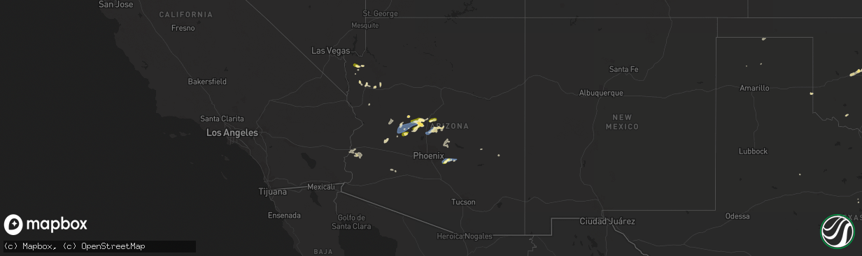
Hail Map in Arizona on September 2, 2022
The weather event in Arizona on September 2, 2022 includes Wind and Hail maps. 16 states and 226 cities were impacted and suffered possible damage. The total estimated number of properties impacted is 13,366.
Want more than just the map?
Turn this storm into a full workflow.
- Owner + property data so you know who to knock
- OnDemand branded weather history reports to win the "did we even have hail?" argument
- RoofTrace estimate so reps stop guessing numbers at the door
Bought this map? Upgrade within 7 days and we'll credit the $230. (10-15 min setup call)
Wind
Hail
13,366
Estimated number of impacted properties by a 1.00" hail or larger0
Estimated number of impacted properties by a 1.75" hail or larger0
Estimated number of impacted properties by a 2.50" hail or largerStorm reports in Arizona
Arizona
| Date | Description |
|---|---|
| 09/02/20226:55 PM CDT | Called spotter and had 55 mph sustained on the hill east of the 17 with at least a 62 mph gust via weather station she has access to. Damage to smaller billboard sign a |
| 09/02/20226:20 PM CDT | Report of power outages and power poles down due to thunderstorm related wind gusts in new kingman-butler. |
| 09/02/20226:05 PM CDT | Delayed report...communications tower knocked down by the wind and over roadway shared via social media. |
| 09/02/20224:19 AM CDT | At 919 PM MST, a severe thunderstorm was located 17 miles southwest of Kofa Wildlife Refuge, or 27 miles northeast of Martinez Lake, moving southwest at 15 mph. HAZARD...60 mph wind gusts and quarter size hail. SOURCE...Radar indicated. IMPACT...Hail damage to vehicles is expected. Expect wind damage to roofs, siding, and trees. Locations impacted include... Yuma Proving Ground.This includes AZ Route 95 between mile markers 58 and 74. |
| 09/02/20223:55 AM CDT | At 855 PM MST/855 PM PDT/, severe thunderstorms were located along a line extending from near Blythe to 14 miles southwest of Kofa Wildlife Refuge, moving west at 25 mph. HAZARD...60 mph wind gusts and quarter size hail. SOURCE...Radar indicated. IMPACT...Hail damage to vehicles is expected. Expect wind damage to roofs, siding, and trees. Locations impacted include... Blythe, Quartzsite, Cibola, Palo Verde, Ripley, Blythe Airport, East Blythe and Ehrenberg.This includes the following highways...AZ Interstate 10 between mile markers 1 and 16.CA Interstate 10 between mile markers 146 and 156.AZ Route 95 between mile markers 74 and 102. |
| 09/02/20223:16 AM CDT | At 815 PM MST, a severe thunderstorm was located 16 miles west of Kofa Wildlife Refuge, or 33 miles north of Martinez Lake, moving southwest at 20 mph. HAZARD...60 mph wind gusts and quarter size hail. SOURCE...Radar indicated. IMPACT...Hail damage to vehicles is expected. Expect wind damage to roofs, siding, and trees. This severe thunderstorm will remain over mainly rural areas of southwestern La Paz and north central Yuma Counties.This includes AZ Route 95 between mile markers 81 and 100. |
| 09/02/20222:01 AM CDT | At 701 PM MST, a severe thunderstorm was located near Gladden, or 29 miles southeast of Alamo Lake, moving west at 10 mph. HAZARD...60 mph wind gusts and quarter size hail. SOURCE...Radar indicated. IMPACT...Hail damage to vehicles is expected. Expect wind damage to roofs, siding, and trees. Locations impacted include... Wenden and Gladden. This includes US Highway 60 between mile markers 60 and 79. |
| 09/02/202212:56 AM CDT | At 556 PM MST, a severe thunderstorm was located 7 miles northeast of Wickenburg, moving west at 20 mph. HAZARD...60 mph wind gusts and nickel size hail. SOURCE...Radar indicated. IMPACT...Expect damage to roofs, siding, and trees. Locations impacted include... Wickenburg.This includes the following highways...US Highway 60 between mile markers 90 and 121.AZ Route 74 between mile markers 1 and 2. |
| 09/02/202212:49 AM CDT | At 548 PM MST, severe thunderstorms were located along a line extending from near Walker to 8 miles northwest of Castle Hot Springs, moving west at 25 mph. HAZARD...60 mph wind gusts and quarter size hail. SOURCE...Radar indicated. IMPACT...Hail damage to vehicles is expected. Expect wind damage to roofs, siding, and trees. Locations impacted include... Congress, Wilhoit, Walnut Grove, Kirkland, Wagoner, Yarnell, Peeples Valley and Glen Ilah.This includes the following highways... State Route 89 between mile markers 258 and 301. State Route 71 near mile marker 109. Highway 93 between mile markers 189 and 194. |
| 09/02/202212:46 AM CDT | At 546 PM MST, a severe thunderstorm was located 14 miles east of Alamo State Park, or 15 miles east of Alamo Lake, moving southwest at 25 mph. HAZARD...60 mph wind gusts and nickel size hail. SOURCE...Radar indicated. IMPACT...Expect damage to roofs, siding, and trees. Locations impacted include... Alamo State Park. |
| 09/02/202212:39 AM CDT | At 538 PM MST, a severe thunderstorm was located near Gold Canyon, moving west at 35 mph. HAZARD...60 mph wind gusts. SOURCE...Radar indicated. IMPACT...Expect damage to roofs, siding, and trees. Locations impacted include... Mesa, Chandler, Gilbert, Tempe, Apache Junction, Gold Canyon, Sun Lakes, Queen Creek, Gold Camp, San Tan Village Mall, San Tan Valley, Seville, Freestone Park, Florence Junction and Queen Valley.This includes the following highways...AZ Interstate 10 between mile markers 156 and 160, and between milemarkers 165 and 181.US Highway 60 between mile markers 174 and 221.AZ Route 87 between mile markers 148 and 172. |
| 09/02/202212:17 AM CDT | At 517 PM MST, severe thunderstorms were located along a line extending from Mayer to near Crown King, moving west at 30 mph. HAZARD...60 mph wind gusts and quarter size hail. SOURCE...Radar indicated. IMPACT...Hail damage to vehicles is expected. Expect wind damage to roofs, siding, and trees. Locations impacted include... Cordes Junction, Bumble Bee, Cordes Lakes, Groom Creek Subdivision, Walker, Poland Junction, Cordes, Spring Valley, Ponderosa Park, Crown King, Mayer, Lower Wolf Creek Campground, Hazlett Hollow Campground, Turney Gulch Group Campground and Upper Wolf Creek Group Campground.This includes the following highways... Interstate 17 between mile markers 250 and 269. State Route 89 between mile markers 302 and 305. State Route 69 between mile markers 263 and 277. |
| 09/02/202212:07 AM CDT | At 506 PM MST, a severe thunderstorm was located 9 miles north of Superior, moving west at 15 mph. HAZARD...60 mph wind gusts and nickel size hail. SOURCE...Radar indicated. IMPACT...Expect damage to roofs, siding, and trees. Locations impacted include... Florence Junction, Queen Valley, Superstition Mountains and Gold Camp.This includes the following highways...US Highway 60 between mile markers 208 and 220.AZ Route 79 between mile markers 146 and 150. |
| 09/02/202212:03 AM CDT | At 502 PM MST, a severe thunderstorm was located 7 miles northwest of Congress, or 21 miles northwest of Wickenburg, moving southwest at 15 mph. HAZARD...60 mph wind gusts and quarter size hail. SOURCE...Radar indicated. IMPACT...Hail damage to vehicles is expected. Expect wind damage to roofs, siding, and trees. This severe thunderstorm will remain over mainly rural areas of Yavapai County.This includes the following highways... State Route 71 between mile markers 96 and 107. Highway 93 between mile markers 163 and 184. |
| 09/01/202211:47 PM CDT | At 447 PM MST, a severe thunderstorm was located 9 miles east of Black Canyon City, or 14 miles northeast of New River, moving southwest at 20 mph. HAZARD...60 mph wind gusts and nickel size hail. SOURCE...Radar indicated. IMPACT...Expect damage to roofs, siding, and trees. Locations impacted include... New River.This includes AZ Interstate 17 between mile markers 229 and 241. |
| 09/01/202211:28 PM CDT | At 427 PM MST, severe thunderstorms were located along a line extending from 12 miles northeast of Cordes Junction to near Horseshoe Reservoir, moving west at 25 mph. HAZARD...60 mph wind gusts and quarter size hail. SOURCE...Radar indicated. IMPACT...Hail damage to vehicles is expected. Expect wind damage to roofs, siding, and trees. Locations impacted include... Cordes Junction, Bumble Bee, Cordes Lakes, Black Canyon City, Rock Springs, Cordes, Horseshoe Reservoir and Spring Valley.This includes the following highways... Interstate 17 between mile markers 242 and 271. State Route 69 between mile markers 263 and 269. |
| 09/01/202210:52 PM CDT | At 351 PM MST, a severe thunderstorm was located over Skull Valley, or 10 miles west of Prescott, moving southwest at 15 mph. HAZARD...60 mph wind gusts and quarter size hail. SOURCE...Radar indicated. IMPACT...Hail damage to vehicles is expected. Expect wind damage to roofs, siding, and trees. Locations impacted include... Wilhoit, Yava, Skull Valley and Kirkland. This includes State Route 89 between mile markers 283 and 294. |
| 09/01/202210:44 PM CDT | Yuma proving ground station measured a 66 mph wind gust. |
| 09/01/202210:41 PM CDT | At 341 PM MST, a severe thunderstorm was located over New Kingman-Butler, or near Kingman, moving southwest at 15 mph. HAZARD...60 mph wind gusts and quarter size hail. SOURCE...Radar indicated. IMPACT...Hail damage to vehicles is expected. Expect wind damage to roofs and trees. Locations impacted include... Kingman, New Kingman-Butler and Golden Valley. This includes Interstate 40 in Arizona between mile markers 39 and59. |
| 09/01/202210:37 PM CDT | At 337 PM MST, a severe thunderstorm was located near Chloride, or 16 miles northwest of Kingman, moving southwest at 15 mph. HAZARD...60 mph wind gusts and quarter size hail. SOURCE...Radar indicated. IMPACT...Hail damage to vehicles is expected. Expect wind damage to roofs and trees. Locations impacted include... Golden Valley and Chloride. |
| 09/01/202210:25 PM CDT | At 325 PM MST, severe thunderstorms were located along a line extending from 6 miles northwest of Sycamore Creek to near Sunflower to near Canyon Lake, moving west at 10 mph. HAZARD...60 mph wind gusts and quarter size hail. SOURCE...Radar indicated. IMPACT...Hail damage to vehicles is expected. Expect wind damage to roofs, siding, and trees. Locations impacted include... Round Valley, Ballantine Trailhead, Sugarloaf Mountain, Sycamore Creek, Sunflower, Saguaro Lake, Canyon Lake, Goldfield Ranch, Salt River Tubing Recreation Area, Rio Verde, Horseshoe Reservoir and Fort McDowell.This includes AZ Route 87 between mile markers 193 and 223. |
| 09/01/20229:17 PM CDT | At 217 PM MST, a severe thunderstorm was located 12 miles west of Hilltop, or 19 miles northeast of Globe, moving south at 10 mph. HAZARD...60 mph wind gusts and quarter size hail. SOURCE...Radar indicated. IMPACT...Hail damage to vehicles is expected. Expect wind damage to roofs, siding, and trees. This severe thunderstorm will remain over mainly rural areas of Gila County.This includes US Highway 60 between mile markers 262 and 281. |
| 09/01/20229:17 PM CDT | At 217 PM MST, a severe thunderstorm was located 11 miles south of Young, or 21 miles northeast of Roosevelt, moving southwest at 15 mph. HAZARD...60 mph wind gusts and quarter size hail. SOURCE...Radar indicated. IMPACT...Hail damage to vehicles is expected. Expect wind damage to roofs, siding, and trees. Locations impacted include... Reynolds Creek Group Campground and Rose Creek Campground. This includes State Route 288 between mile markers 273 and 300. |
| 09/01/20228:59 PM CDT | Corrects previous tstm wnd dmg report from 12 sse congress. Spotter c190 tweeted there was a couple miles... Maybe more... Of downed power lines starting about 3.5 mile |
| 09/01/20228:59 PM CDT | Jeremy perez tweeted there was a couple miles... Maybe more... Of downed power lines starting about 3.5 miles northwest of wickenburg. |
| 09/01/20228:25 PM CDT | Lsr from phoenix spotter maa010 showing 1 1/8 inch hail with a picture included. Big hail spike on radar was at 6:09 p.m. |
| 09/01/20228:15 PM CDT | 68 mph gust measured at the stanton raws. Time estimated from radar. |
| 09/01/20228:12 PM CDT | A local report indicates 1.00 inch wind near 2 E QUEEN CREEK |
| 09/01/20228:10 PM CDT | Social media picture of a large uprooted tree. |
| 09/01/20227:55 PM CDT | Trained spotter estimated around 60 mph winds with minor tree damage. |
| 09/01/20227:53 PM CDT | Sunset point raws showed 12g72 mph at 5:53 p.m. Went back to radar and highest reflectivity at the surface was around 5:16 p.m. |
| 09/01/20227:45 PM CDT | A local report indicates 65 MPH wind near 8 SE APACHE JUNCTION |
| 09/01/20227:11 PM CDT | Time of report updated based on time of tractor trailer incident on i-17. Sunset point raws showed 12g72 mph at 5:53 p.m. Went back to radar and highest reflectivity at |
All States Impacted by Hail Map on September 2, 2022
Cities Impacted by Hail Map on September 2, 2022
- Winter, WI
- Marion, WI
- Clintonville, WI
- Ridgeland, WI
- Vesper, WI
- Shawano, WI
- Mosinee, WI
- Weatherford, OK
- Geary, OK
- Green Bay, WI
- Egg Harbor, WI
- Sturgeon Bay, WI
- Cornell, WI
- Pittsville, WI
- Arpin, WI
- Prairie Farm, WI
- Clayton, WI
- Dallas, WI
- Barron, WI
- Wausau, WI
- Rothschild, WI
- La Farge, WI
- Ontario, WI
- Holmen, WI
- Bruce Crossing, MI
- Ewen, MI
- Shiocton, WI
- Selden, KS
- Kingman, AZ
- Golden Valley, AZ
- Land O'Lakes, WI
- Marenisco, MI
- Clear Lake, WI
- Glenwood City, WI
- Deer Park, WI
- Stewartville, MN
- Holly, CO
- Nekoosa, WI
- Jim Falls, WI
- Melrose, IA
- Mystic, IA
- Plano, IA
- Moravia, IA
- Westby, WI
- Cashton, WI
- Coon Valley, WI
- Norwalk, WI
- Kirkland, AZ
- Skull Valley, AZ
- Pencil Bluff, AR
- Oden, AR
- Harvey, AR
- Mount Ida, AR
- Ranger, TX
- Desdemona, TX
- Yucca, AZ
- Wickenburg, AZ
- Gruver, TX
- Arcadia, WI
- Ettrick, WI
- Stratford, WI
- Antigo, WI
- Eyota, MN
- Dover, MN
- Mass City, MI
- Hackberry, AZ
- Congress, AZ
- Muenster, TX
- Baldwin, WI
- Fountain City, WI
- Channing, TX
- Hoxie, KS
- Hollandale, WI
- Bird City, KS
- Racine, MN
- Grand Meadow, MN
- Rollingstone, MN
- Minnesota City, MN
- Dodge, WI
- Altura, MN
- Winona, MN
- Saint Charles, MN
- Utica, MN
- Lebanon, NE
- Waldron, AR
- Hill City, KS
- Jennings, KS
- Dresden, KS
- Clayton, KS
- Penokee, KS
- Norcatur, KS
- Morland, KS
- Oberlin, KS
- Albia, IA
- Wakefield, MI
- Exeland, WI
- Hartsville, TN
- Dixon Springs, TN
- La Crosse, WI
- Oakley, KS
- Kit Carson, CO
- Bartley, NE
- Gamaliel, KY
- Lafayette, TN
- Red Boiling Springs, TN
- Cresco, IA
- Manitowish Waters, WI
- Grinnell, KS
- Plainview, AR
- Rose Creek, MN
- Dexter, MN
- Elkton, MN
- Adams, MN
- Taopi, MN
- Ogema, WI
- Prentice, WI
- Brantwood, WI
- Appleton, WI
- Greenville, WI
- Hortonville, WI
- Kensett, IA
- Hanlontown, IA
- Manly, IA
- Grand Marsh, WI
- Adams, WI
- Wisconsin Dells, WI
- New Auburn, WI
- Rhinelander, WI
- West Salem, WI
- Bangor, WI
- Sparta, WI
- Rockland, WI
- Roff, OK
- Wellington, TX
- Menomonie, WI
- Elk Mound, WI
- Sunray, TX
- Presque Isle, WI
- New Franken, WI
- Mcalester, OK
- Stuart, OK
- Aniwa, WI
- Ringle, WI
- Coalgate, OK
- Meadview, AZ
- Frederick, OK
- Cambridge, NE
- Leoti, KS
- Atwood, KS
- Mayer, AZ
- Crown King, AZ
- Ontonagon, MI
- Stephenville, TX
- Fort Mcdowell, AZ
- Scottsdale, AZ
- Marienthal, KS
- Lovilia, IA
- Cope, CO
- De Leon, TX
- Dolan Springs, AZ
- Buckeye, AZ
- Promise City, IA
- Scott City, KS
- Waukon, IA
- Bellevue, TX
- Bowie, TX
- Willow Beach, AZ
- San Tan Valley, AZ
- Saint Jo, TX
- San Carlos, AZ
- Waterloo, IA
- Cedar Falls, IA
- Decorah, IA
- Brownsville, MN
- Hokah, MN
- Pelkie, MI
- Queen Creek, AZ
- Gold Canyon, AZ
- Wellton, AZ
- Dry Creek, LA
- Kinder, LA
- Salome, AZ
- Eustis, NE
- Wilsonville, NE
- Oskaloosa, IA
- Tracy, IA
- Curtis, NE
- Walters, OK
- Peridot, AZ
- Ringgold, TX
- Ridgeway, IA
- Pauma Valley, CA
- Yarnell, AZ
- Chaseburg, WI
- Seymour, IA
- Bussey, IA
- Black Canyon City, AZ
- Eagle River, WI
- Wilson, WI
- Woodville, WI
- Spring Valley, WI
- Lenora, KS
- Baraga, MI
- Wardville, OK
- Holton, IN
- Montgomery, TX
- Stoddard, WI
- Herndon, KS
- Rotan, TX
- McDonald, KS
- La Crescent, MN
- McCook, NE
- Saint Ignace, MI
- Hudson, IA
- Grant, LA
- Pitkin, LA
- Plover, WI
- Bancroft, WI
- Blythe, CA
- Forestburg, TX
- Mesa, AZ
- Park Falls, WI
- Ojibwa, WI
- Downing, WI
- Boyceville, WI
- Prescott, AZ


