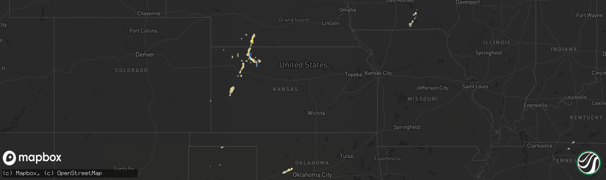
Hail Map in Kansas on September 2, 2022
The weather event in Kansas on September 2, 2022 includes Wind and Hail maps. 16 states and 226 cities were impacted and suffered possible damage. The total estimated number of properties impacted is 0.
Want more than just the map?
Turn this storm into a full workflow.
- Owner + property data so you know who to knock
- OnDemand branded weather history reports to win the "did we even have hail?" argument
- RoofTrace estimate so reps stop guessing numbers at the door
Bought this map? Upgrade within 7 days and we'll credit the $230. (10-15 min setup call)
Wind
Hail
0
Estimated number of impacted properties by a 1.00" hail or larger0
Estimated number of impacted properties by a 1.75" hail or larger0
Estimated number of impacted properties by a 2.50" hail or largerStorm reports in Kansas
Kansas
| Date | Description |
|---|---|
| 09/02/20226:44 PM CDT | A local report indicates 61 MPH wind near PENOKEE |
| 09/02/20226:36 PM CDT | Approximately a foot in diameter tree limb was blown down from a cottonwood. In addition two small tents were damage. |
| 09/02/20226:00 PM CDT | 66mph wind gust measured at k-383 |
| 09/02/20225:58 PM CDT | Estimated wind gusts of 50-70 mph. |
| 09/02/20222:56 AM CDT | At 755 PM CDT, a severe thunderstorm was located near Modoc, moving south at 25 mph. HAZARD...60 mph wind gusts and quarter size hail. SOURCE...Radar indicated. IMPACT...Hail damage to vehicles is expected. Expect wind damage to roofs, siding, and trees. This severe thunderstorm will remain over mainly rural areas of northeastern Kearny, northwestern Finney and southwestern Scott Counties.This new warning for replaces the previous warning for northern Finney and Scott County. |
| 09/02/20222:43 AM CDT | At 743 PM CDT, a severe thunderstorm was located 5 miles northwest of Modoc, moving south at 20 mph. HAZARD...60 mph wind gusts and quarter size hail. SOURCE...Radar indicated. IMPACT...Hail damage to vehicles is expected. Expect wind damage to roofs, siding, and trees. This severe thunderstorm will remain over mainly rural areas of eastern Wichita County, including the following locations... Lydia and Marienthal. |
| 09/02/20222:23 AM CDT | At 722 PM CDT, the wind shift gust front ahead of severe thunderstorms was located along a line extending from near Shields to near Modoc, moving south at 50 mph. HAZARD...60 mph wind gusts and penny size hail. SOURCE...Radar indicated. IMPACT...Expect damage to roofs, siding, and trees. Severe thunderstorms will be near... Shields around 725 PM CDT. Scott City and Dighton around 730 PM CDT. Shallow Water around 740 PM CDT.Other locations in the path of these severe thunderstorms includeFriend. |
| 09/02/20222:02 AM CDT | At 701 PM CDT, severe thunderstorms were located along a line extending from 7 miles south of Hill City to near Quinter, moving south at 30 mph. HAZARD...60 mph wind gusts and penny size hail. SOURCE...Radar indicated. IMPACT...Expect damage to roofs, siding, and trees. Severe thunderstorms will be near... Collyer around 710 PM CDT.Other locations in the path of these severe thunderstorms includeWakeeney, Voda and Trego Center. |
| 09/02/20221:56 AM CDT | At 655 PM CDT, severe thunderstorms were located along a line extending from 10 miles southwest of Gove to 8 miles east of Russell Springs, moving south at 25 mph. HAZARD...60 mph wind gusts and penny size hail. SOURCE...Radar indicated. IMPACT...Expect damage to roofs, siding, and trees. Locations impacted include... Scott State Lake and Healy. |
| 09/02/20221:42 AM CDT | At 642 PM CDT, severe thunderstorms were located along a line extending from near Monument to 5 miles east of Oakley to 3 miles east of Grinnell, moving southwest at 20 mph. HAZARD...60 mph wind gusts and nickel size hail. SOURCE...Radar indicated. IMPACT...Expect damage to roofs, siding, and trees. Severe thunderstorms will be near... Monument around 650 PM CDT.Other locations in the path of these severe thunderstorms includeRussell Springs.This includes Interstate 70 in Kansas between mile markers 69 and 96. |
| 09/02/20221:33 AM CDT | At 632 PM CDT, severe thunderstorms were located along a line extending from 7 miles south of Edmond to 4 miles northeast of Morland to near Hoxie, moving southeast at 30 mph. HAZARD...60 mph wind gusts and quarter size hail. SOURCE...Radar indicated. IMPACT...Hail damage to vehicles is expected. Expect wind damage to roofs, siding, and trees. Severe thunderstorms will be near... Morland around 640 PM CDT. Hill City around 650 PM CDT.Other locations in the path of these severe thunderstorms includeBogue and Nicodemus. |
| 09/02/20221:29 AM CDT | At 629 PM CDT, a severe thunderstorm was located 7 miles north of Grinnell, moving south at 10 mph. HAZARD...60 mph wind gusts and quarter size hail. SOURCE...Radar indicated. IMPACT...Hail damage to vehicles is expected. Expect wind damage to roofs, siding, and trees. Locations impacted include... Grainfield and Grinnell.This includes Interstate 70 in Kansas between mile markers 76 and 93. |
| 09/02/20221:04 AM CDT | At 603 PM CDT, a severe thunderstorm was located near Jennings, or 17 miles southeast of Oberlin, moving south at 30 mph. HAZARD...70 mph wind gusts and nickel size hail. SOURCE...Trained weather spotters. Estimated 70 mph winds were reported in Jennings. IMPACT...Expect considerable tree damage. Damage is likely to mobile homes, roofs, and outbuildings. This severe thunderstorm will remain over mainly rural areas of northeastern Sheridan and southeastern Decatur Counties. |
| 09/02/202212:57 AM CDT | At 557 PM CDT, a severe thunderstorm was located 7 miles east of Menlo, or 7 miles west of Hoxie, moving south at 15 mph. HAZARD...60 mph wind gusts and quarter size hail. SOURCE...Radar indicated. IMPACT...Hail damage to vehicles is expected. Expect wind damage to roofs, siding, and trees. This severe thunderstorm will remain over mainly rural areas of southwestern Sheridan County, including the following locations... Seguin. |
| 09/02/202212:27 AM CDT | At 526 PM CDT, a severe thunderstorm was located 8 miles southeast of Danbury, or 12 miles northeast of Oberlin, moving south at 15 mph. HAZARD...60 mph wind gusts and quarter size hail. SOURCE...Radar indicated. IMPACT...Hail damage to vehicles is expected. Expect wind damage to roofs, siding, and trees. Locations impacted include... Norcatur. |
| 09/01/202211:54 PM CDT | At 454 PM CDT, a severe thunderstorm was located 6 miles northwest of Wilsonville, or 22 miles east of McCook, moving south at 20 mph. HAZARD...60 mph wind gusts and quarter size hail. SOURCE...Radar indicated. IMPACT...Hail damage to vehicles is expected. Expect wind damage to roofs, siding, and trees. Locations impacted include... Lebanon. |
| 09/01/202210:33 PM CDT | Mesonet station ur350 4.4 ne hayne |
| 09/01/20228:46 PM CDT | Report from mping: trees uprooted or snapped; roof blown off. |
| 09/01/20228:38 PM CDT | A local report indicates 59 MPH wind near 8 ENE GARDEN CITY |
All States Impacted by Hail Map on September 2, 2022
Cities Impacted by Hail Map on September 2, 2022
- Winter, WI
- Marion, WI
- Clintonville, WI
- Ridgeland, WI
- Vesper, WI
- Shawano, WI
- Mosinee, WI
- Weatherford, OK
- Geary, OK
- Green Bay, WI
- Egg Harbor, WI
- Sturgeon Bay, WI
- Cornell, WI
- Pittsville, WI
- Arpin, WI
- Prairie Farm, WI
- Clayton, WI
- Dallas, WI
- Barron, WI
- Wausau, WI
- Rothschild, WI
- La Farge, WI
- Ontario, WI
- Holmen, WI
- Bruce Crossing, MI
- Ewen, MI
- Shiocton, WI
- Selden, KS
- Kingman, AZ
- Golden Valley, AZ
- Land O'Lakes, WI
- Marenisco, MI
- Clear Lake, WI
- Glenwood City, WI
- Deer Park, WI
- Stewartville, MN
- Holly, CO
- Nekoosa, WI
- Jim Falls, WI
- Melrose, IA
- Mystic, IA
- Plano, IA
- Moravia, IA
- Westby, WI
- Cashton, WI
- Coon Valley, WI
- Norwalk, WI
- Kirkland, AZ
- Skull Valley, AZ
- Pencil Bluff, AR
- Oden, AR
- Harvey, AR
- Mount Ida, AR
- Ranger, TX
- Desdemona, TX
- Yucca, AZ
- Wickenburg, AZ
- Gruver, TX
- Arcadia, WI
- Ettrick, WI
- Stratford, WI
- Antigo, WI
- Eyota, MN
- Dover, MN
- Mass City, MI
- Hackberry, AZ
- Congress, AZ
- Muenster, TX
- Baldwin, WI
- Fountain City, WI
- Channing, TX
- Hoxie, KS
- Hollandale, WI
- Bird City, KS
- Racine, MN
- Grand Meadow, MN
- Rollingstone, MN
- Minnesota City, MN
- Dodge, WI
- Altura, MN
- Winona, MN
- Saint Charles, MN
- Utica, MN
- Lebanon, NE
- Waldron, AR
- Hill City, KS
- Jennings, KS
- Dresden, KS
- Clayton, KS
- Penokee, KS
- Norcatur, KS
- Morland, KS
- Oberlin, KS
- Albia, IA
- Wakefield, MI
- Exeland, WI
- Hartsville, TN
- Dixon Springs, TN
- La Crosse, WI
- Oakley, KS
- Kit Carson, CO
- Bartley, NE
- Gamaliel, KY
- Lafayette, TN
- Red Boiling Springs, TN
- Cresco, IA
- Manitowish Waters, WI
- Grinnell, KS
- Plainview, AR
- Rose Creek, MN
- Dexter, MN
- Elkton, MN
- Adams, MN
- Taopi, MN
- Ogema, WI
- Prentice, WI
- Brantwood, WI
- Appleton, WI
- Greenville, WI
- Hortonville, WI
- Kensett, IA
- Hanlontown, IA
- Manly, IA
- Grand Marsh, WI
- Adams, WI
- Wisconsin Dells, WI
- New Auburn, WI
- Rhinelander, WI
- West Salem, WI
- Bangor, WI
- Sparta, WI
- Rockland, WI
- Roff, OK
- Wellington, TX
- Menomonie, WI
- Elk Mound, WI
- Sunray, TX
- Presque Isle, WI
- New Franken, WI
- Mcalester, OK
- Stuart, OK
- Aniwa, WI
- Ringle, WI
- Coalgate, OK
- Meadview, AZ
- Frederick, OK
- Cambridge, NE
- Leoti, KS
- Atwood, KS
- Mayer, AZ
- Crown King, AZ
- Ontonagon, MI
- Stephenville, TX
- Fort Mcdowell, AZ
- Scottsdale, AZ
- Marienthal, KS
- Lovilia, IA
- Cope, CO
- De Leon, TX
- Dolan Springs, AZ
- Buckeye, AZ
- Promise City, IA
- Scott City, KS
- Waukon, IA
- Bellevue, TX
- Bowie, TX
- Willow Beach, AZ
- San Tan Valley, AZ
- Saint Jo, TX
- San Carlos, AZ
- Waterloo, IA
- Cedar Falls, IA
- Decorah, IA
- Brownsville, MN
- Hokah, MN
- Pelkie, MI
- Queen Creek, AZ
- Gold Canyon, AZ
- Wellton, AZ
- Dry Creek, LA
- Kinder, LA
- Salome, AZ
- Eustis, NE
- Wilsonville, NE
- Oskaloosa, IA
- Tracy, IA
- Curtis, NE
- Walters, OK
- Peridot, AZ
- Ringgold, TX
- Ridgeway, IA
- Pauma Valley, CA
- Yarnell, AZ
- Chaseburg, WI
- Seymour, IA
- Bussey, IA
- Black Canyon City, AZ
- Eagle River, WI
- Wilson, WI
- Woodville, WI
- Spring Valley, WI
- Lenora, KS
- Baraga, MI
- Wardville, OK
- Holton, IN
- Montgomery, TX
- Stoddard, WI
- Herndon, KS
- Rotan, TX
- McDonald, KS
- La Crescent, MN
- McCook, NE
- Saint Ignace, MI
- Hudson, IA
- Grant, LA
- Pitkin, LA
- Plover, WI
- Bancroft, WI
- Blythe, CA
- Forestburg, TX
- Mesa, AZ
- Park Falls, WI
- Ojibwa, WI
- Downing, WI
- Boyceville, WI
- Prescott, AZ


